Week 55: Beartooth Highway

We traveled southeast from Glacier just over one year ago, on July 13, 2016.  (Yes – that means we have officially lapped ourselves in blog post writing!)  We drove across rolling farmland through rural Montana, an area exactly as desolate as it sounds.  We noticed with a bit of sadness that each hill was a little less roll-y as we moved away from Glacier and the Rocky Mountains.

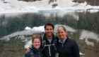
Our first stop was Great Falls, Montana, because unlike the east side of Glacier, Great Falls was large enough to have a Target – and even better, wi-fi at the RV park!  Blessed, blessed wi-fi.  Plus, Jake’s dad was flying out of and staying overnight in Great Falls after spending a few days visiting the Fischers near Grand Teton.  So we had a nice reunion and some tasty food at – where else?  The local Jakers Restaurant.
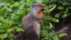
Gesundheit

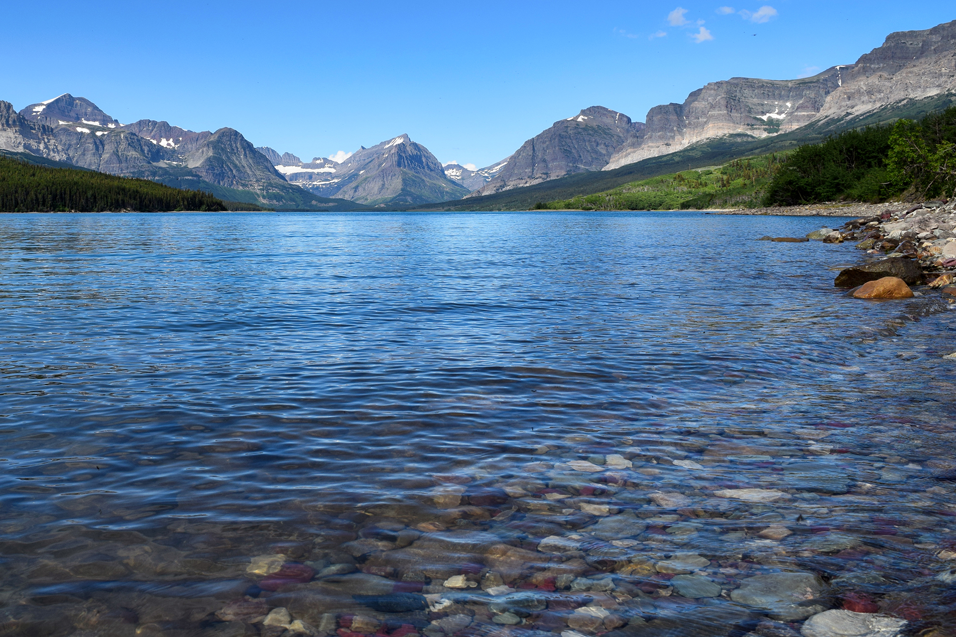
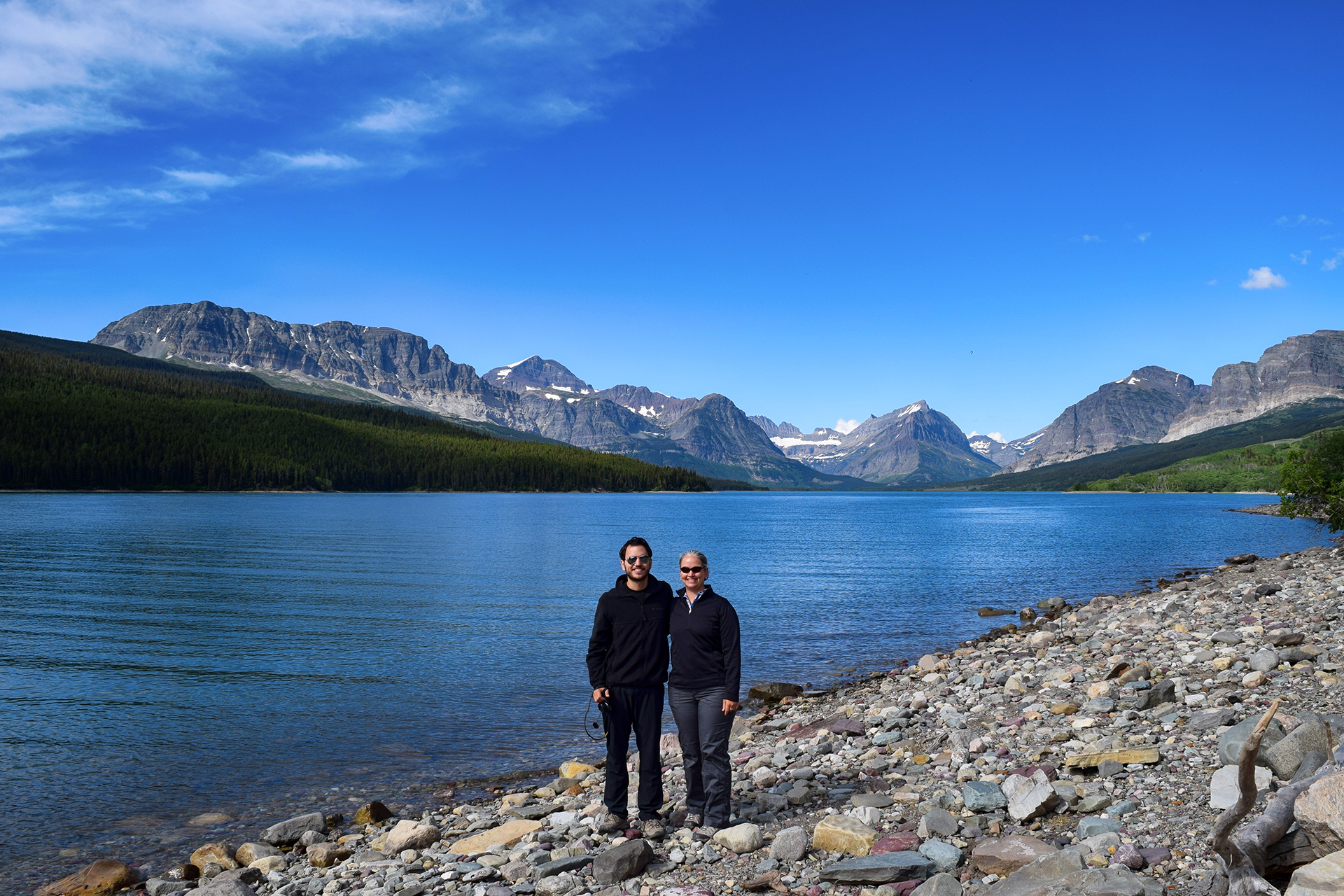
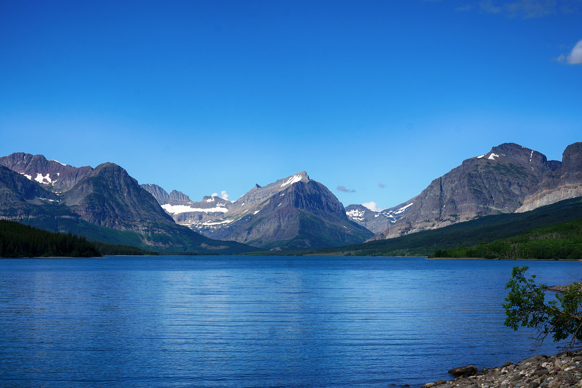
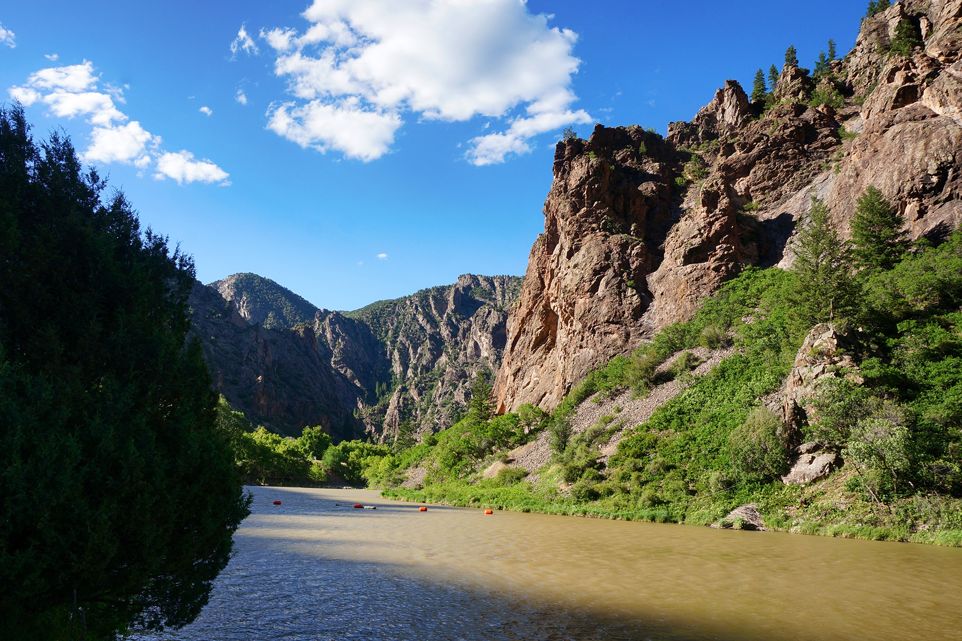
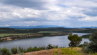
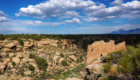
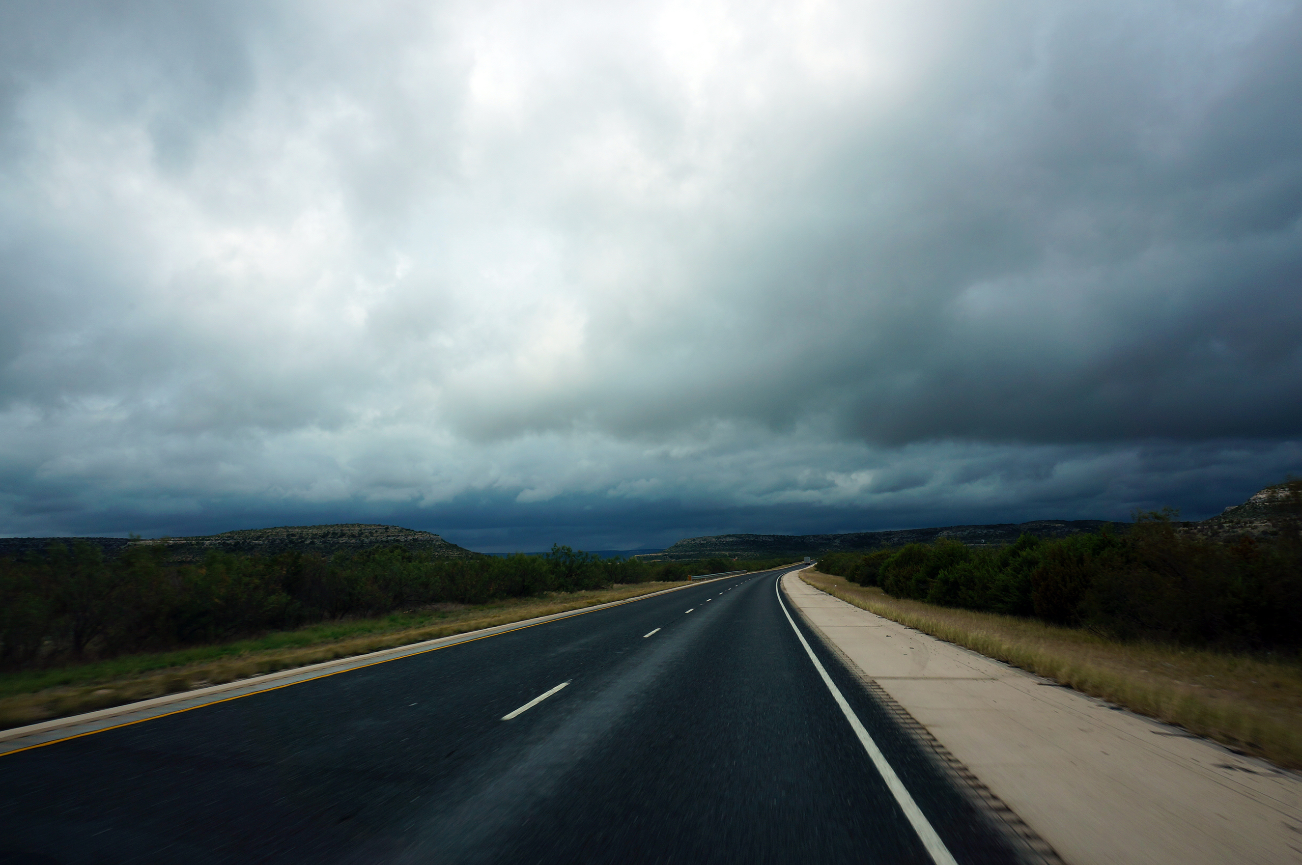
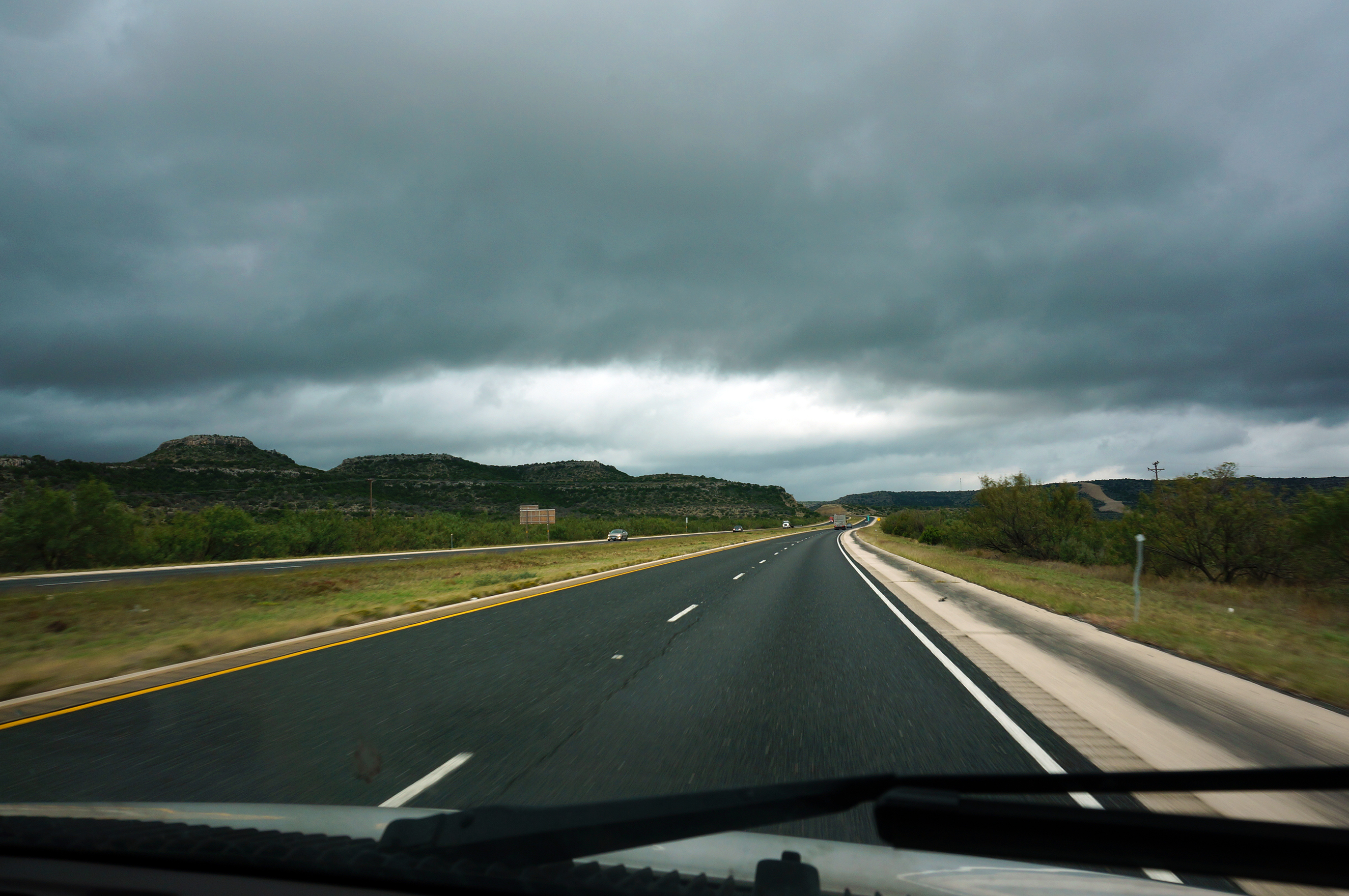
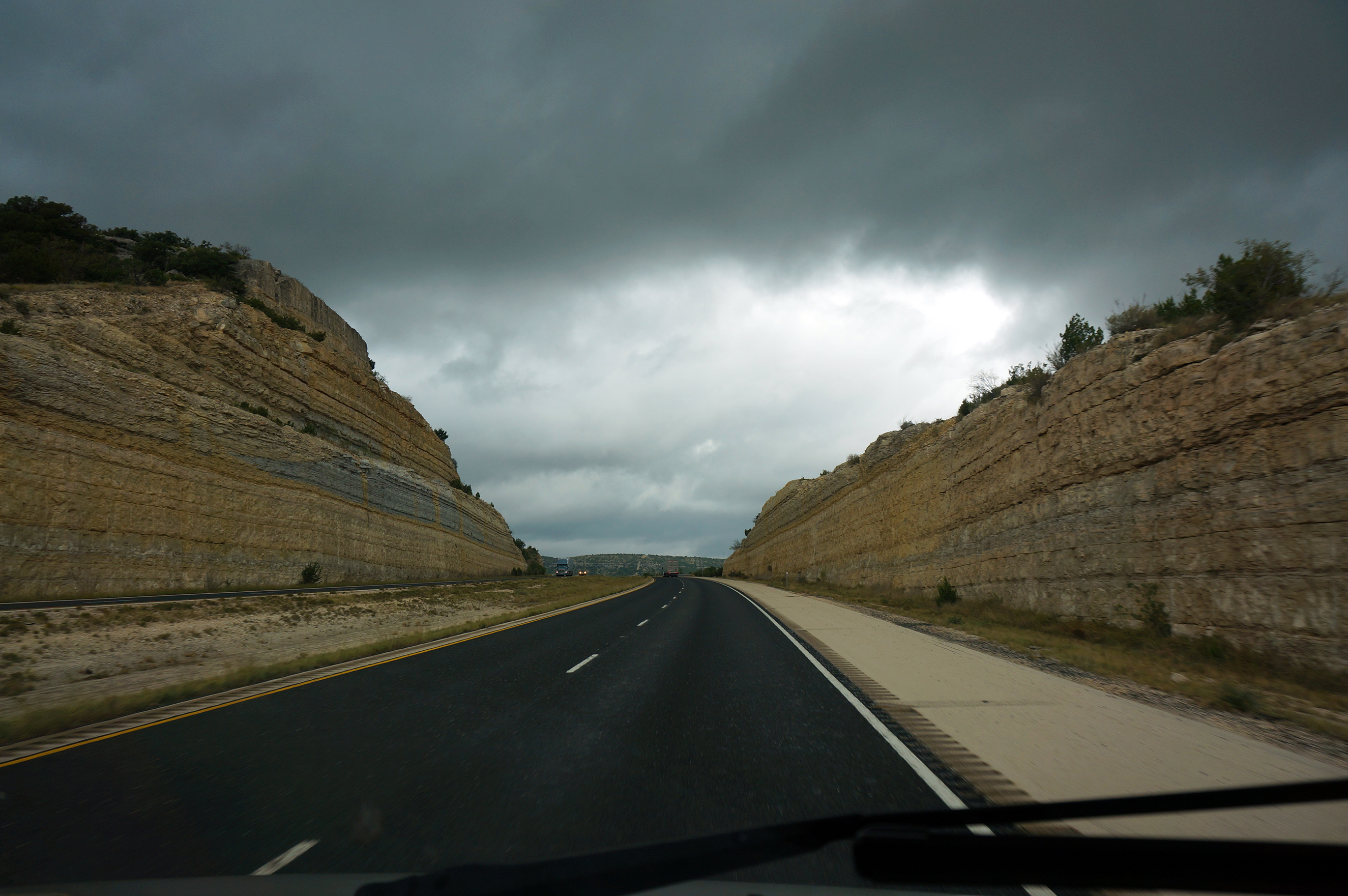
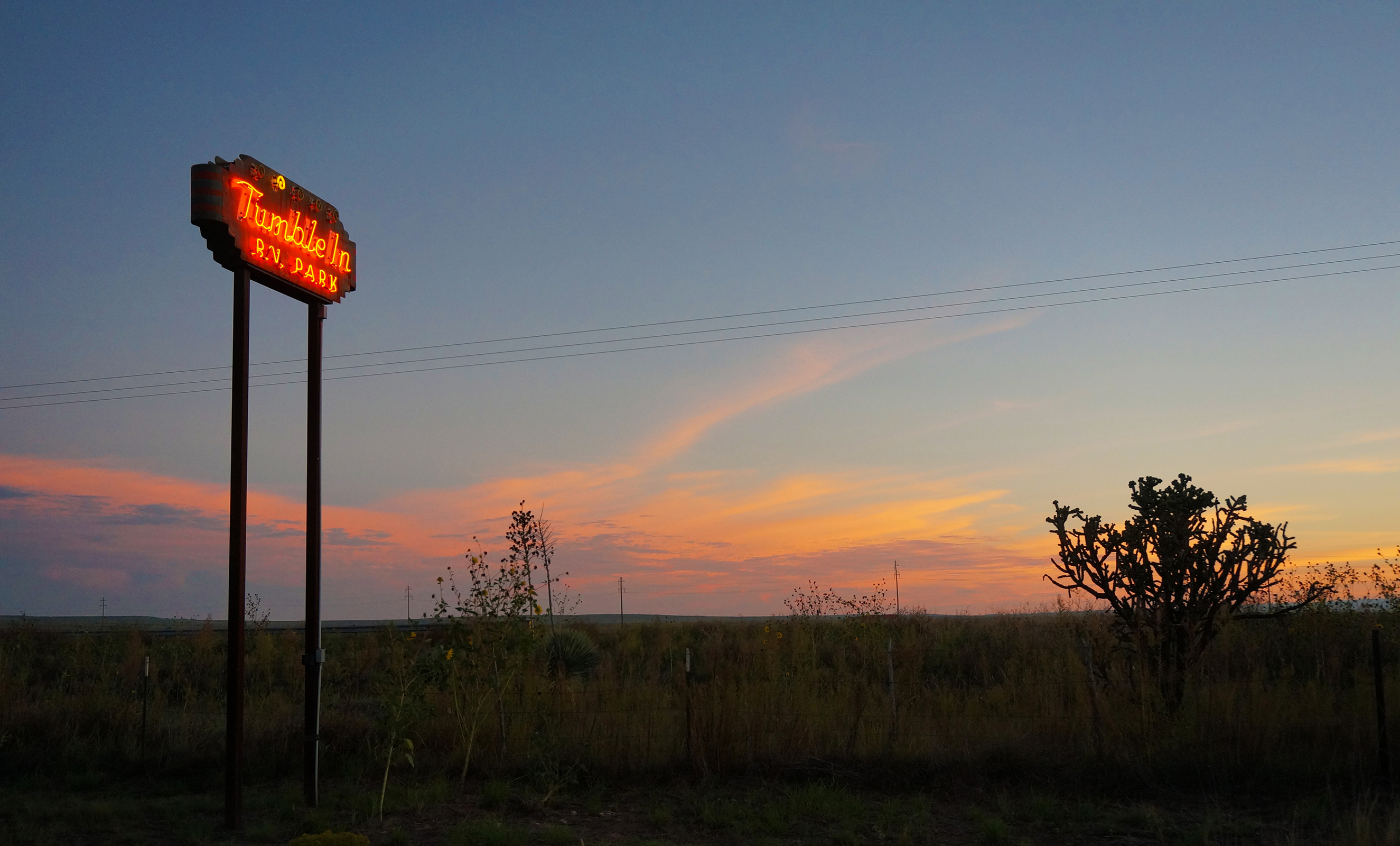
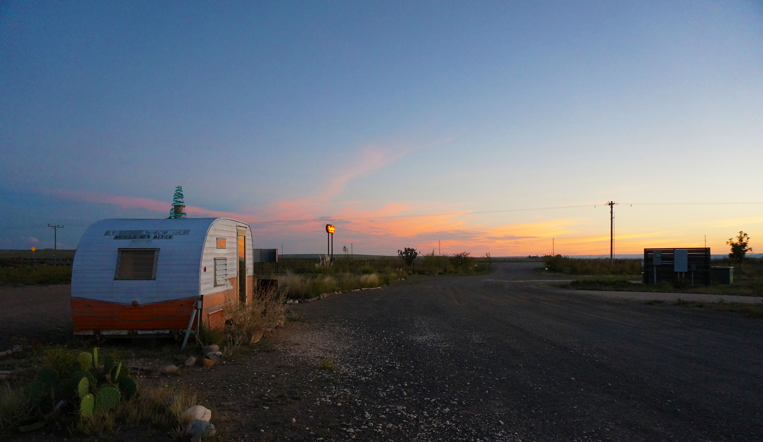
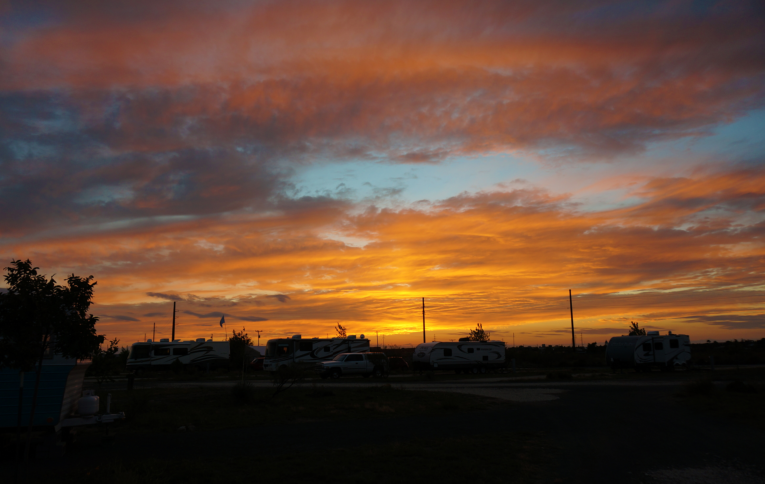
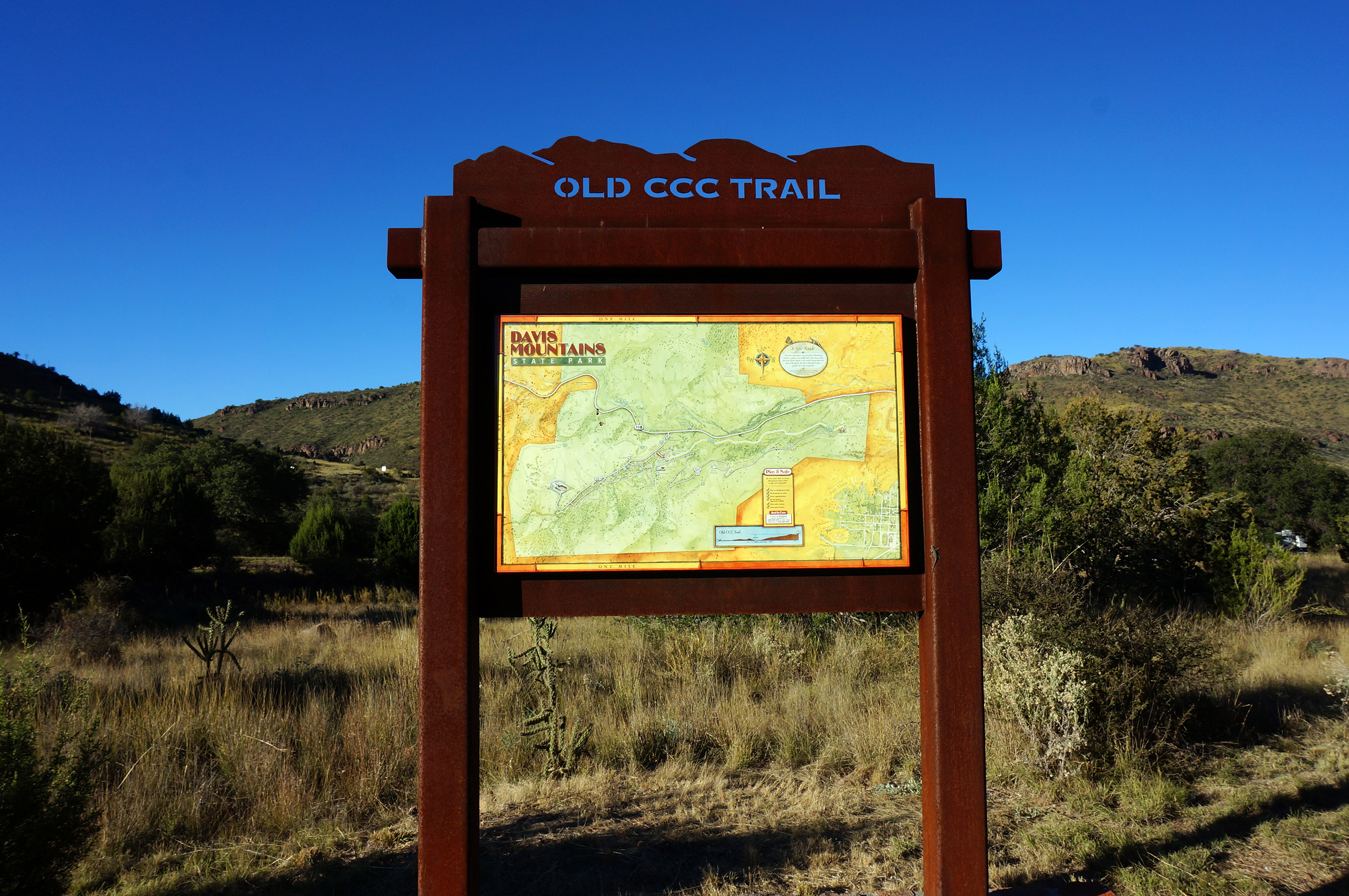
The next morning, we once again drove southeast through rural Montana farmland, cutting a zigzag path through one of the country’s emptiest states.  We eventually made it to a real highway (I-90), and stopped for two nights in the tiny town of Columbus, Montana.  Our destination was a free, town-run campground, curiously called Itch-Kep-Pe Park.  We never found out the origin of the name, but for free, it was certainly nice. Itch-Kep-Pe Park sits on the banks of the Yellowstone River, and some spots offered amazing river views (but not ours, sadly).

One night, we heard a camper in a tent nearby getting sick outside.  An unexpected benefit to living in a motorhome is that you have your house with you when you travel, and so we happened to have Pepto Bismol on hand.  It’s just like lending your neighbor a warm, pink, goopy cup of sugar.

Highway to the Danger Zone

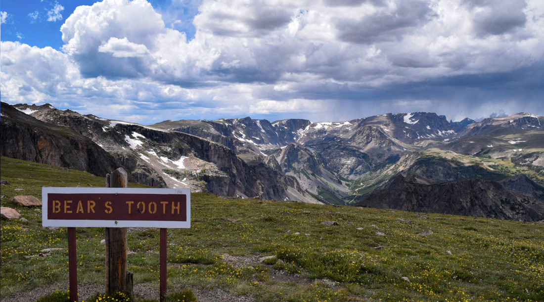
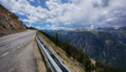
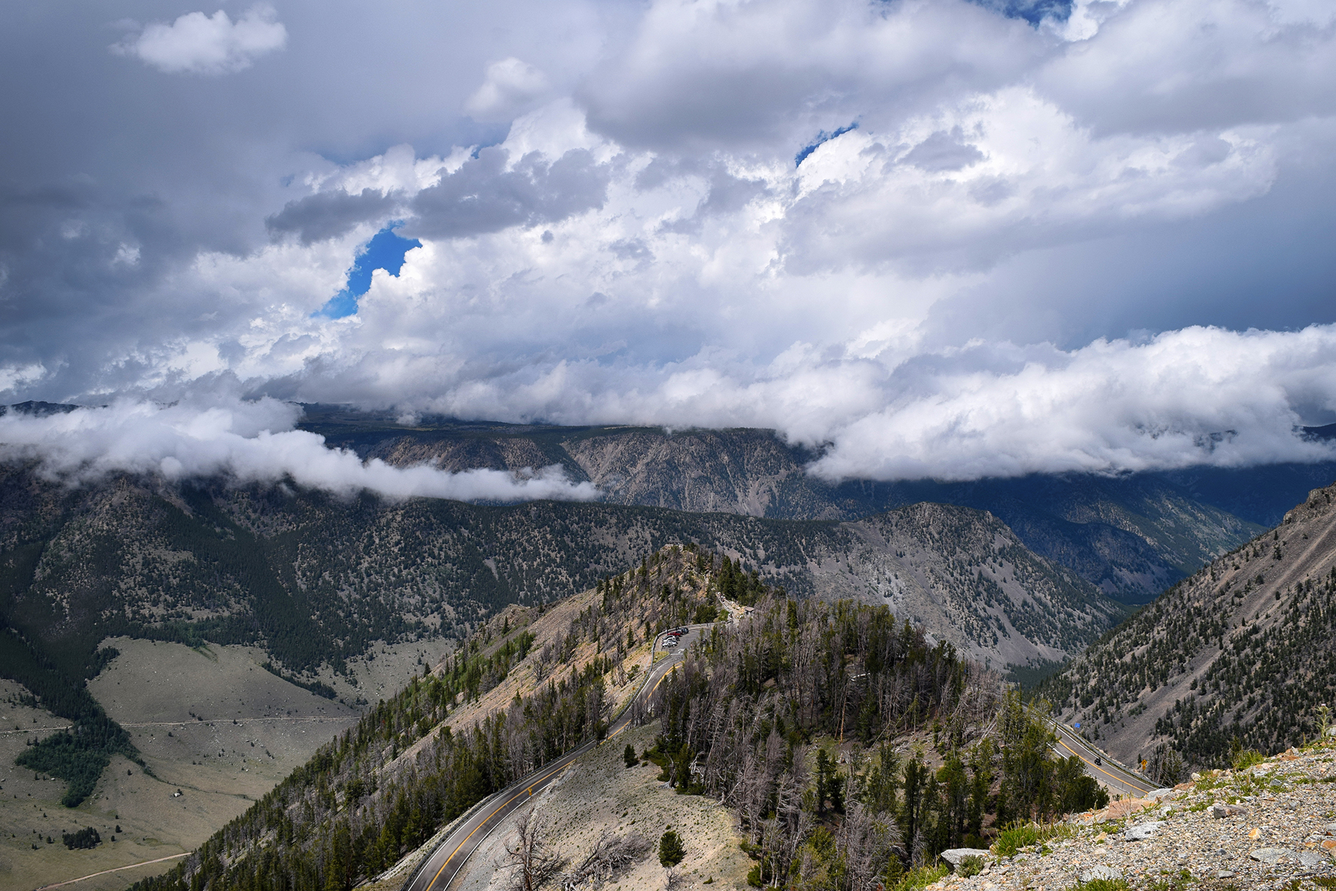
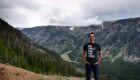
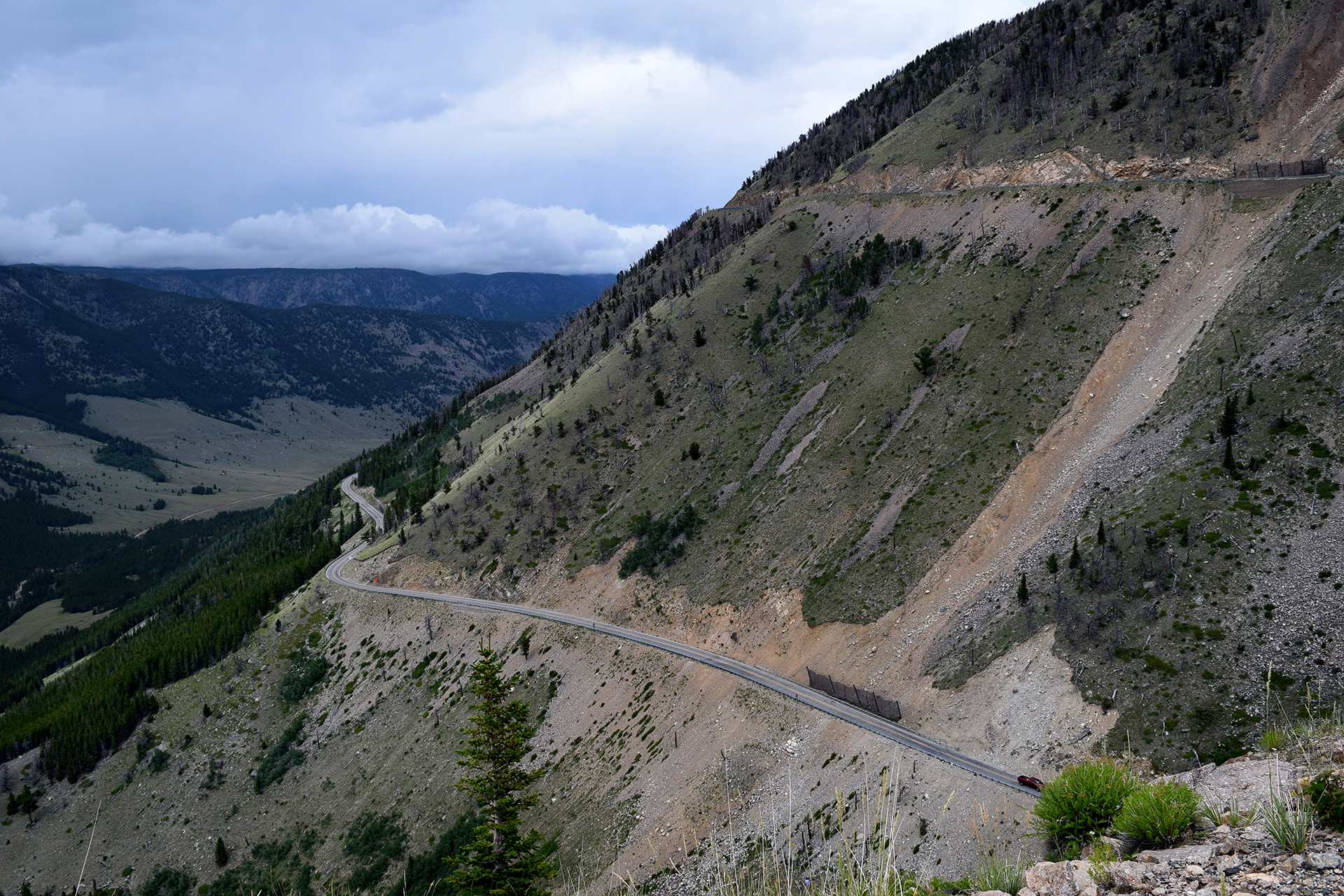
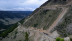
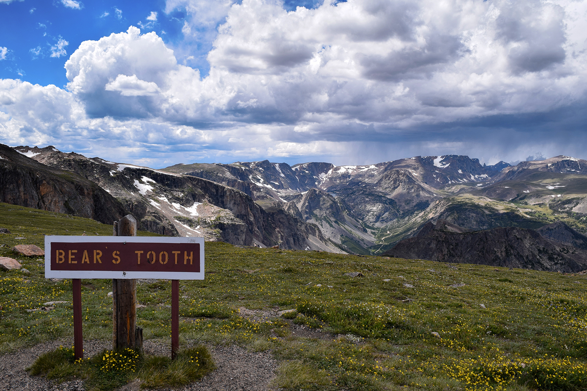
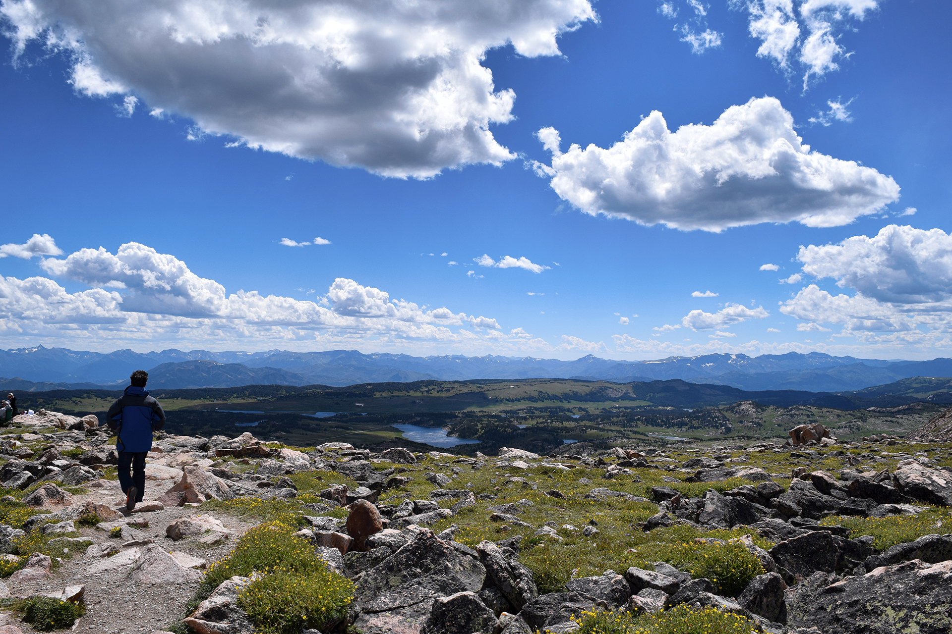
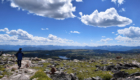
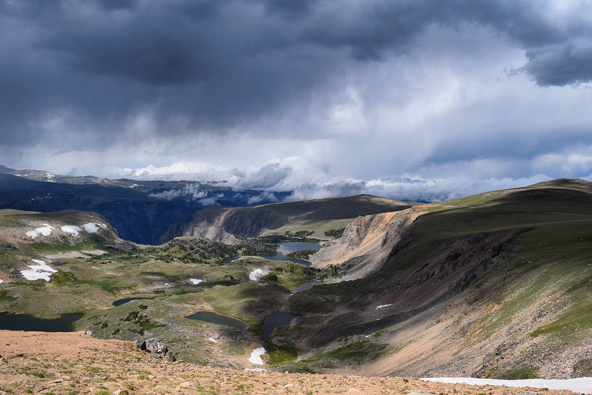
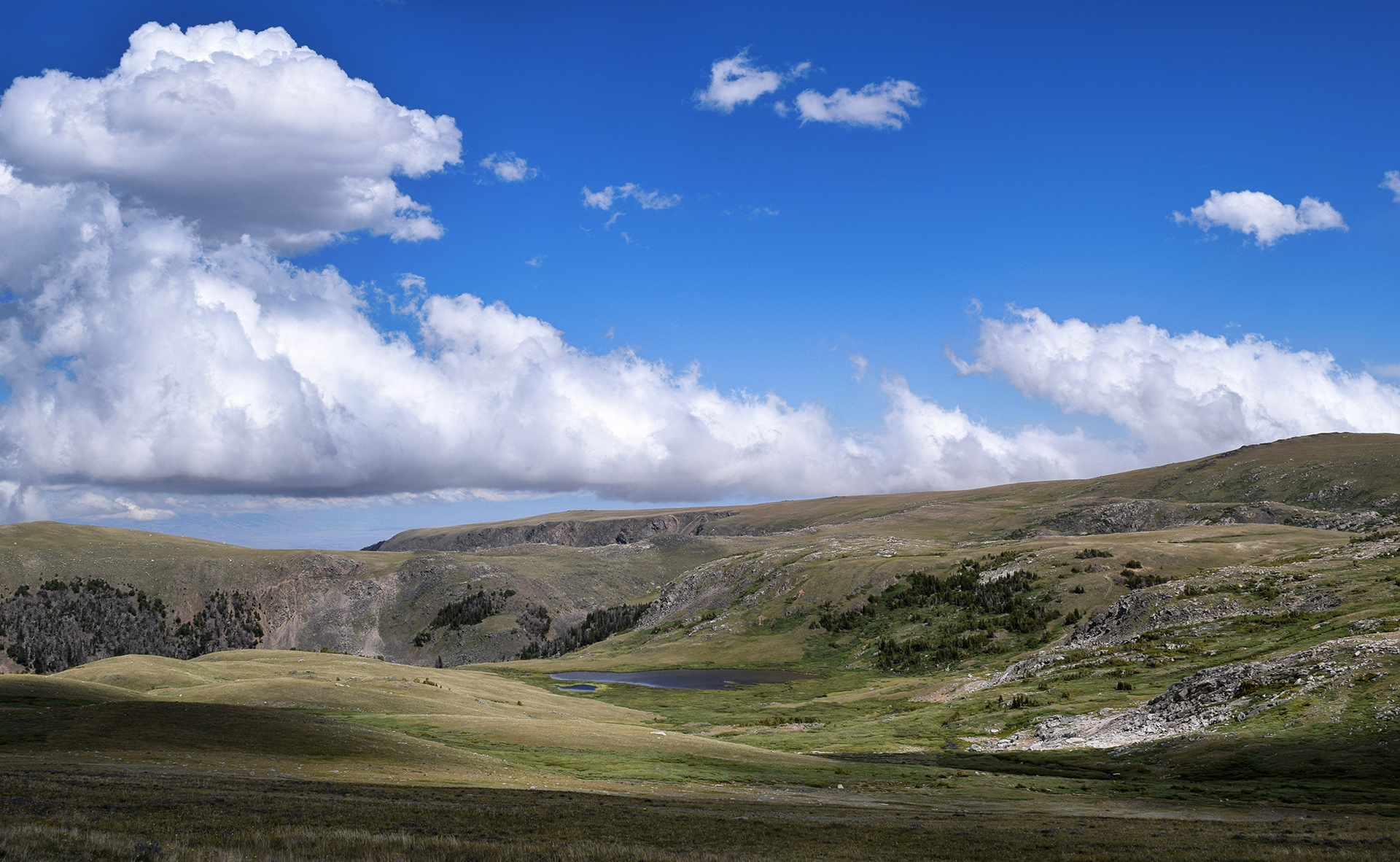
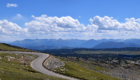
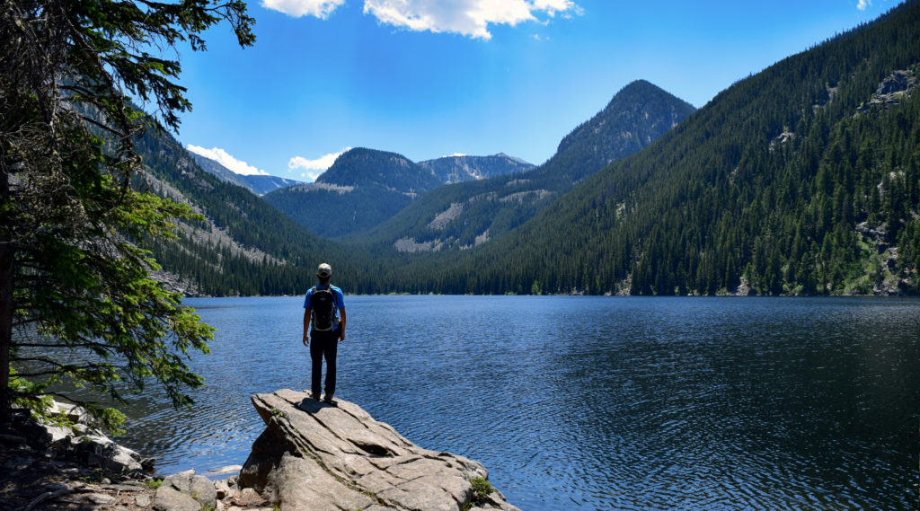
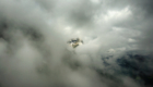
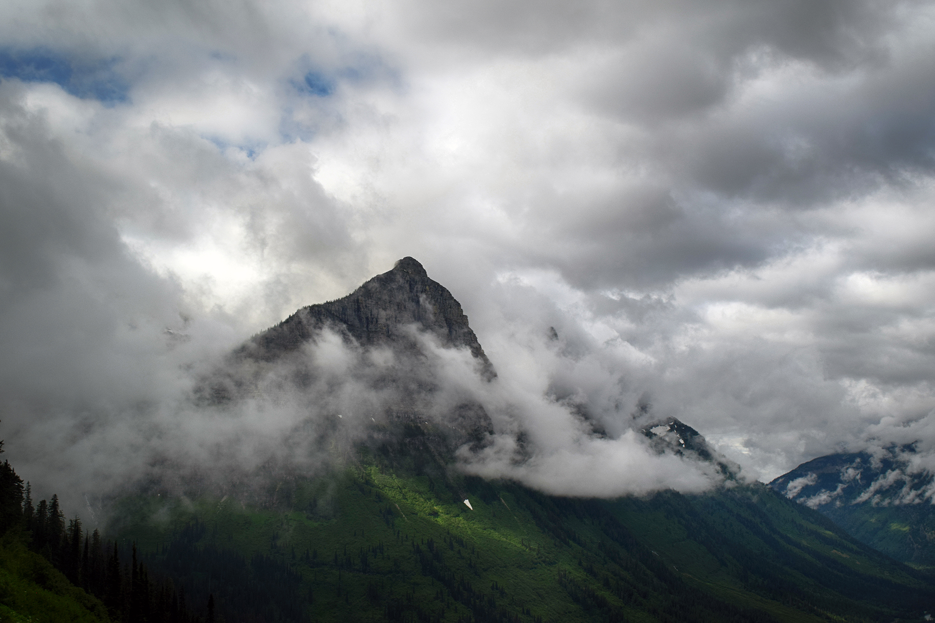
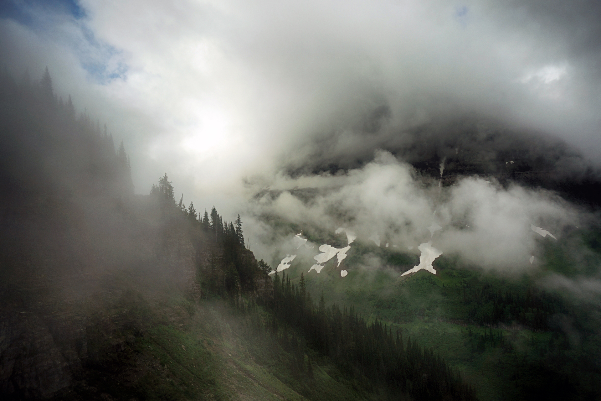
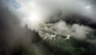
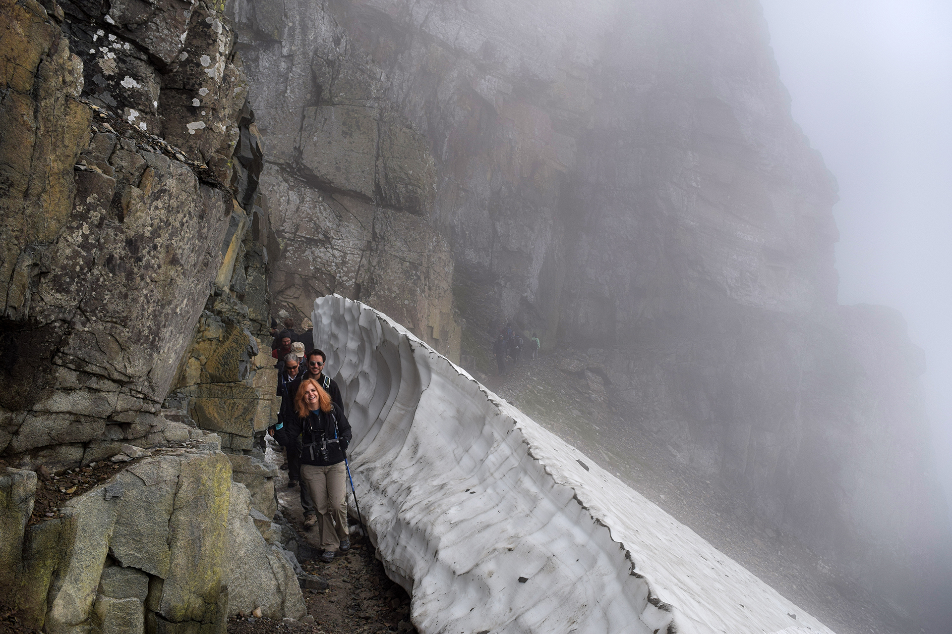
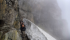
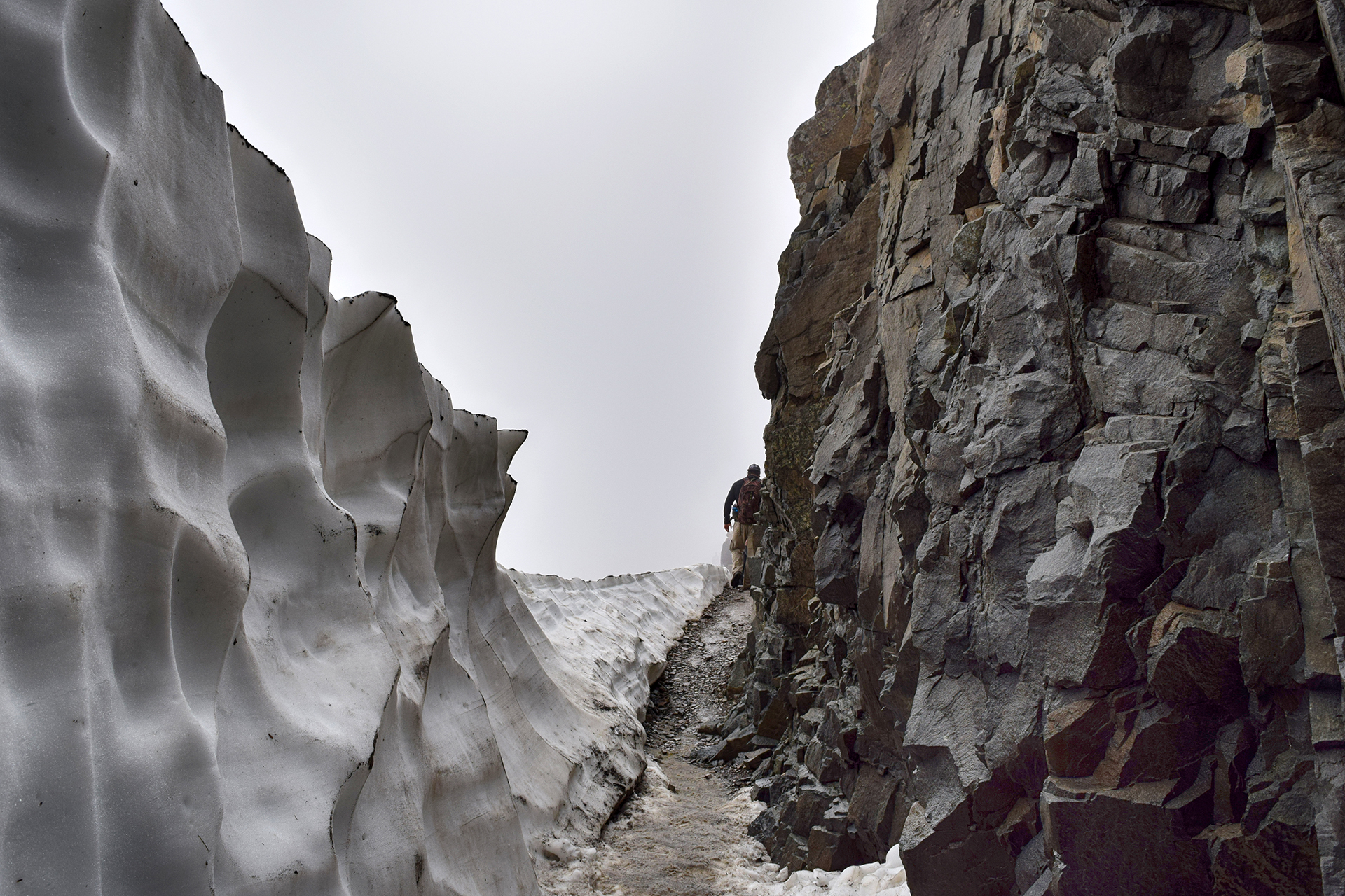
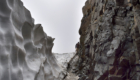
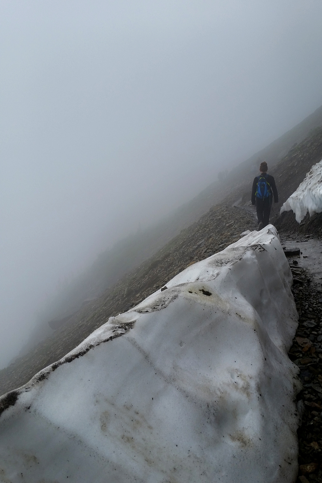
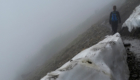
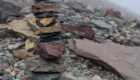
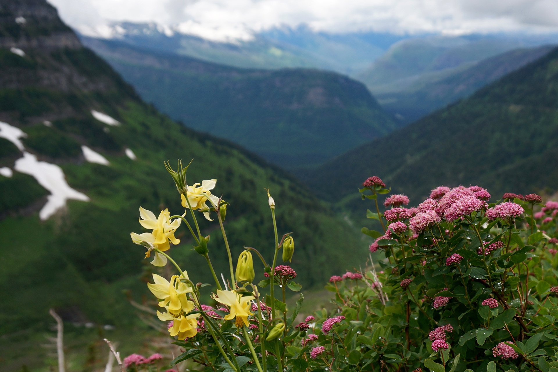
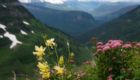
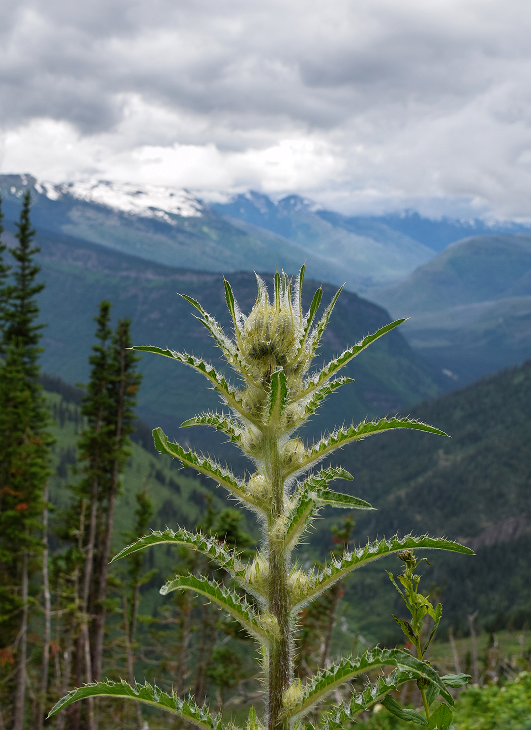
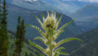
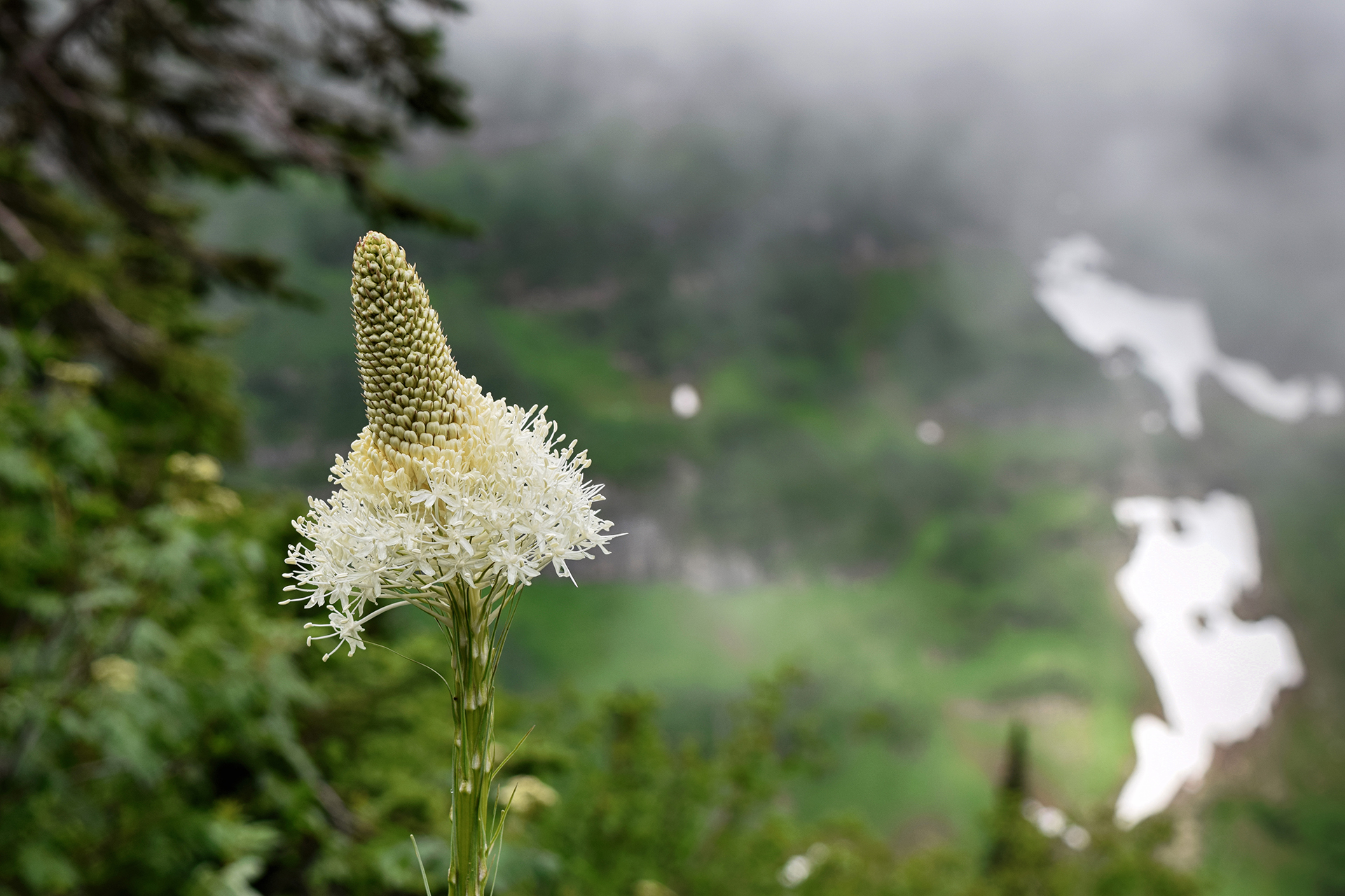
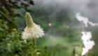
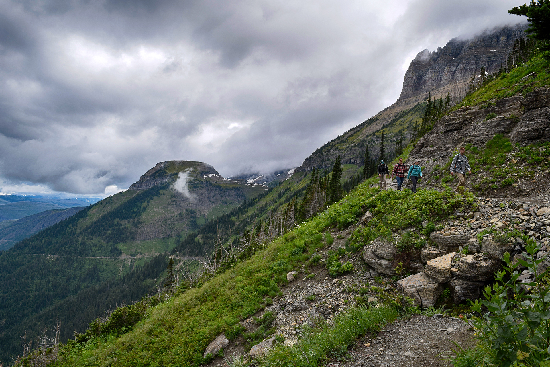
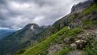
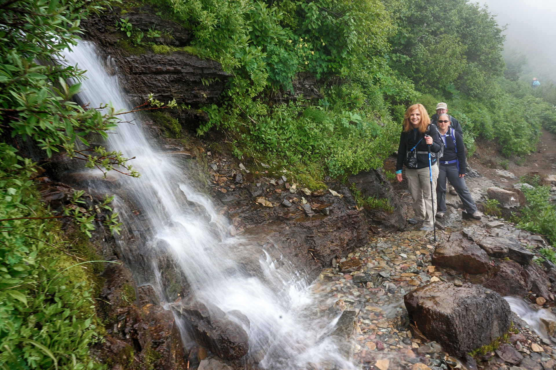
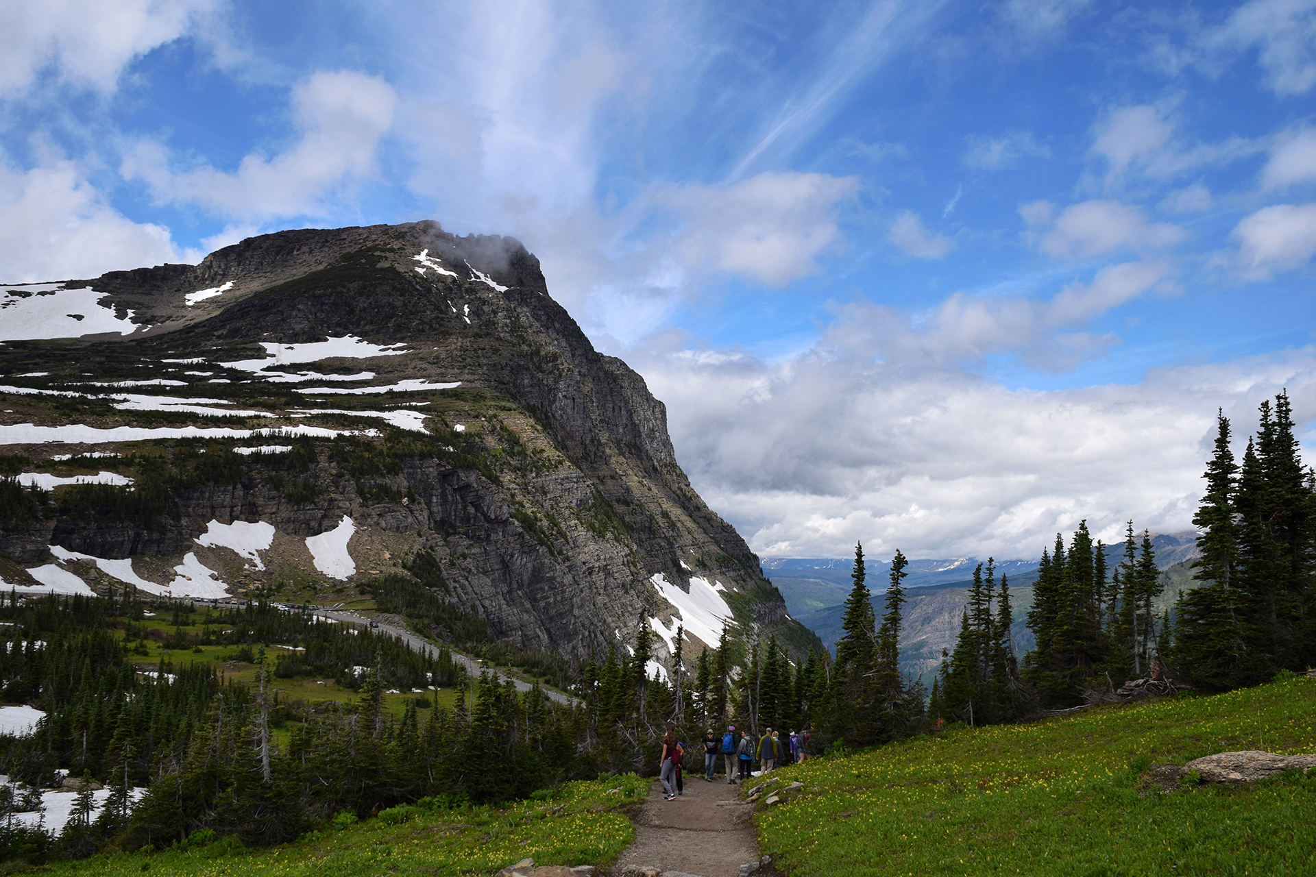
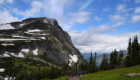
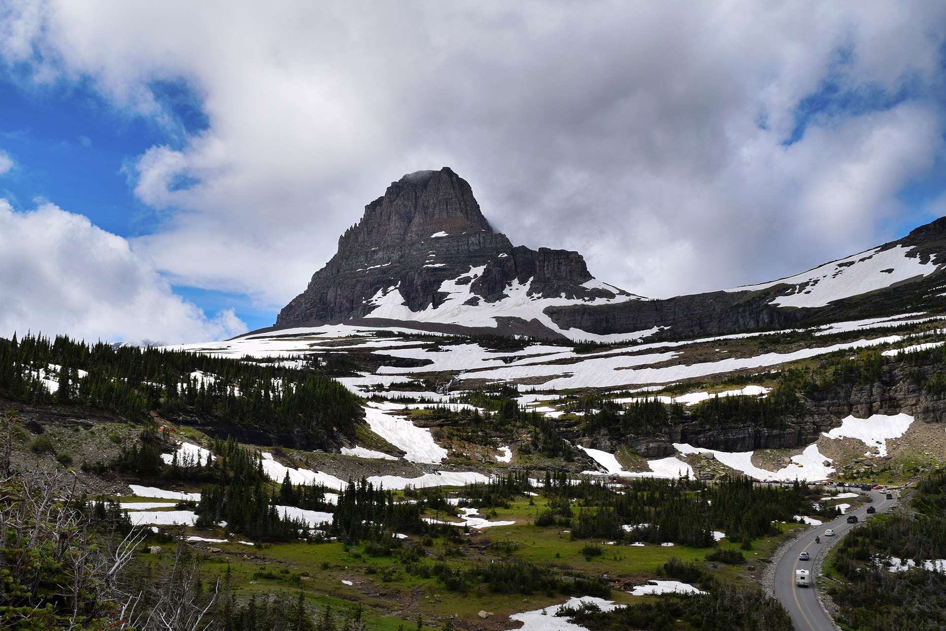
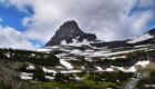
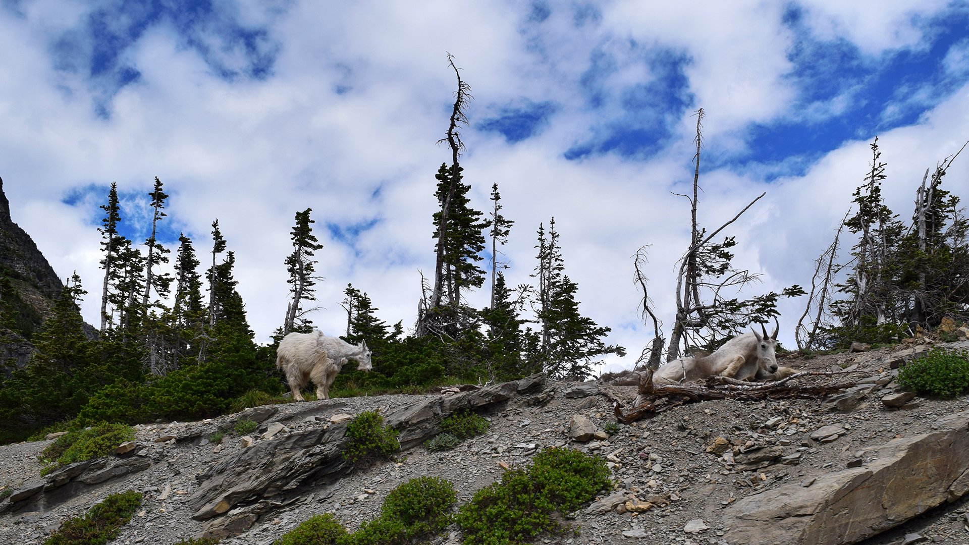
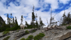
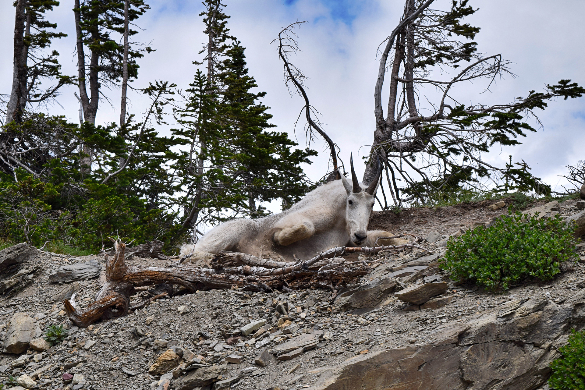
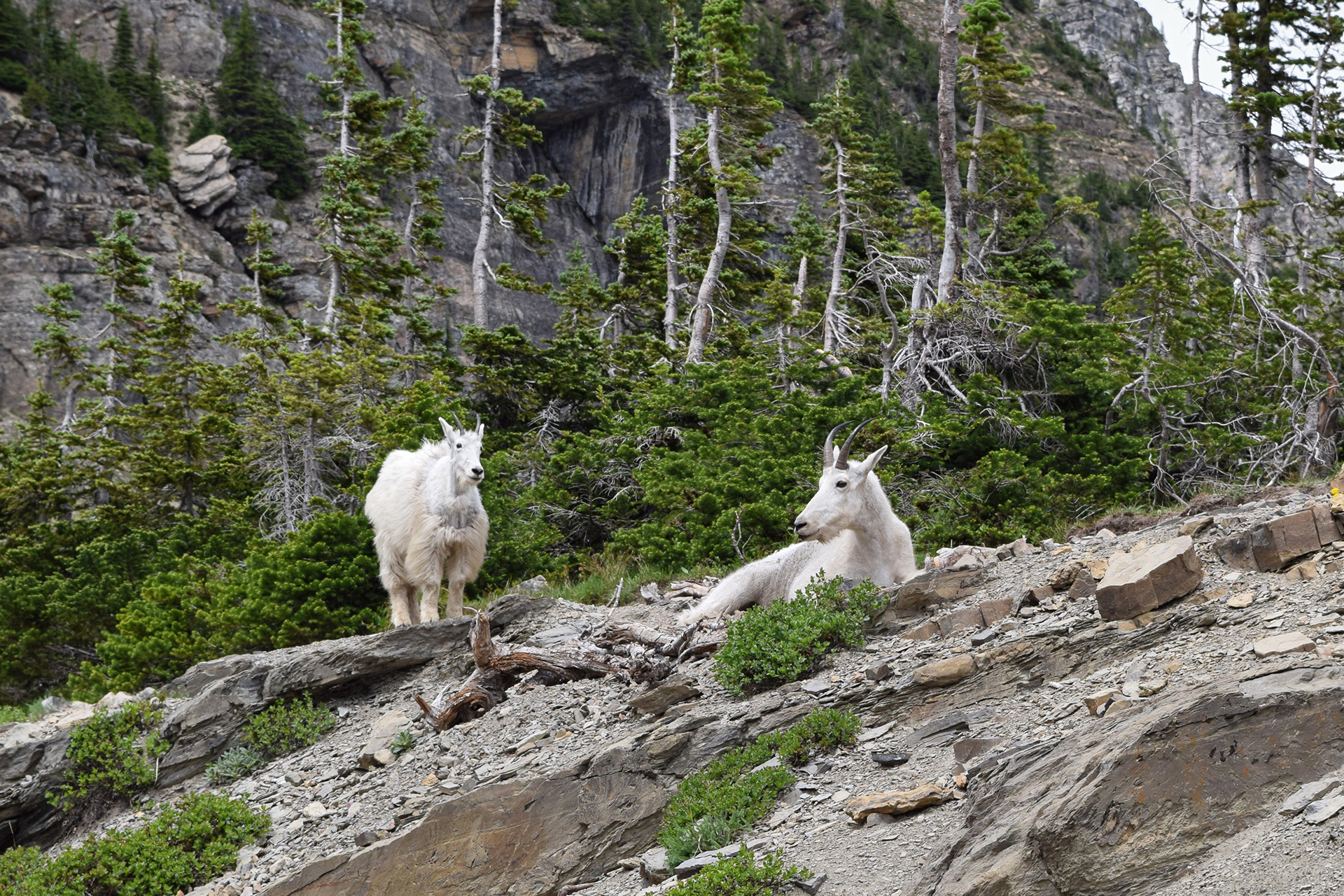
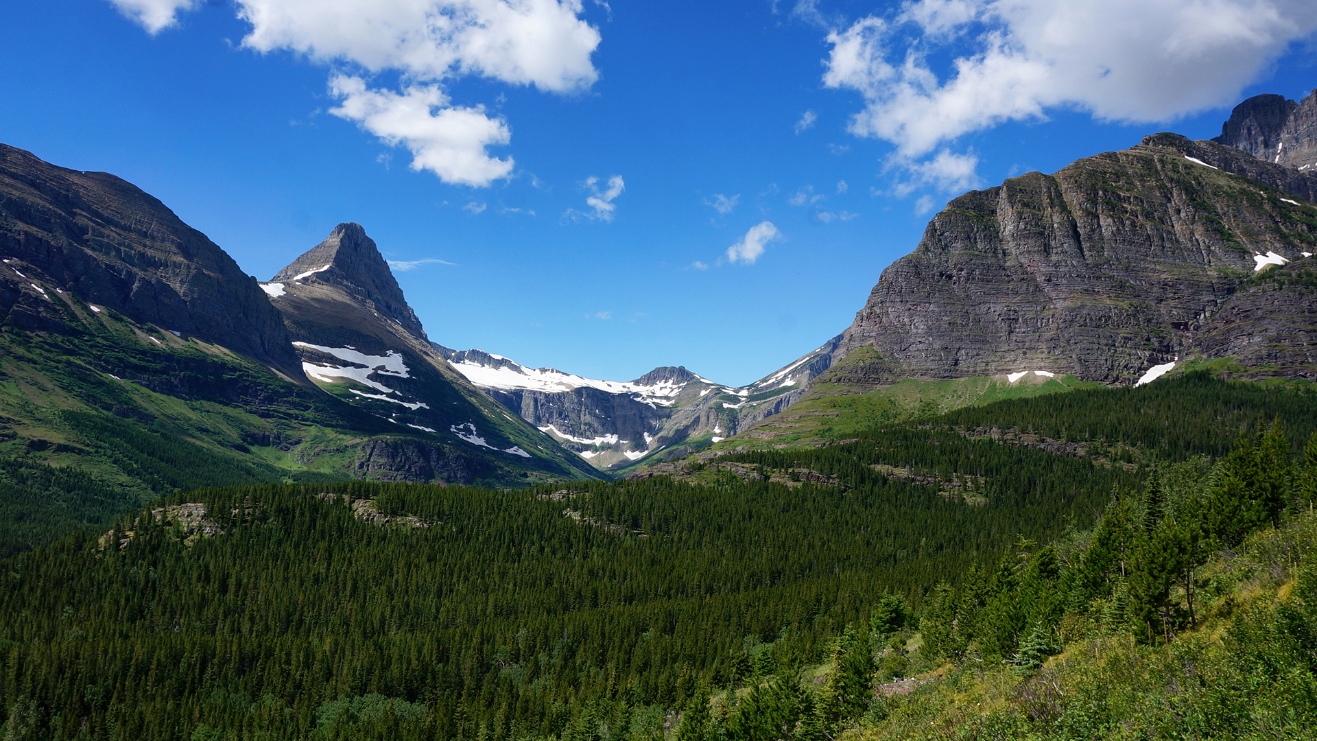
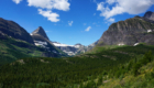
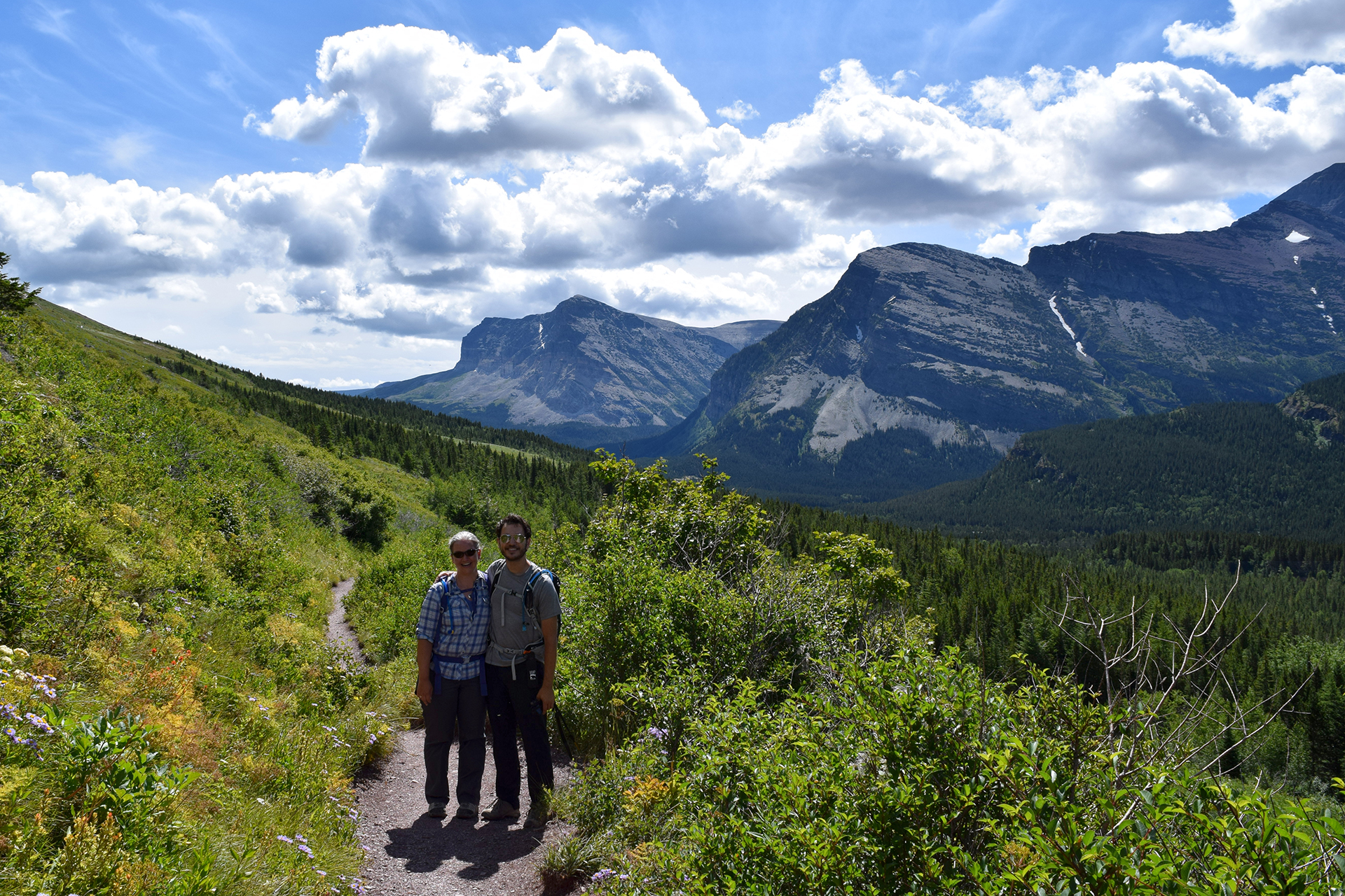
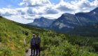
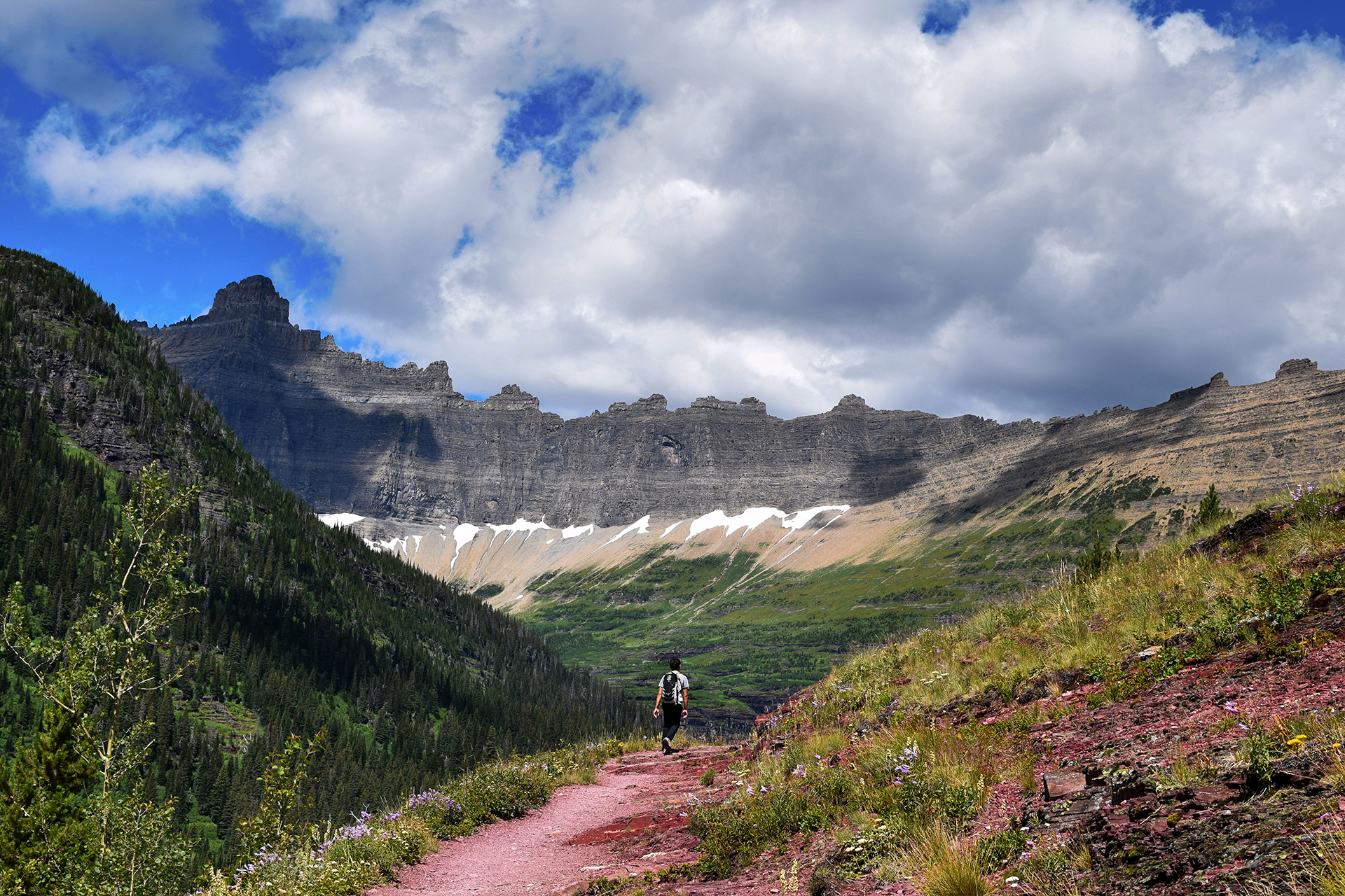
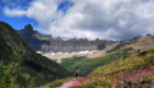
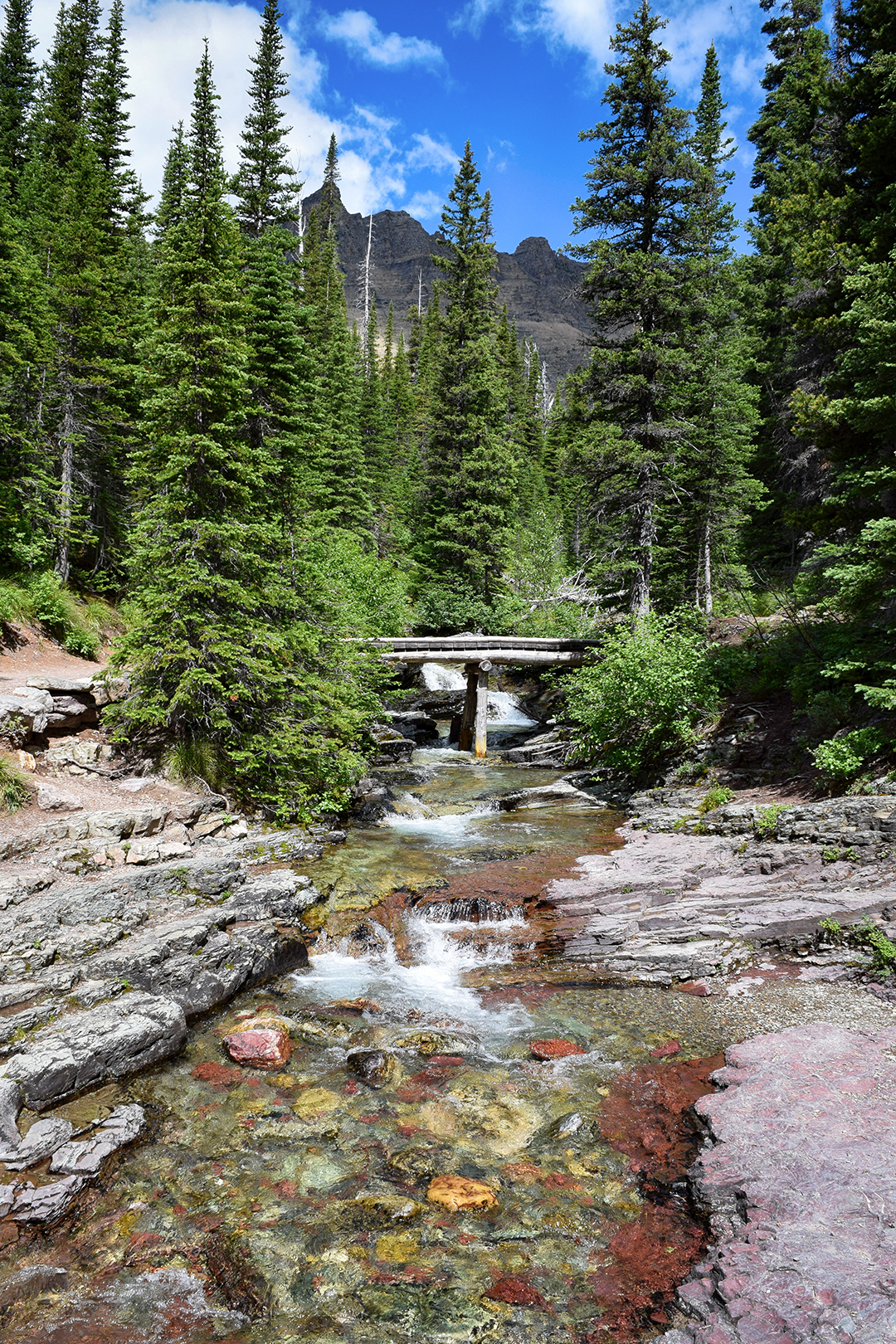
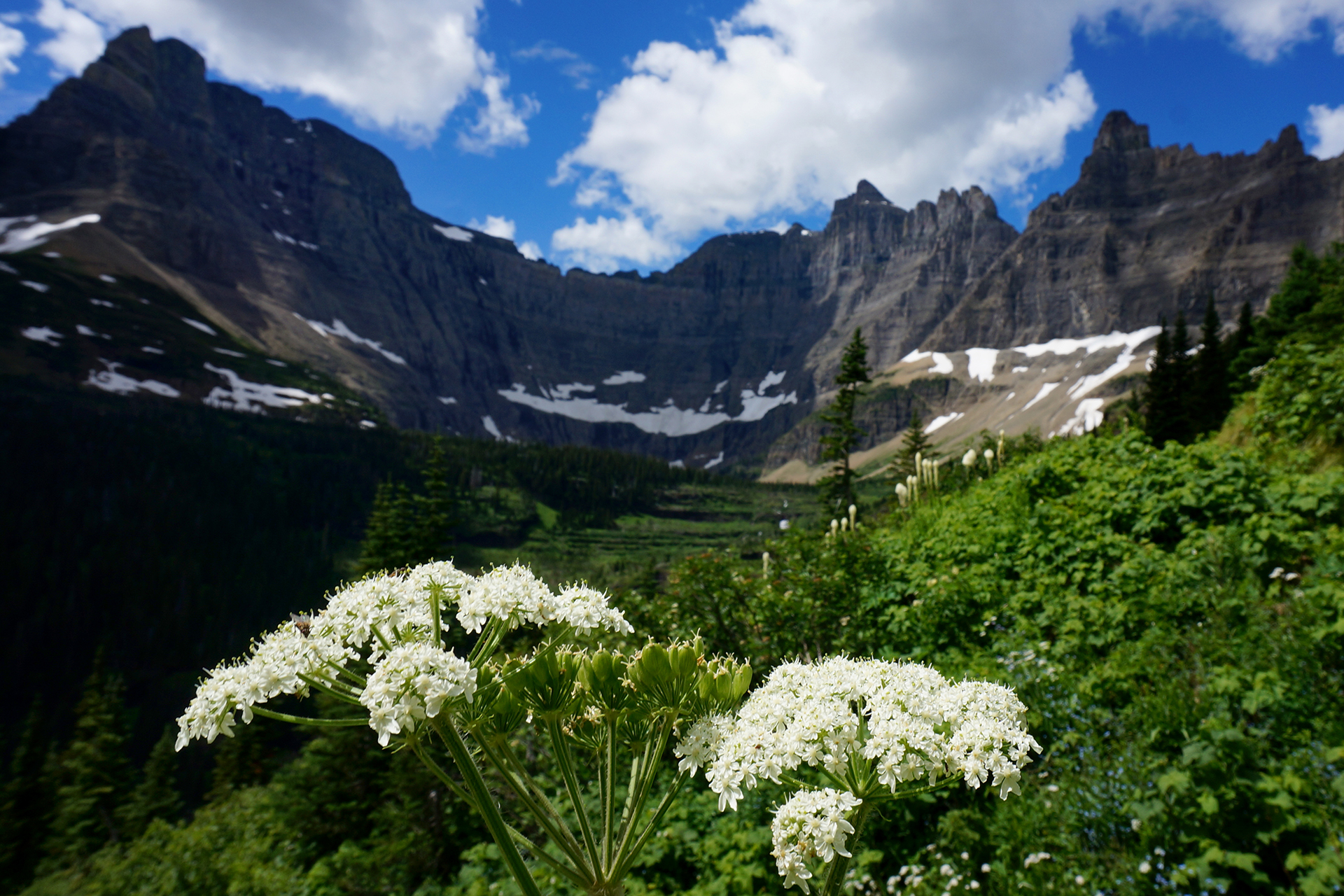
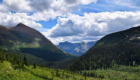
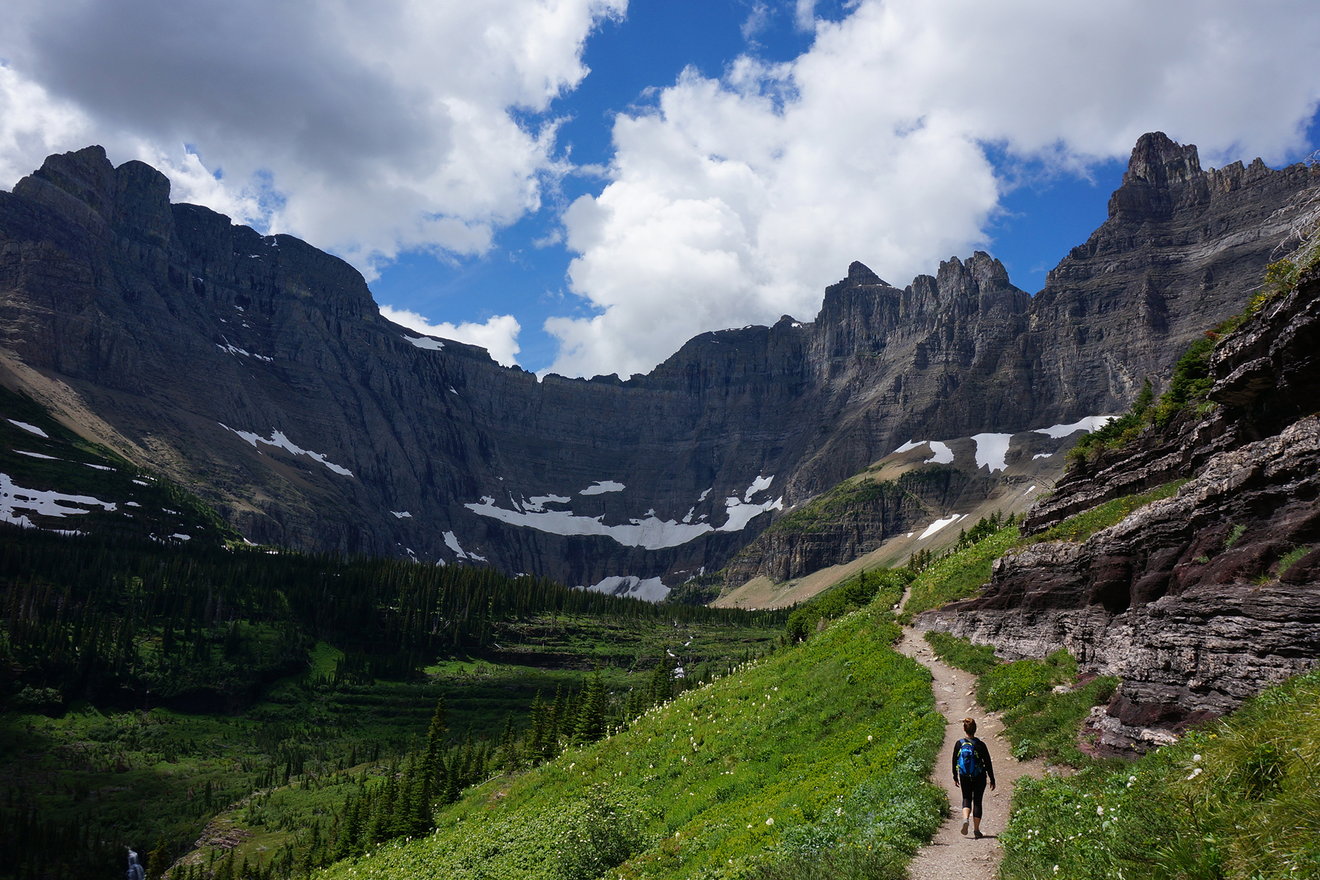
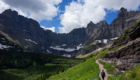
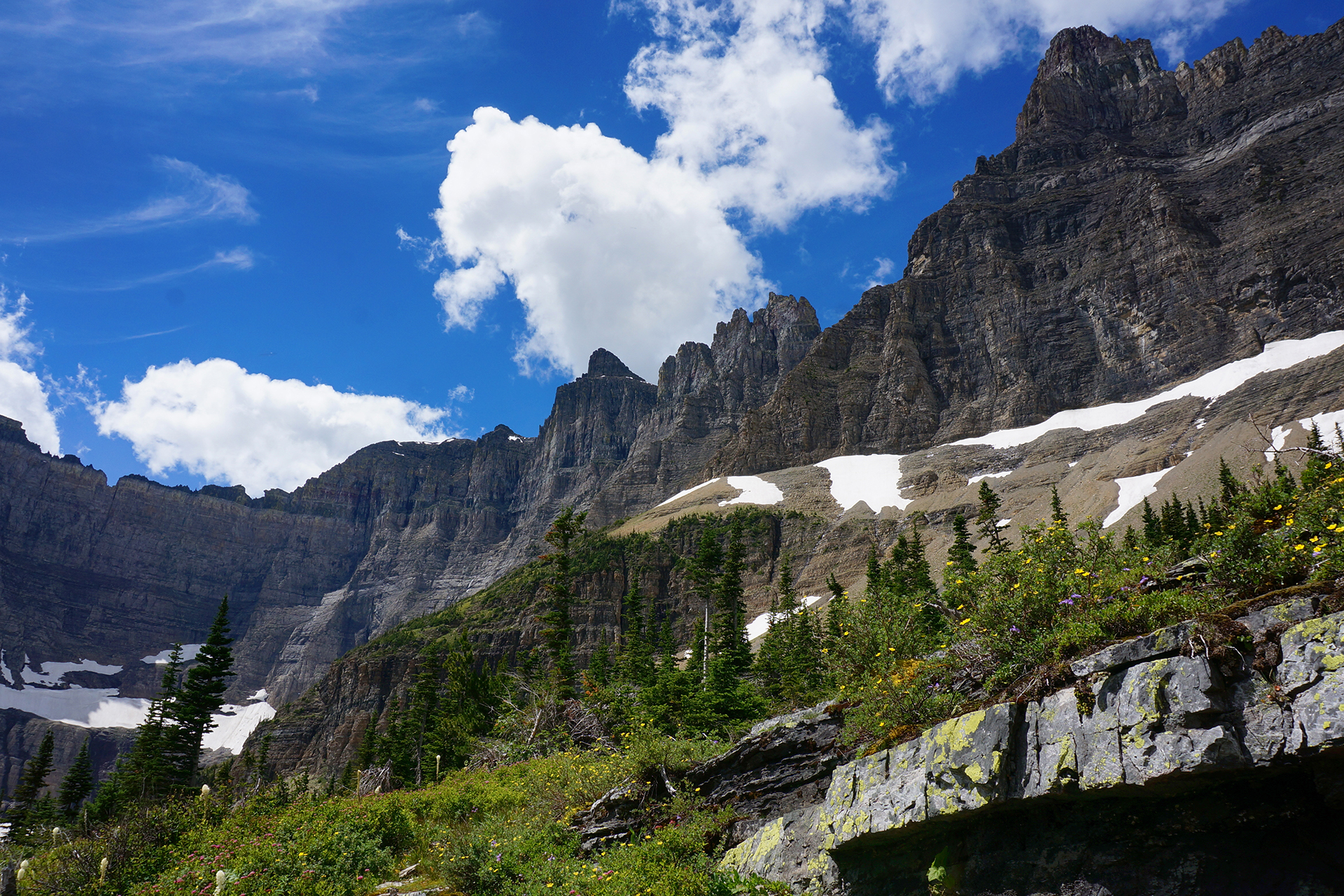
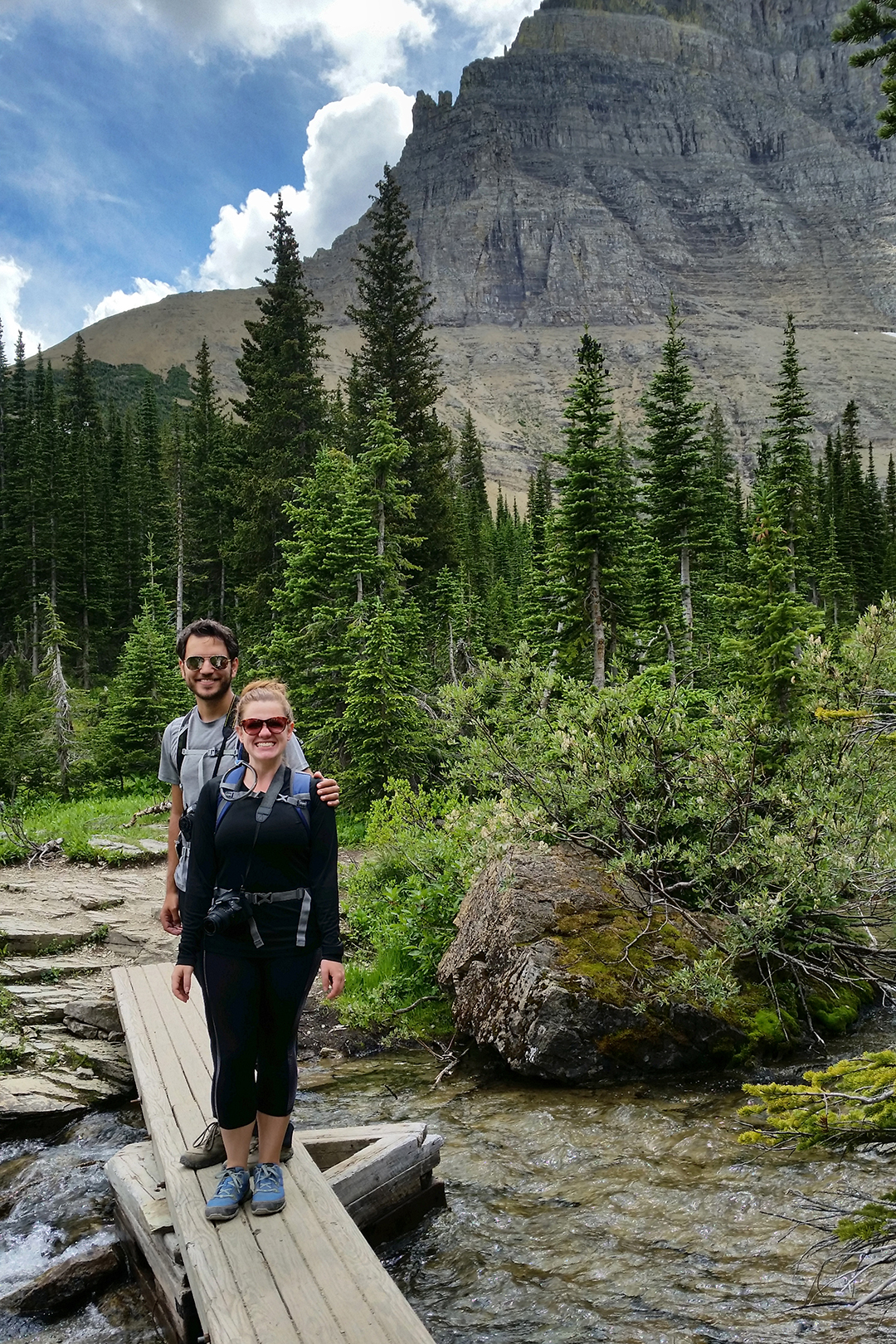
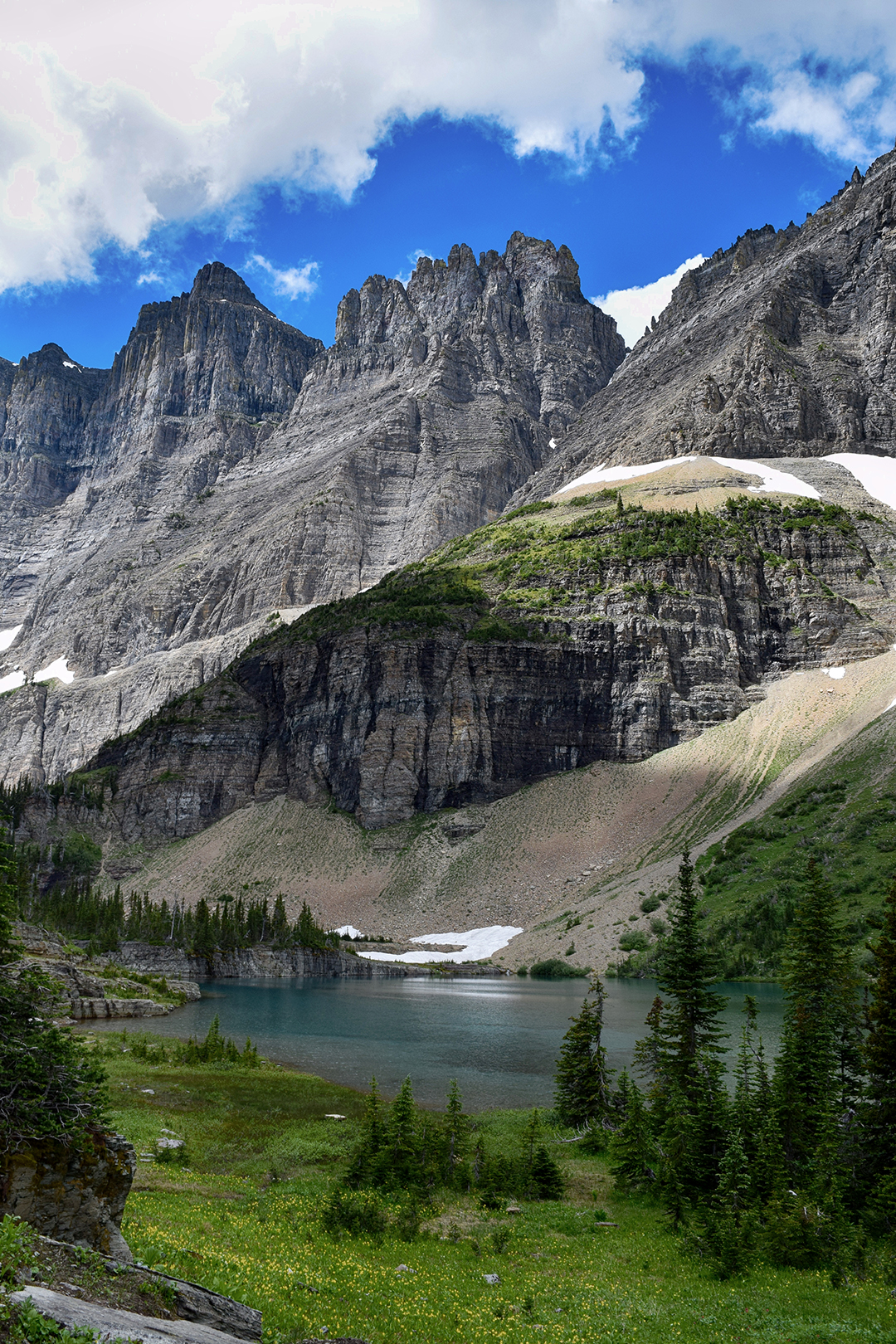
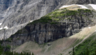
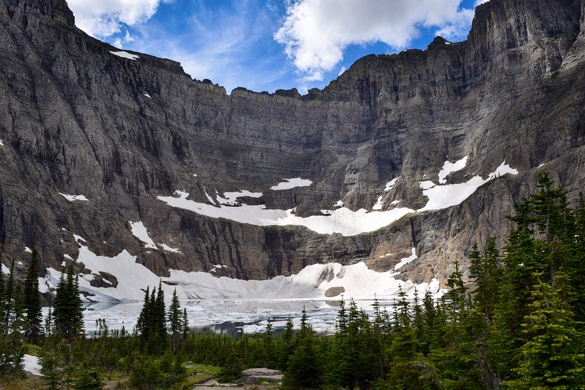
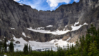
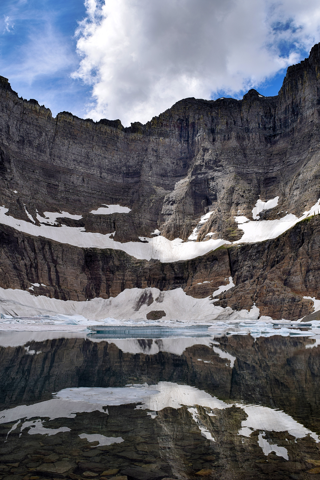
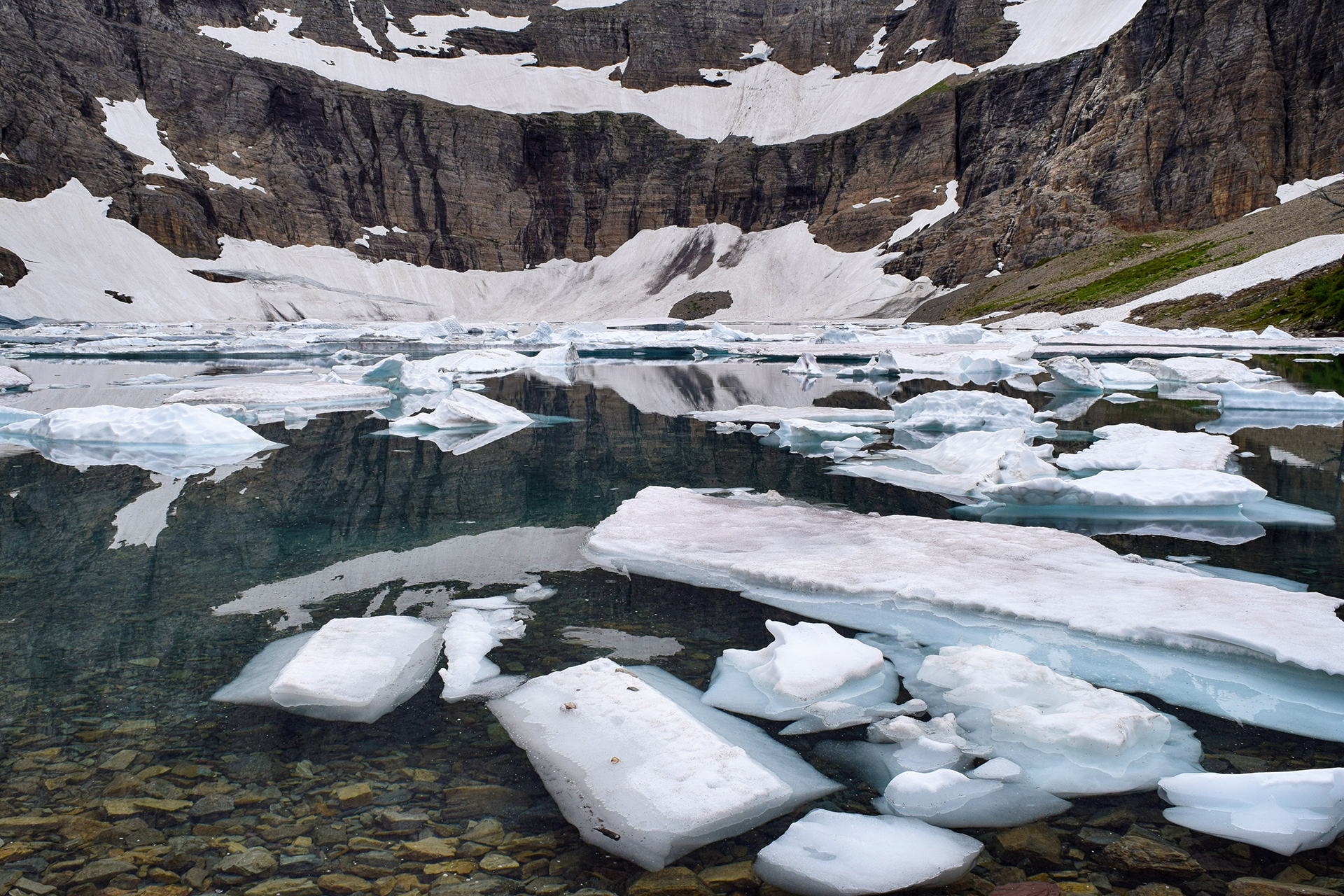
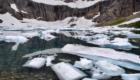
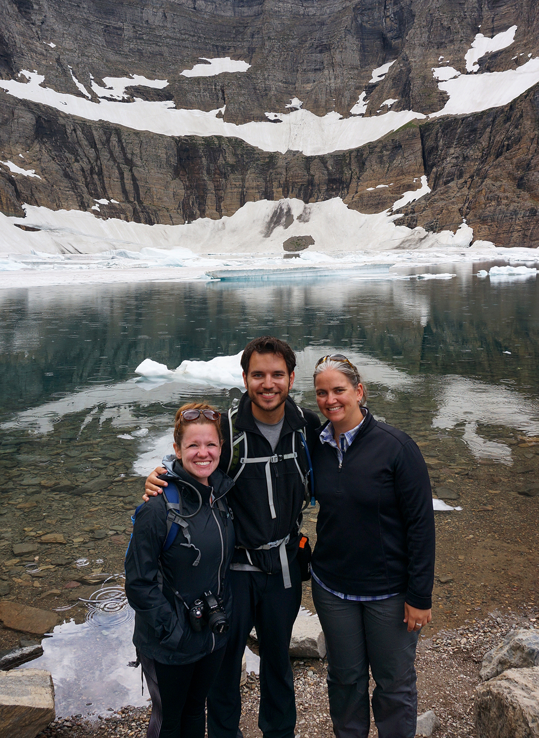
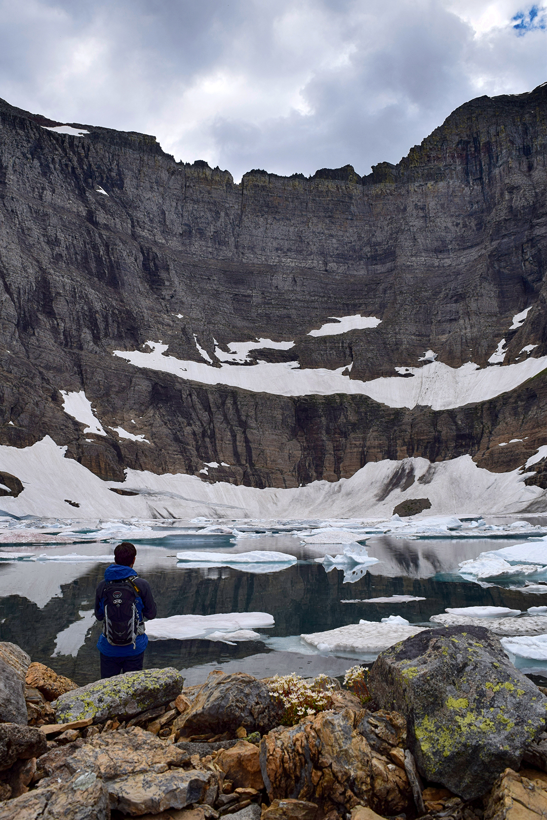
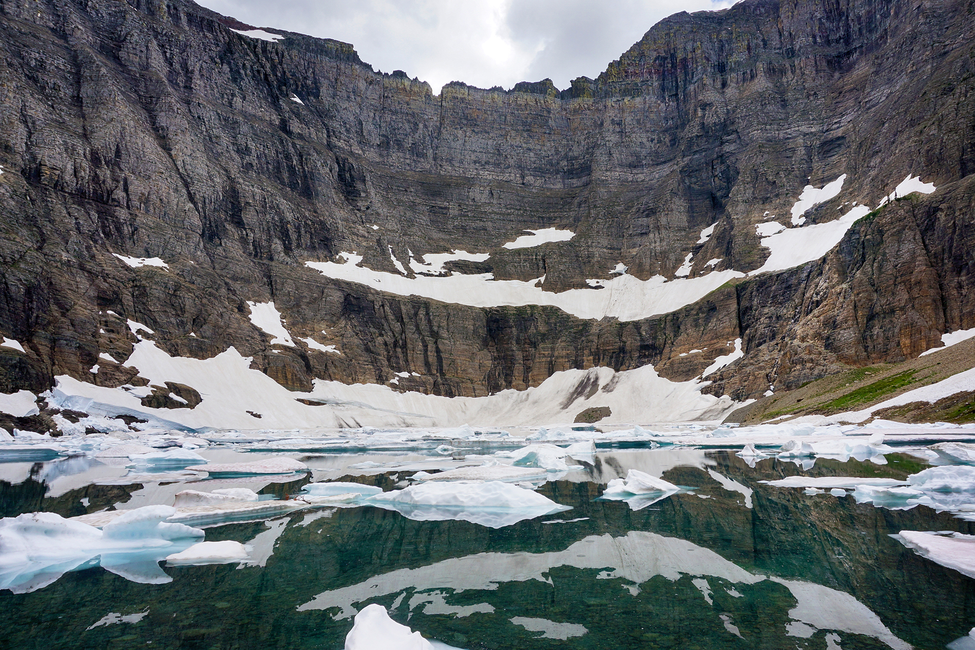
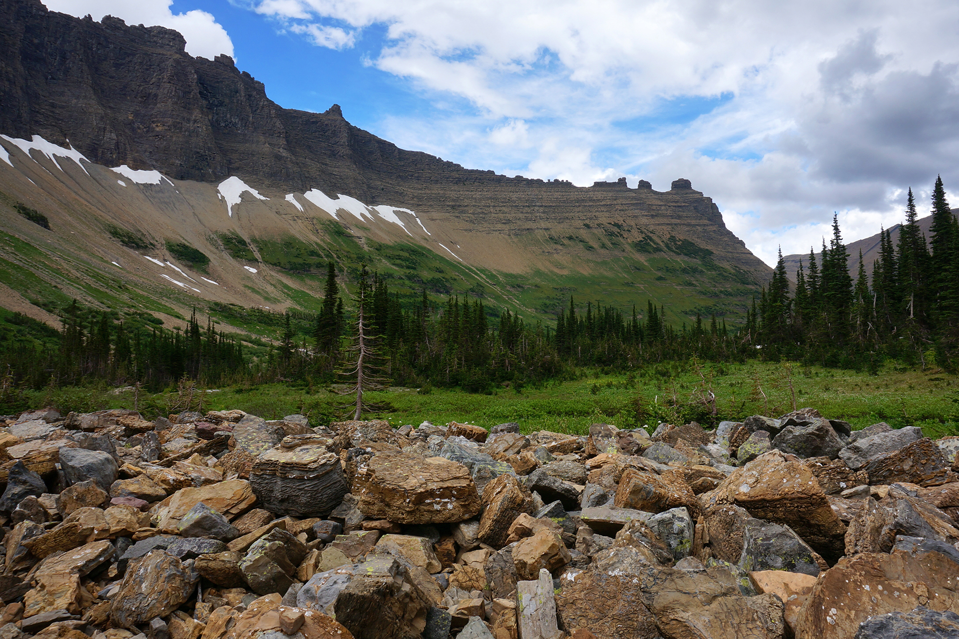
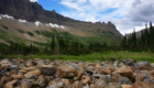
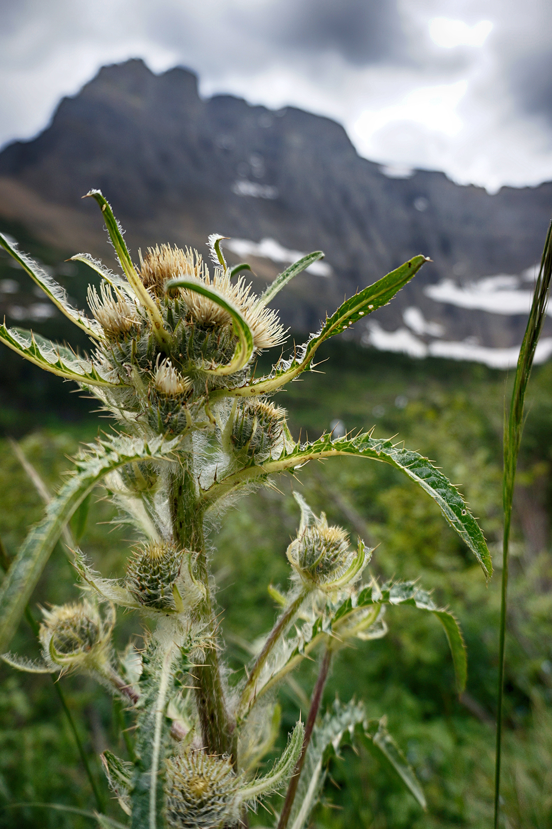
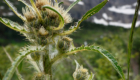
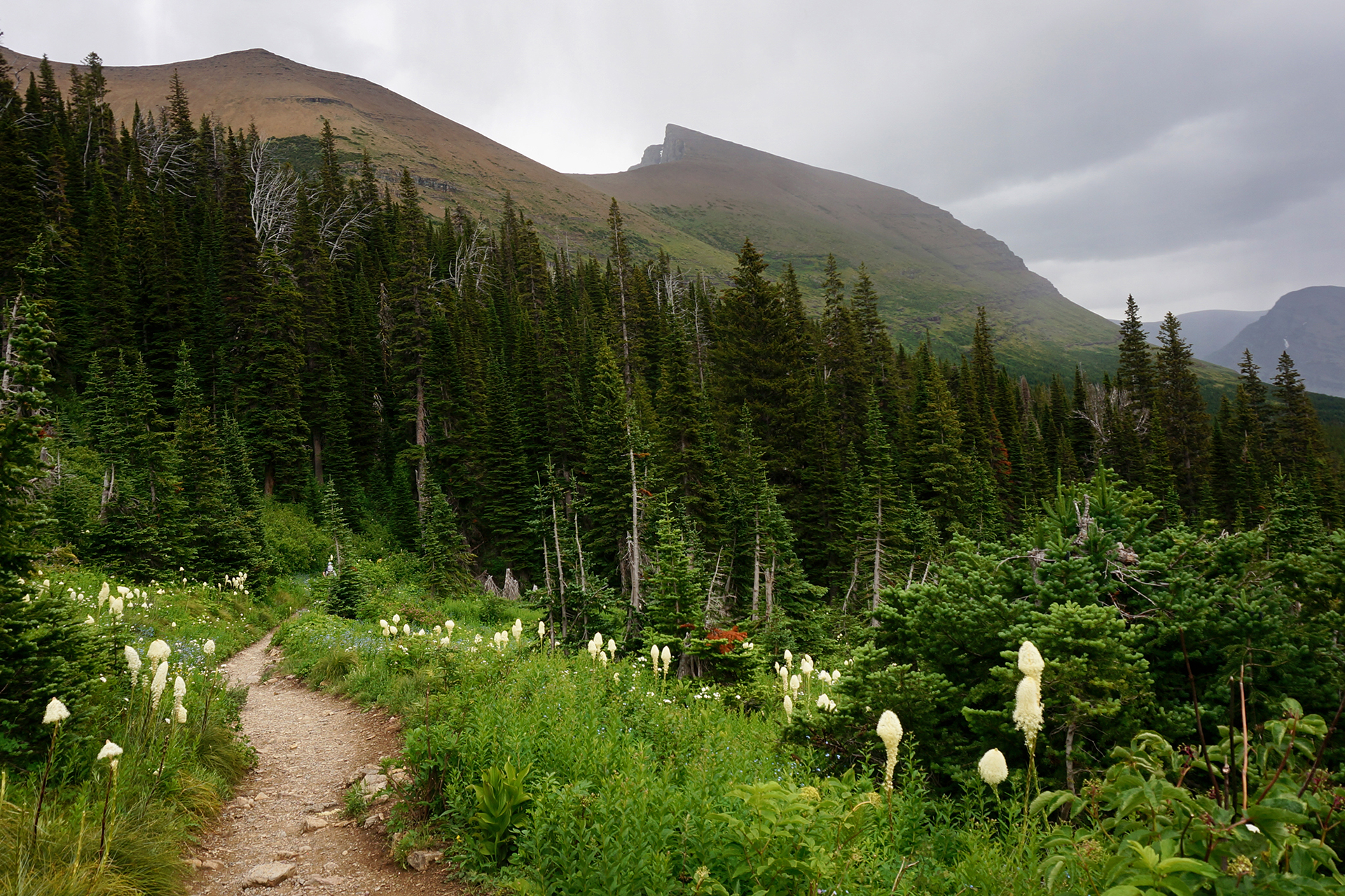
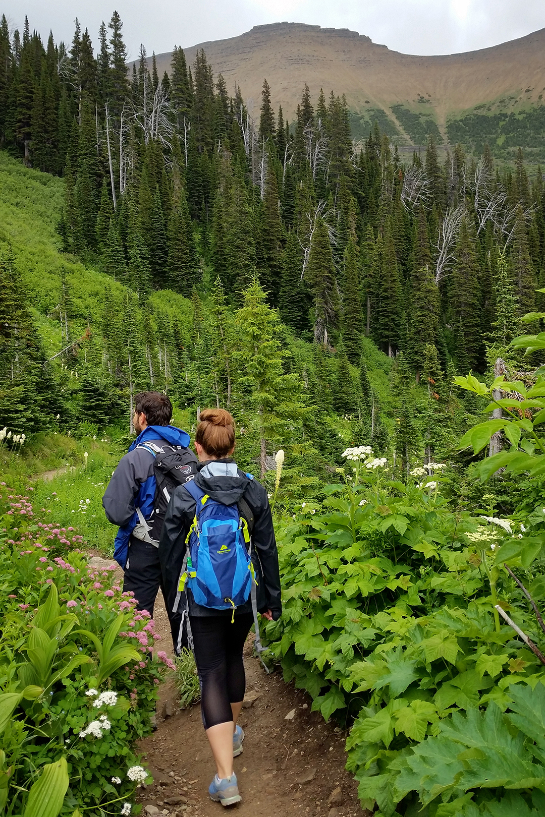
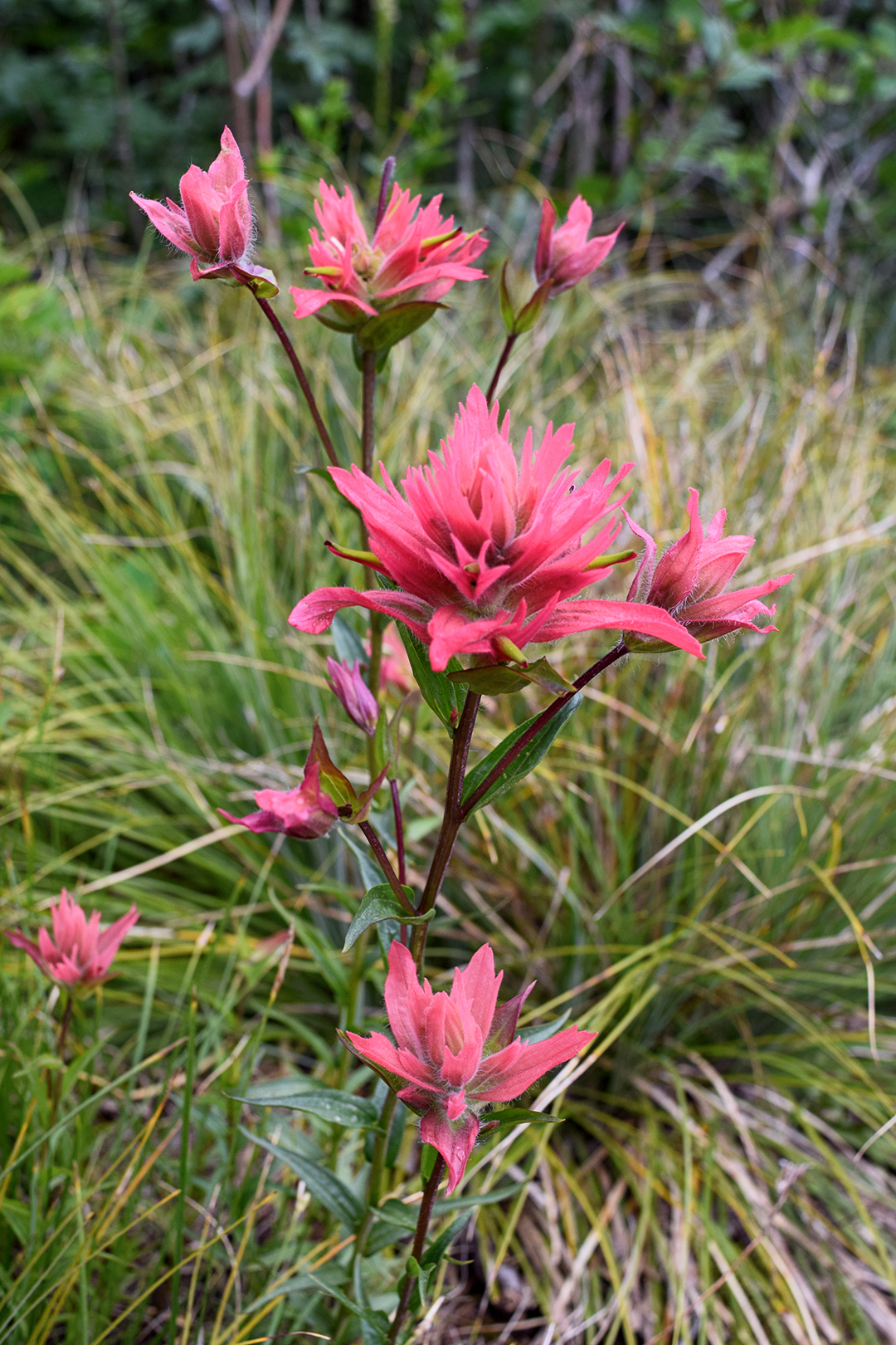
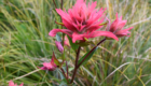
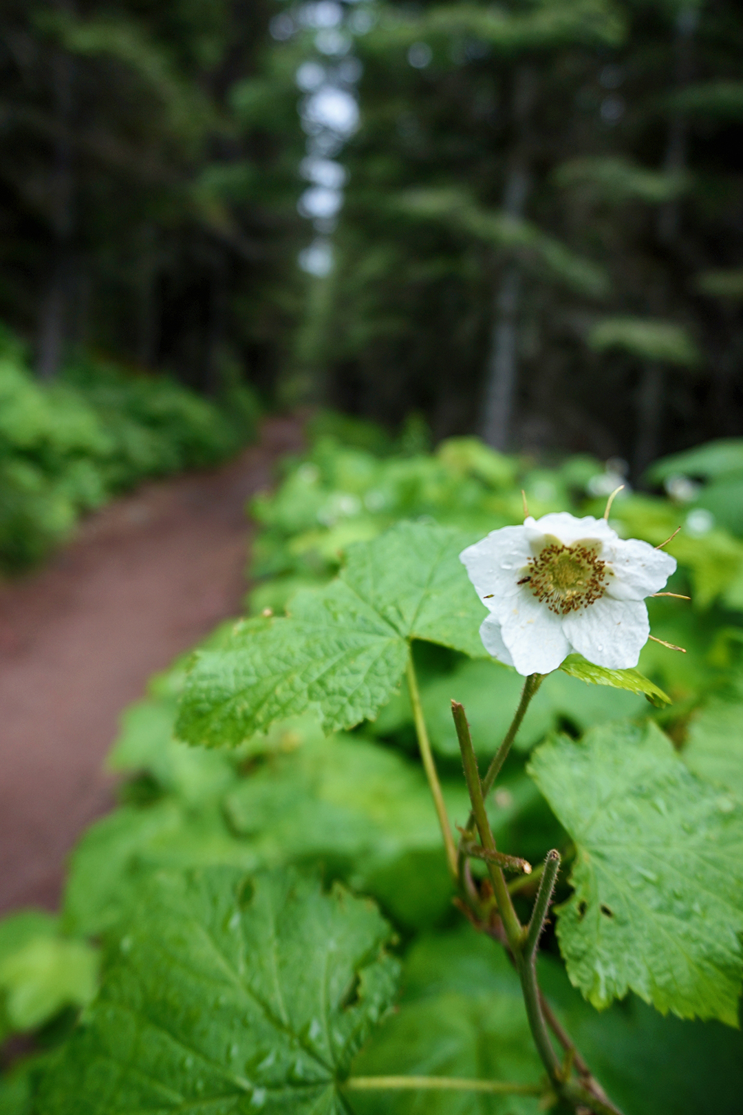
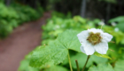
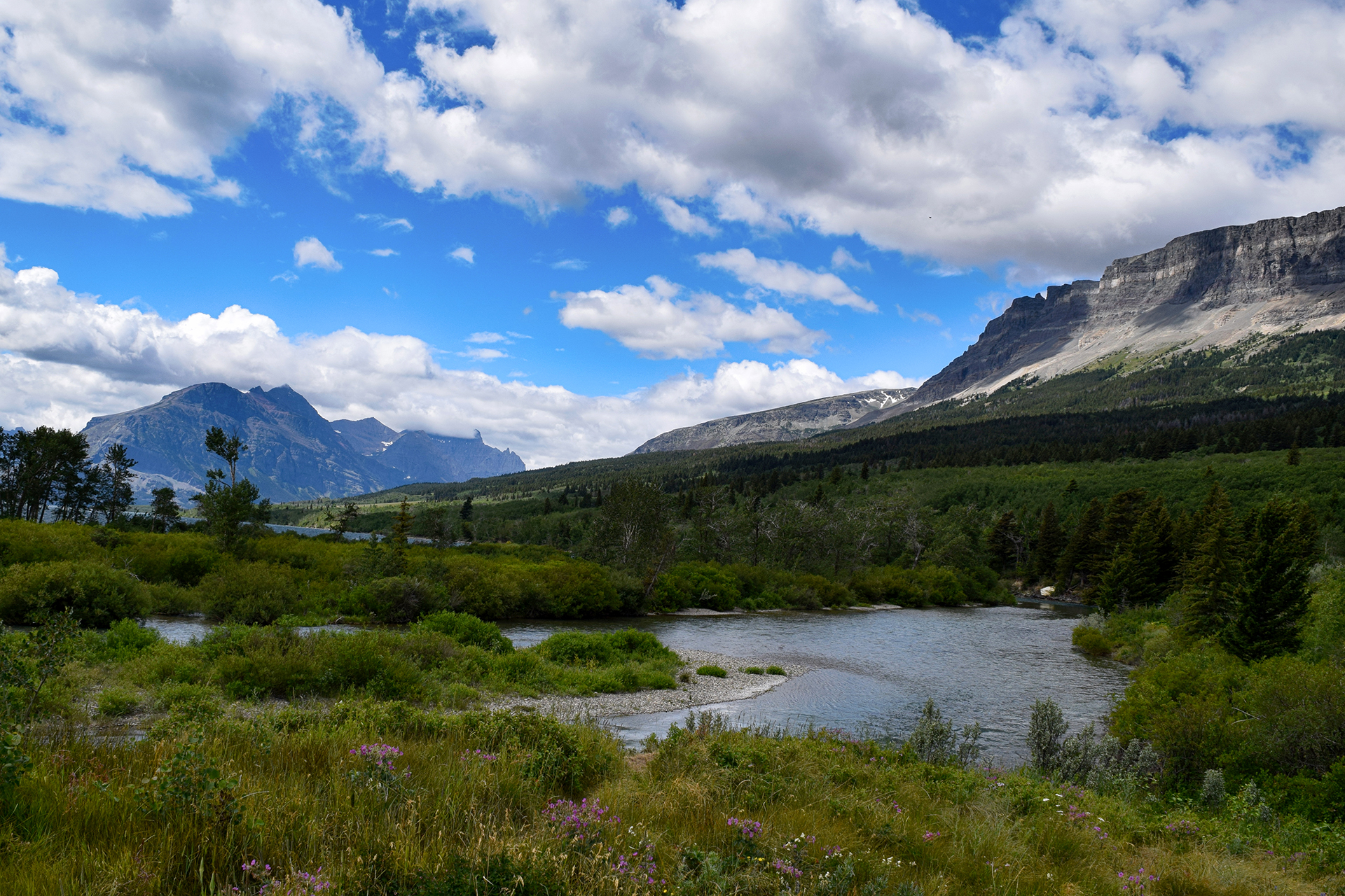
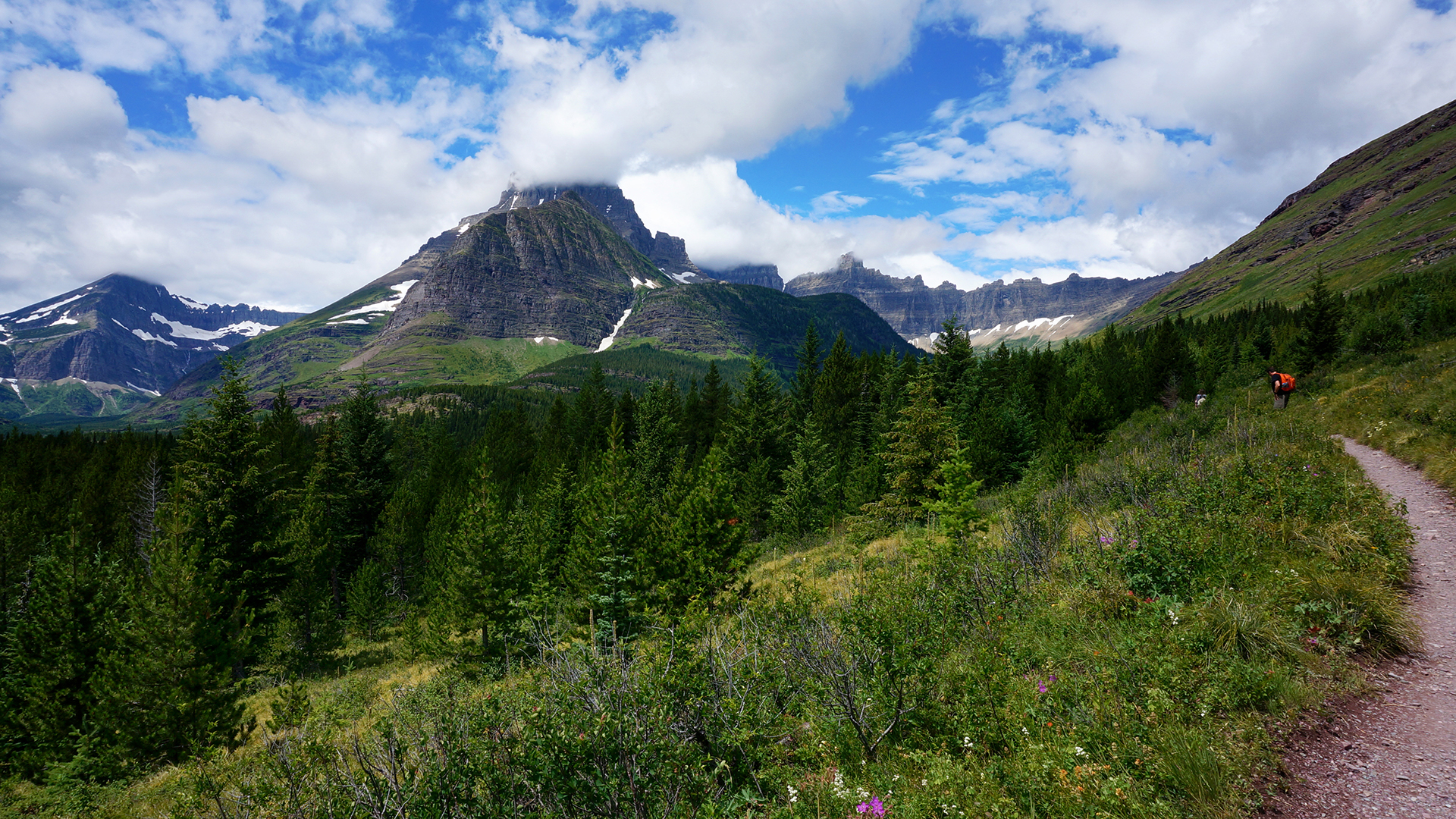
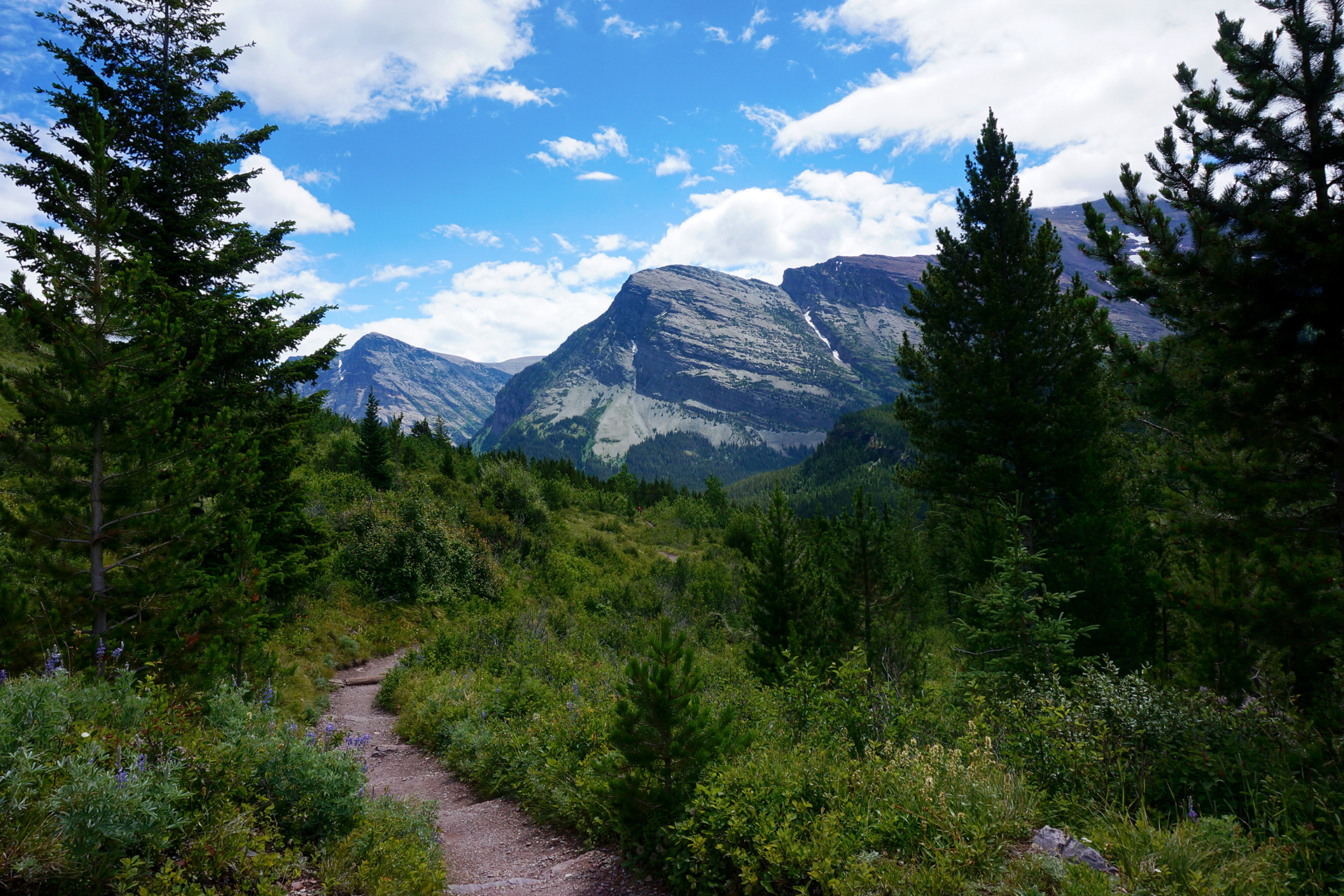
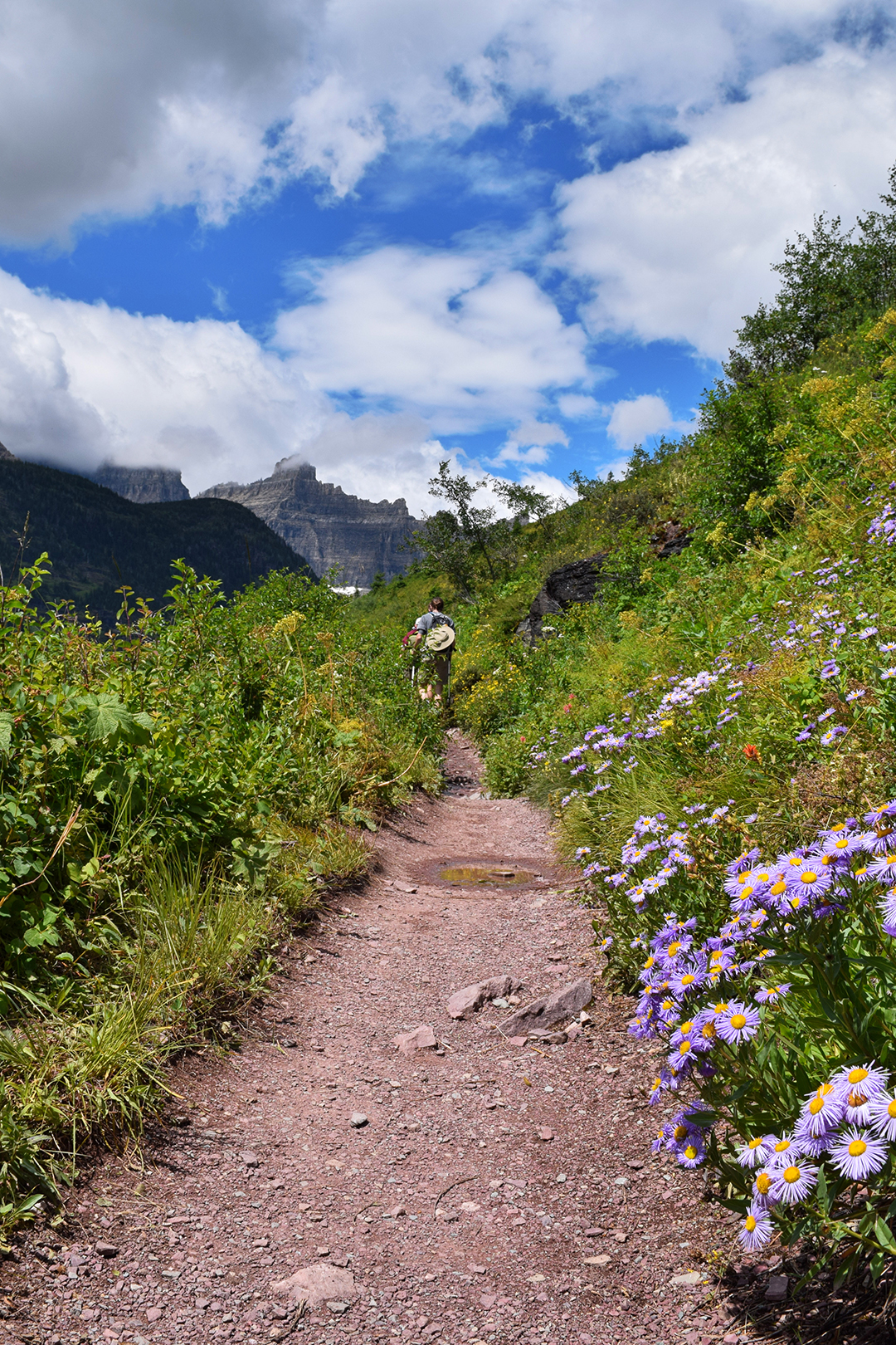
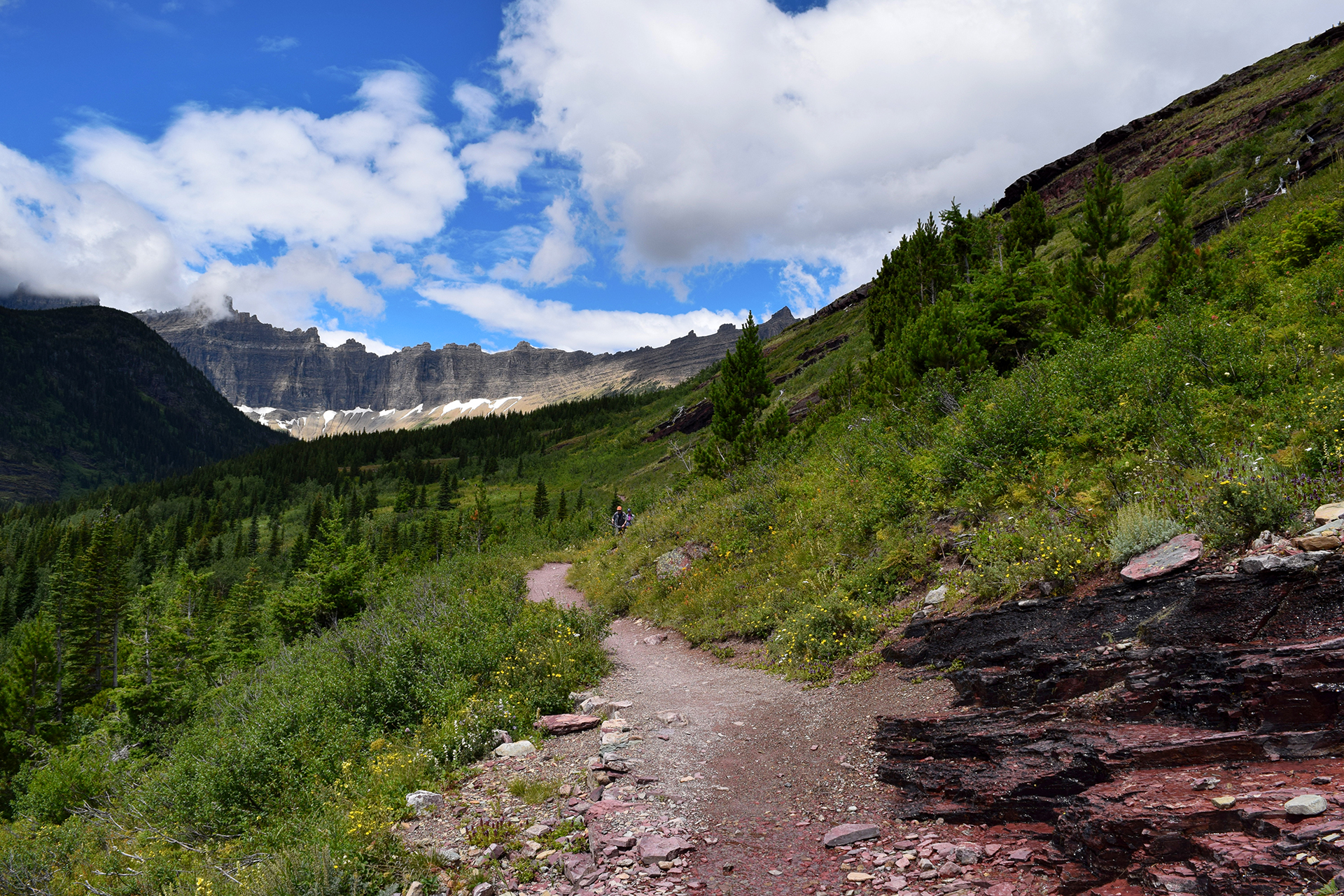
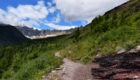
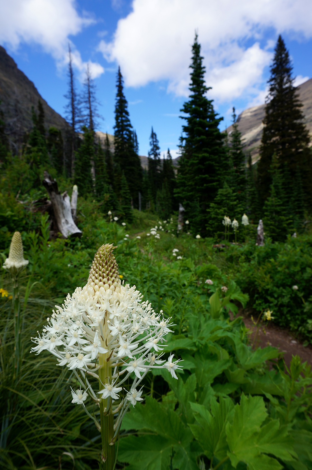
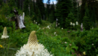
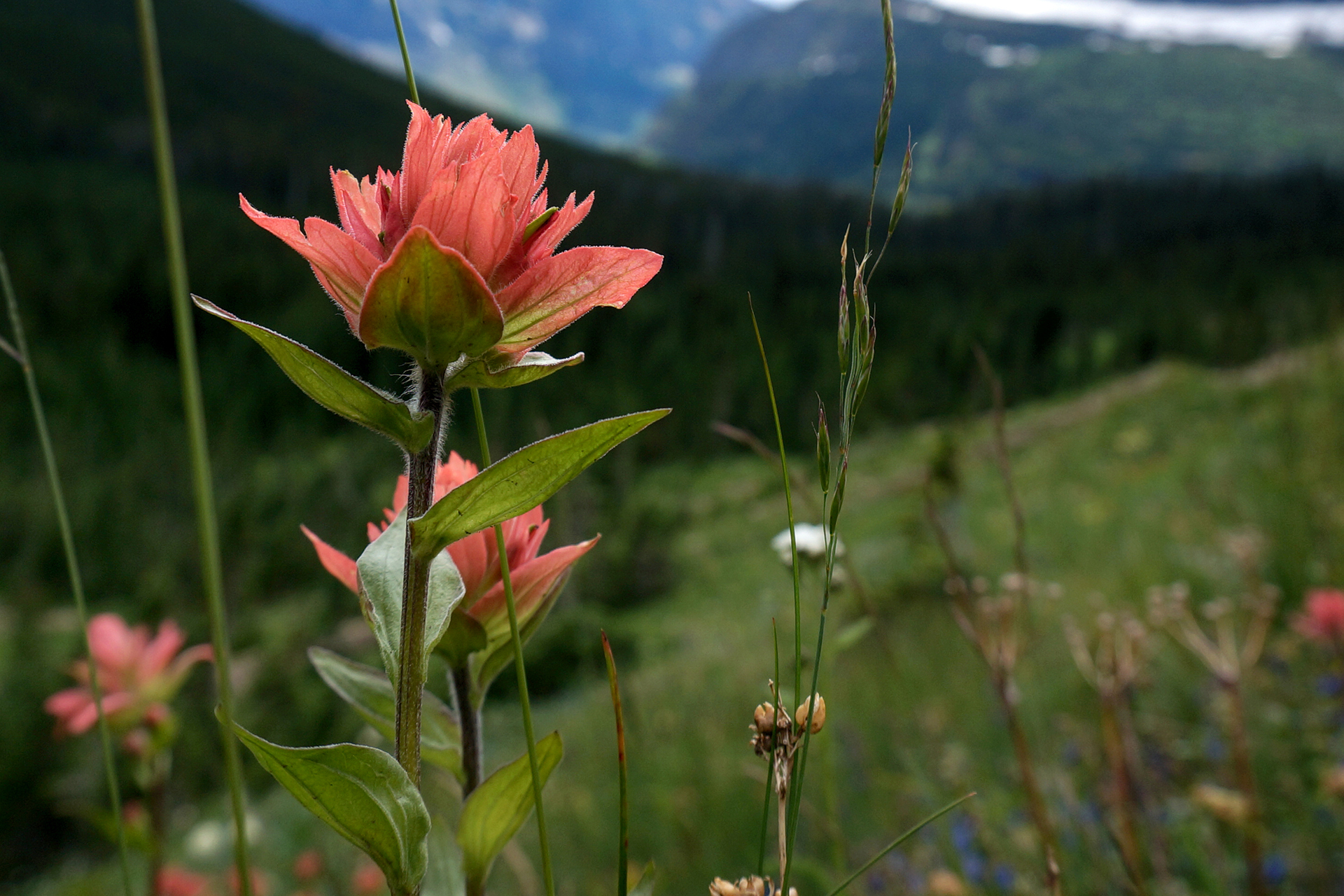
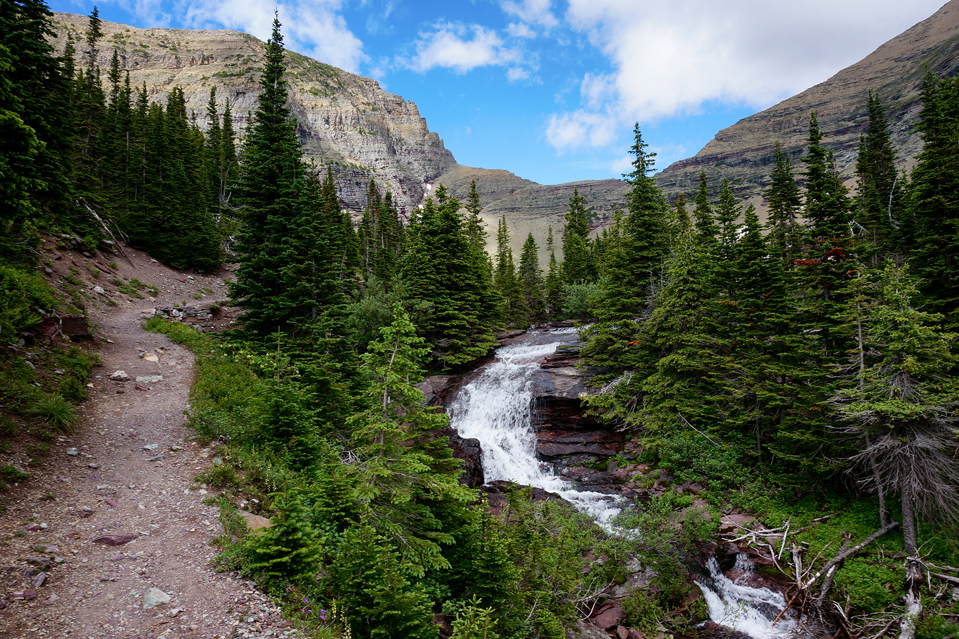
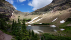
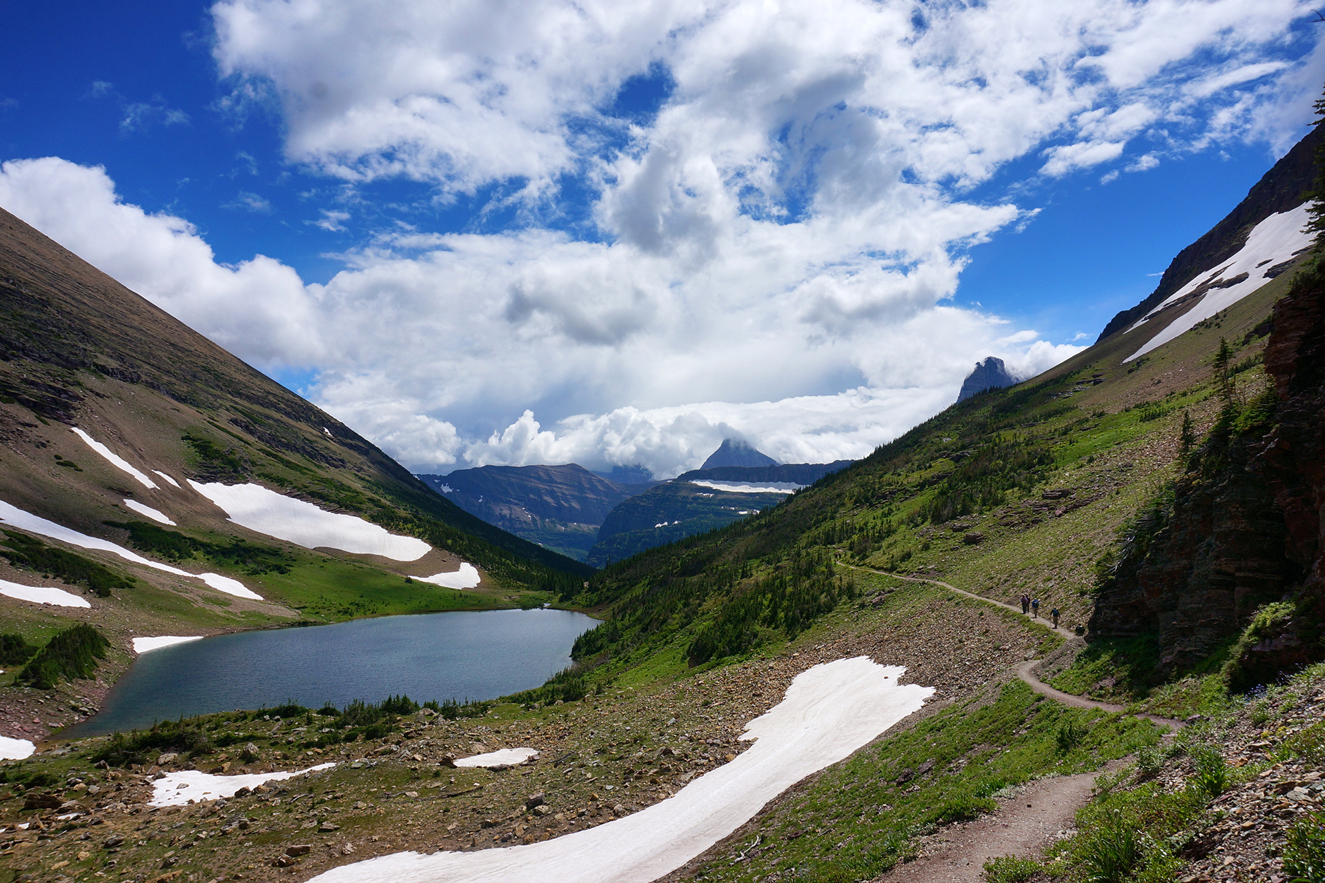
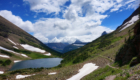
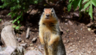
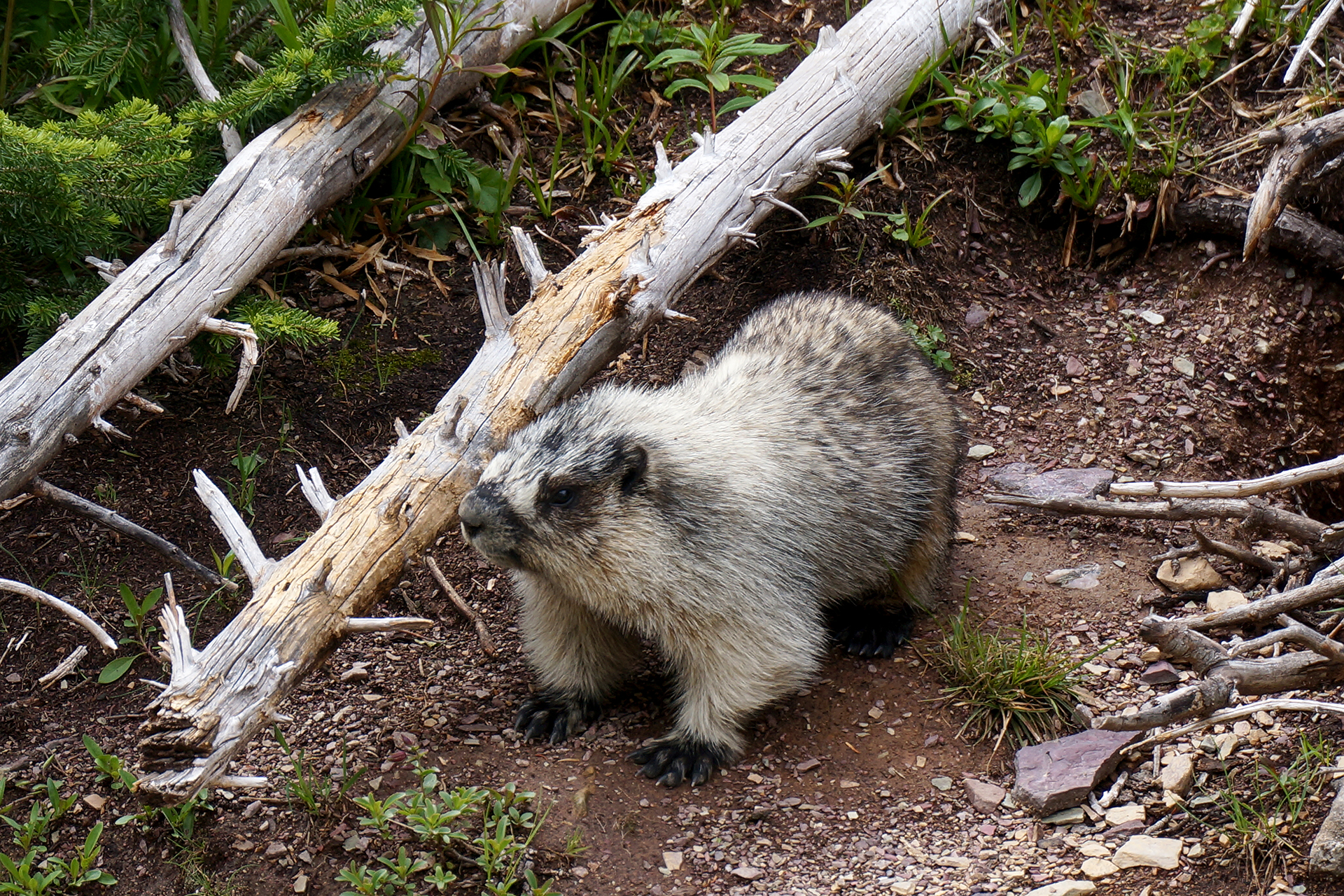
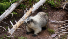
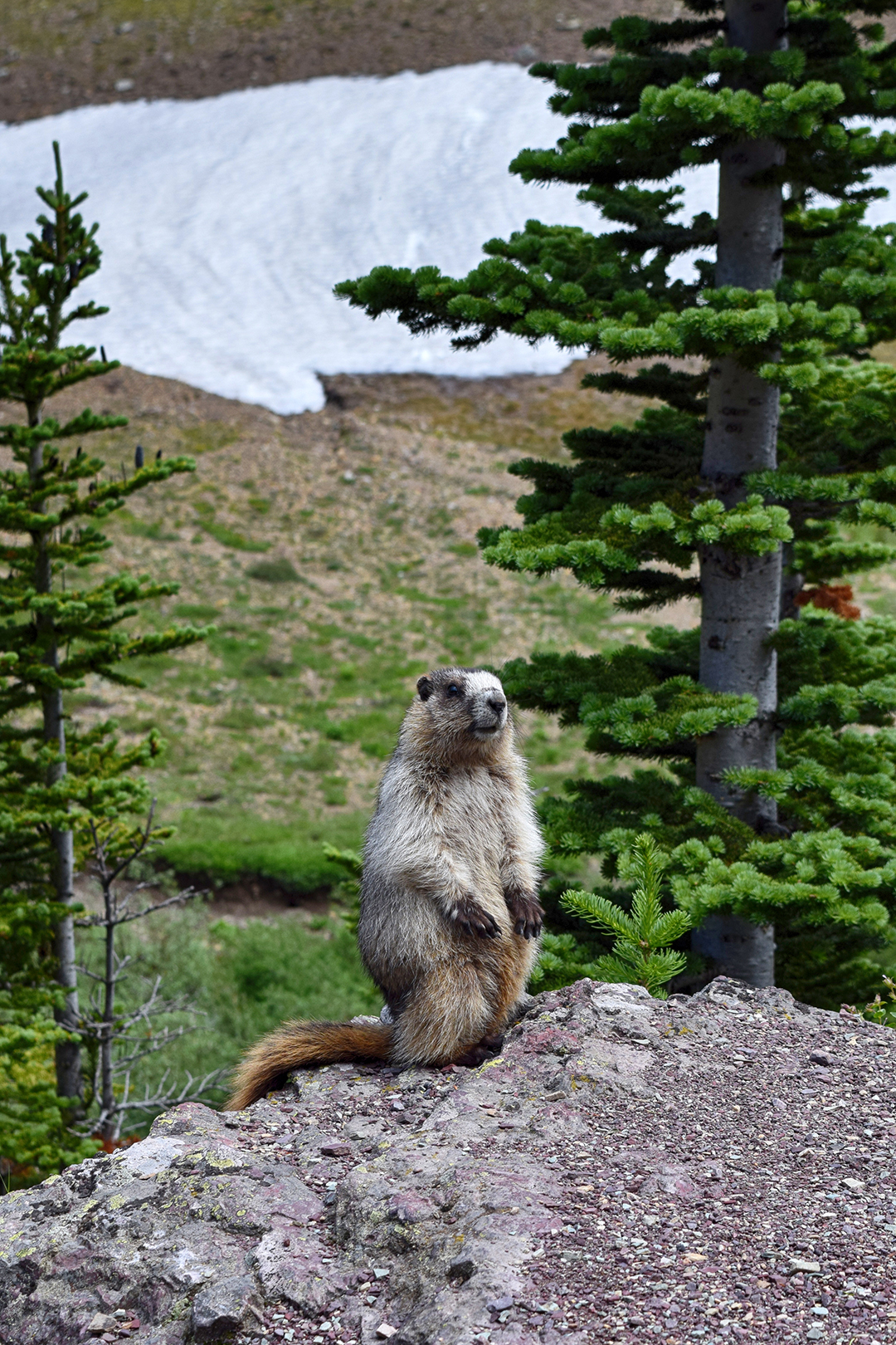
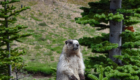
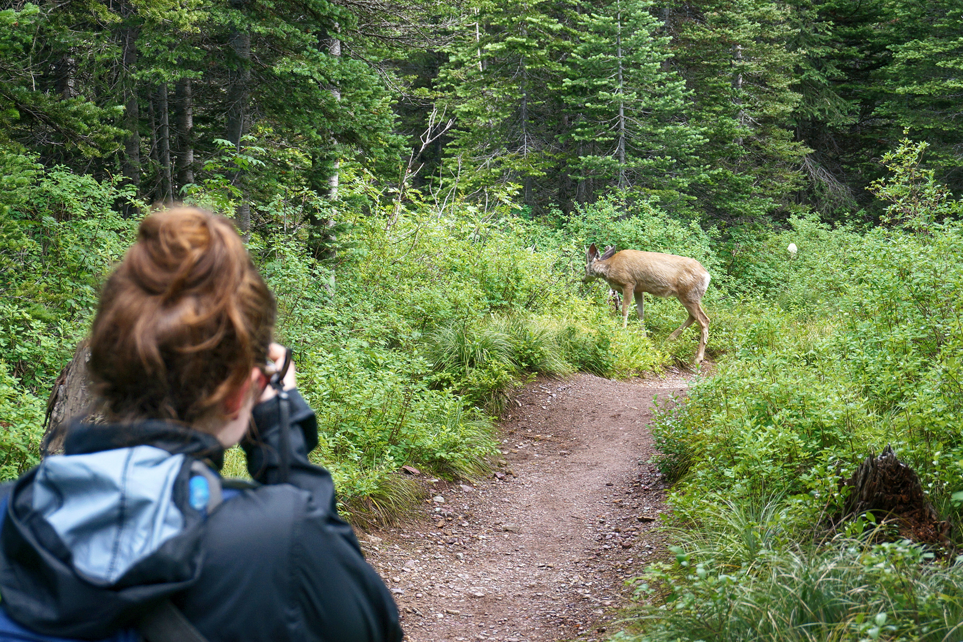
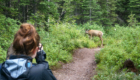
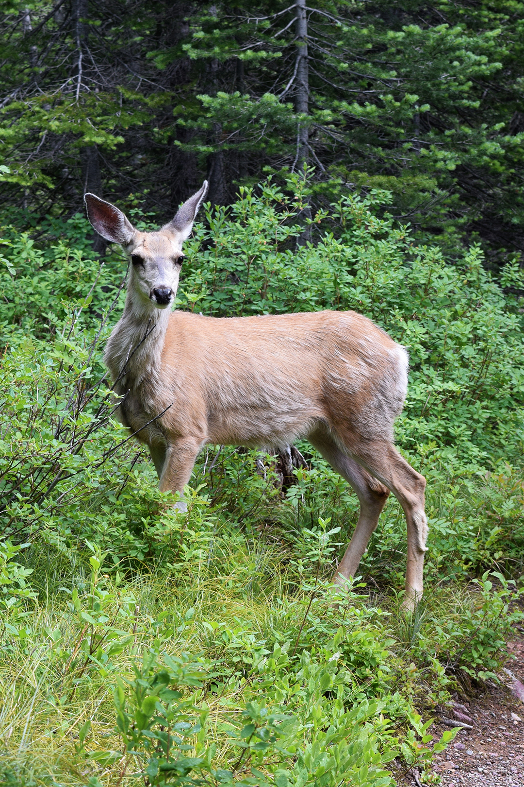
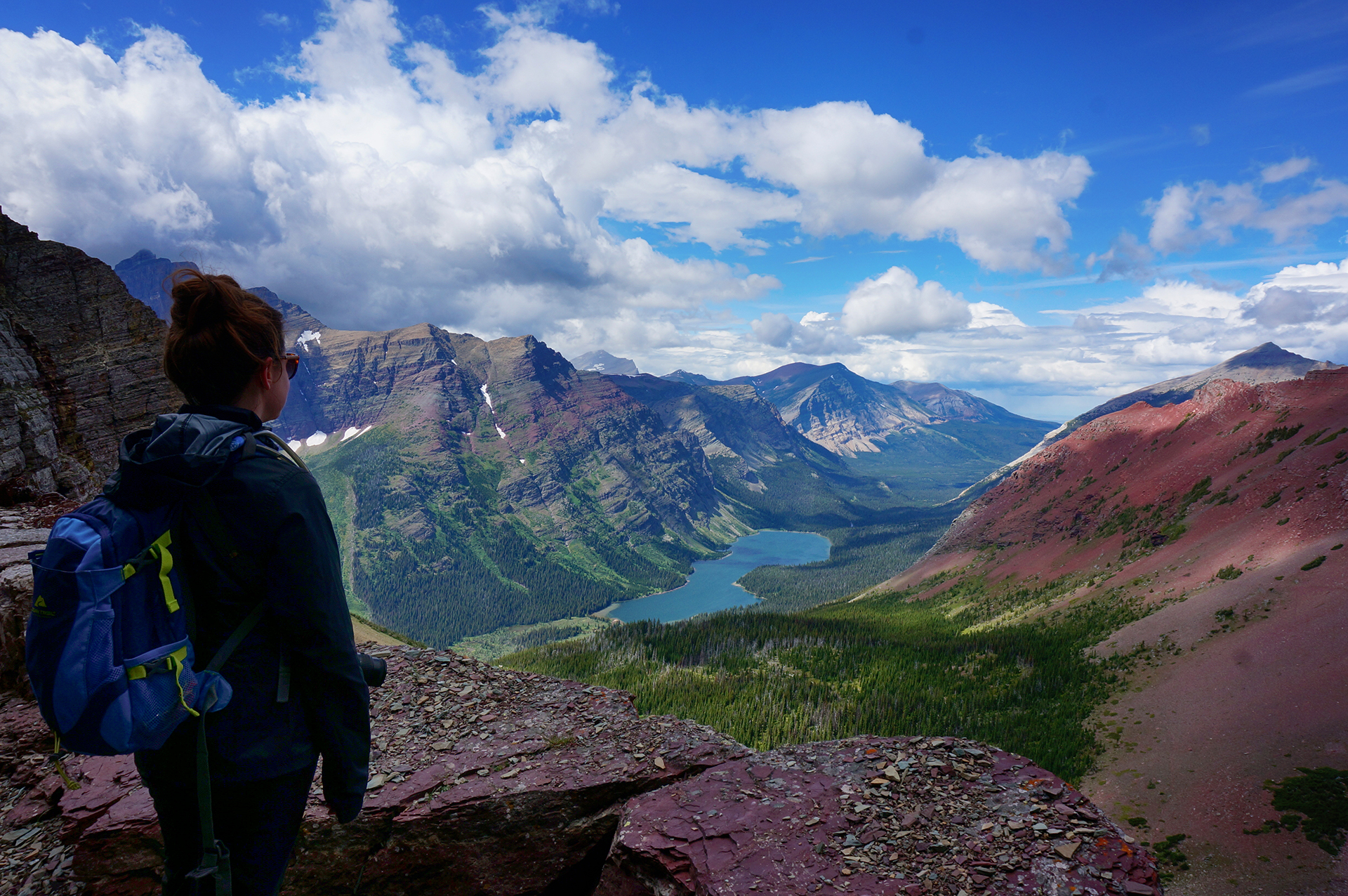
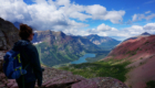
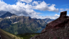
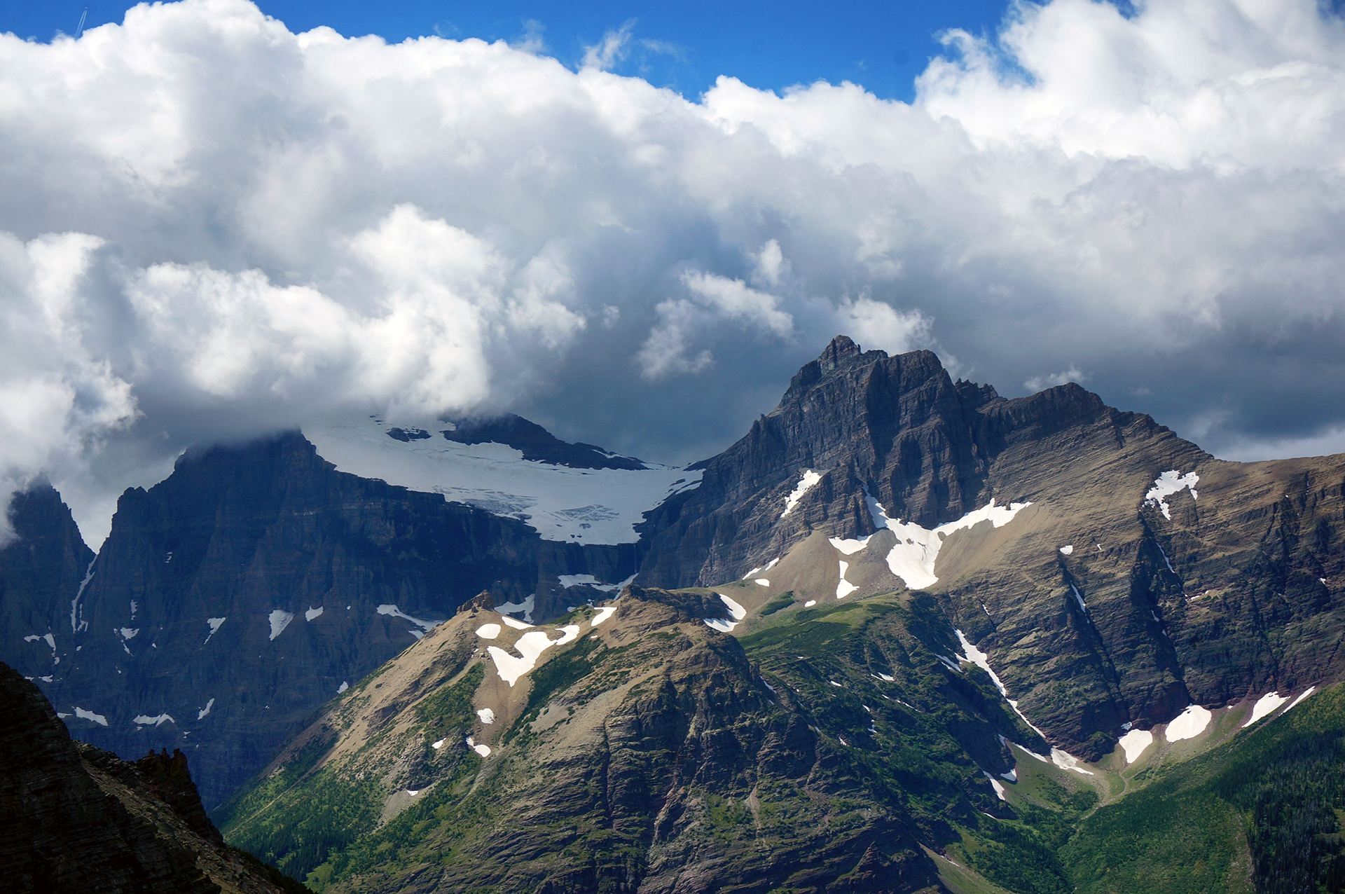
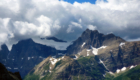
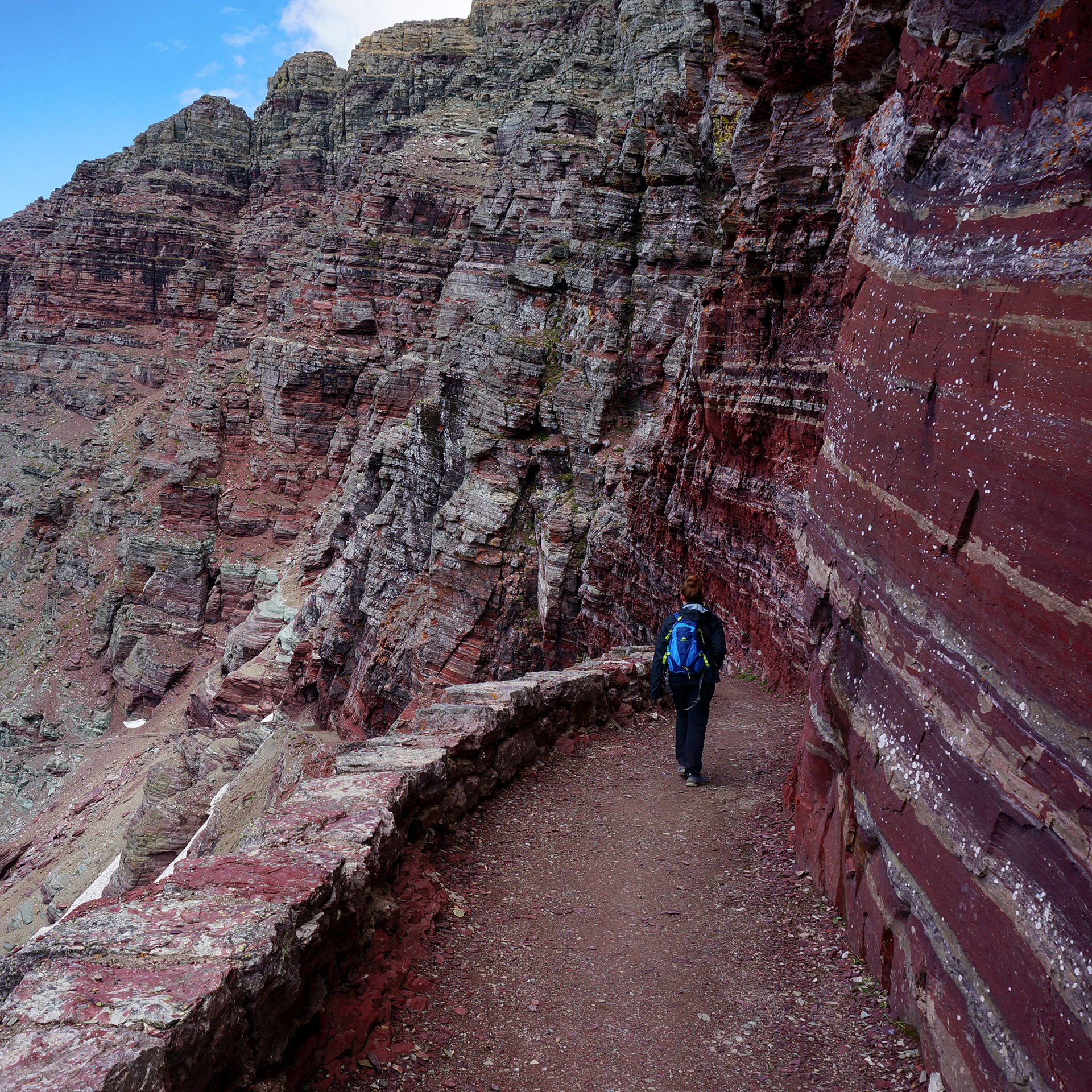
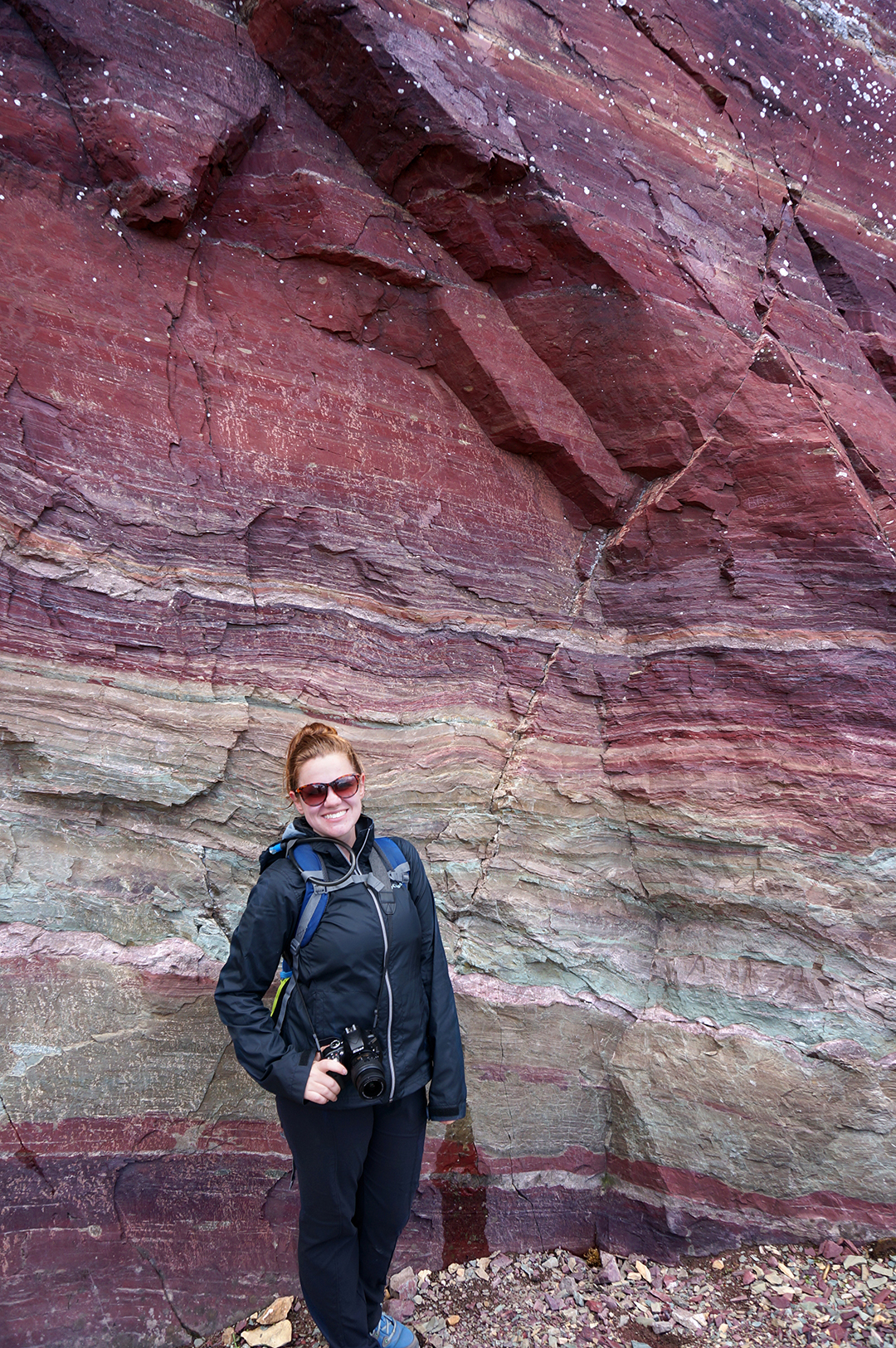
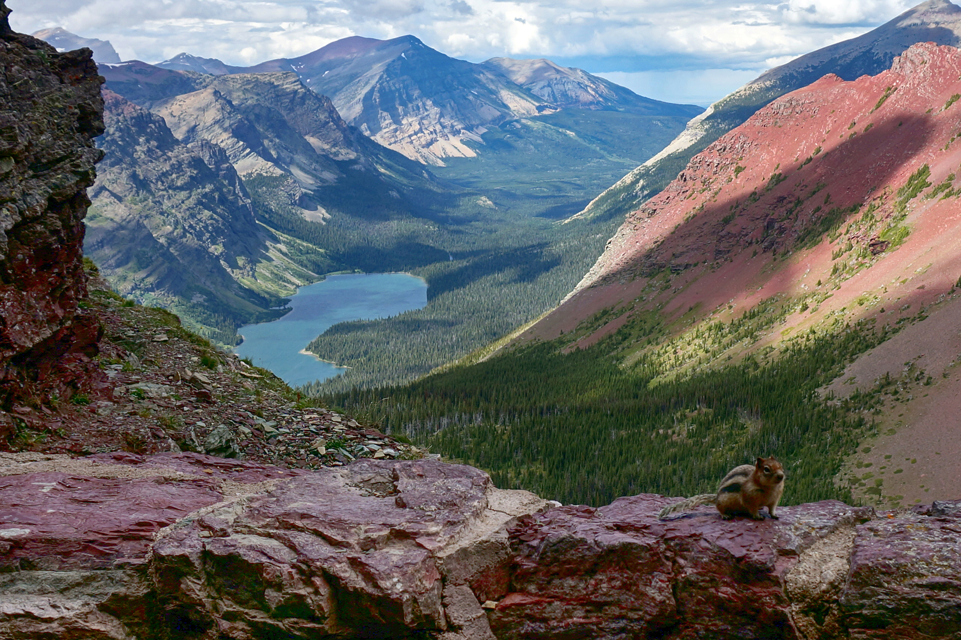
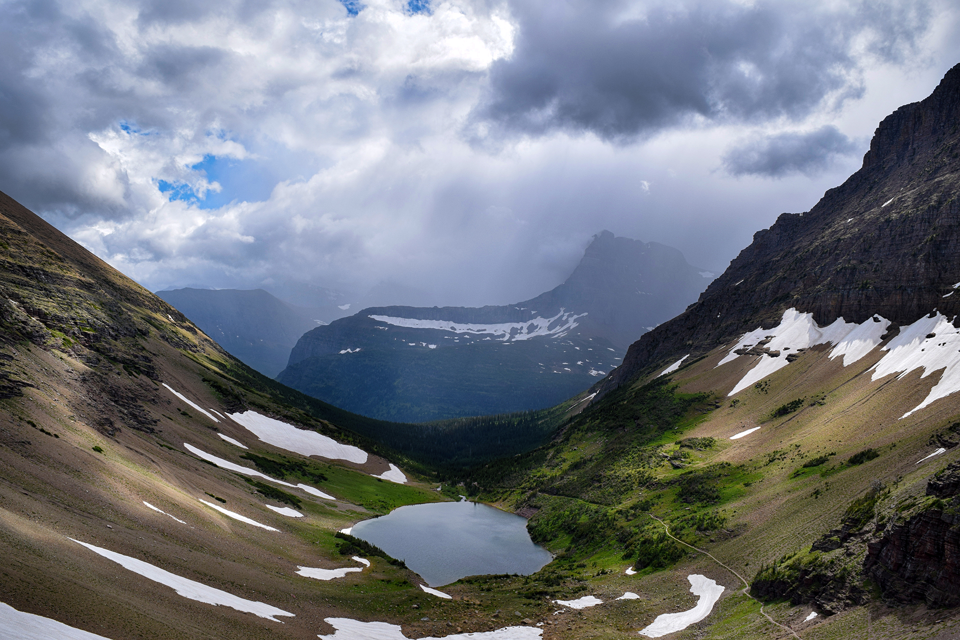
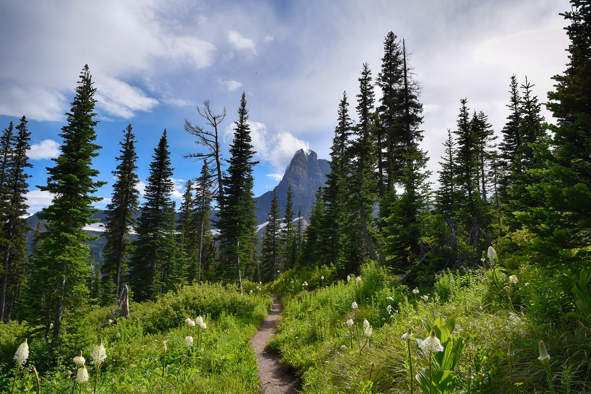
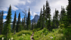
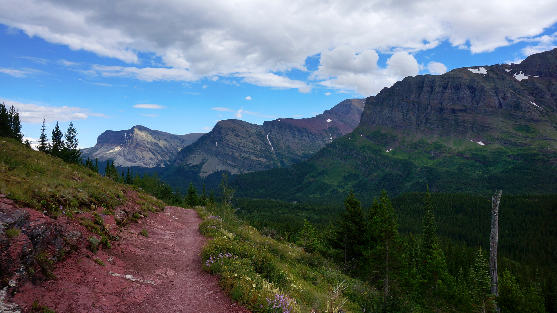
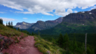
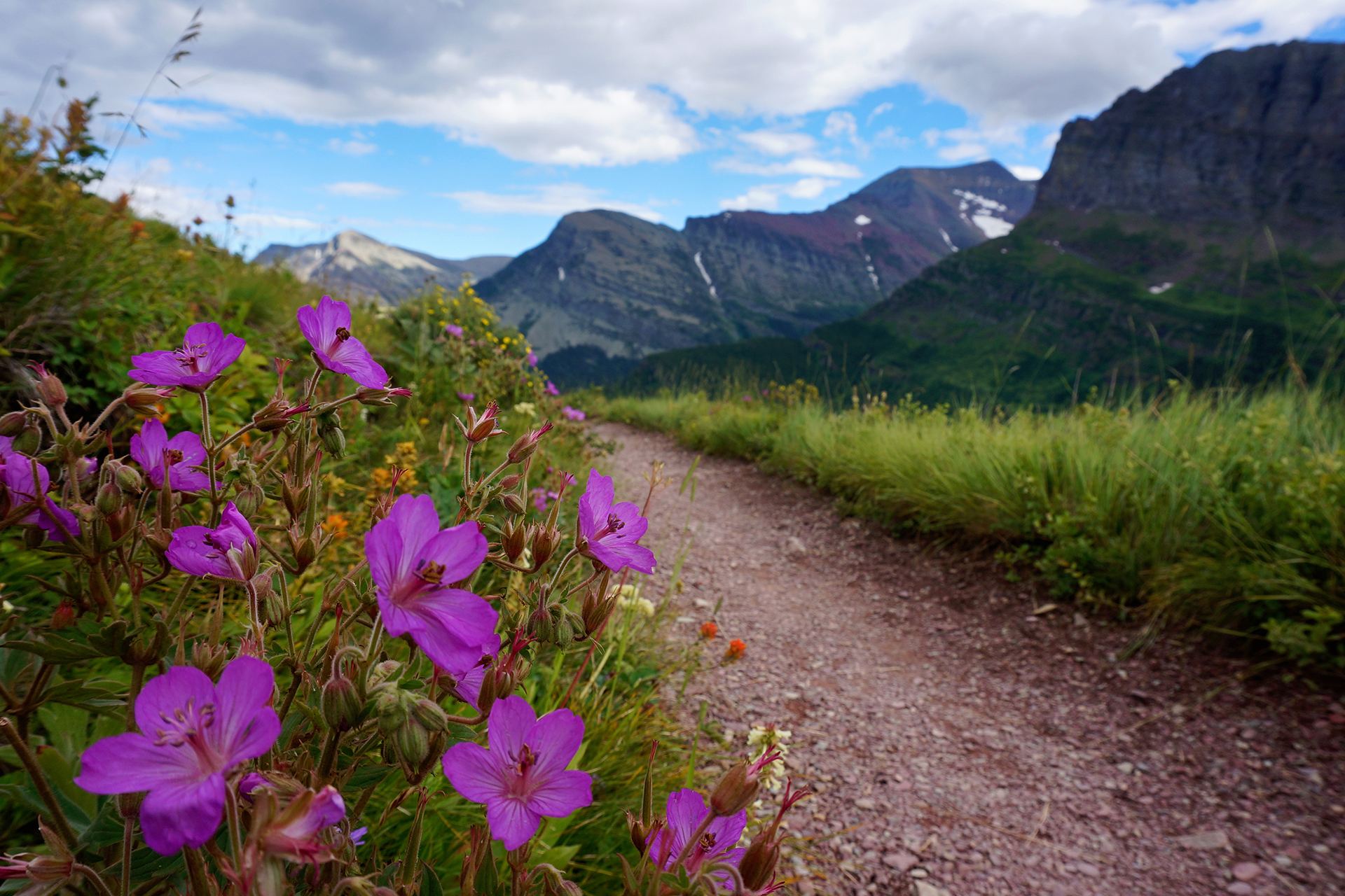
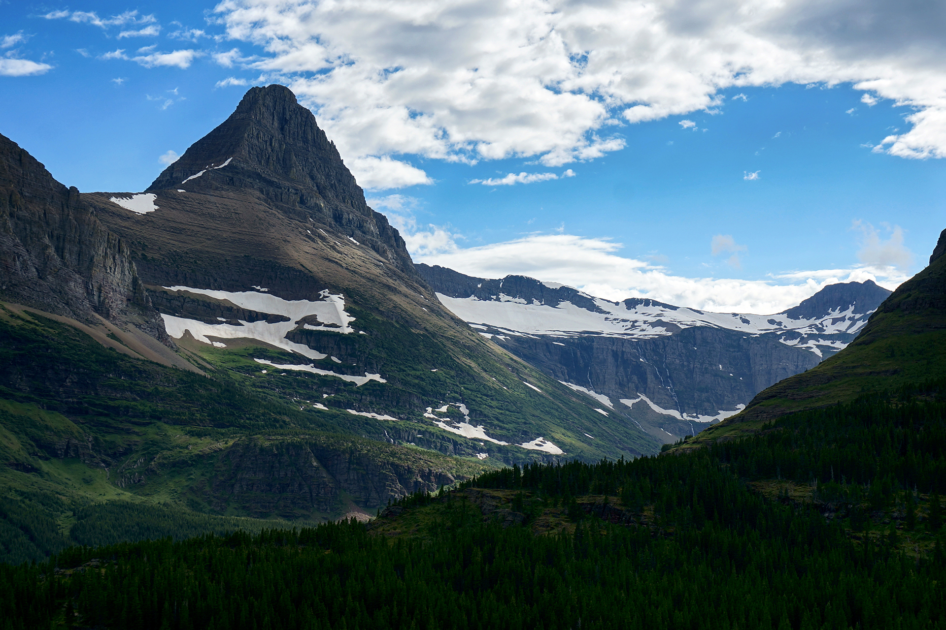
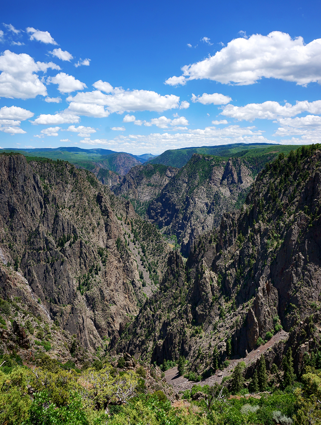
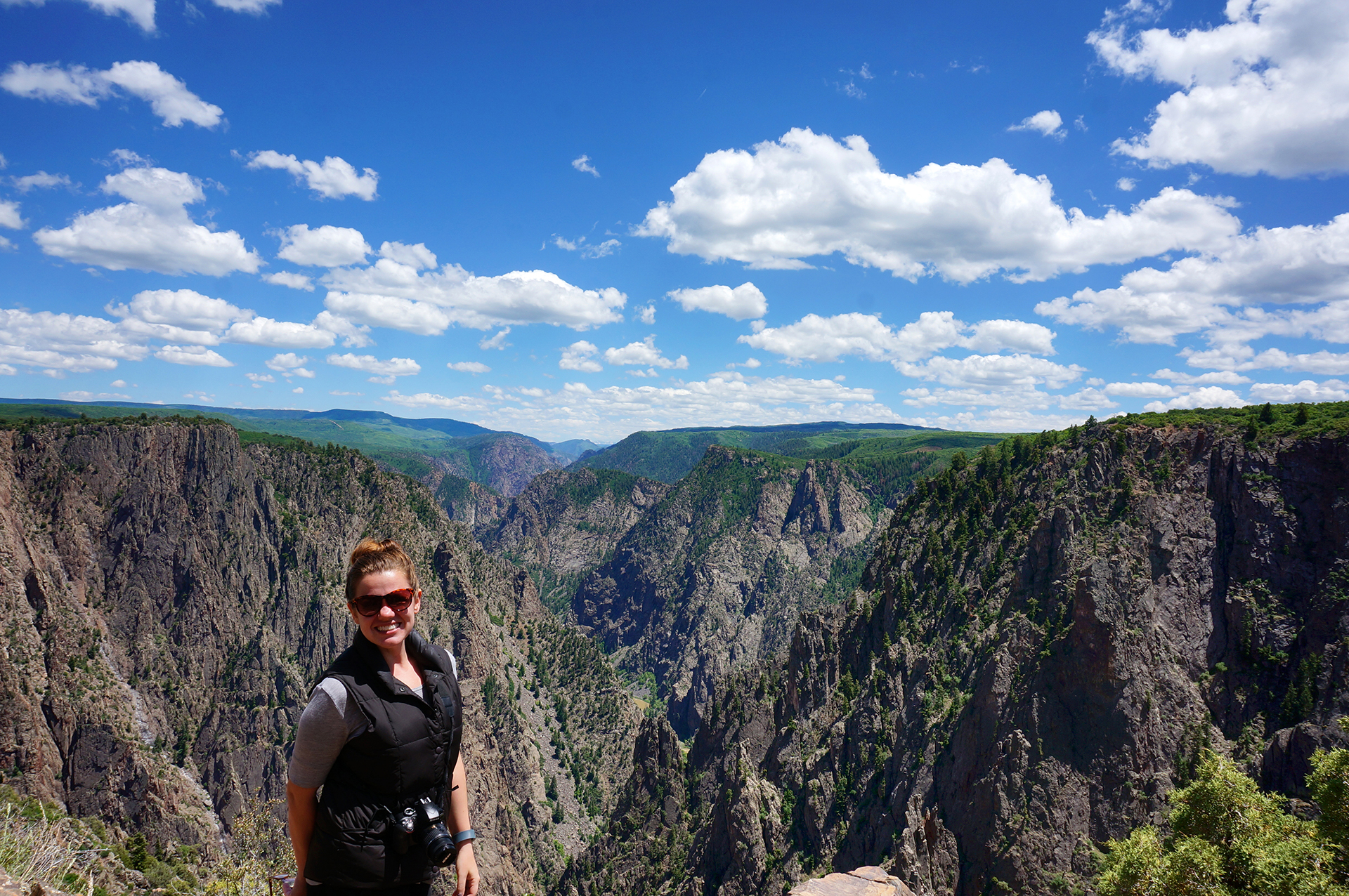
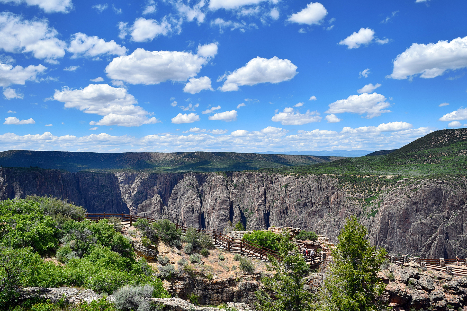
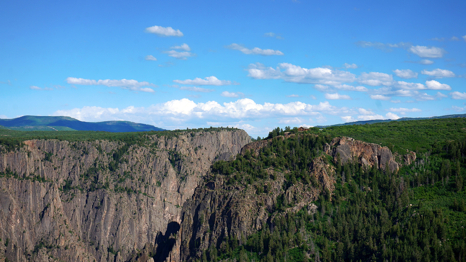
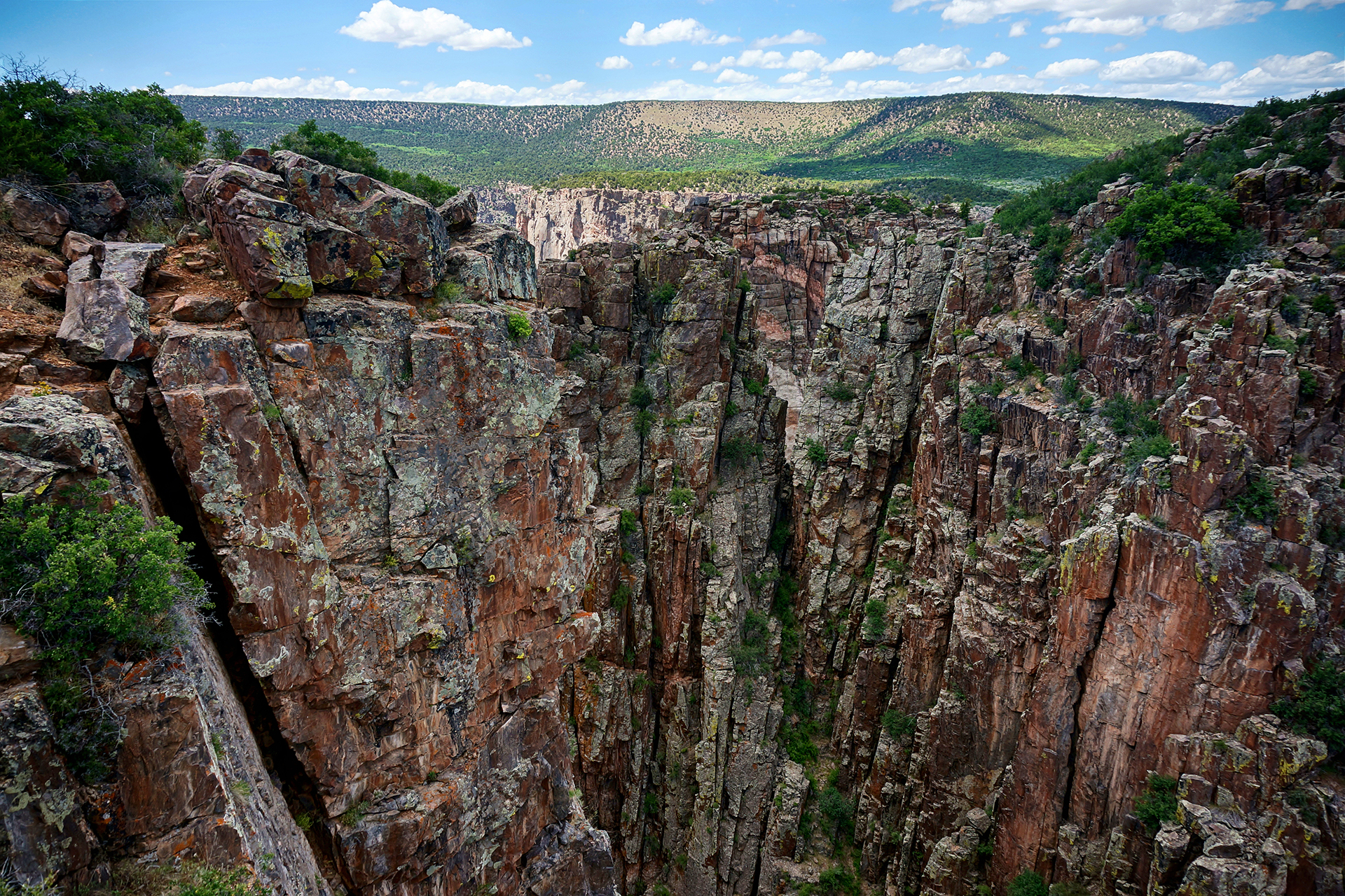
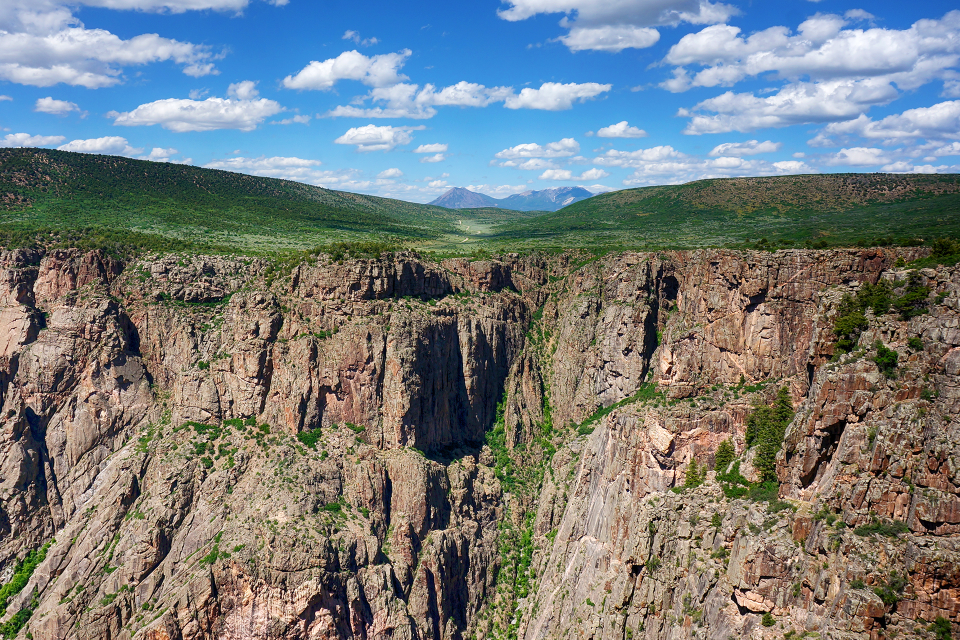
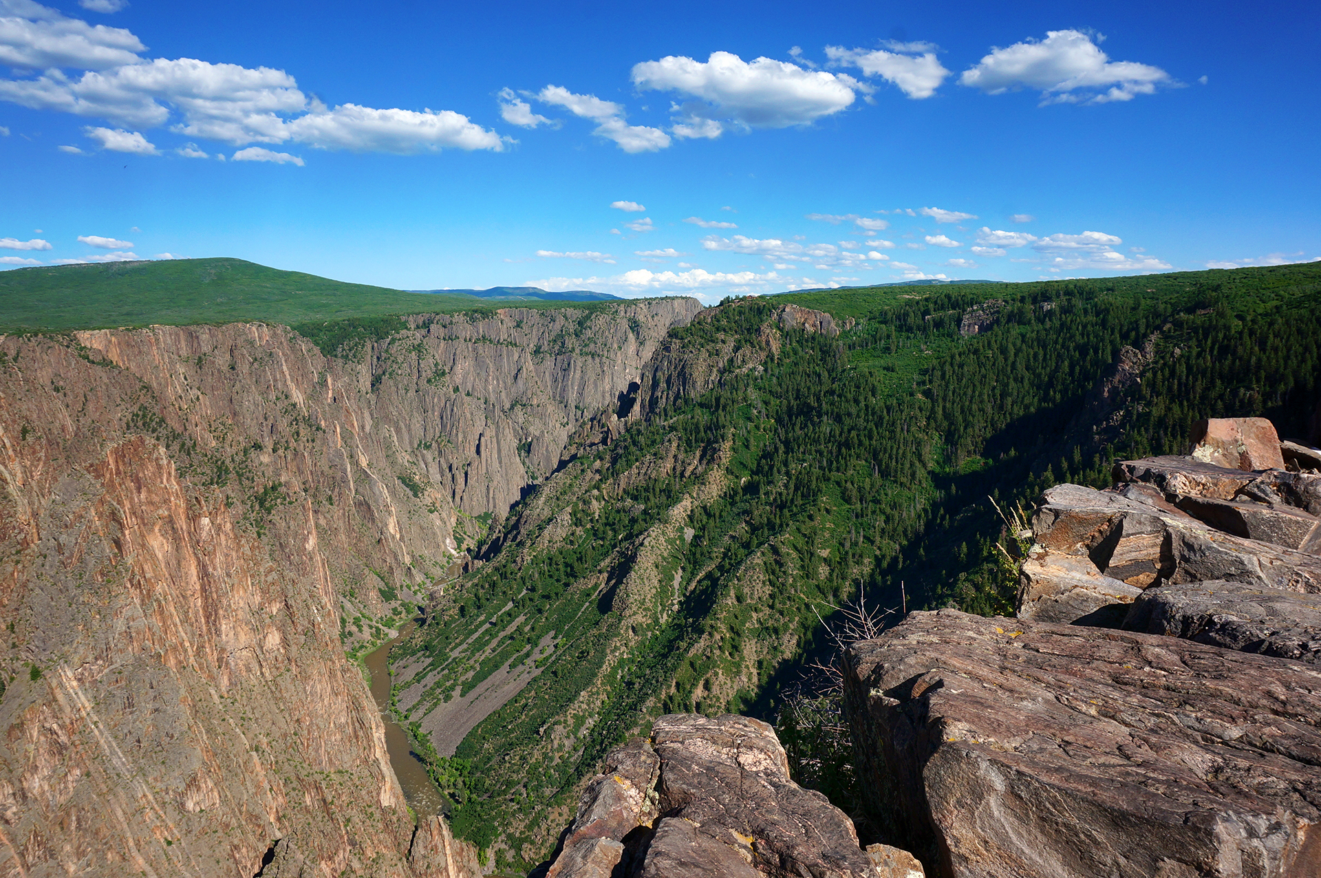
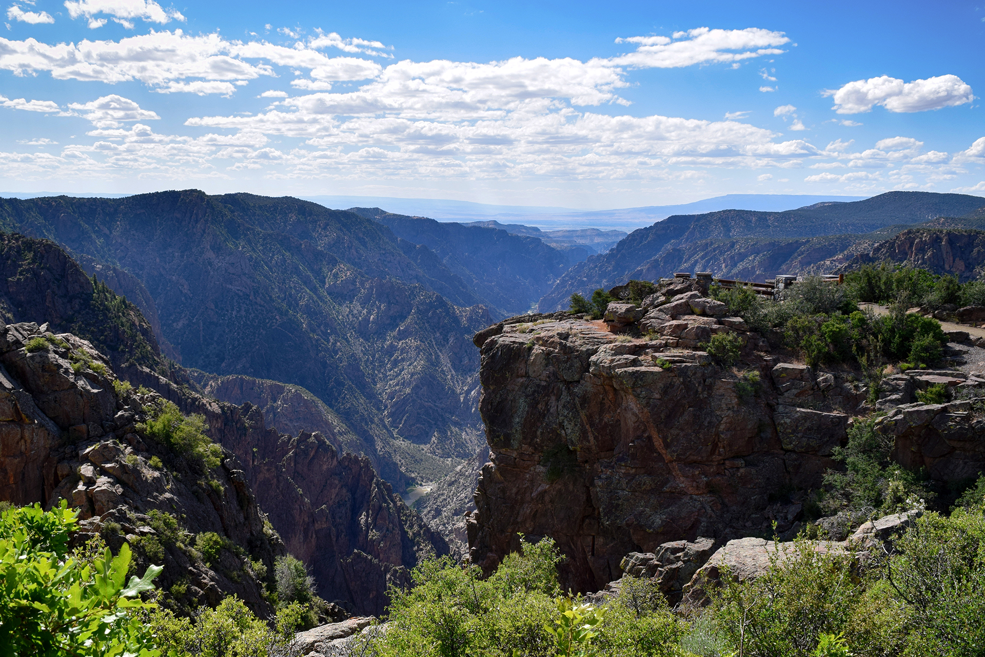
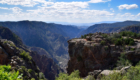
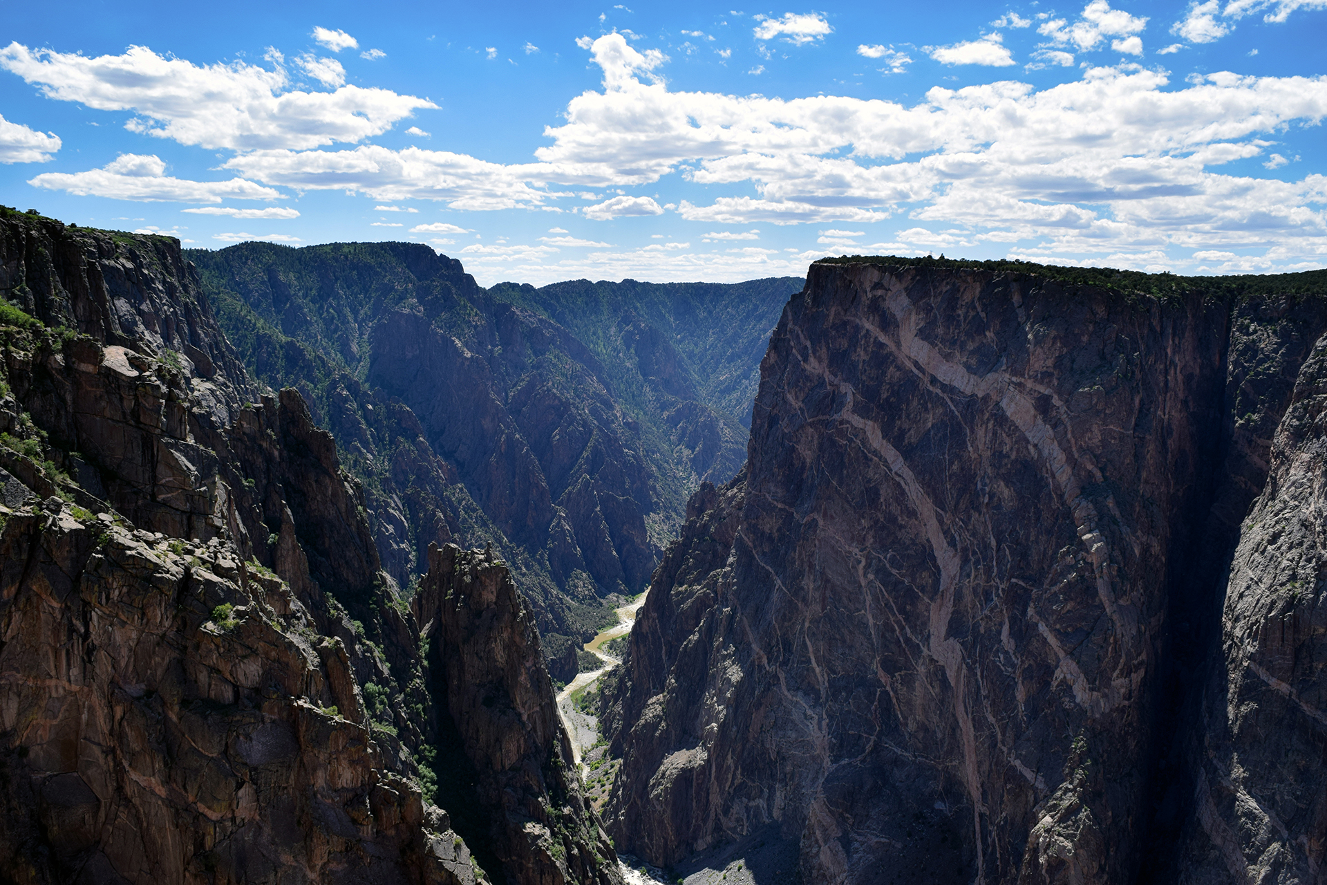
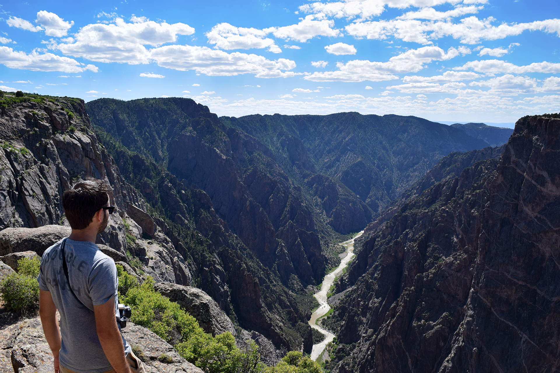
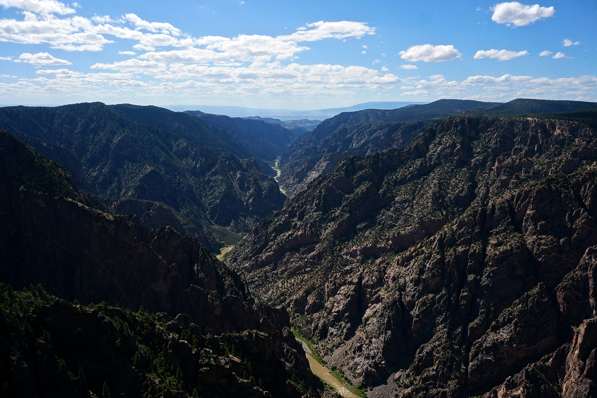
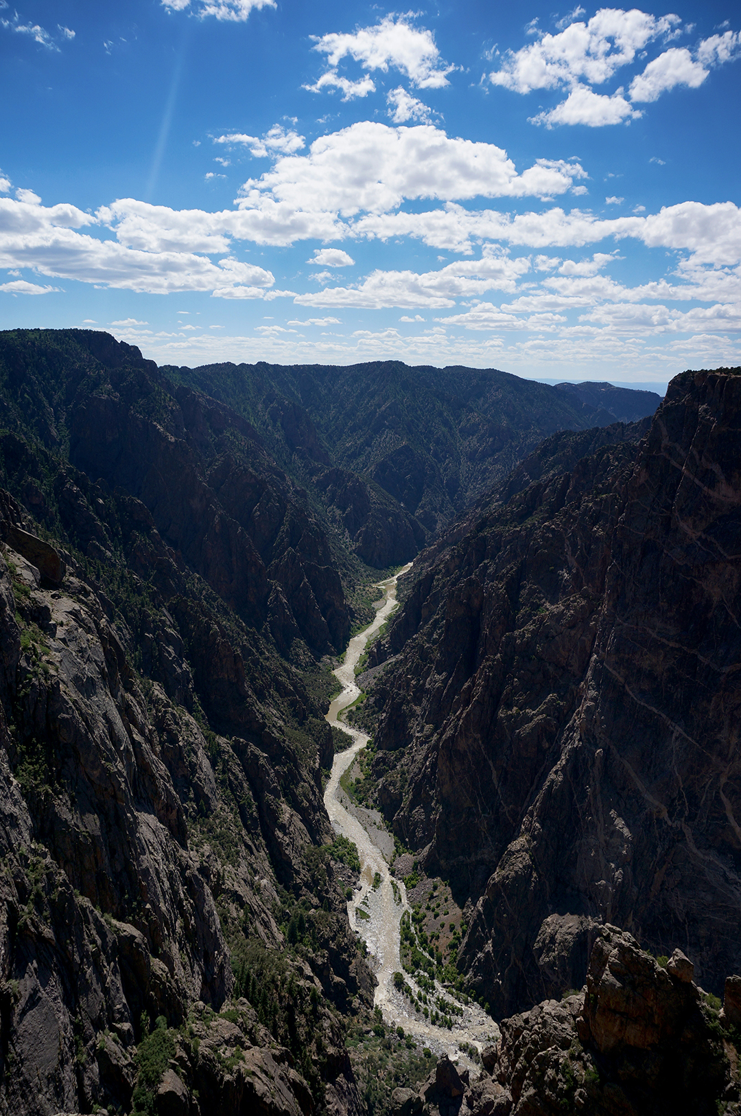
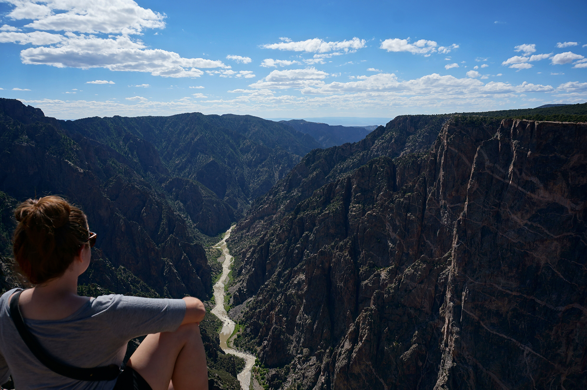
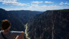
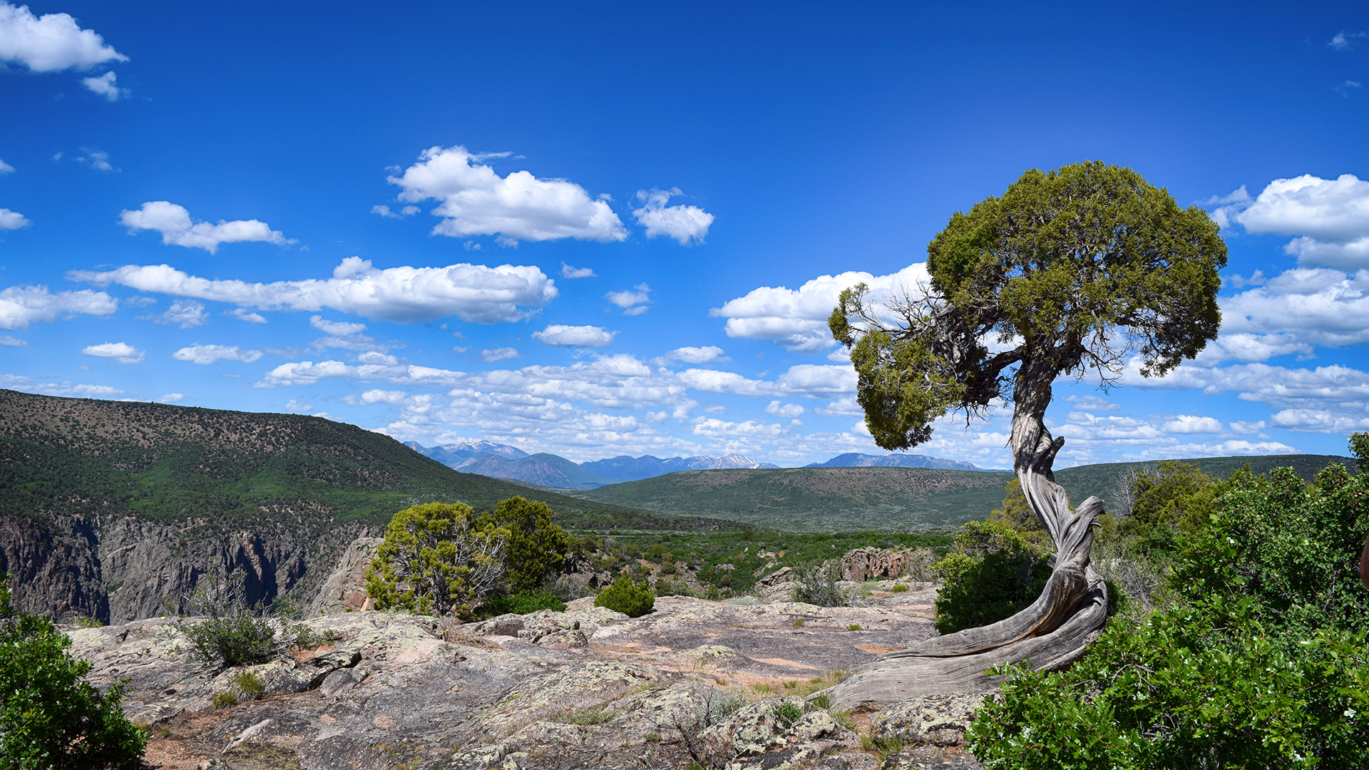
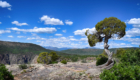
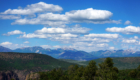
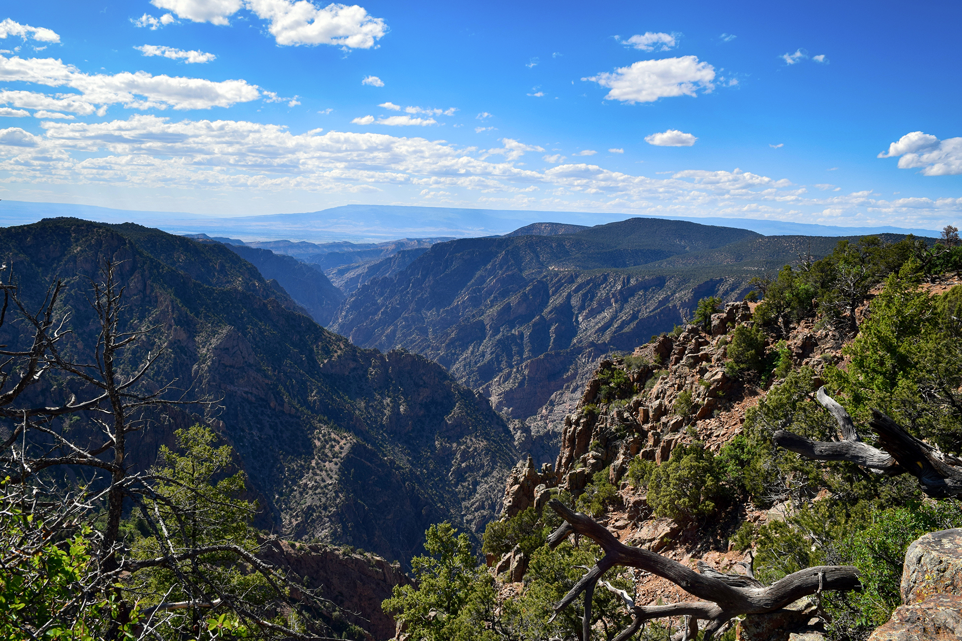
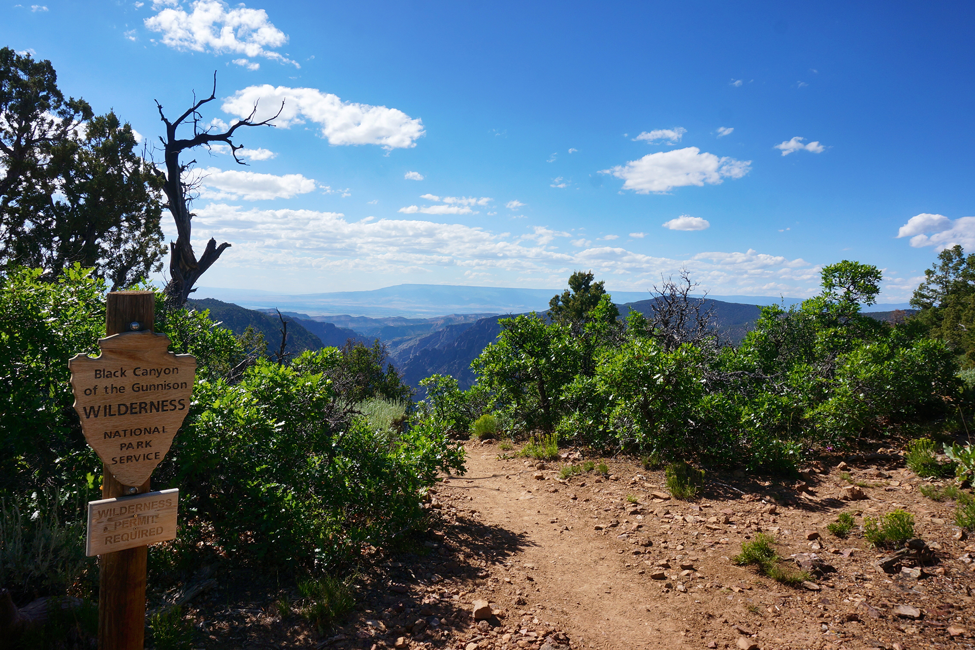
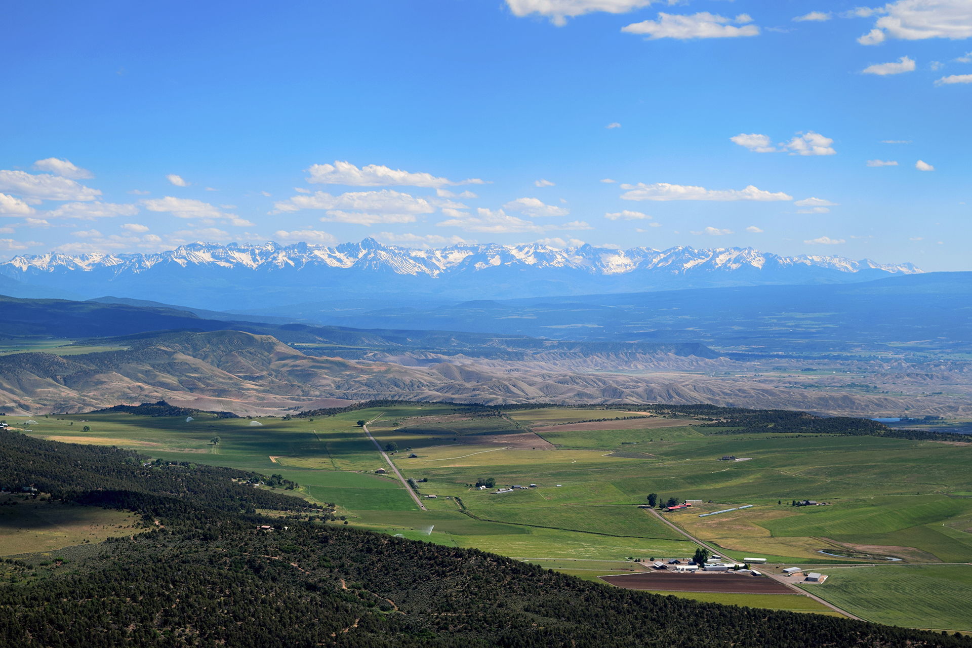
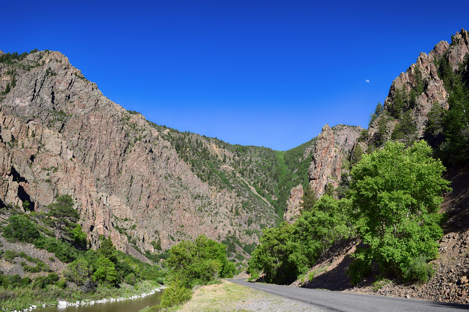
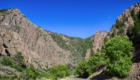
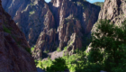
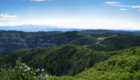
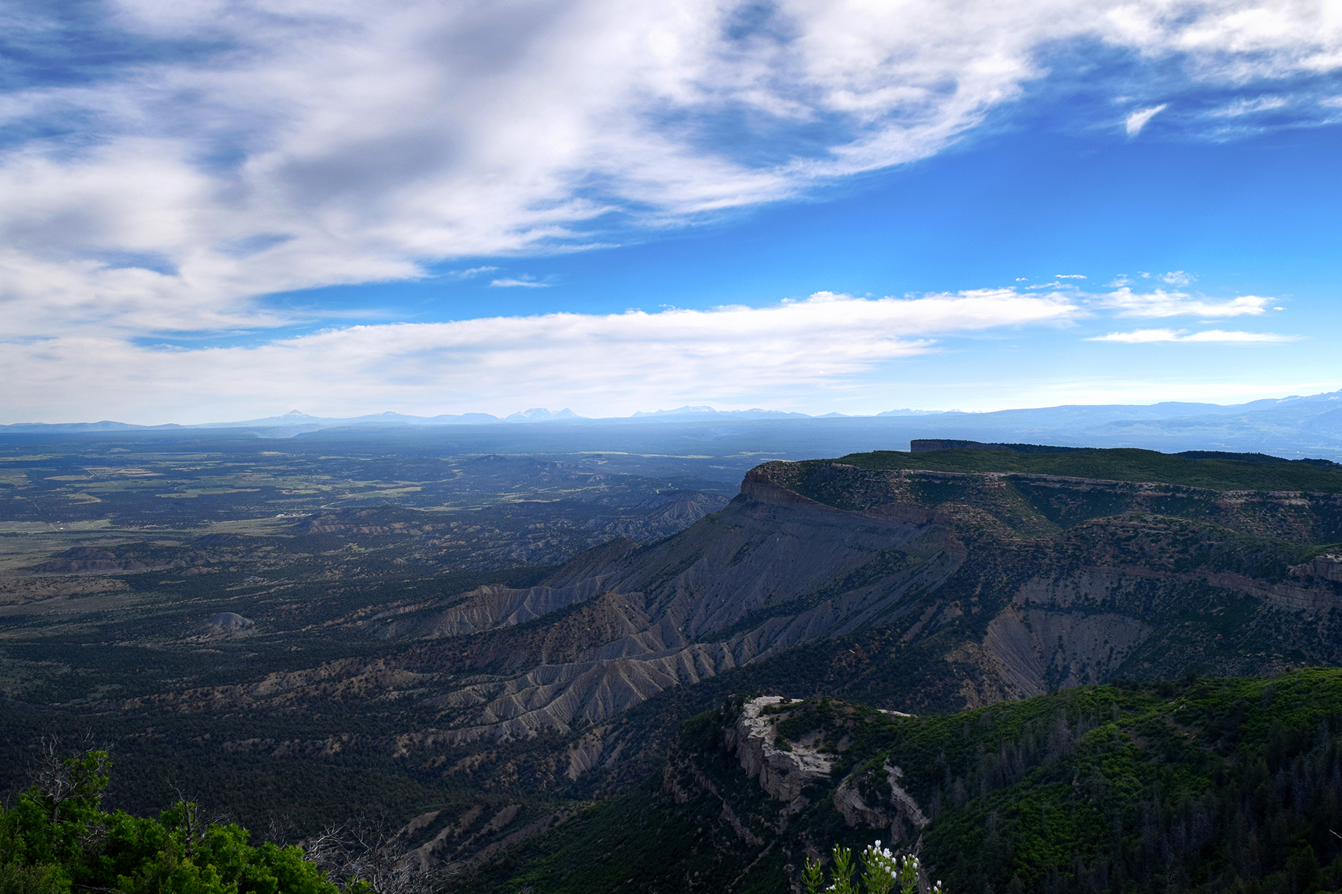
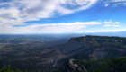
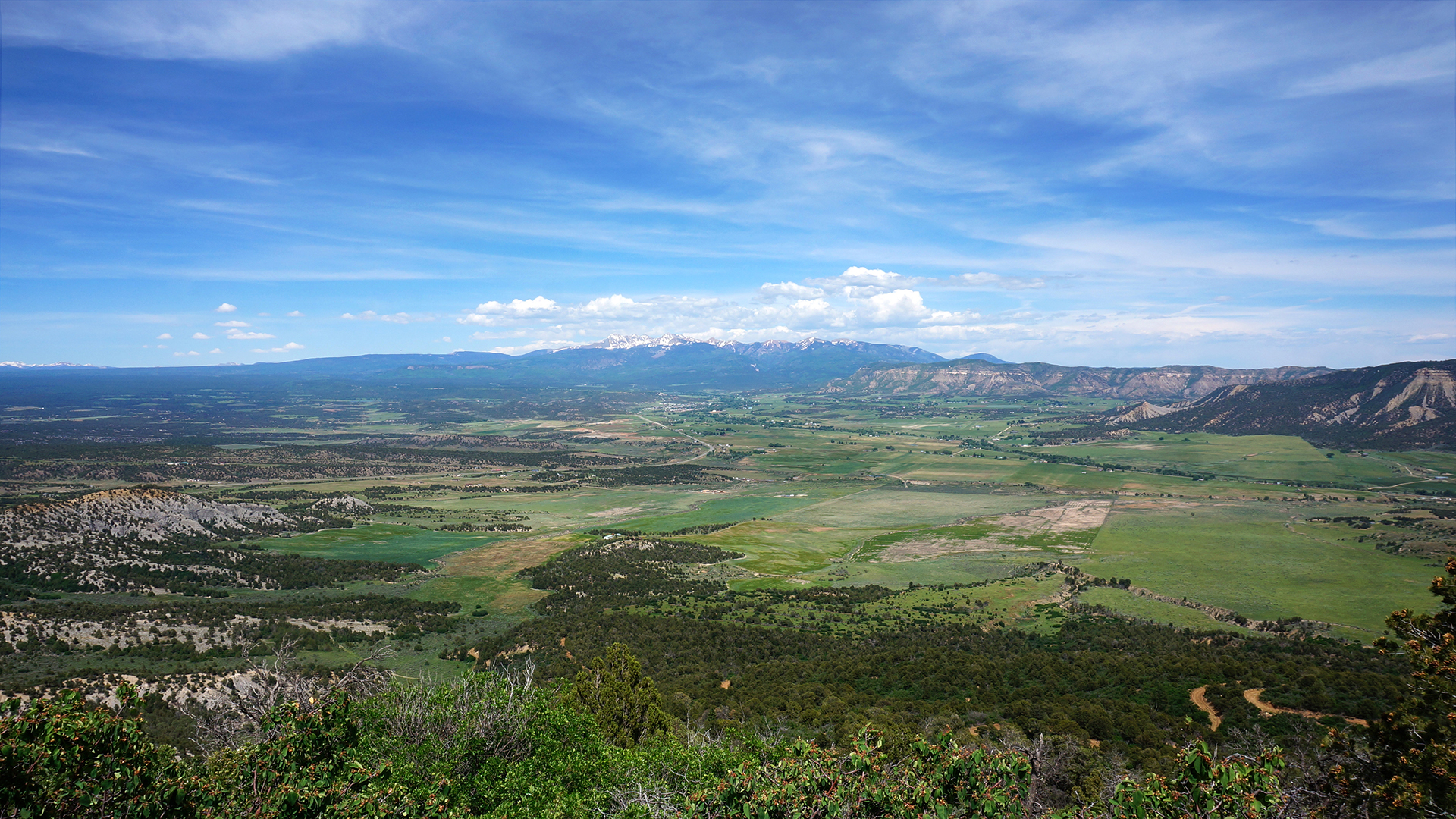
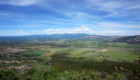
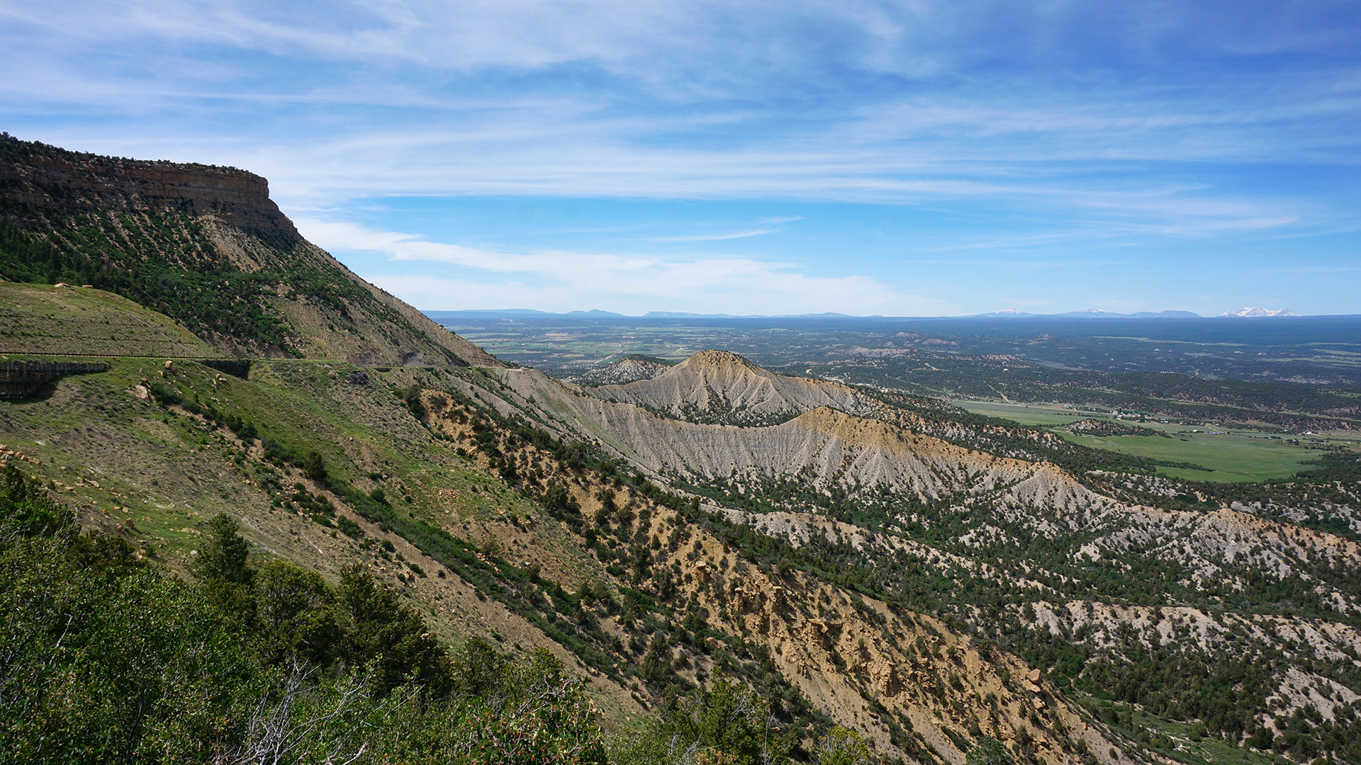
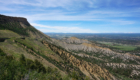
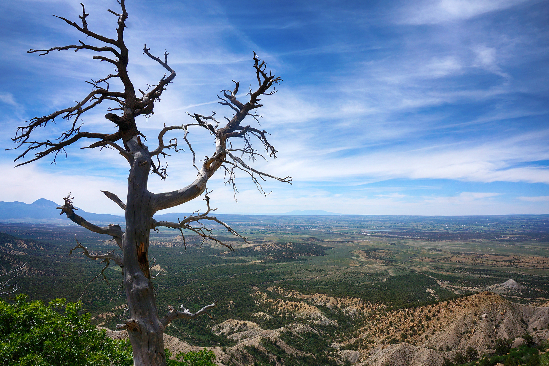
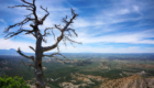
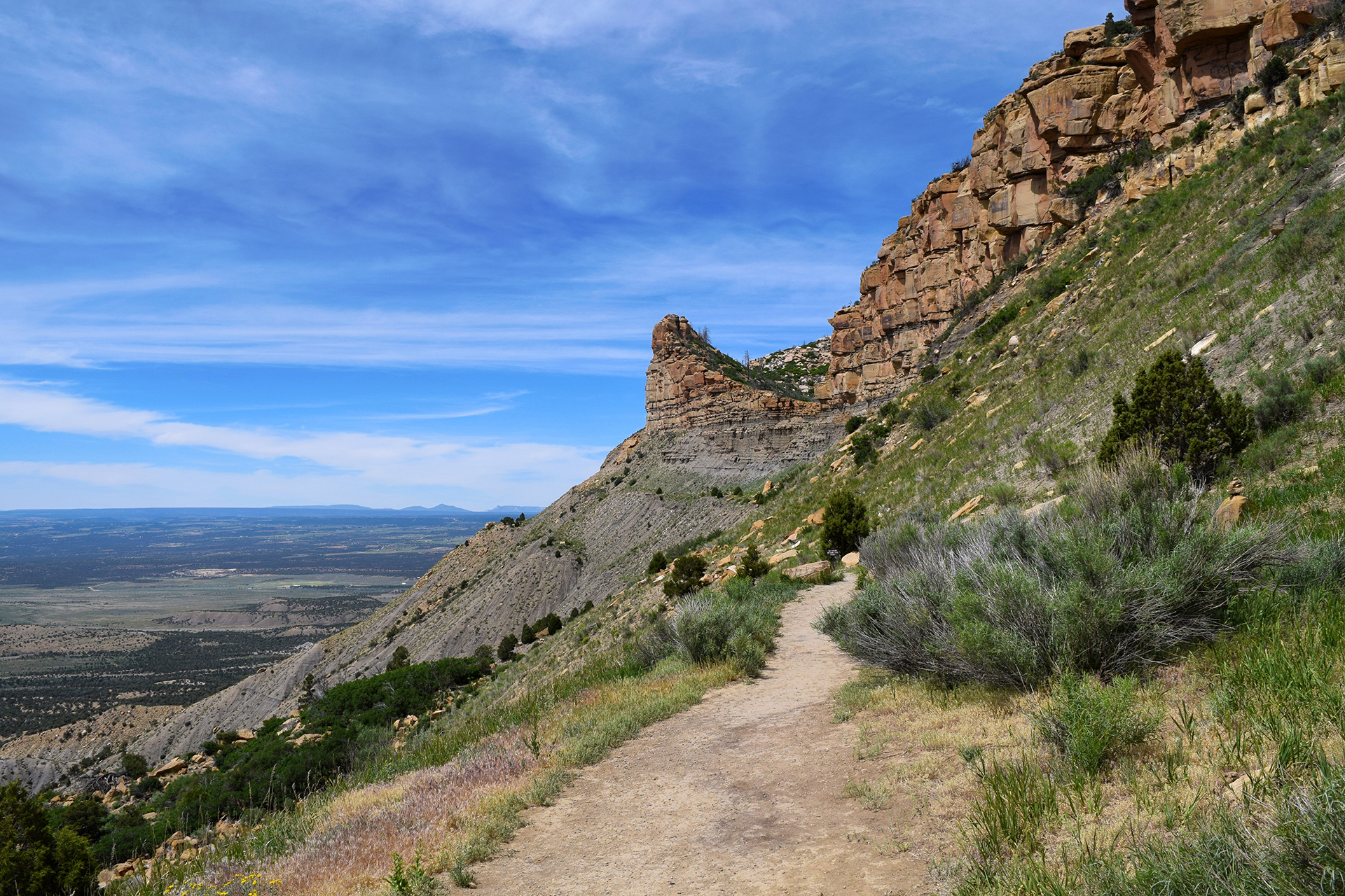
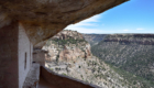
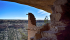
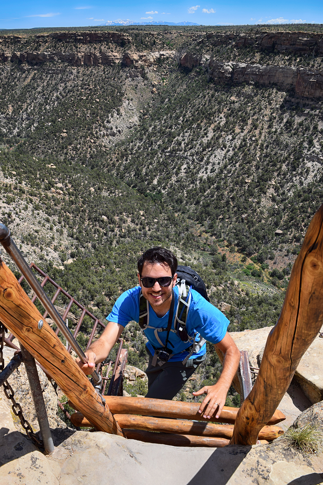
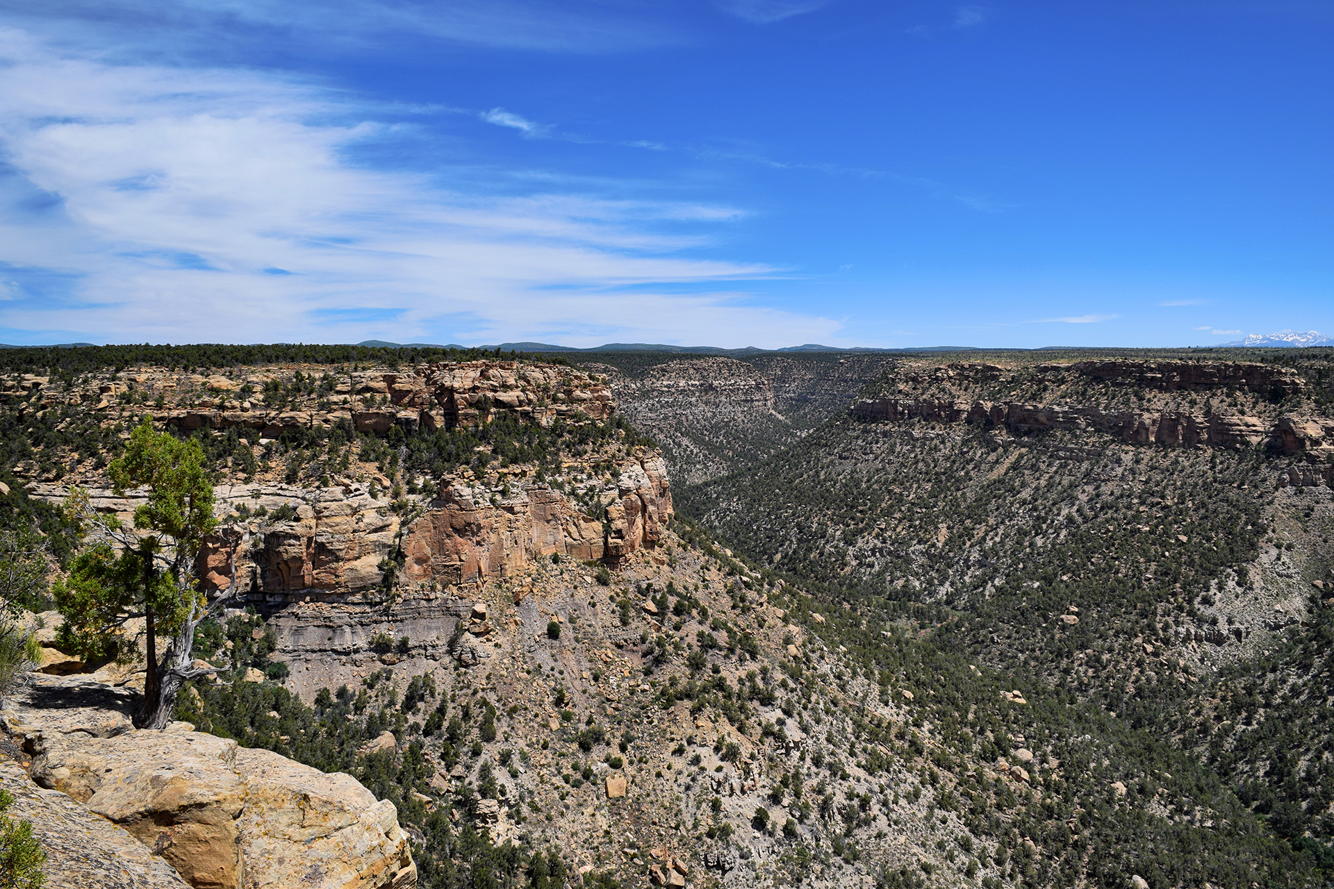
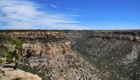
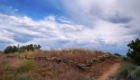
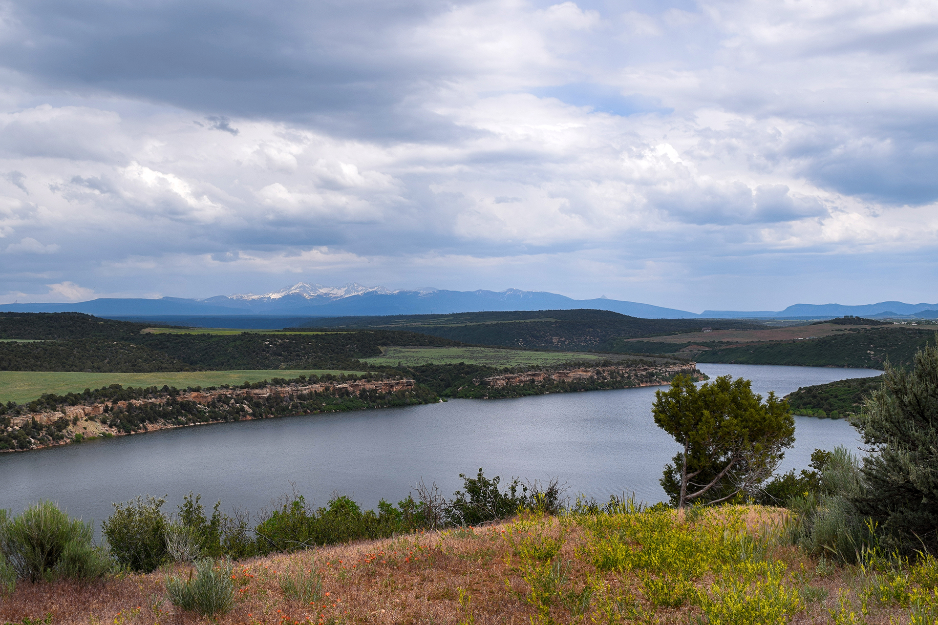
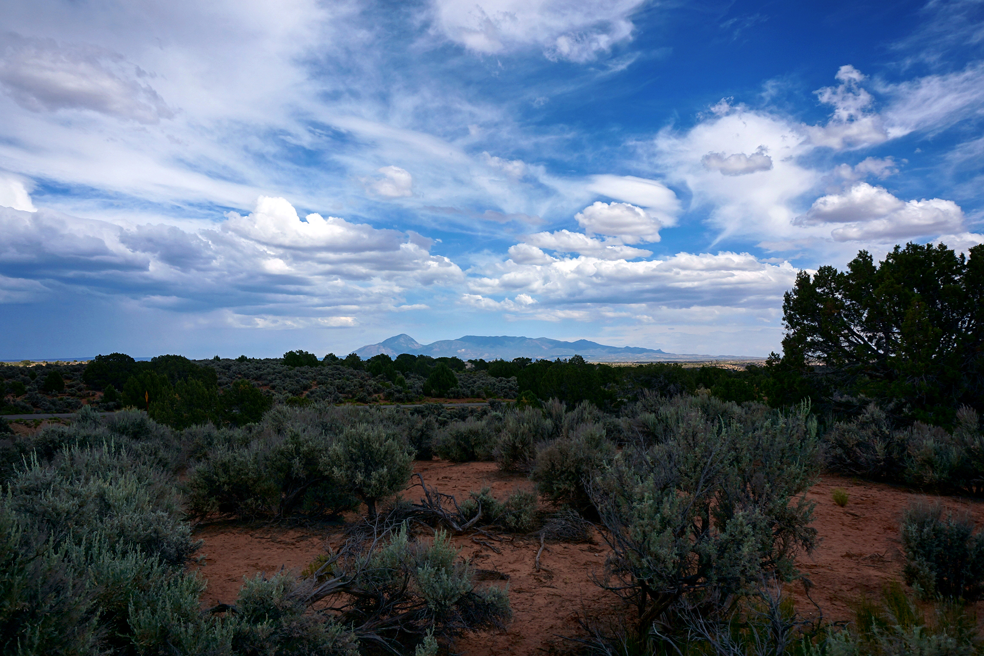
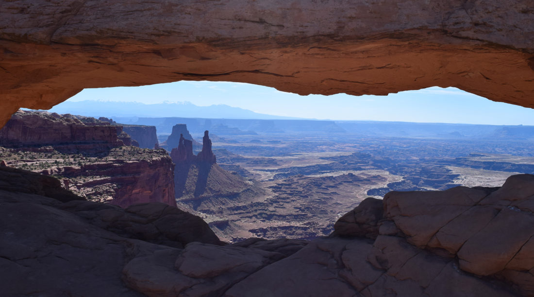
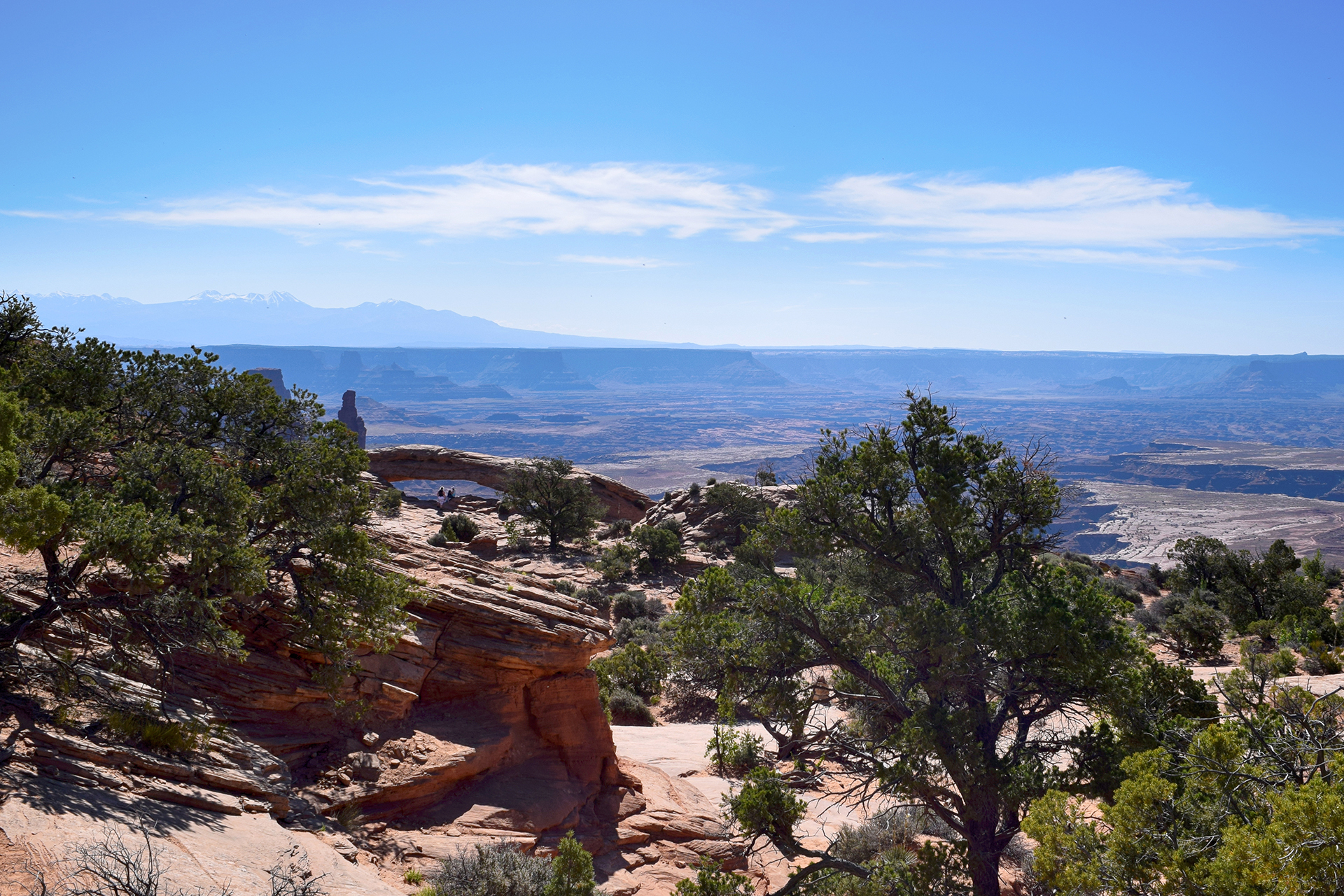
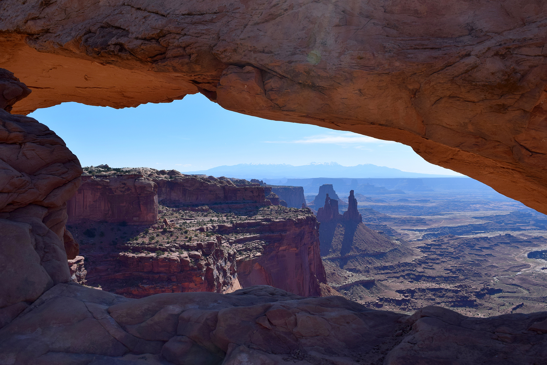
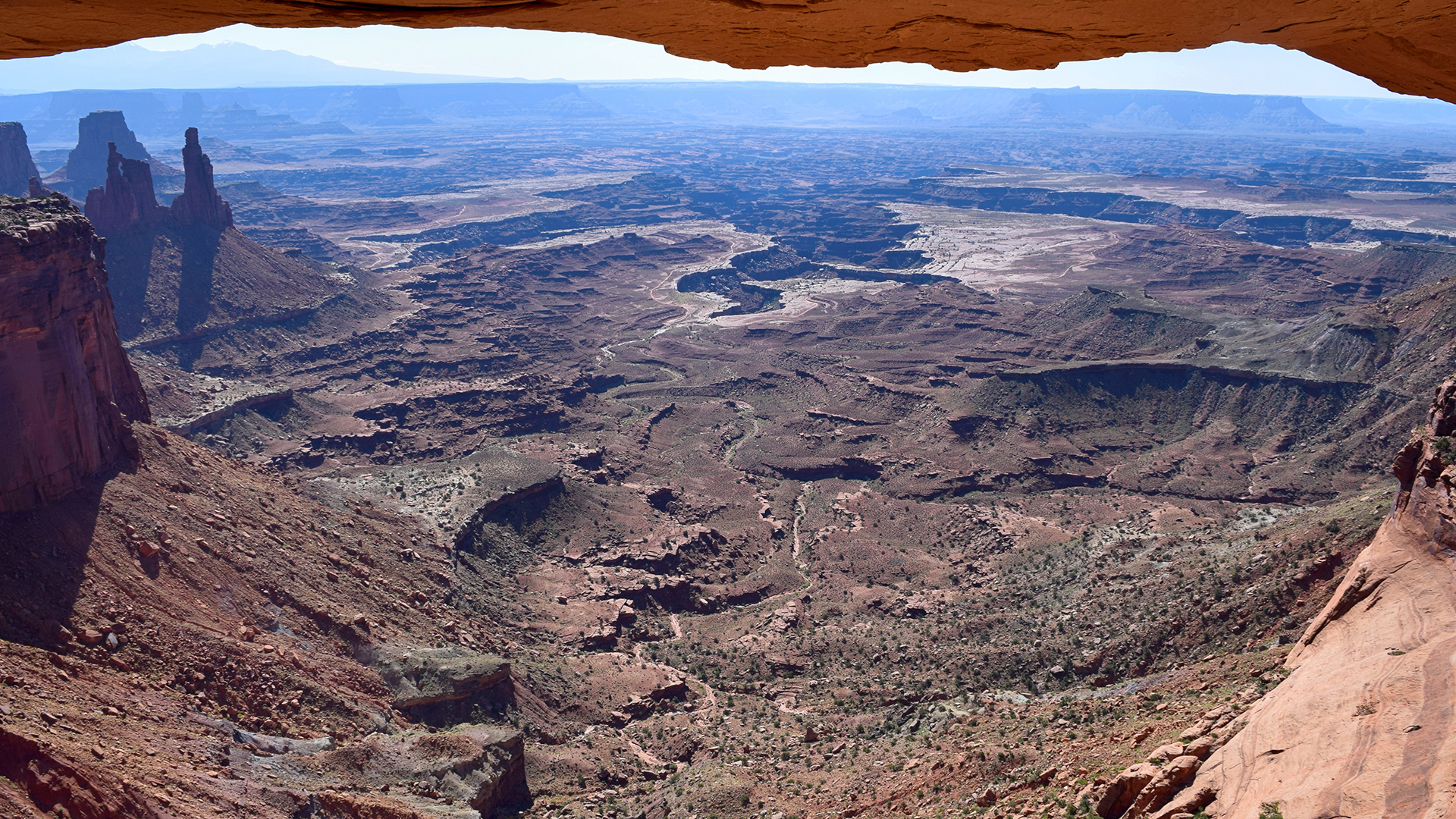
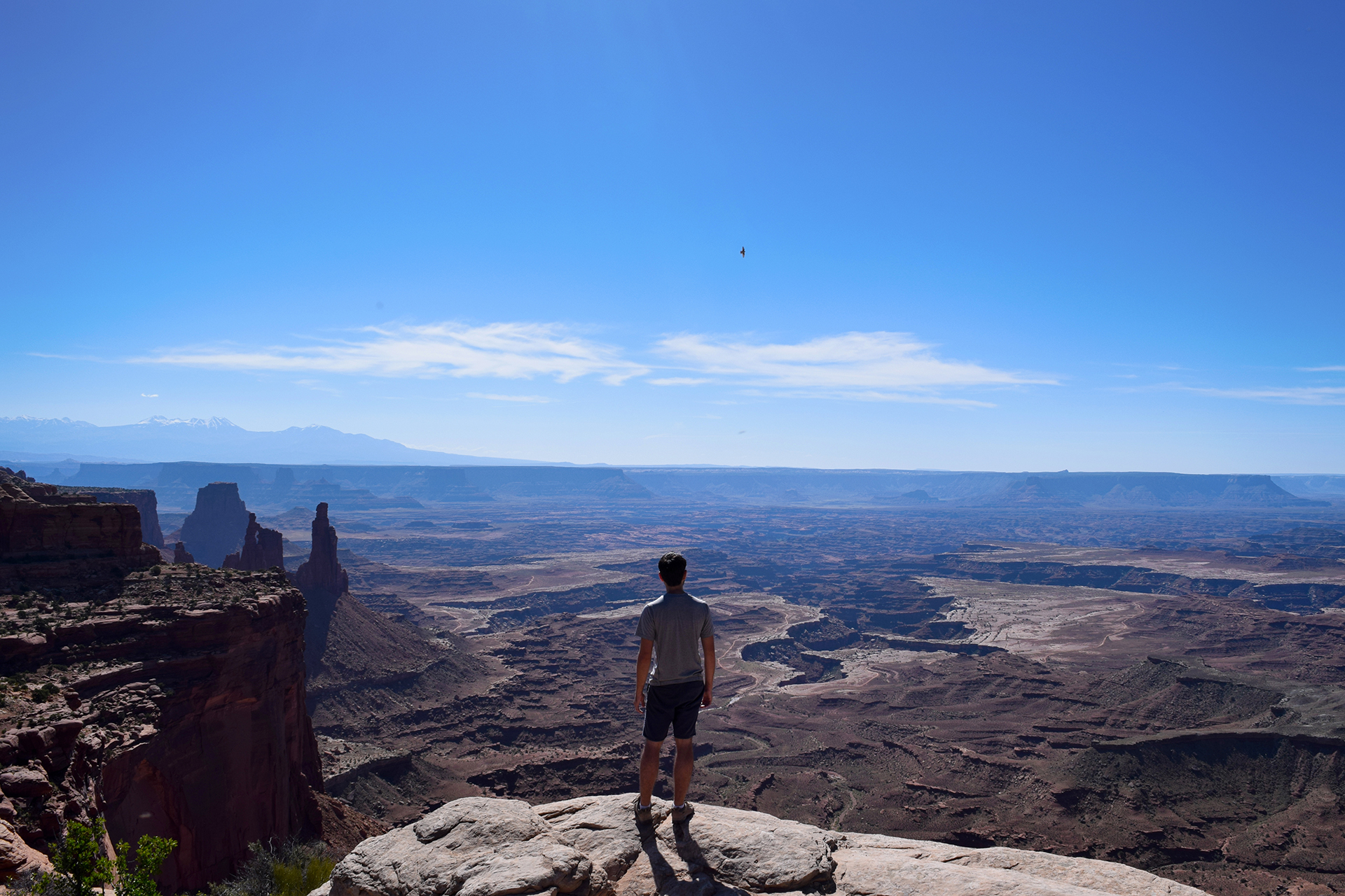
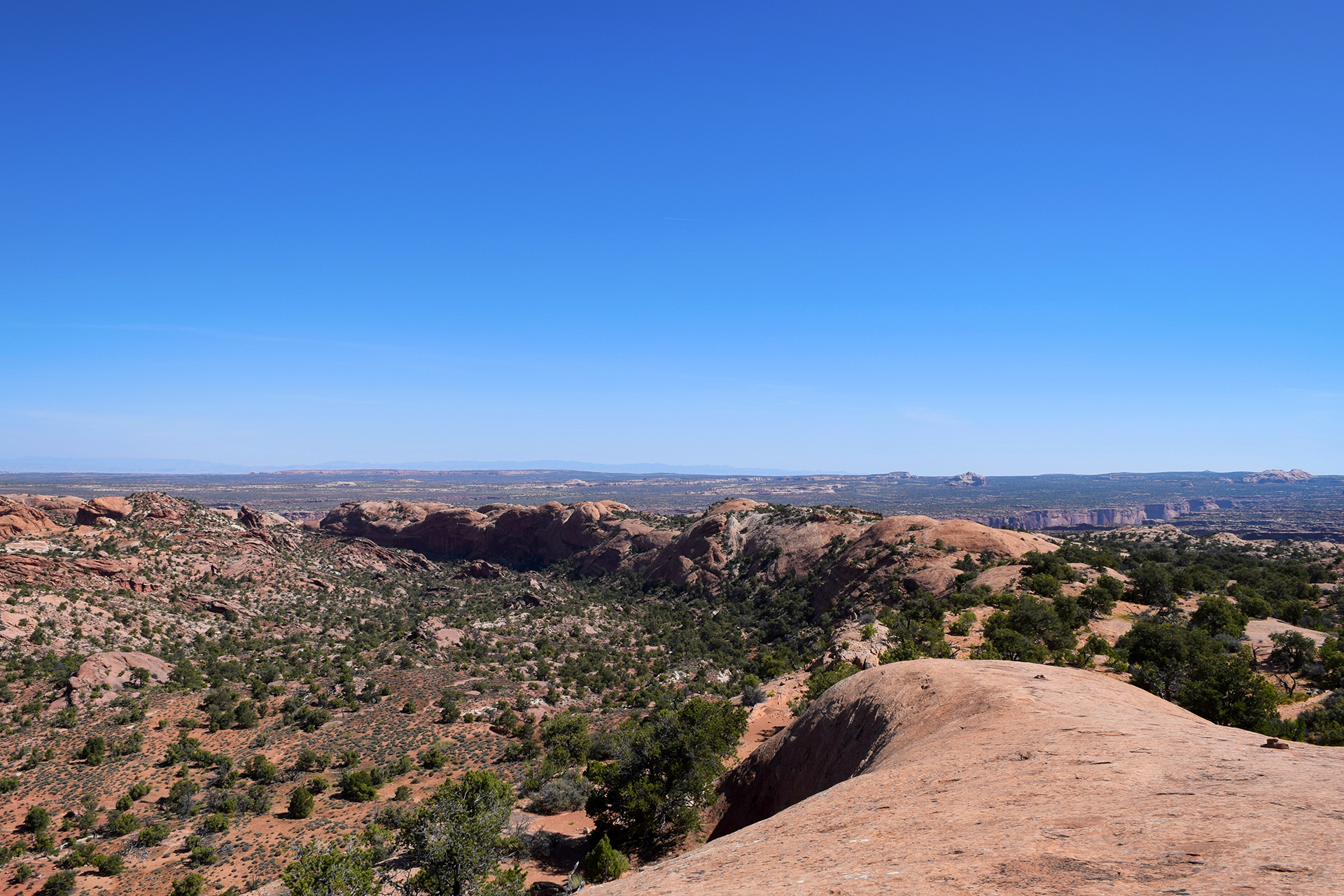
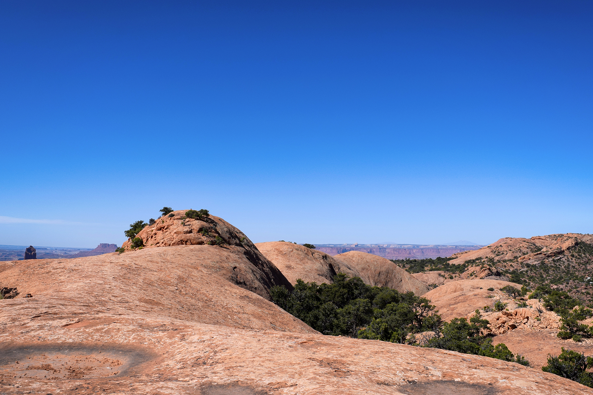
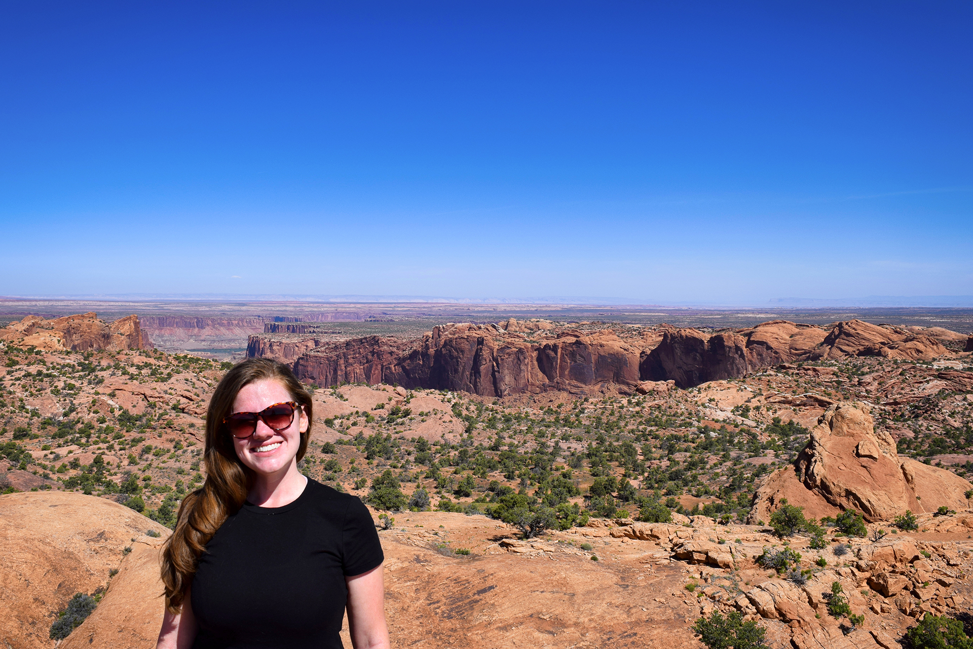
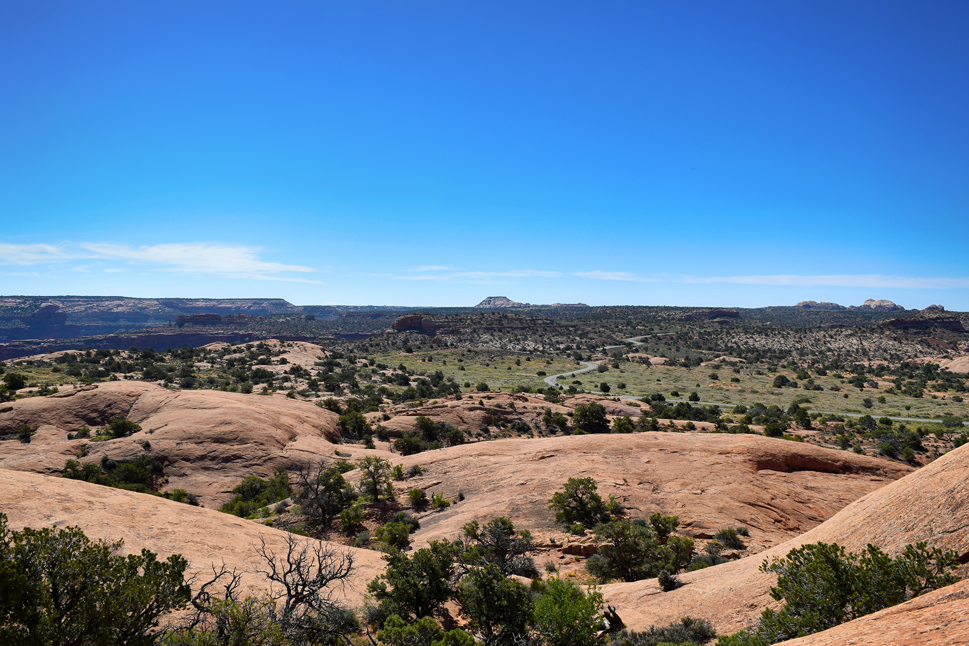
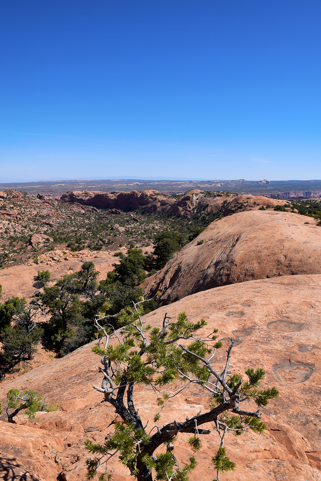
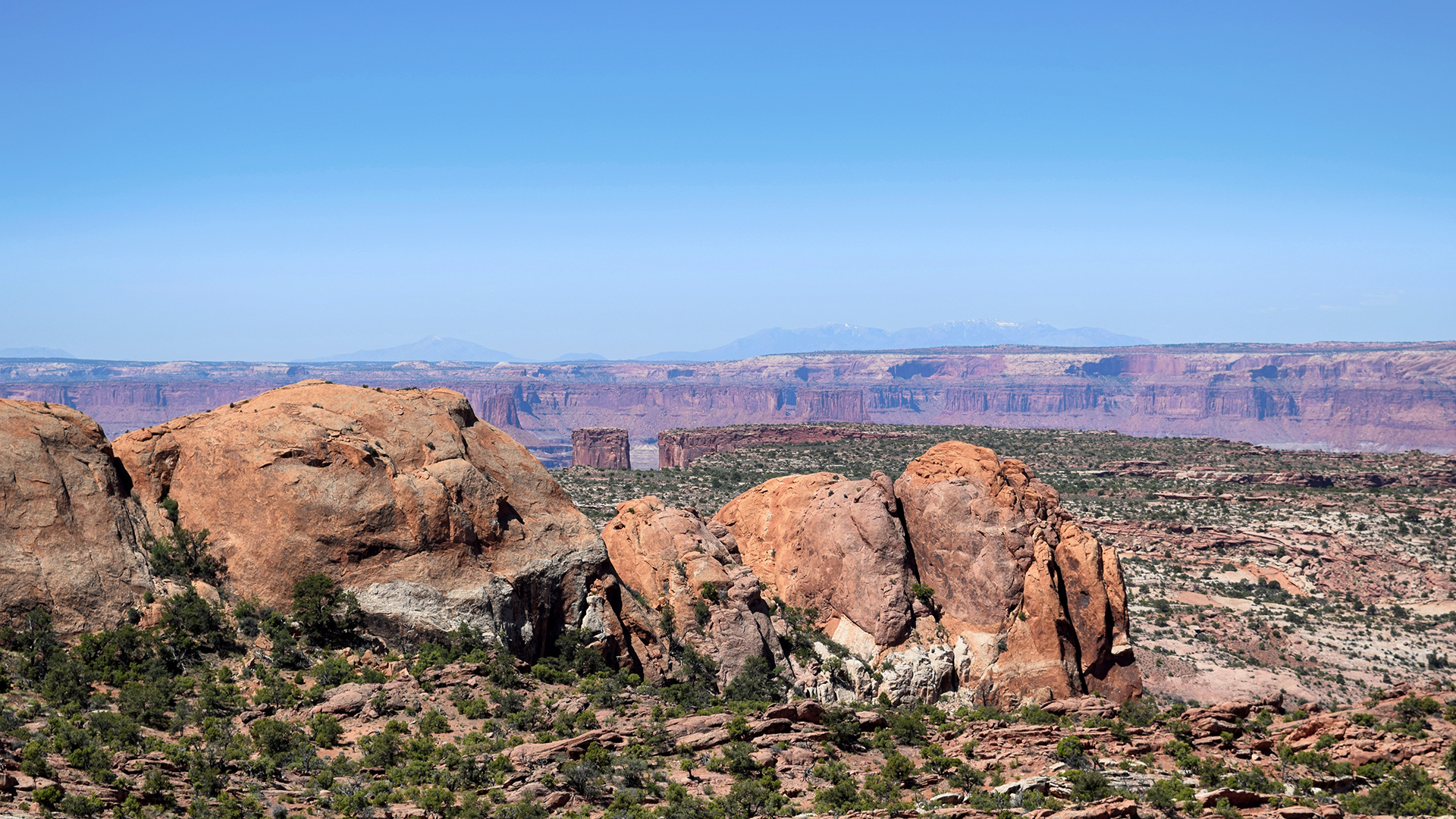
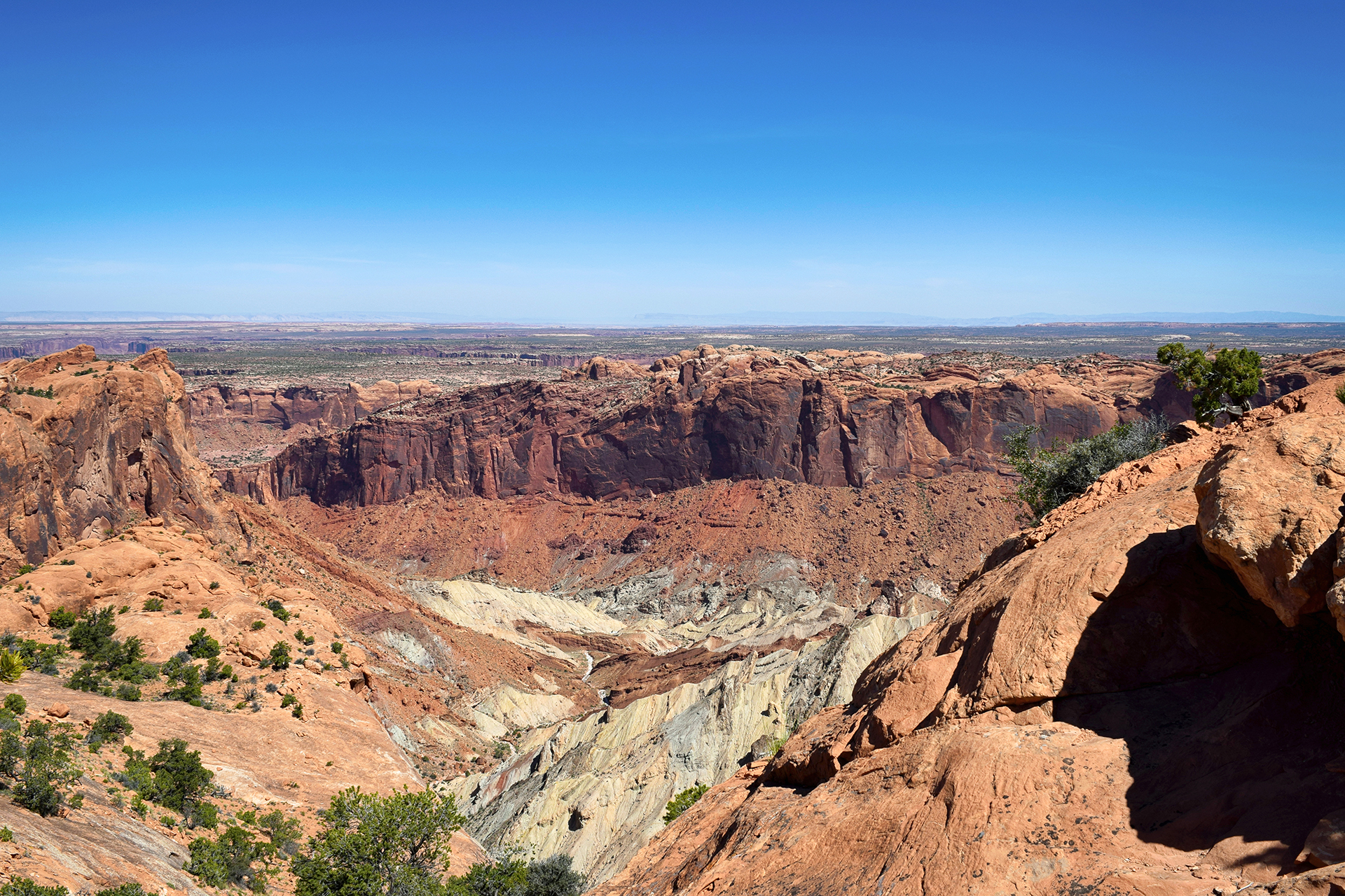
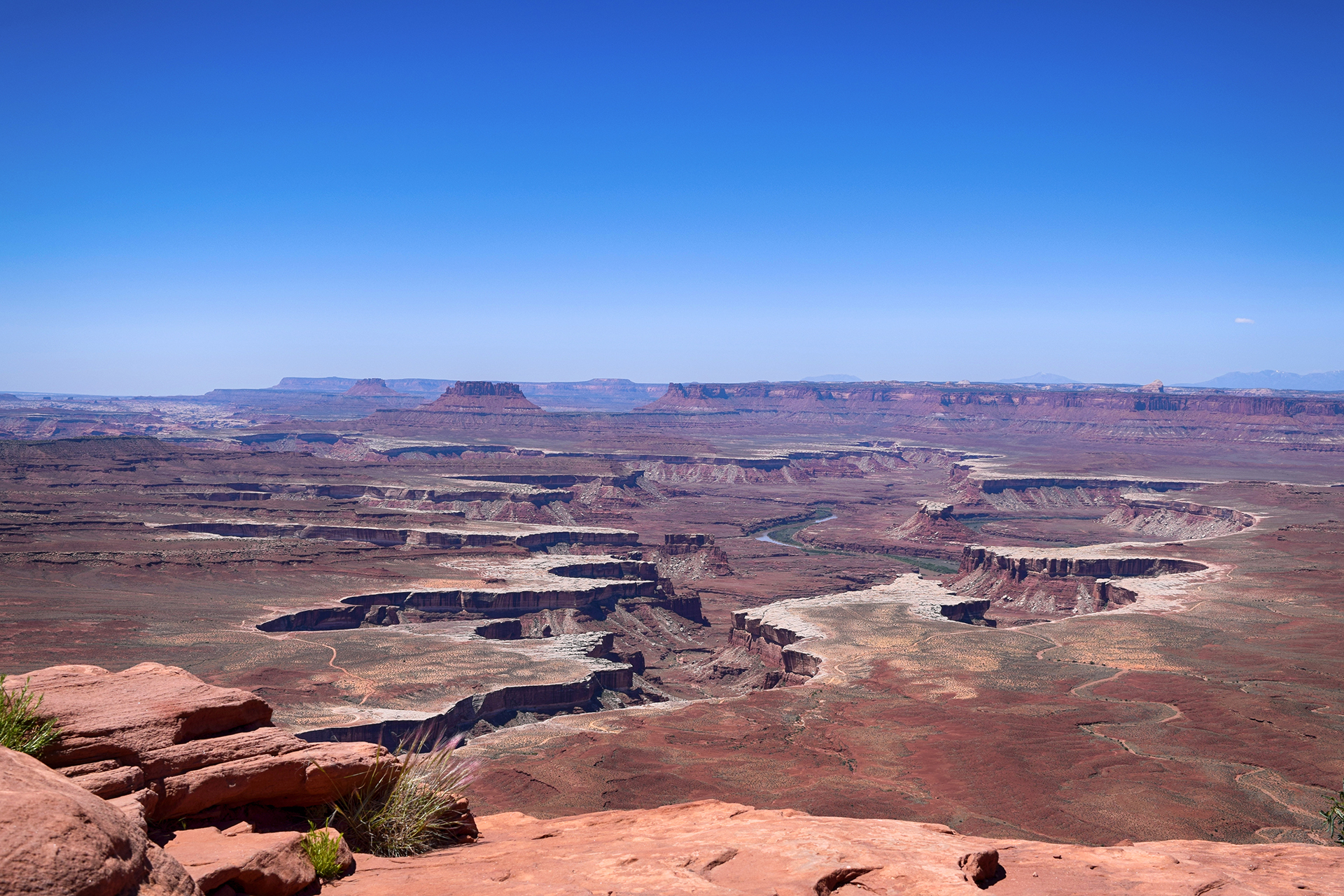
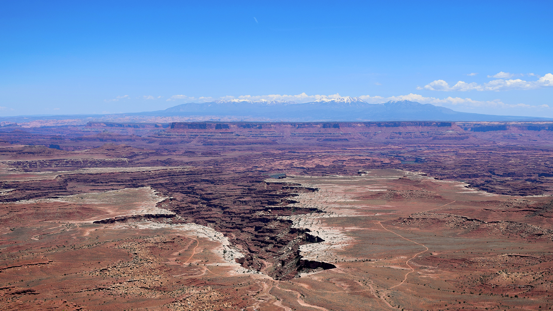
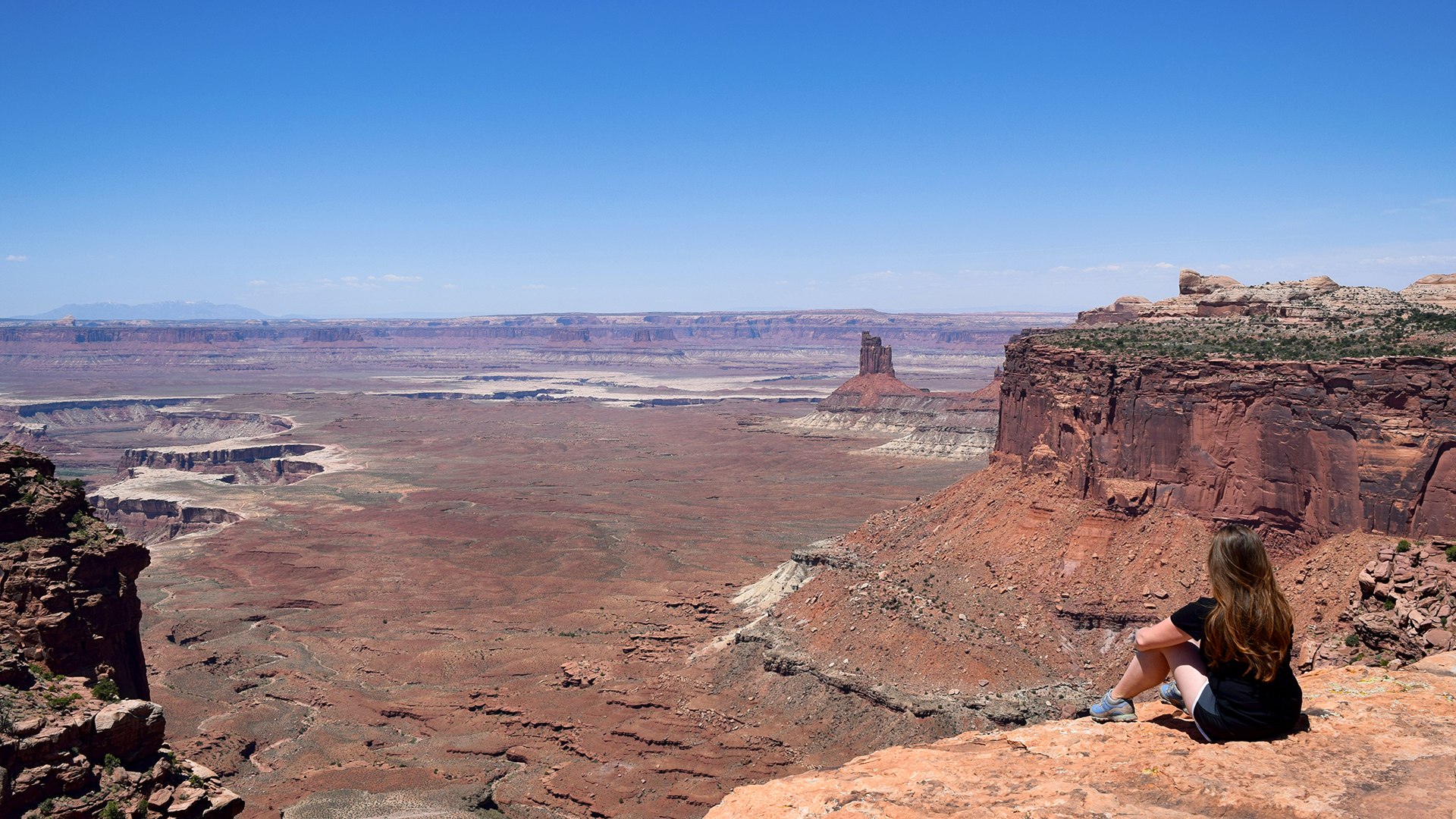
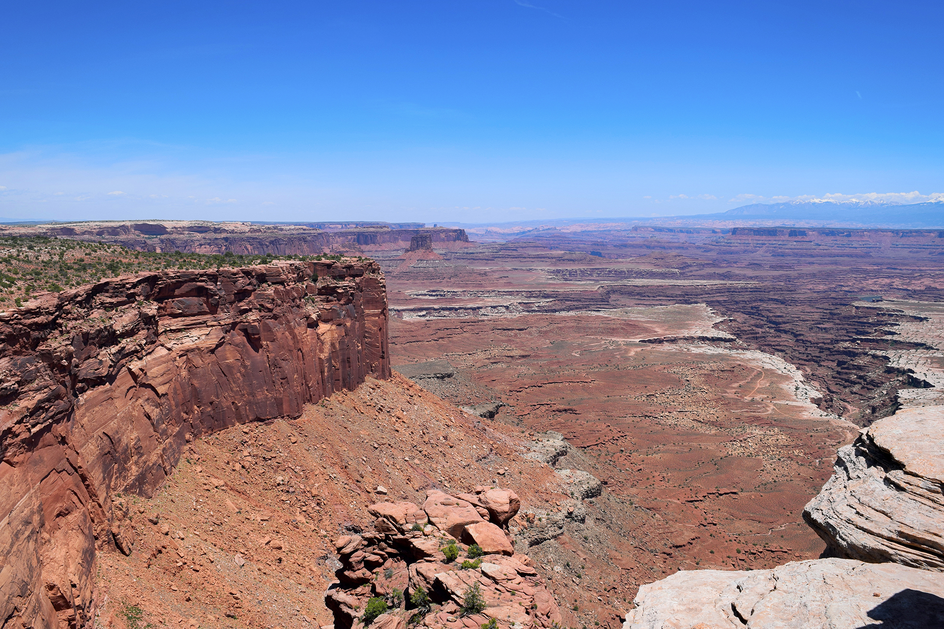
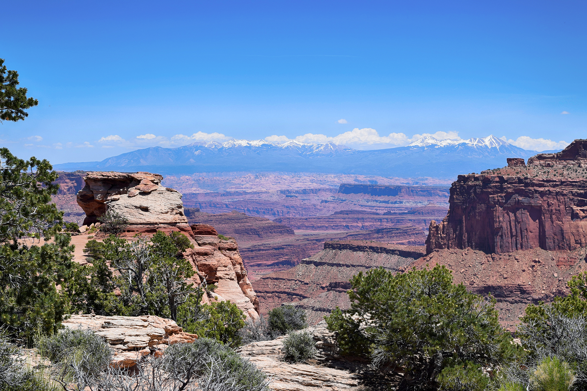
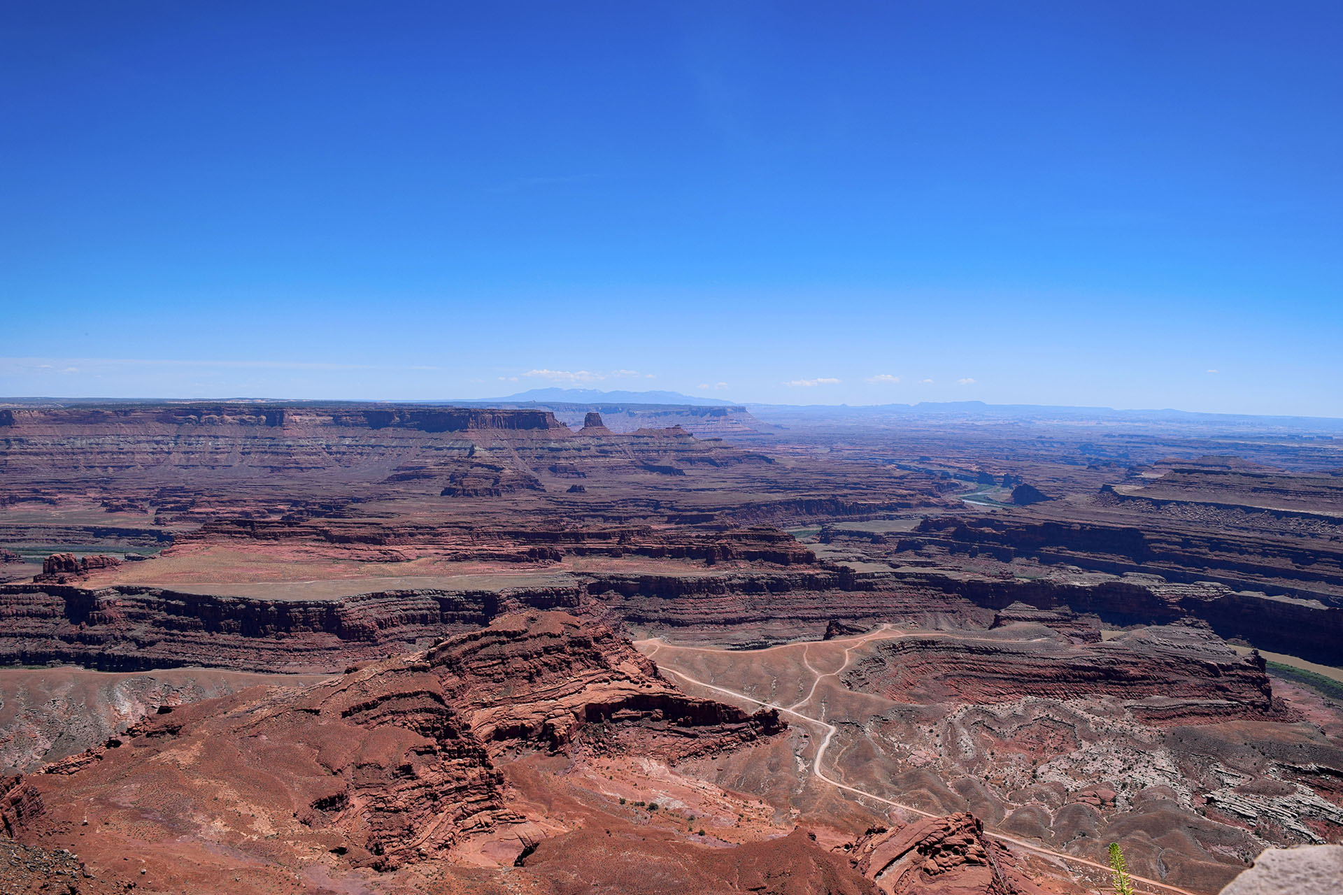
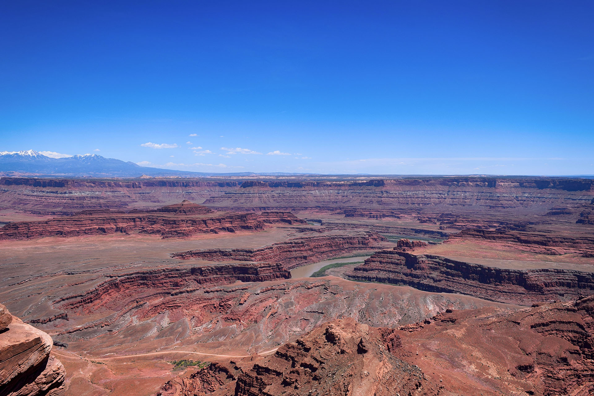
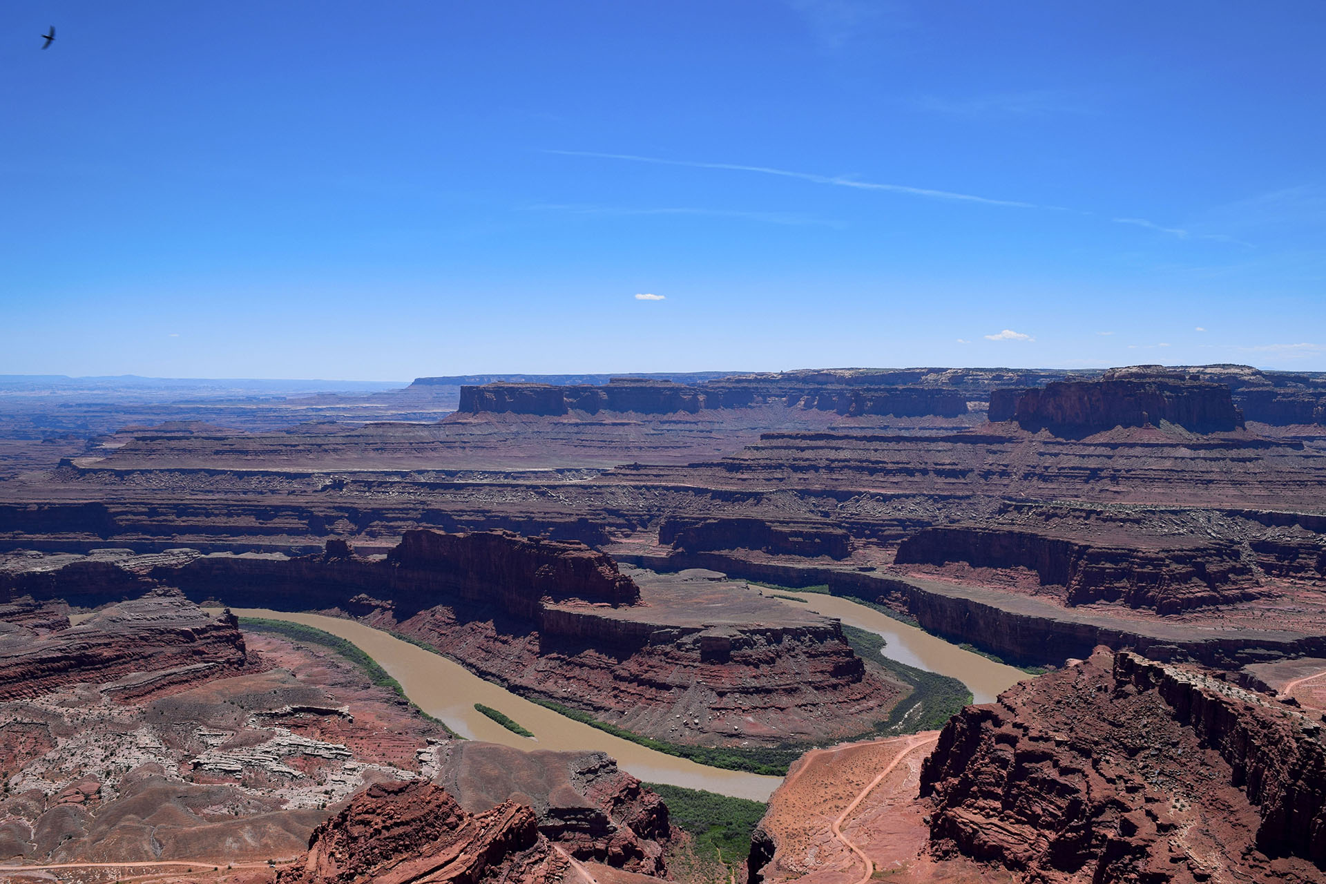
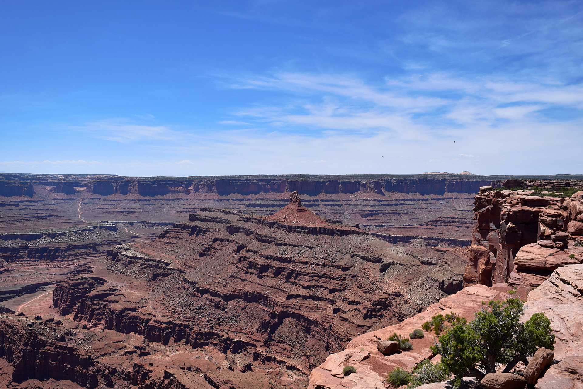
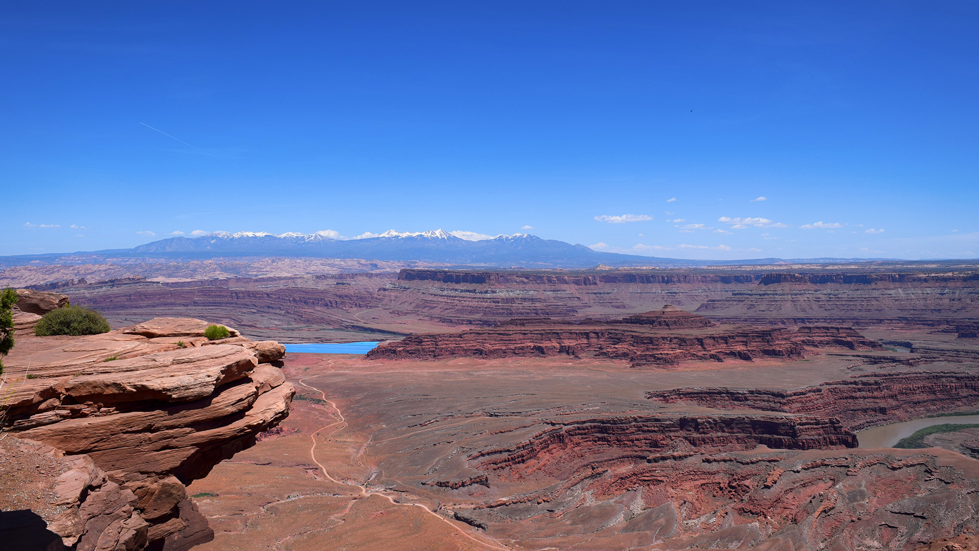
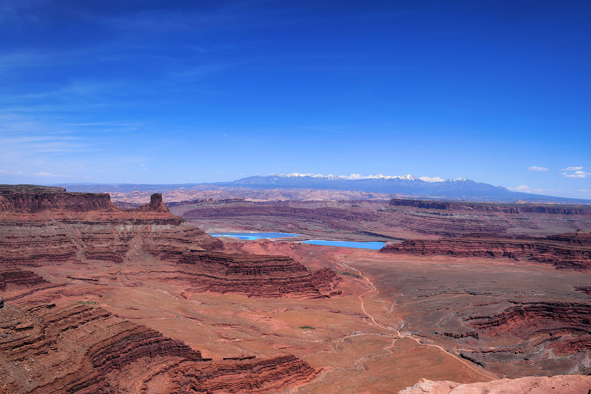
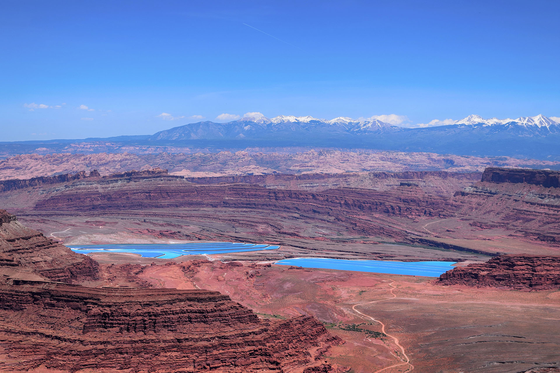
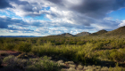
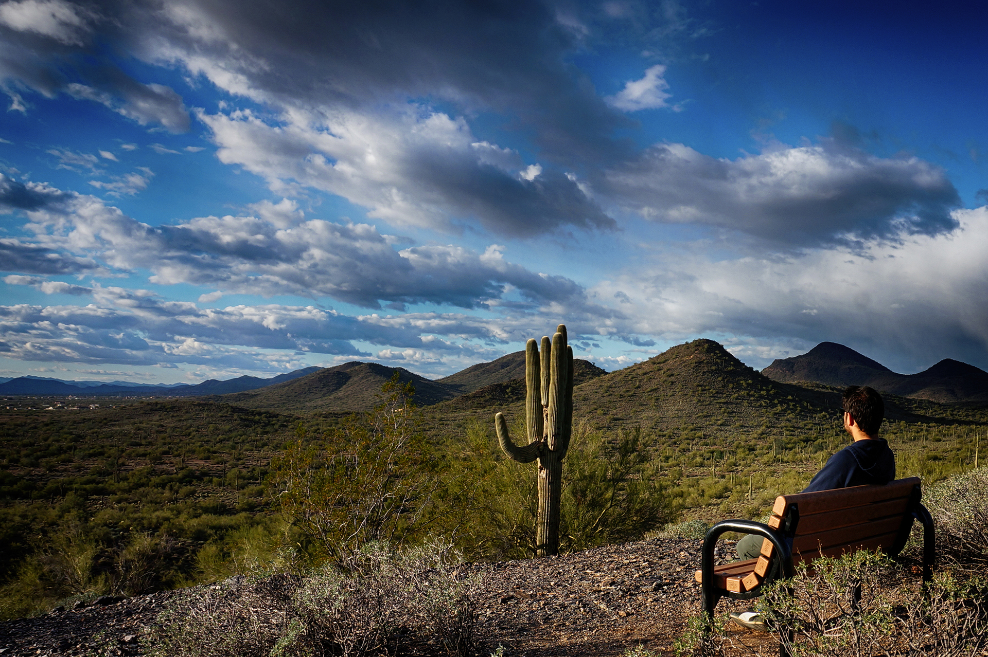
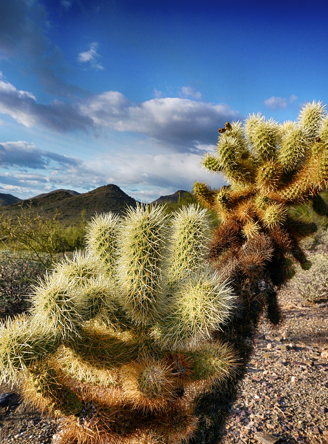
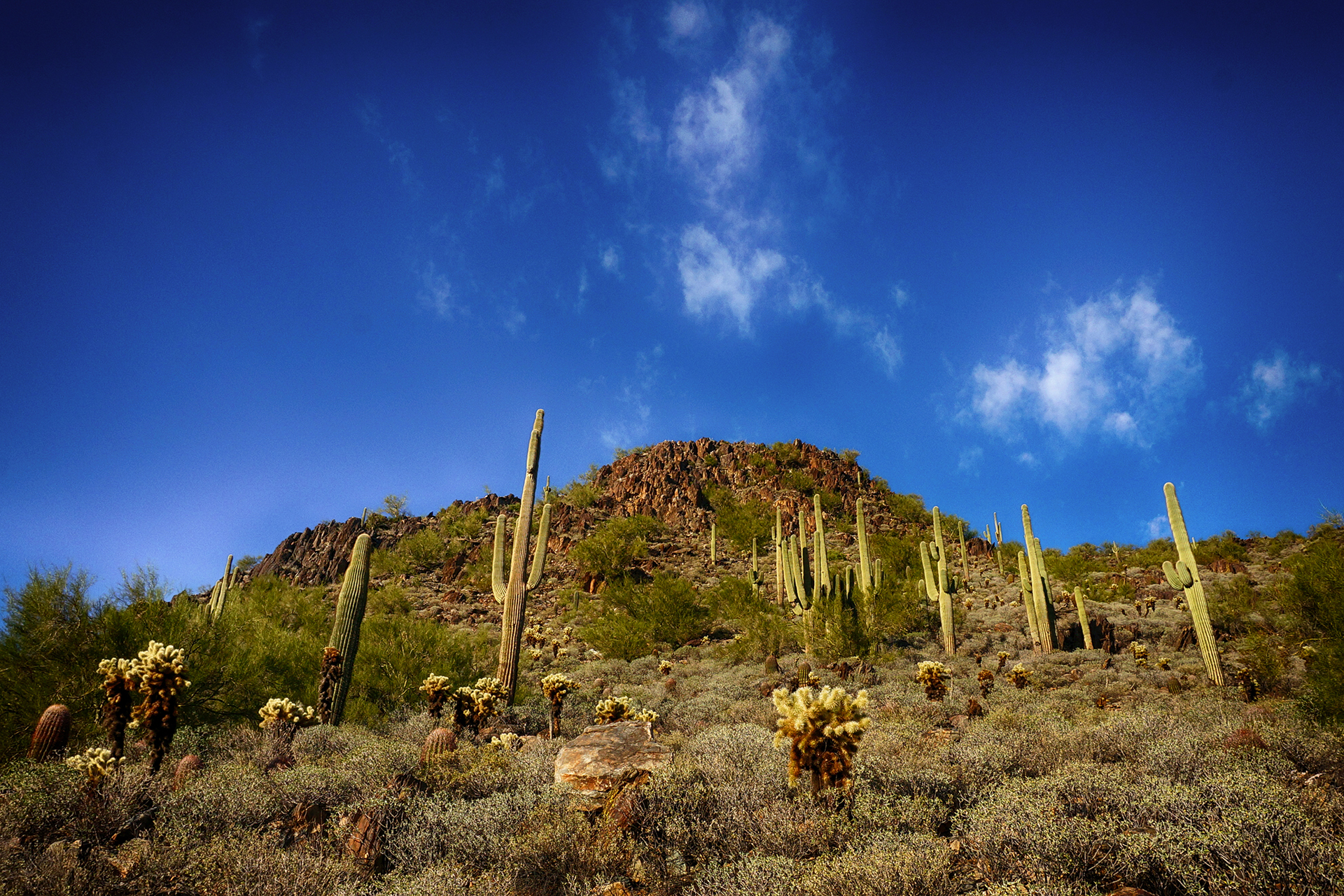
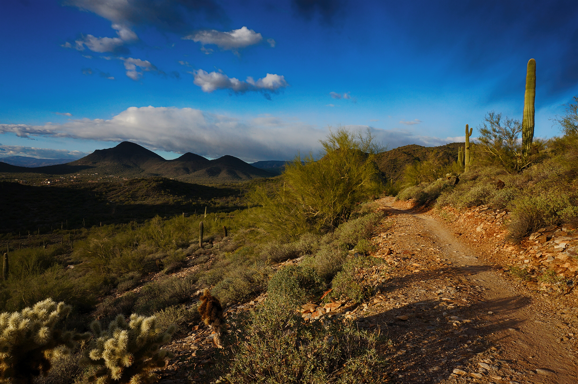
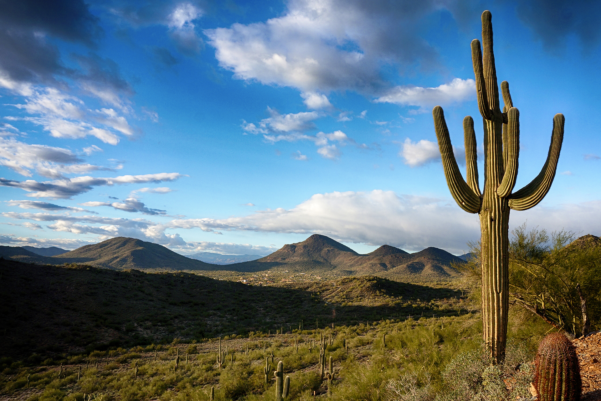
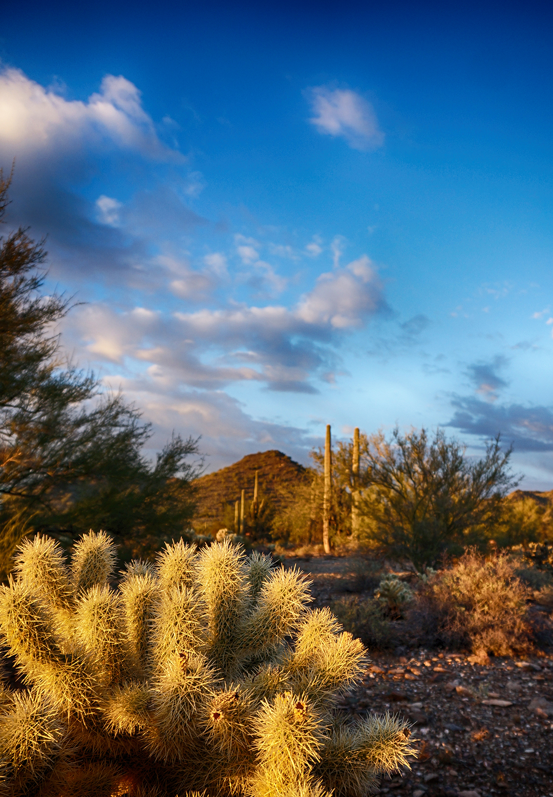
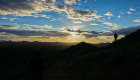
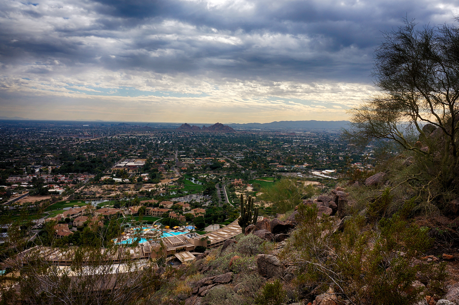
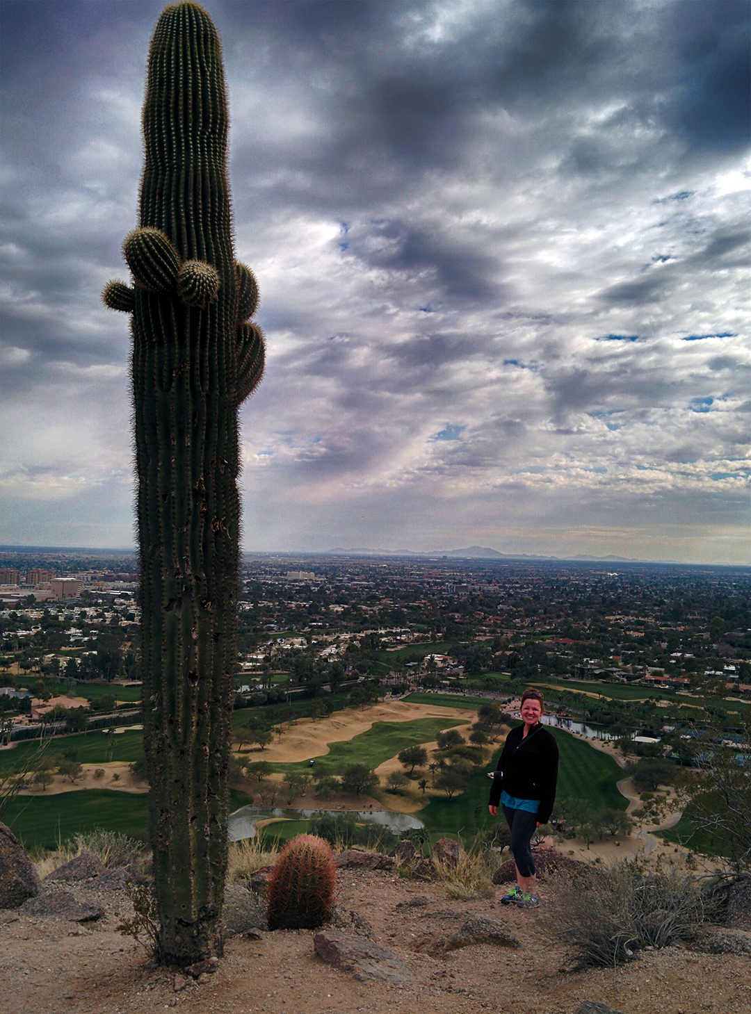
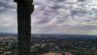
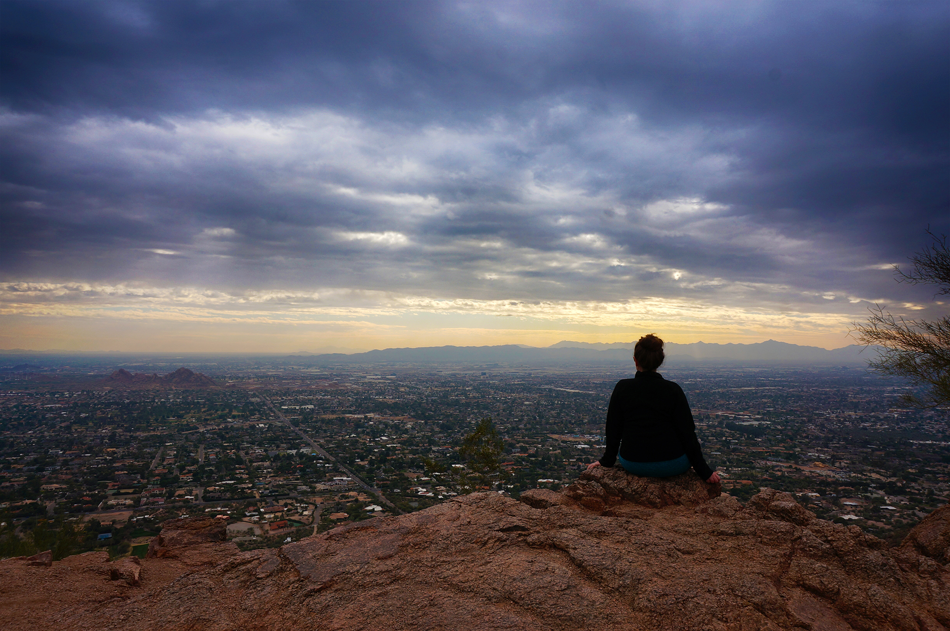
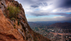
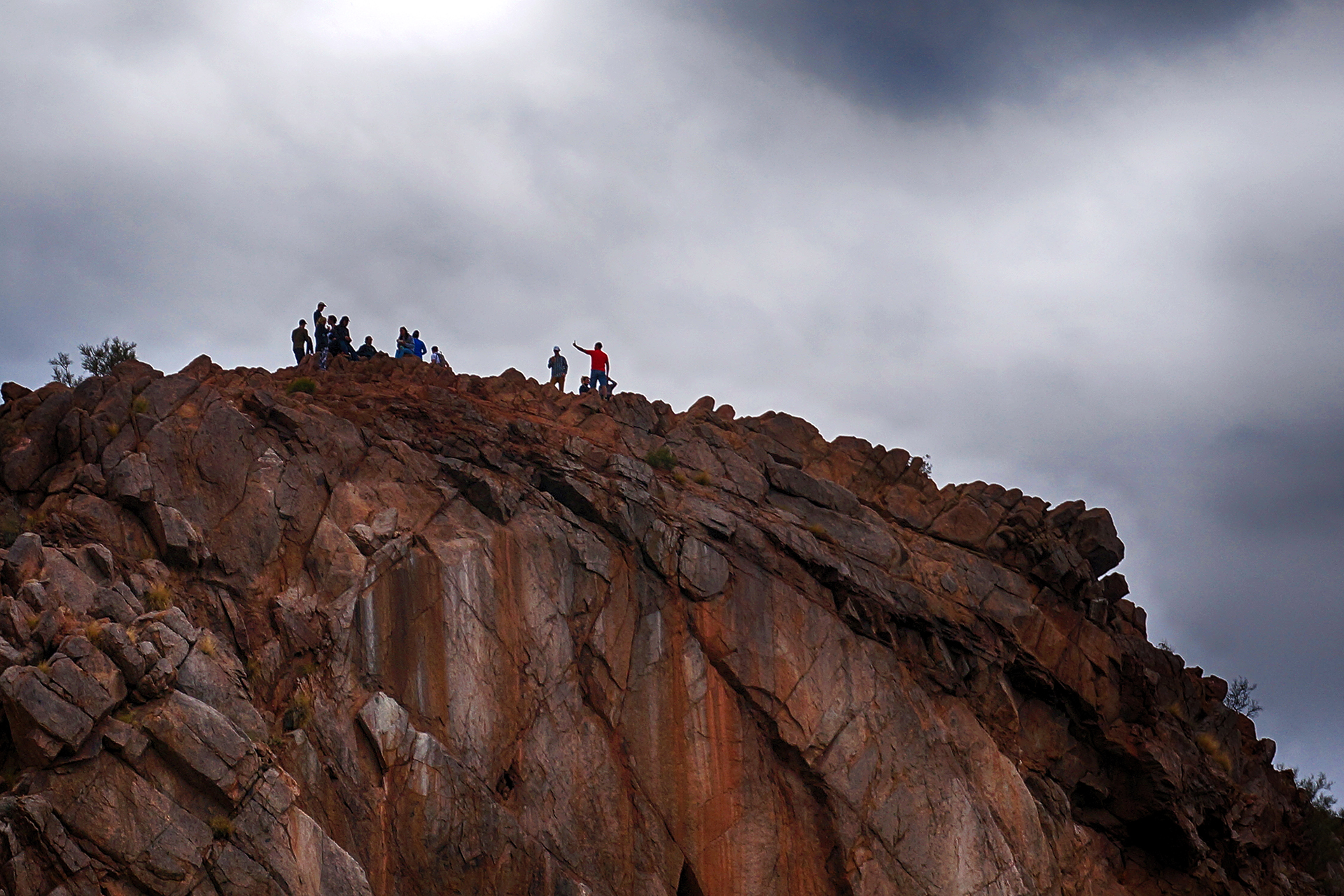
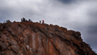
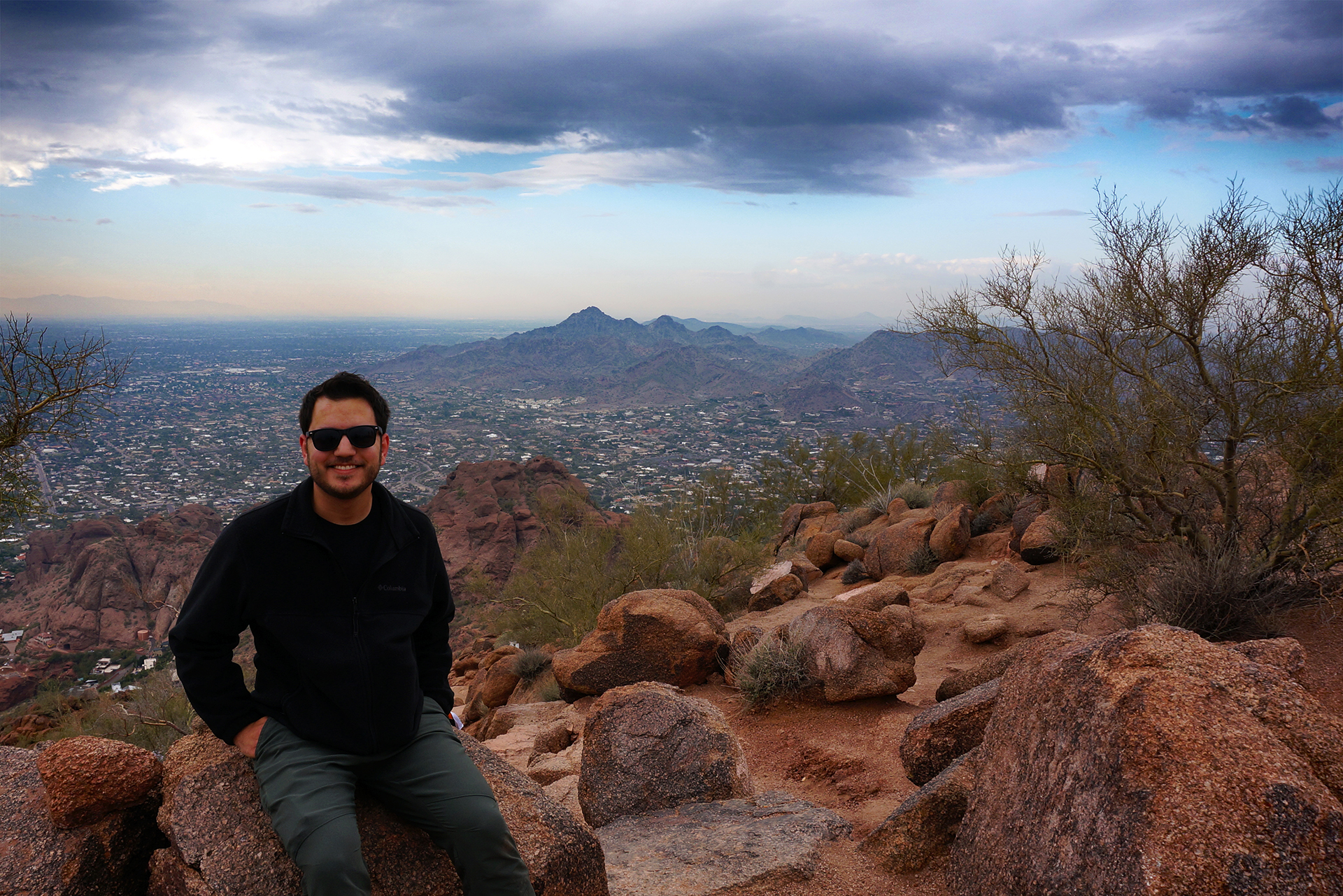
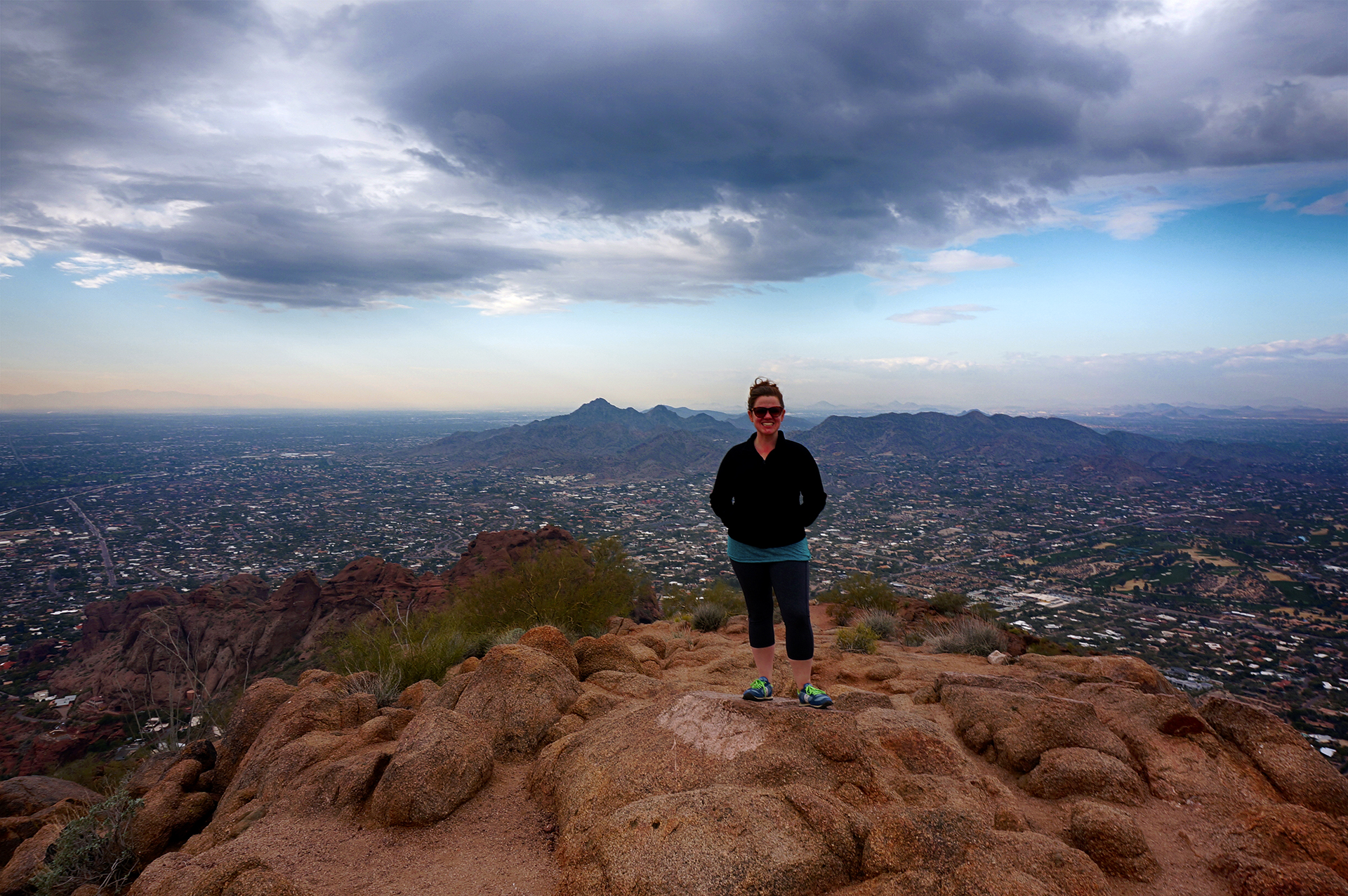
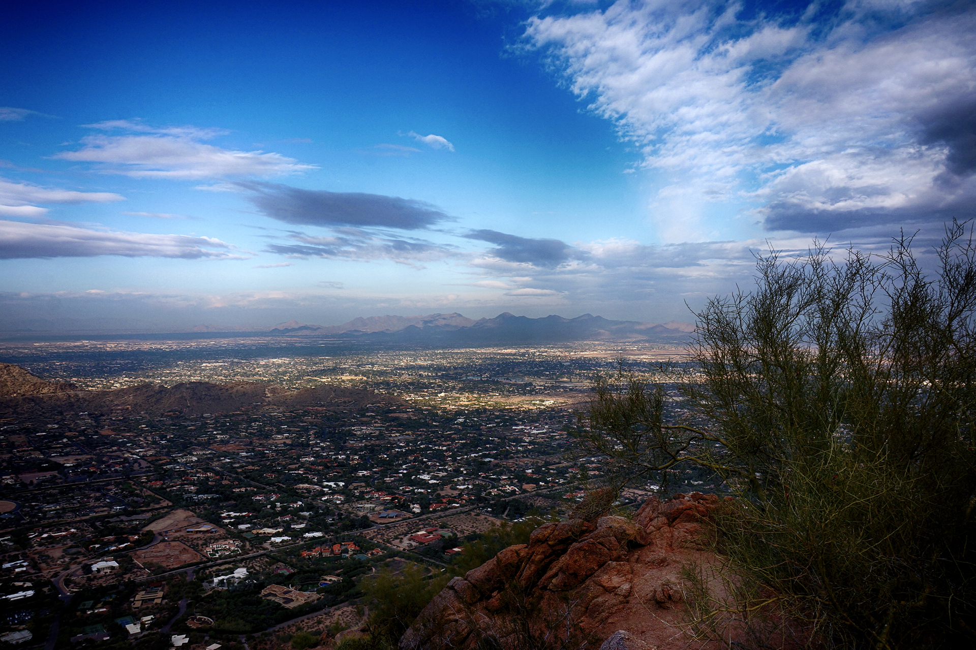
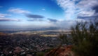
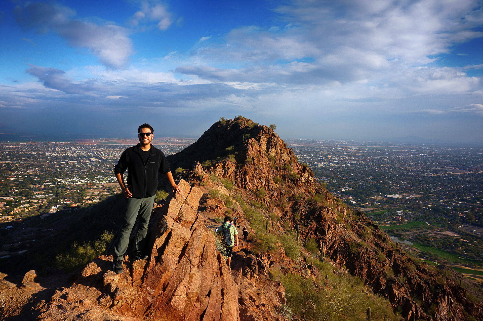
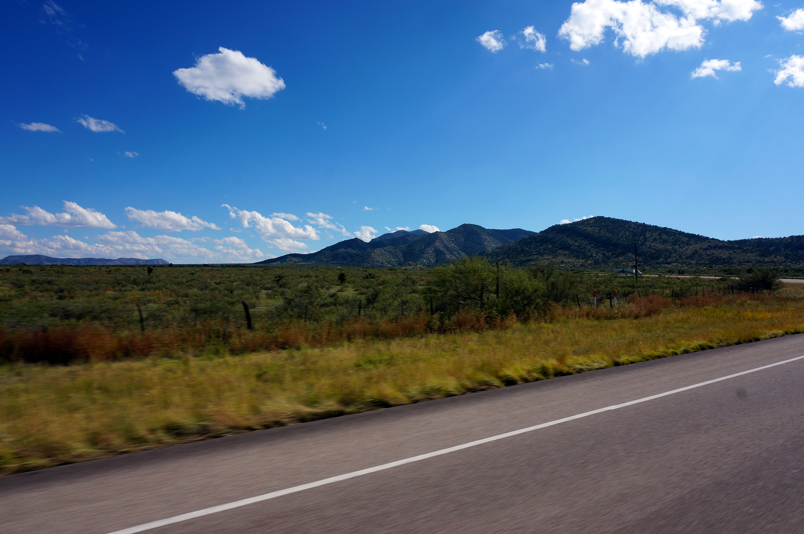
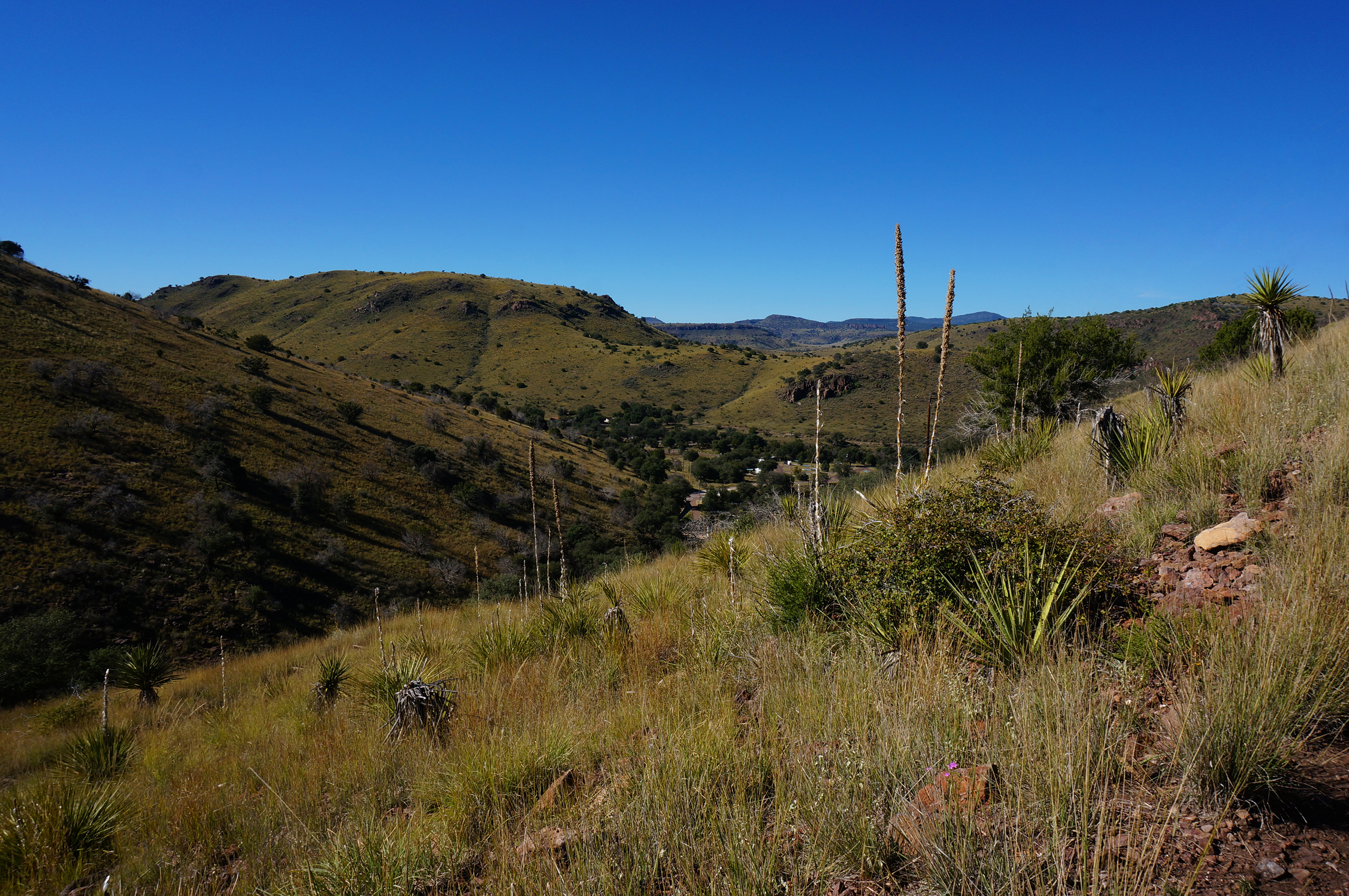
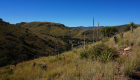
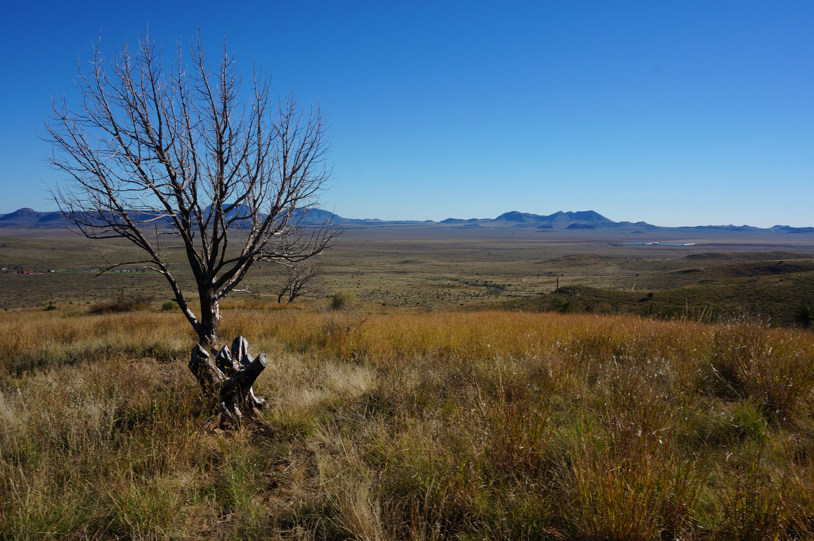
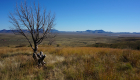
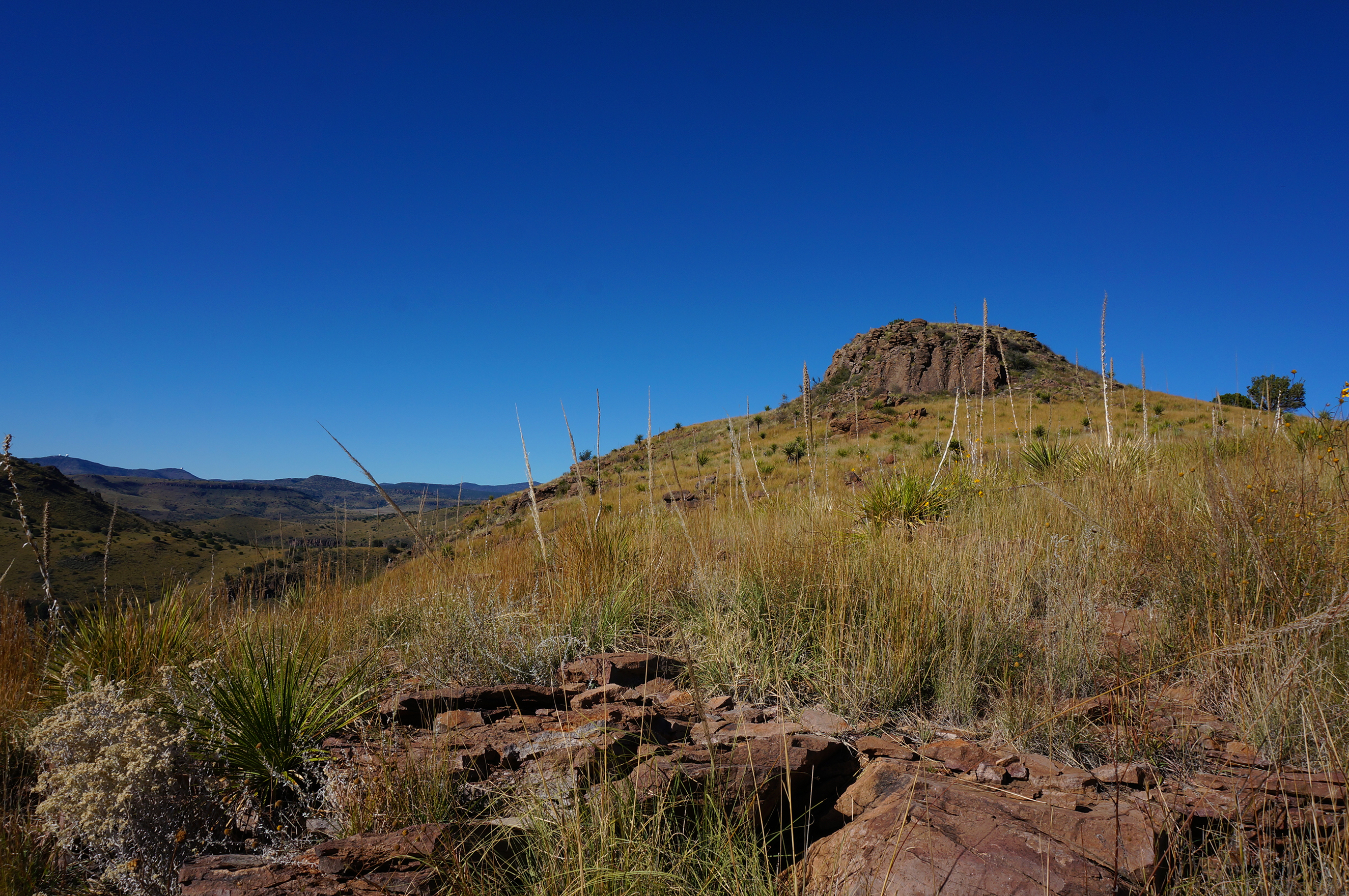
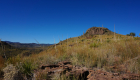
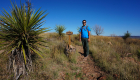
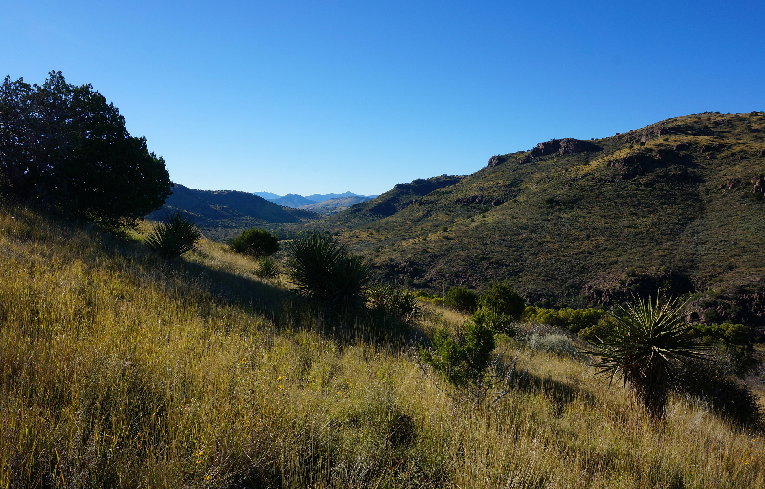
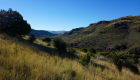
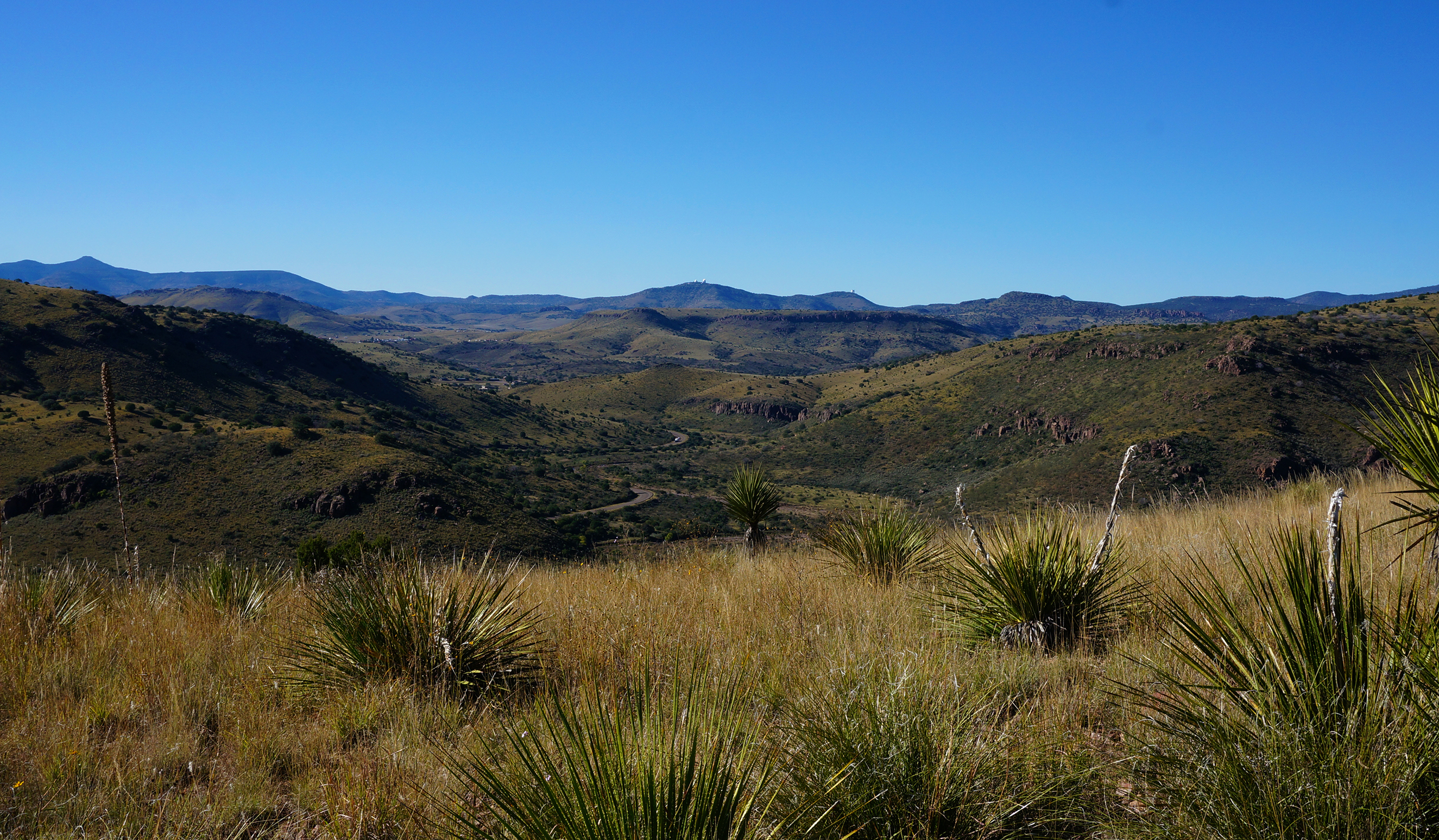
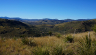
While staying at Itch-Kep-Pe, we took a drive down to see the Beartooth Highway.  The road runs from Red Lodge in southern Montana across the Wyoming border, ultimately leading to Yellowstone National Park.  It’s one of the most famous and beautiful highways in the country, switchbacking up steeply through beautiful mountain country and then cutting across a high ridgeline for miles.

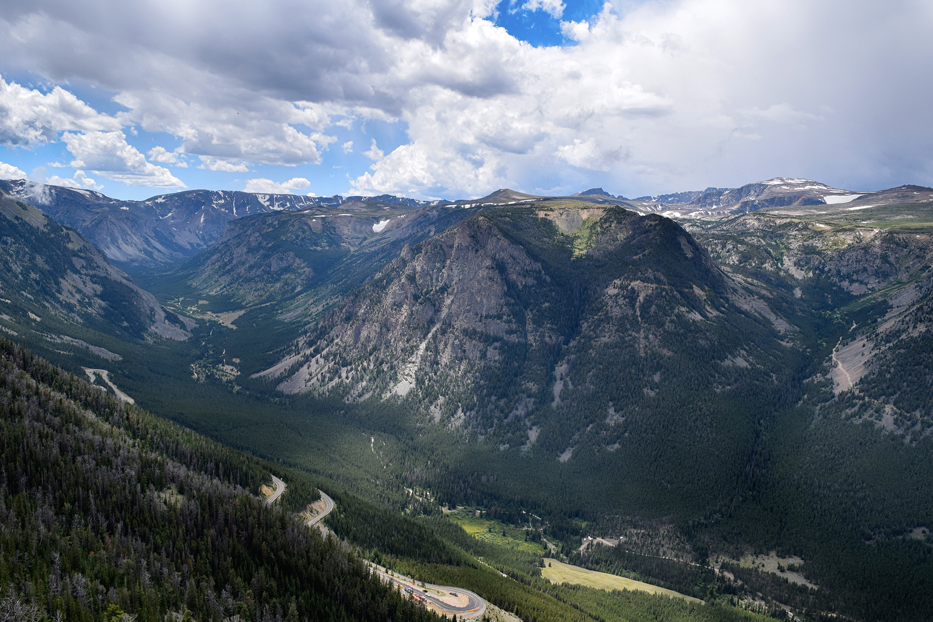
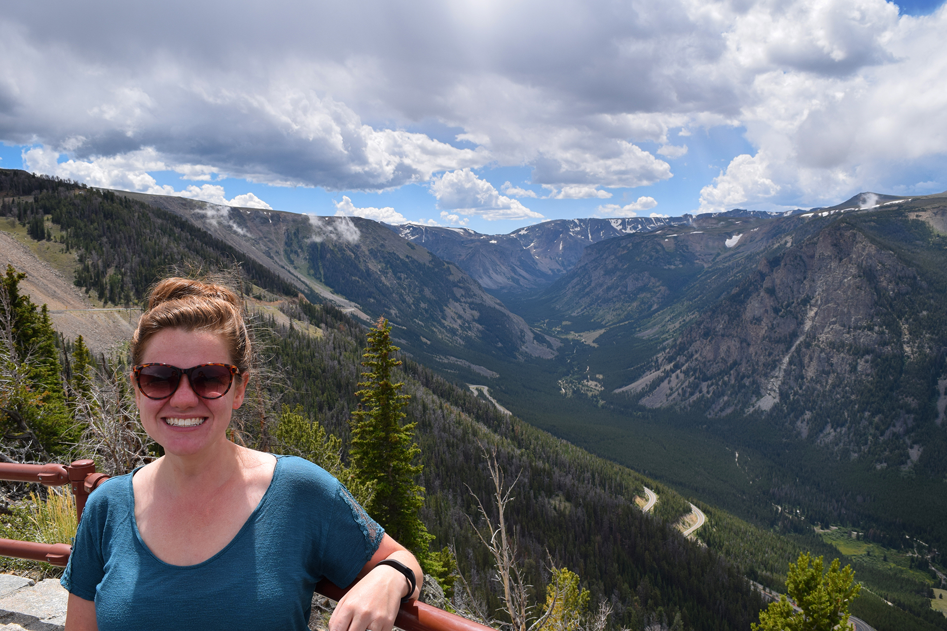
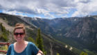
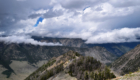
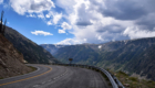
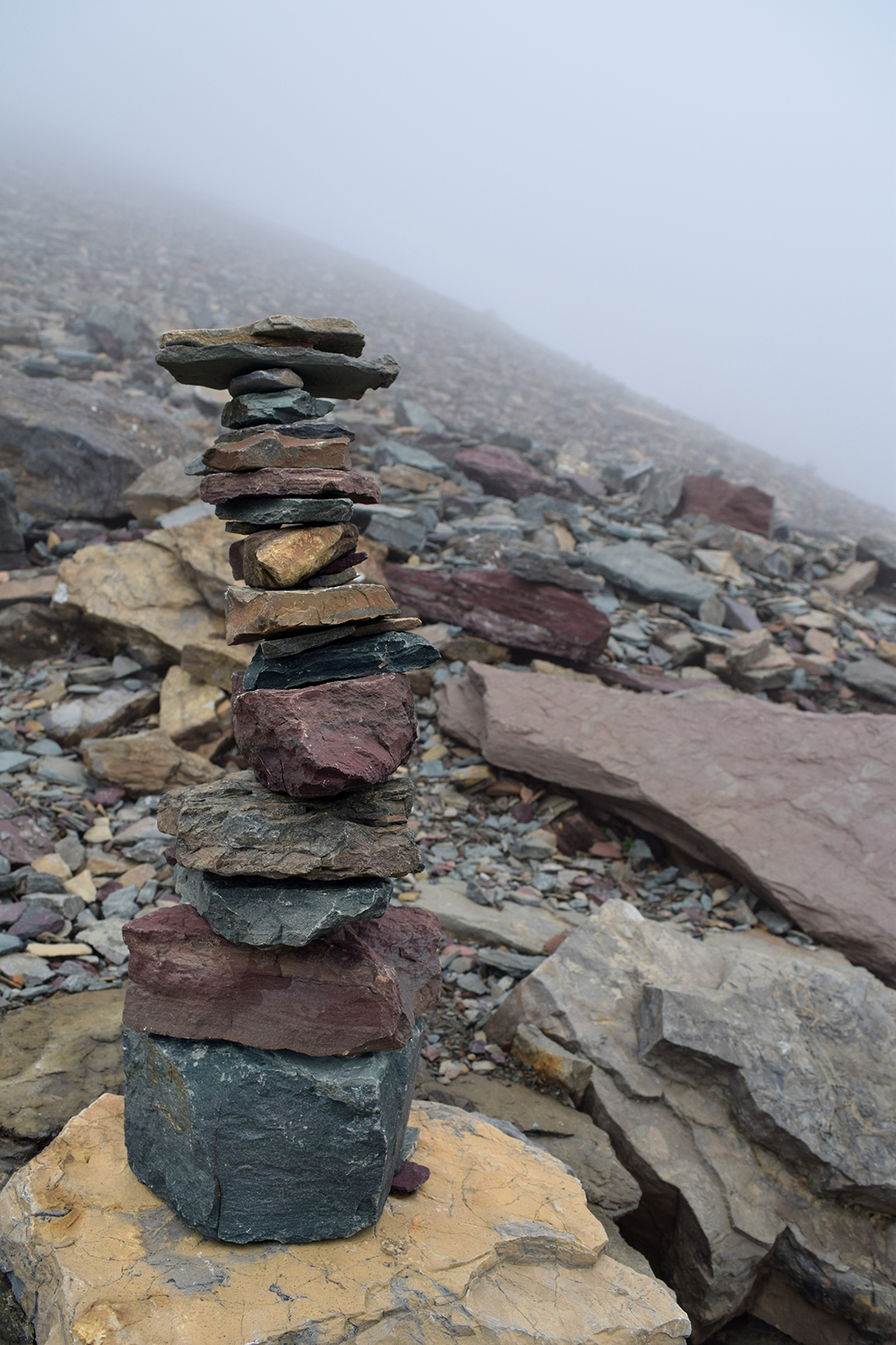
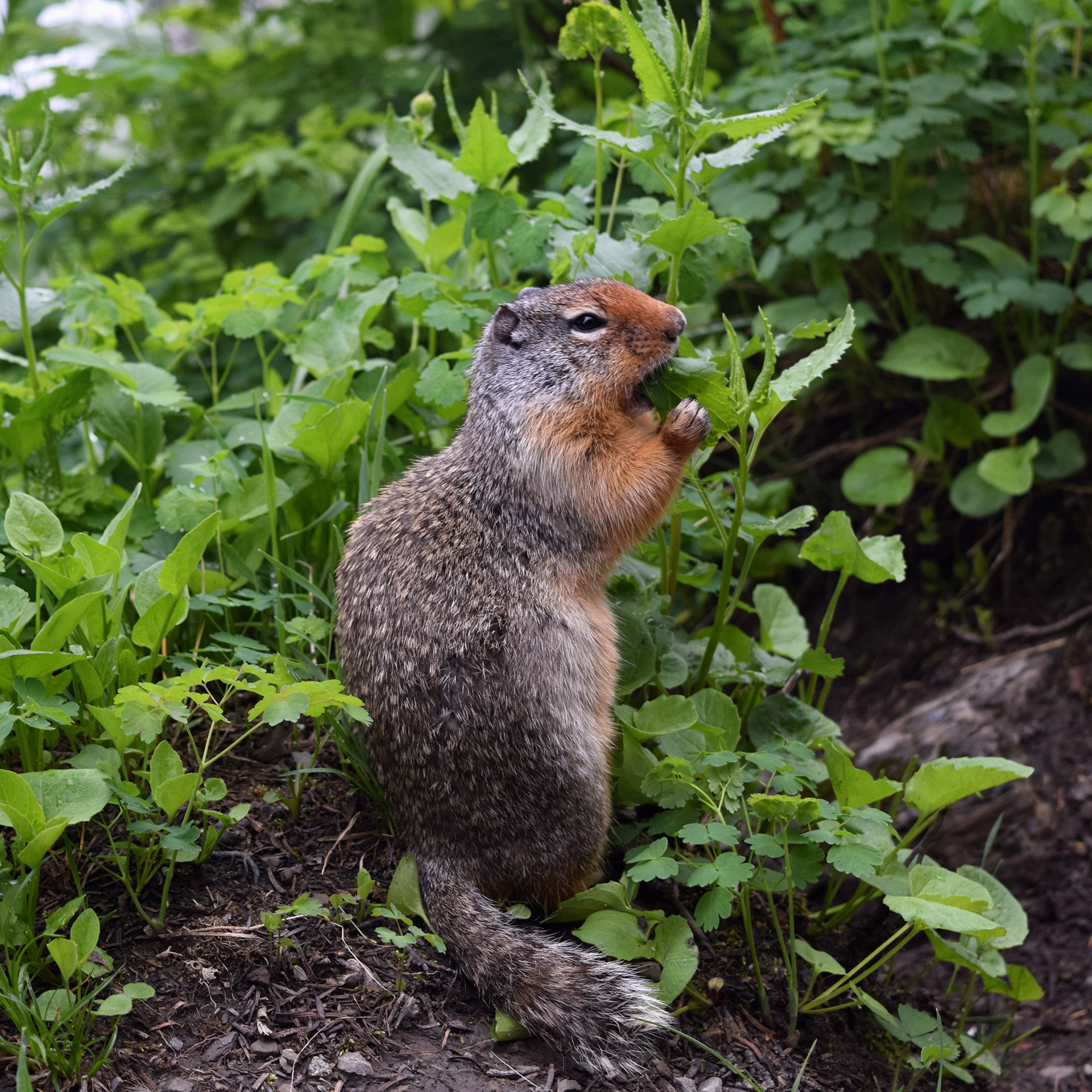
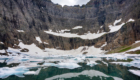
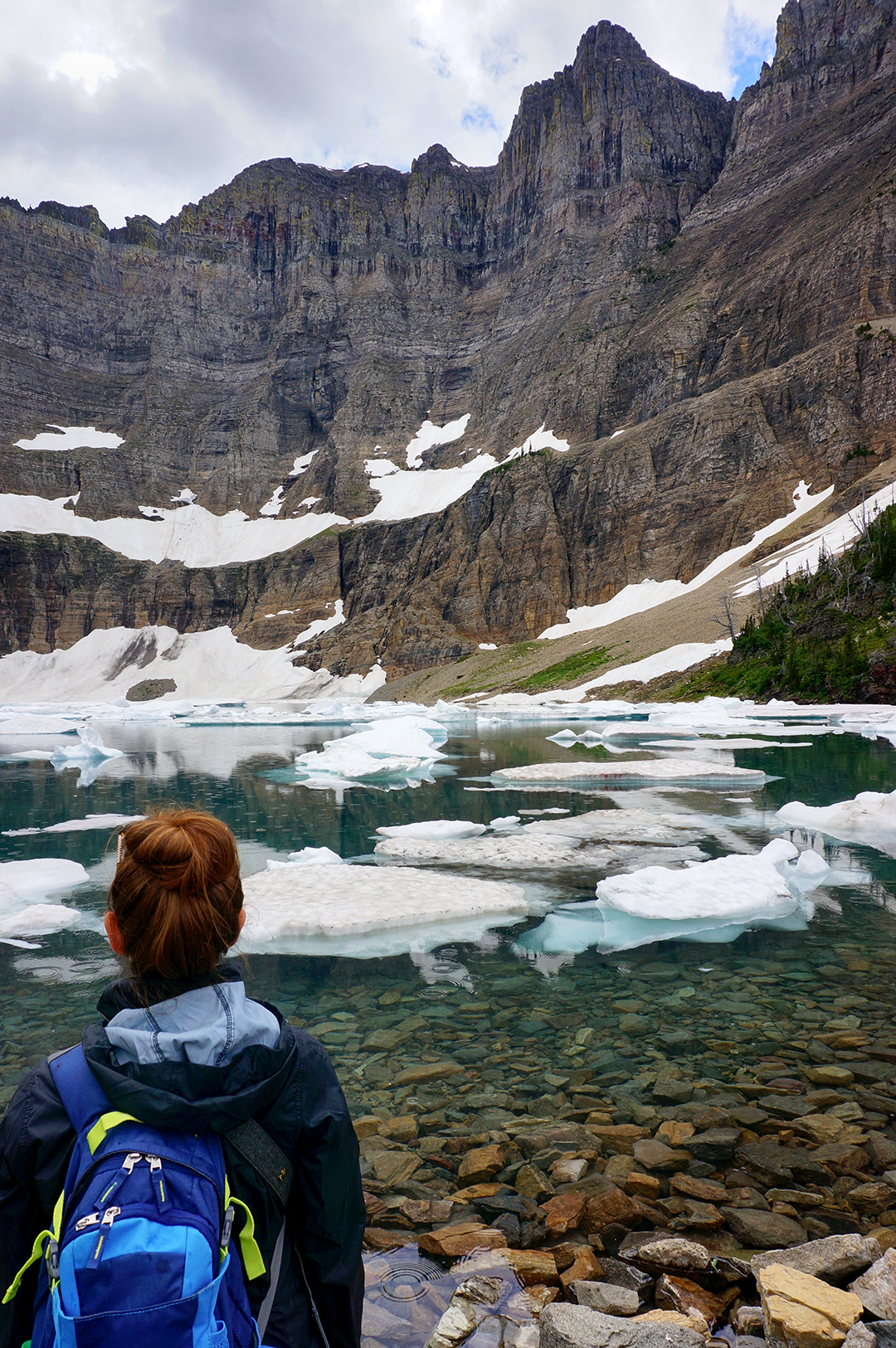
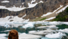
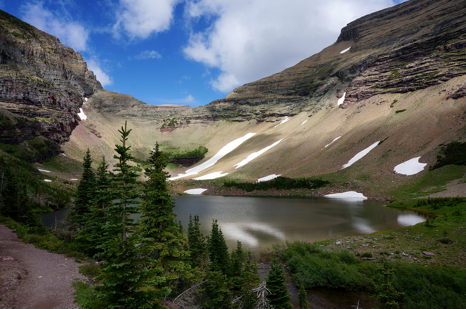
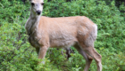
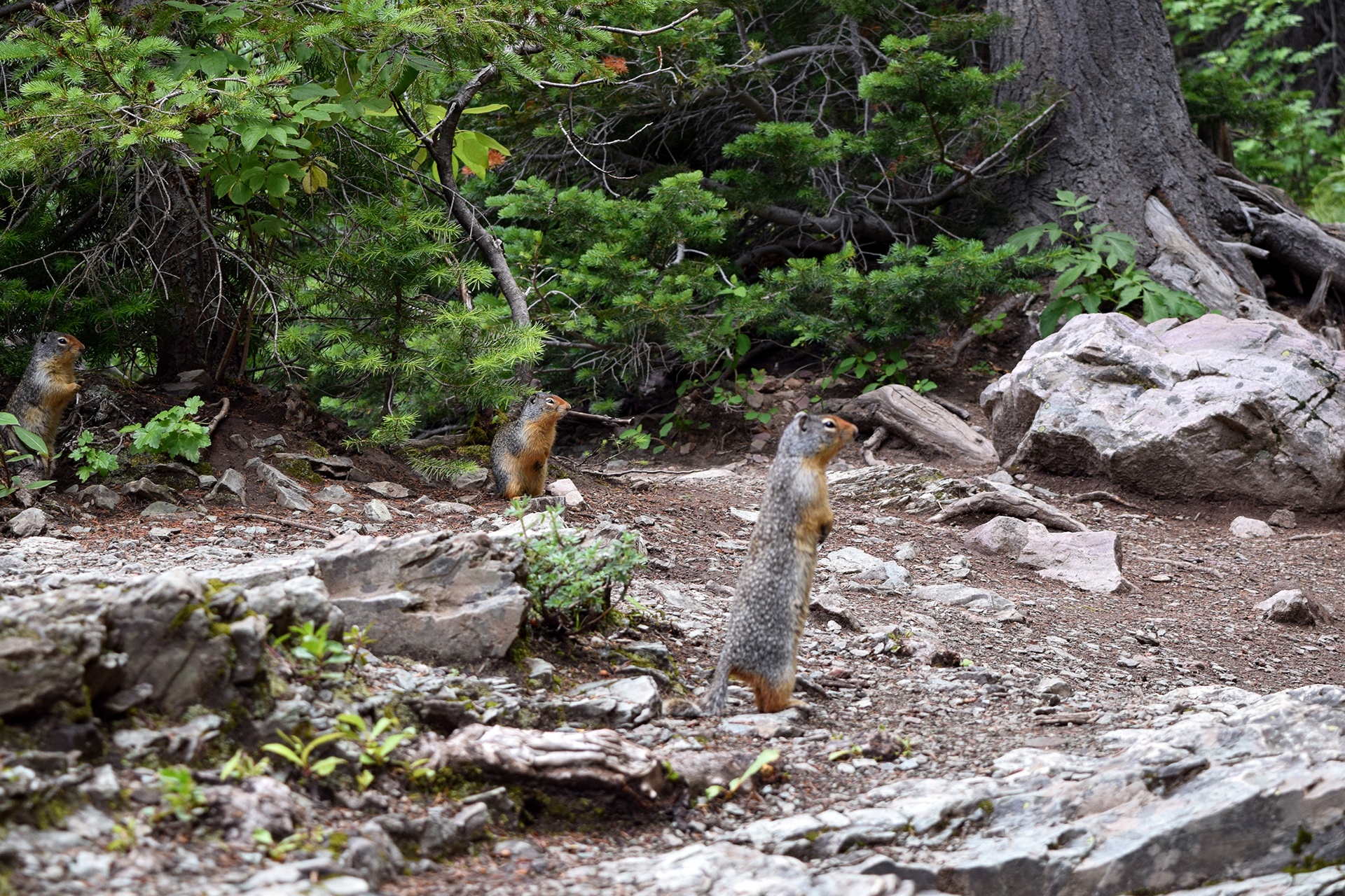
After climbing the mountain, you arrive at a meadow formed by glaciers, with boulders and lakes around every bend.

It’s gorgeous.

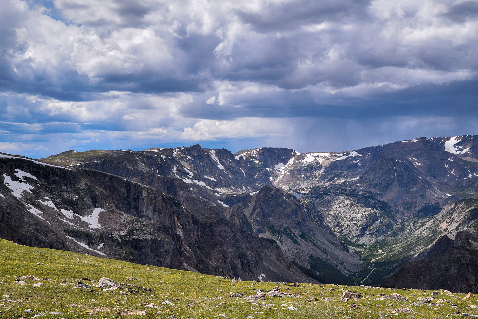
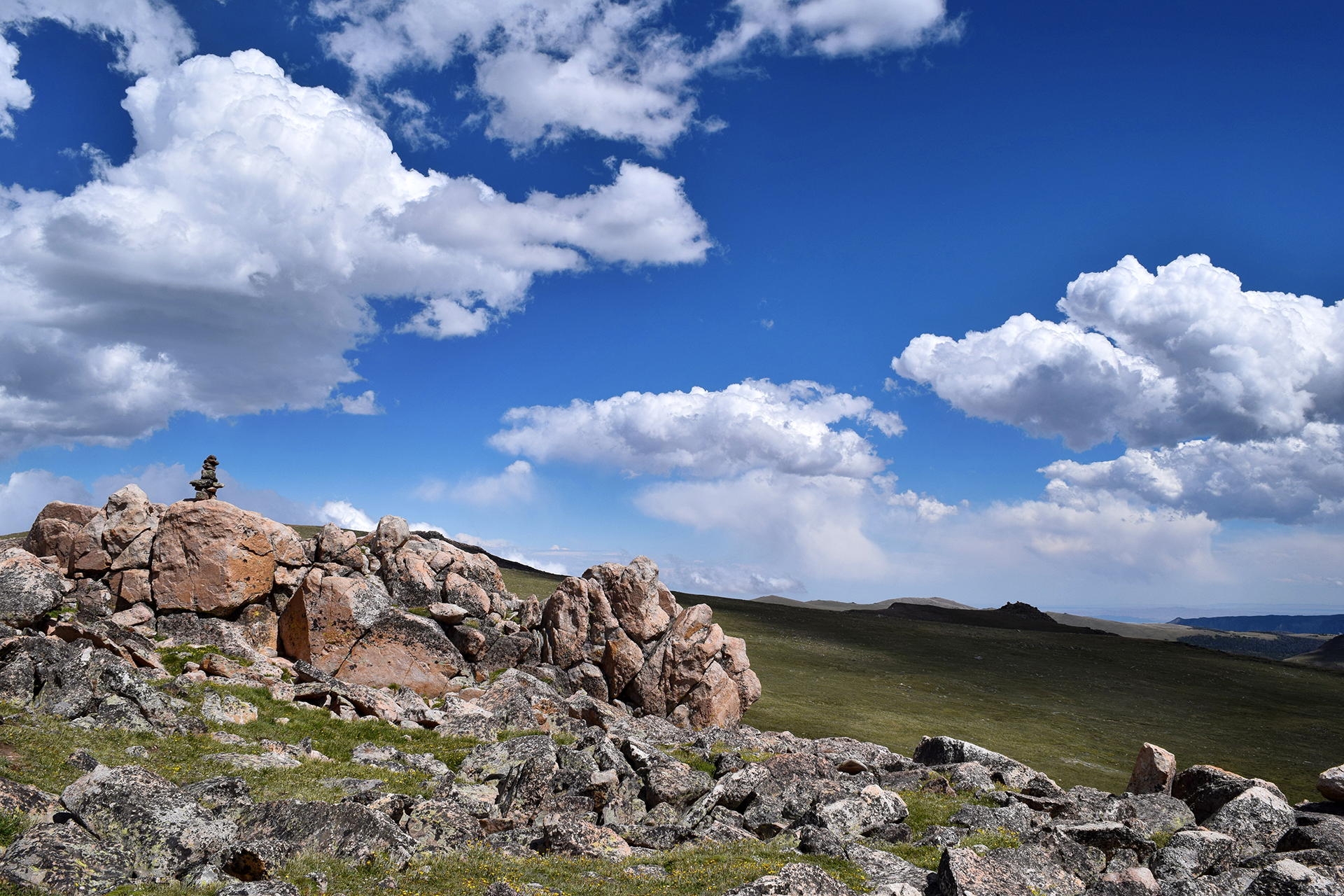
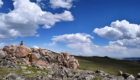
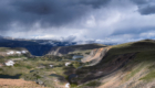
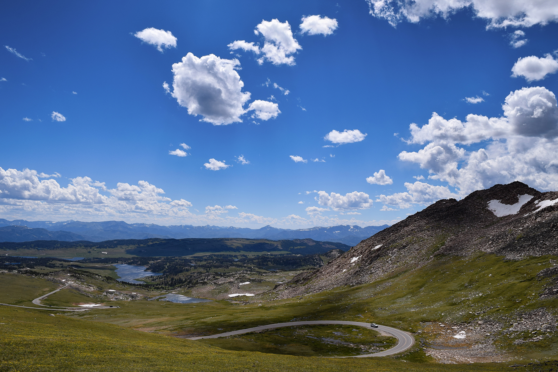
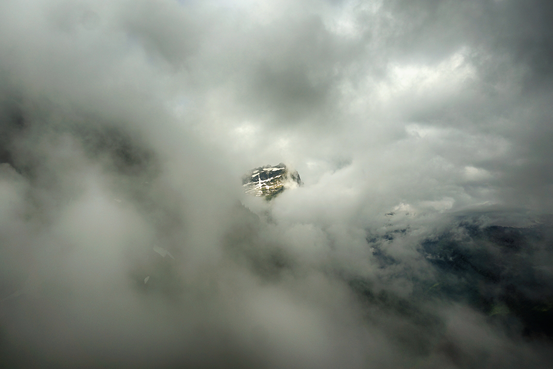
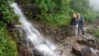
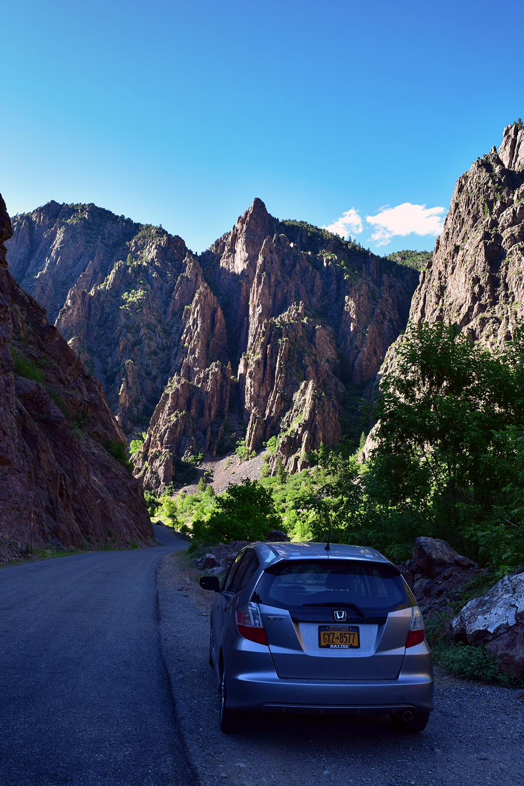
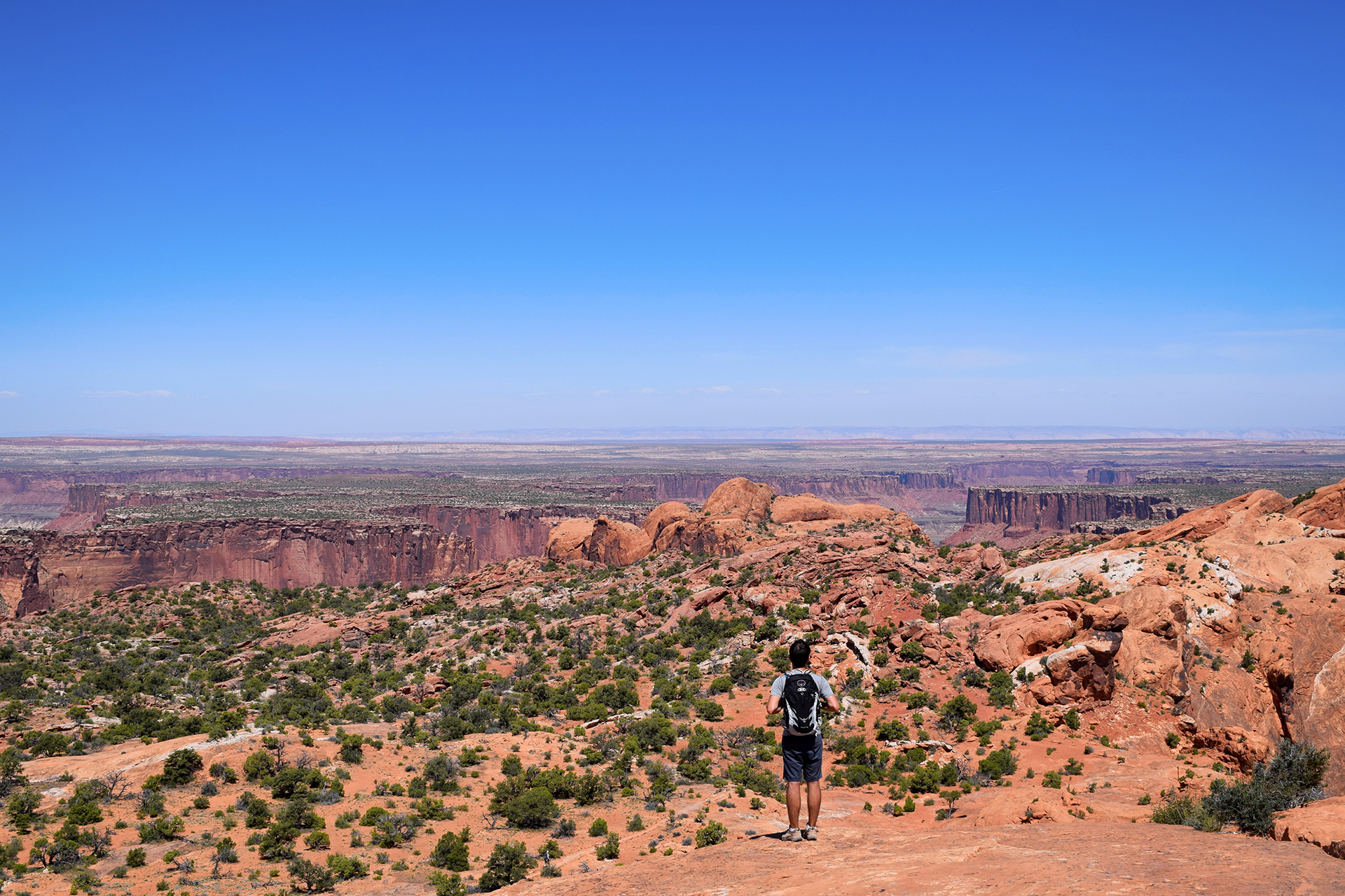
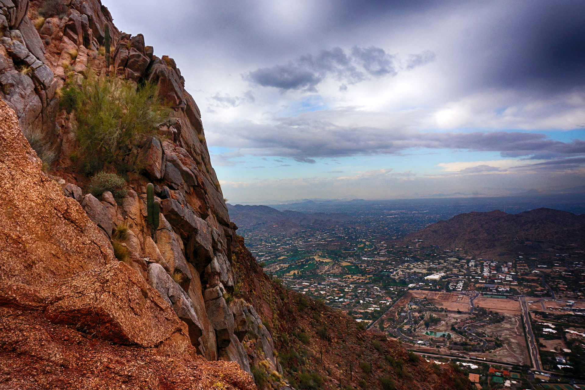
And full of hairpin turns.

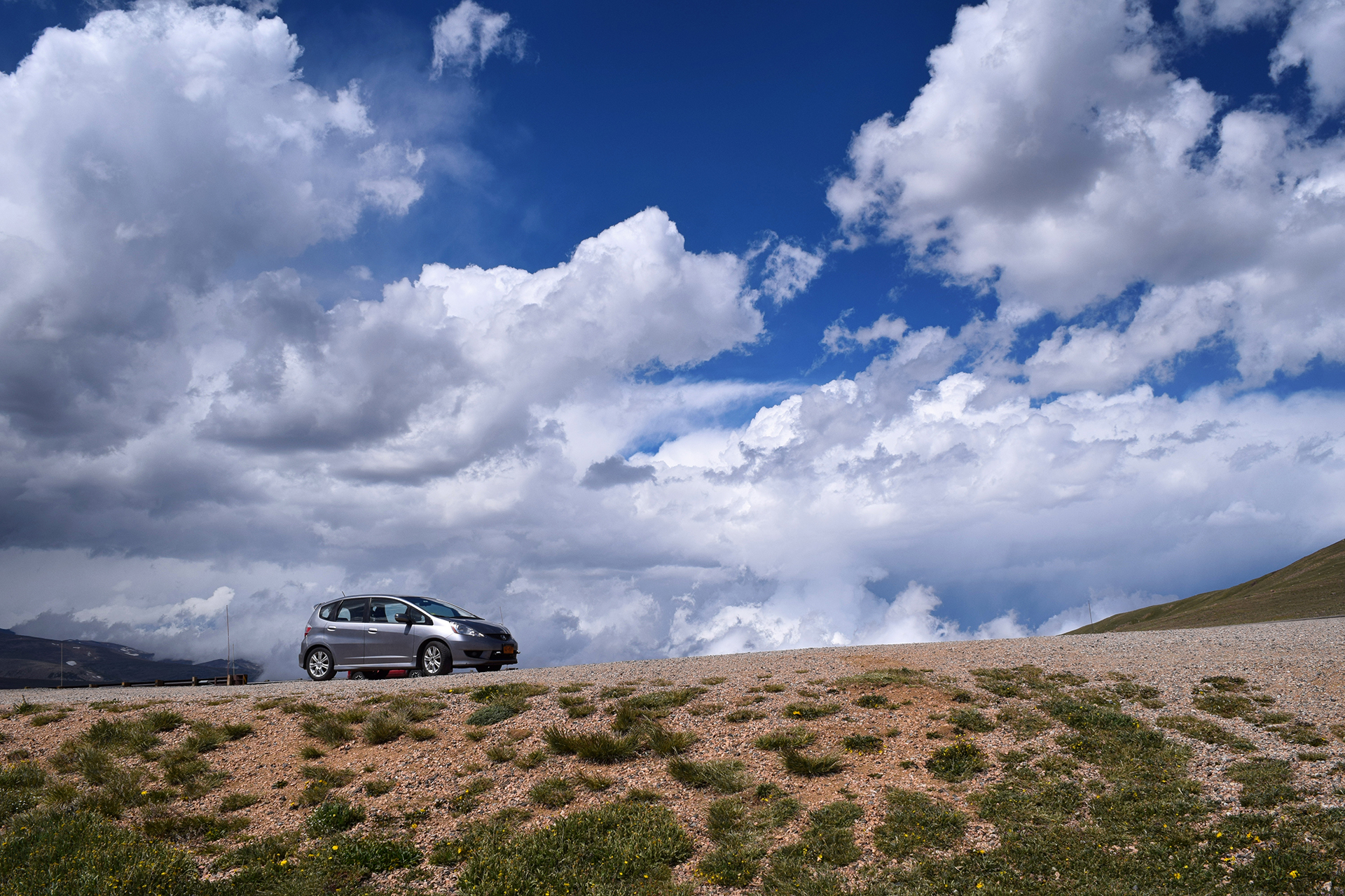
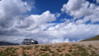
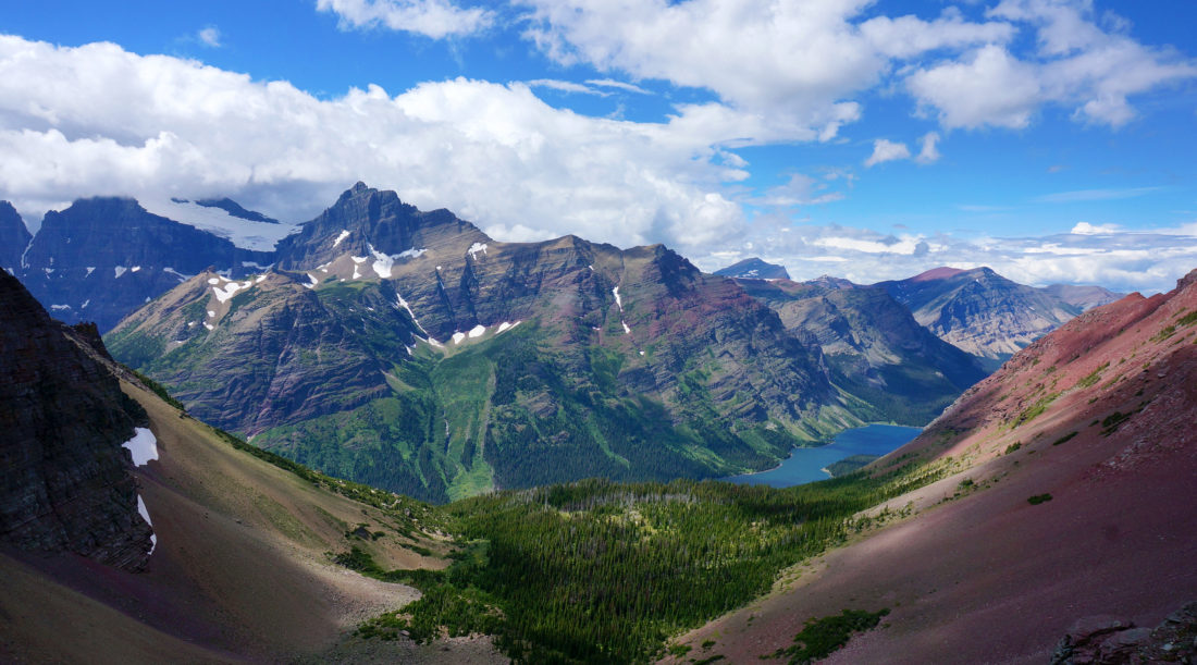
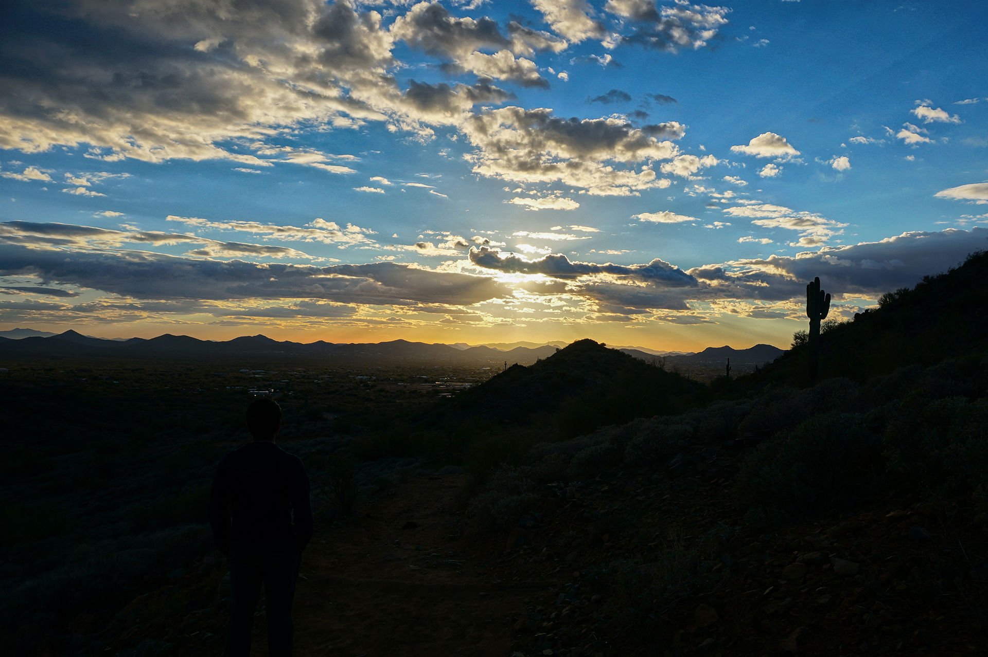
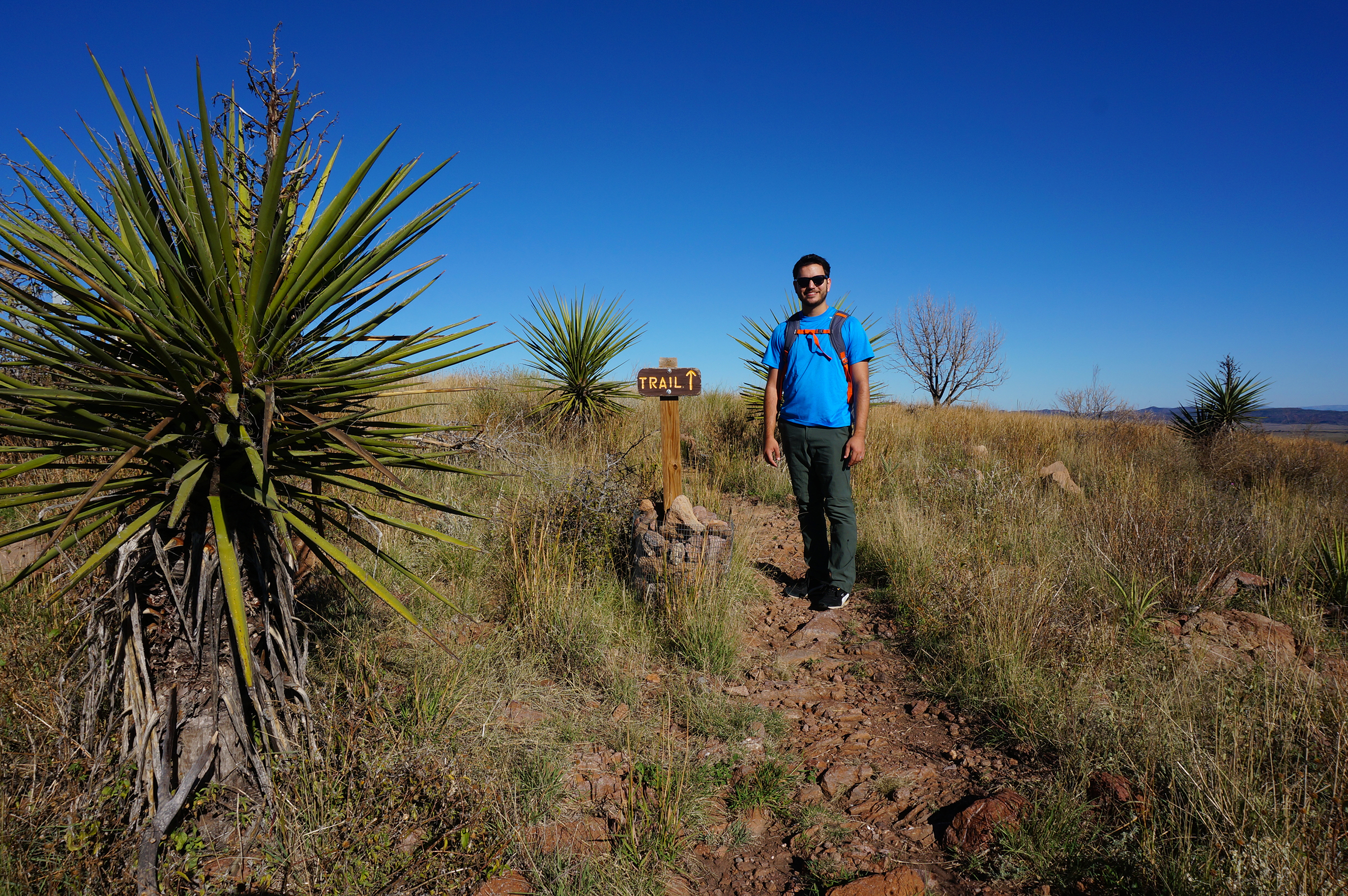
This would be an extremely bad place to bring an RV, but we saw people trying anyway.  We didn’t drive the entire length, as the road climbs to more than 12,000 feet and Jake began getting a headache and altitude sickness.  (Also, we had just been in Yellowstone!)  Nonetheless, there were some amazing views.

On the way back, as we passed through Red Lodge, we noticed an incredible number of motorcycles and bikers parked on the town’s main drag.  We had unknowingly visited during the Beartooth Rally, a large motorcycle gathering that attracted all sorts of people wearing leather.  We didn’t stay – it was a little intimidating, to be honest – but it nicely foreshadowed something we would soon be walking into face-first.

We’ll save that story for another time.

Roadtrip Time Travel

Next Post

Roadtrip Status

We’ve reached the end of our roadtrip!  We’re settled down in Denver, but we’re going to keep making blog posts and posting our favorite photos from the trip, so stay tuned for more.

Follow Us On Social Media

FacebooktwitterinstagramFacebooktwitterinstagram

Latest Posts

0

Week 54: Glacier National Park: Part 2

We’re back with Part 2 of our trip to Glacier National Park, a place so beautiful it makes the background of our pictures look photoshopped.  If you haven’t seen Part 1, check it out here.

Logan Fog

Due to grizzly bear activity, hikes in Glacier tend to close without warning.  That happened to us when we reached Logan Pass, the top of Going-to-the-Sun road, and found the option we wanted was closed.  So, in the spirit of adventure, we persuaded Jake’s family to go on one of Glacier’s most famous hikes:  The Highline Trail.  The Highline Trail starts at Logan Pass, and it runs directly above Going-to-the-Sun road.

Oh, and it starts with a walk along the side of a cliff.

There is a handrail, of sorts.  A chain wrapped in long pieces of garden hose is bolted to the wall, reminding us of a more comfortable version of Angel’s Landing at Zion.  Jake’s mom is no fan of heights, but she got made it through beautifully – perhaps because a massive fog bank made it impossible to look down.

Unfortunately, the fog hung around for more than just the cliff walk.  The actual trail was bursting with birds and bees, Spring flowers and cute little animals, and melting snow (in July!) but we couldn’t see a damn thing more than ten feet away.  The swirls and eddies of the fog would provide tantalizing glimpses of the valley we knew was there, but couldn’t see.

We decided to turn back after a while, but as luck would have it, the fog lifted right before we made it back – and it was a stunning sight.

Incidentally, Logan Pass isn’t especially high by Rocky Mountain standards (6,600 feet), but it does have one thing going for it:  mountain goats!  They hang out right near the visitor’s center, slowing traffic and accomplishing basically nothing.  As far as we can tell, their life consists entirely of licking rocks and sleeping.

Animals after our own heart.

West Side > East Side

After our week with Jake’s family was up, we sadly said our goodbyes – to Jake’s mom and dad, that is.  Nothing Mundane’s official sister, Kate, stayed with us for a few more days, as we traveled around the park to… the East Side.

That probably makes no sense, so here’s the explanation.  Glacier is huge, and the main entrances are on the west side and the east side, connected by Going-to-the-Sun Road.   The west side is near a large tourist town with restaurants, breweries, grocery stores, and the coolest gift shop we’ve ever been to.

The east side has… an RV park, and a gas station.  And that’s about it.

That’s a slight exaggeration, but not by much.  There was a bar, a burrito stand, and the world’s tiniest and saddest-looking miniature golf course, but certainly no brewery or grocery store.  Our Internet connection approximated the AOL dial-up days.  We couldn’t even buy cooking wine, since the area is on the Blackfeet Tribe reservation and it was a tribal holiday (although apparently the bar was fine!).

At least we were able to get reservations at the RV park here.  As it turned out, the RV park itself has its own restaurant.  The enterprise was essentially built by hand by settlers in the 1950s, and there were some interesting mementos.  Our favorite were the guestbook pages laminated into the table.

There is a downside to being a family run business, however, not to mention being the only game in town.  The waiters and waitresses may literally have never been to another restaurant, because their service was so terrible it was almost impressive.  They genuinely could not have cared less whether we enjoyed our meal.  Jake also learned that, while “chef’s choice” may get you something good and unique at a high-end sushi restaurant, it gets you “a pile of whatever crap we couldn’t sell this month” at family-run RV park restaurants in northwestern Montana.

Learning is fun.

Ice, Ice Baby

Undeterred by culinary atrocities, we struck out with Kate on a hike to Iceberg Lake.  The trail cuts through a beautiful alpine meadow teeming with wildflowers, set against a backdrop so magnificent we can’t possibly do it justice with words.   Just take a look at the pictures.

We passed through a dense forest with few people around, which made us slightly nervous because this is grizzly bear country.  We certainly didn’t want to surprise any grizzlies, so we clapped and talked loudly as we went.  (Some people wore bells for this purpose, but several different rangers later confided in us that these are worthless.)

No bears were encountered – maybe they didn’t like our singing – and we soon reached the lake, surrounded on three sides by sheer mountain cliffs.  It was July, but icebergs were floating in the water.

The waters here were crystal-clear, and very cold.  A few people were taking a dip anyway, but we decided that discretion is the better part of valor and politely declined that option.  We had a lovely picnic by the lake, made a photosphere, and headed back.

There was a lot of beargrass here – tall, white, fuzzy flowers, like huge cottonballs on a stick.  They were allegedly named beargrass by Lewis & Clark, who saw some grizzlies playing in a field of beargrass and assumed the bears must love them.

We have no idea if that’s generally true.  Buuuuuut… we did come close to a grizzly bear on the way back!

It was foraging just off the trail, nearly invisible becuase it was downslope and around the bend from where we were walking.  Jake caught a glimpse of someone down the path gesturing wildly, and somehow correctly interpreted it as, “bear nearby – proceed with caution!”  He stretched out his arm for Heather and Kate to stop.

Heather assumed someone was just taking a picture, and tried her best to barrel through Jake’s arm (and into the waiting paws of the grizzly up ahead).

Luckily she stopped in time, and no mishaps were had.  We waited a bit, then edged around the trail, bear spray in hand.  We were relieved to see the bear had dropped lower down the slope, and we quickly scooted past.  It had probably been just a few feet off the trail you can see below.

We reported the bear sighting, like good junior rangers.  And we took the opportunity to visit one of Glacier’s many beautiful chalets, set in a preposterously beautiful location right by an alpine lake.  We have no idea what it costs, but wow.   This would be a rather nice place to stay.

Light At The End of the Tunnel

After Iceberg Lake, Kate left to head back to Colorado, and we decided to stay one more day for one more hike.  Many camping spaces at Glacier are first-come, first-served, so at 7 a.m., we drove down to the park and snagged one of the prettiest parking spaces you’ll ever see.

The trail we picked is called the Ptarmigan Tunnel, named after the bird (the “p” is silent).  The first two miles or so share the trail with the Iceberg Lake hike we had just done, but we didn’t mind – that’s a view we would happily see every day.

The trail then branched off and became considerably less populated.  We trekked steeply uphill through an even denser, more enclosing forest than the day before, making us more than a little nervous.  A guidebook we read described this area as “natural grizzly bear habitat,” and we were grateful for our hiking prowess as we pushed hard to get out of the danger zone.

Then things opened up, and we picnicked for lunch near a beautiful alpine lake.  (Glacier has a lot of those.)  Several marmots – like beavers without the big teeth – frolicked nearby, cute, furry, and utterly unafraid of humans.  There was a lot of wildlife on this trail, all habituated to visitors – we even walked along the trail behind a deer for a little while.

Eventually, we tackled the final stretch of the trail.  The path switchbacks up an incredibly steep mountainside, almost a cliff.  Thankfully it was a relatively short distance to the top, because this was probably the most punishing stretch we ever hiked.  We were more or less delirious in the picture below.

You can’t see it in that picture, but we were facing the Ptarmigan Tunnel.  Created in the early 1930s by the CCC using dynamite, it passes through the very top of the mountain.  Due to massive winter snows, the rough-hewn tunnel is sealed by a large iron door for nine months out of the year – and it had just opened.

On the other side?  Paradise.

Friends, we had been on the road for over a year at this point.  We had seen the country’s most beautiful mountains, deserts, beaches and plains, but nothing – nothing – ever stopped us in our tracks like this.

It was the most fantastical thing we have ever seen.  At that moment, tired, sweaty, and half-delirious, we knew we had reached the pinnacle of our trip.  There were more places to visit, and a lot more pictures to take, but nothing would ever come close to this view.

We wandered around for a few minutes, taking photos and another photosphere, and prepared to leave as a storm began forming in the distance.  Before we turned, Jake took a look at the trail, which continues on, across the mountainside and down into the valley beyond, and made a promise to himself.

“Someday.”

We passed back through the tunnel and found the storm clouds had already blotted out the view from the other side.  It felt fitting somehow, like nothing else deserved to be seen after the beauty we had just experienced.  And then it was a long, tired walk back to our car.

On the drive back out, we spotted two more grizzly bears, foraging in a meadow near the road.

Nearby, another pristine lake beckoned, its shores lined by brilliantly colored rocks.

Perhaps there was more left to see, after all.

Thanks for an amazing visit, Glacier.  ‘Til next time!

Roadtrip Time Travel

Roadtrip Status

We’ve reached the end of our roadtrip!  We’re settled down in Denver, but we’re going to keep making blog posts and posting our favorite photos from the trip, so stay tuned for more.

Follow Us On Social Media

FacebooktwitterinstagramFacebooktwitterinstagram

Latest Posts

0

Week 51: Black Canyon of the Gunnison

After our short but fascinating visits to Mesa Verde and Hovenweep, we headed northeast through western Colorado to a town called Montrose.  This was easier said then done: the high Colorado peaks typically run north-south through the state, but between Cortez and Montrose there is a spur, which is to say, “very high mountain range.”  In the spirit of adventure – and after some thorough research – we decided to take the direct-and-scenic route directly through the mountains via Highway 145.

We were a little nervous after our disastrous drive on Utah’s Scenic Highway 12, but Highway 145 was smooth sailing.  The views were magnificent the entire way, and when we stopped for a quick picnic lunch at the highest point, Lizard Head Pass, we just had to take a picture.  The result was one of our favorites from the trip.

As usual, getting back down from the mountain pass was trickier than getting up, but careful braking and our RV’s extremely non-aerodynamic profile helped us descend safely.  We soon made it to the wide-open RV park near Montrose, and if the CVS in Cortez had been exciting, the big-box stores here made us positively giddy.  It had been over a month since we had been in any kind of real city (Salt Lake City), and the dusty tourist towns of Moab and Kanab just can’t quite scratch the itch.

We will happily wander for 40 days in the desert, so long as there’s a Target at the end.

The Black Canyon of the Gunnison

We stayed in Montrose to visit the nearby Black Canyon of the Gunnison, a national park with a foreboding name.  Although obscure, it turned out to be well worth visiting.  The Black Canyon is named because it is so deep and narrow that sunlight almost never reaches the bottom.  The deepest spots receive only 33 minutes of sunlight per day.

The “Gunnison” part of the Black Canyon of the Gunnison is a swift-flowing river, and it carved the canyon over the course of millions of years.  Unlike the rivers that created most large canyons, however, the Gunnison did not have the luxury of cutting through soft sandstone and limestone.  Instead, the Gunnison carved the Black Canyon out of an incredibly hard type of rock called schist.

Because the rock is so hard, it lasts.  The oldest schist here is approximately 1.75 billion years old.

It all adds up to some rather striking views.  Can you spy Jake in the picture below?

The only reason the canyon is even possible is because the Gunnison flows with incredible fury during the late spring and summer.  At times, the flow rate of the water can exceed 8,000 cubic feet per second.  For reference, wading through the famous Narrows at Zion National Park is prohibited as too dangerous if the flow rate surpasses 150 cubic feet per second.

So, yeah.  8,000 cubic feet per second is a lot.  Venturing in is not recommended.

The Black Canyon looked amazing in person, but it’s tough to photograph because the angles are so sharp. It’s all knife edges and sheer cliffs, and the bottom really is dark.  On top of that, most of the rock is a uniform dark grey, although here and there it is slashed with beautiful seams (“dikes”) of lighter-colored pegmatite.

There are many, many overlooks, mostly between 100 to 300 yards away from the road (for some reason everything at the Black Canyon is demarcated in yards).  As national park completionists, we stopped at every single one, and we’ll just say – 300 yards each way may not sound far, but it adds up to a lot of walking!

We really enjoyed one overlook near the end where the canyon widened a bit.  The cliff wall you can see in these photos is about 2,500 feet high. That’s more than 833 yards!

We also took a short but satisfying hike along the outer rim of the canyon.  The elevation was high so our breath was short, but the views out over Western Colorado were magnificent.

After checking out every overlook, we drove down to the Gunnison river itself.  The route there is called East Portal Road, and it is incredibly steep.  The road continuously switchbacks, and even so, it descends at a ridiculous 16% grade.  That’s far more than you’ll ever see on a highway, but our Fit handled it just fine, albeit only in first gear.

At least we got good gas mileage on the descent!

At the bottom, there was a diversion dam for the Gunnison irrigation tunnel and a tiny information and picnic area.  And… nothing else.  After poking around for a few minutes, we headed back up East Portal Road disappointedly, apologizing to our Fit the entire way as it churned its way back up the mountain.

This time, our gas mileage wasn’t quite so good.

Roadtrip Time Travel

Roadtrip Status

We’ve reached the end of our roadtrip!  We’re settled down in Denver, but we’re going to keep making blog posts and posting our favorite photos from the trip, so stay tuned for more.

Our trip to the Black Canyon was on June 14, 2016.

Follow Us On Social Media

FacebooktwitterinstagramFacebooktwitterinstagram

Latest Posts

0

Week 50: Mesa Verde & Hovenweep

After a week in Moab and visits to Arches and Canyonlands National Parks, we continued on our roadtrip, heading southeast into southwestern Colorado.  We had originally planned to visit the famous Monument Valley at this point – it appeared in Forrest Gump, along with many, many westerns – but it didn’t work out.  The area around Monument Valley is incredibly remote, and with so few services, we had been planning to just park in the desert for free.  However, with triple-digit temperatures every day, no air conditioning, and a living space that heats up like a greenhouse, we decided to save Monument Valley for “next time” and head for cooler climates.

Well… air conditioned climates, anyway.  We stayed in Cortez, Colorado, just northeast of the Four Corners (which we did not visit because it is a horrible tourist trap).  From Cortez, it was a short but winding drive to visit Mesa Verde National Park, and a longer but much straighter drive to Hovenweep National Monument.

One exciting development, by the way: Cortez had real stores!  Safeway, CVS, a place to change the oil on our RV – all very welcome for your weary correspondents, who had spent the last month in small towns in the Utah desert.

Mesa Verde

We only had two days in Cortez, but we made them count.  We first visited Mesa Verde National Park, a little-known park set, like Canyonlands’ Island in the Sky, on top of a giant plateau.  Unlike Canyonlands, however, the scenery is not the draw here (although the views were gorgeous).

Unique among national parks, the main draw of Mesa Verde is the huge number of archaeological sites.  In particular, this is the finest place in the country to see Ancestral Puebloan cliff dwellings, located along the edges of valleys like the one below.

The area around the park has been settled since approximately 7500 BCE, but most of the cliff dwellings were built between 750 and 1300 CE.  They are amazing in person, surprisingly large and in excellent condition due to the dry desert air.  (It’s worth noting that many were also restored from ruin by the park service.)  We previously saw cliff dwellings at two locations (one and two) in New Mexico, directly to the south, but the buildings at Mesa Verde blow the ones we saw out of the water.

Much of the park involves a self-guided driving tour, where we looked at various preserved archaeological sites.  This frankly wasn’t all that interesting, but periodically an overlook would provide a view down into a nearby canyon, and we would excitedly point out a visible cliff dwelling.  They’re well camouflaged, so we probably missed some – the park holds more than 600 cliff dwellings in total.

After the drive, we had tickets to take a ranger-guided tour through the Balcony House, one of Mesa Verde’s three largest ruins.  The tour group was huge, but we all fit inside the incredibly well-preserved main room.  In our photos, you can see different rooms – used for storage and sleeping – as well as the large central “kiva,” the round cut-out in the floor that served religious and ceremonial purposes.

The most important part about Balcony House is actually hidden.  In the back of the cave, there is a small, muddy pool of water, fed by a spring in the rock.  Access to drinkable water was hugely important in such an arid region, and all of the major cliff dwellings at Mesa Verde were built around such natural plumbing.

One other fun thing about Balcony House is that the Native Americans who used it did not use ladders or rope.  Instead, they climbed up and down the sheer cliff walls via tiny finger-holds carved into the rock.  Crazy!  Tours today are a little more forgiving, but we did still have to squeeze through a small tunnel in the rock near the exit.

If you ever decide to visit Mesa Verde, you might want to hit the gym first.

After escaping the crowds, we took one last stop to check out the Far View Sites, a short trail that links several ruins that are on the top of the mesa. These ruins are about 200 years older than the cliff dwellings, making them over one thousand years old (!). We were pretty much the only people here, other than a ranger stationed near the trail head. Ah, sweet solitude. Our favorite way to explore.

Hovenweep

On our second day in Cortez, we stopped at the excellent Anasazi Heritage Center*, where the friendly volunteer staff answered all of our dumb questions and even gave us some chocolate bars.  (One thing that became clear to us on our trip: most of our nation’s parks and museums run on volunteers!)  The artifacts on display fascinated us, especially a seven-thousand-year-old basket, as well as the beautiful examples of modern-day basket weaving. And, of course, there was another archaeological site – ruins from the 12th century.

* The preferred word for these peoples now is Ancestral Pueblo; the term “Anasazi” comes from opposing Native American tribes, and was essentially a slur meaning “Ancient Enemy.” 

After having our fill, we decided on the advice of the locals to check out Hovenweep National Monument, a tiny, extremely remote park located on the border between Colorado and Utah on the Utah side.  It’s absolutely barren all around – we were frankly surprised to find that the visitor center had electricity.

But Hovenweep protects something very, very cool: the ruins of dozens of ancient brick towers, built hundreds of years ago by Native Americans – and then abandoned.

The towers at Hovenweep were built between approximately 1200 and 1300 CE, mostly along the canyon edges, with some on the canyon floors.  Nobody really knows why the towers were built, or why they were abandoned.  The largest are three stories high, the precision-cut stone and mortar still holding strong in the desert air.

You can get right up close to many of the towers, with others only visible in the distance.  With so many unique and arresting shapes, it’s a photographer’s paradise.  It was also quiet and still, as only about 4 other people were around in the entire area.  For the first time, we broke out our zoom lens and tripod, trying to capture the somber, slightly awed feeling we felt at being among the ruins.

We probably still didn’t do it justice, but we hope you like the pictures.

Roadtrip Time Travel

Roadtrip Status

We’ve reached the end of our roadtrip!  We’re settled down in Denver, but we’re going to keep making blog posts and posting our favorite photos from the trip, so stay tuned for more.

Our trip to Mesa Verde and Hovenweep was June 10-11, 2016.

Follow Us On Social Media

FacebooktwitterinstagramFacebooktwitterinstagram

Latest Posts

0

Week 49.2: Canyonlands

Sorry, friends, it’s been a while since we posted one of these.  But now we’re back!

Let’s return to early June.  As our final day trip from Moab, we headed out to Canyonlands National Park, the final of Utah’s “Mighty Five” national parks.  Canyonlands is split into three districts, and we visited the most popular and well-developed district, “Island in the Sky.”  We had also planned to visit The Needles, another district to the south which focuses on hiking, but we ended up skipping out due to the constant 100+ degree temperatures.

Canyonlands’ third district is known as The Maze, and it is a natural preserve devoid of services, “one of the most remote and inaccessible areas of the United States.”  We weren’t too keen on recreating the events of 127 Hours – which took place just to the west of Canyonlands – so we decided to stick to Island in the Sky.

We have no regrets.  Island in the Sky’s evocative title is fitting: this section of the park encompasses a massive, flat-topped mesa, and the district’s scenic drive took us around the rim of the plateau for stunning views in every direction.  The park reminded us of the Grand Canyon, and although the vistas may not be quite as spectacular, they are much more varied and weird.

And we like weird.

You Got Your Arches in My Canyonlands

We started things off with an incredible view – through an arch located on the edge of a cliff.  It was pretty early in the day, so we probably didn’t fully appreciate how cool this was at the time.  But that’s why we take photographs!

Awesome.  After the arch, we had fun climbing around on some giant, spherical mounds that arise out of the center of the plateau.  They connect to each other on each end, looking a bit like a giant stone caterpillar or snake.

We also hiked around Upheaval Crater, which scientists believe is either (1) a collapsed salt dome, or (2) the impact crater of a large meteorite.

To be honest, it wasn’t that thrilling in person, but the surrounding terrain was beautiful.

As you can see, we took a lot of nifty photos of each other standing on cliff edges at Canyonlands.  For the below shot, we wandered slightly off the trail to take some cool adventure shots.  Jake had everything lined up when a Swiss hiker saw what we were doing and decided to get his own photos.

He did this by walking directly into the frame, then up next to Heather – where he proceeded to stand and obliviously admire the view for about ten full minutes.  Seriously.

That’s fine, random Swiss guy, take your time.  We’re just standing around here, holding a camera and posing and glaring at you, for your own amusement.  At least the photos turned out pretty well, once he left.

I can see for miles and miles…

After the crater, we stopped for lunch at one of the prettiest picnic spots you will ever see, located right on the edge of the plateau.  The pictures don’t quite do it justice, unfortunately.

From there, it was just one stunning overlook after another.

If you need an awesome picture for your Facebook profile, we recommend Canyonlands.

Roads go ever ever on

On our way out, we stopped at an overlook we had skipped in the morning.  (As crafty national park veterans, we knew its east-facing view would be better once the sun had risen higher.)  There was a rather cool cliff to stand on here, and walking the narrow ledge to get there was only slightly gulp-inducing.

We love that shot, but we mostly wanted to draw your attention to the road you can see running down the canyon.

That’s White Rim Road, a crazy, 100-mile dirt road that you can drive with a 4×4 vehicle.  We actually saw someone driving it in a jeep.  It takes 2-3 days to drive the whole thing, at which point we assume you are helicoptered out because you had to saw off your own arm.

Here’s how you get down.

Dead Horse Point State Park

OK, so you’ve already gotten the cliffside arch, the stone caterpillar, the crater, the overlooks, and the crazy dirt road – but wait, there’s more!  Right next to Canyonlands is Dead Horse Point State Park, which was named after early settlers herded wild horses onto the plateau, tamed a few, built a wall to hold in the rest… and then inexplicably left all the horses to die of thirst.

Sorry, horses, that’s some pretty terrible stuff.  Today, the park exists as basically a single, $10-per-vehicle overlook, piggybacking off of the national park next door.  But man oh man – what an overlook!

One of the prettiest views we’ve seen.  If you’re curious, the bright blue water in the last few photos is from a potash factory.  Obviously unnatural, but kind of beautiful anyway.

That’s the end of this blog post, and as it turns out, the end of our stay in Utah.  Stay tuned for a quick diversion to Colorado before we get to the biggest, baddest parks of them all.

Roadtrip Time Travel

Roadtrip Status

We’ve reached the end of our roadtrip!  We’ve settled down in Denver, but we’re going to keep making blog posts and posting our favorite photos from the trip, so stay tuned for more.

Follow Us On Social Media

FacebooktwitterinstagramFacebooktwitterinstagram

Latest Posts

0

Week 24+ : Driving Down and Climbing Up in Phoenix

After a short stay in Holbrook, Arizona to visit the Petrified Forest, we had hoped to head to the Grand Canyon.  Unfortunately, it was December, and the weather at the Grand Canyon was literally freezing (and also snowing).  Rather than freeze ourselves in our little metal house, we decided to take the lead of snowbirds everywhere and fly south for the winter.  We changed our destination to Phoenix, via Flagstaff, Arizona.

Diminishing Turns

We knew nothing about Flagstaff before we traveled through it, but now we know one thing:  it’s really high.  Flagstaff sits at an ear-popping 6,900 feet, and as a result, the landscape is more “alpine forest” than the Arizona desert landscape you probably picture.  As it turns out, Flagstaff sits along a mountainous ridge that extends over most of Arizona; Phoenix, much lower in the Valley of the Sun, is more of an outlier than Flagstaff!

Since we performed our typical “none” level of research, we knew “none” of this at the time.  However, we could tell the elevation was high as we were driving through Flagstaff, due to our homemade altimeter: a bag of Tostitos we bought in Florida and never opened.  We leave it in the RV now because it is pressurized at sea level, and it’s fun to watch it expand when we travel to places at a higher elevations.  As we passed through Flagstaff, we genuinely thought it might explode.  [Ed. note:  we took pictures, but sadly lost them.]

From Flagstaff, we descended 6,000 feet in about 100 miles to get to Phoenix, which sounds scary but was quite well managed.  It took longer than expected, but we did make it to our beautiful campsite at Phoenix, spirits high and Tostitos bag deflated.  This would be as far as we would go for the next month.

Aged Like Fine Wine

Our first impression of Phoenix was that it was much nicer than we imagined.  It was winter, so unlike this classic Arrested Development bit, it wasn’t hot.  In fact, the temperature was quite comfortable, and since we were staying at a county park outside of the city proper, the landscape was surprisingly green.  All the buildings were nice and new (thanks, housing bubble!), but retail signage was subdued, with most of the stores located in brown, adobe-style buildings.  (Aesthetically pleasing, although a bit confusing in practice.)

Almost everyone we met was friendly and relaxed, in part we were pretty far outside the city center, but also because everybody around us was a retiree.  Now, we certainly expected there would be a fair number of older folks around, but the sheer uniformity of it was staggering.  The deli counter people at the (gloriously huge) grocery store we went to were retirement age, as were the checkout clerks at Target.  (Gotta make those balloon mortgage payments, we guessed.)  Everywhere we went, the grey-haired workers were friendly, hard-working, and slow-moving.

It wasn’t bad, really, but it was certainly unique.

Cactus Fight!

We were in Phoenix in early December, and as the holidays approached, most of our time was spent running errands and making preparations for our upcoming roadtrip-within-a-roadtrip. We then returned to Phoenix in January, but after traveling across the country twice (see next blog post!), we didn’t have the stomach for much travel sightseeing.

In other words: we didn’t take many pictures.

However, we did spend a fair bit of time hiking within the park we were staying at.  There was a nice trail which went up and around a mountain, offering beautiful views of the valley Phoenix sits in, along with many very tall cacti.

Obviously, we enjoyed this all in a classy and respectful fashion.

My money is on the Saguaro.

The Straw That Broke

We did do one adventure while in Phoenix, climbing Camelback Mountain, a tall mountain which sits very close to downtown Phoenix.  Before we went, we read online that it was tough, but as seasoned-ish hikers, we assumed it wouldn’t be a problem.  We didn’t even bat an eye at the “double black diamond” designation at the base of the trail.

Friends, let us tell you, Camelback Mountain is no joke.  It climbs to a height of 2,700 feet very steeply, and the final section involves scrambling around and over huge boulders, propped up precariously and proximately to a cliff.  They try to make the trail clear by marking it with blue paint, but it’s pretty easy to lose it, especially near the top.

Oh yes… there’s the trail.

The hike is as exhausting as it is legitimately dangerous – multiple people have died, and dozens have to be rescued every year.  In fact, a man saved a woman from falling off the edge by grabbing her ankle just a month ago!

In other words, Camelback is intense.  That said, the view from the top is truly spectacular.  Definitely recommend, but be ready for a workout – and tread cautiously.

Roadtrip Status

Still alive?  Check.

Where are you now?  The tiny town of Trinidad, California, in the land of old-growth redwoods.

Next location?  We’re here for a week, then heading further up the California coast.  Get ready for a lot of redwood pictures.

Follow Us On Social Media

FacebooktwitterinstagramFacebooktwitterinstagram

Latest Posts

1

Week 17: Tumbling In To Marfa

After a brief stay at the spectacular Caverns of Sonora, and carefully avoiding some crazy flooding, we headed west to our second-to-last Texas destination:  Marfa, Texas.  Marfa is a tiny town of approximately 2,000 people, located in the west Texas desert, one of the most middle-of-nowhere places you can find in the United States.

The stars on that map represent places we have stayed on our trip, so you can see the Caverns of Sonora to the east and El Paso to the west.  We’ll get to the star near Amarillo much later…

You might imagine this to be the most boring drive imaginable, and you wouldn’t be wrong about that.  The distances are long, the roads are painfully straight, and the cactus-to-person ratio is unmeasurably high.  It’s certainly more relaxing than driving the RV through, say, New Orleans rush hour (protip: never do that), but you quickly run out of things to do.  Jake spent his non-driving time holding his phone steady to make sped-up, “hyperlapse” videos of how intensely boring the drive was:

A 16x hyperlapse, so 5 minutes in about 18 seconds.

Another 16x hyperlapse (as best we can remember), driving into the big city of Alpine, Texas (population 6,000).  

That said, the drive was still a lot different than we imagined.  When we thought of the Texas desert before this trip, we pictured flat, sandy plains.  However, one realization we have made from exploring the deserts of the Southwest is that “desert” almost always goes hand-in-hand with “mountains.”  Desert scenery is spectacularly mountainous; if you look carefully in the hyperlapses, you can see ridges in the background.  In person, the landscape is arrestingly beautiful.

And there is almost never sand.  Sometimes we saw grass and trees, like back home.  Mostly, Southwestern deserts are scrublands, endless fields of small green bushes atop brown, rocky soil.  This makes the mountains stand out even further, and gives new, important meaning to TLC’s 1990s classic, “No Scrubs.”

The other thing worth knowing about the desert is that it is, as a nature documentary would say, a land of “contrasts” and “extremes.”  What they mean by that is “it gets really freaking hot during the day, and really cold at night.”  With so little humidity, temperature is overwhelmingly driven by the sun.  Stand full in its glare, and you’ll be sweating; step three feet away into the shade, and the perceived temperature drops about thirty degrees, just like that.  It doesn’t help that Marfa and much of the southwest is at a surprisingly high altitude (see, e.g.Santa Fe), so the temperature swings at night were, umm, rather extreme.

Wear layers.

So, back to Marfa.  As we said, it is tiny, consisting of just a few streets and a single stoplight.  Marfa historically existed for ranchers and as a stop-over for travelers, and during World War II, there was an Army base there.  However, the future of the town took a very unique turn in the 1970s, when minimalist NYC artist Donald Judd began staying and working in Marfa part-time.  He ultimately ended up buying huge amounts of property in the area, including the abandoned Army base, and created some stunning works of art in the middle of the desert.  Over time, other members of the NYC art scene visited and worked in Marfa.

Today, Marfa still services ranchers and travelers, but it also has numerous museums and galleries.  It’s a fun and funky place, with food trucks, an organic grocery store, and a campground named El Cosmico where you can stay in a teepee or a yurt.  To the sometimes-consternation of the residents, these things have lead to Marfa becoming increasingly hip:  BEYONCE stayed at El Cosmico.  It’s really all pretty amazing, although the incongruities can be a bit jarring:  for example, seeing a farmer’s dirty, hard-working pickup truck driving behind a gleaming new Escalade was surreal.

We stayed at an adorable RV park called the “Tumble In,” and it was tough to beat the sunsets or the price.  If you’re ever just passing through the Chihuahan desert – as we all do, from time to time – it’s well worth a visit.

Since we were in Marfa, we stopped to see some of Judd’s work.  Judd converted the Army base into a showcase for his and his friends’ work, installing large sculptures into the existing buildings.  For example, three warehouse-sized structures contained a series of beautiful, polished, waist-high aluminum rectangles, each one with different sides and interiors.  We weren’t allowed to take pictures of them, but you can see some here.  Outside, 15 huge concrete forms – mostly hollow, open-ended cubes – made for silent, geometric guardians in the desert.  It was all extremely cool.  There was more, including a series of colored light installations set up in former barracks halls, and a downtown warehouse full of sculptures made from crushed cars, but you’ll have to visit Marfa to see them.

We took a day trip outside of Marfa to go hiking in the Davis Mountains, about a half-hour to the north.  (Do you like straight, flat roads with no humans?  If so, that is the drive for you.)  We stopped in to the visitor center to make sure the hiking trails hadn’t been washed away in the recent flooding, and the friendly female worker there assured us they hadn’t.  Then, she excitedly told us that the hike was “great” because there was a “huge black rattlesnake” at the top of the mountain we’d be climbing.

“You and I have very different definitions of ‘great,'” Jake said.  But we never encountered the rattlesnake, and the hike was a good tune-up for our next adventure:  Big Bend National Park (blog post sold separately).

We’re getting slightly ahead of ourselves, but we wanted to show you one more thing near Marfa, since it’s semi-famous for it.  (Marfa is also famous for the Marfa Lights, but the night we tried to see them was cloudy, and nothing appeared.)  About 20 miles northwest of Marfa, on the way to El Paso, artists created the Prada Marfa store.  It’s a fake boutique with some real (but unusable) Prada products inside, all alone in the middle of the desert.  It’s a symbol, a prank, and a fantastic photo opportunity, all rolled into one.

RECENT NEWS

What’s now:  We are in Morro Bay, California, celebrating Jake’s birthday!

What’s next:  We are heading to Pinnacles National Park, followed by some more of coastal California.

Obligatory social media self-promotion:  If you want to follow along and you haven’t yet, please Like us on Facebook and/or follow us on Twitter (@NothingMundane) and/or Instagram (NothingMundane) to make sure you get all the updates.  All your friends are doing it.

Shamefully missed a prior post?  We made a list of the most recent ones, just for you.  To see every road trip blog post, click here.

0