Week 48.1: Capitol Reef National Park

Howdy, friends!  We’re back with another blog post, after an unexplained, 10-day downtime for our website caused by our hosting provider.  It wasn’t fixed until we tweeted at them, marking the first time Twitter has actually been useful.  That said, we can’t lay the blame entirely at our host’s digital feet.  We’ve been updating slowly for a couple of reasons of our own, the first being that we took a LOT of pictures at these national parks.  Heather has been doing heroic work in identifying the good photos and making them look pretty, but it’s a slow process.

The second reason is that we have been traveling once again.  We’ve just finished our most recent cross-country trek, from New York all the way to Denver!  This time there’s no follow-up, since we’ve reached the end of our roadtrip at last.  We’re in it to win it in Colorado, and we’re looking forward to its friendly people, sunny days, and apartments that don’t require “emptying the tanks” (especially that!).

Not to fear, we’re still committed to finishing these blog posts, even if they’re sadly falling further and further behind.  We hope you still enjoy reading about our untimely adventures as much as we enjoy sharing them.  So without further ado, let’s start our stationary life off by relating one of our biggest driving blunders.

Scenic Deathway

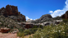
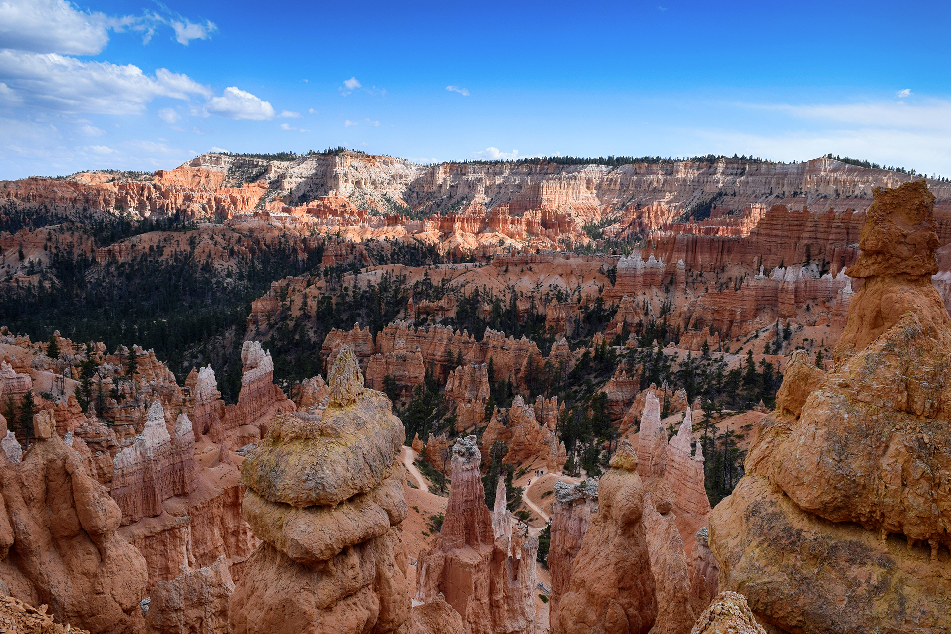
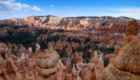
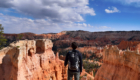
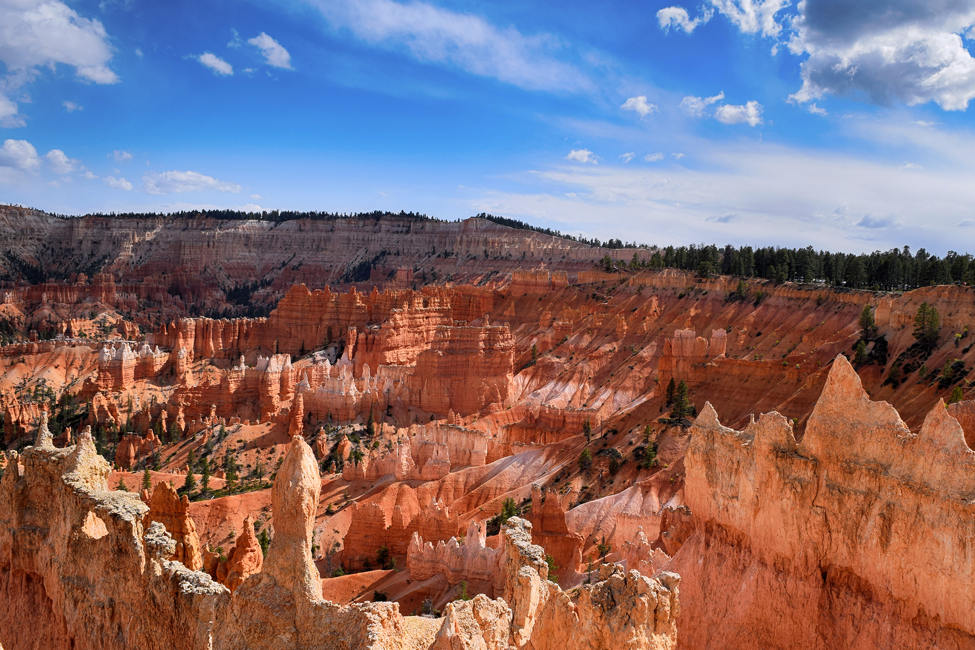
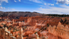
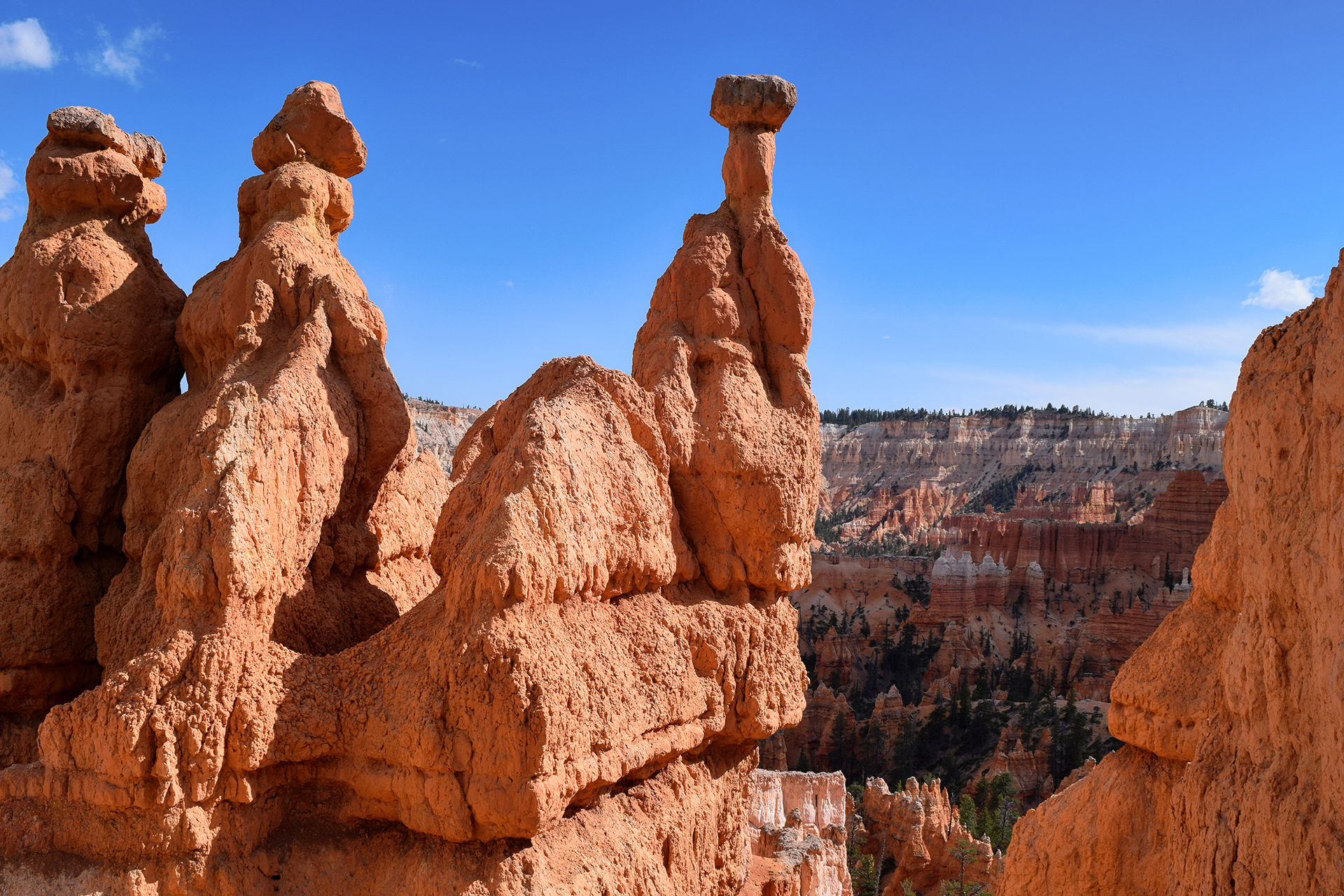
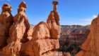
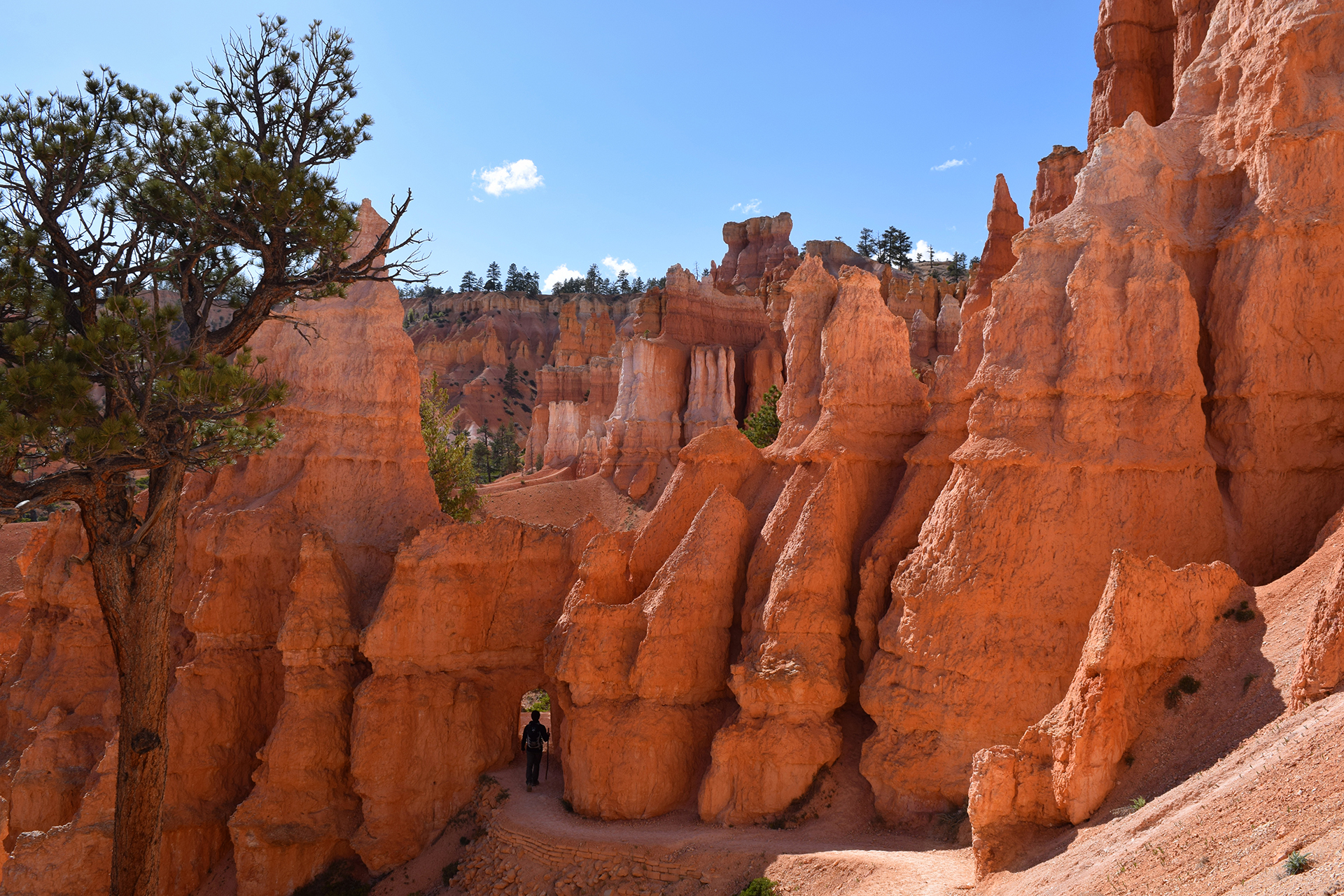
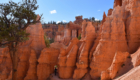
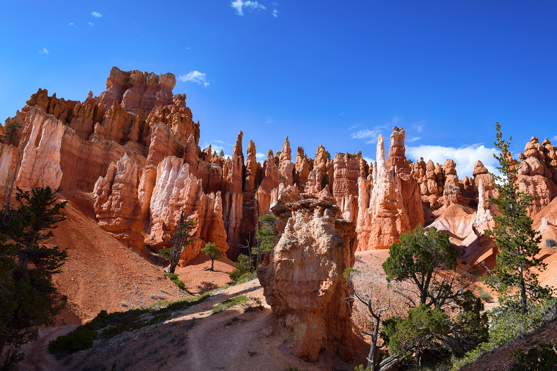
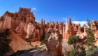
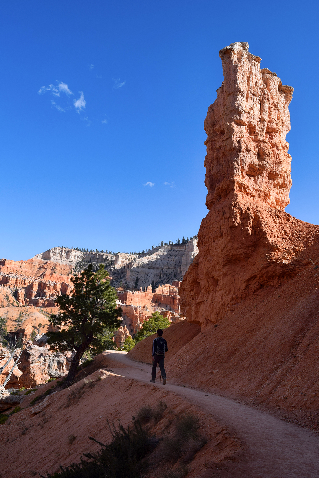
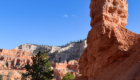
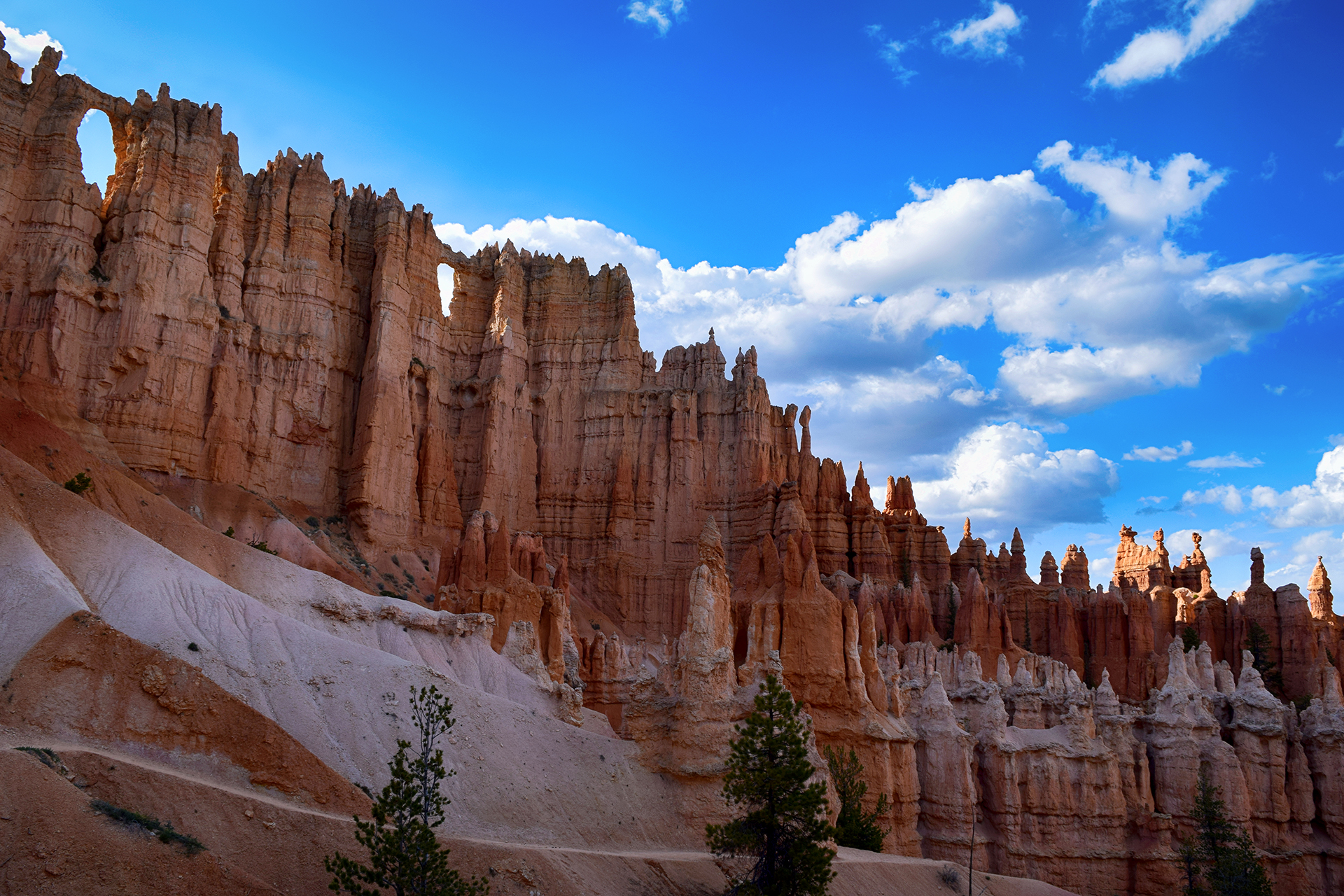
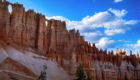
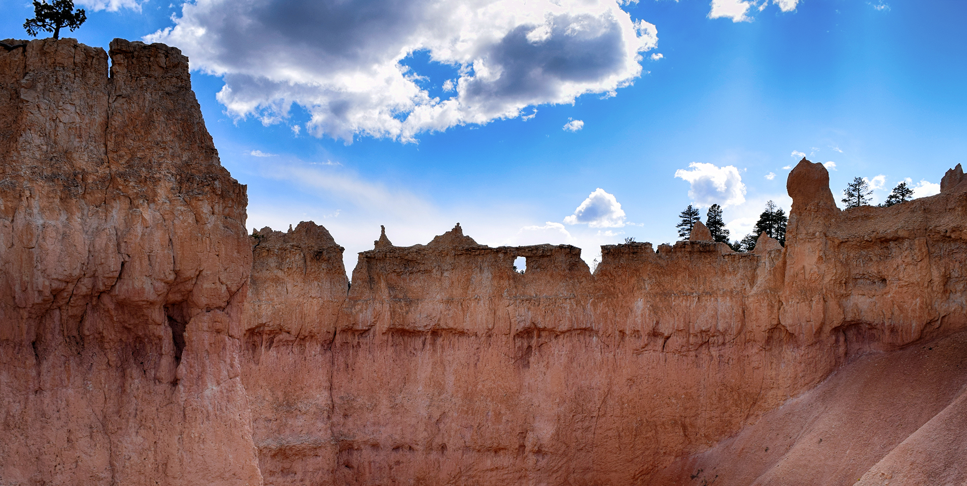
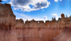
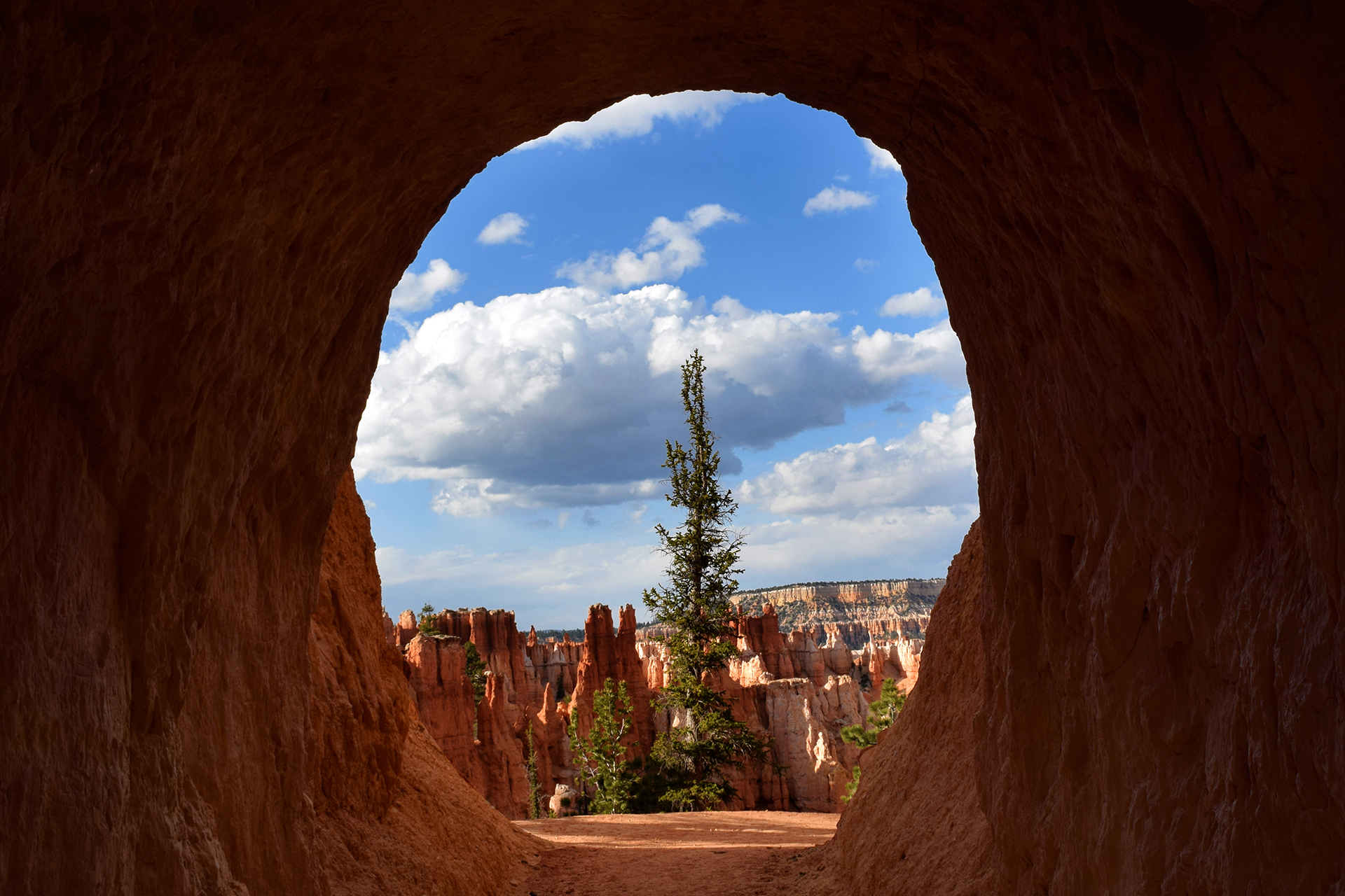
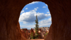
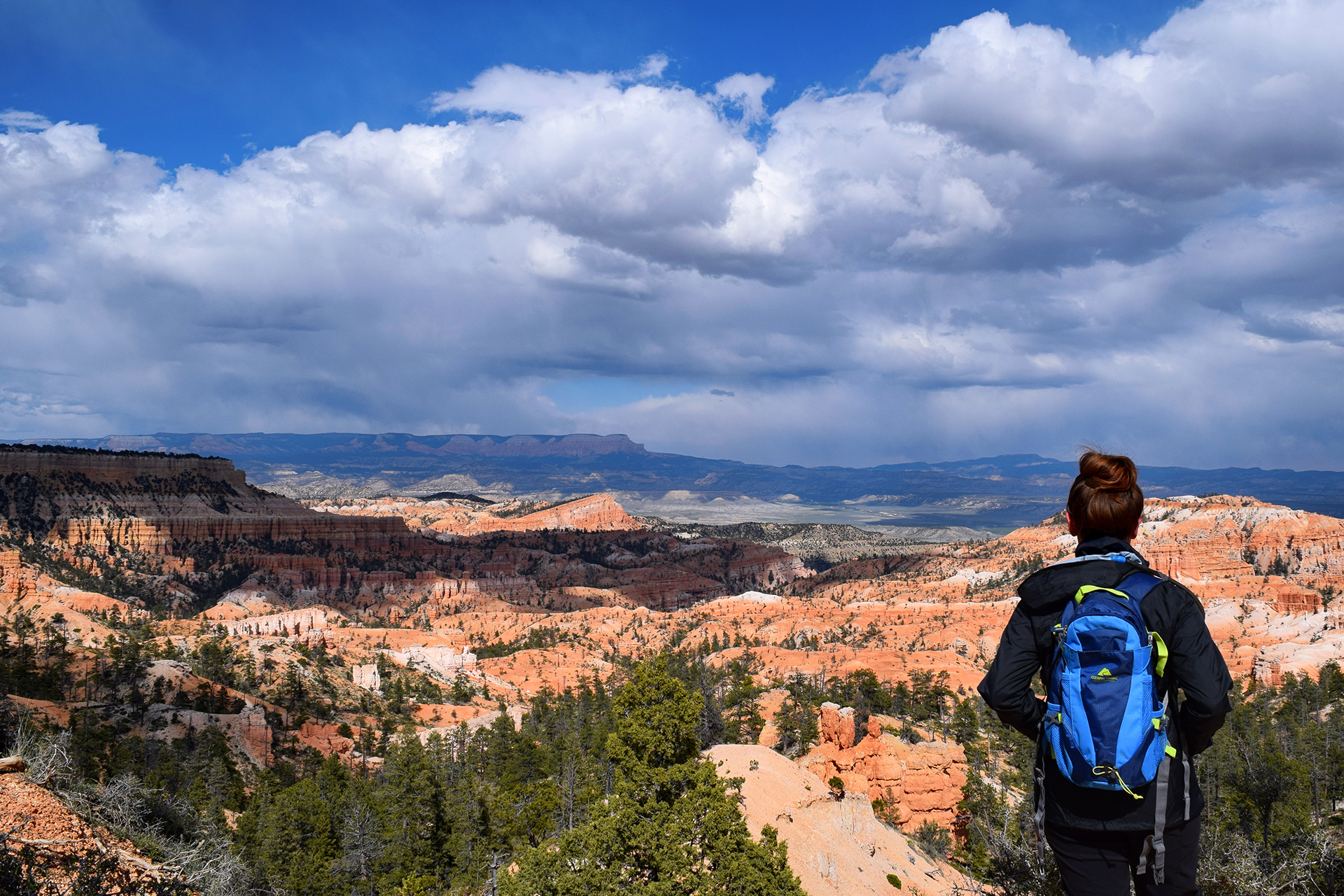
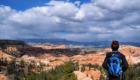
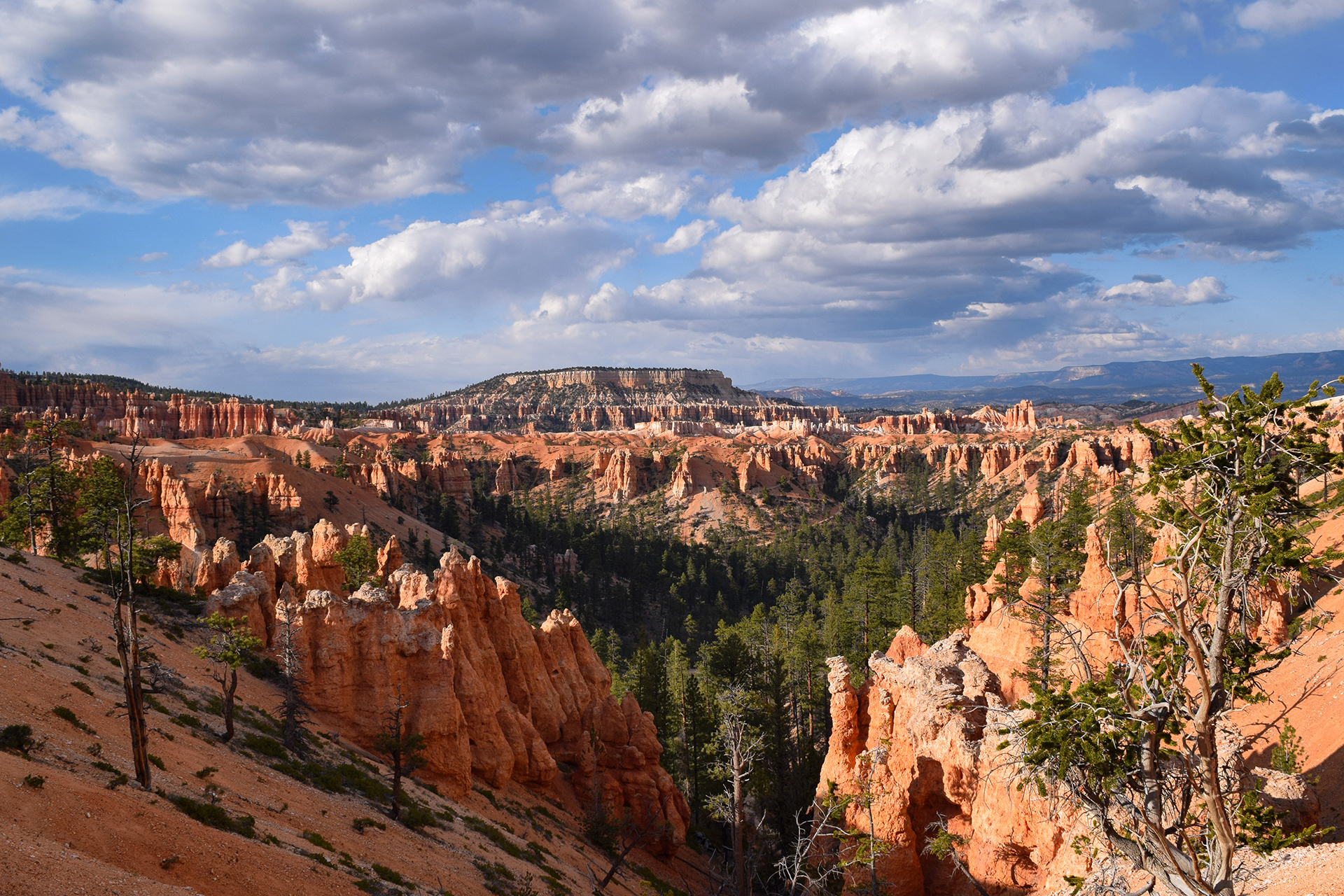
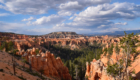
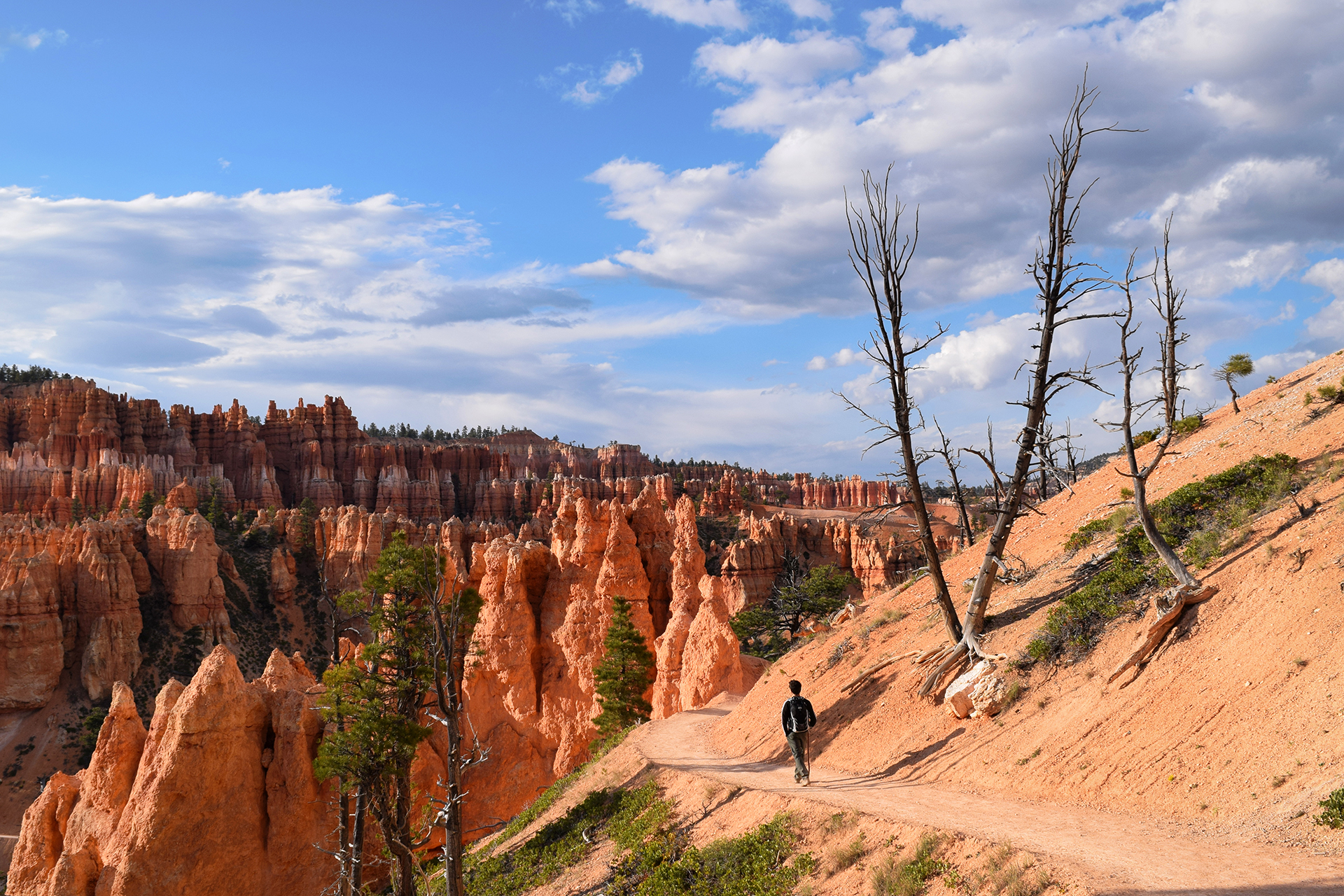
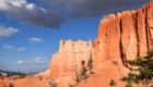
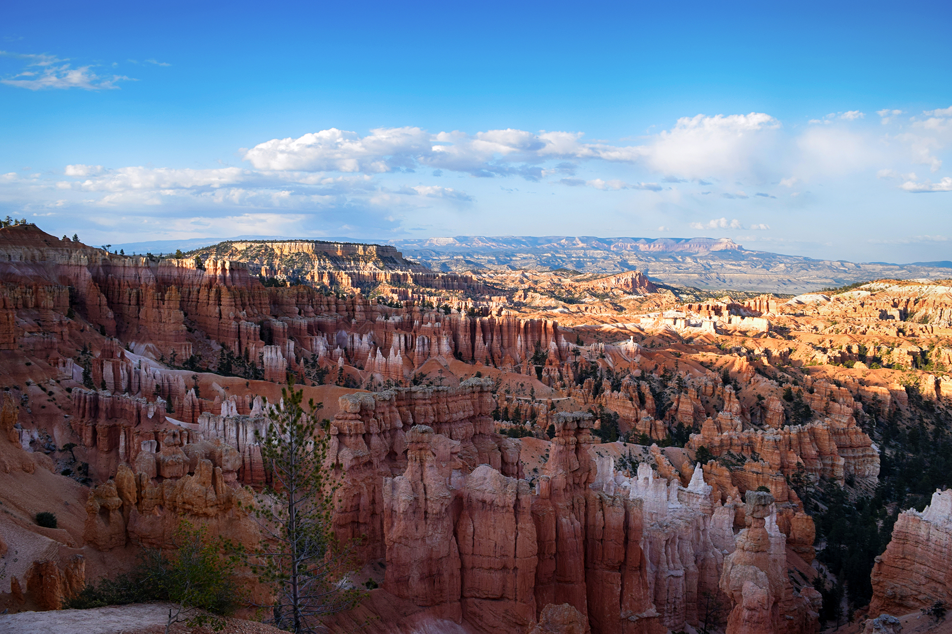
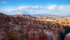
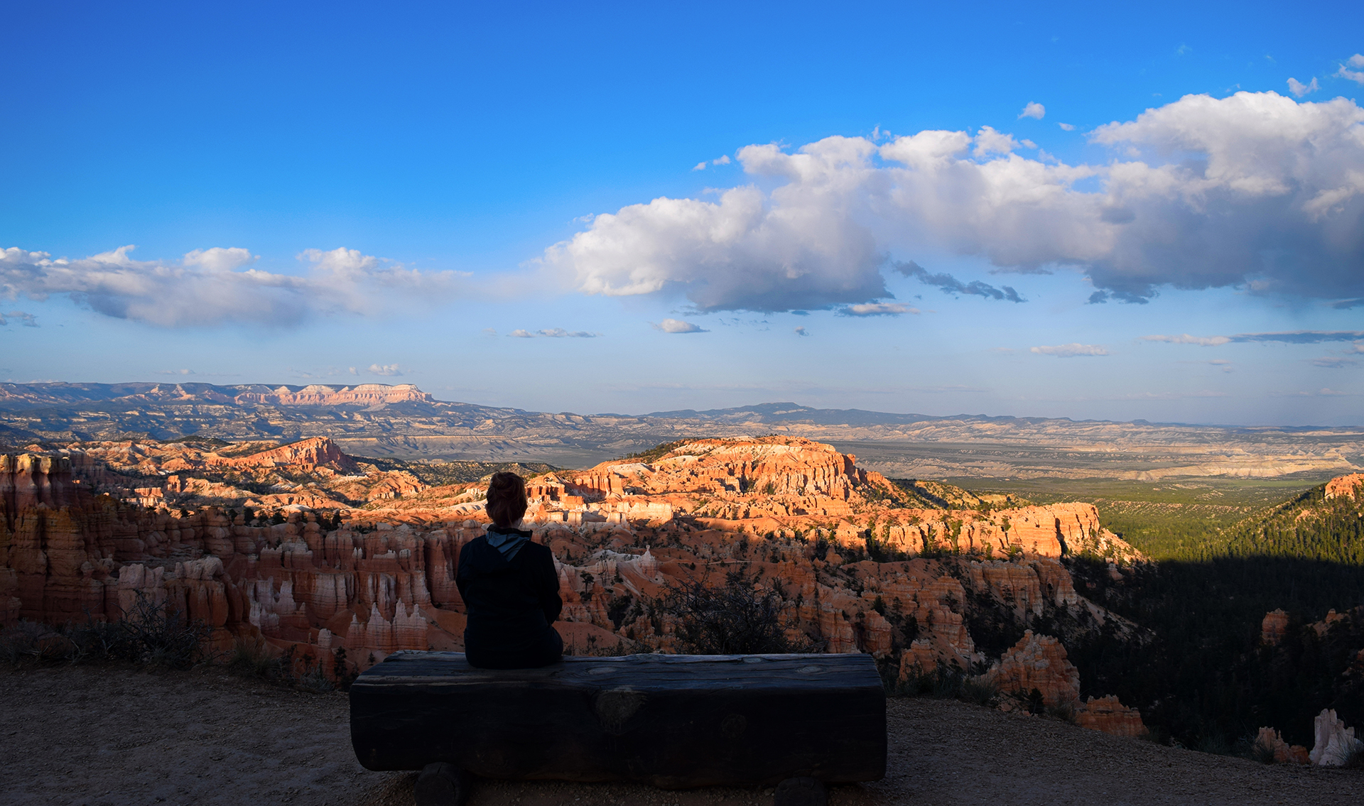
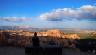
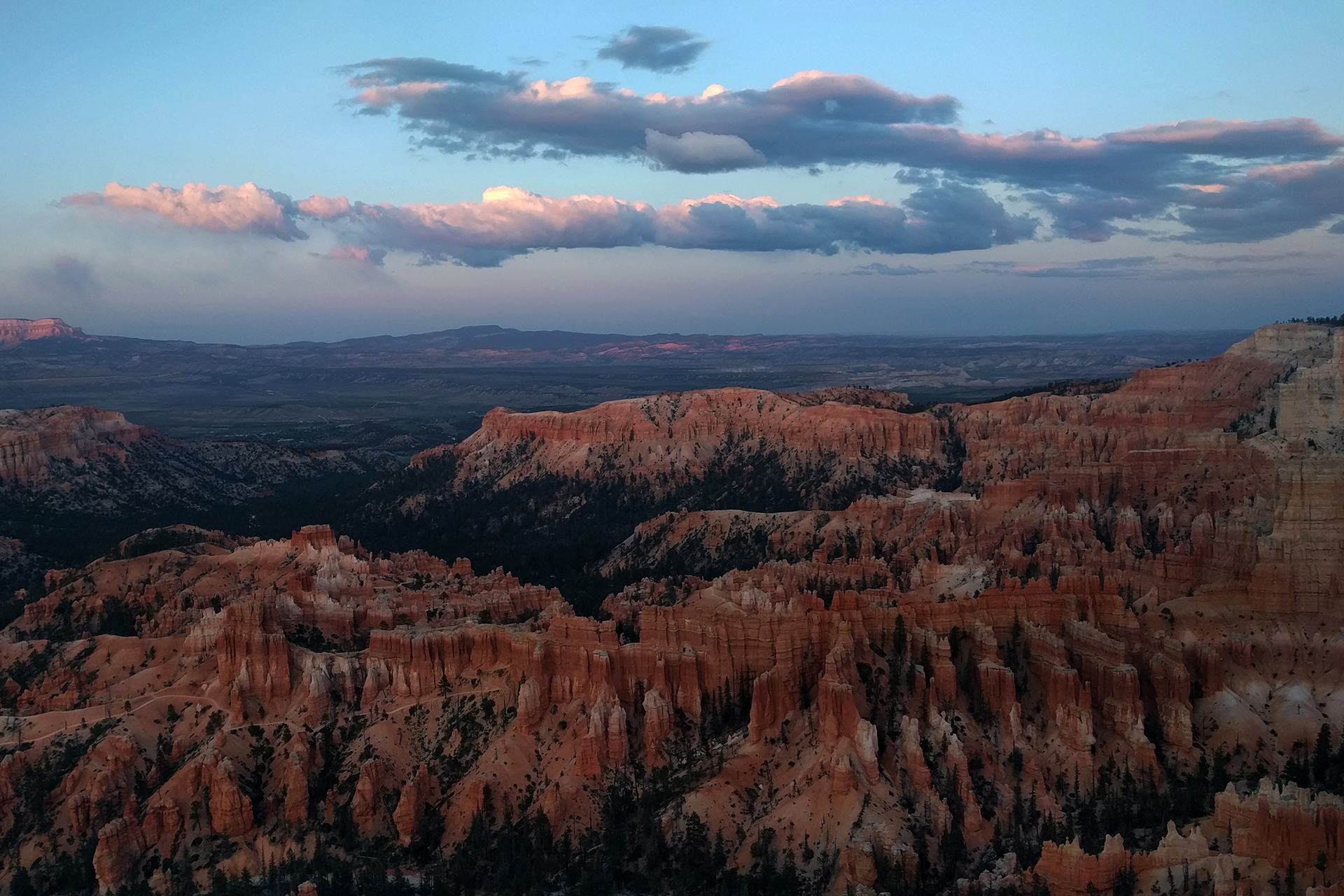
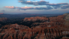
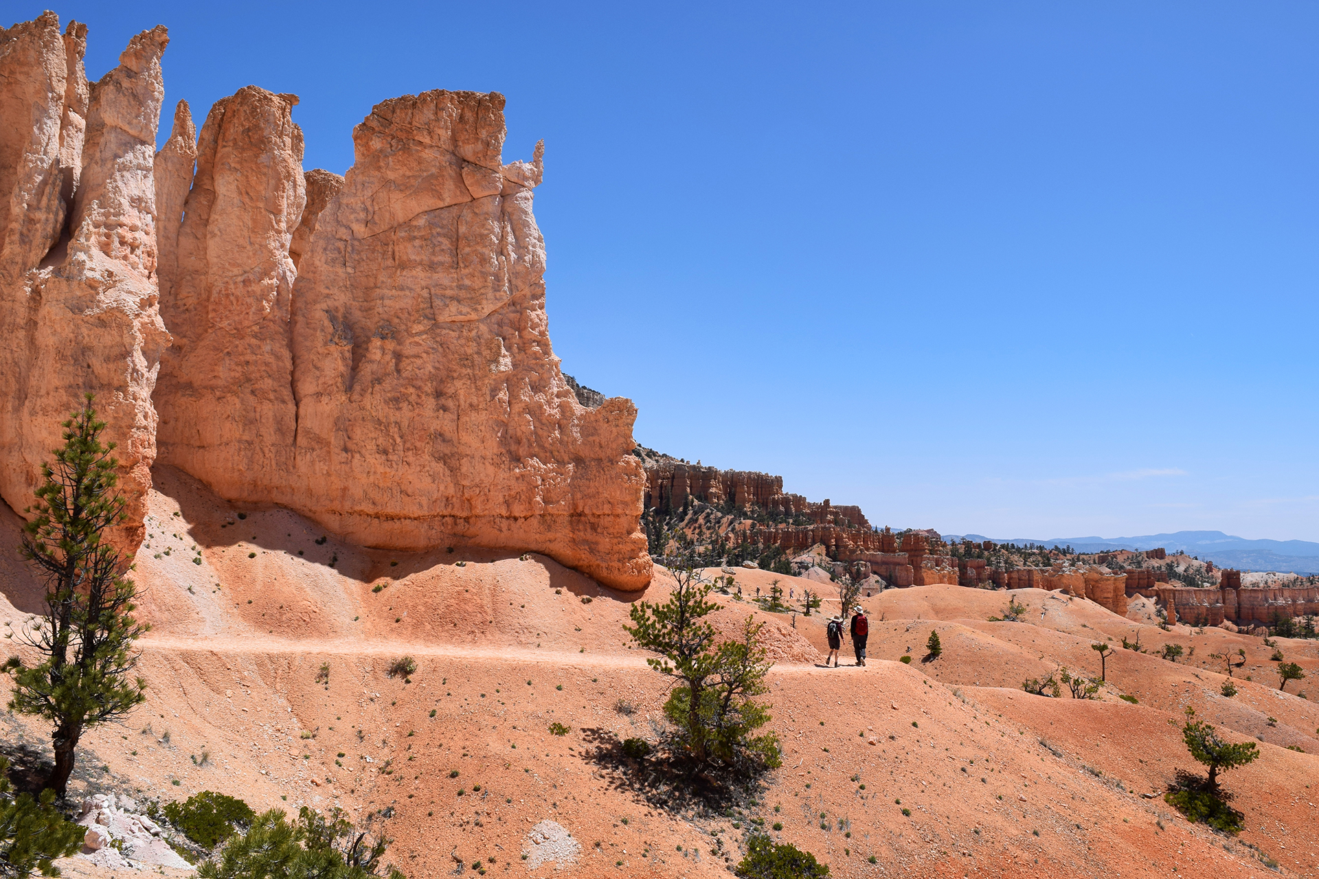
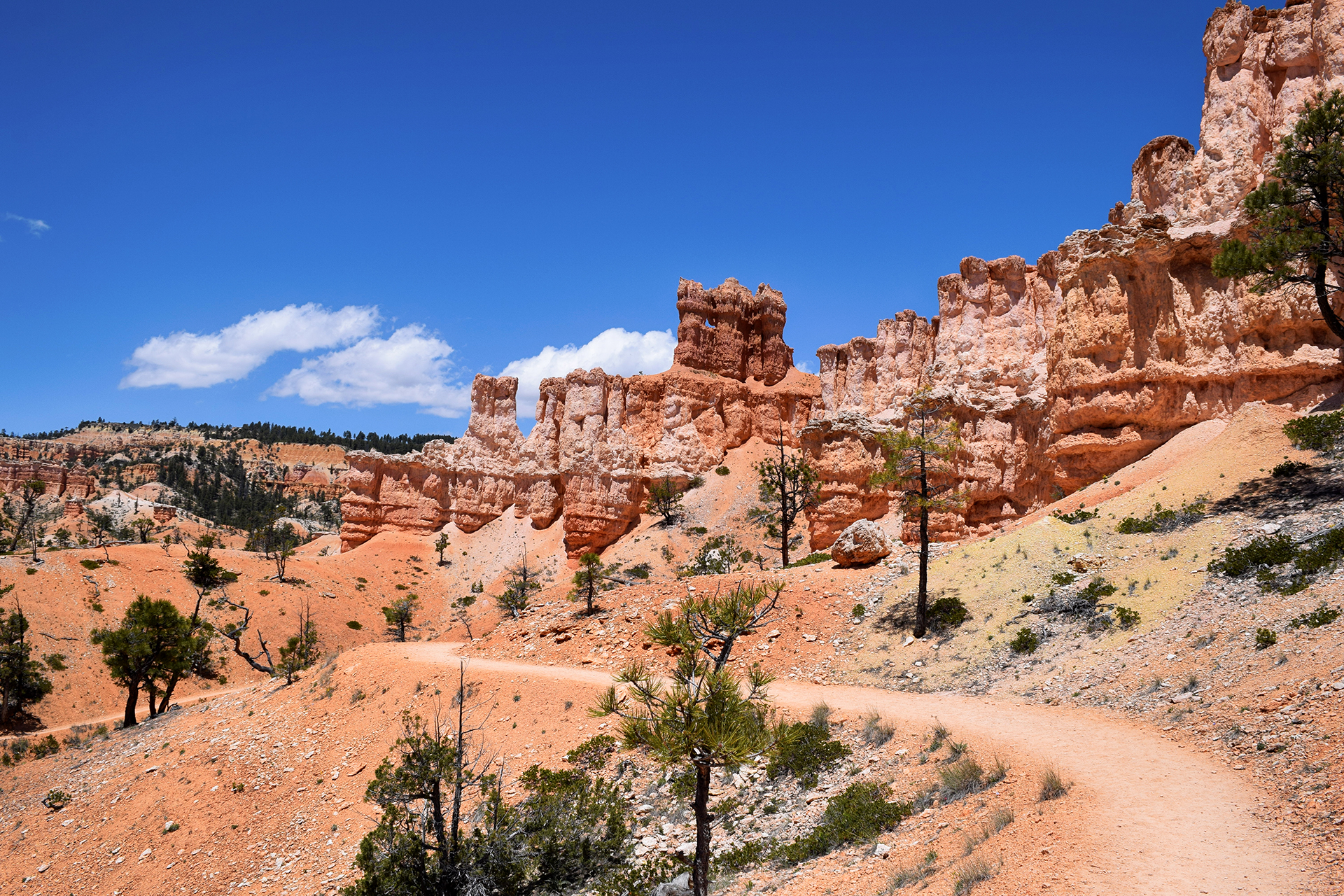
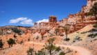
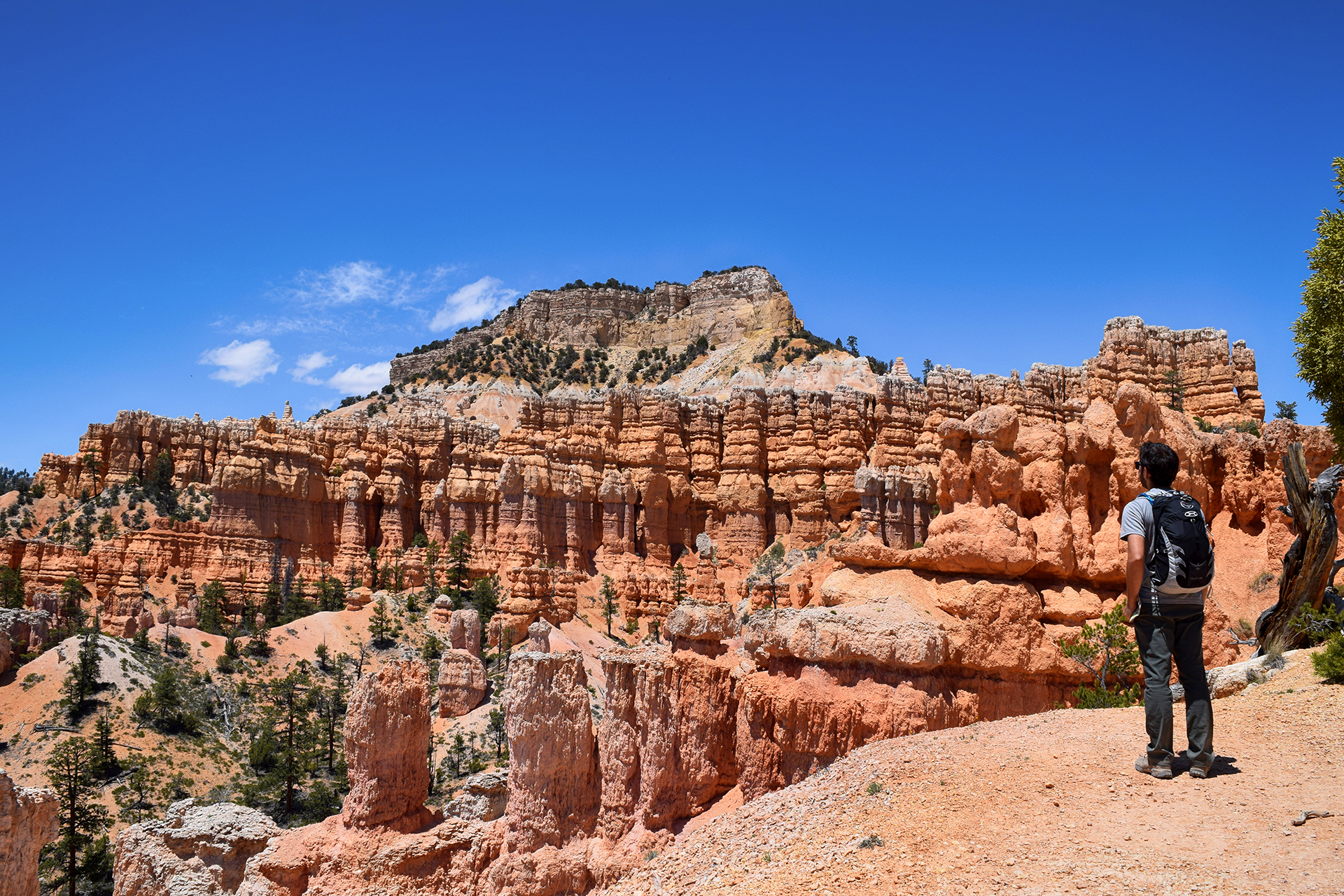
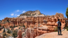
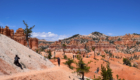
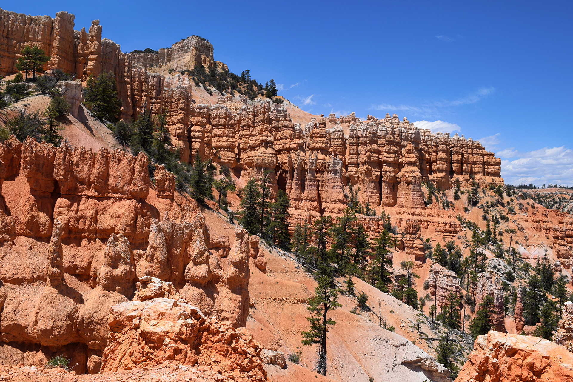
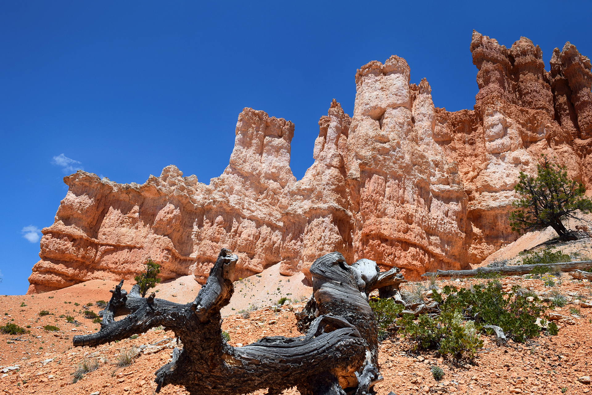
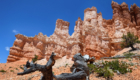
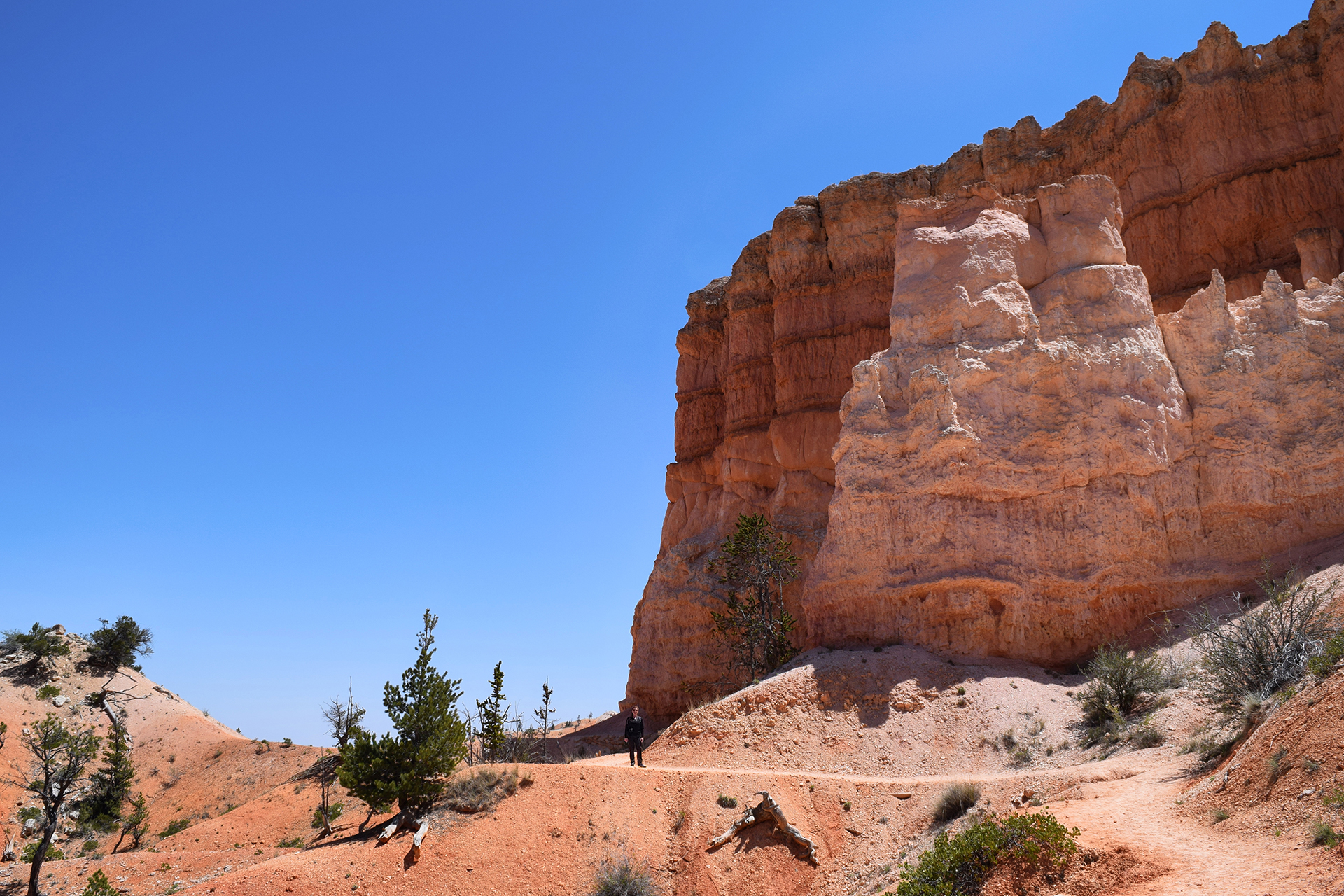
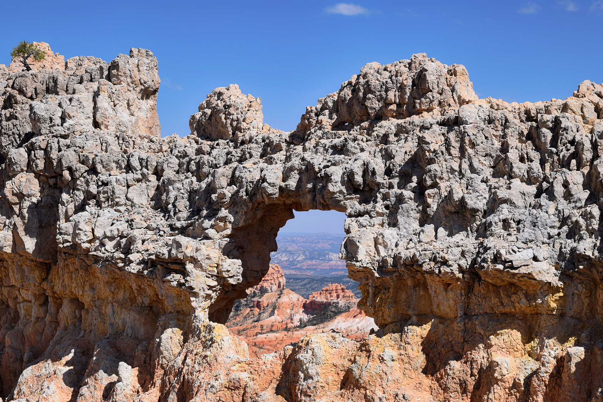
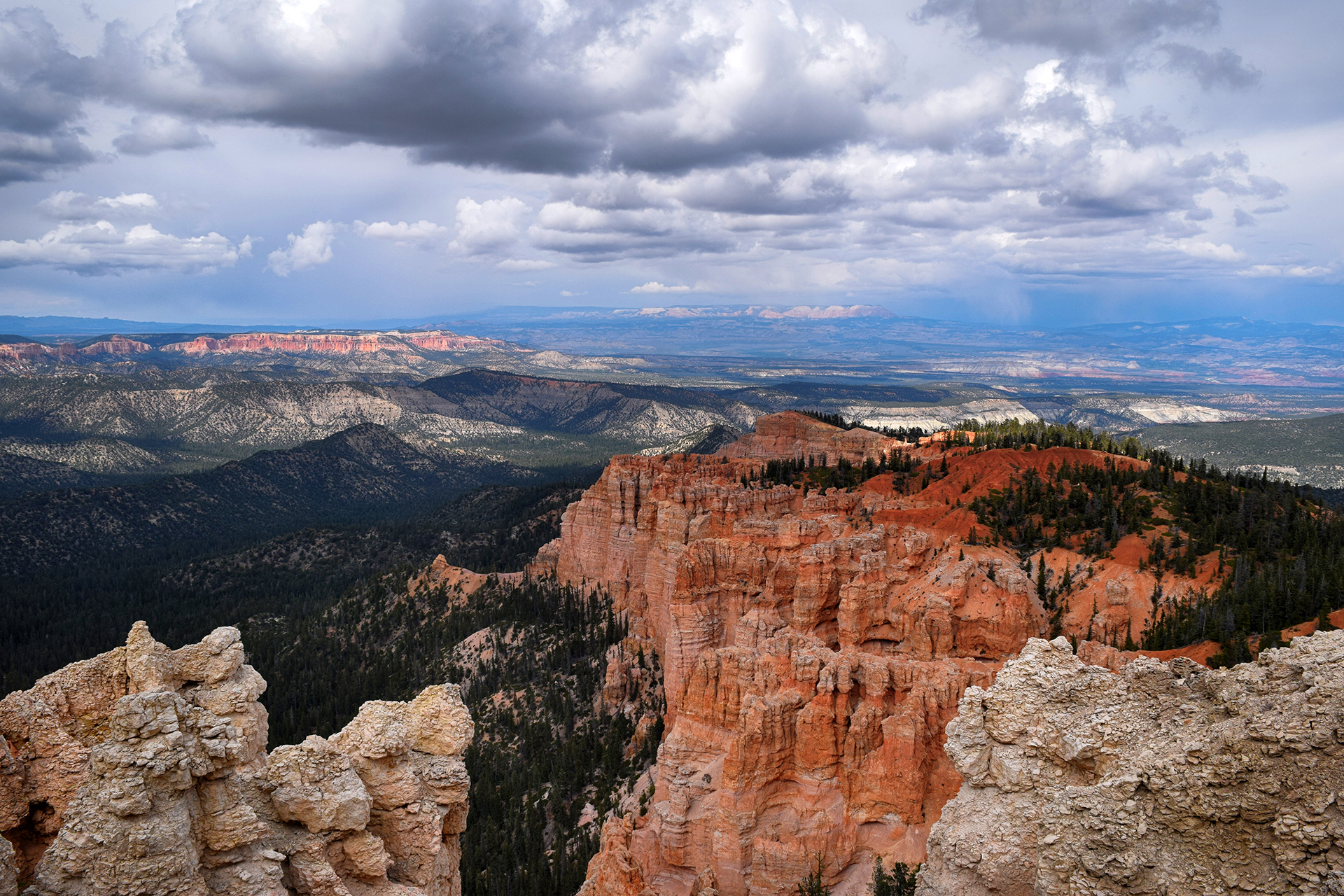
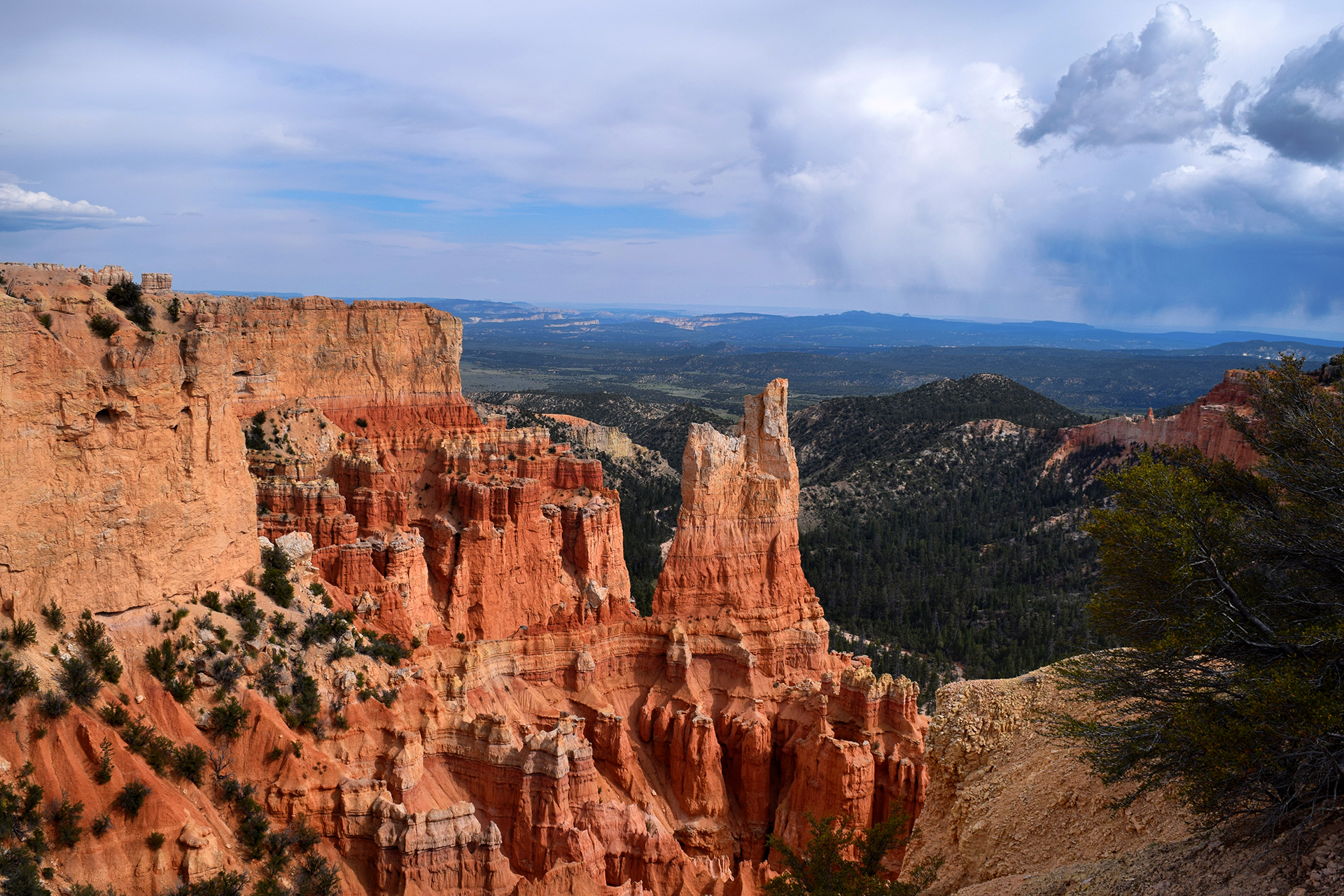
We last left off at the stunning Bryce Canyon, and from there it was a relatively short drive to our next destination, Capitol Reef National Park.  After reading about it online, we decided to get there via Utah’s Scenic Byway 12.  Now, if we weren’t piloting an RV, we would have loved this drive.  The terrain was rugged and beautiful; according to some informational plaques, this was the last uncharted region in the continental United States. In other words: this place is truly remote. An Army explorer surveyed it in 1871, and the road follows their route exactly, since there really is only one way through these mountains.

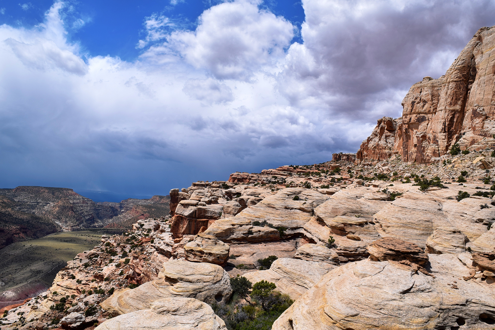
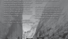
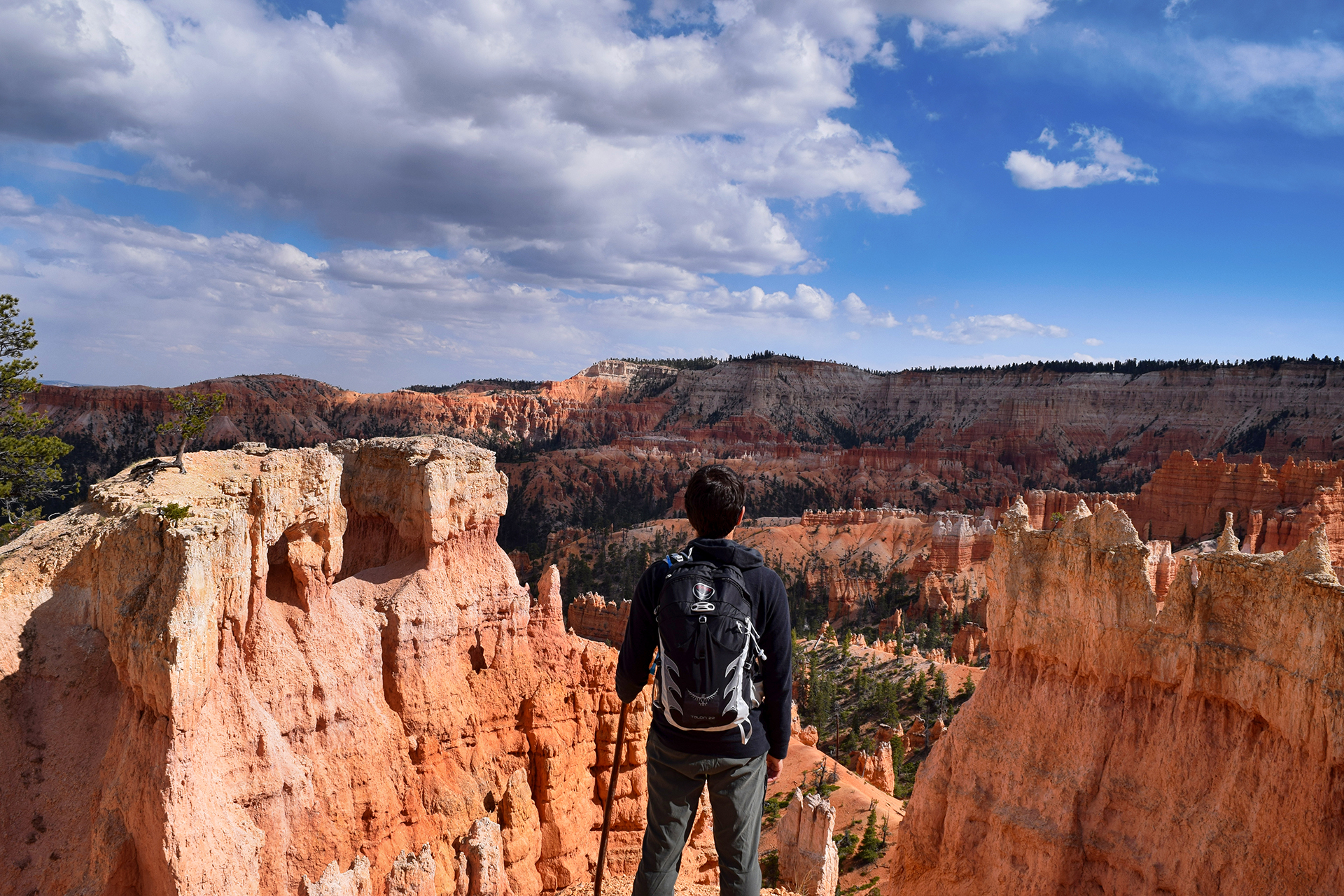
Wait, mountains?  Oh yes.  The road goes up and down constantly, through twisting canyons and along the long, exposed spine of a mountain ridge – a section called, fittingly, the Hogback. Imagine an elevated roadway with cliffs on either side; we were a little busy for photos, but here’s an awesome picture we found on the Internets.

In other places, just to keep things interesting, the stone alongside the road was Utah slickrock, which looks and feels exactly like it sounds.  The views were awesome, but this was a very bad drive to make a mistake.

The online discussions we read said that this road was fine for RVs, but good lord, it was not. We soon found ourselves in a nightmare drive, the road twisting and turning while ascending and descending steeply.  This is bad news if you’re in a 12,000 pound vehicle pulling a car behind it, and although our motorhome is a total beast, we had to pull over several times to let its brakes and engine cool down.

Finally, we reached the highest point on the drive, well over 10,000 feet.  This high up, a light drizzle had turned into a fierce hail storm.  At least it cooled the engine!  We stopped at an overlook for a quick photo of the view, and since the entrance was narrow, Heather hopped outside to check for oncoming vehicles before we returned to the highway.  Given the all-clear, Jake drove up to Heather and stopped the RV to let her back in.

That’s when a sheet of slushy ice slid off the roof directly onto Heather.

Luckily, we were nearly to our destination, because the atmosphere for the rest of the drive was a little… chilly.

Capitol Reef

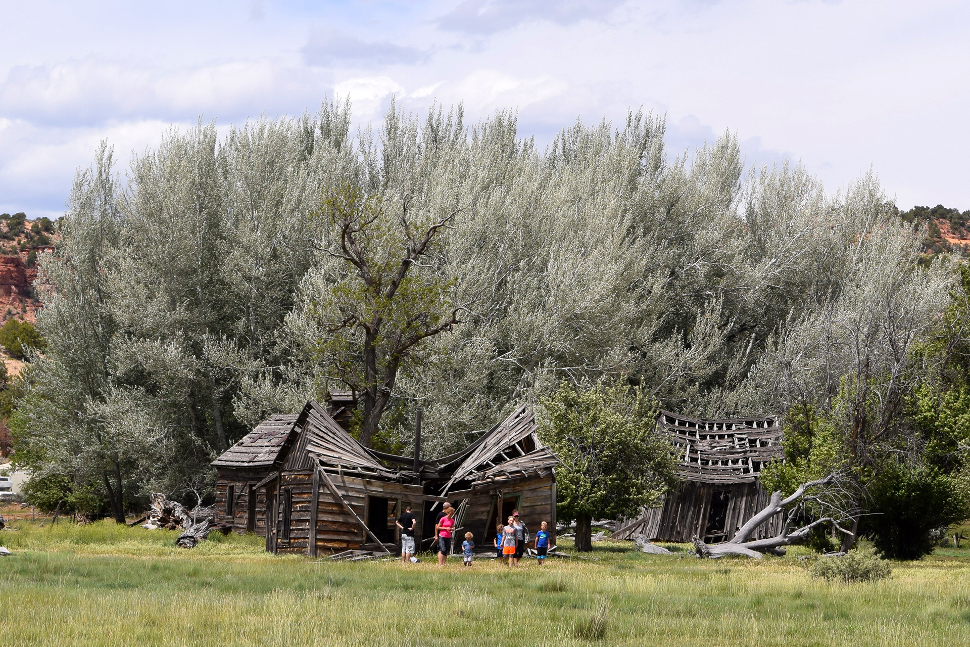
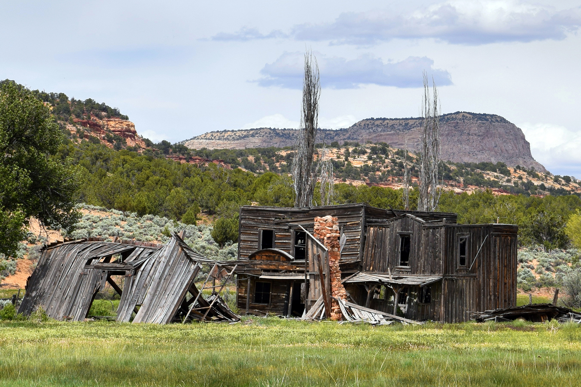
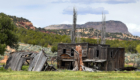
At last, we made it to the tiny town of Torrey, Utah, population about 300. There were a few restaurants, but unfortunately for your hungry correspondents ,there was no grocery store.  So, we walked across the street to a gas station convenience store to see what we could find, and came away with some sliced turkey, ice cream, and Combos: the dinner of champions.

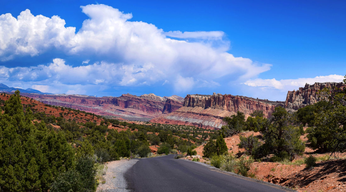
OK, on to the park, which we had frankly never heard of.  Capitol Reef is the least visited of Utah’s “Mighty 5” national parks, by far, and apparently it’s normally pretty empty.  But unfortunately for us it was Memorial Day weekend, so the crowds were out in full force. We had to skip a few of the more popular spots because there was no parking left – and woe be to the poor few rangers in the visitor center, at times literally surrounded by questioning visitors.

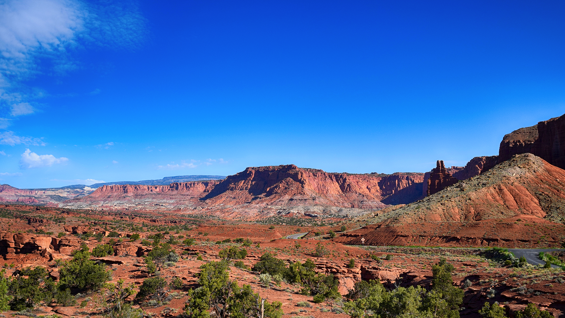
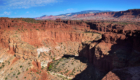
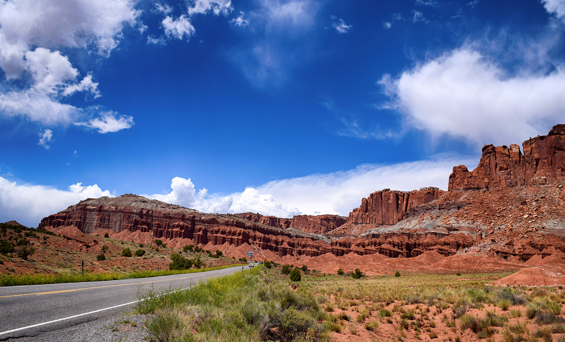
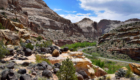
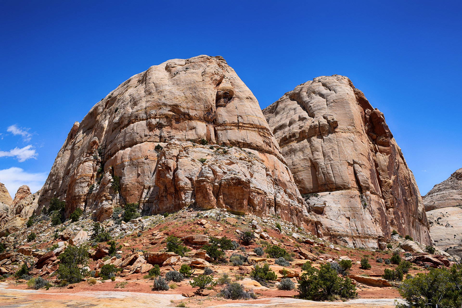
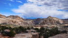
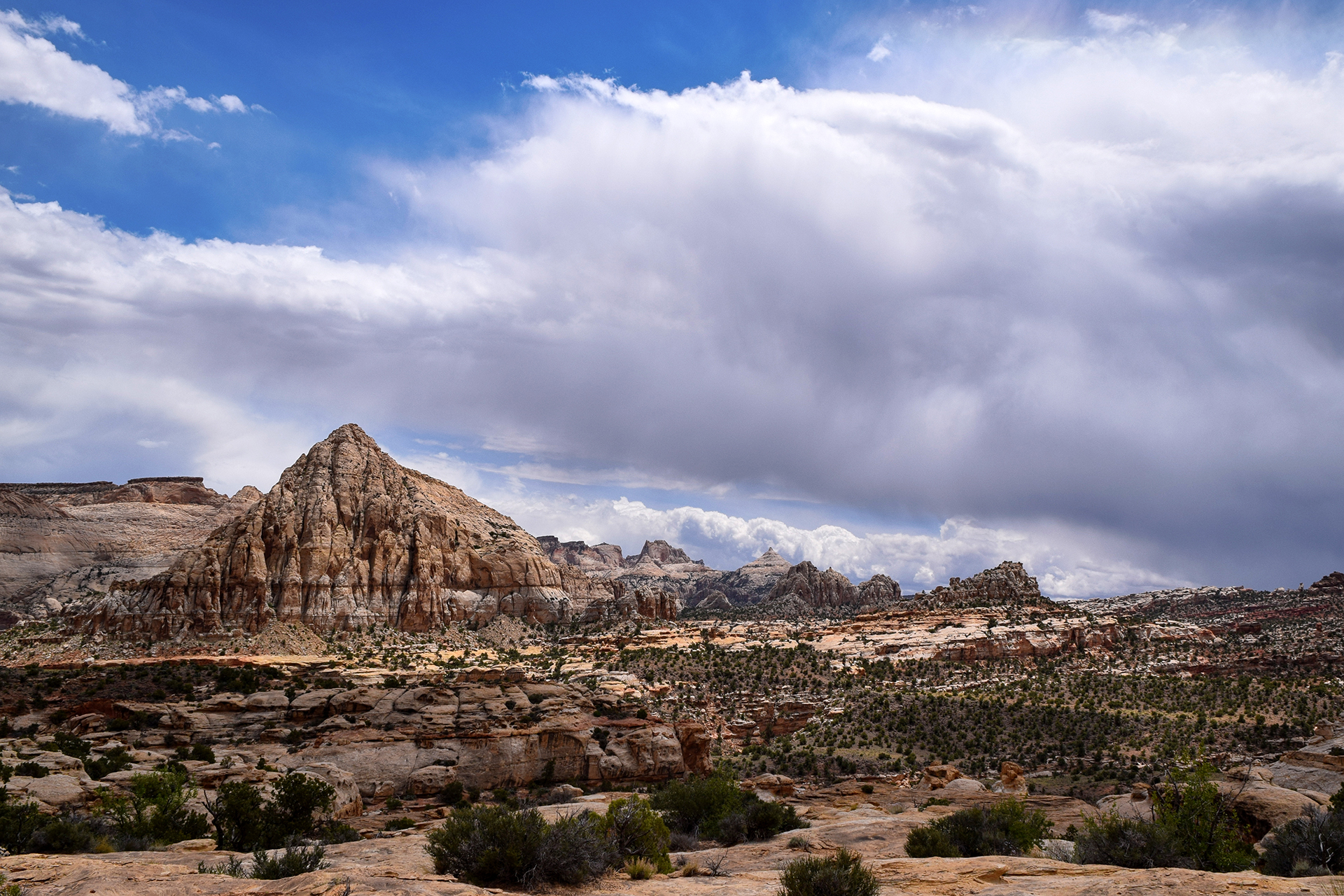
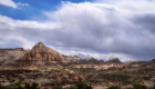
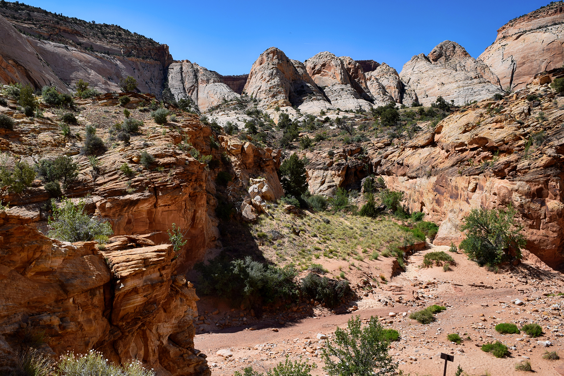
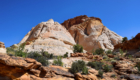
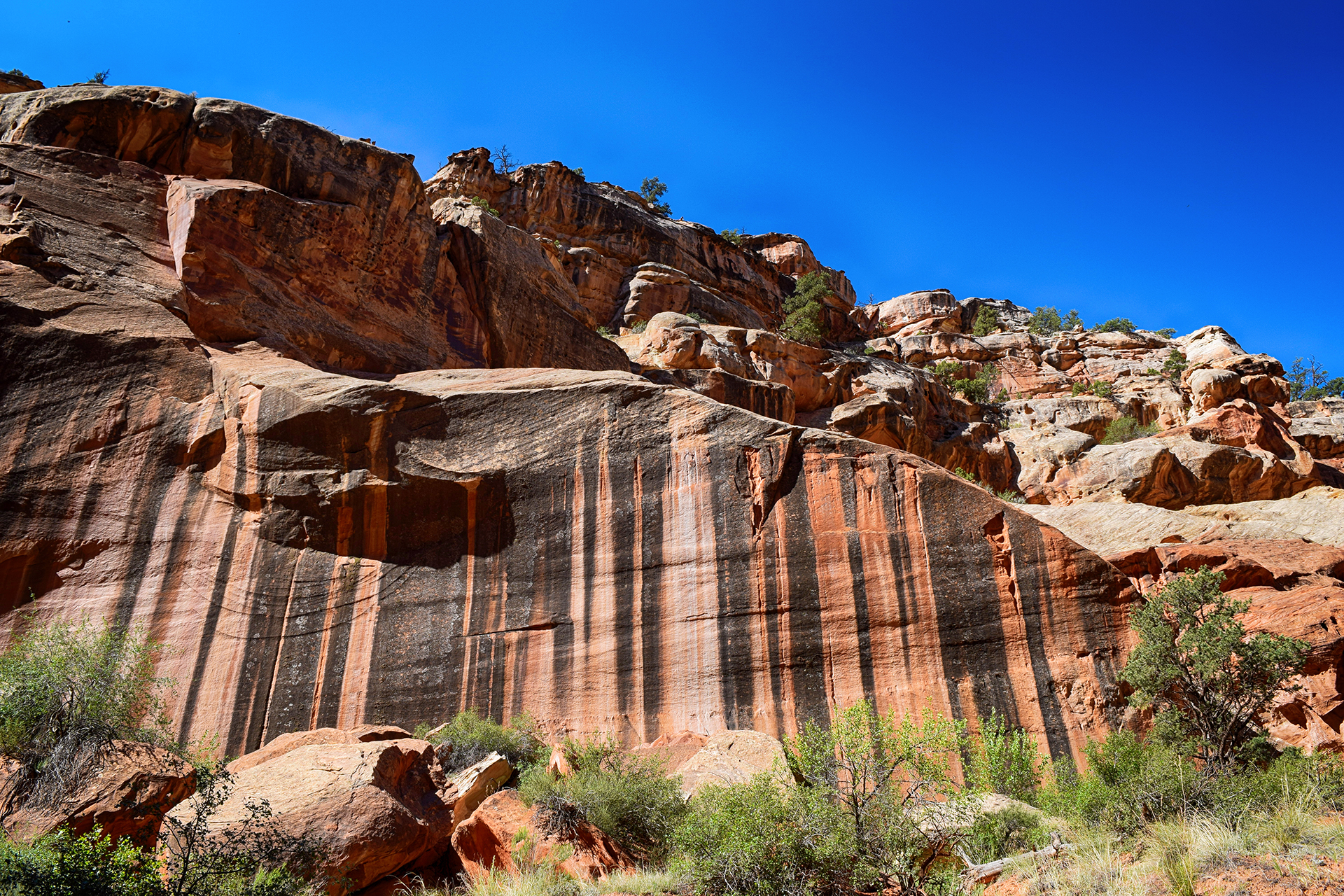
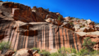
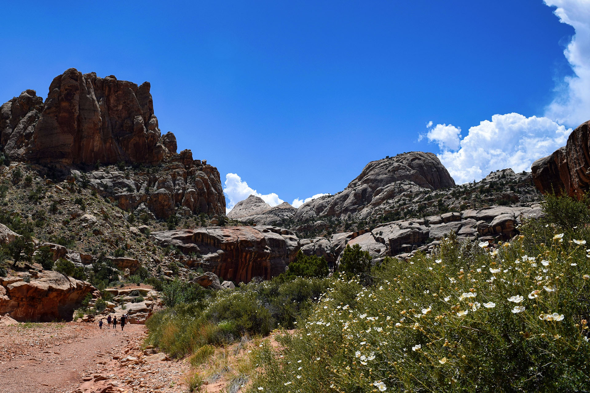
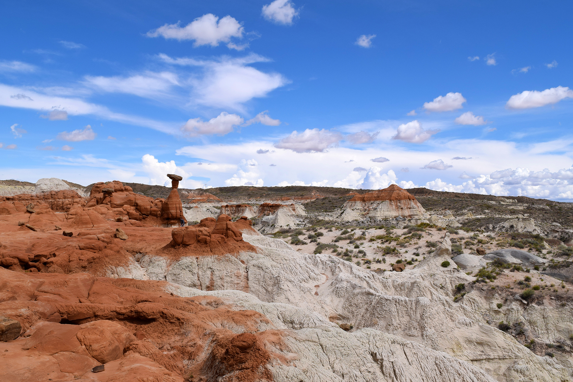
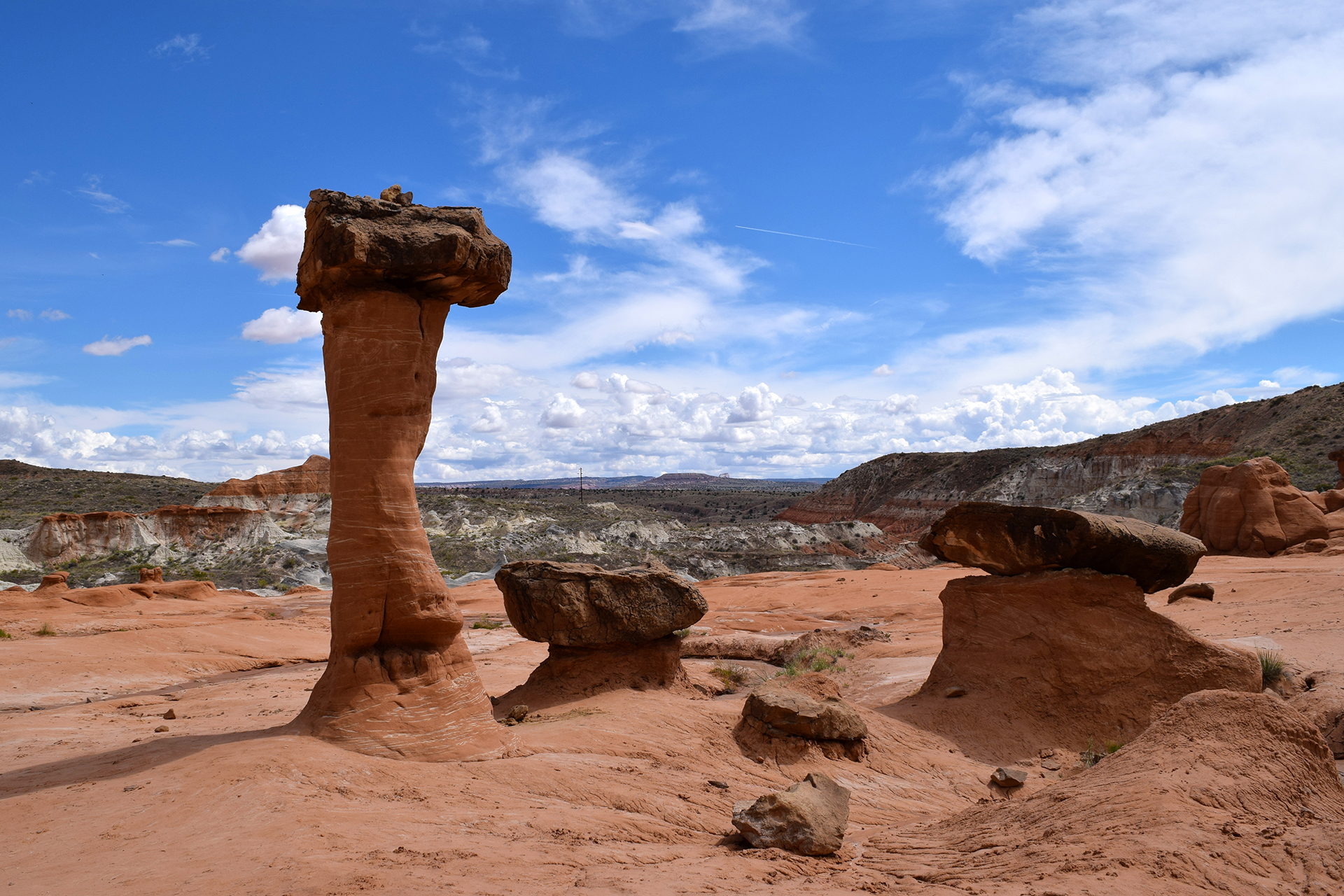
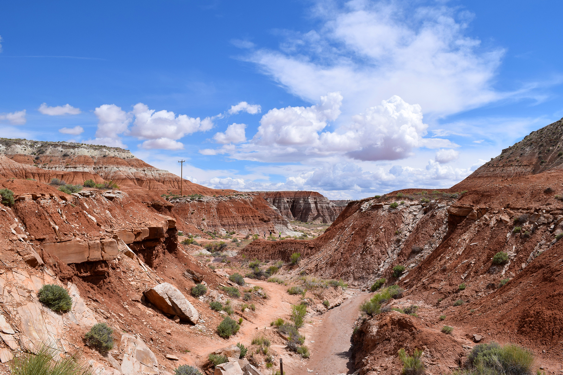
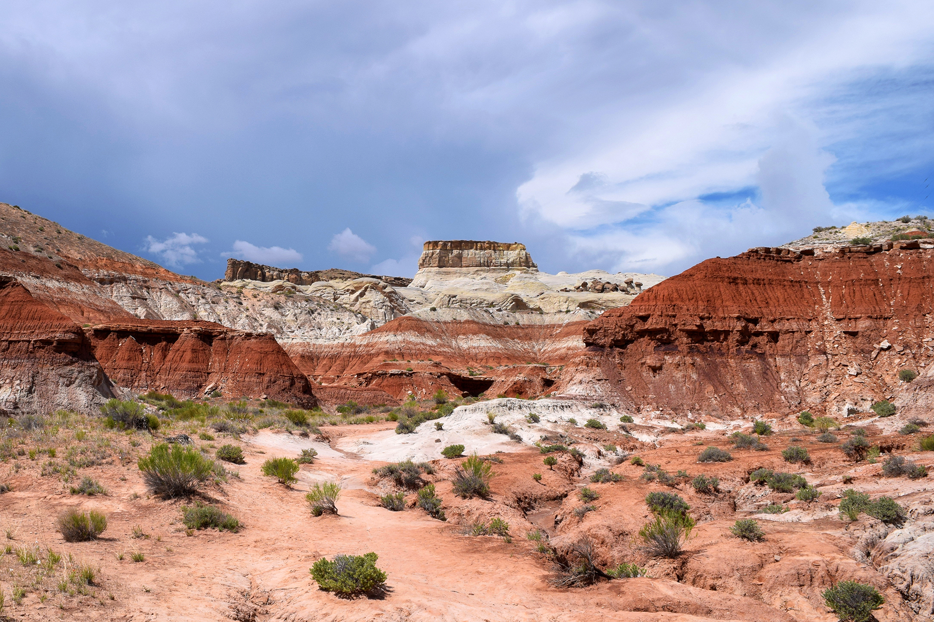
Capitol Reef is cool, but perhaps not quite as eye-popping as Zion or Bryce Canyon.  Nonetheless, it has plenty of charm.  The park covers the most scenic part of the “Waterpocket Fold,” which is basically a 100 mile long uplifted rock wall. It’s unclear whether the Fold has played any part in keeping out wildlings, but it does make for some interesting terrain.

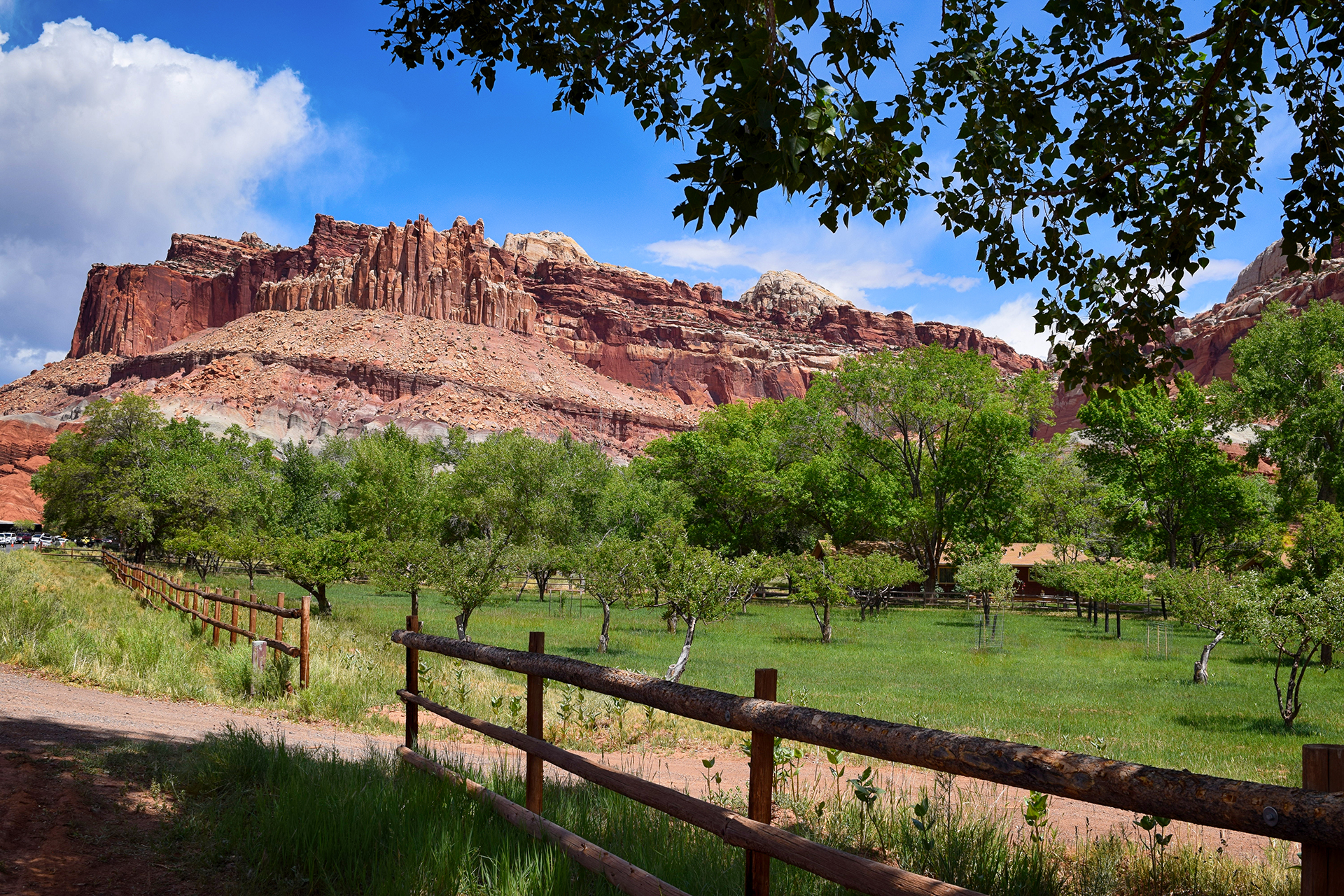
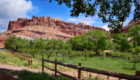
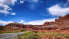
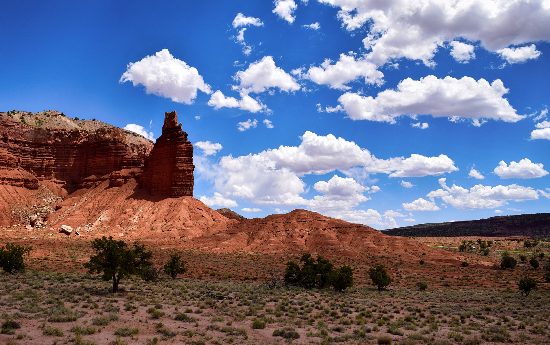
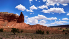
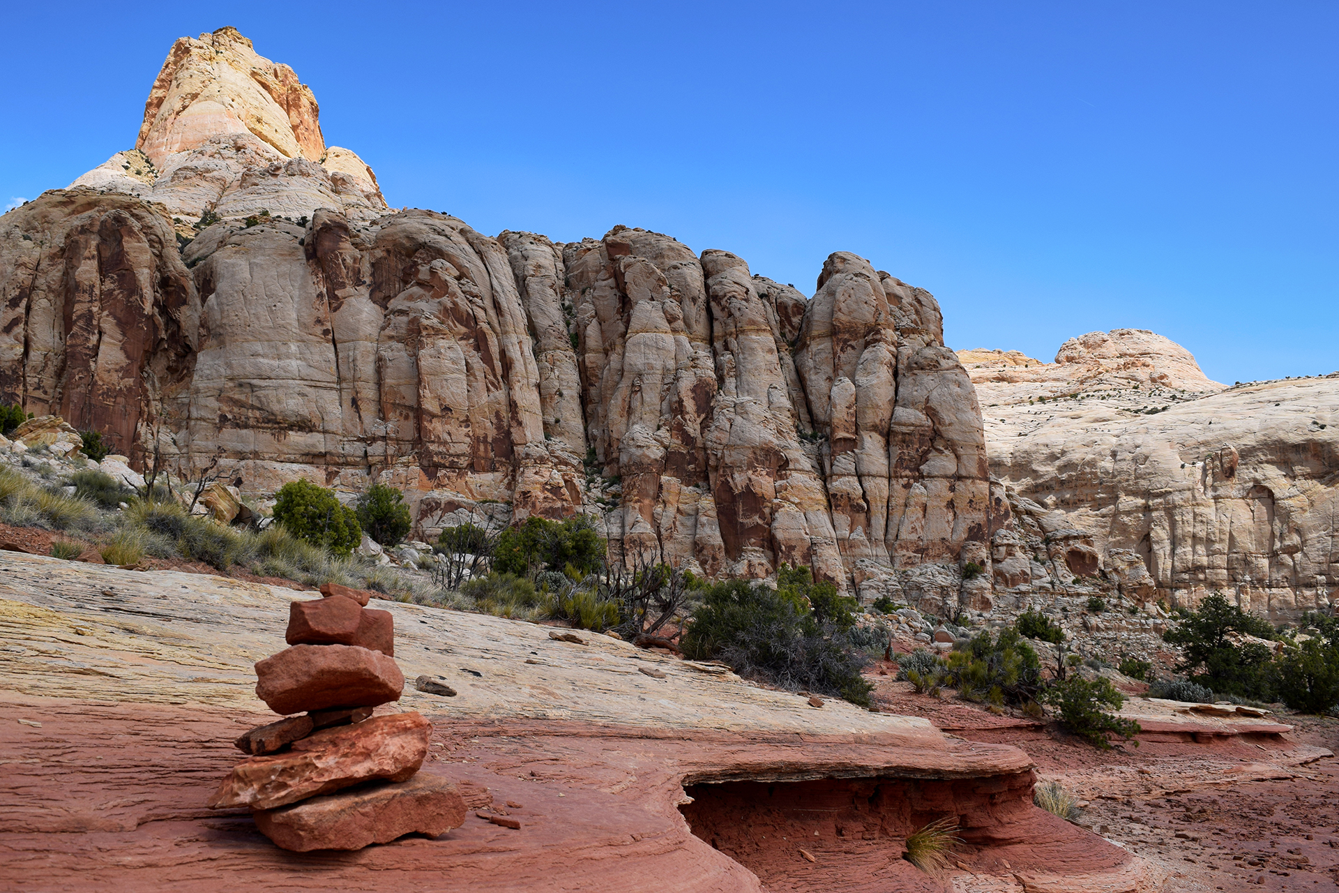
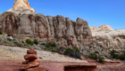
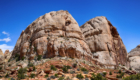
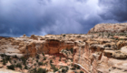
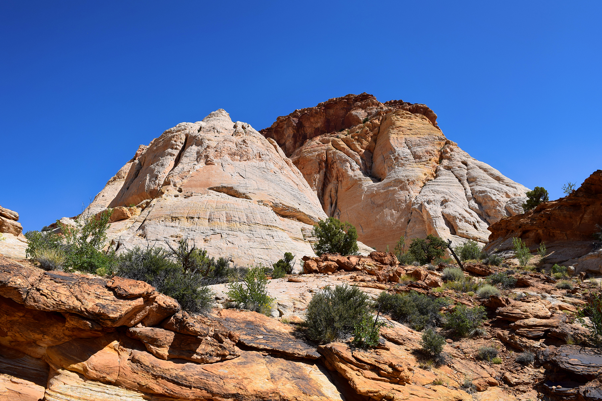
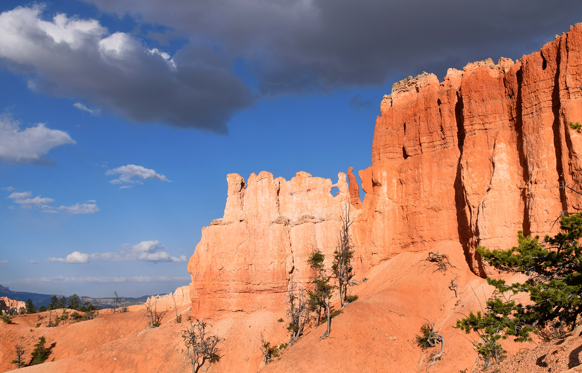
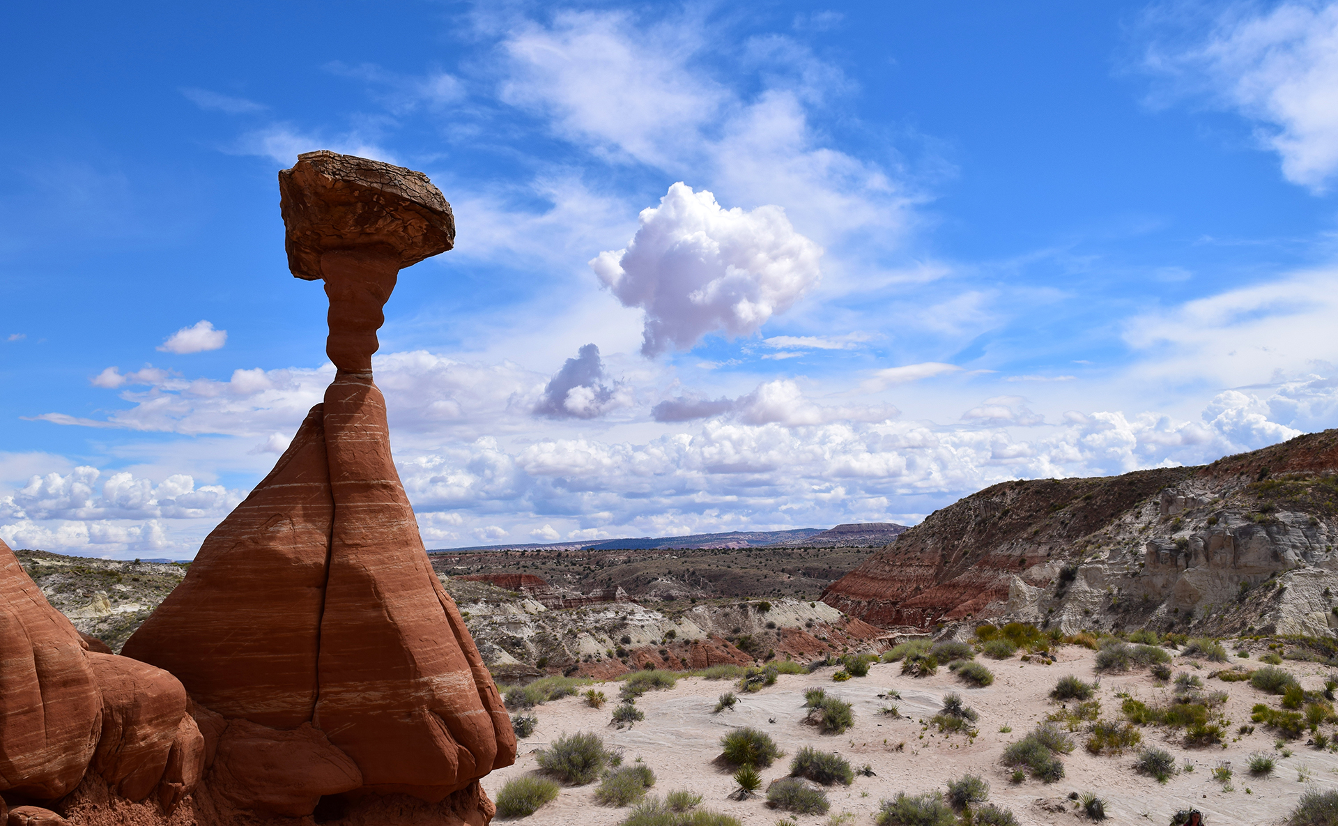
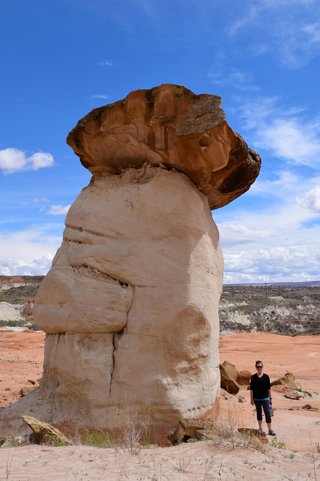
The most well-known feature here is a large rock dome that early settlers thought looked like the U.S. Capitol in Washington, D.C. “Capitol Reef” is a combination of that, plus the ocean reef-like Waterpocket Fold.  Unfortunately, our photo of the Capitol Dome doesn’t capture the most “capitol” angle of the rock, but you can see its pointy peak in the background – along with a fairly ominous sky.

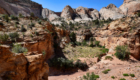
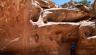
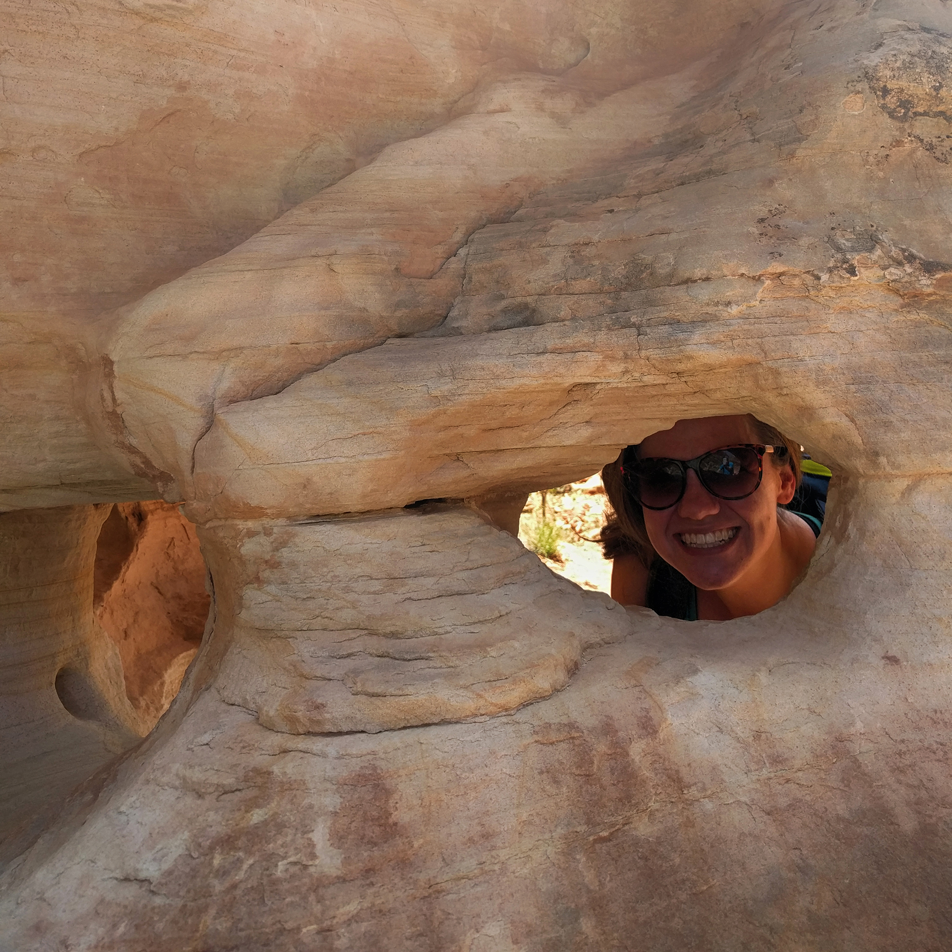
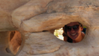
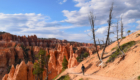
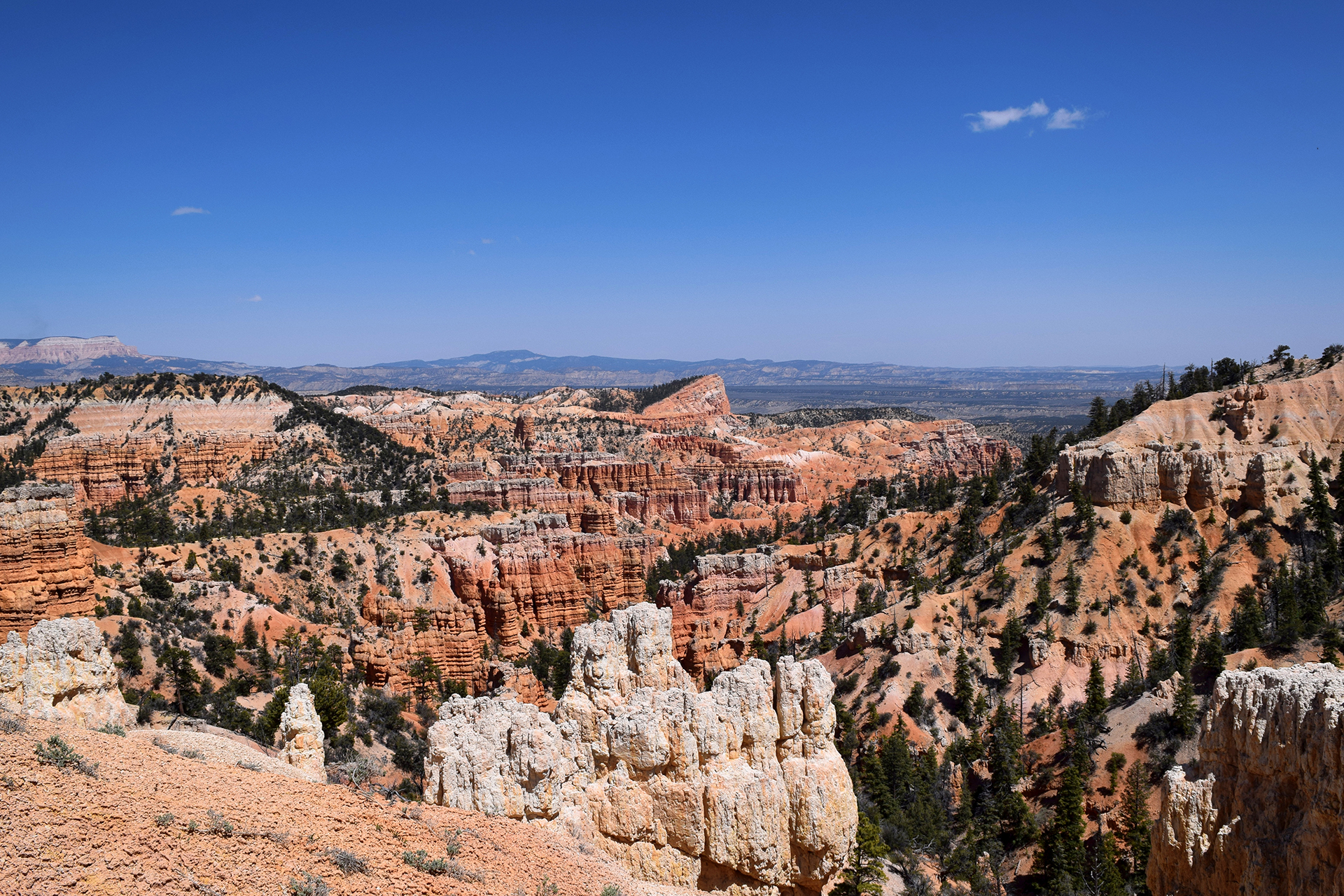
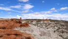
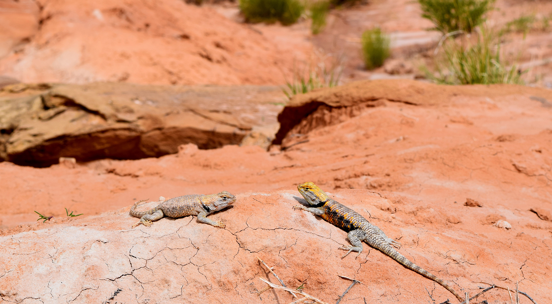
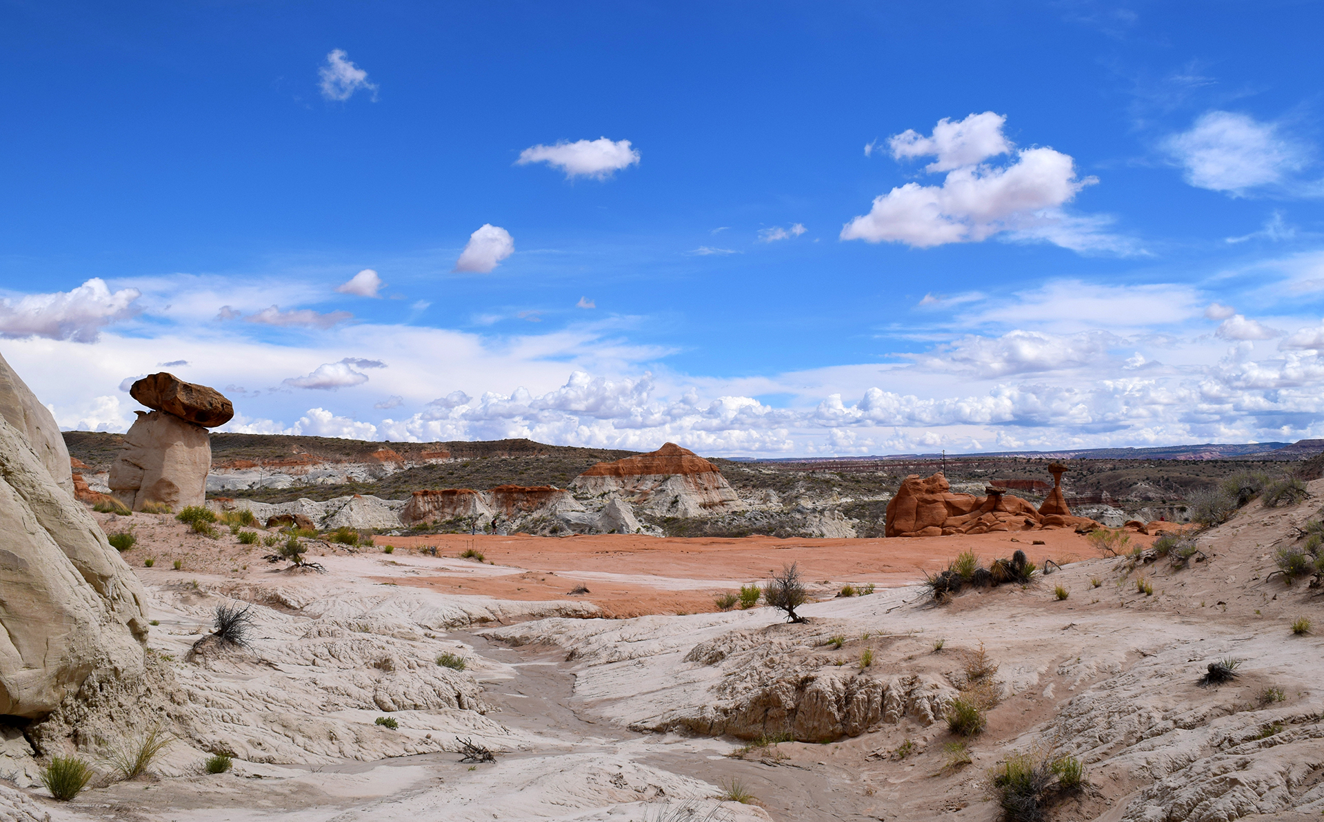
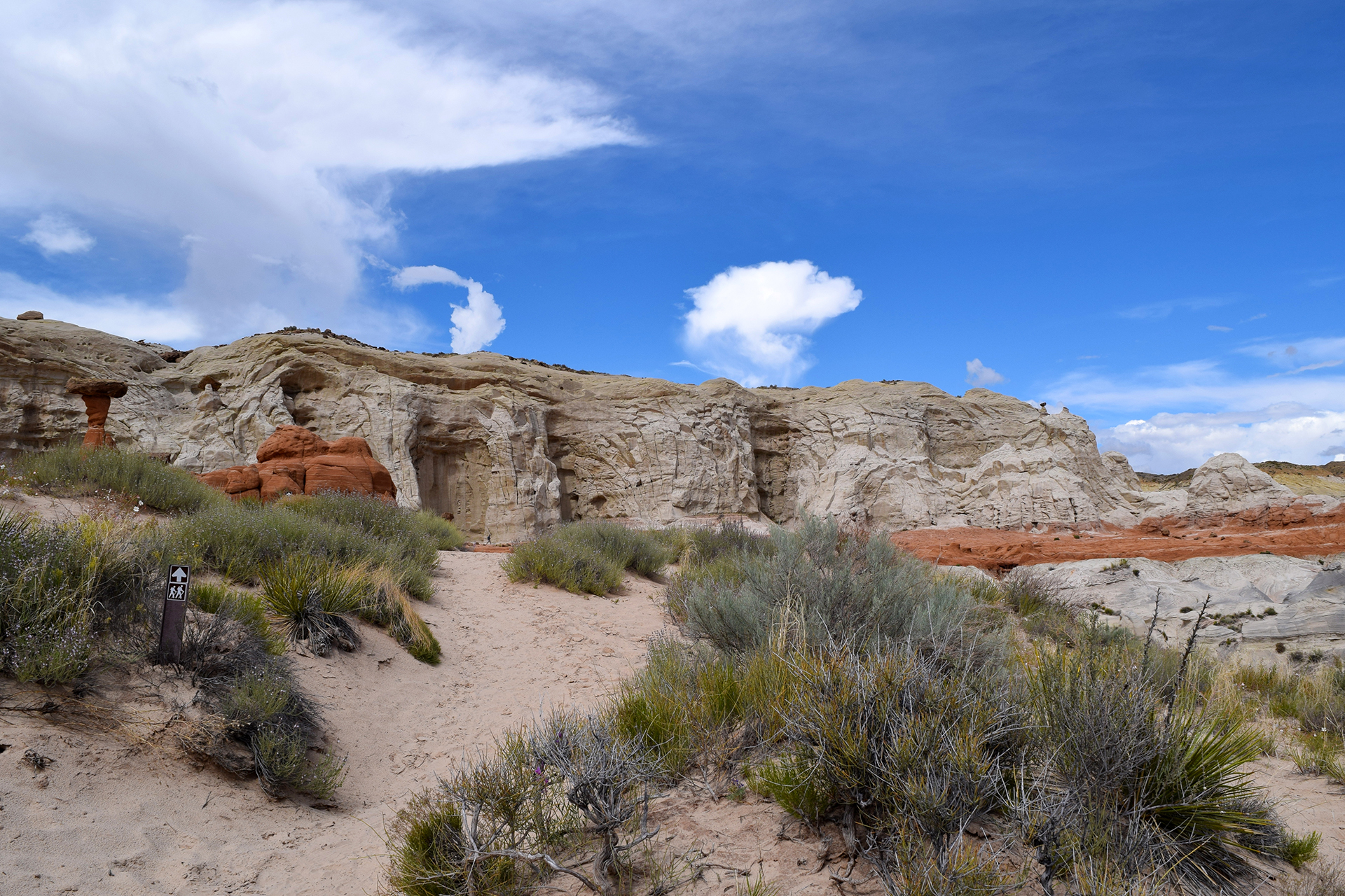
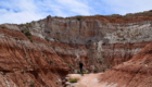
On our first day, we took a hike up over the aforementioned slickrock.  There’s no real “trail” to speak of here, just occasional rock cairns (piles) suggesting a route over the dusty stone.

We got lost about 15 times in 20 minutes.

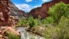
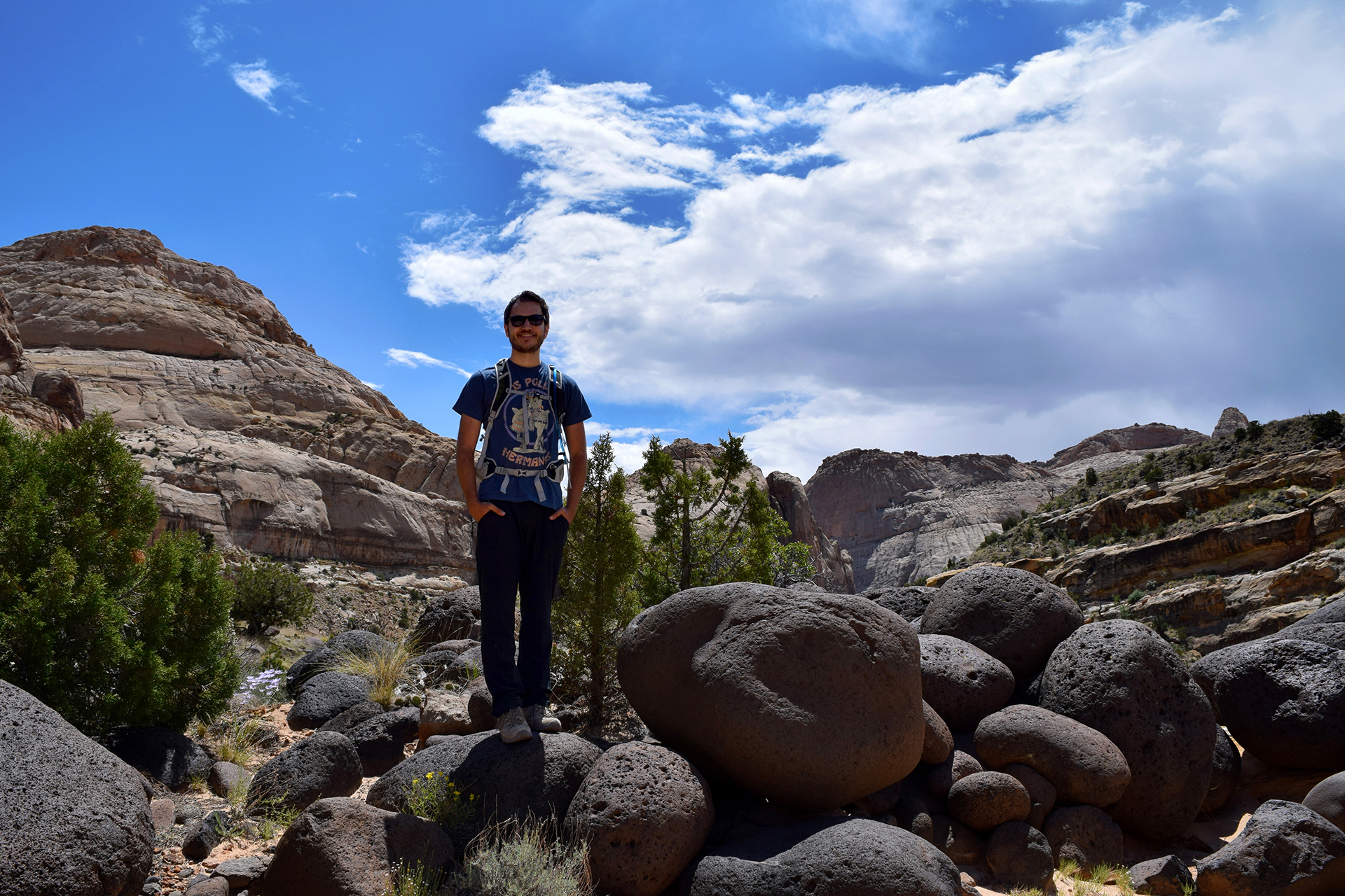
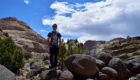
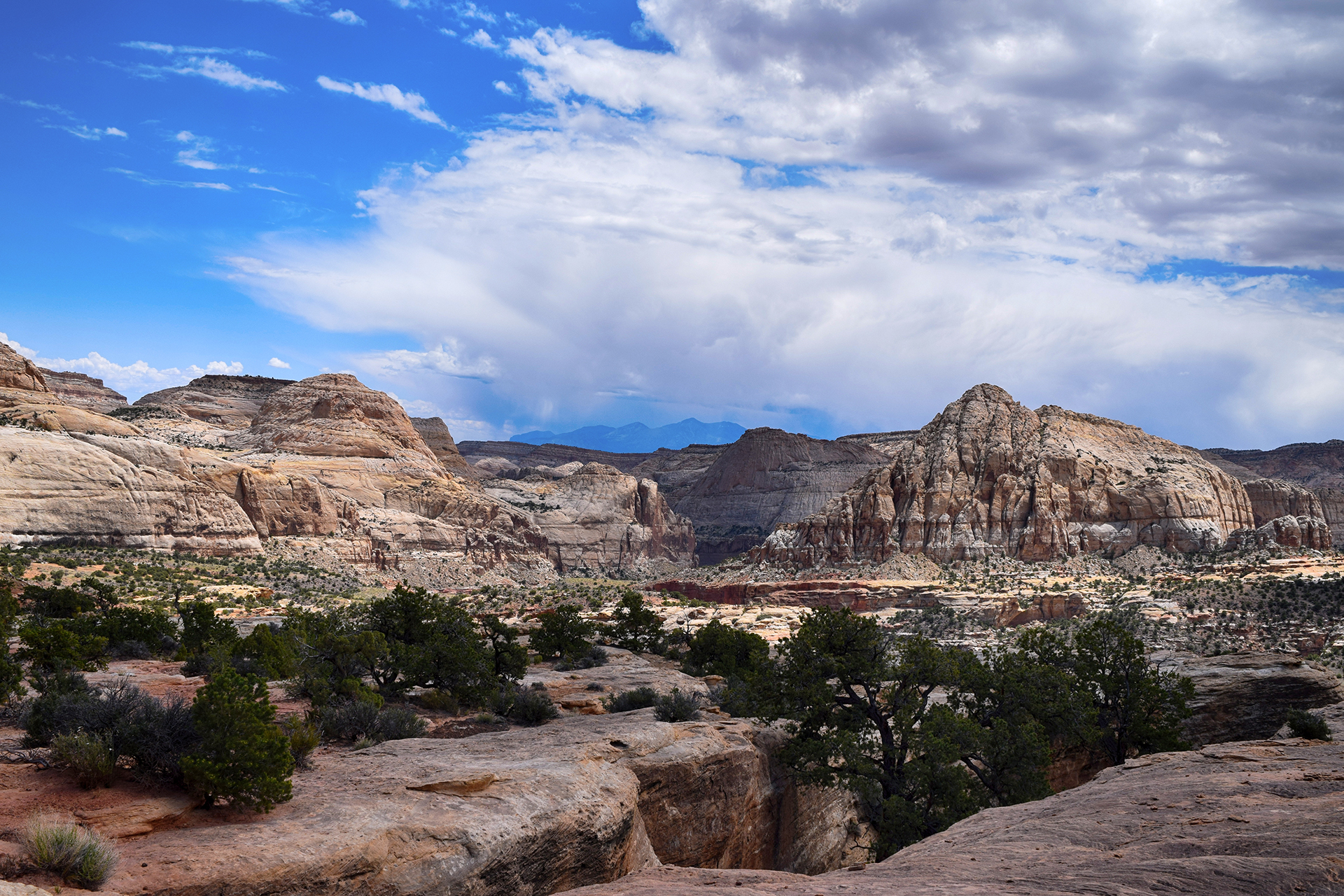
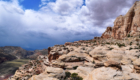
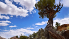
It was worth it, though, as we got a really cool view of the valley.

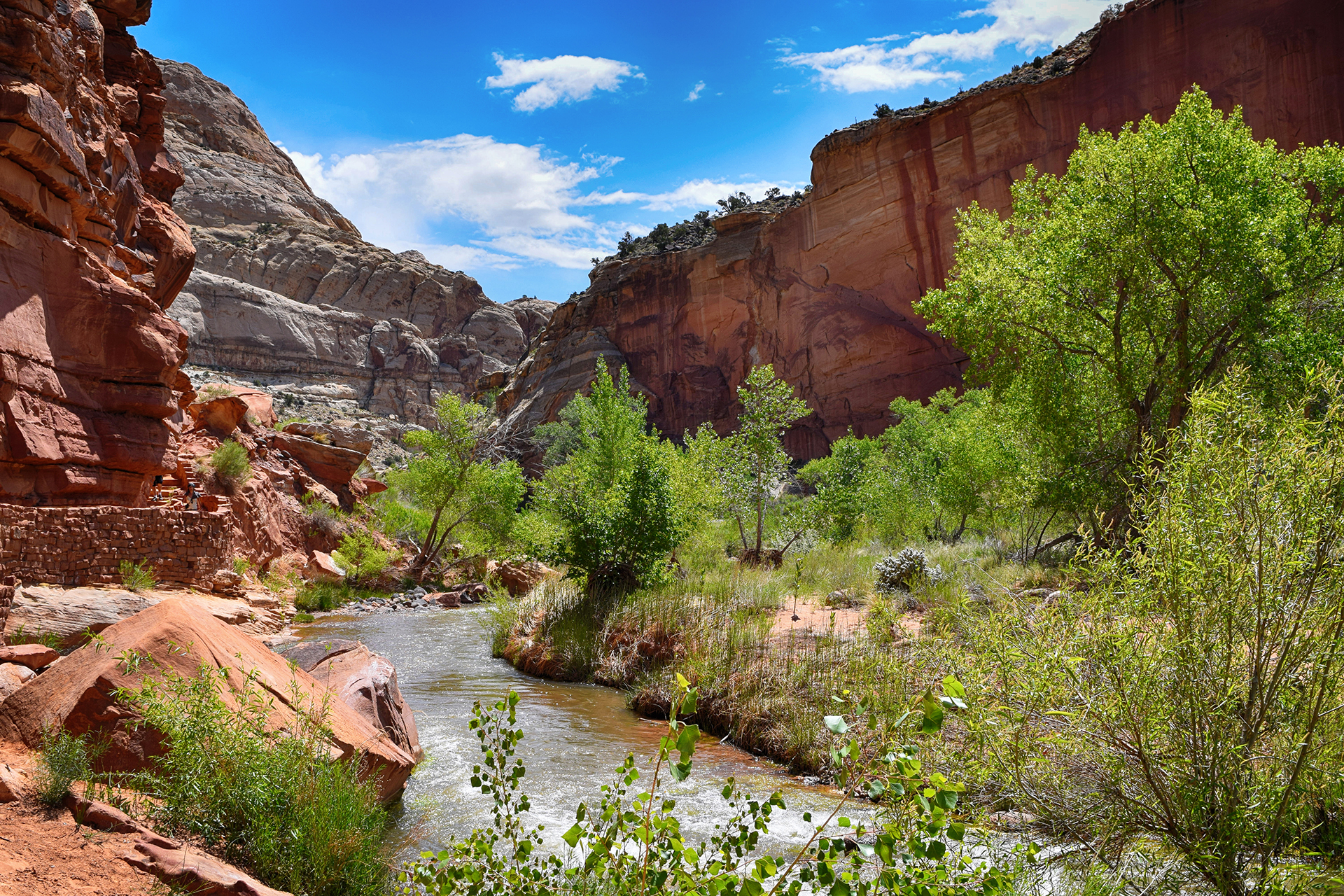
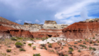
You can see how shockingly green it is in that valley below.  The river that carved that canyon still flows, and early pioneers took full advantage by planting numerous fruit trees, orchards of which still exist today.  We’ll get to them later.

You can also see an oncoming thunderstorm, and so could we, which is why this particular hike ended a bit early.
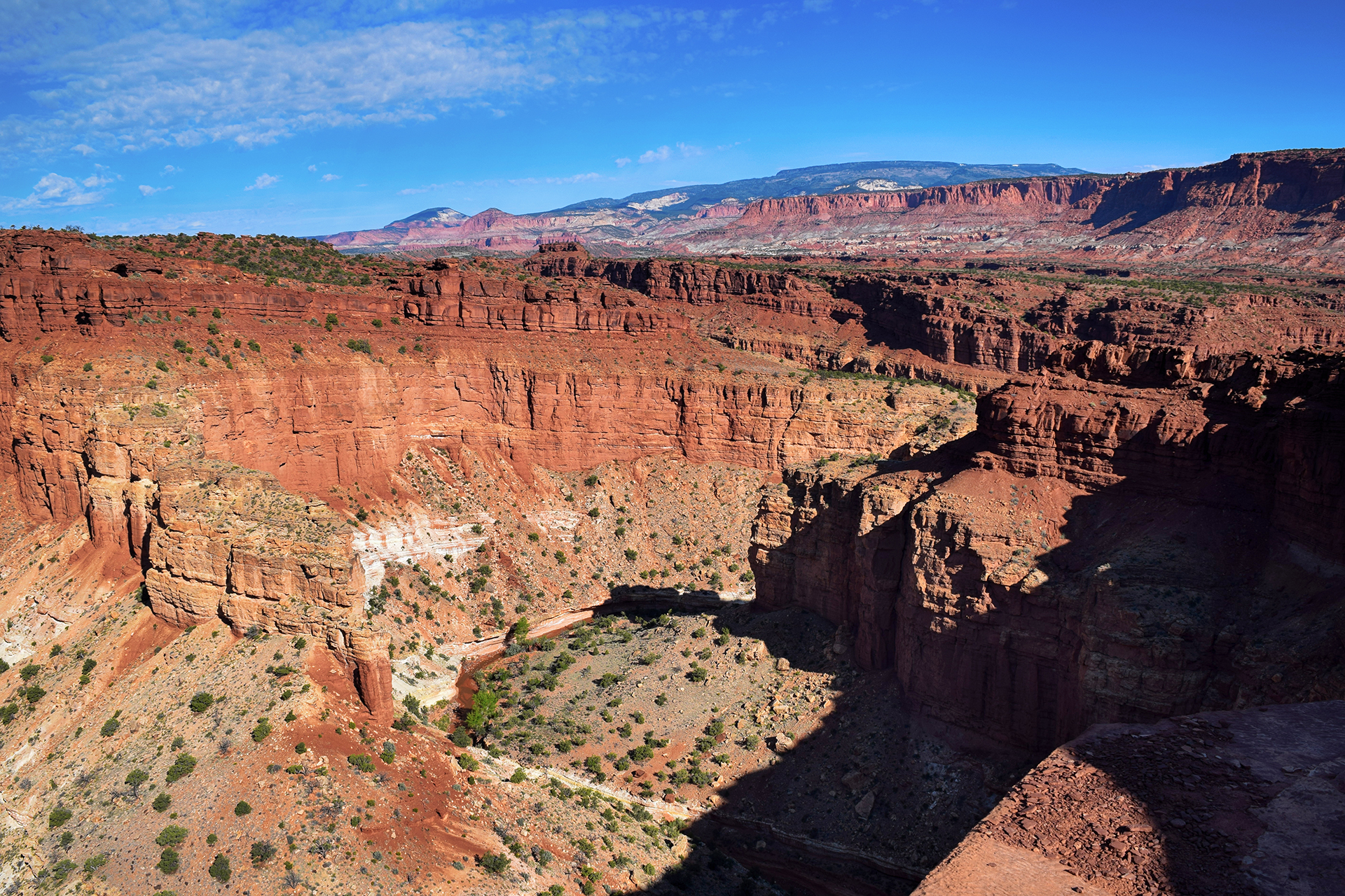
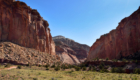
Into the Fold

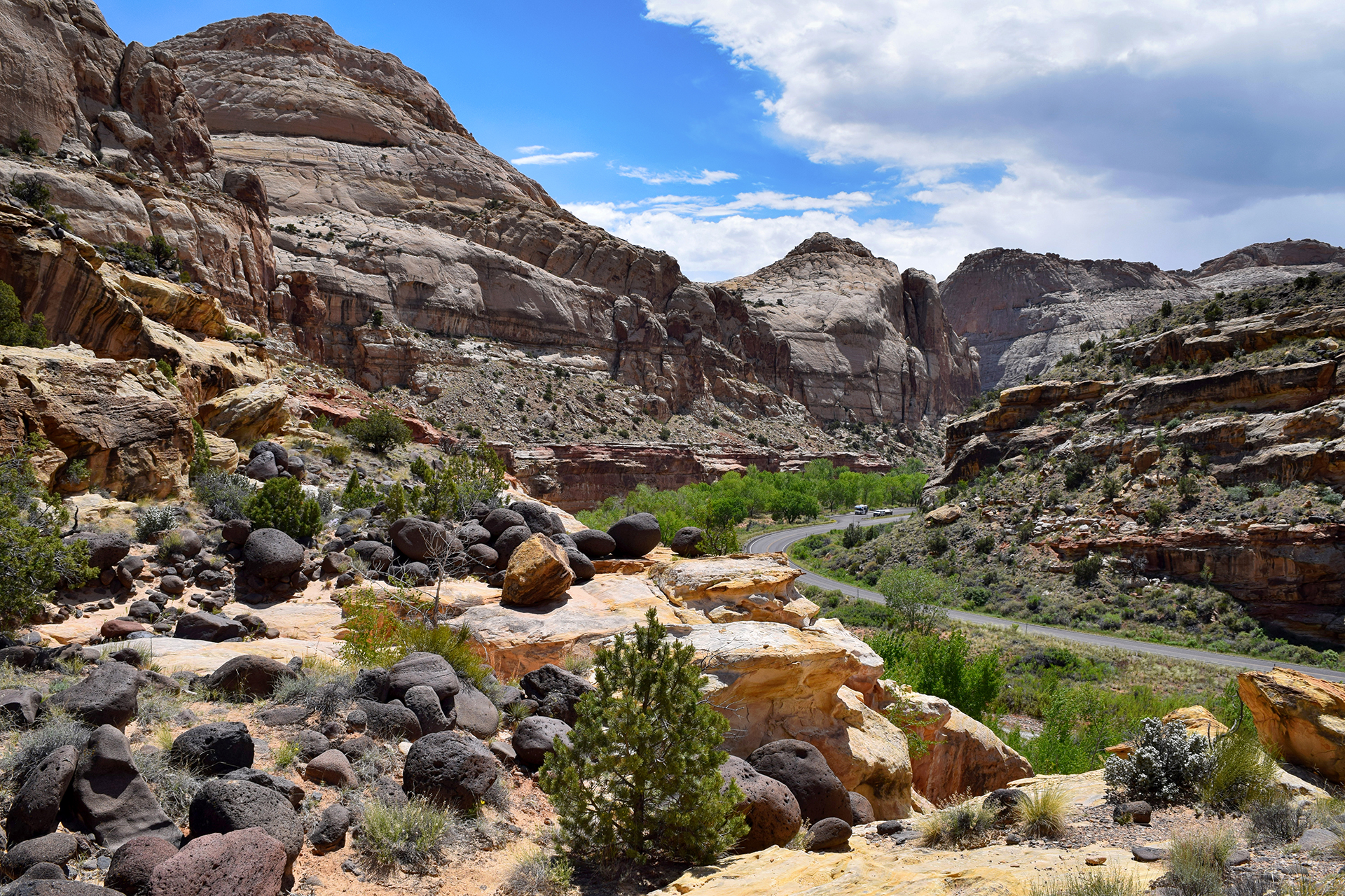
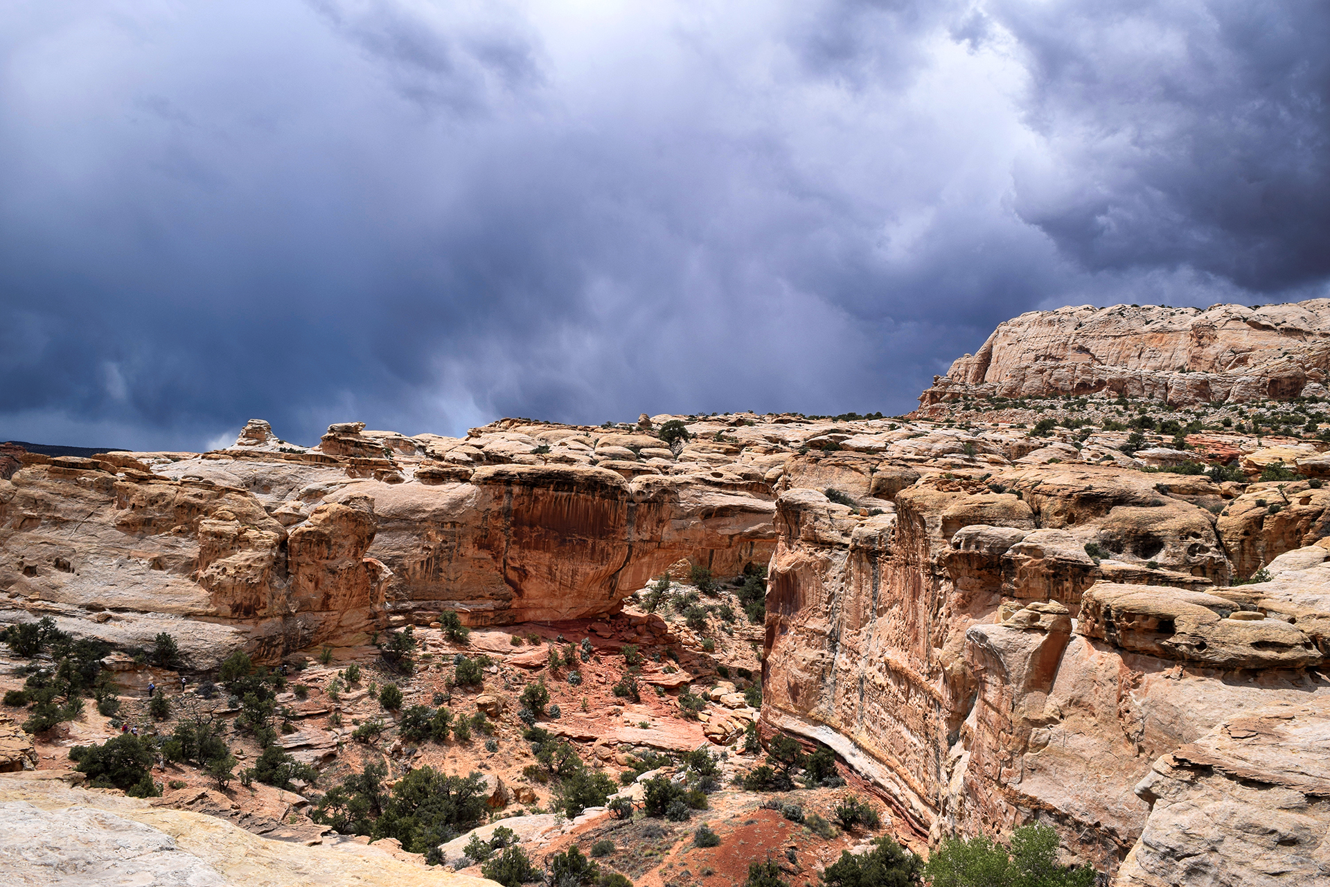
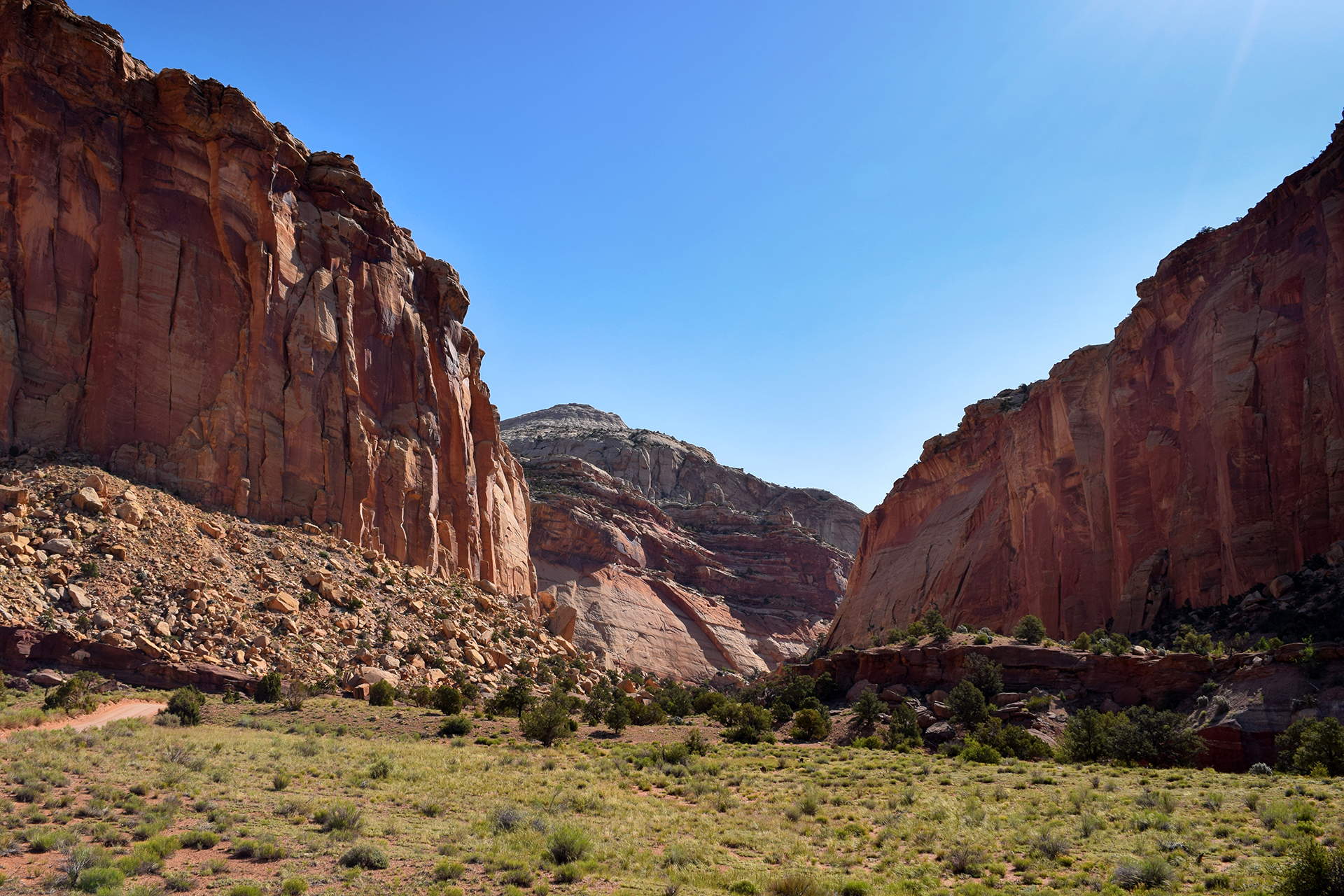
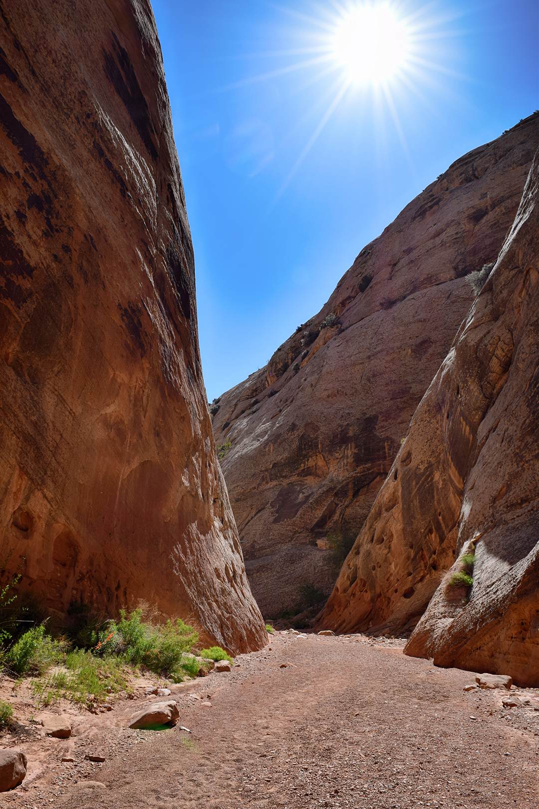
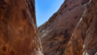
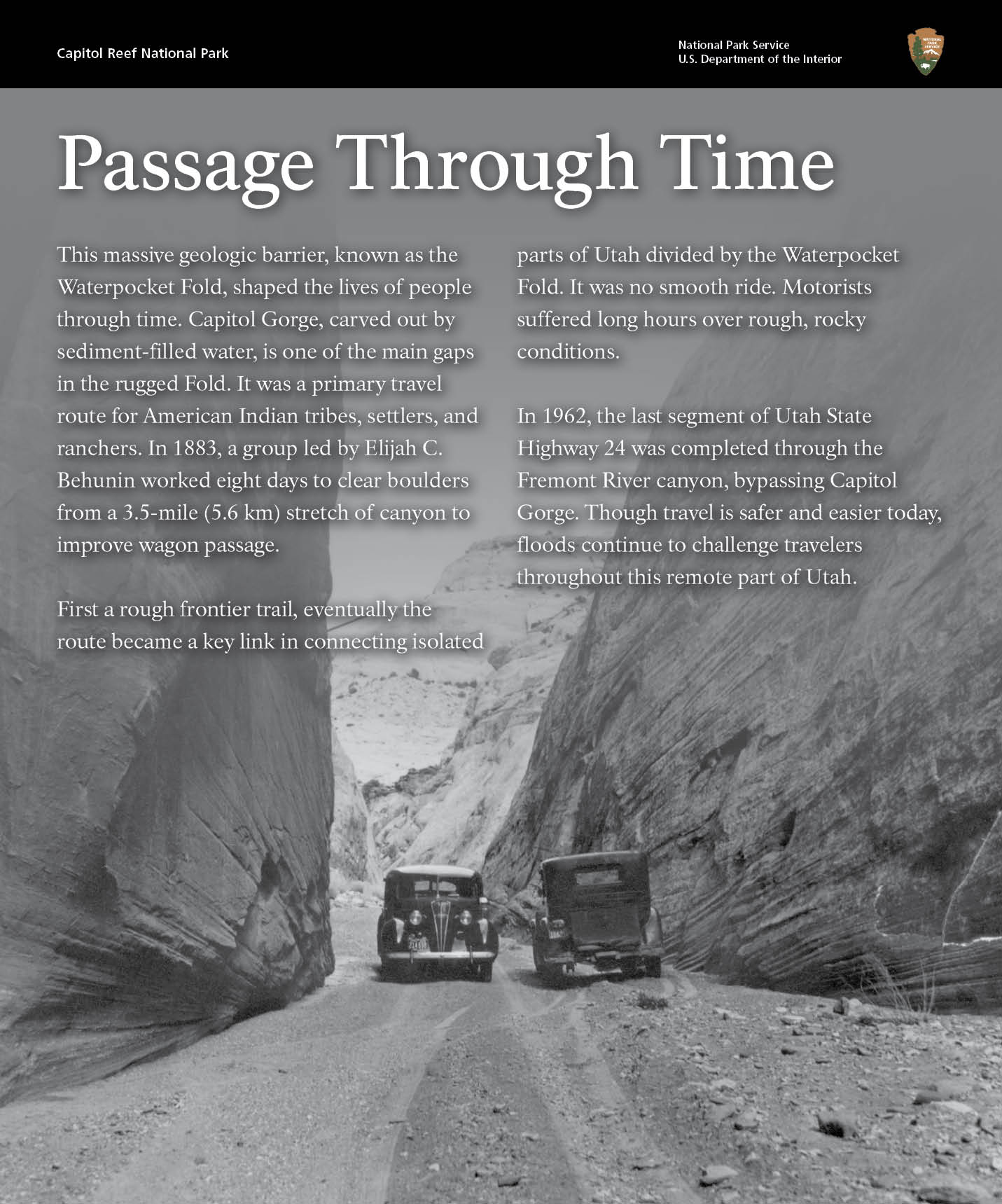
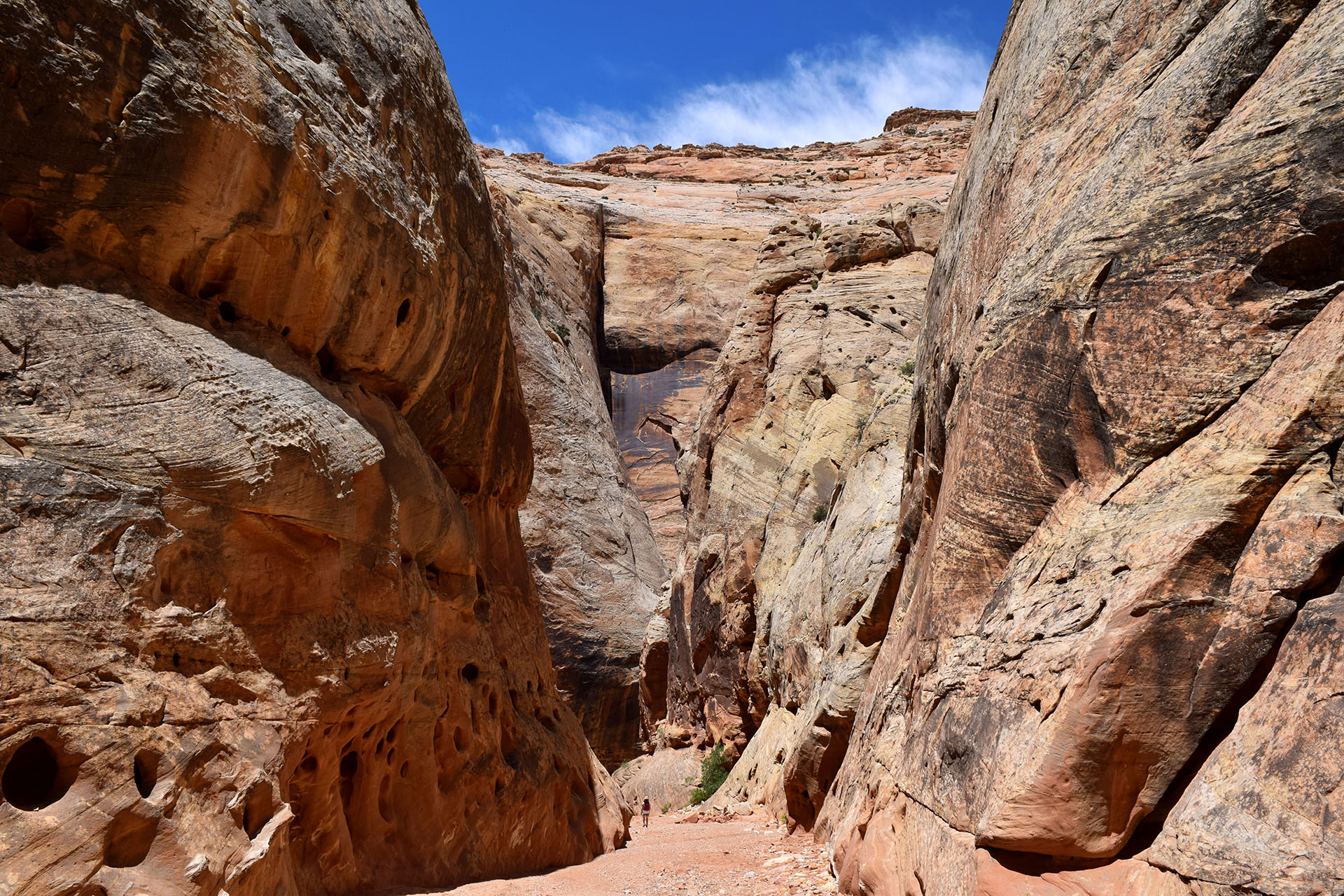
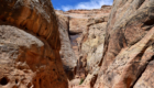
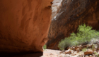
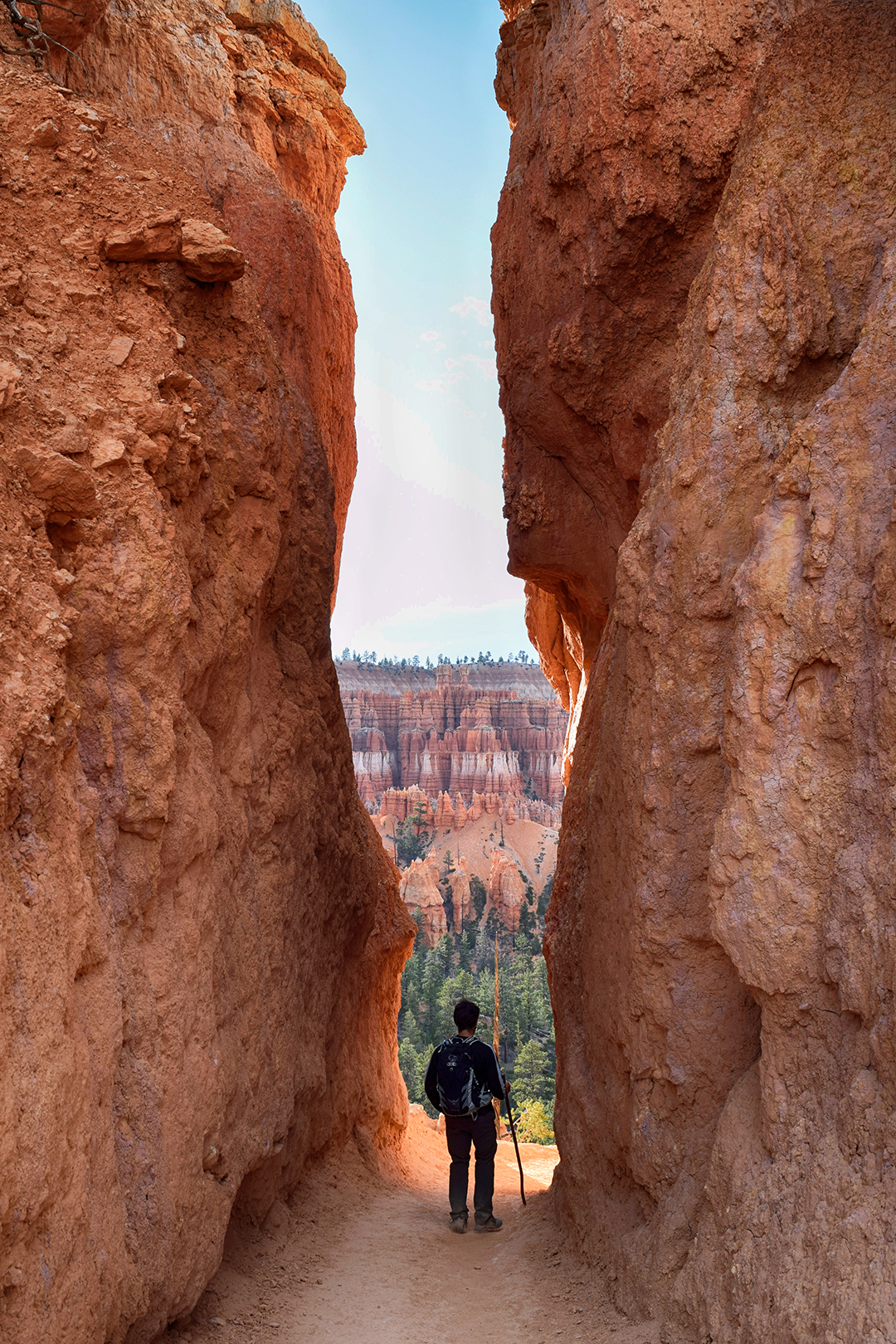
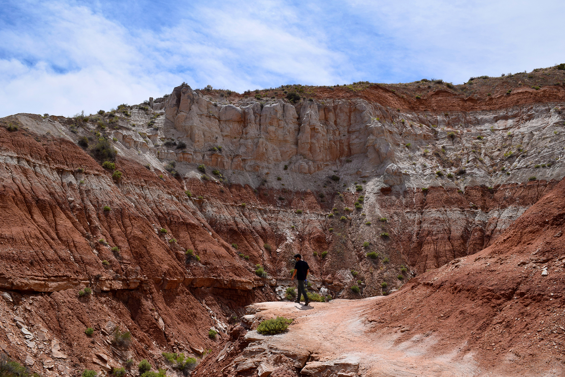
The next day, we explored some of the area’s many natural canyons. The first one we visited was actually a former road, and once the only way through the Waterpocket Fold. We got there by driving through a slot canyon, an experience as epic as the Hogback but without the risk of falling off a cliff.

Early pioneers spent untold numbers of back-breaking hours removing boulders from this canyon to ease wagon travel. It’s a good reminder of how insanely difficult it was to settle Utah, and the incredible obstacles that early settlers somehow overcame… sometimes literally.

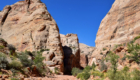
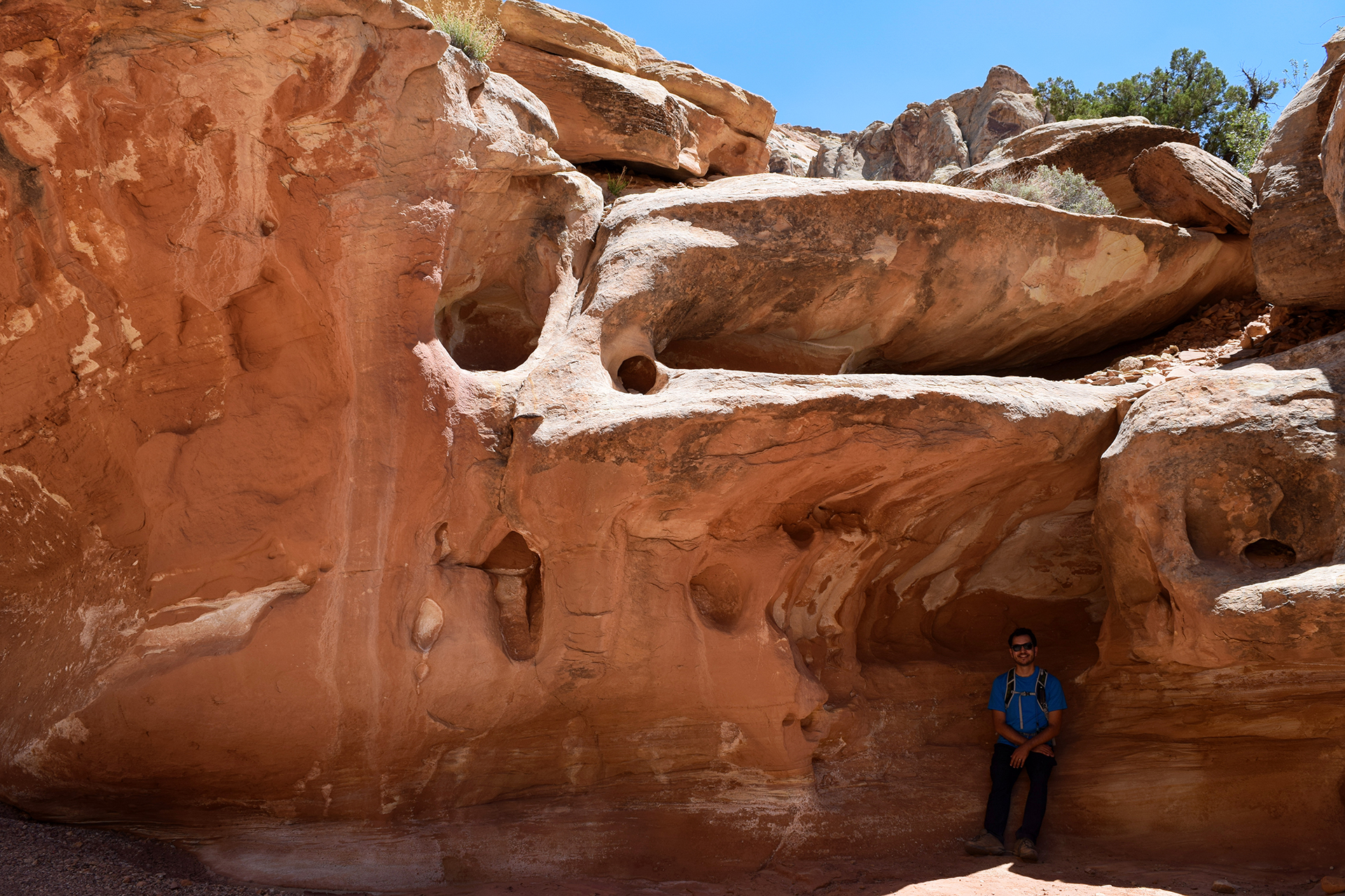
Speaking of early settlers, one feature of this canyon is a large number of pictograms drawn on the rock walls by Native American inhabitants. Later, Mormon pioneers created their own “graffiti wall,” tagging their name and the date. Our favorite was the person who signed their name using bullets, a method of which cartoon 1920s gangsters would surely approve.

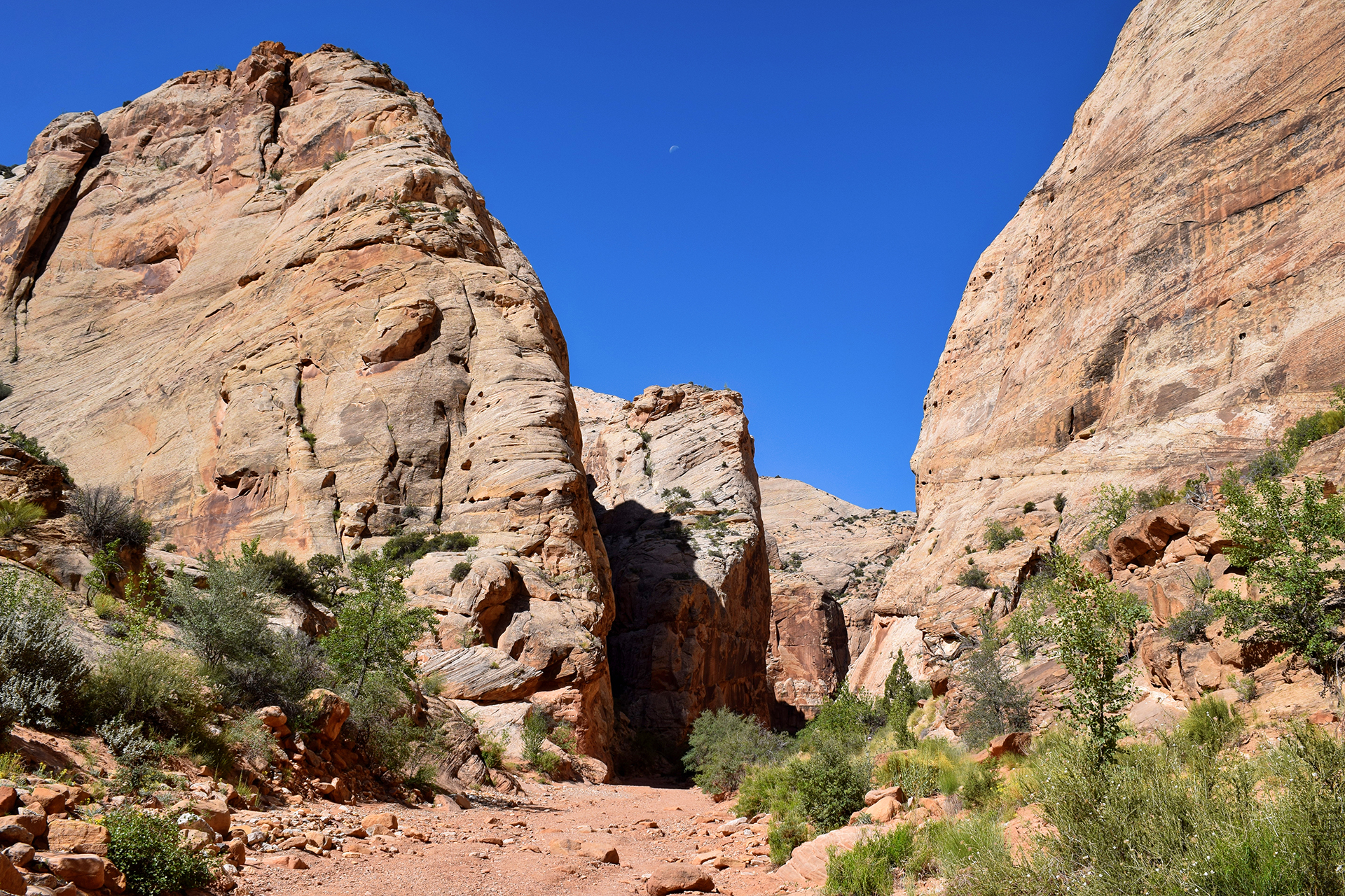
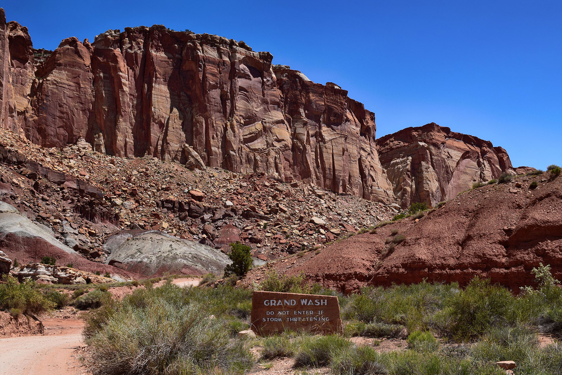
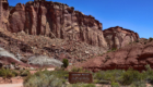
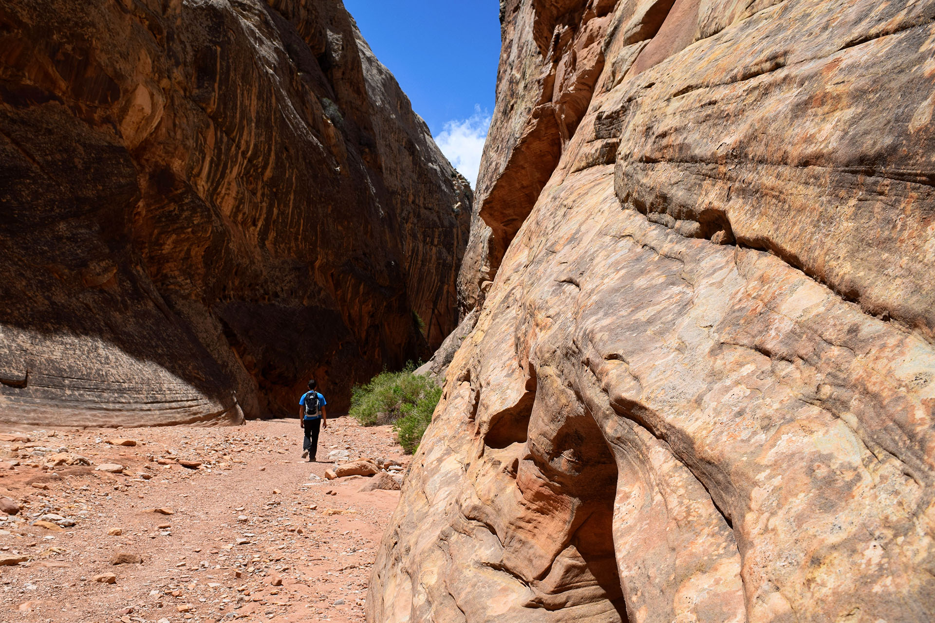
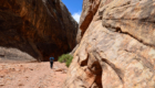
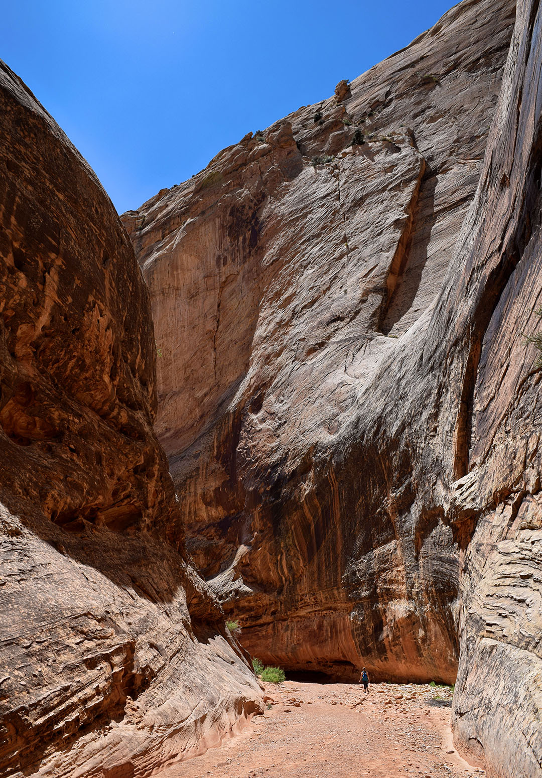
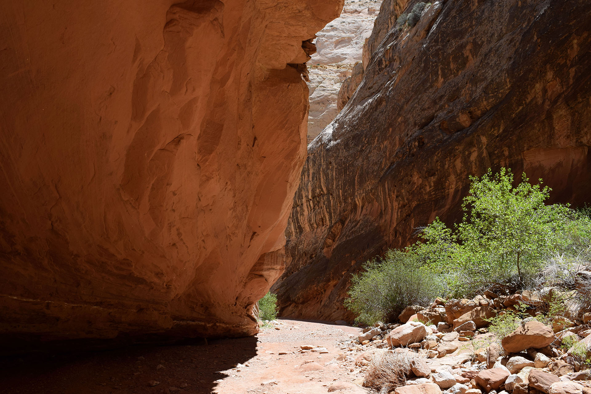
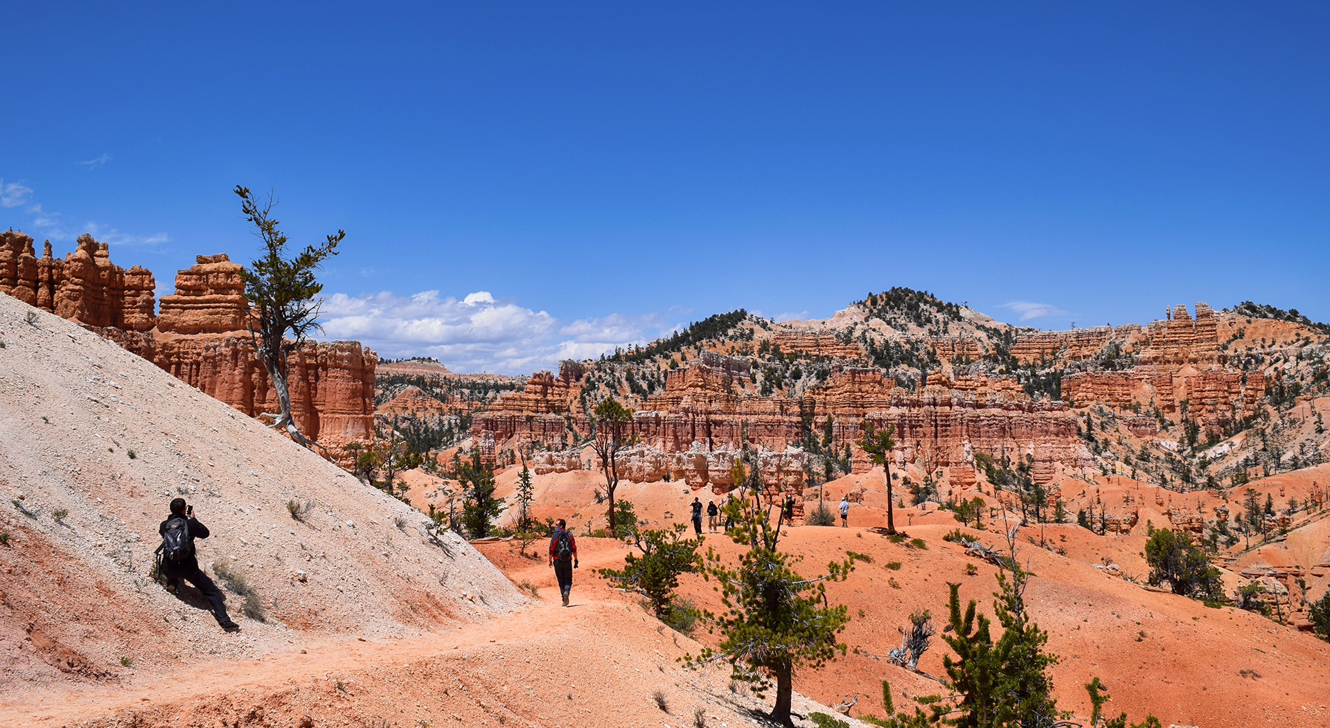
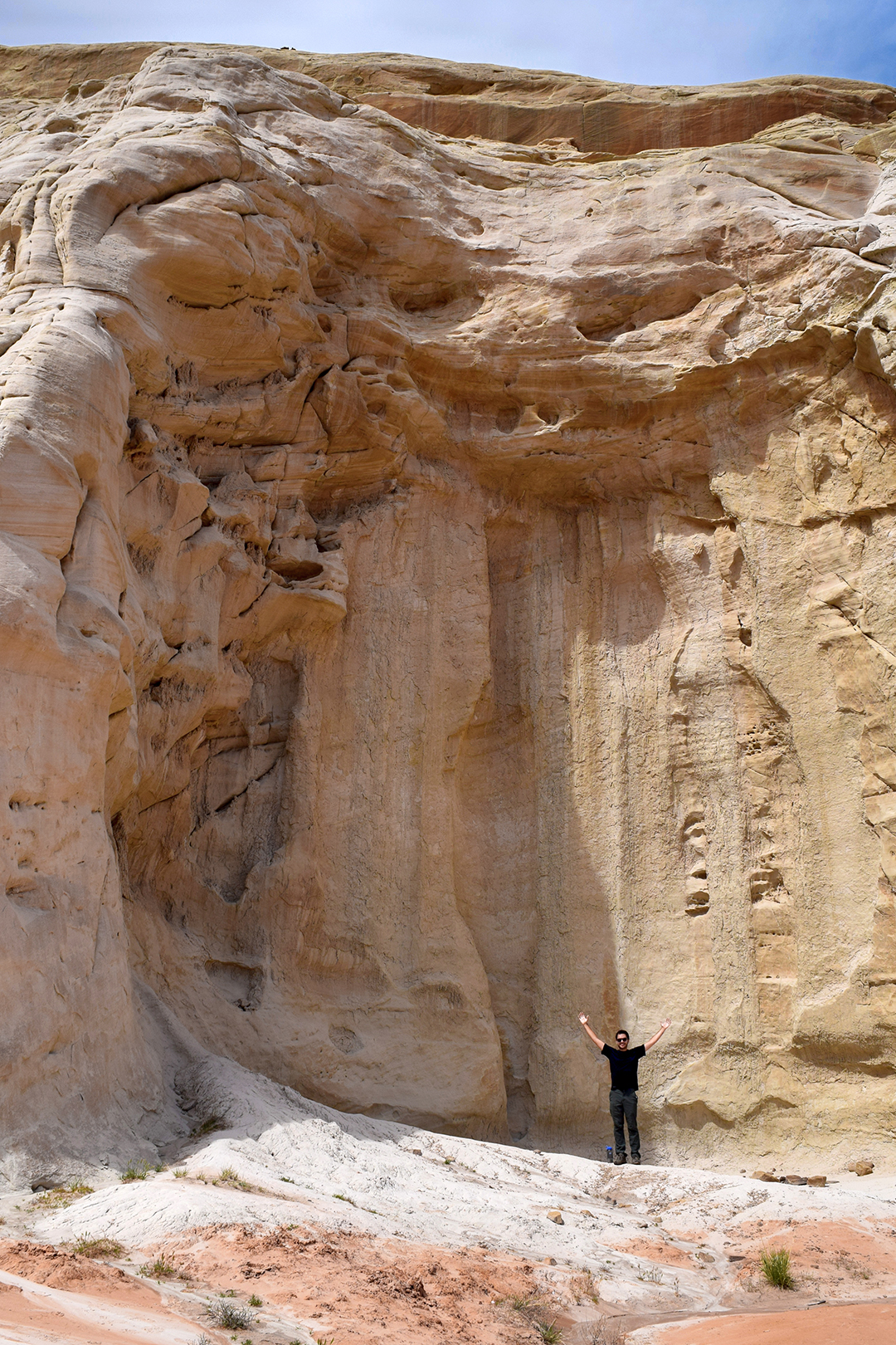
Next, we headed to the Grand Wash, a huge slot canyon carved away by rushing floods. It’s absolutely stunning in person, just these gigantic rock walls on either side with almost nobody else around.  We recommend taking a look for the people in these pictures to get a sense of how massive this canyon really was.  Few things have made us feel more awed or insignificant.

Our last stop was equally exciting, but very different.  We mentioned that the orchards in this area still bear fruit, but it doesn’t go to waste. You can pick it yourself (although we were out of season), and the National Park Service actually harvests the rest for use in baked goods, sold in an adorable little house on-site.

Pie proved to be a southern Utah obsession – we had just had some in Kanab (lackluster) Bryce Canyon (amazing) – and we are happy to report that the pie and cinnamon rolls we got here were delicious.

We saw a lot of great stuff on our road trip, but seriously: a pie stand in a national park!! Life just doesn’t get any better than that.

Roadtrip Time Travel

Roadtrip Status

We’ve reached the end of our roadtrip!  We’re settling down in Denver, but we’re going to keep making blog posts and posting our favorite photos from the trip, so stay tuned for more.

Follow Us On Social Media

FacebooktwitterinstagramFacebooktwitterinstagram

Latest Posts

0

Week 48: Bryce Canyon National Park

We stayed for a while (for us) in Kanab, Utah – visiting the Grand Canyon and Zion National Park – but eventually, it was time to move on.  Our next destination was Bryce Canyon National Park.  It was only about 80 miles away, but it felt like another world.

Hold the Door

Bryce Canyon National Park really is otherworldly, and it was one of our top-3 favorite places from the entire trip.  It has some really unusual geology – Bryce Canyon sits at the top of Utah’s “Grand Staircase” of brightly layered rock formations (described in our Zion post).  The rock at Bryce is a beautiful pinkish-orange color, and it is very soft, which causes it to weather in a unique way.  Essentially, the region’s wild temperature swings cause overnight snows that melt during the day, cutting away a tiny bit of rock each time.

The end result is an eroded rock pillar, narrow and very tall, called a hoodoo (although we usually called them hodors).  The astonishing thing is that they form in massive formations as entire sections of mountain are cut away, creating row upon row of pillars.  These formations are often mind-bendingly uniform, like soldiers standing at attention.

They are especially pretty when a formation is banded with rock layers.

Although hoodoos can be found in many places in the desert, Bryce Canyon has more hoodoos than anywhere else in the world.  In addition, the formation process results in the mountain being carved out into a curved shape, like an amphitheater.  The most famous of these is Bryce Amphitheater, where the view from the rim is as cool as the other side of the pillow.

Walkie Talking

Many people just view Bryce Amphitheater and the short scenic drive, but the entire area is amazing.  We actually overheard a young man in a gigantic pick-up truck bragging that he was going to see the entire national park in “under twenty minutes.”  To each their own – *coughdbagcough* – but personally, we were head over heels for hoodoos, so we took a different approach, hiking everywhere and trying to see everything.

Bryce Canyon is relatively small, so unlike Zion, we were able to do every major hike in just a few days.  It is also much, much less crowded than Zion, and venturing down the trails even a quarter-mile often left us in complete solitude.  This was national park heaven, and we hiked in quiet amazement for miles past hundreds of fantastic rock formations – not just hoodoos, but rock curtain walls, windows and archways, even something that looked like a sinking ship.

Some of the hikes were tough, but we were basically mountain goats at this point.  In fact, the night we got in, we planned to do one short, 3 mile hike, starting around 5:30 p.m. (the best lighting for photos at Bryce is at dawn and dusk).  Once we started, though, we couldn’t bear to stop, and we decided to tack on another 5 miles as the sun began to set.

One the one hand, it might not have been the smartest idea to hike 8 miles at sunset in a place known for its freezing temperatures at night.  But on the other hand… hoodoos.

Game Changers

The next day, we hiked another 8 miles, this time through the area known as Fairyland.  There were a lot of cool sights, but unfortunately Tinkerbell was nowhere to be found.  We did have an amusing encounter at the end, however, when Jake spotted a woman with what looked like a large iced coffee and wandered over to ask her where she got it.

“Oh, this isn’t coffee, it’s just soda,” she said, and told us where to find the store.  Then, she leaned closer and whispered conspiratorially, “but the soda does have caffeine in it.  It’s a game changer!”

Oh, right.  We were in Utah, and many Mormons consider caffeine to be forbidden.

“We’ll just keep it between us,” Jake said, and winked.

And then we left to get some god-damned caffeine.

Religious taboos aside, friends, if you ever come to Bryce Canyon (and you should try), please, please, please try a hike down among the hoodoos.  The views from the top are great, but once you get down to the hoodoos’ level, you realize how incredible they really are.

Plus, you never know when you might encounter two other tourists attempting to cram themselves into a single rock window for a photo.

You might even get to take a picture of them while pretending not to notice.

Gnarls Barkley

Aside from the hoodoos and the generally beautiful landscape, there is one more awesome thing about Bryce Canyon.  It contains a few bristlecone pines, one of the world’s longest-lived trees.  They are quite rare, and we attempted to see some (without success) at Great Basin National Park. The only place we actually saw any bristlecone pines was at Bryce.  While the Great Basin pines can be up to 5,000 years old, these are only (!) about 1,800 years old.

Stunted, twisted, and with weird bottle-brush needles, they are… not the world’s best-looking tree.  To be fair, we’d all probably look a bit worse for wear if we were nearing the end of our second millennia.

Notes from Bryce Canyon City

We didn’t realize it at first, but Bryce Canyon is very high – the elevation is over 7,500 feet.  The days were sunny and warm, but true to form, it snowed every night.  After spending an entire winter above freezing, we had to get out our winter hat and gloves.  In late May.

The owners of the combination campground / gas station we were staying at also own a restaurant, and based on internet reviews, we stopped for some pie.  At first, we were distracted by the fact that every worker at the busy restaurant appeared to be directly related.  Then we tried the pies, and we have to say: they really were incredible!  Some of the best we’ve ever had.  They really put the ho-made pies at the Thunderbird to shame.

As a final note, the town of Bryce Canyon City itself was only incorporated in 2007, and the population is only 198 people, making it possibly the smallest town we ever stayed in.

But it does have an airport…

Roadtrip Status

Roadtrip Time Travel

Still alive?  Check.

Where are you now?  Upstate New York.

Next location?  Heading westward one last time, towards Colorado.  Time to have jobs again!

Follow Us On Social Media

FacebooktwitterinstagramFacebooktwitterinstagram

Latest Posts

0

Week 47: Kanab, Utah

After a slightly weird caving experience at Great Basin National Park, we continued south through Utah, quickly leaving the interstate behind. Southwestern Utah contains some very rolling hills, and it was a bit of a tense drive before we finally made it to Kanab, Utah. We stayed for nine days in mid-May, mixing some amazing sightseeing with more everyday tasks like laundry and trip planning.

Nothing mundane, of course.  Never that.

Kanab is a small but busy town of only 4,300 people.  As any real estate agent can tell you, it’s all about location, location, location, and Kanab has that in spades. Situated between three national parks (Zion, Bryce Canyon, and the north rim of the Grand Canyon – all coming up next) and numerous state parks and national monuments, the scenery around Kanab is breathtaking. As a result, it’s a touristy place, but in a low-key sort of way, and we found the vibe more charming than annoying.

Kanab UT 1

As in most tourist towns, the residents are enterprising. For example, there is a local newsletter with detailed write-ups on all the area activities, and it runs close to 50 full-length pages. It was quite helpful, but we didn’t realize until later that every article was written by the same woman! Ms. Dixie Brunner, thanks for all the advice.

By the way, despite staying for more than a week, we didn’t even come close to seeing everything.  Touristry in Utah requires some serious time-management triage.

In the 1950s, some similarly enterprising locals convinced Hollywood producers to shoot westerns in the area – including the TV show Gunsmoke. Tipped off by Dixie, we stopped by one of the old sets, now decaying slowly in the desert near some new housing developments. Sort of sad to see, but it made for some cool pictures.

Unlucky Numbers

As the headquarters for several federal park activities, Kanab has the unique distinction of being the location for a very special lottery. Six times a week, tourists gather at 9:00 a.m. sharp to try to win a coveted permit to see The Wave. You’ve probably never heard of it, but you may have seen a picture – The Wave features parallel bands of red and white rock curving gracefully in the shape of… well, a wave.  Here’s a picture from Wikipedia:

TheWave 1600pixels.jpg
[By Gb11111Own work, CC0, https://commons.wikimedia.org/w/index.php?curid=15724006]

There were at least eighty people at the morning lotteries, but only a few winners – only ten people total are allowed to see the Wave each day.  We tried three times, but never won.  Bummer!  At least we got to see something similar earlier in our trip at the Valley of Fire.

Hard Rock Life

With no Wave, we instead took another Dixie suggestion and visited the Toadstools. These are a series of super-cool hoodoos – weathered rock pillars – with caps of harder (and therefore larger) stone on top.

The toadstools were pretty awesome, as was the general landscape.  What really blew our minds, though, was that the toadstools aren’t even a big attraction. There is so much cool stuff in southern Utah that these amazing rock formations barely even merit a parking lot! We would never have known they were there if not for our Kanab newsletter, and we couldn’t help but wonder what else is waiting out there to be discovered. (Answer: a lot.)

BAFFs

Our final stop in Kanab (aside from the national parks) was a pretty heart-warming one. Kanab is the headquarters for the Best Friends Animal Sanctuary, a non-profit group dedicated to ending euthanasia for unwanted animals. Their motto is “Save Them All,” and although they have grown to many locations nationwide, the Kanab facility is the largest and most important. It is their “shelter of last resort,” where un-adoptable animals of any species are sent to live out their days in the peace and quiet of beautiful Angel Canyon – mostly dogs and cats, but also pigs, horses, birds, and more.

We took a tour of the vast sanctuary, and it was really wonderful. Everything is thoughtfully designed with the animals in mind, whether it be bright, airy houses for the cats, or the dozens and dozens of individual and shared runs for the dogs – they have both a “Dogtown” and a “Dogtown II.”

The fantastic trainers work diligently to rehabilitate every animal, even the ones that will never be adopted. Some have physical or mental issues – we saw a volunteer walking one dog which constantly turns in circles as it walks – while others are there for different reasons.  Many of Michael Vick’s abused pit bulls ended up at Best Friends, and we actually got to meet one. She was smaller than we expected, but with an incredibly broad chest and the deepest bark we have ever heard. Like many “fighting” dogs, she actually had a very sweet disposition, but due to court order, she can never be adopted.

So, she gets to live here instead.

Best Friends is the rare kind of place that makes you happy about humankind. But of course this sort of thing happens in a lot of different places, and we’d be remiss if we didn’t mention that Jake’s aunt and uncle in LA, Fran and Bob, foster rescued cocker spaniels for another wonderful charity, Camp Cocker. Despite our cold, cynical hearts, we have to say thanks to Best Friends, Fran and Bob, and everyone who does such amazing work for animals everywhere.

Marketeering

Rather than end on a warm, sappy note, we’ll share one more quick story. After leaving Zion National Park late one night, we grabbed a bite to eat a restaurant just outside of Kanab called Thunderbird, which advertises itself as the “Home of the Ho-Made Pies.”

We just had to try them, but friends, we’re sad to report: those pies appear neither ho-made, nor even homemade!  In fact, we’re pretty sure some of the filling was still in the shape of the Sysco jug it came in.  We were so dispirited we didn’t even get a picture.  To quote Lionel Hutz, “[t]his is the most blatant case of fraudulent advertising since my suit against the film The Neverending Story.”

Ah, well.  We figured we’d just have to eat some more pie in the future to make up for it.  (Spoiler alert! We did.)

Roadtrip Time Travel

Roadtrip Status

Still alive?  Check.

Where are you now?  Pittsburgh, PA, beginning the job search process.

Next location?  We’ll be in Pittsburgh for a while, for once.

Follow Us On Social Media

FacebooktwitterinstagramFacebooktwitterinstagram

Latest Posts

0