Week 35: Death Valley Is Incredible

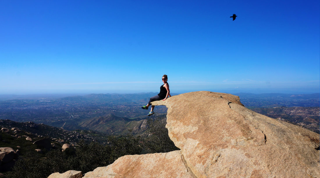
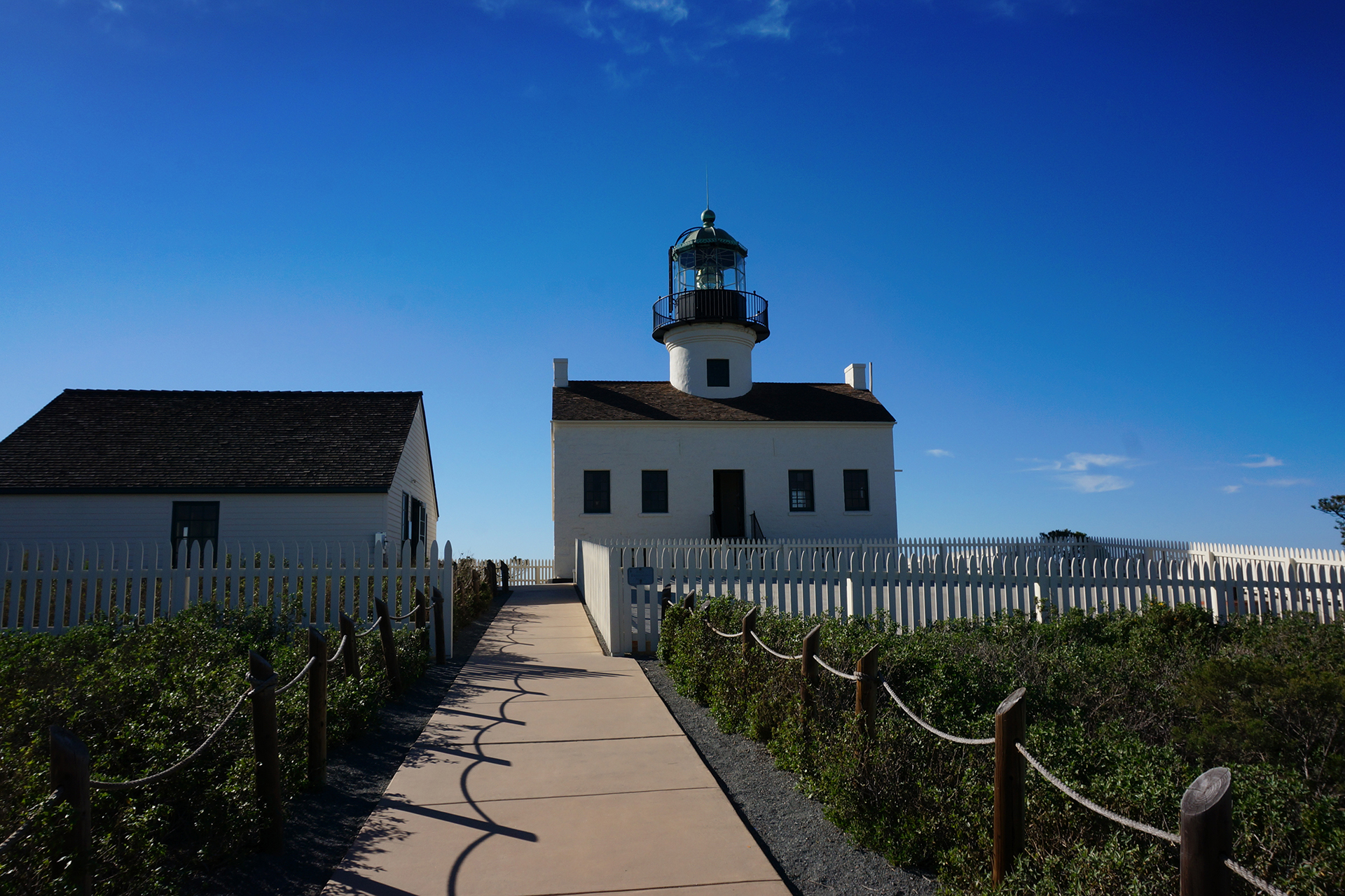
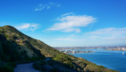
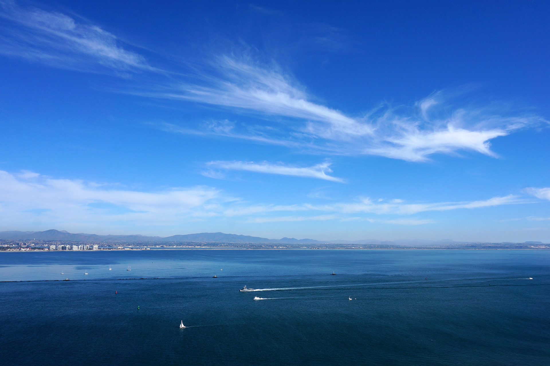
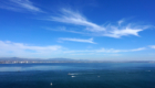
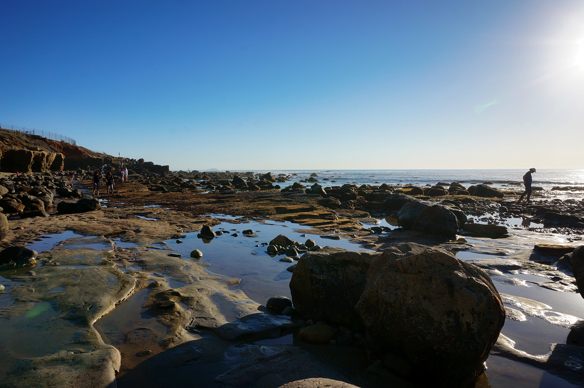
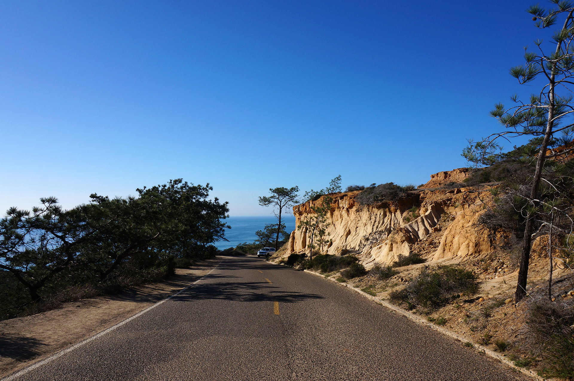
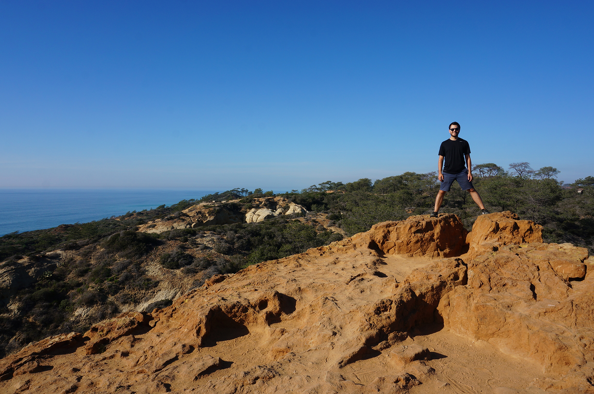
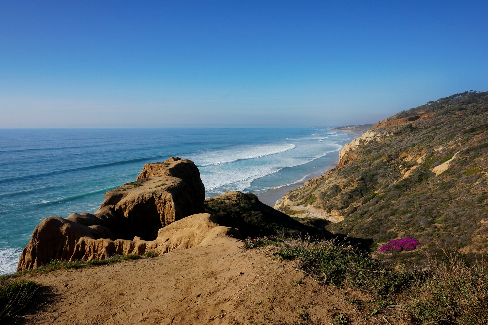
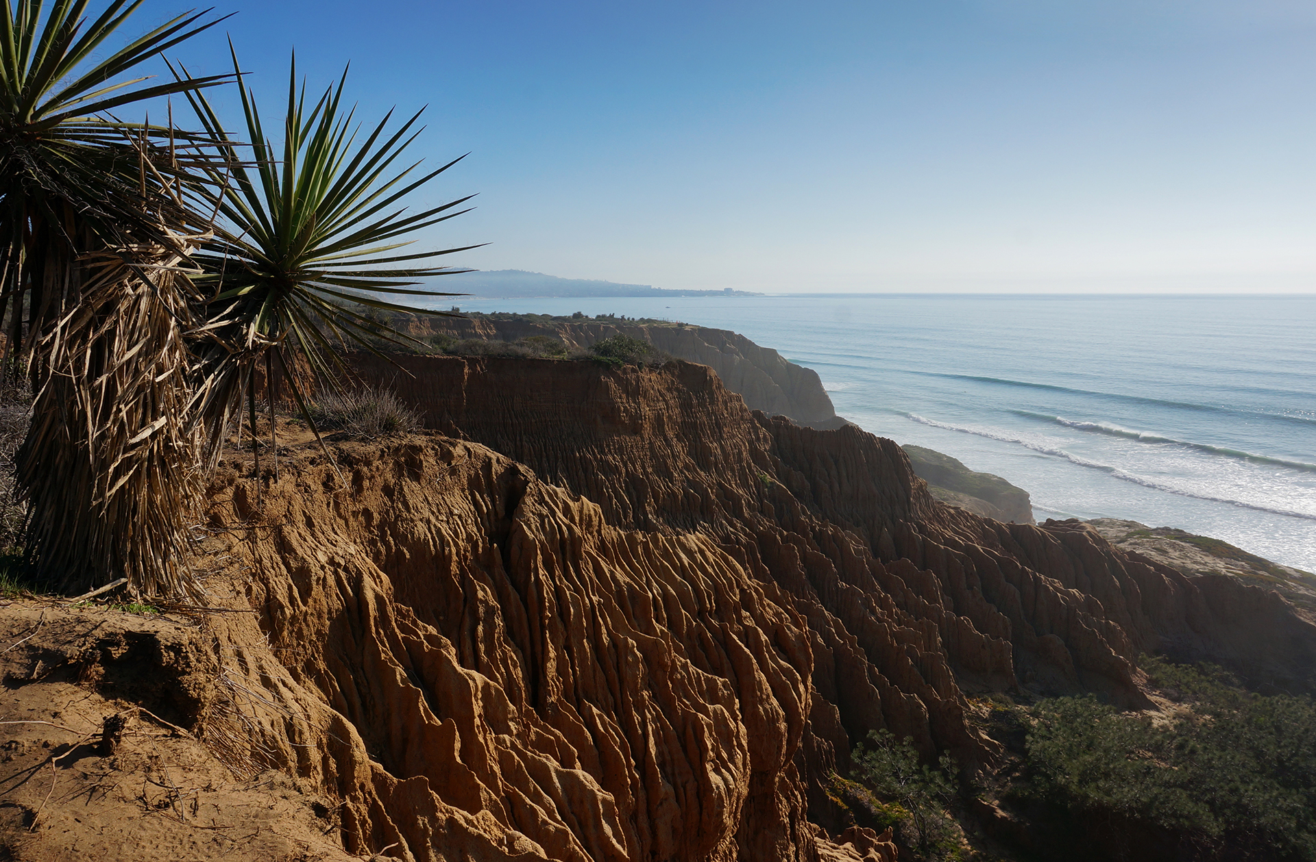
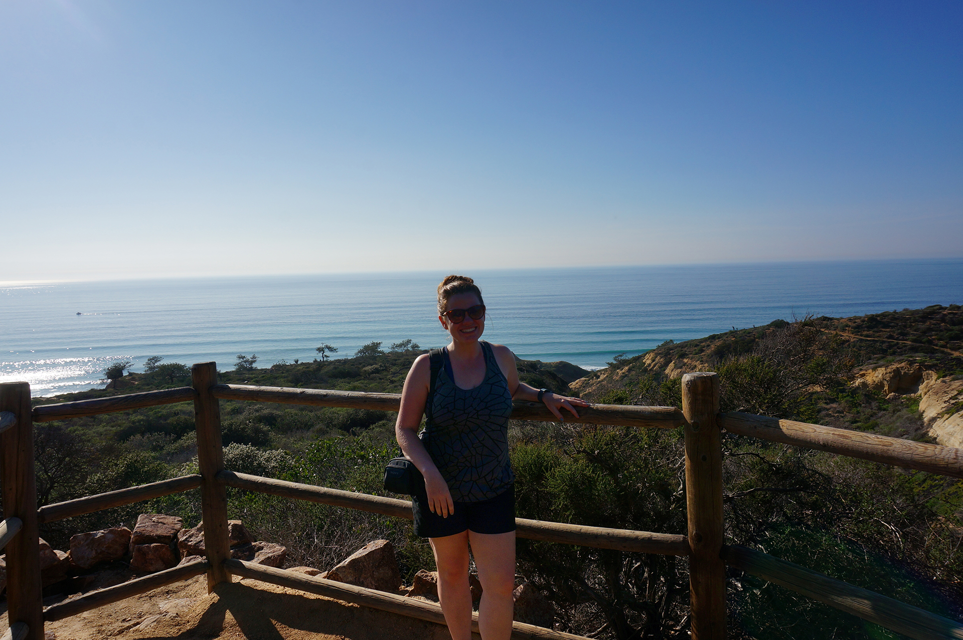
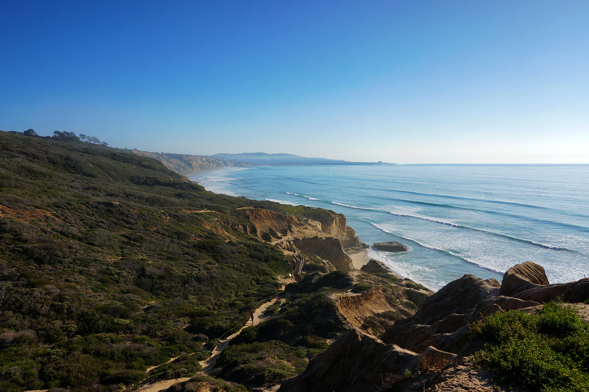
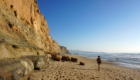
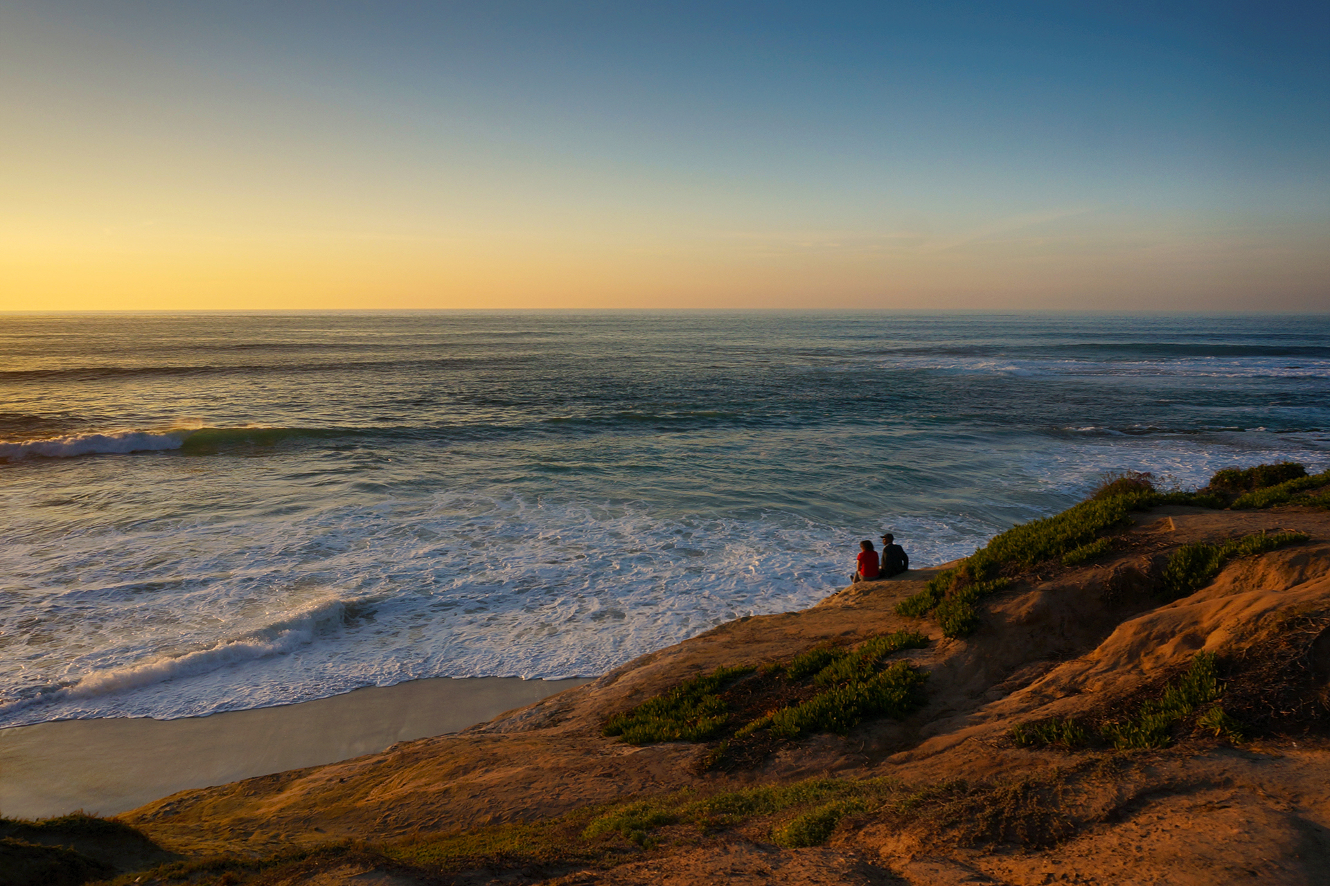
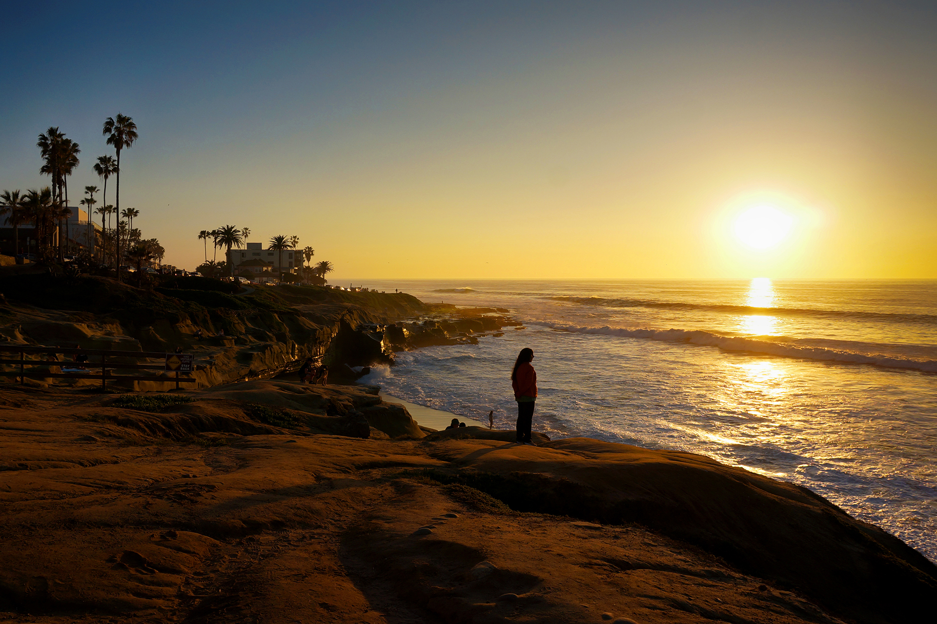
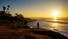
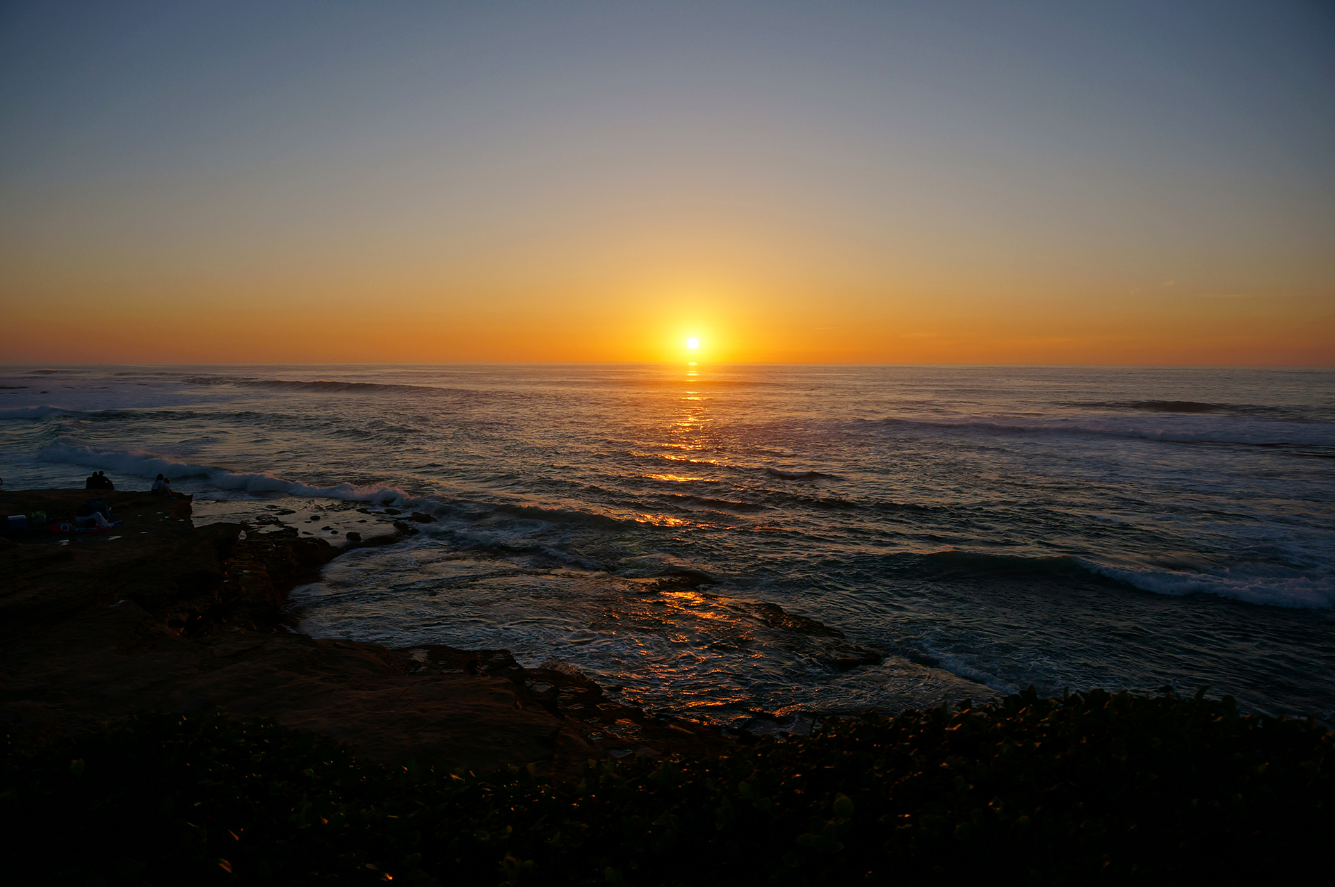
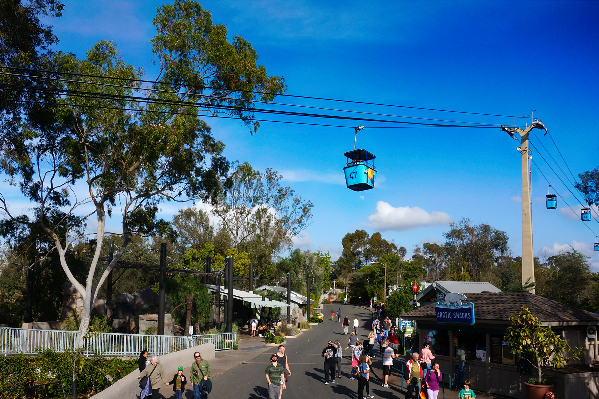
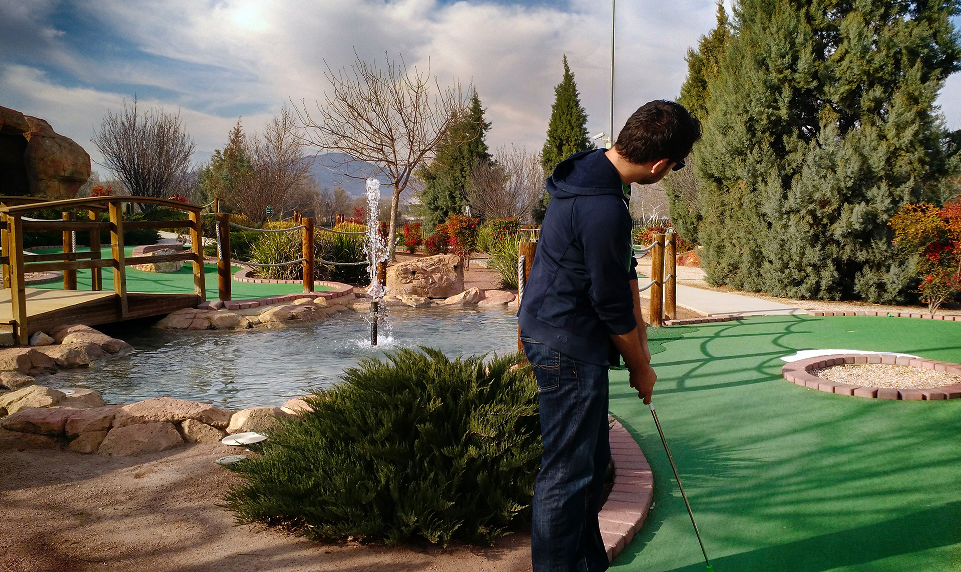
People often ask us what our favorite place has been so far on our trip.  Well, there have been quite a few. We covered one of the places in our last blog post: San Diego, “the land of perfect weather and also lots of beer.”  As luck would have it, our next stop also turned out to be one of our favorites: Death Valley, “the land of perfect February weather and also has some beer.”

Whoopsie Goldberg

It’s a long 362 miles from San Diego to Death Valley, and we unfortunately had a bit of a rough start.  About 20 miles out of San Diego, we stopped to get gas in a suburban gas station that looked like it would be big on the GasBuddy map.  Unfortunately, the station turned out to be very small.  Stubbornly, we tried to drive into the station anyway, but we ran into some problems.

Well, more accurately, we ran into a cement pole.

It was really just a scrape along the side of the RV, but we got a little stuck.  A little-known fact is that an RV pulling a car towed “flat” (i.e., not in a dolly) cannot back up without causing serious damage to the car.  As you probably guessed, that is how we pull our car, so it took a little while – and some frantic unhooking – to get things sorted away.  In the end, it wasn’t so bad: the RV was basically fine, minus an inconsequential dent and some paint, and the cement pole didn’t even seem bothered.

Our takeaway from this misadventure?  Never leave San Diego.
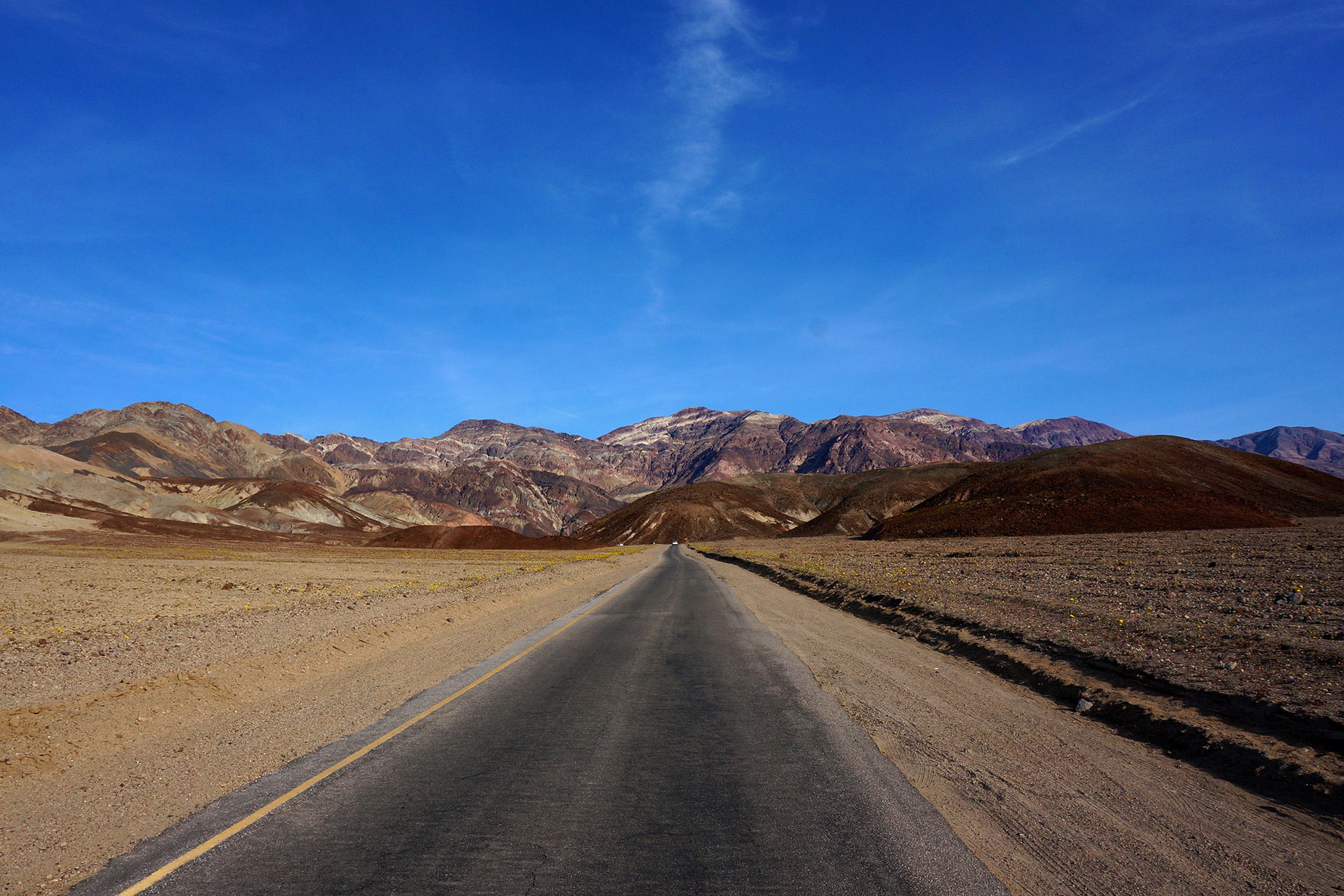
Drive into Death

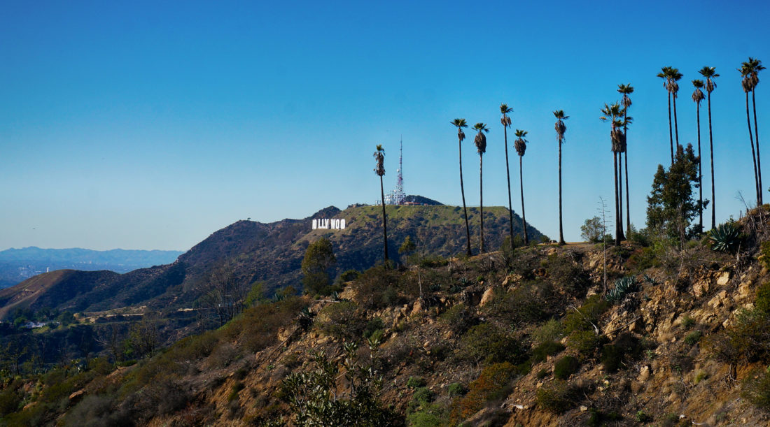
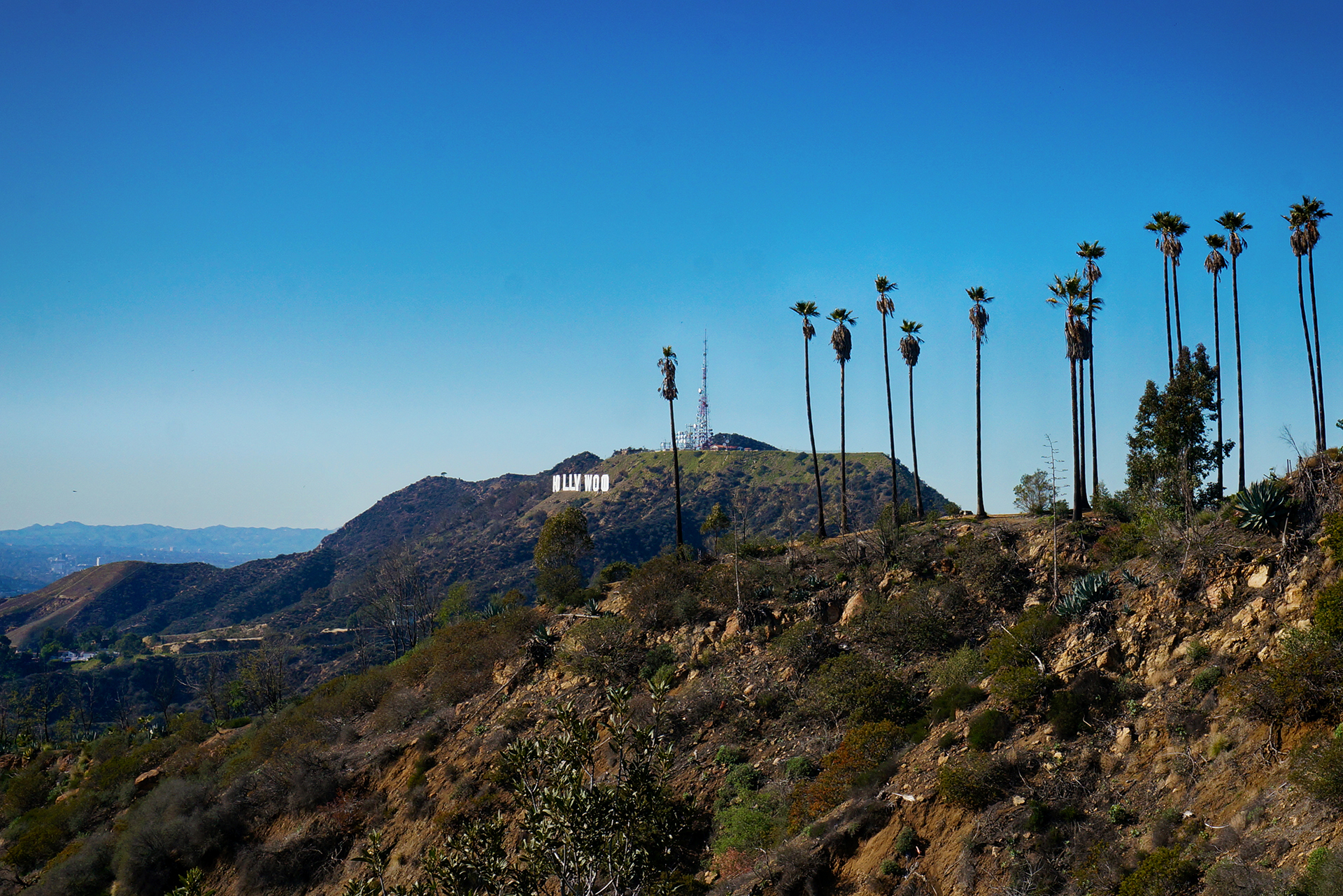
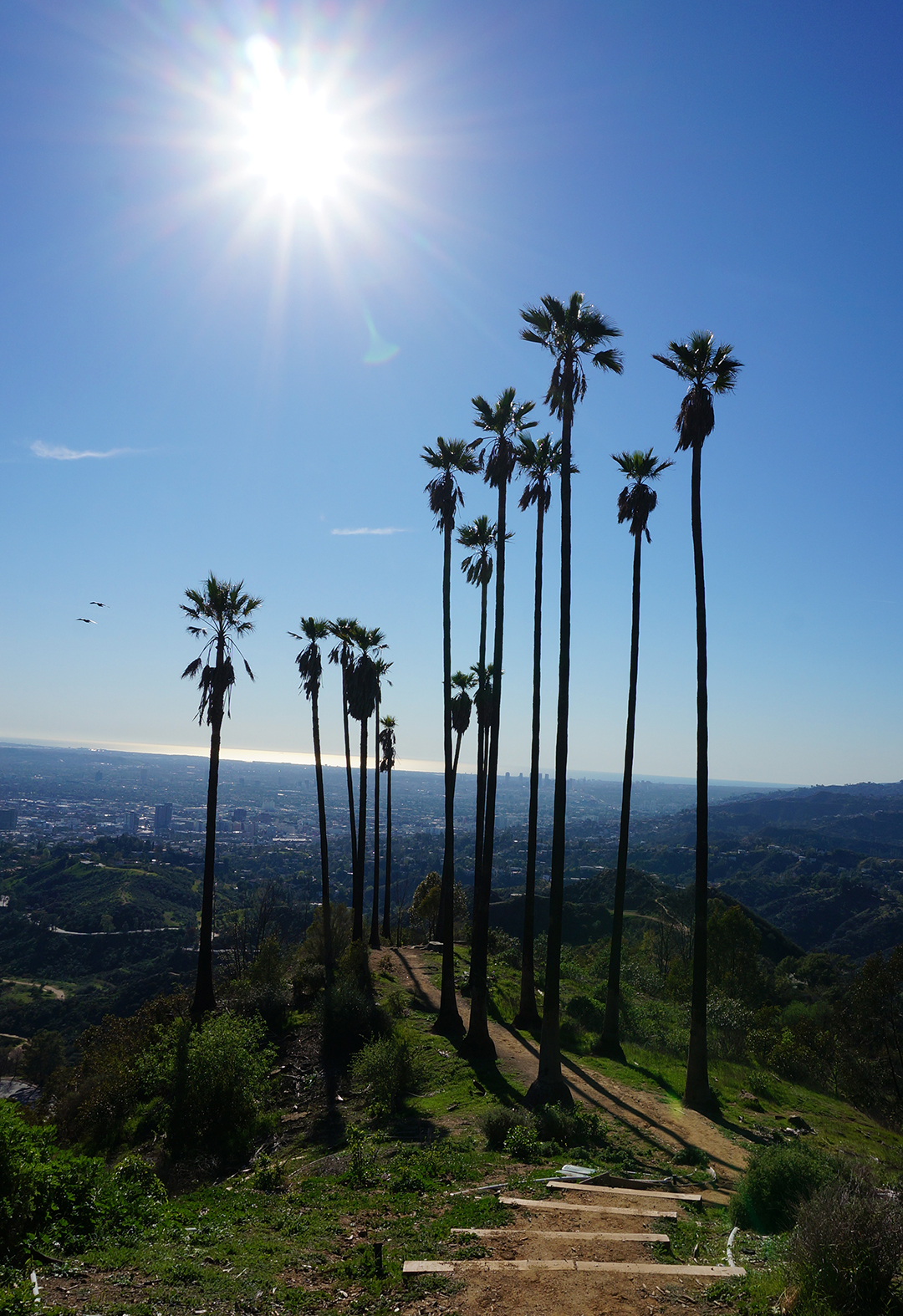
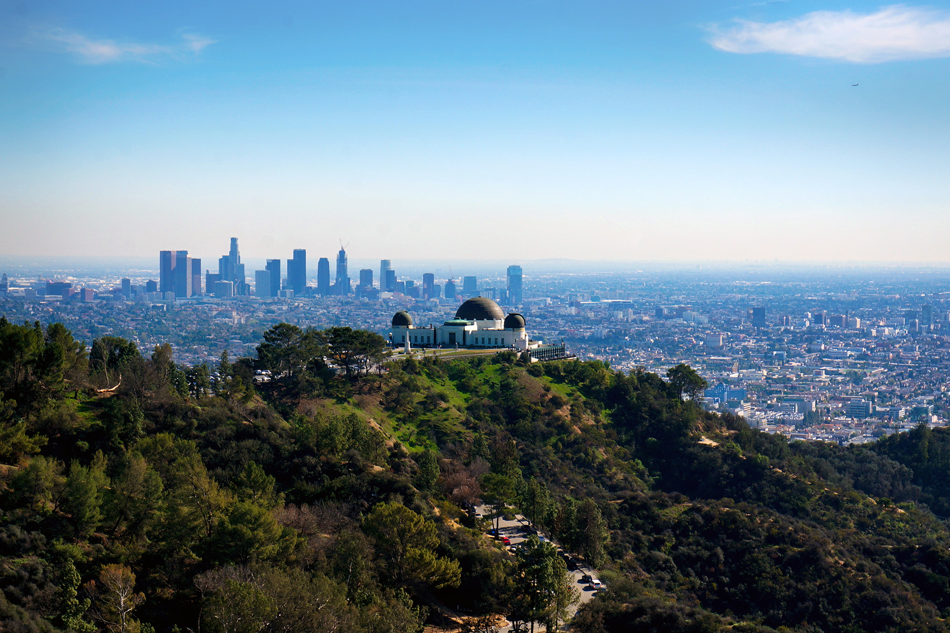
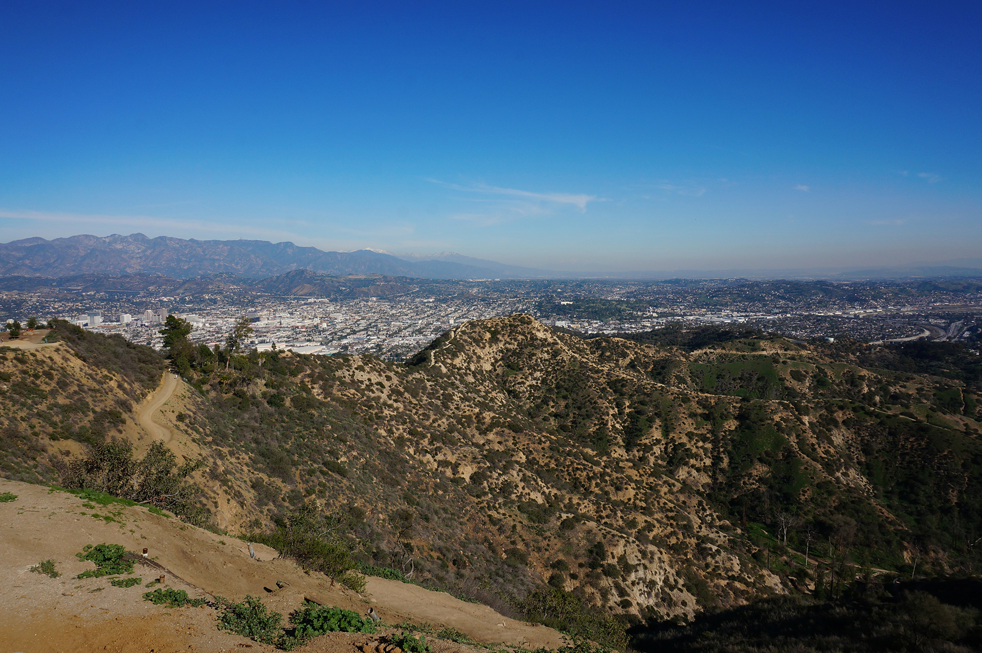
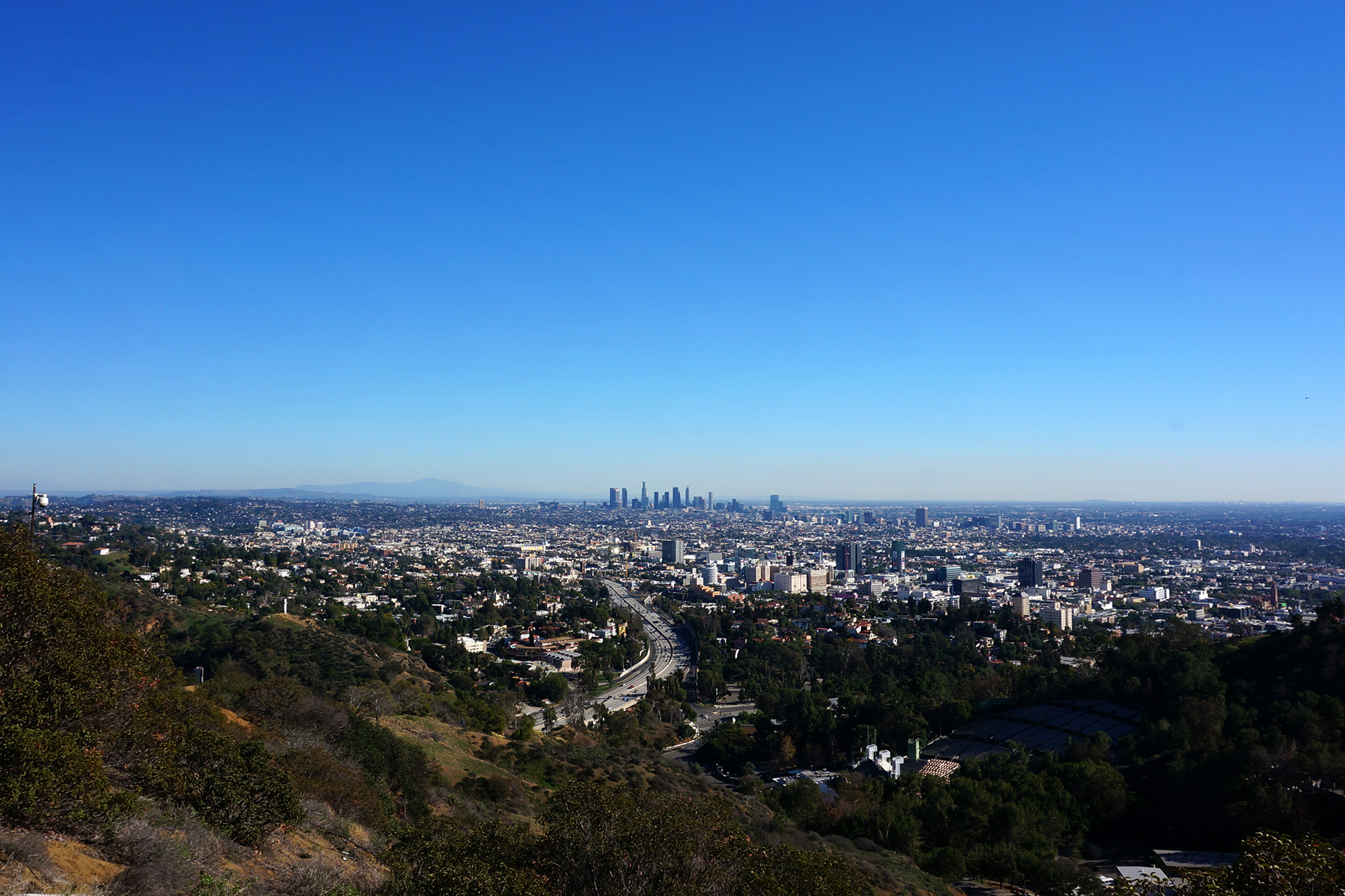
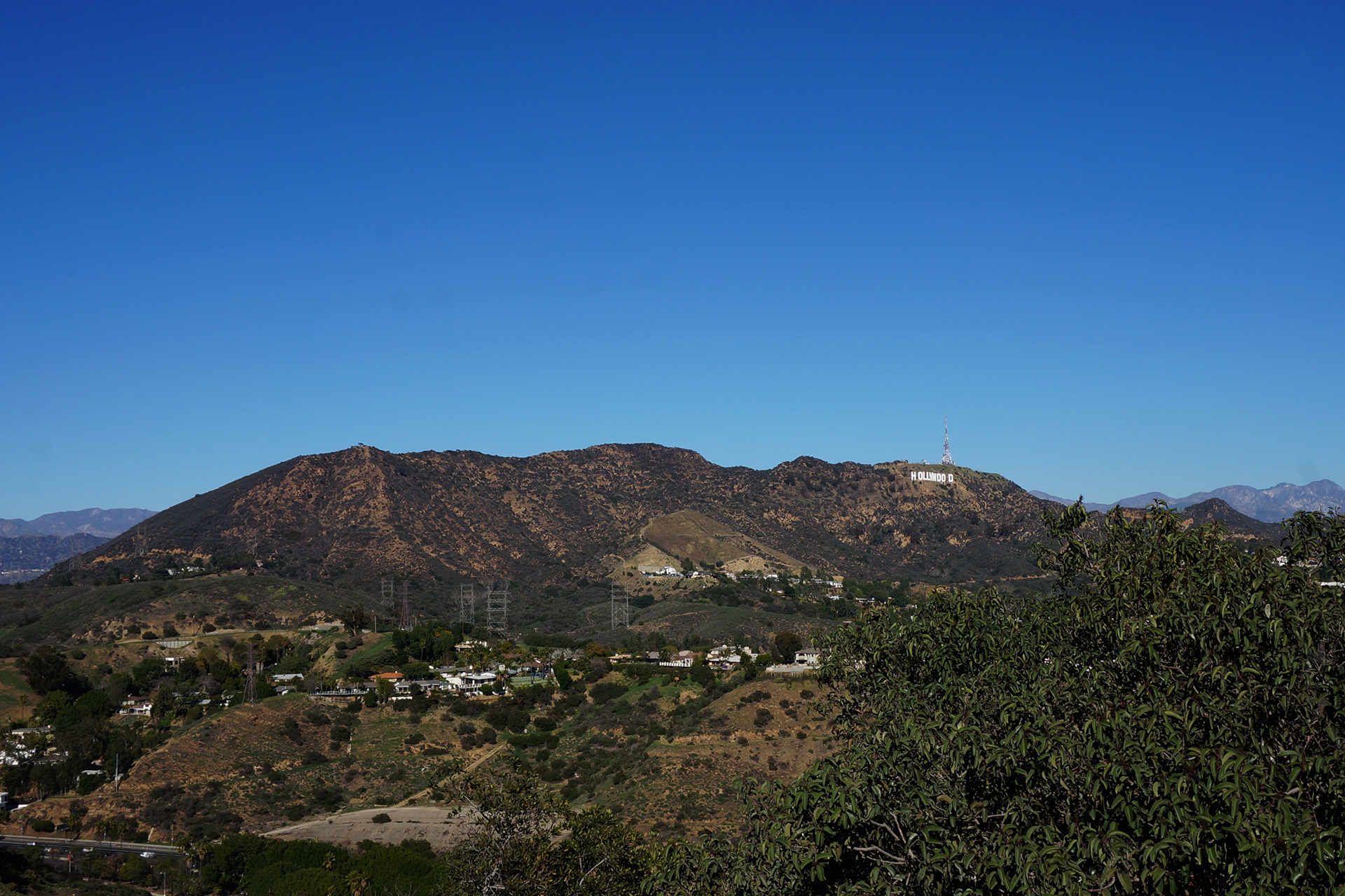
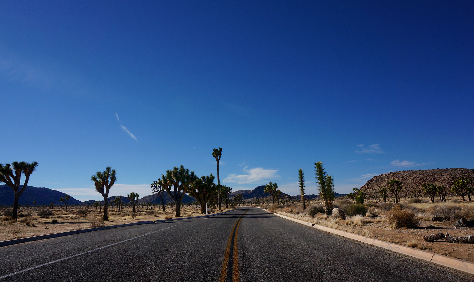
After feeling like novice RV drivers, we shook off our little blunder, and marched on to Death Valley.  The drive took us back past Los Angeles, up and over a fairly serious mountain pass, and then into a long descent into a broad plain.  The population began thinning out, and we passed Barstow, then Baker (home to a giant thermometer – don’t visit in the summer), and the road to the Scrabblicious town of Zzyzx.

We turned off the interstate, and towards Death Valley… another 120 miles away.  It was dark by the time we made it to our campsite, basically a painted rectangle in a big dirt parking lot.  We definitely annoyed our star-gazing neighbors with our headlights as we tried to back into the spot in the dark.

We couldn’t see anything outside except for a different neighbor, who was watching a black and white movie outside, on a big-screen TV, using a fairly loud generator.  (We declined his invitation to join.)  So, we went to bed, and the next morning, we awoke to a pretty magical place.

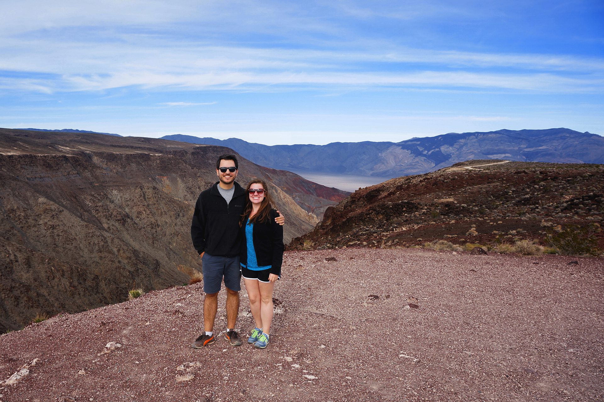
Welcome to Death Valley

The first thing you should know about Death Valley is that it’s a National Park, which means that it’s awesome, and the second thing is that it is huge.  More than 5,200 square miles – roughly the size of Jake’s home state, Connecticut.  It is in California, which is the size of 32 Connecticuts, and it’s tucked away in the eastern part, near Nevada.  There isn’t a whole lot around.

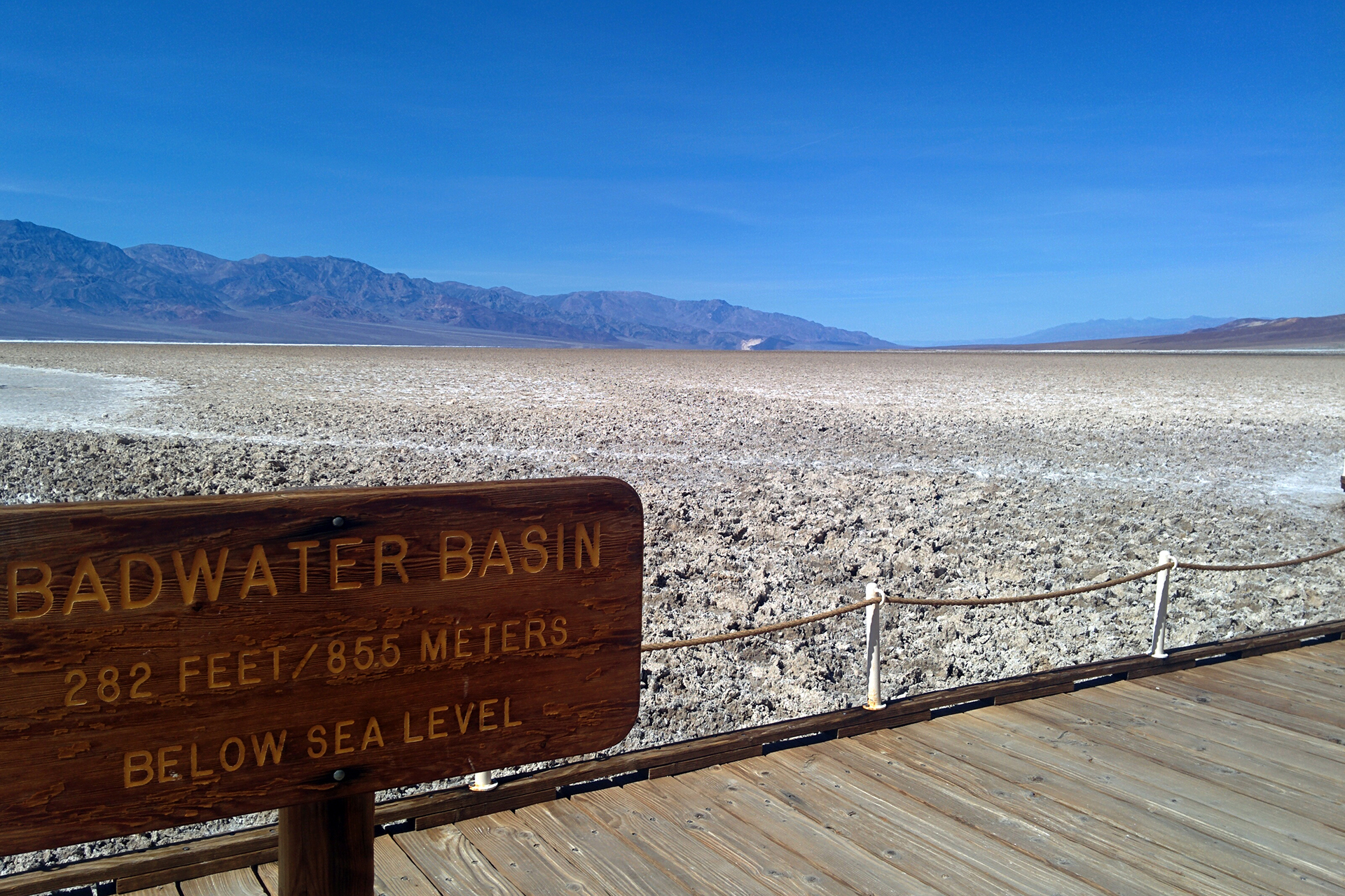
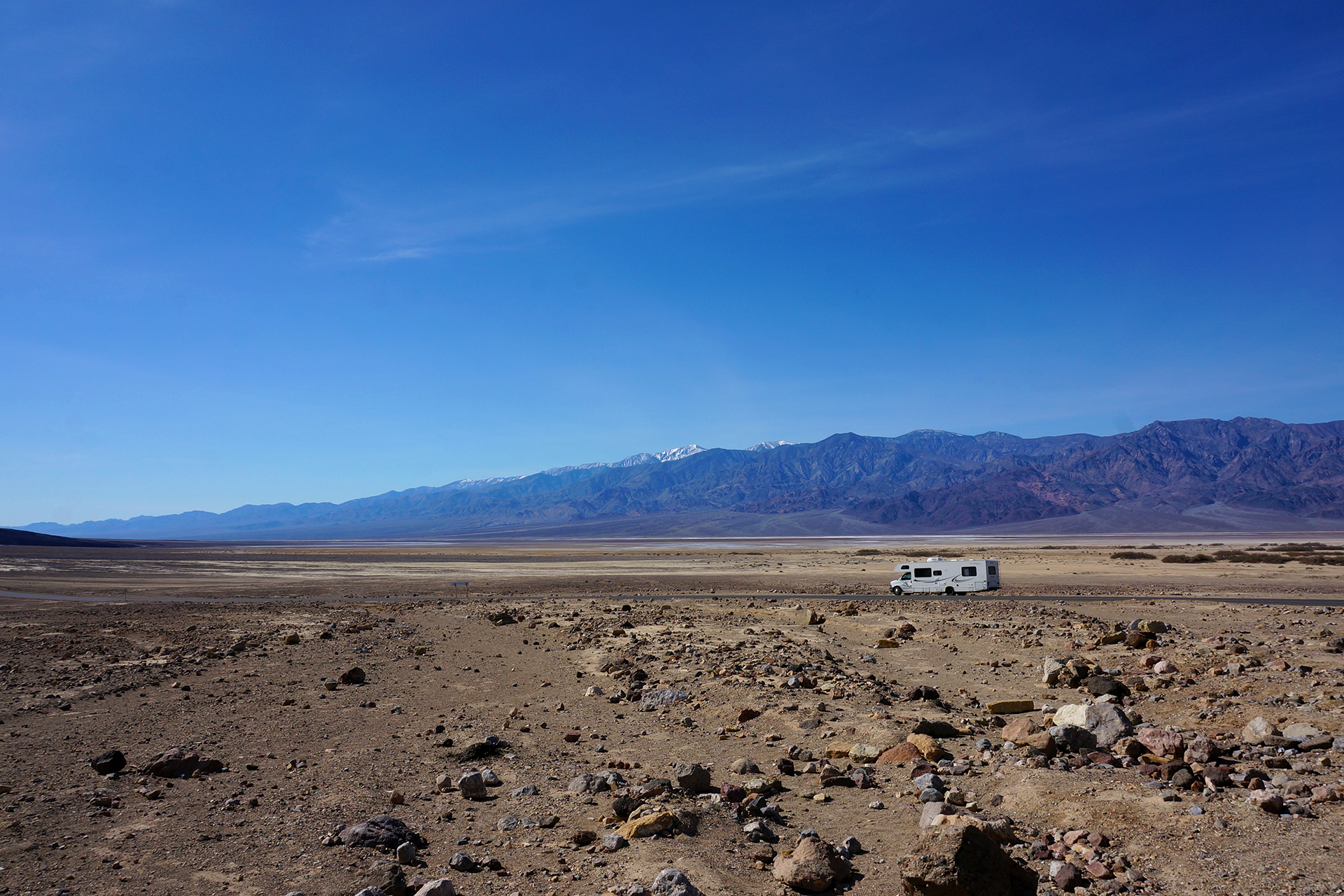
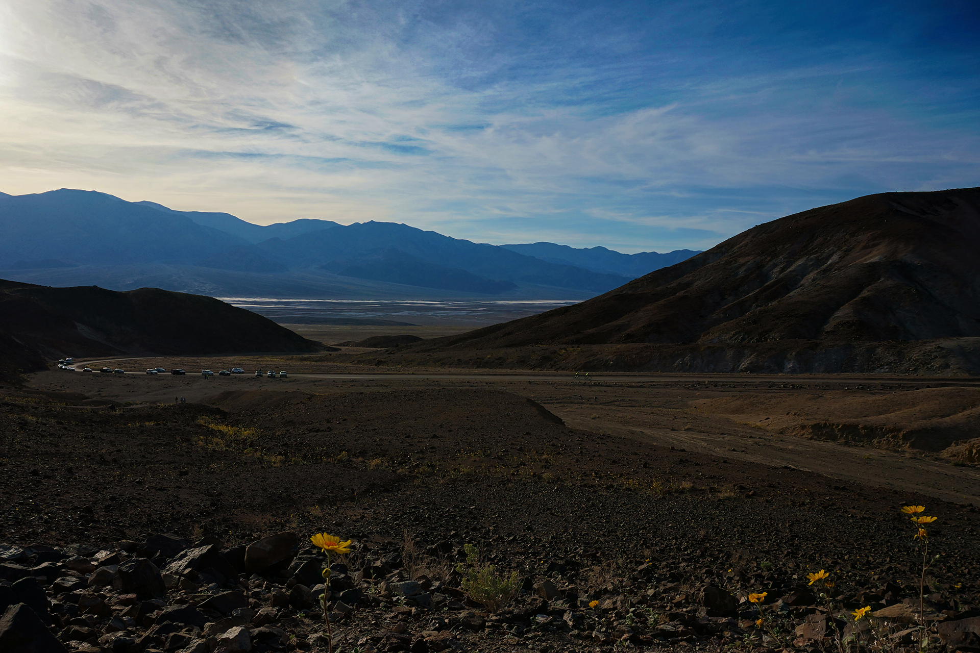
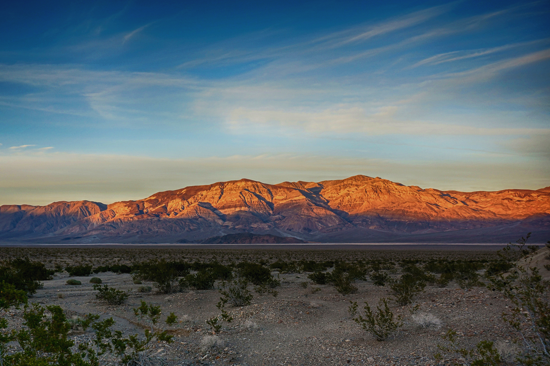
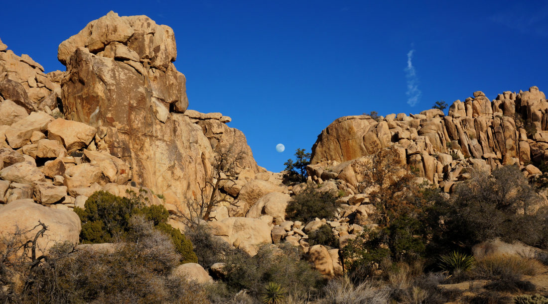
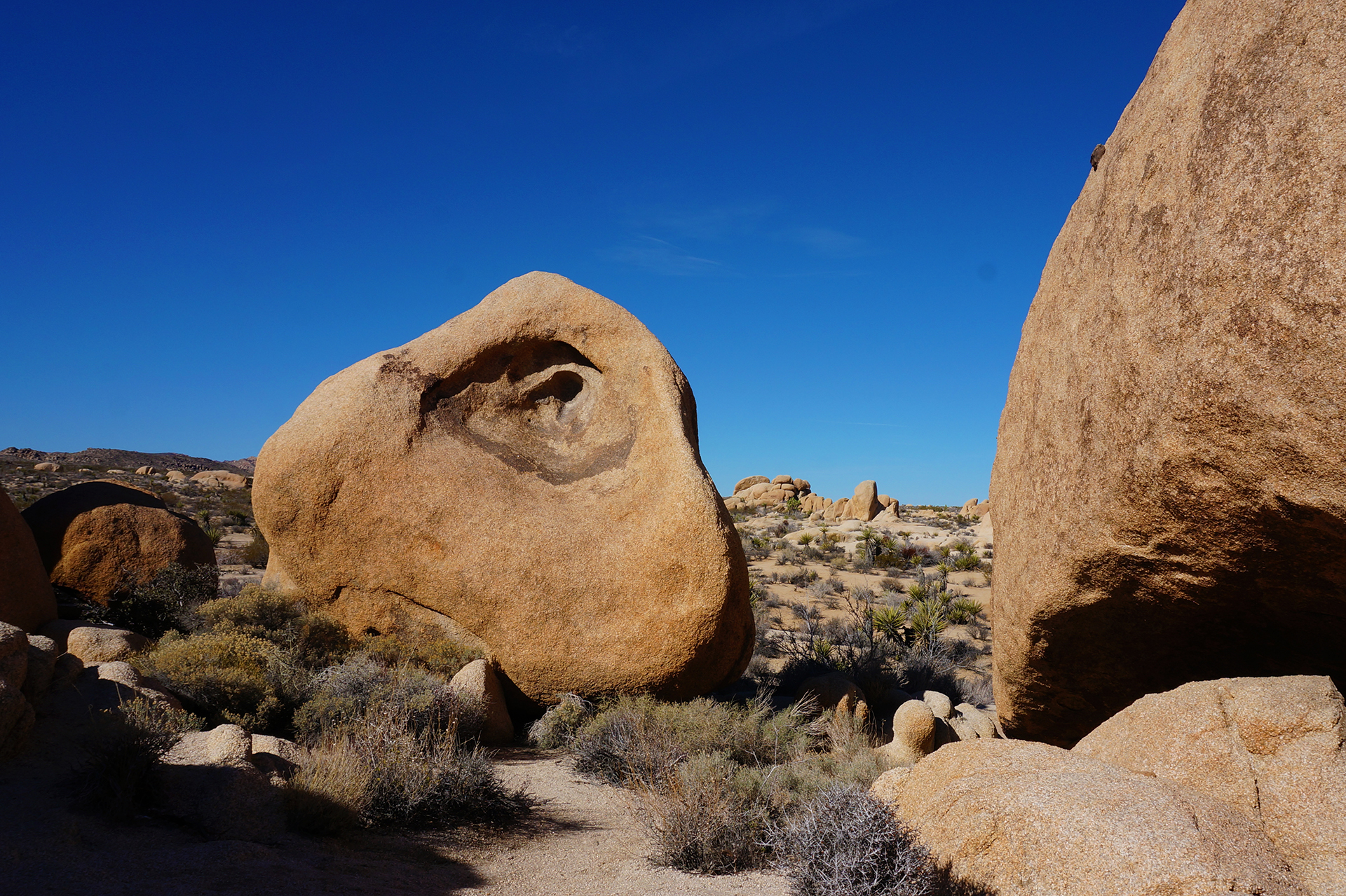
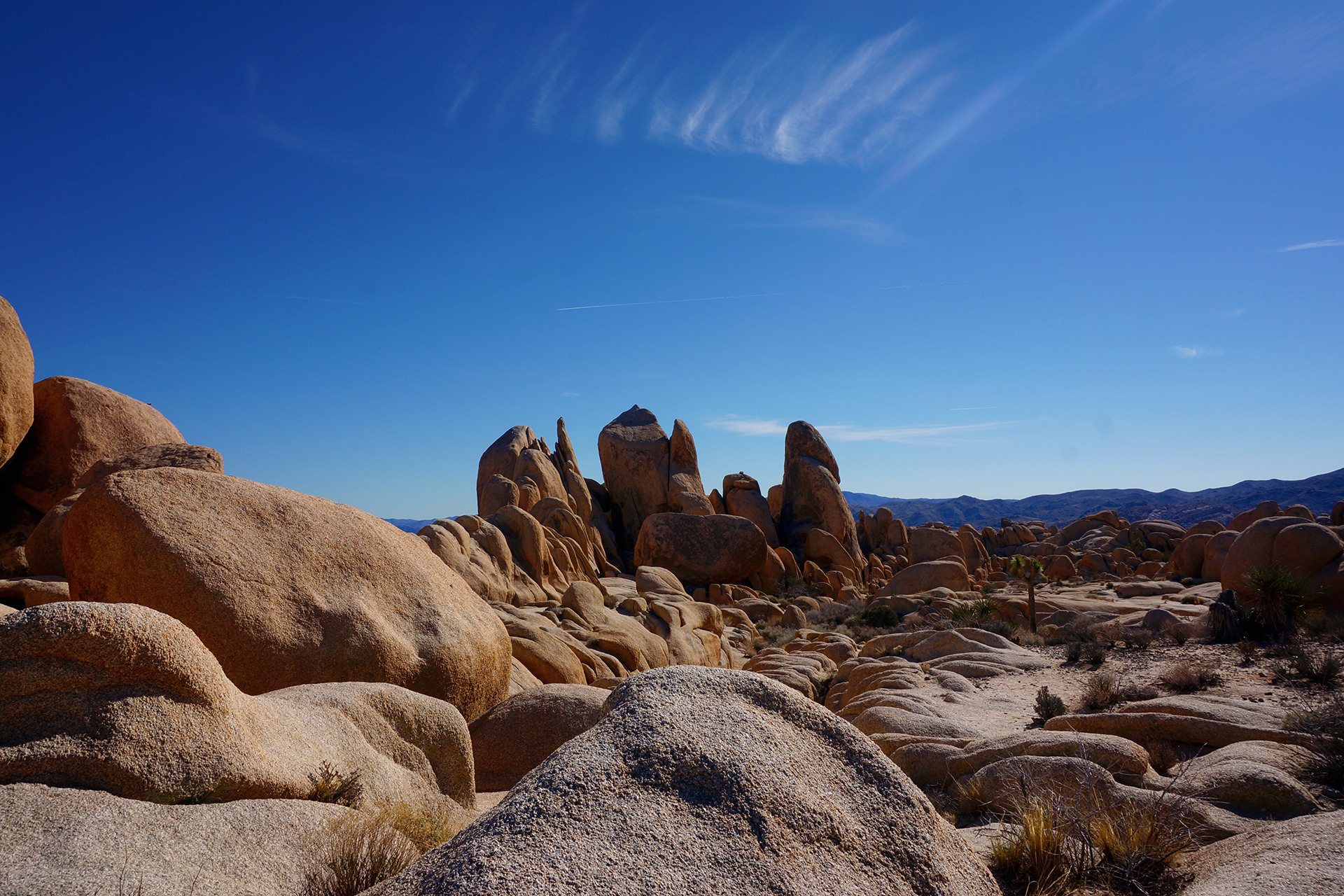
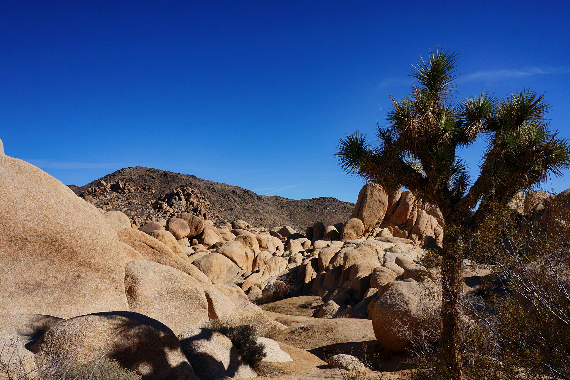
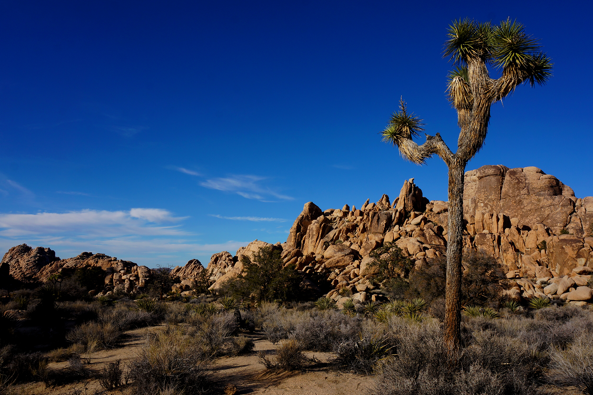
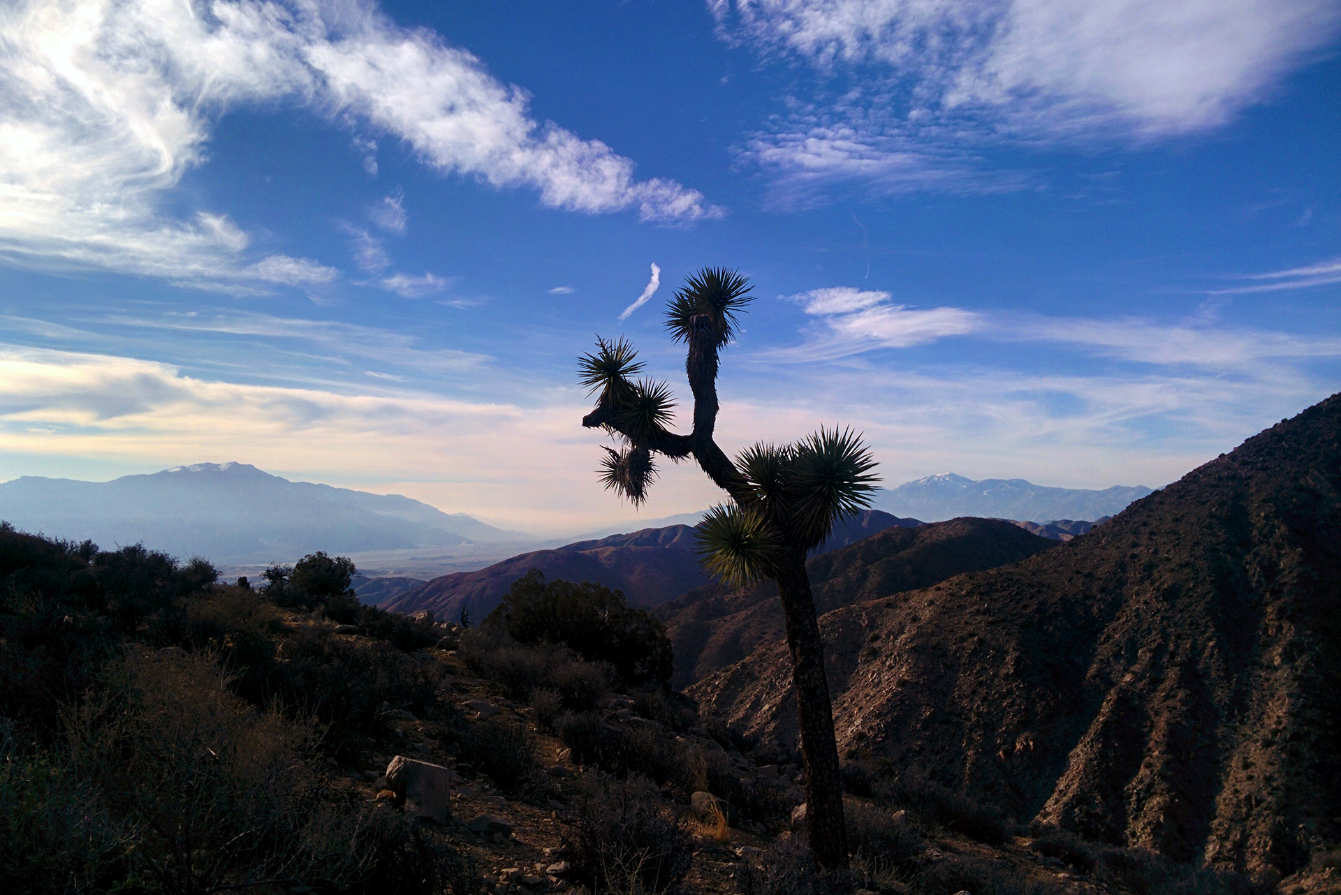
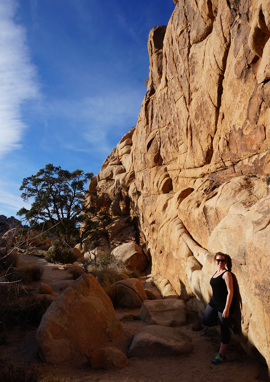
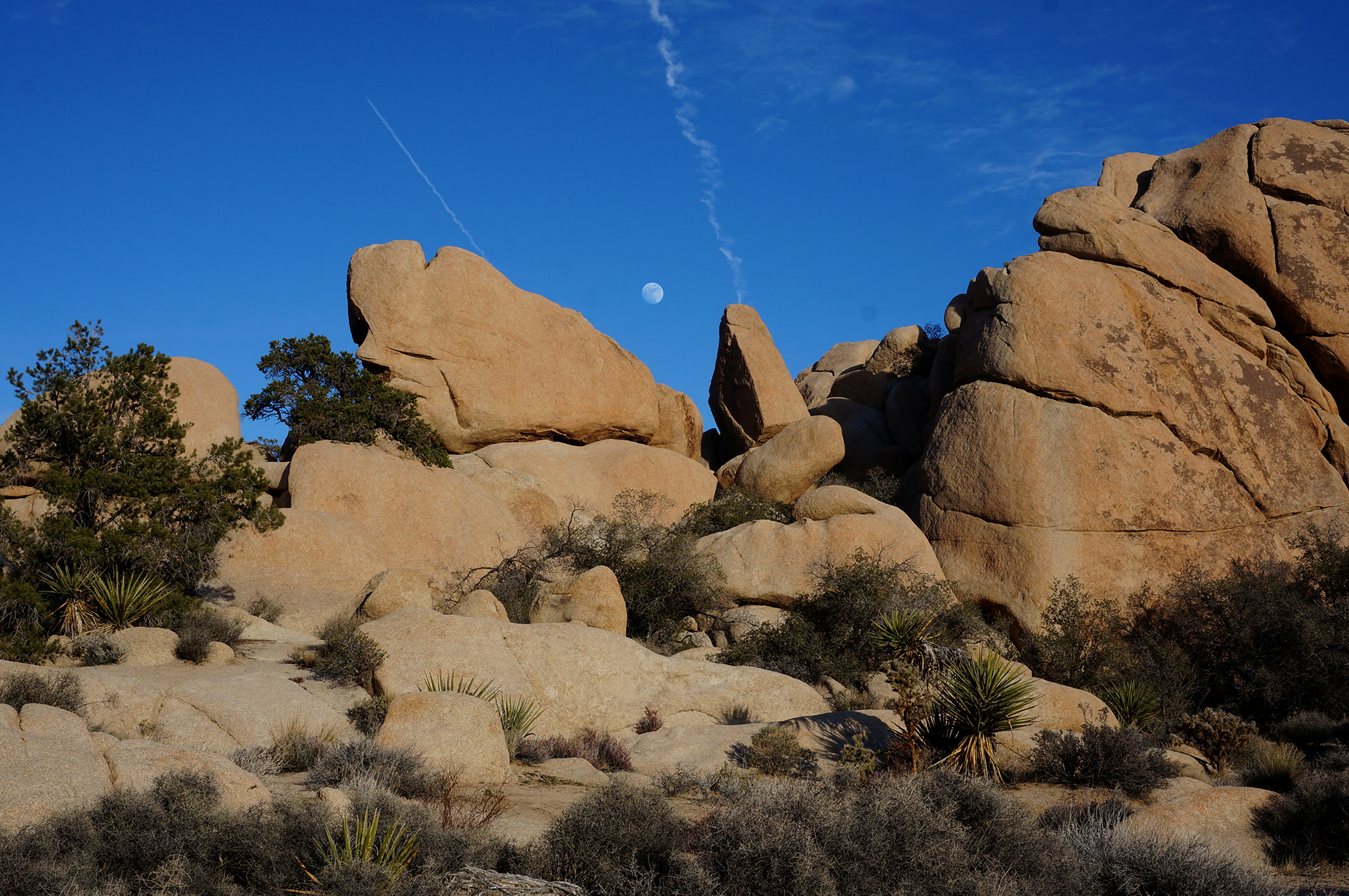
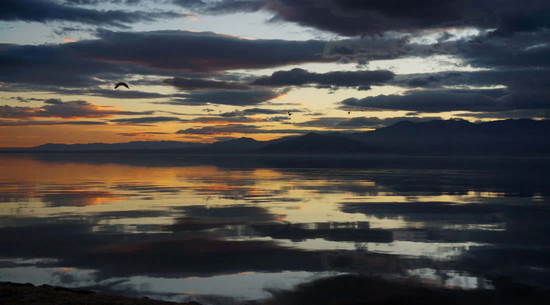
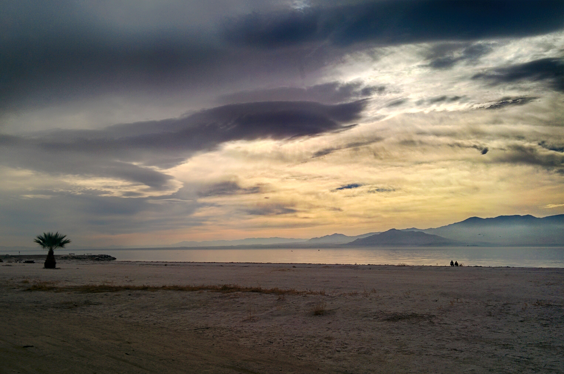
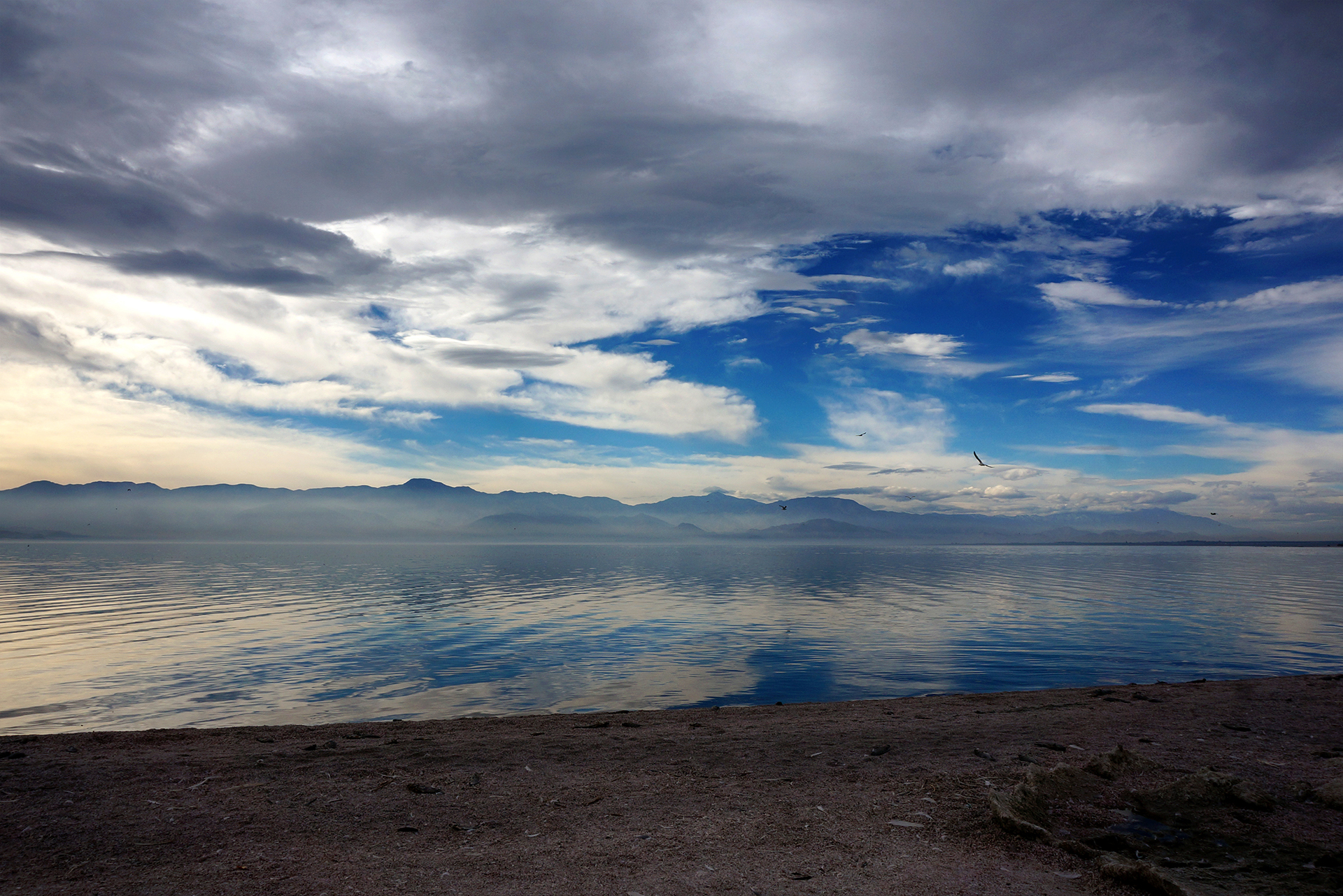
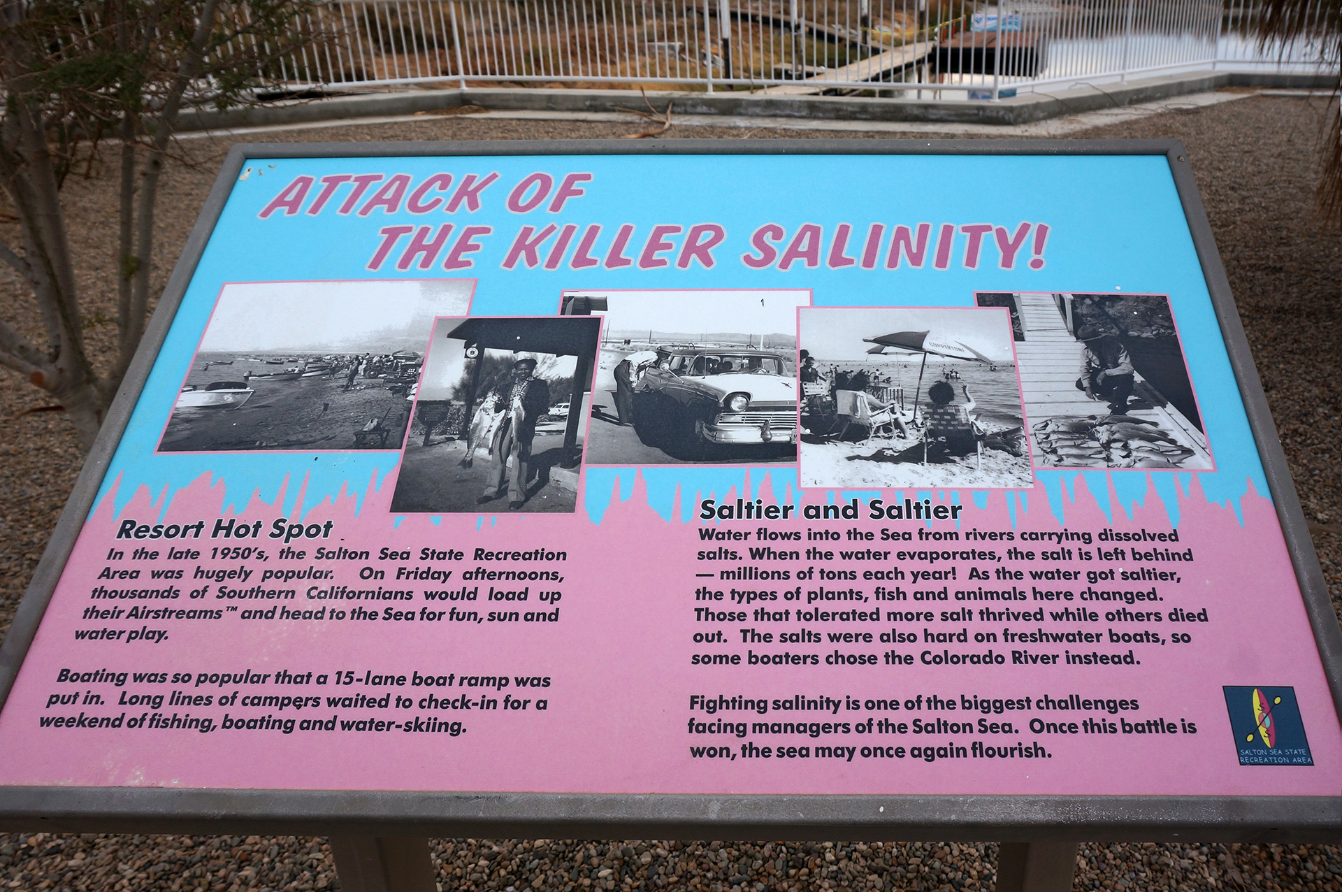
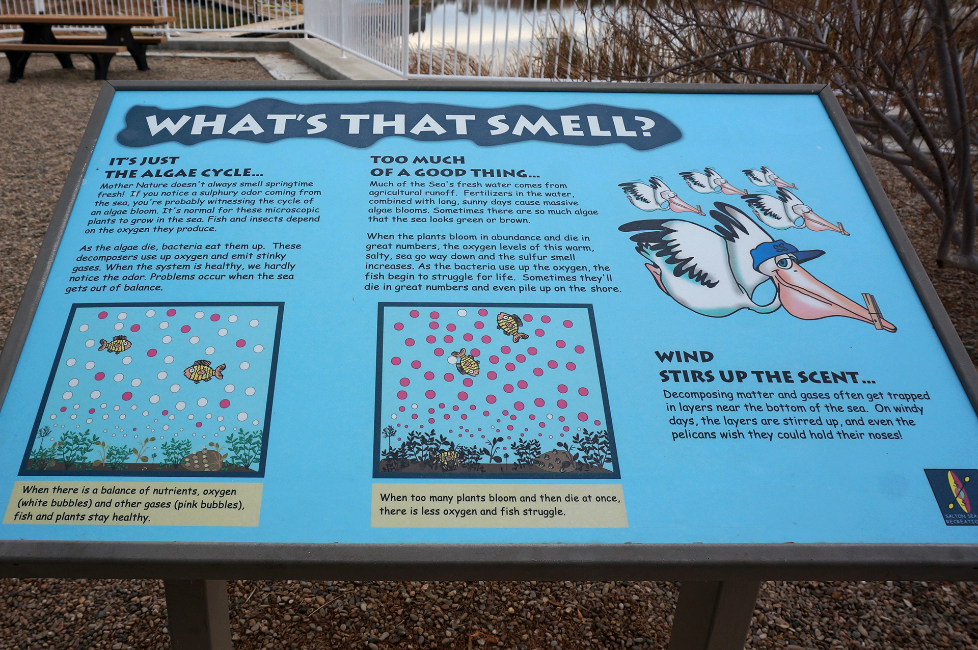
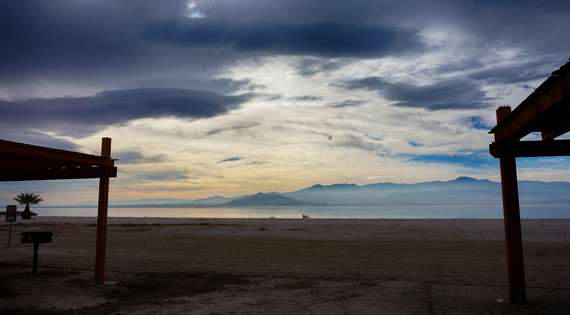
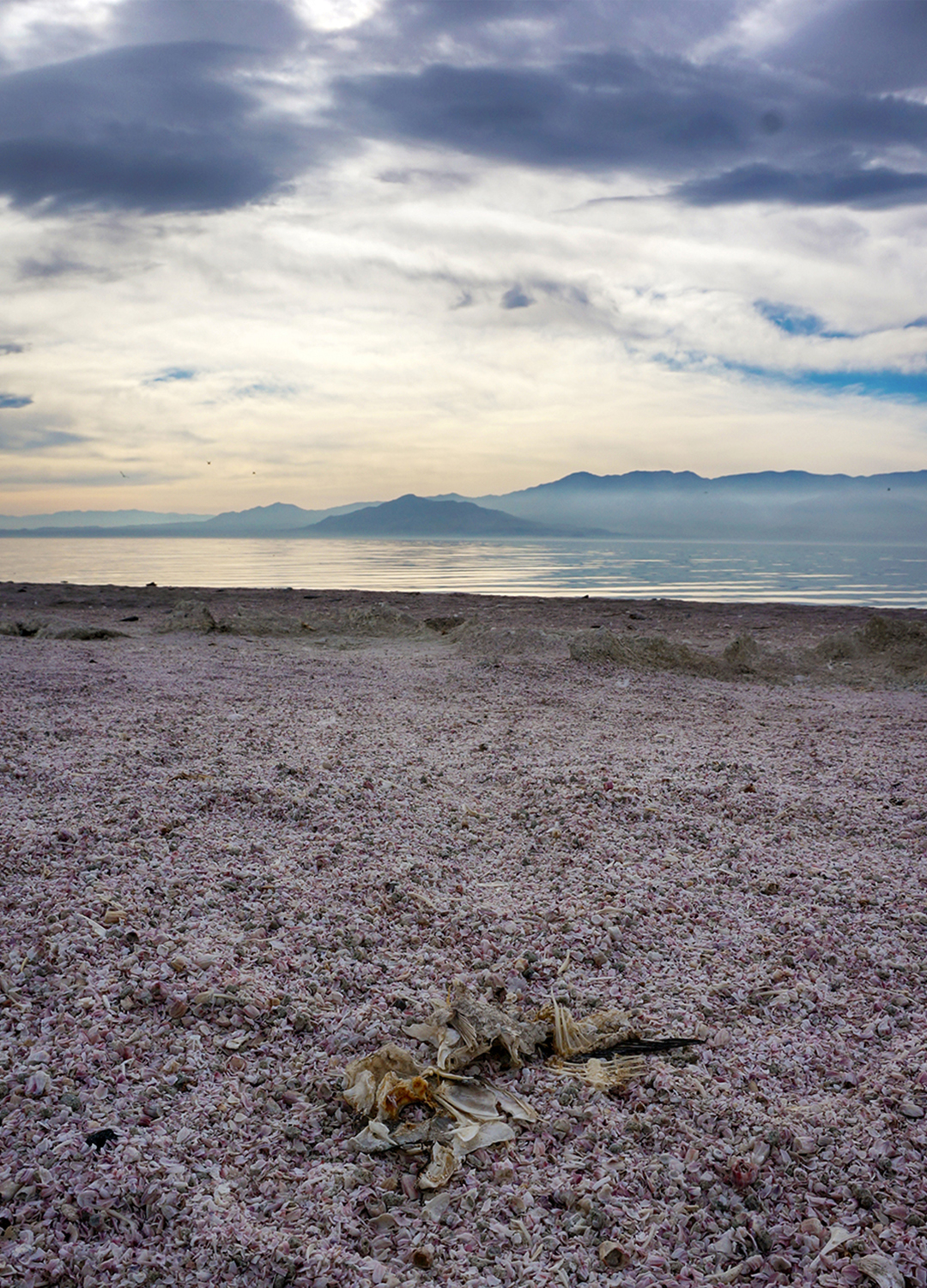
Now, just about everyone has heard of Death Valley, and they probably know it is dryhot, and low.  All of those things are true – much of Death Valley is dry and hot, and the low parts are very low: at 282 feet below sea level, it is the sixth-lowest place on Earth (just ahead of the smelly Salton Sea). But most people (like past Jake and Heather) do not know that Death Valley is also full of stunning mountain ranges, beautiful rock formations, and towering sand dunes.

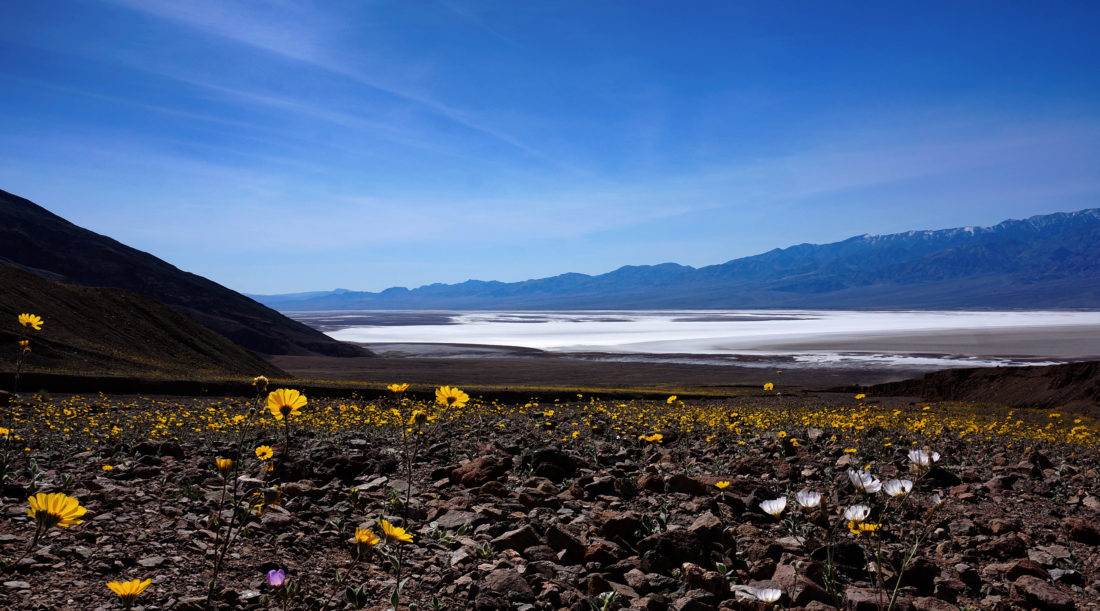
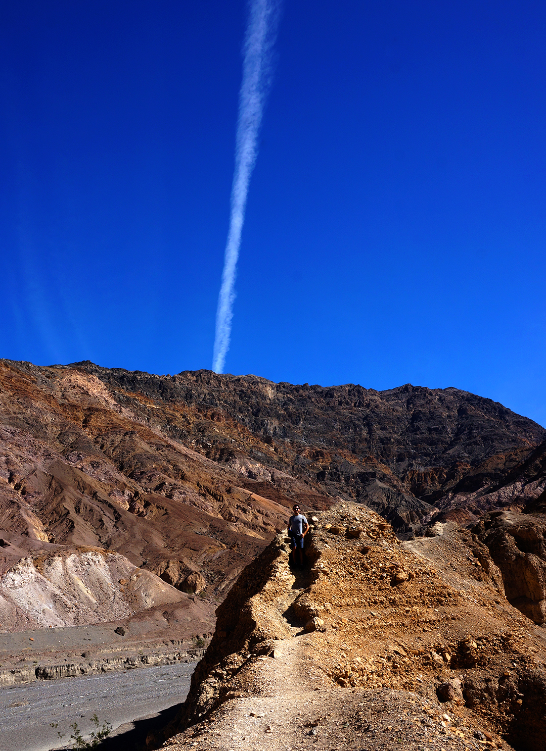
If you go hiking up in the mountains, you’ll find some very unexpected things, like a waterfall.  And if you are lucky enough, and visit during just the right February, you will be treated to something spectacular: a once-in-a-decade wildflower superbloom.

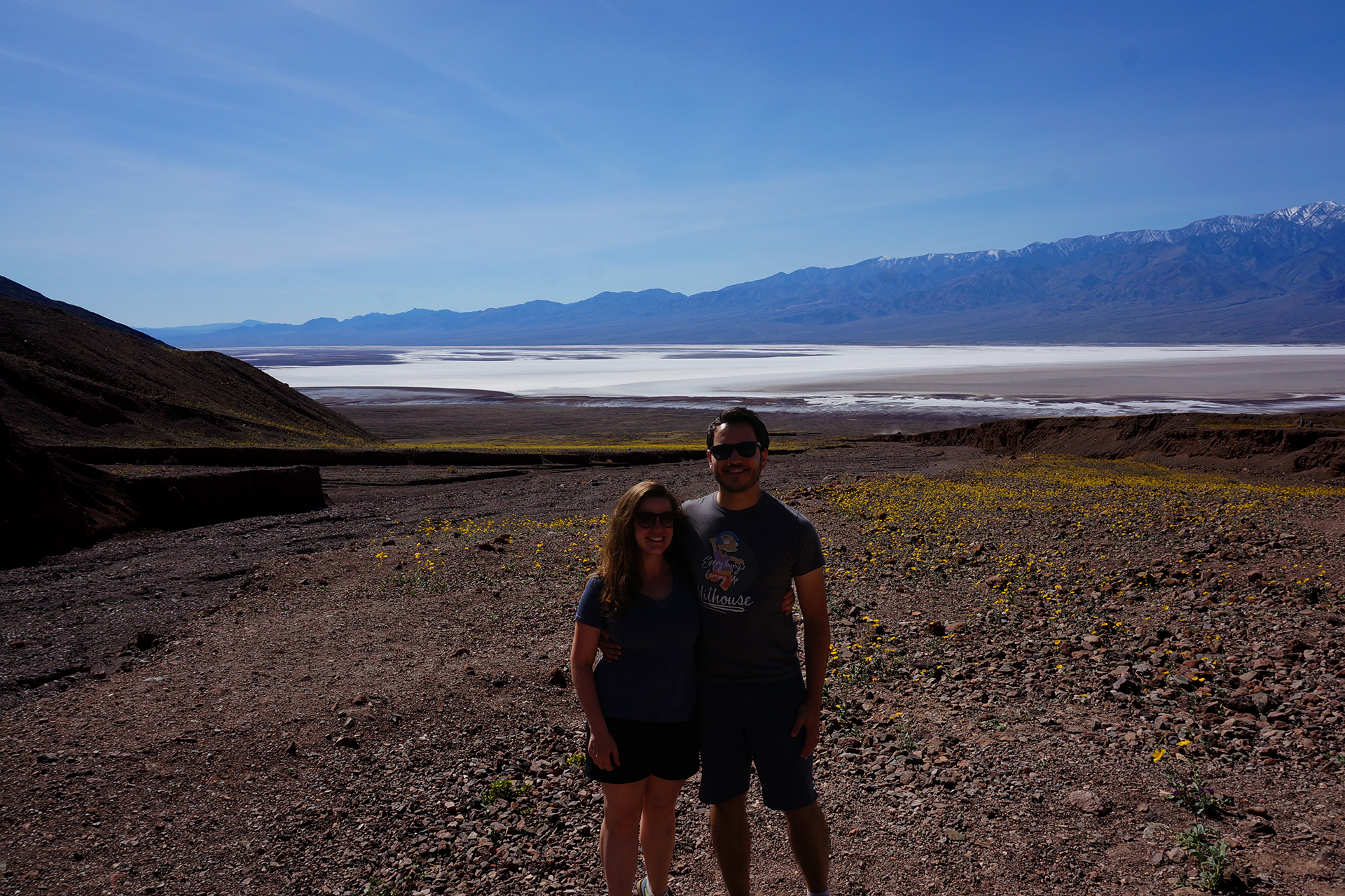
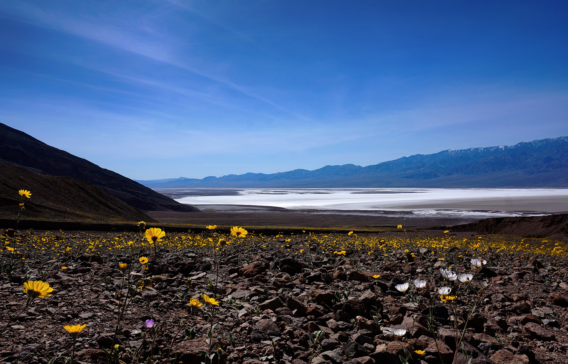
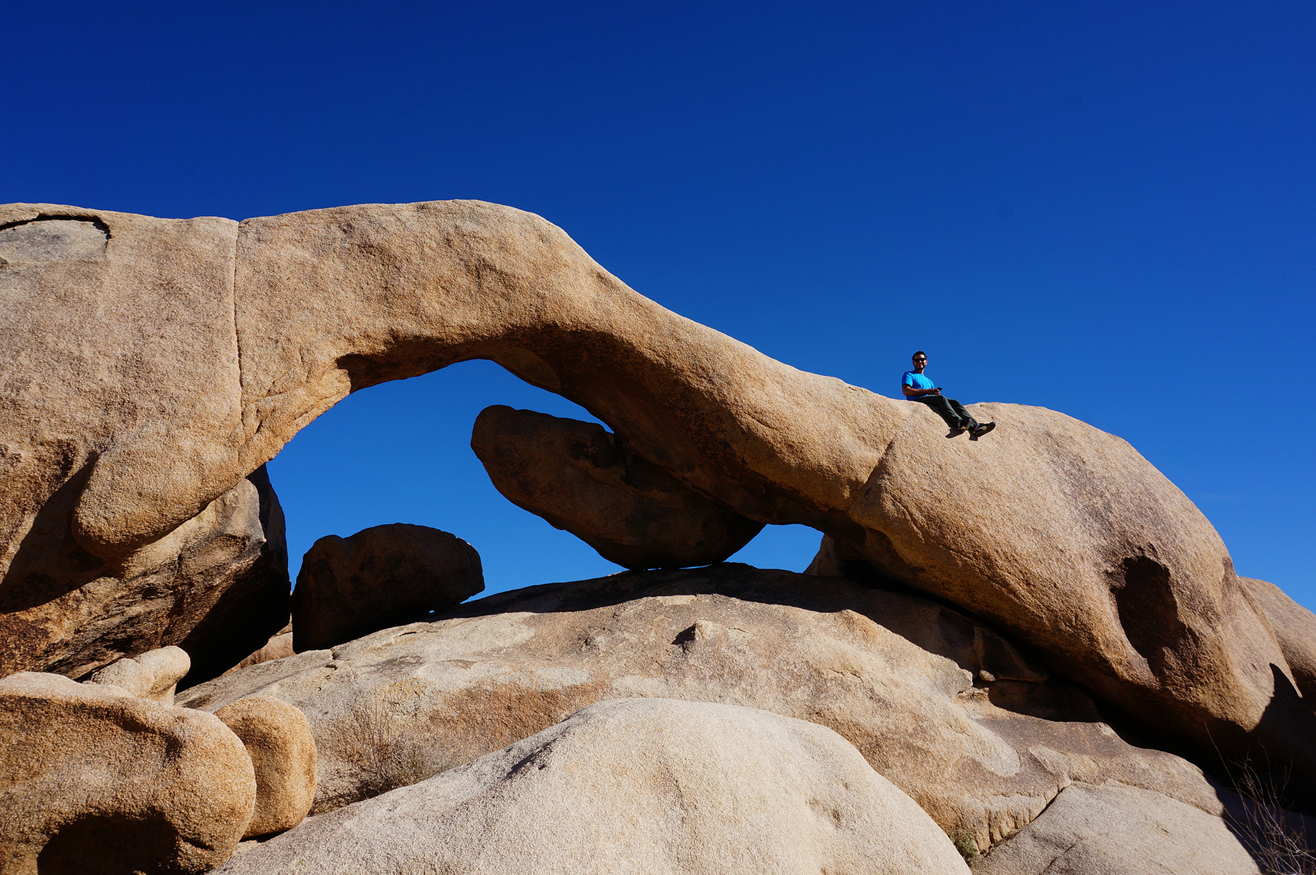
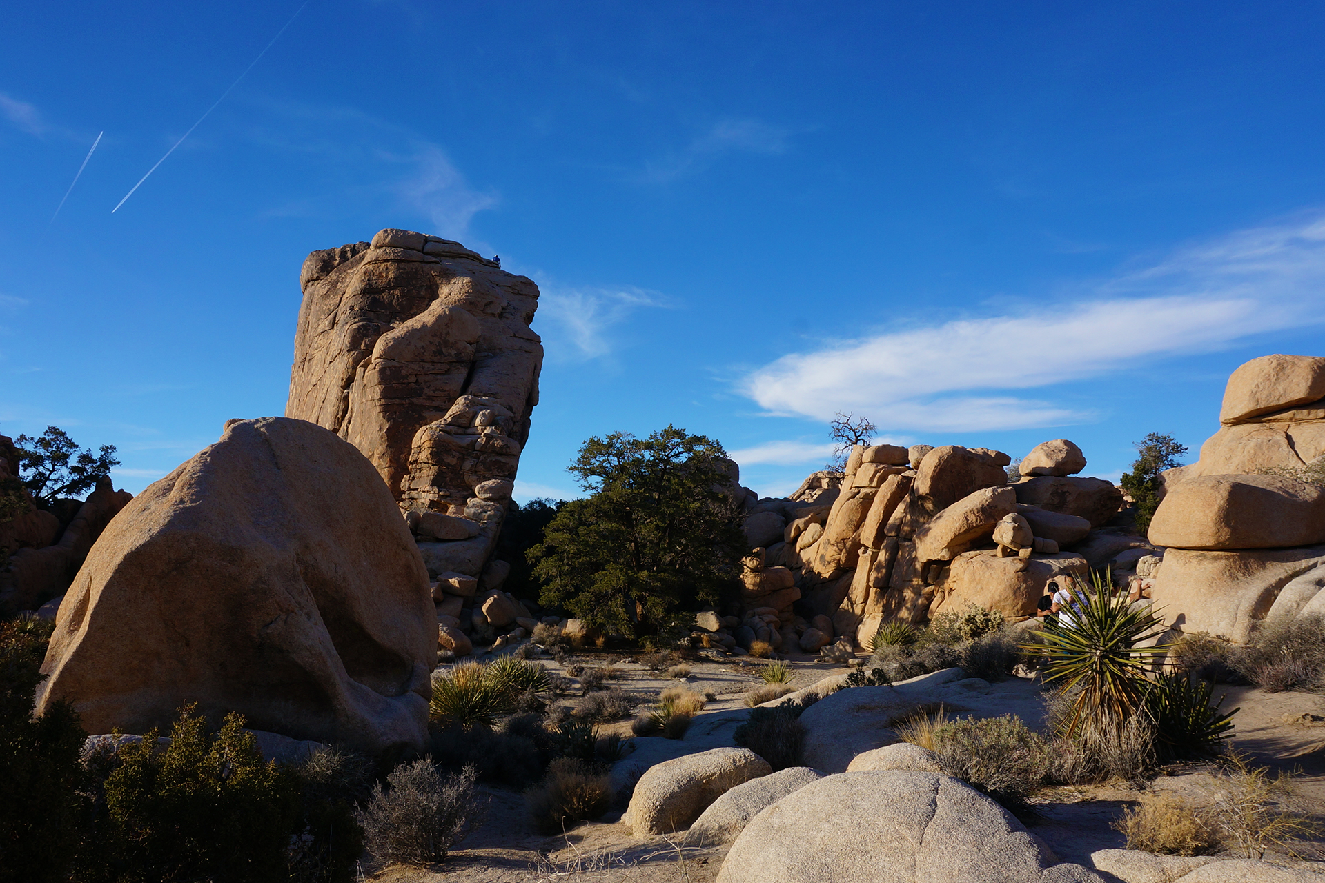
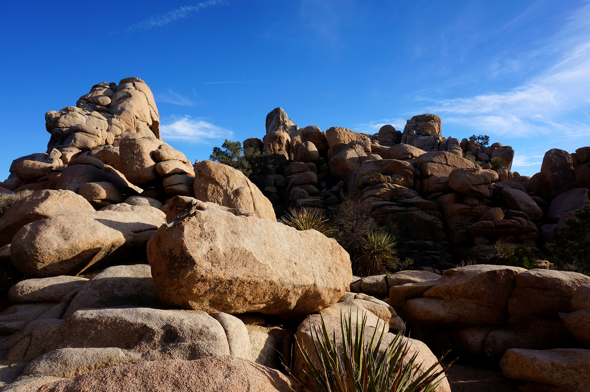
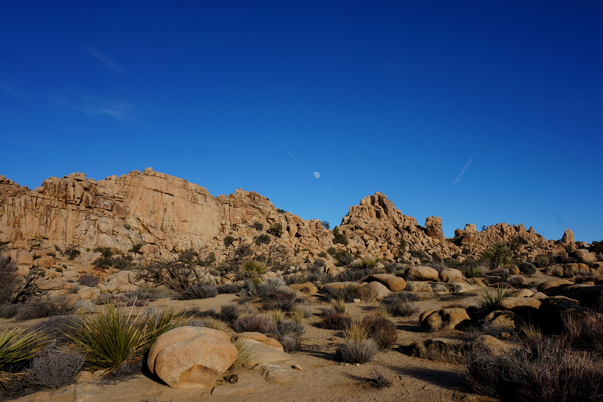
Death Valley National Park is a totally unique, beautiful, and surreal world, the ultimate desert. The mountains and rocks here are not gray and featureless, but vibrantly colorful.  There are salt flats, shimmering white, covered with undulating patterns.  There are sand dunes, canyons, and arches, and the stars shine brighter in Death Valley than almost anywhere on Earth.  And when we were there, it was carpeted with wildflowers.
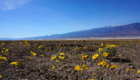
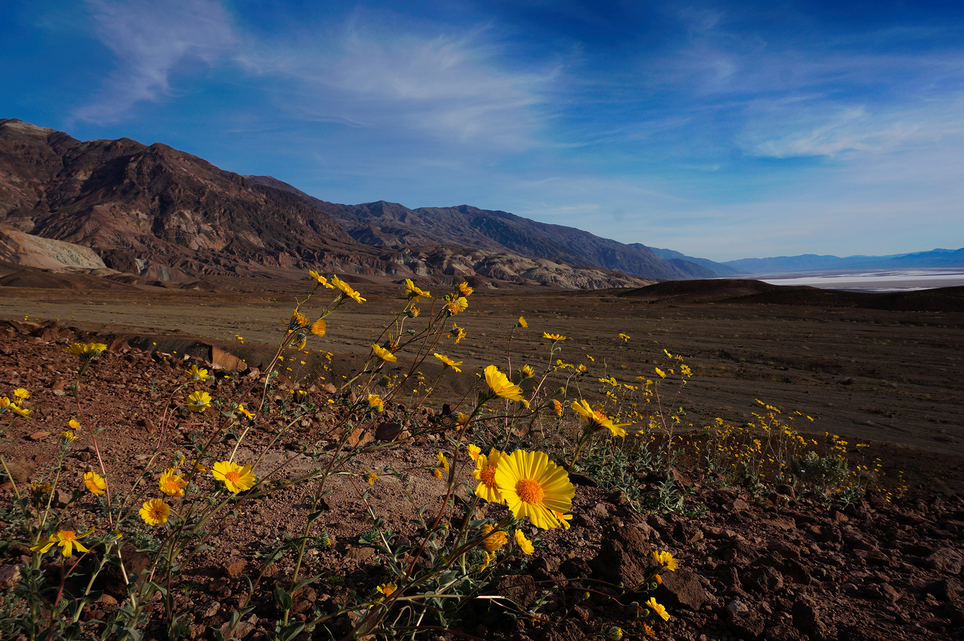
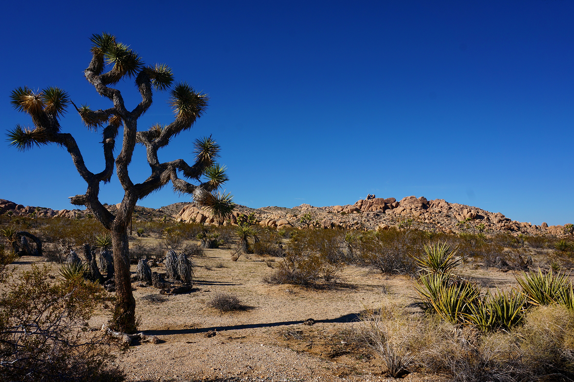
Flower Power

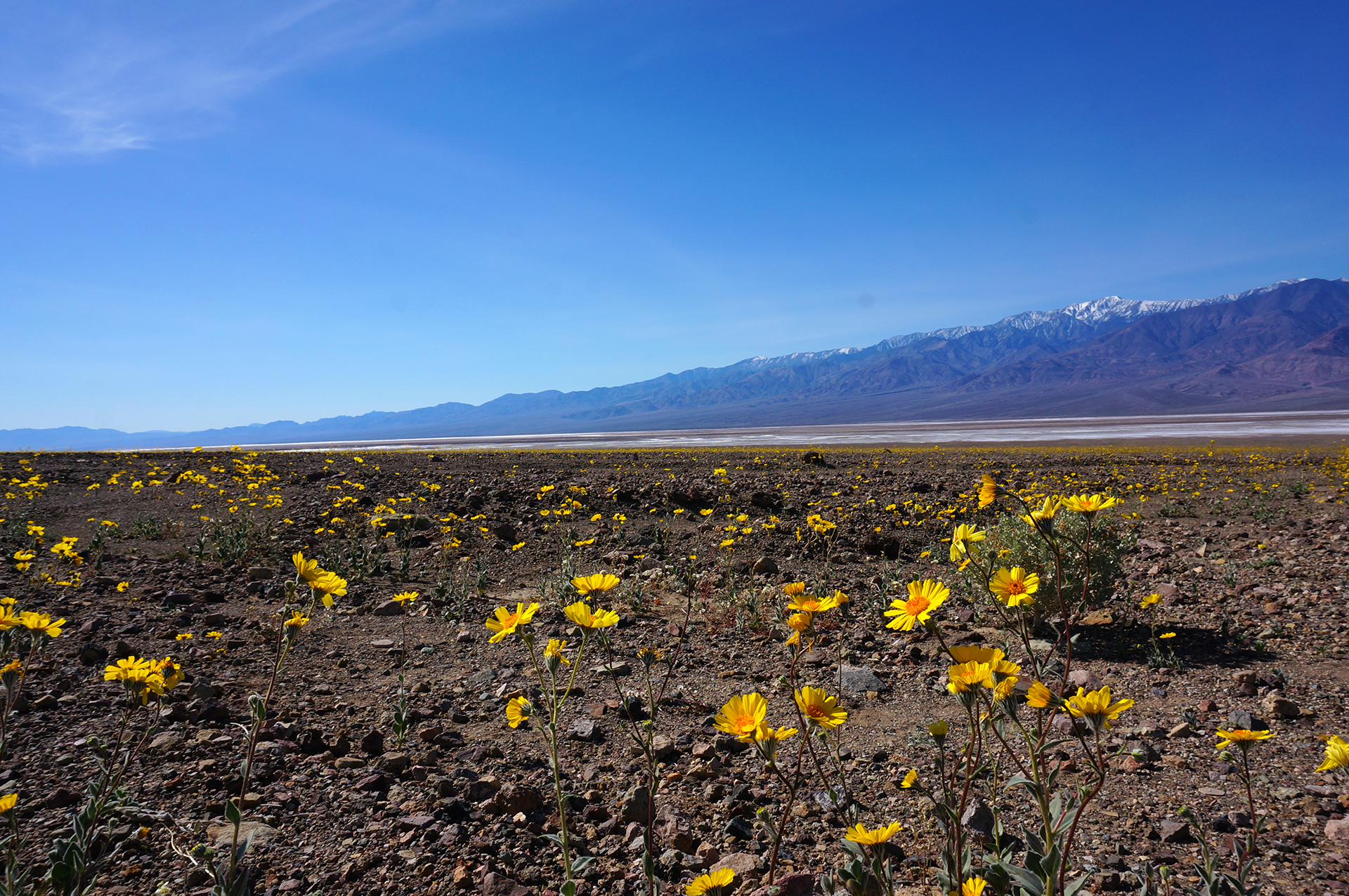
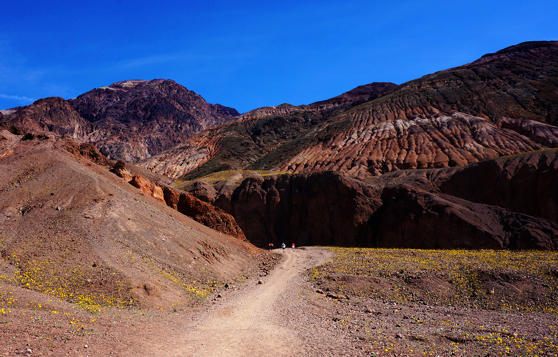
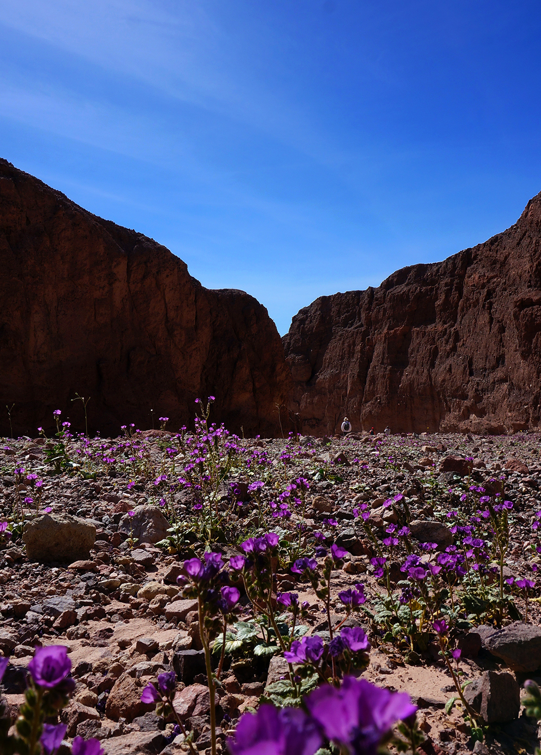
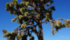
Death Valley experienced a wildflower “superbloom” this Spring, basically because it rained last October.  We understand it is normally bare, but when we were there, the flowers were growing everywhere throughout the park.  Vast fields of yellow flowers covered the rock, flecked with white and purple flourishes like paint from a flicked brush.

The flowers were a constant companion in our exploration of Death Valley.  Unlike most places you see flowers, these grow on what otherwise looks like bare rock, so there’s nothing green behind it.  The effect is totally unique, seemingly flaunting the impossibility of what nature has produced.

Like everyone else at Death Valley, we also took their picture!  A lot. It wasn’t unusual to see people pulled over on the side of the road, wandering into the wildflower meadows with their cameras.  We did it too, and we have to say – frolicking through a wildflower meadow was definitely not what we imagined when we decided to visit Death Valley.

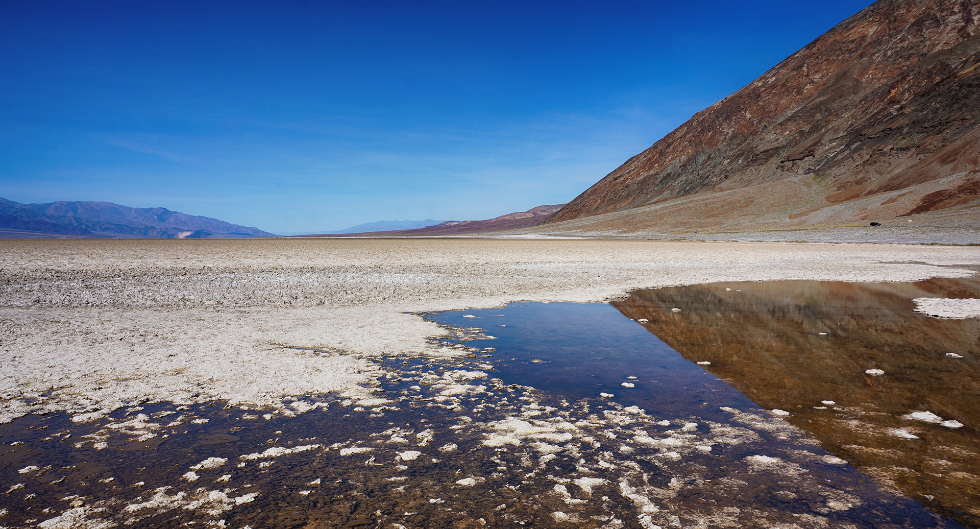
We Went Down, Down, Down

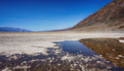
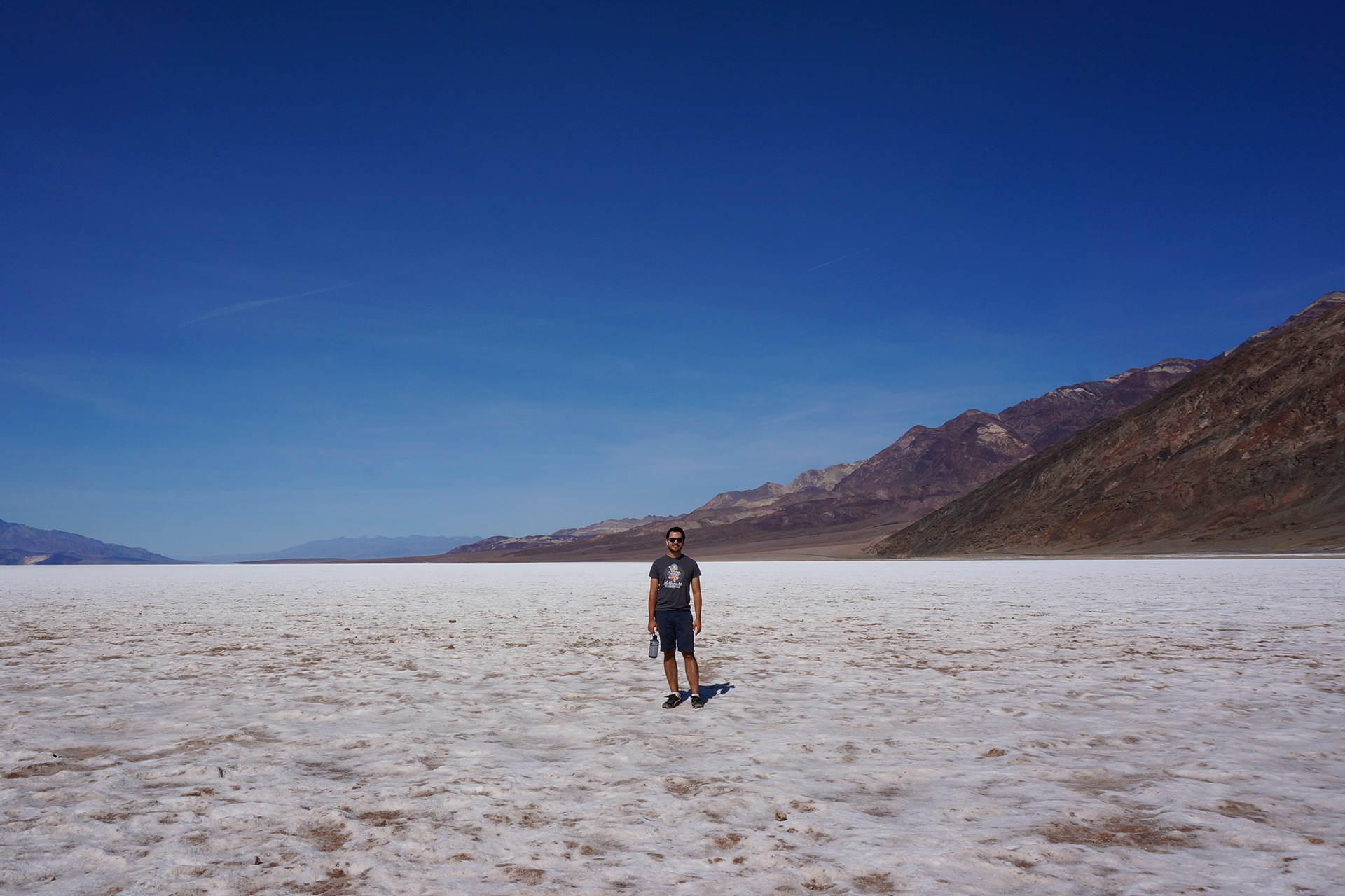
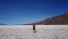
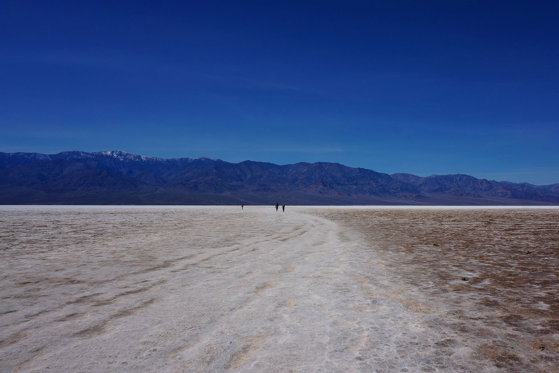
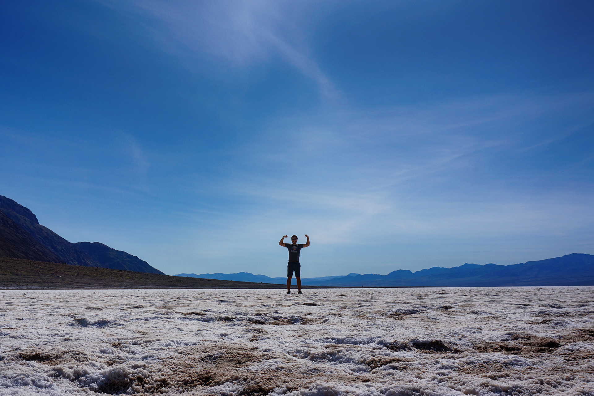
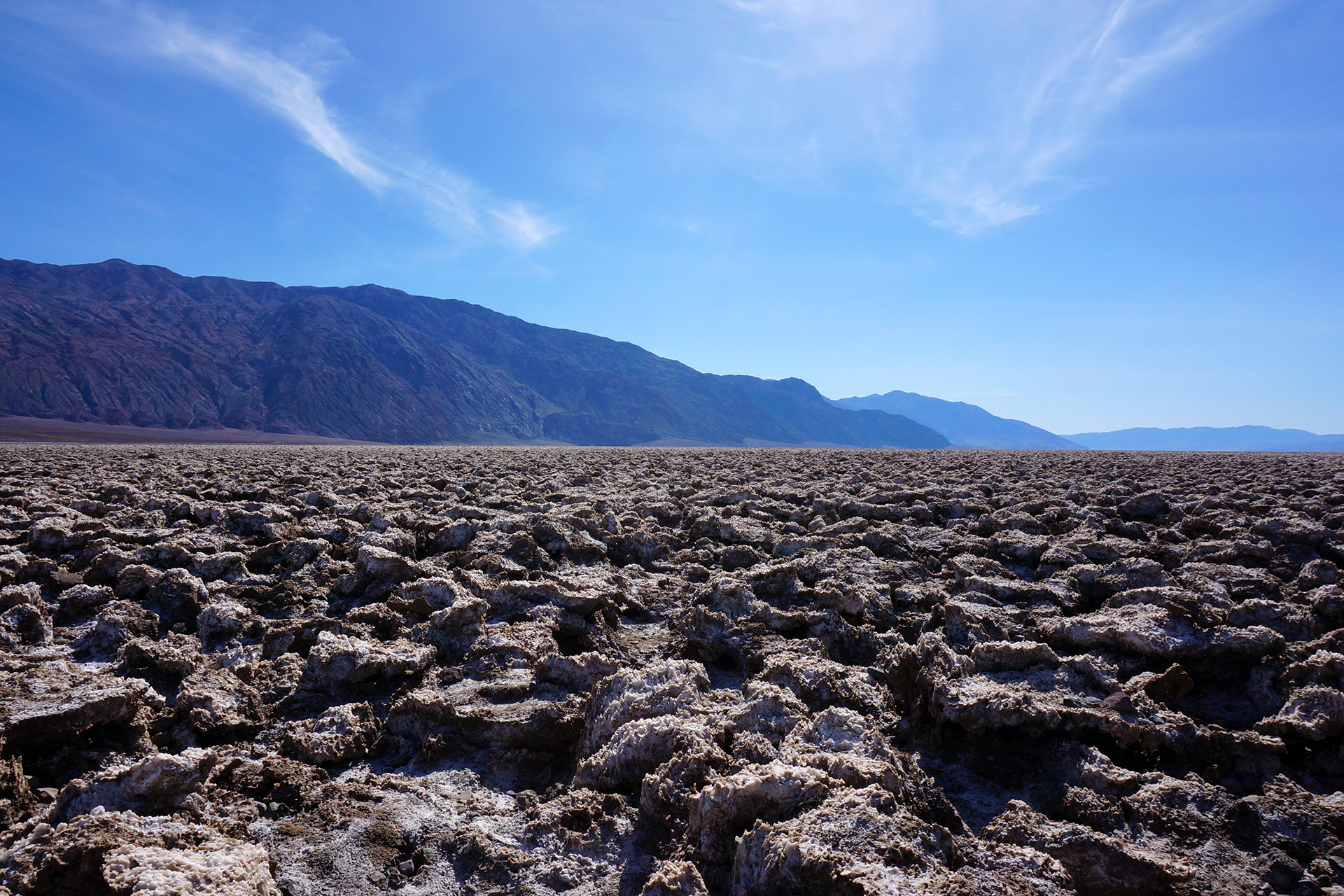
There was a lot to see in Death Valley, so we’re going to start at the bottom and work our way up.  The most famous part of Death Valley is the salt flats, specifically the area named Badwater Basin (named for a small pond you definitely don’t want to drink from). As we mentioned, it sits at -282 feet below sea level, making it one of the lowest places on Earth.

The salt flats are the result of thousands of years of flash floods, which wash salt and other minerals off the nearby peaks and into the low-lying valley before evaporating.  The salt forms into an array of geometrical patterns, endlessly shifting with the wind.  Although the temperature was comfortable, the sun was blazing; if we had visited in the summer, it would have been brutally hot.

An amazing fact about Badwater Basin is that it runs along a mountain range, or really, is part of it – imagine a flat plane, like a piece of plywood, that has been flipped up nearly vertically.  The result is that the peaks just a few miles away rise to more than 11,000 feet.  Seeing something that high from one of the lowest places on earth is surreal.

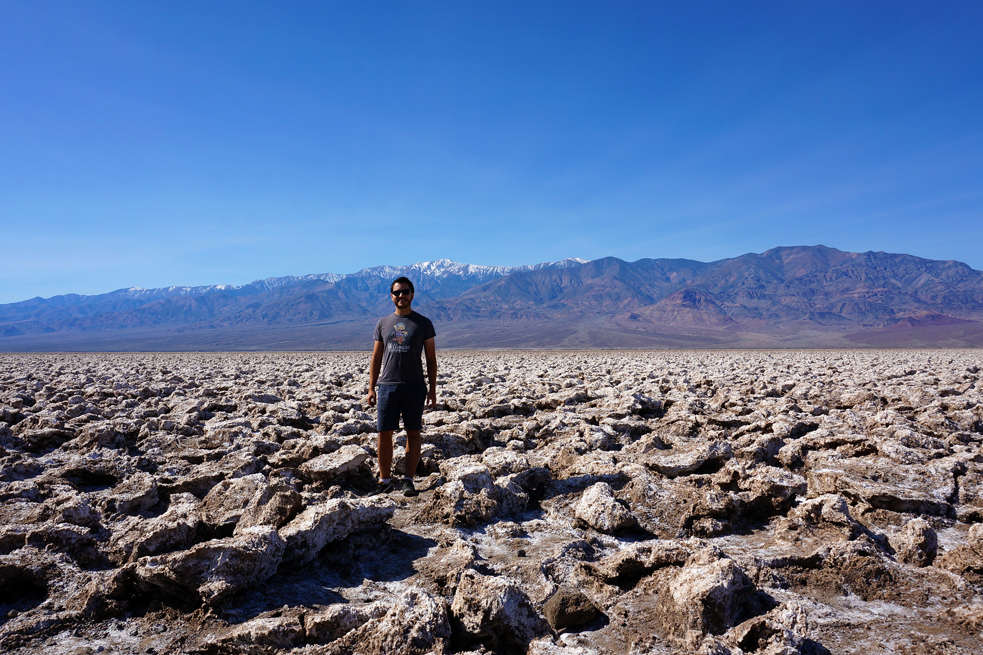
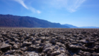
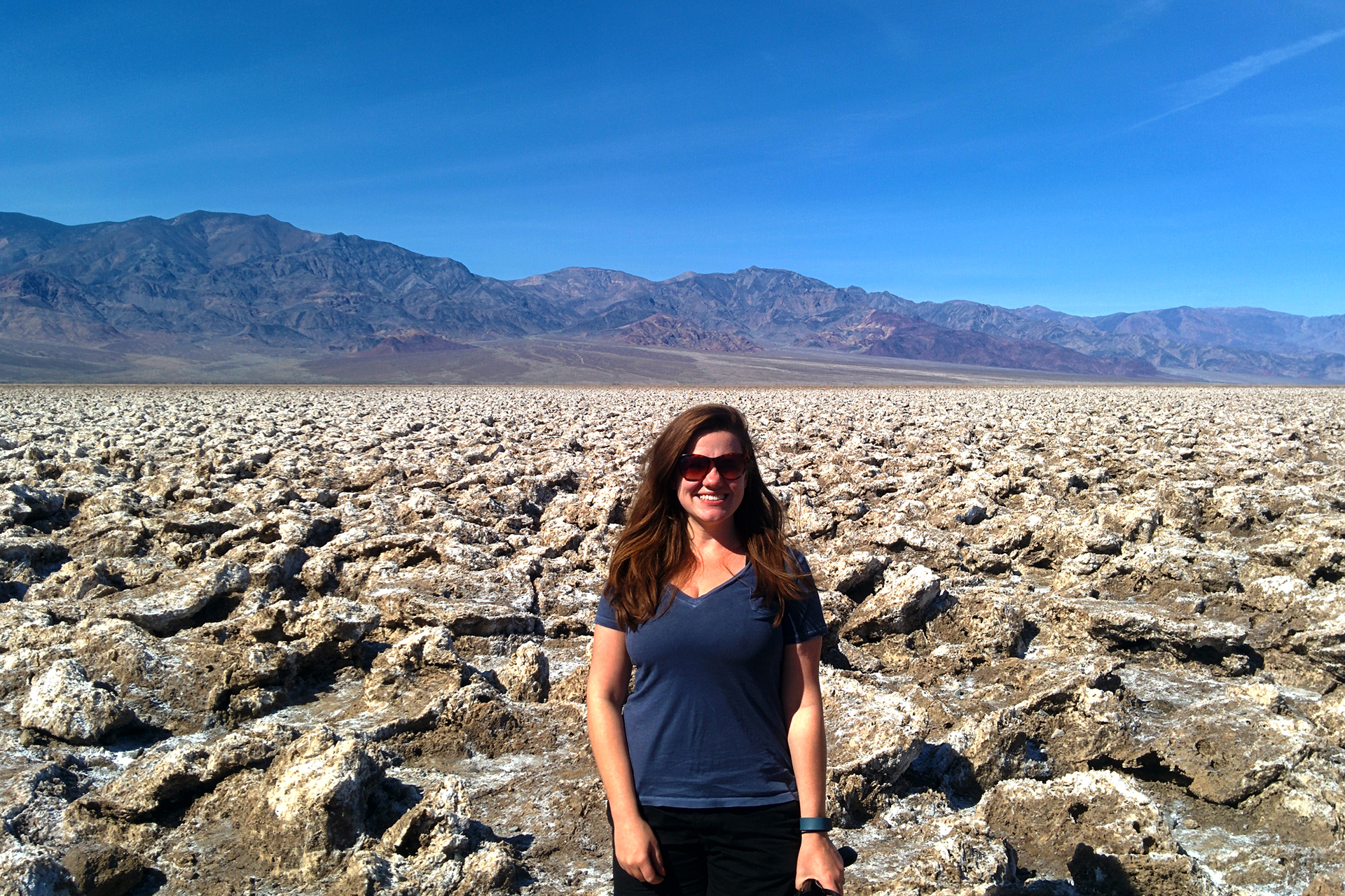
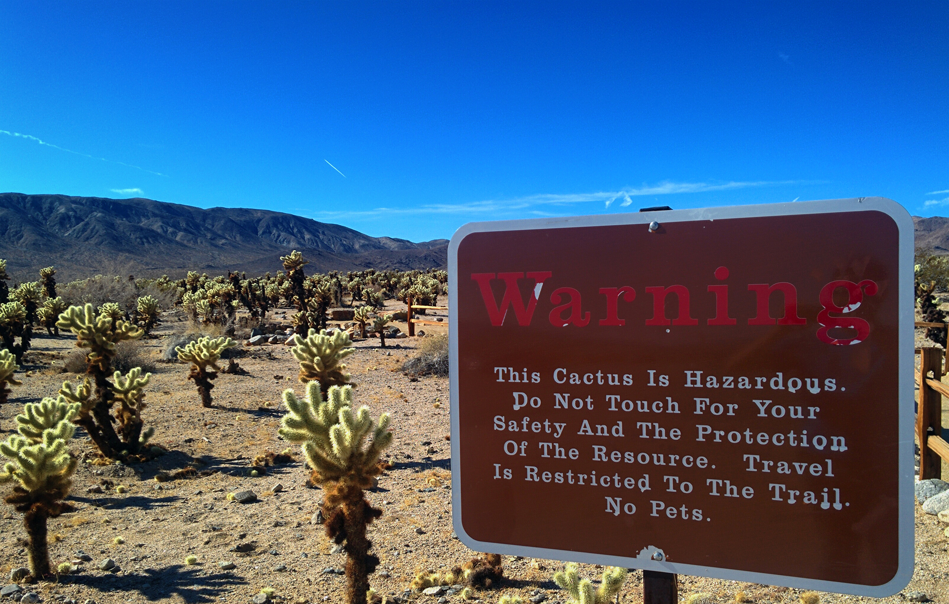
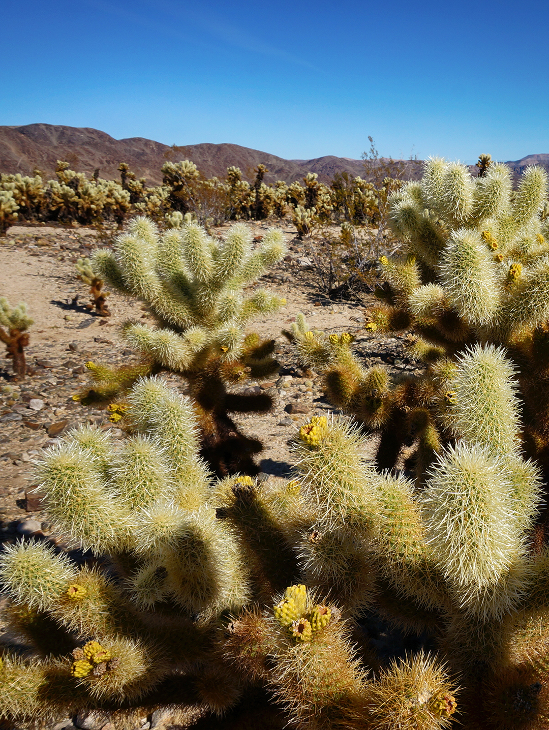
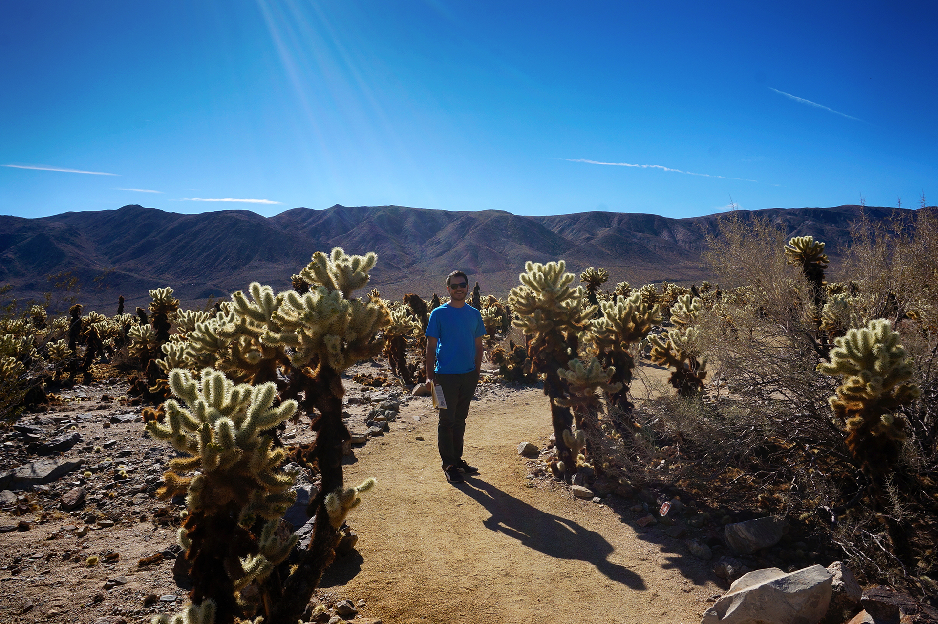
After Badwater Basin, and some more wildflower frolicking, we came to the awesomely-named Devil’s Golf Course. Speaking of an endless array of geometrical patterns, the shapes formed here are truly fascinating. However, the little salt and rock spires are sharp, and extremely coarse – signs warn you very strongly not to fall over onto them.

But we went out and took a few pictures anyway, because #YOLO.
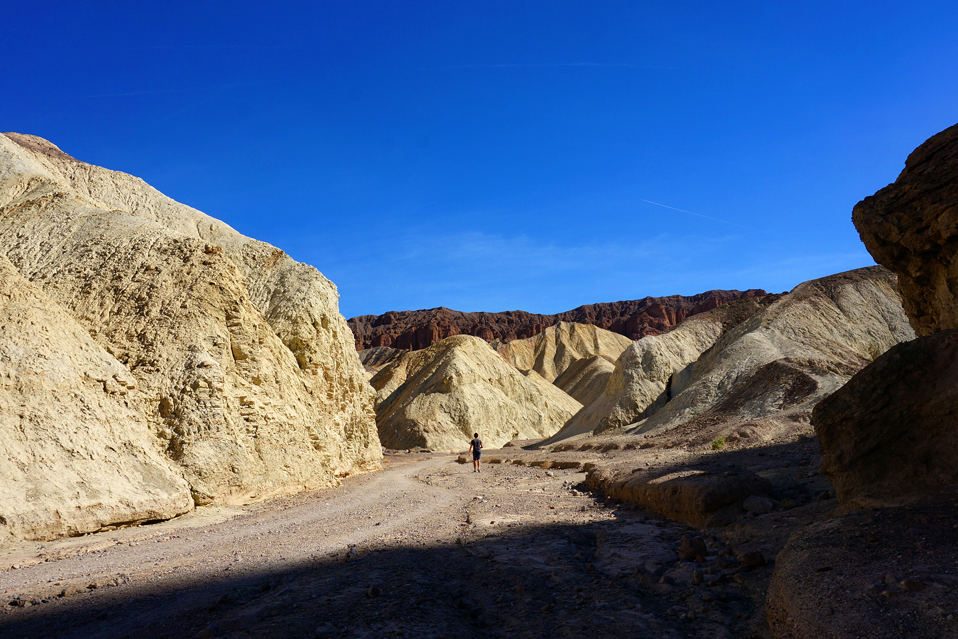
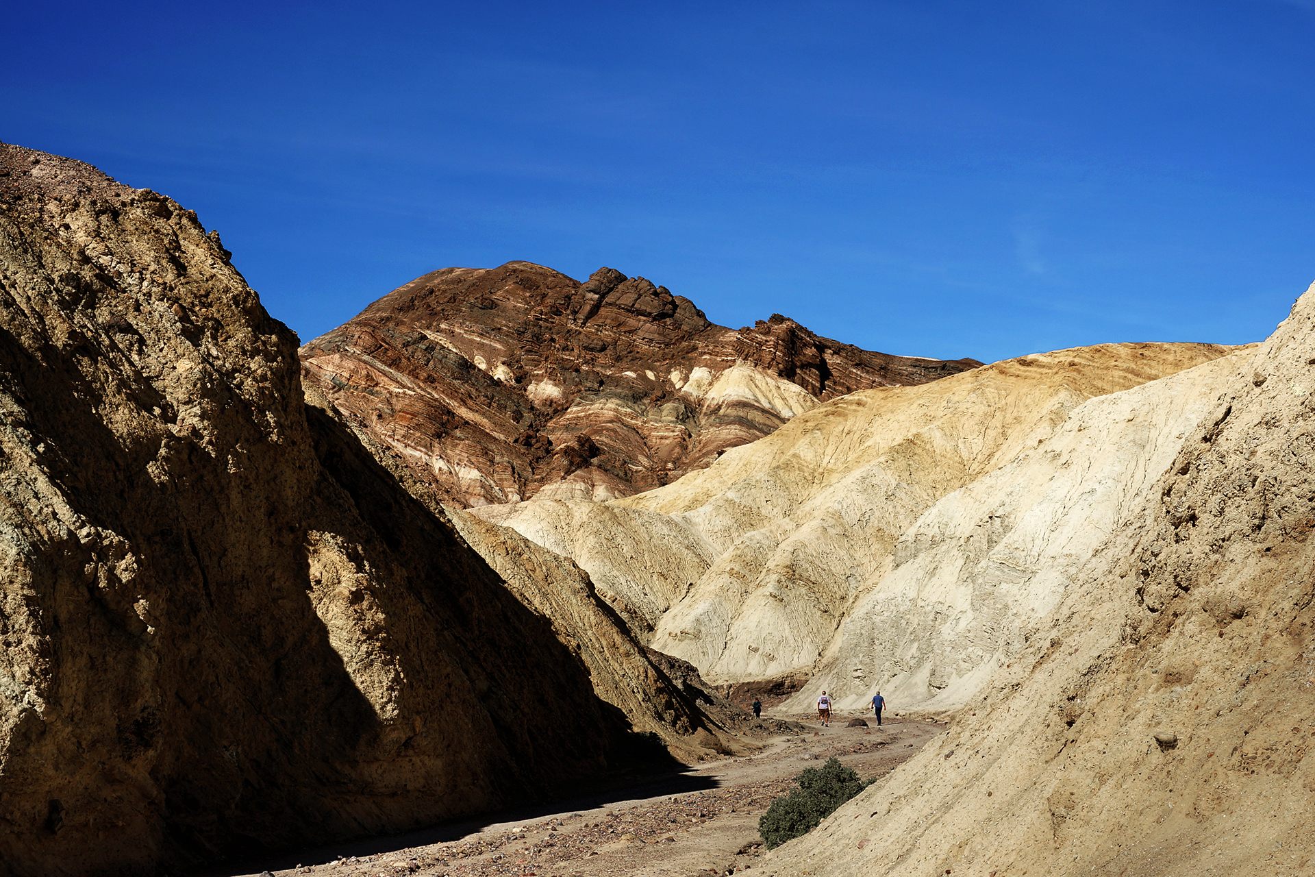
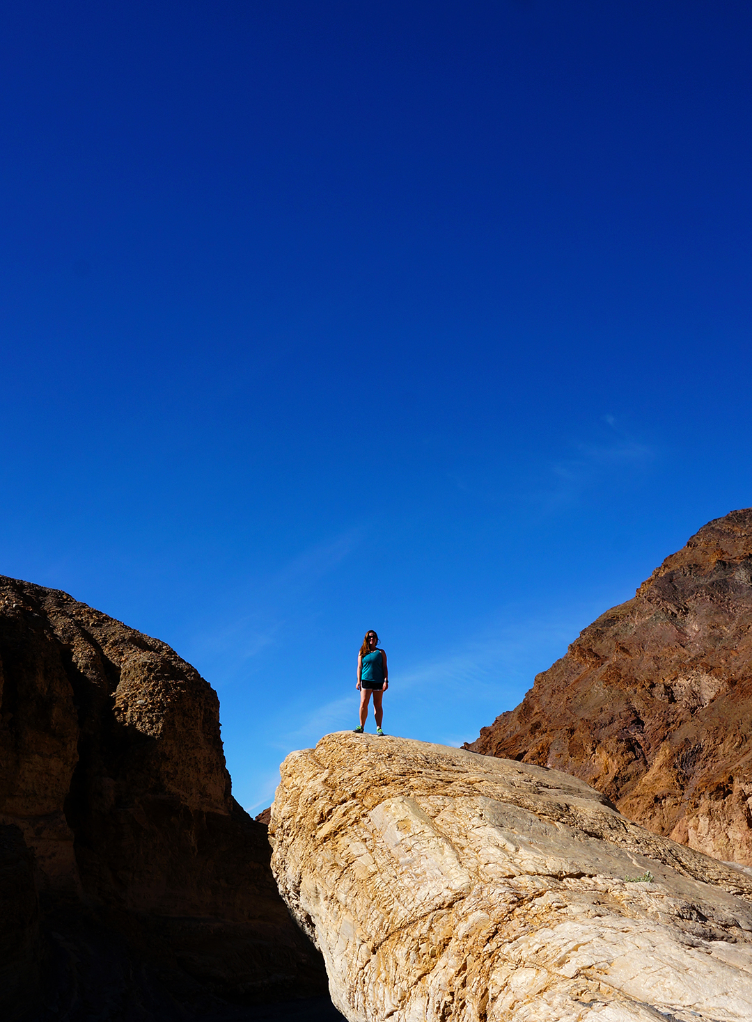
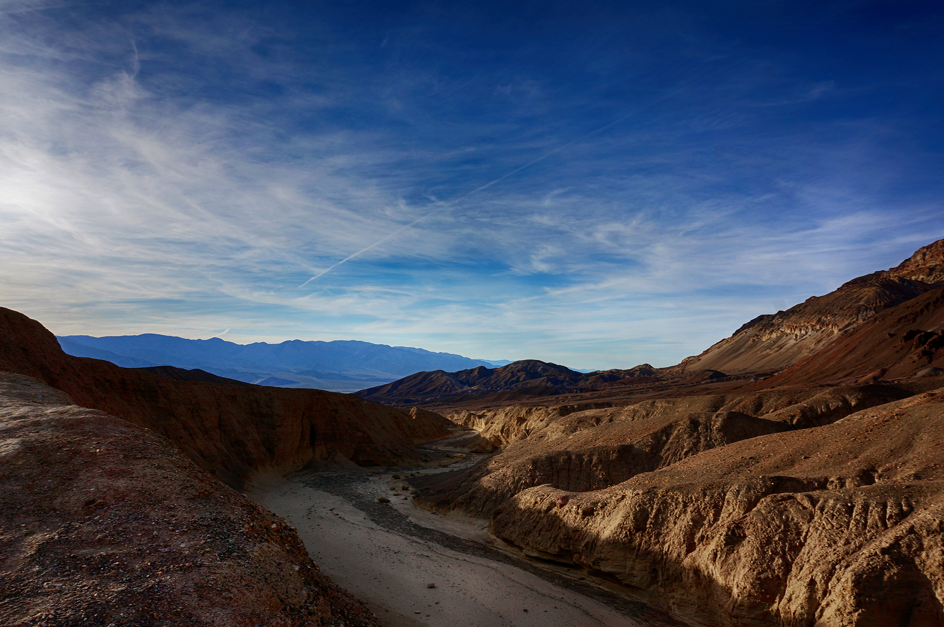
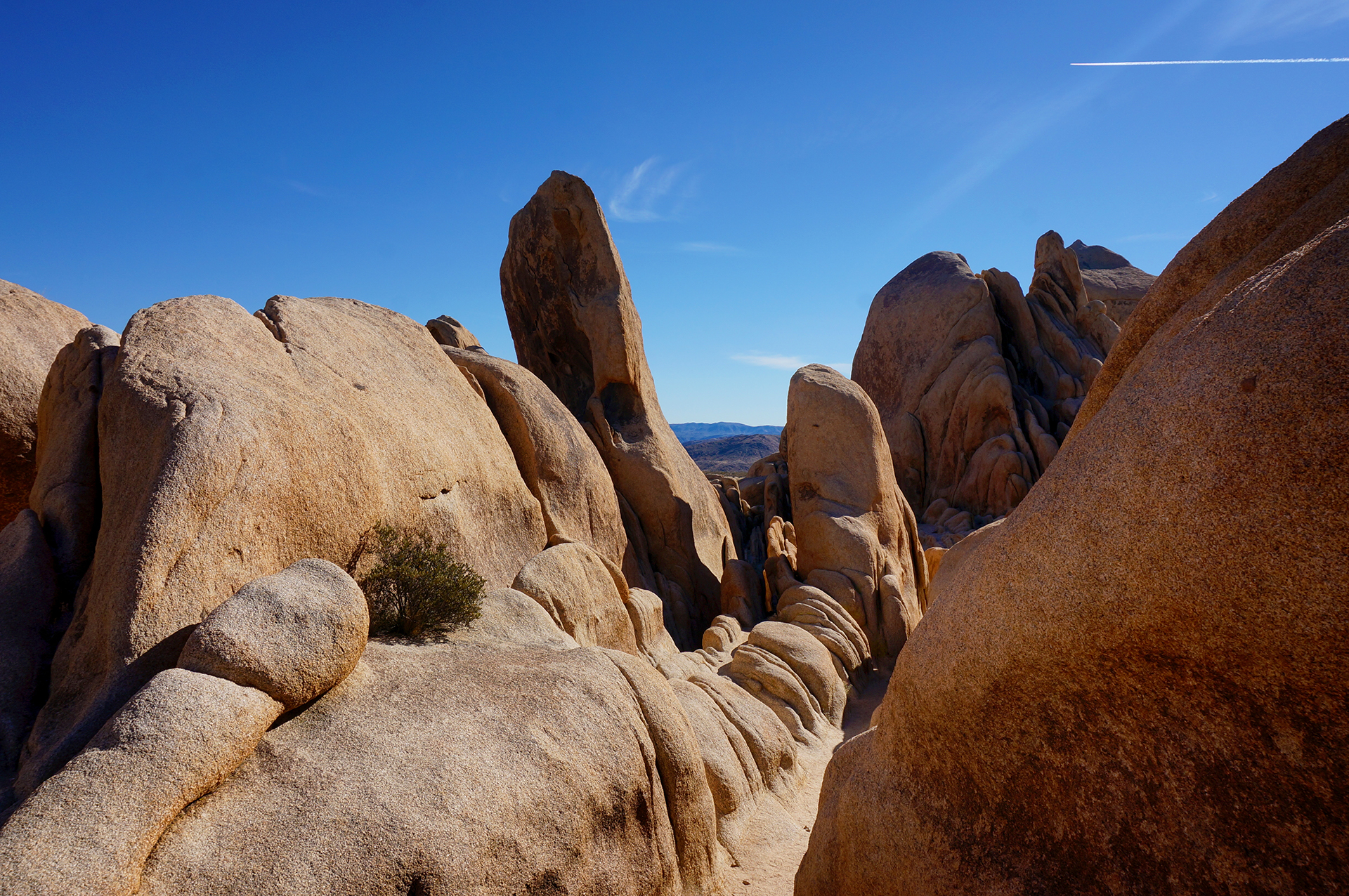
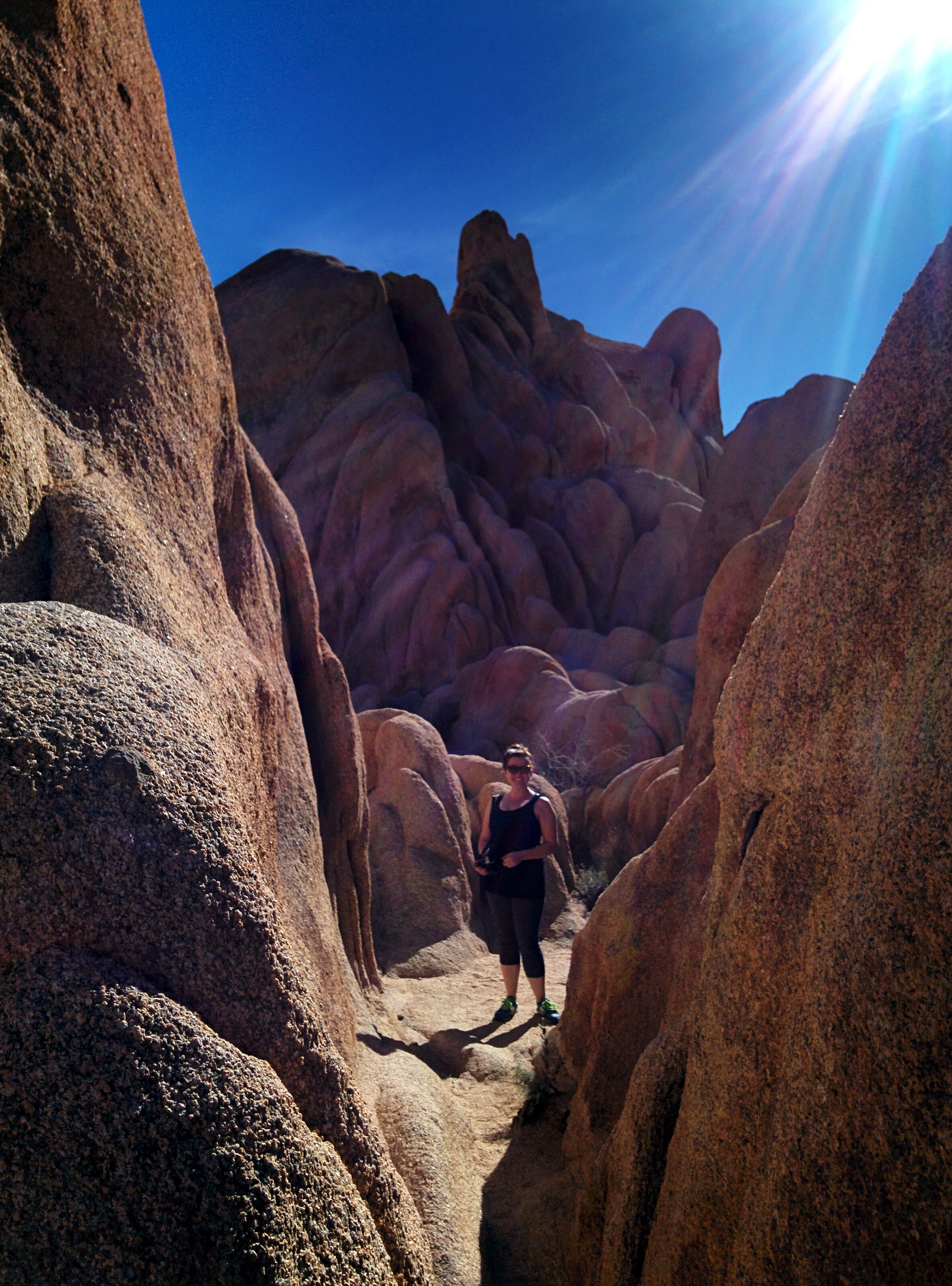
Canyonero

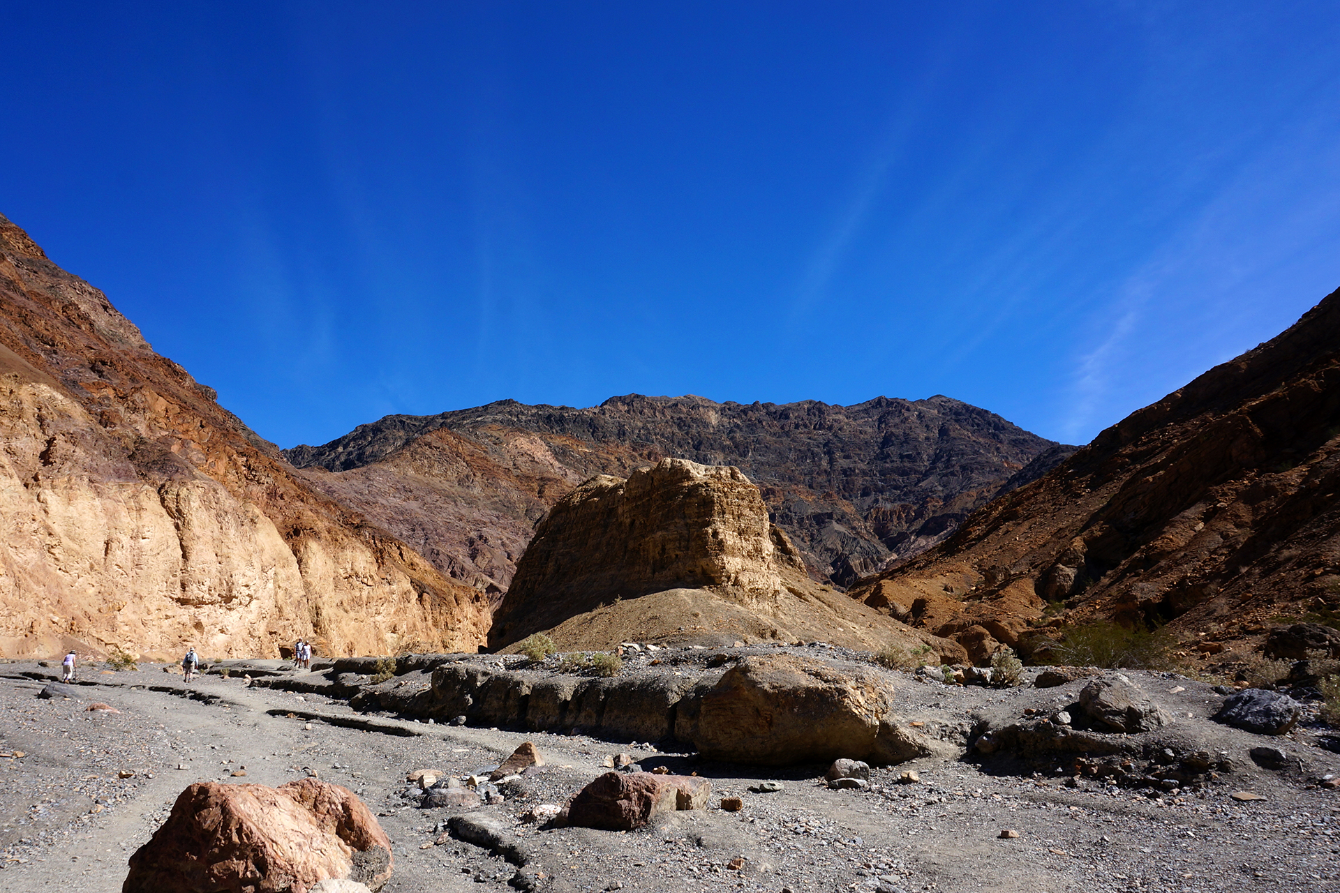
The geology of Death Valley is extremely varied, and goes far beyond murderous salt flats.  One of our favorite features was the numerous slot canyons.  We walked through the Golden Canyon, which twisted and turned before opening into a much larger canyon.  We met a woman here on crutches – she had apparently just broken her foot, but decided to go through with her vacation anyway.  Hardcore!

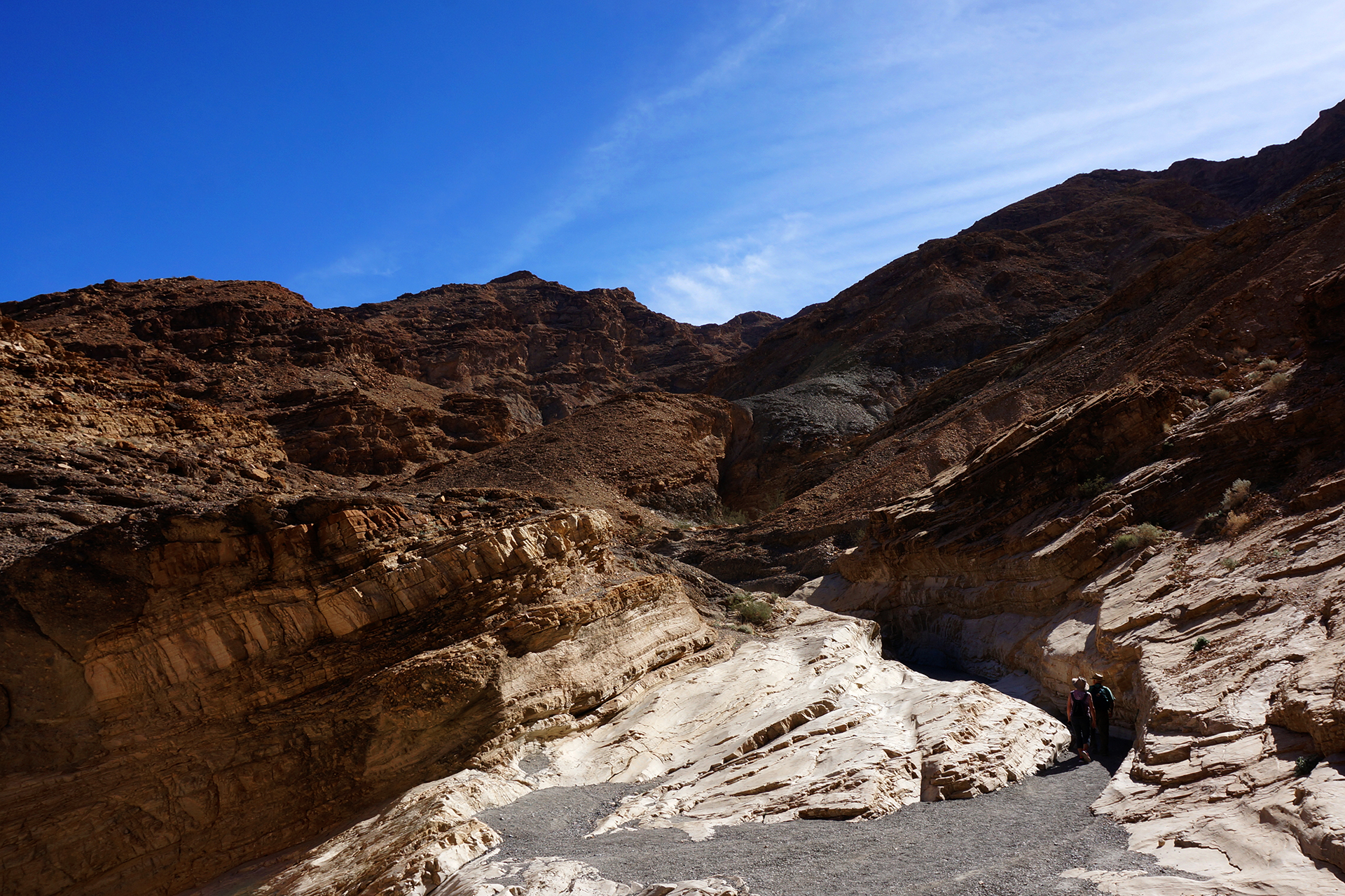
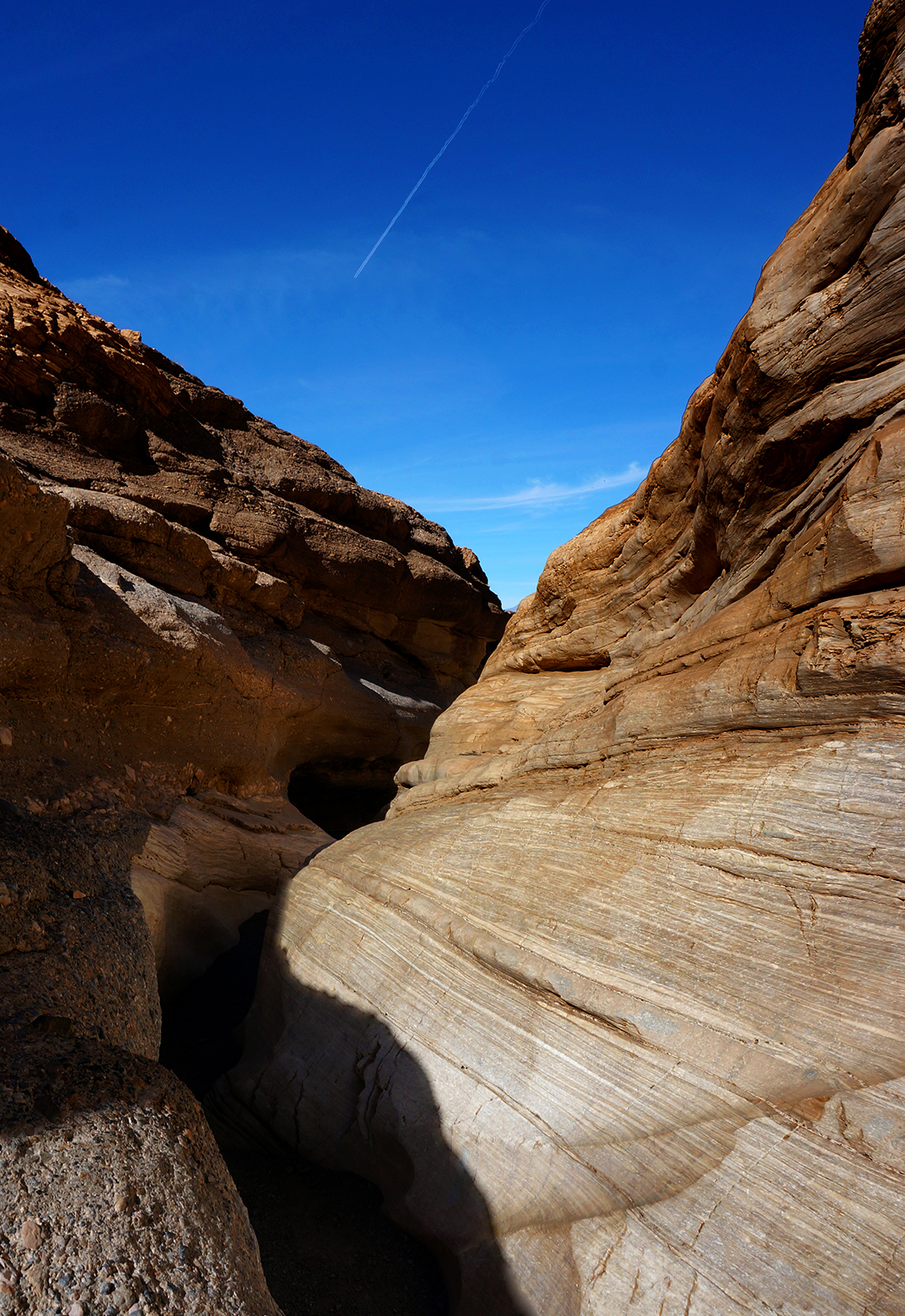
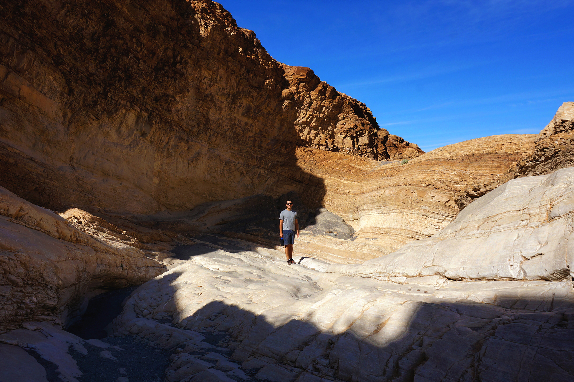
We also drove up to Mosaic Canyon, which is about 1.5 extremely bumpy dirt-road miles off the main drag.  It featured incredibly smooth marble walls that were glorious to touch, as well as coarse, aggregate walls studded with millions of tiny rocks (the “mosaic”).  Extremely cool.

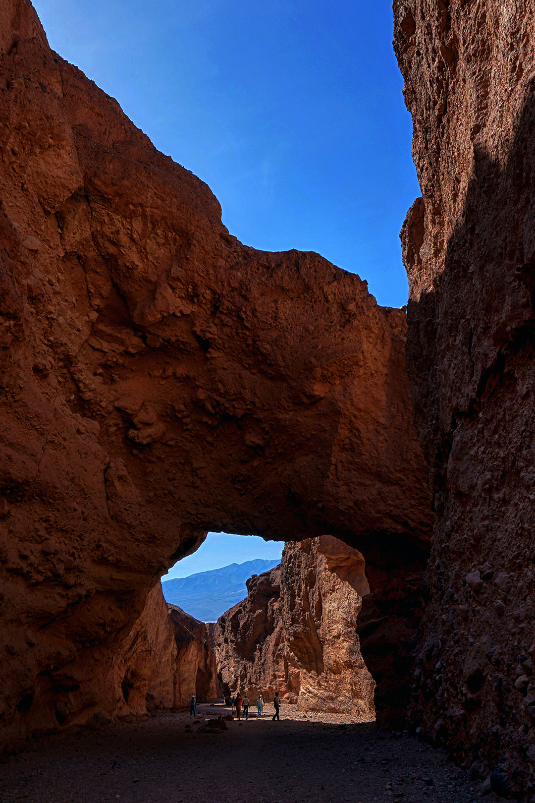
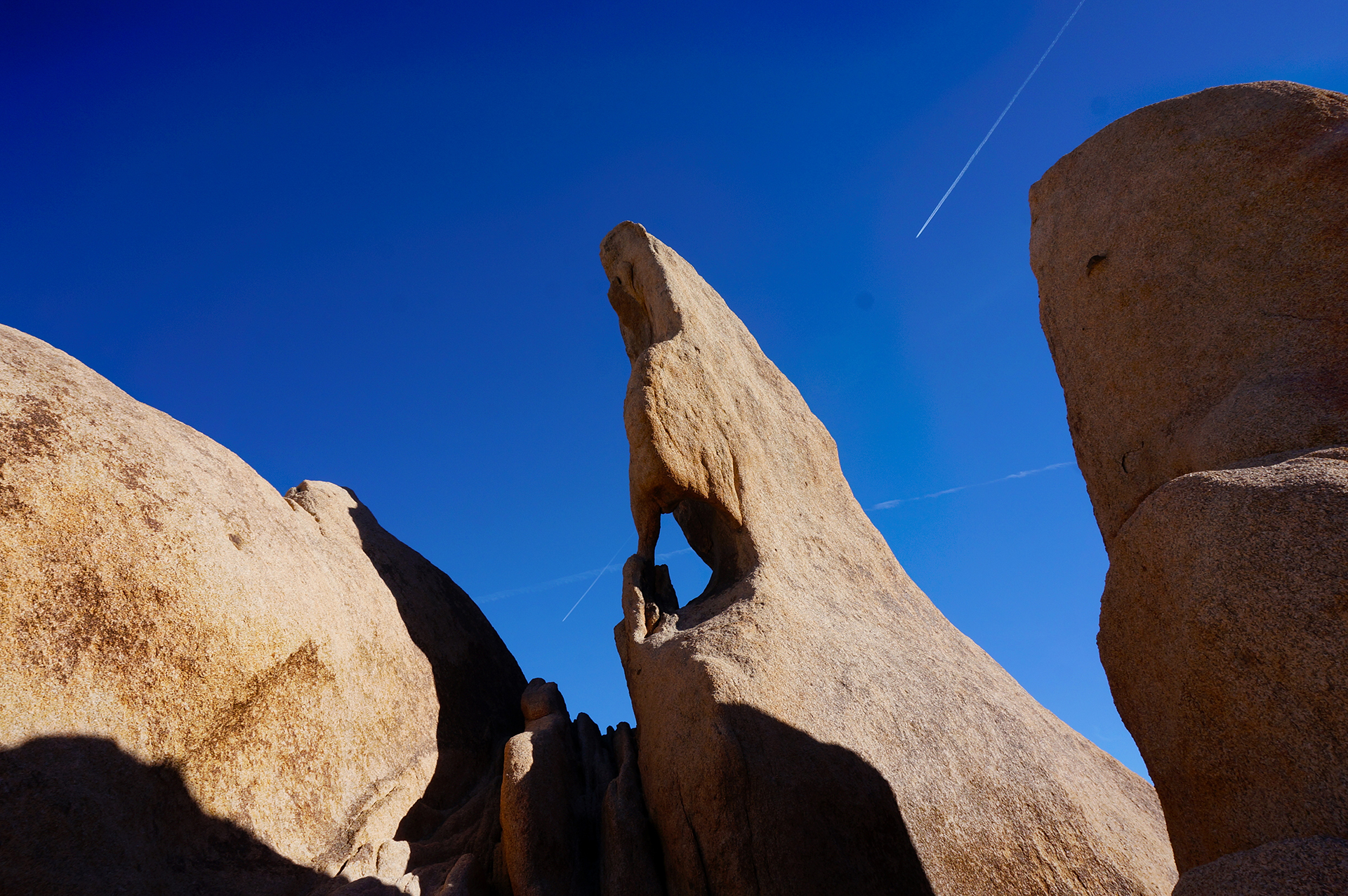
We also walked through the canyon at Natural Bridge, which unsurprisingly features a… natural bridge (arch). The views of the salt flats from here, seen over a verdant field of wildflowers, was simply stunning.

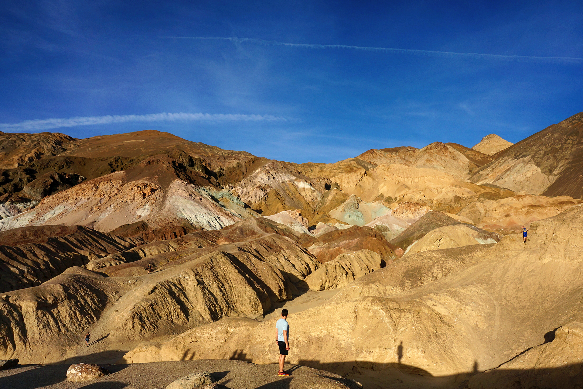
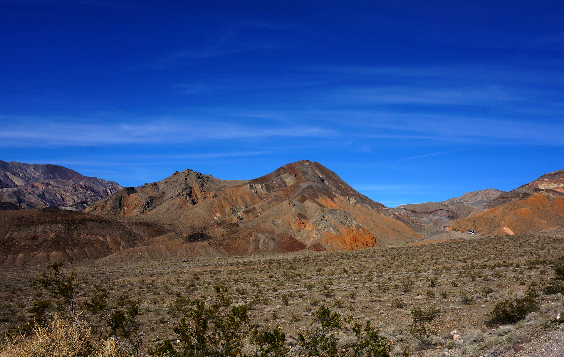
Painting With Minerals

Death Valley, like the Petrified Forest, offers lots of vibrantly colorful badlands.  We drove the park’s popular loop road, the beautiful Artists’ Drive, and gawked at the scenery the entire way. The crown jewel is called Artists’ Palette, a rock formation that looks as though each face was painted a different hue.  We don’t really know how this happens, but we suspect the culprits were highly aesthetic witches.

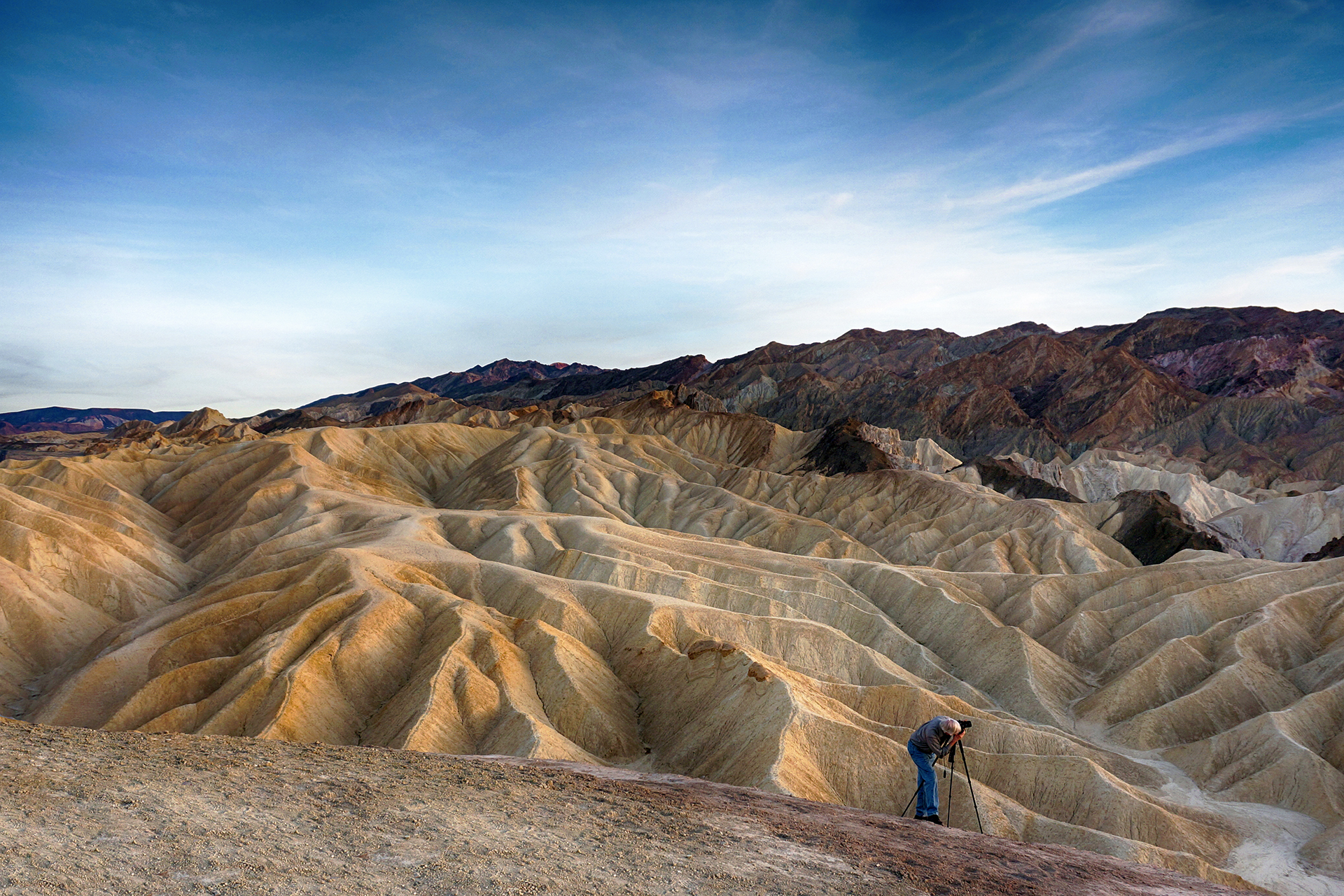
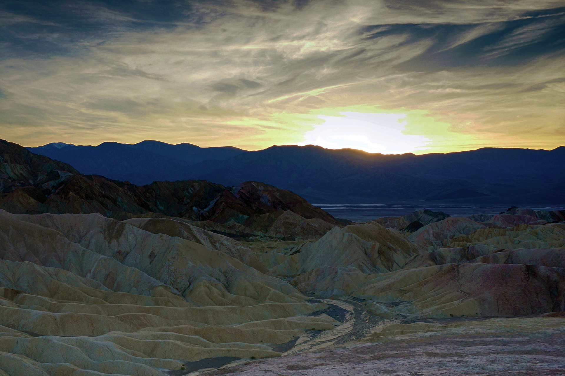
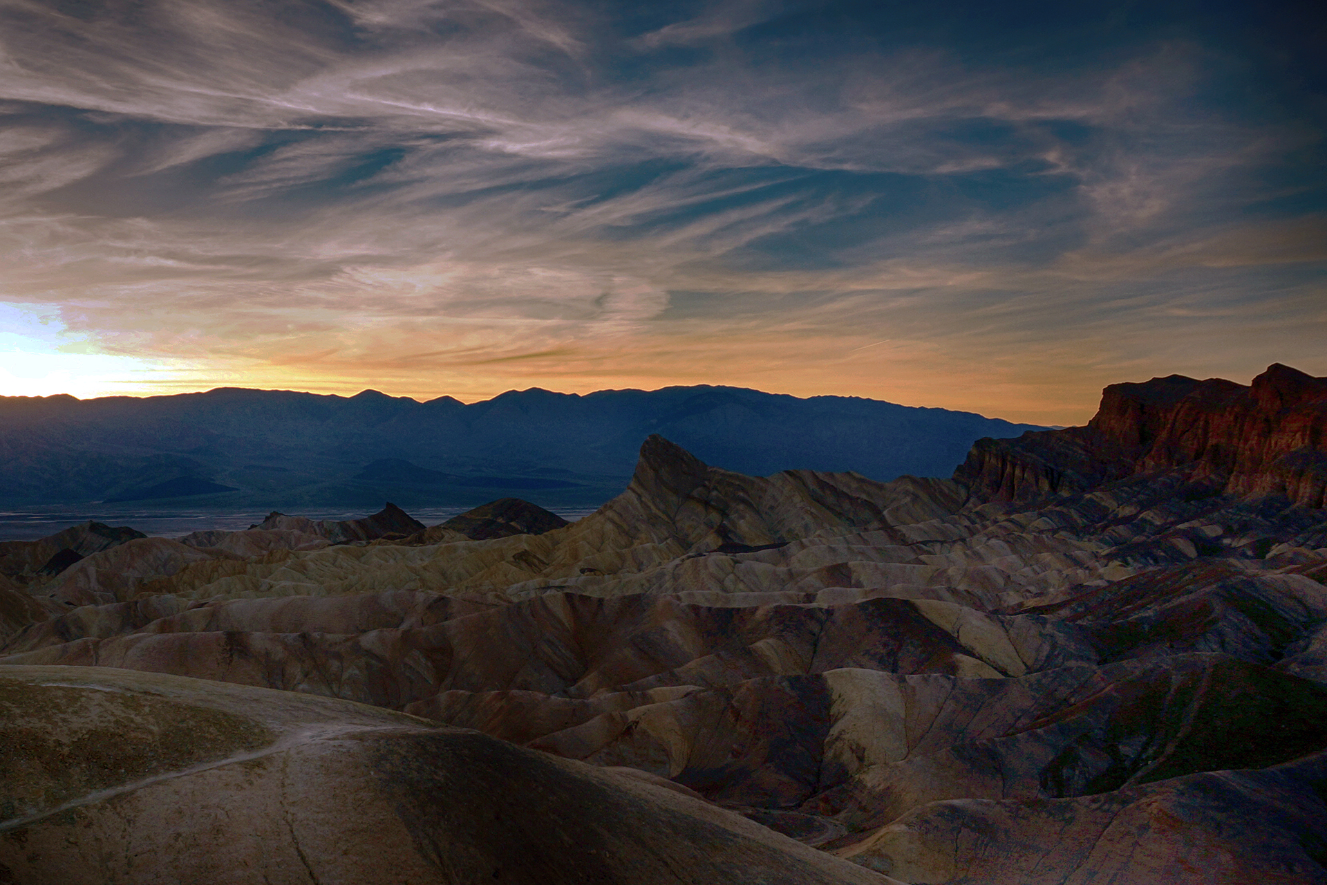
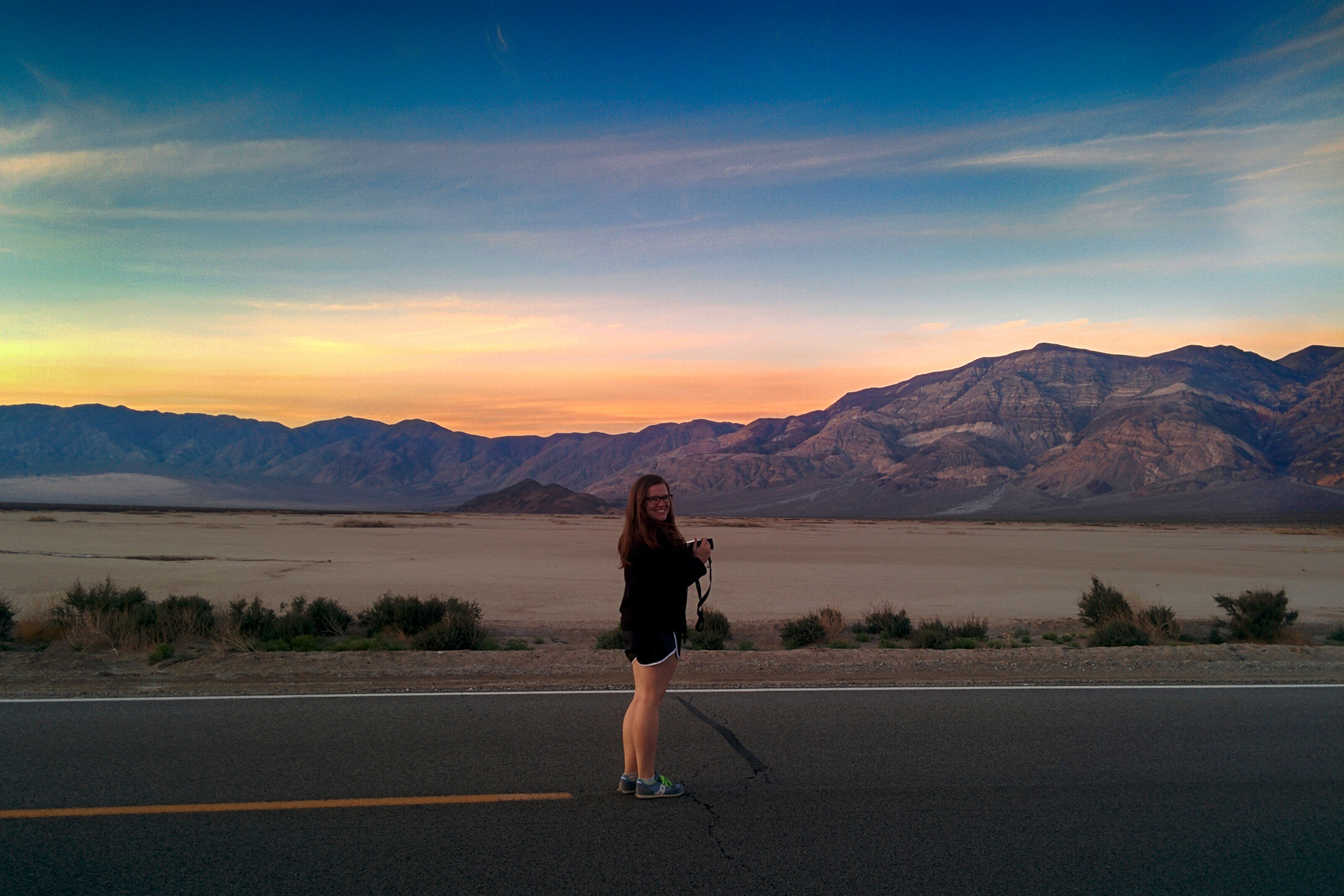
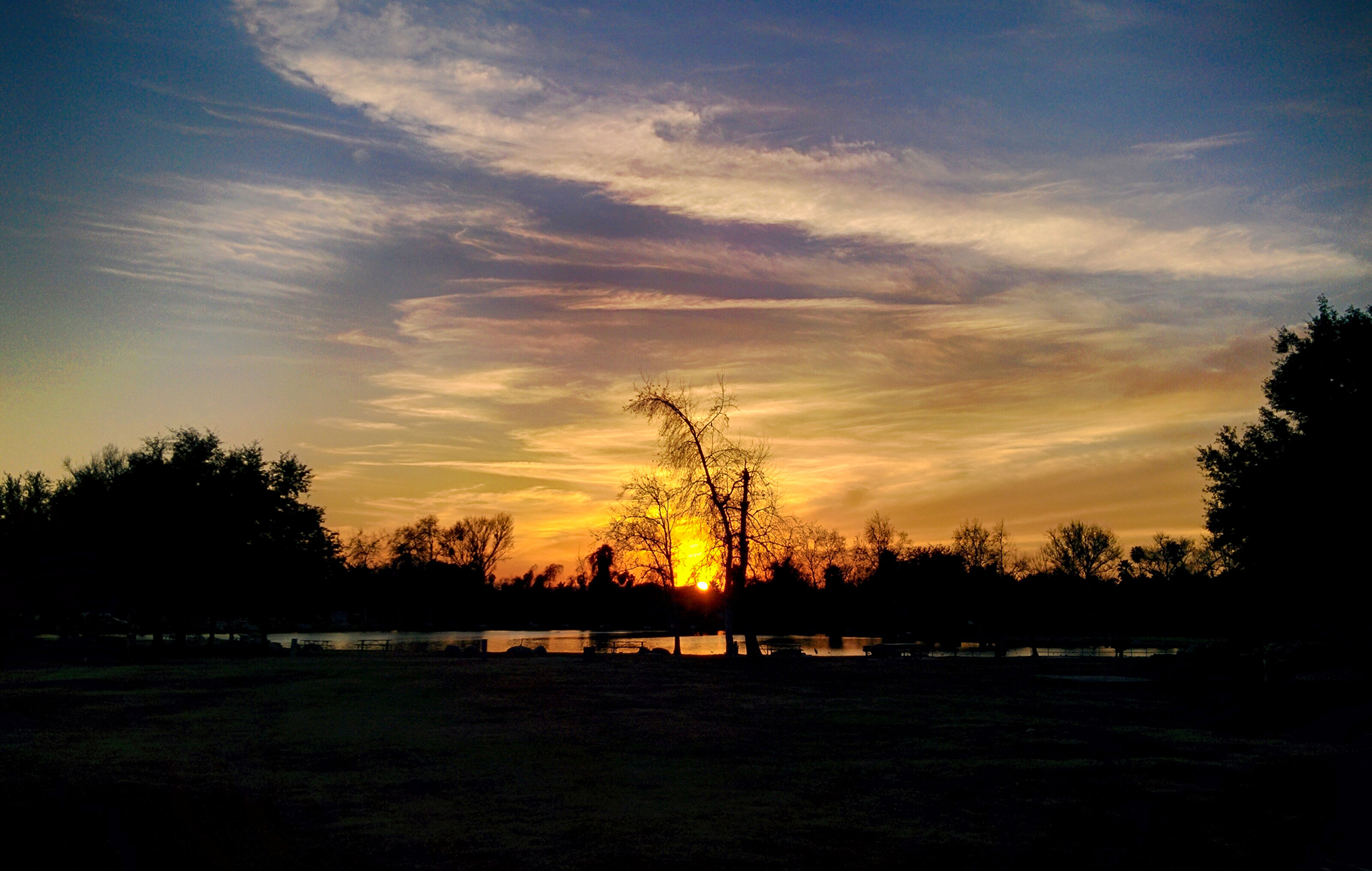
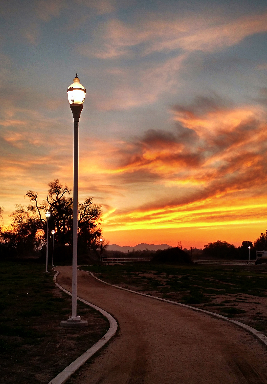
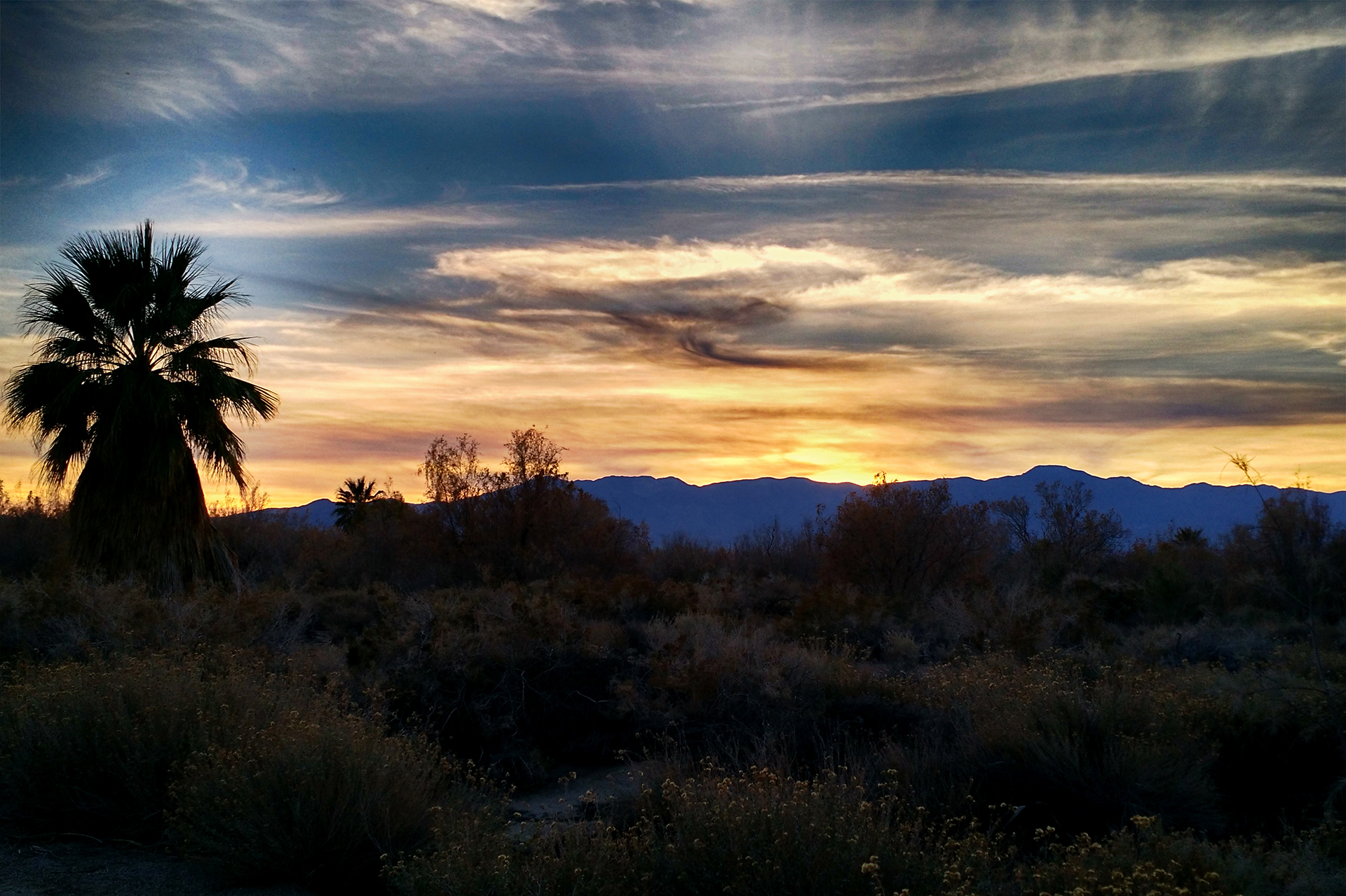
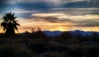
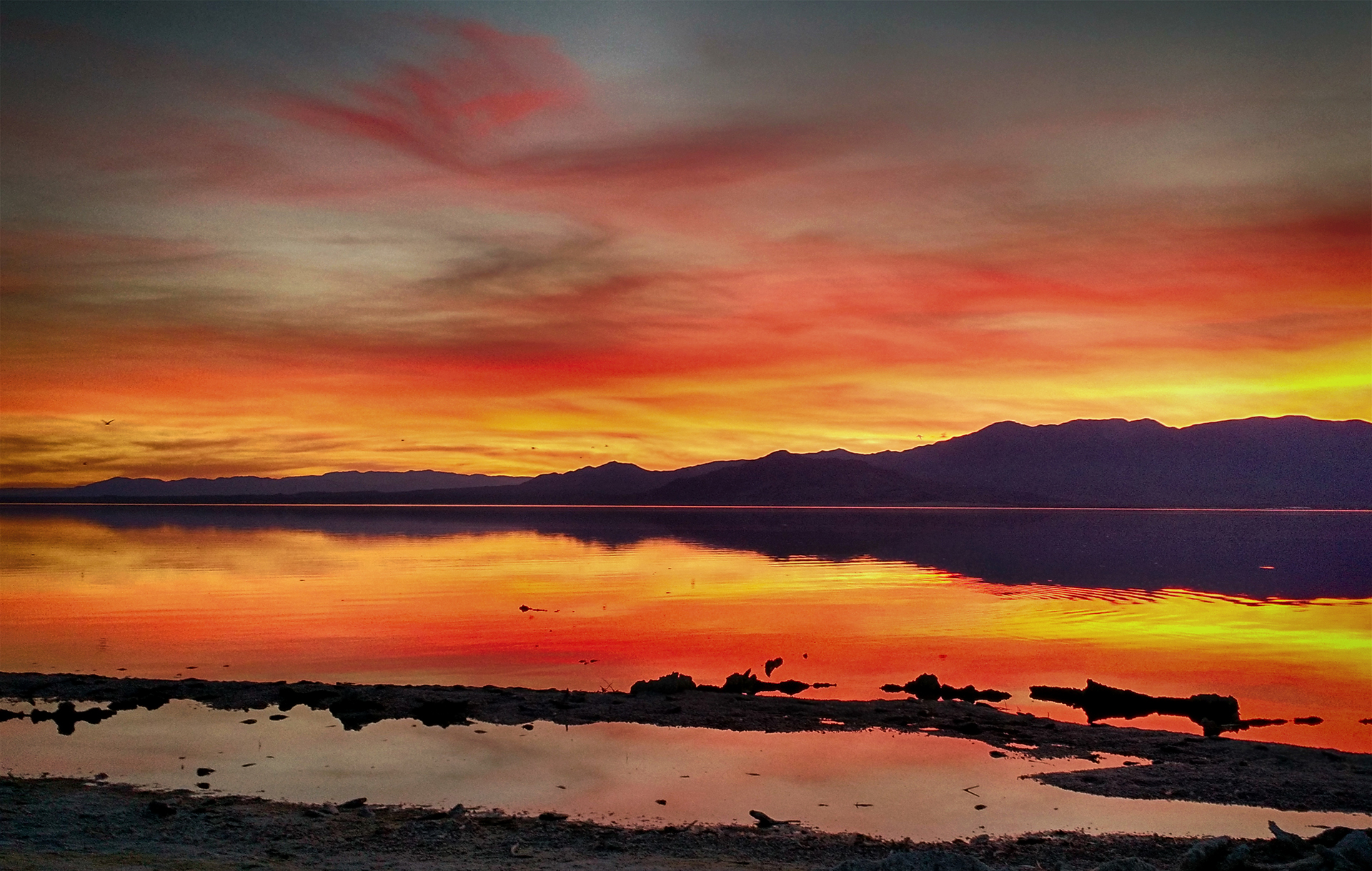
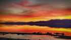
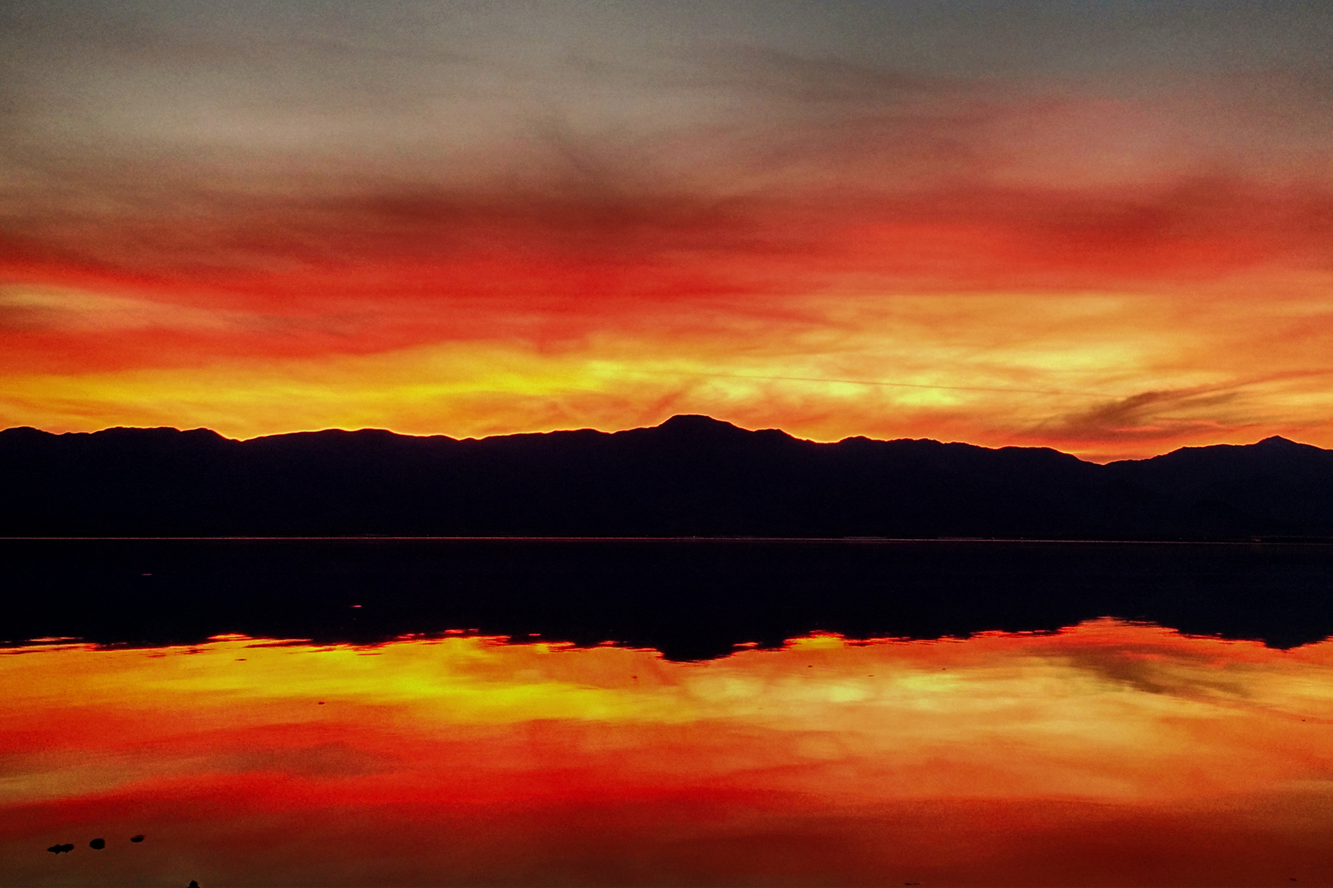
Nearby, but on the other side of the mountain range, was Zabriskie Point. This spot is known for its beautiful sunsets, and we saw a good one, albeit not as mind-blowing as it can apparently become.  Frankly, it didn’t matter – the infinitely varied badlands and the views of the valley are pretty under any kind of light.

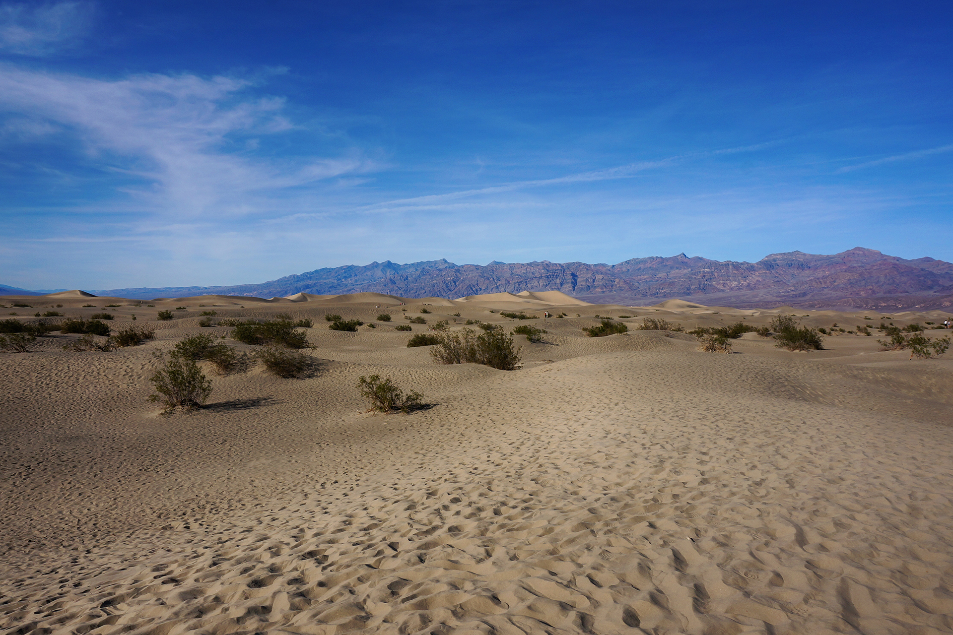
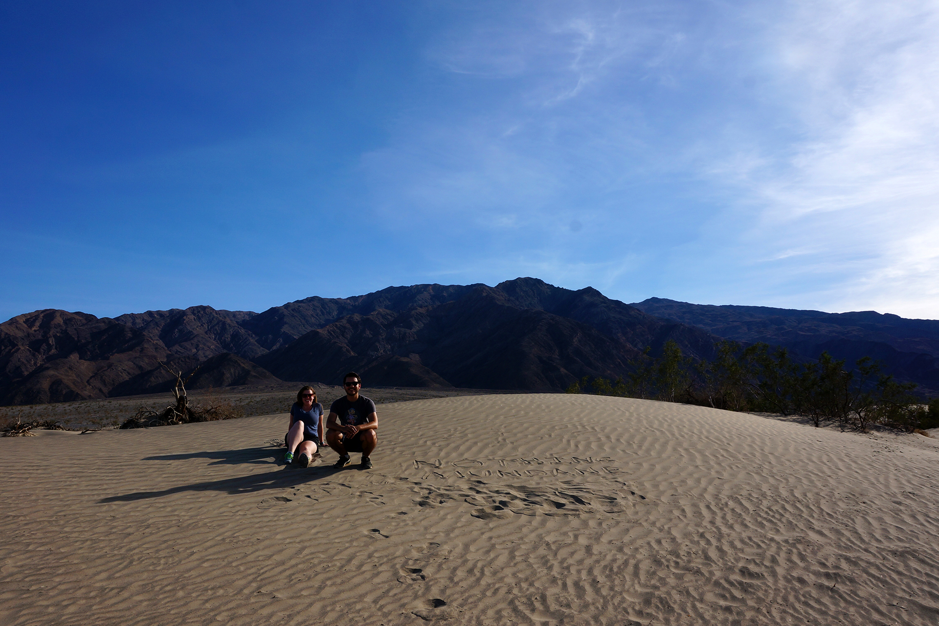
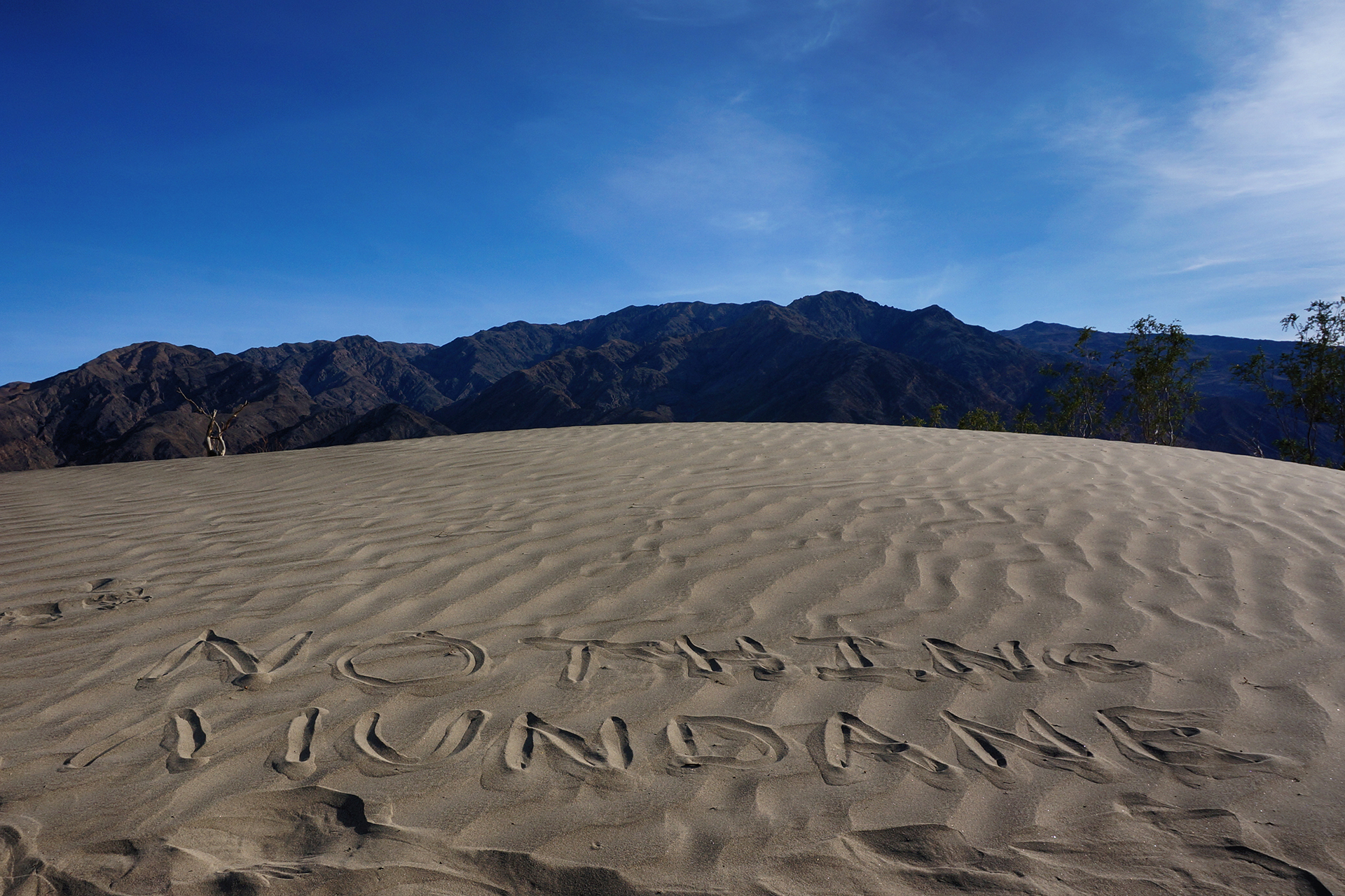
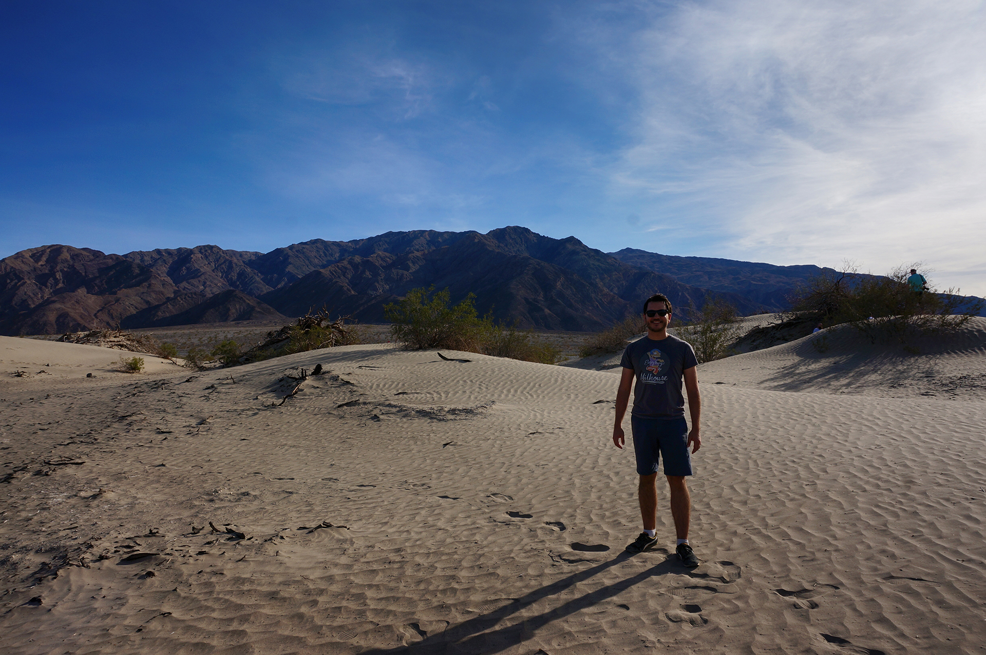
Sand Dunes and Star Wars

One of the most famous features of Death Valley are the Mesquite Sand Dunes, which appear in lots of movies, including the first two (original) Star Wars.  Actually, lots of Star Wars scenes were filmed in Death Valley, as this fascinating guide shows.  In any event, we love us some sand dunes, since they are great for photographing.

With all the other things to do, we didn’t spend as much time here as at White Sands National Monument, but we did find time to recreate our Nothing Mundane mark
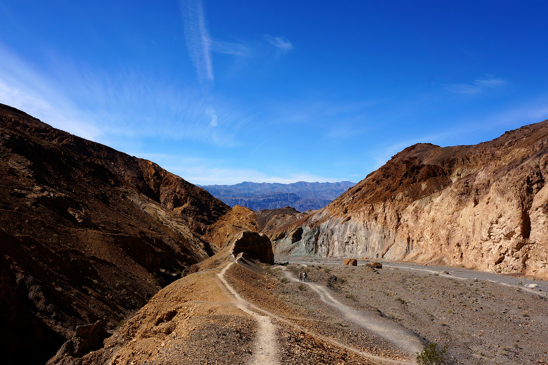
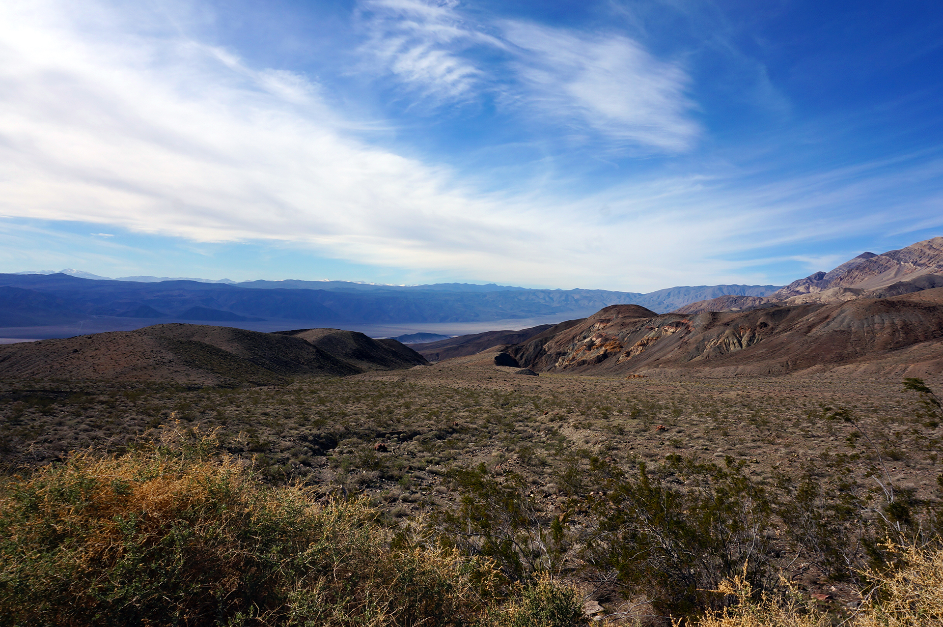
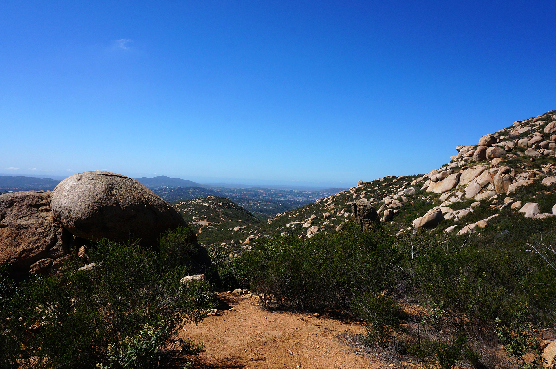
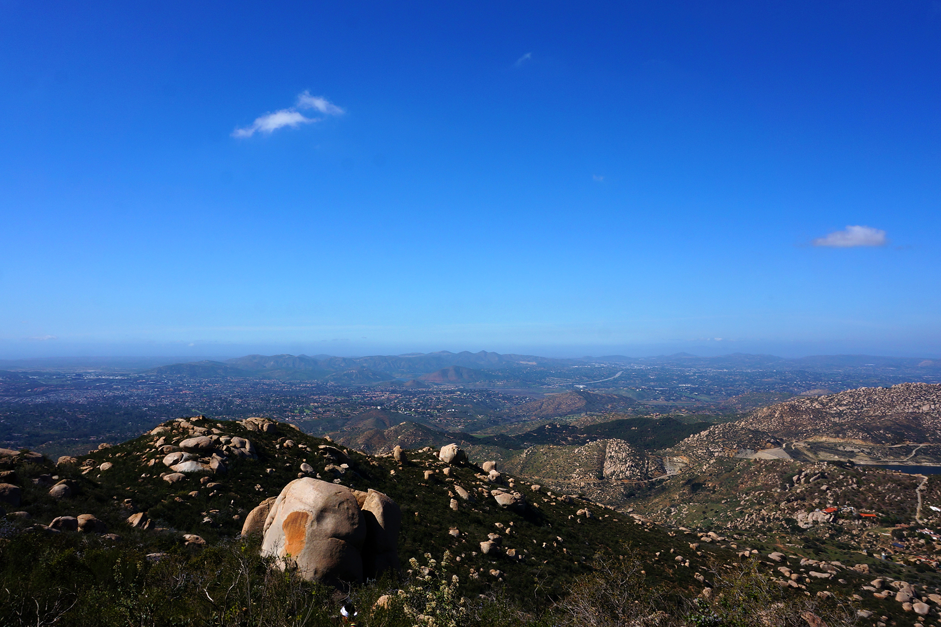
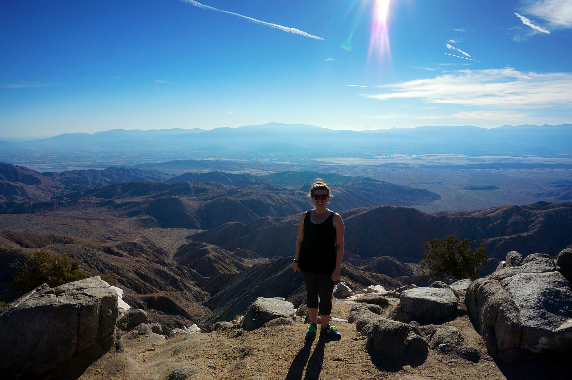
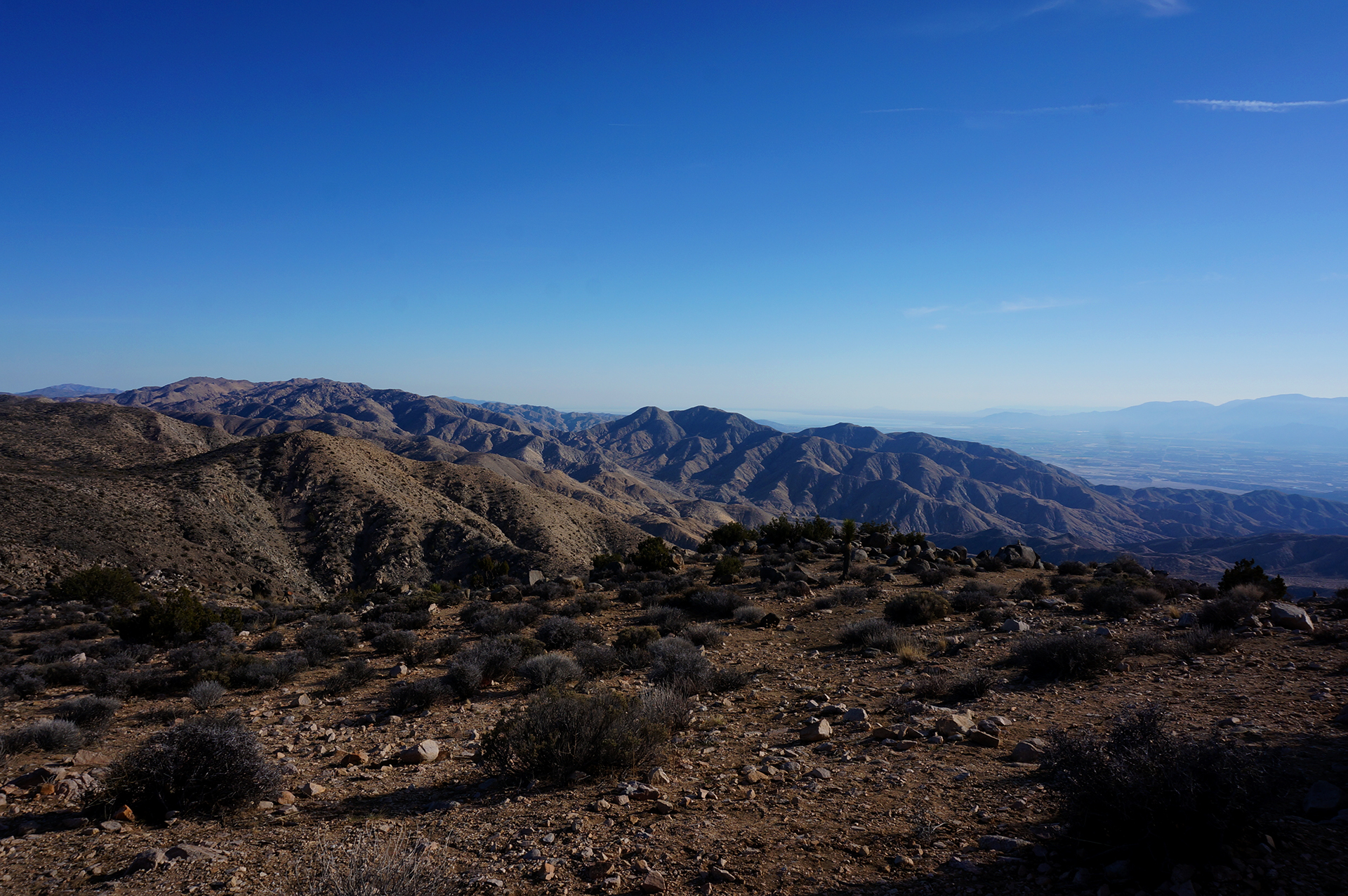
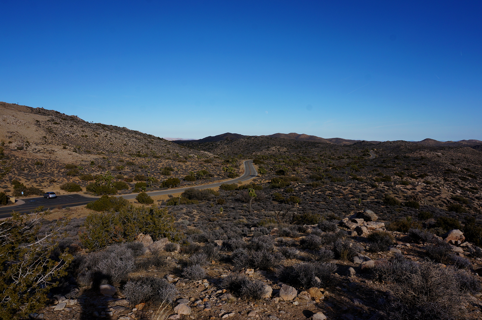
High Desert

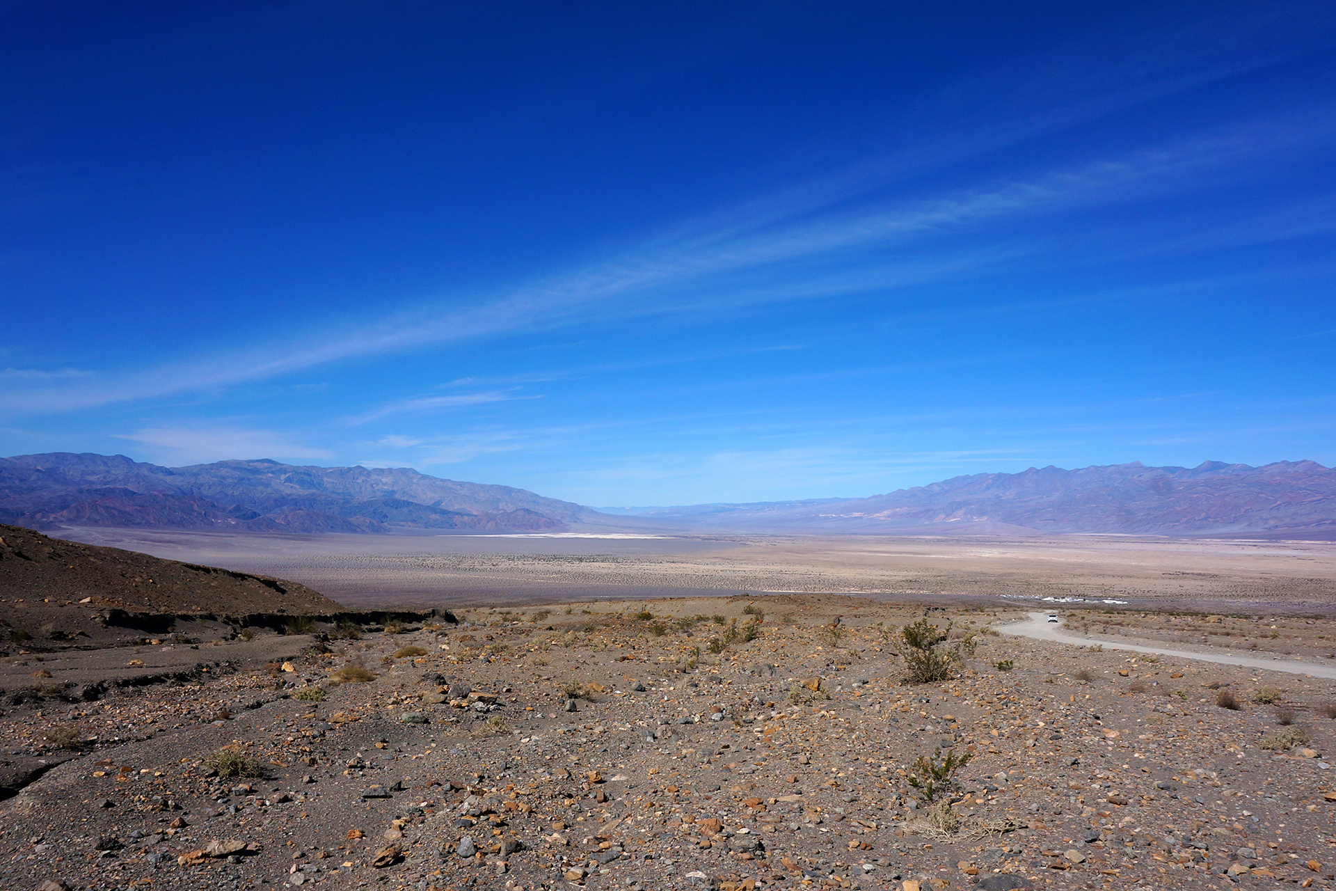
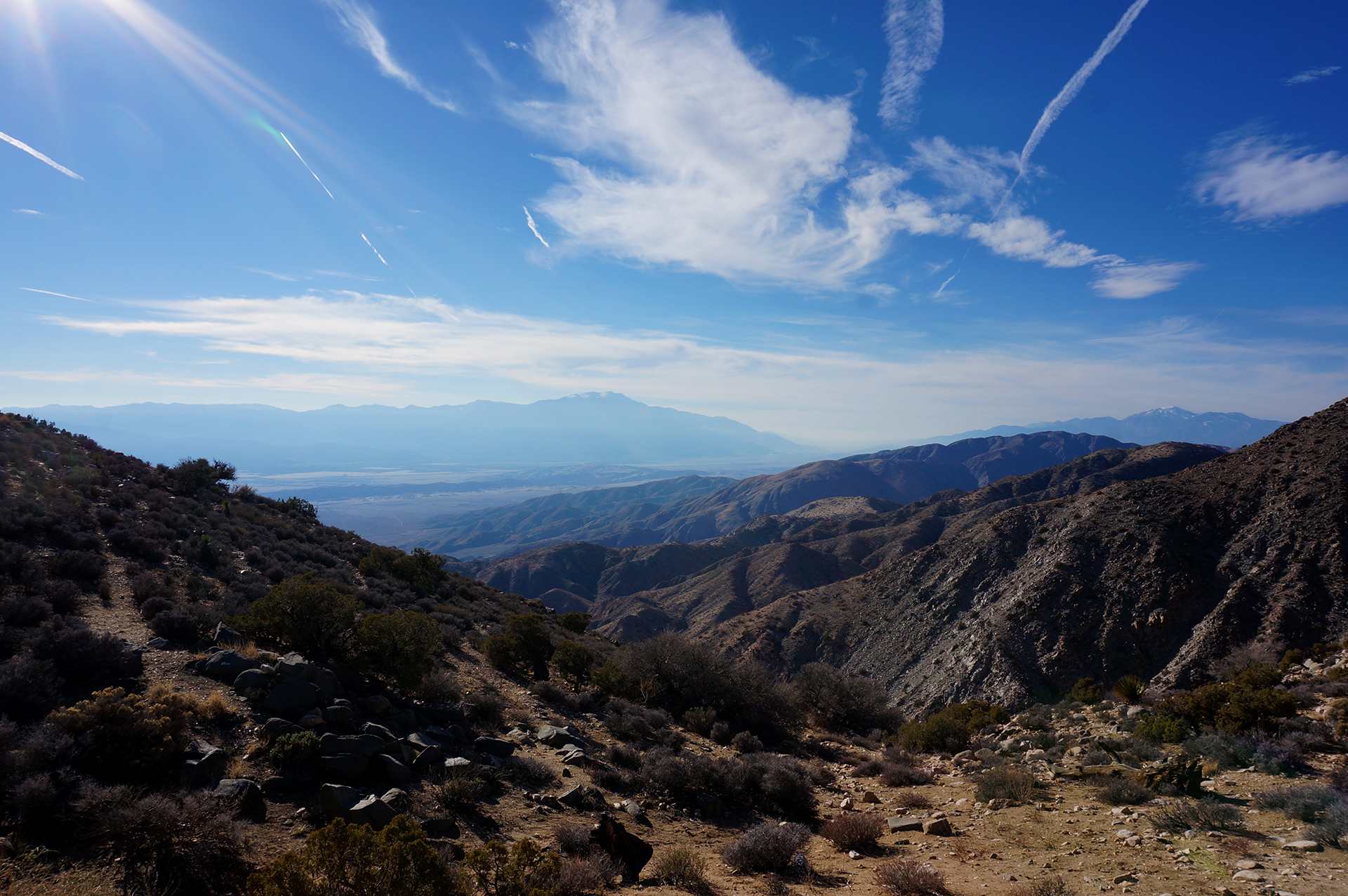
Alright, enough of this low desert stuff.  We spent an entire day driving west from our campground (reminder: Death Valley is huge) to explore the numerous mountain ranges in Panamint Springs.  We went up and over a high pass, down into a low valley, and up and over another pass.  Whew!

We’re definitely glad we did all this, because this was one of the most unique drives we’ve ever taken. The horizon is so flat we often couldn’t even tell we were going uphill!  At one point, we thought our car was having mechanical problems because the RPMs were so high. However, we realized when we drove back the same way that we had just been going up a massive grade – totally unaware of it.

Flat or inclined?  It’s surprisingly difficult to tell.

At every point along the way, the mountains and the views were magnificent. The highway hugs the cliffs while spiraling around the peaks – definitely not the kind of place you want to speed (although, of course, lots of people did).  Also not a good place to have your brakes fail… and ours did not, so thanks, fly-by-night mechanic from New Jersey!

In between two mountain peaks, we entered a crazy valley, traversed by a steep but perfectly-straight road. The flats here, different from Badwater Basin, offered their own grand views.  And since it’s 2016, beyond the normal selfies, there were people modeling here for a photoshoot.  In the absolute middle of nowhere.  We live in strange times.

Liquid Treasures

On the way back from our trip over the mountains, we stopped at a magical little place called Darwin Falls.  It was a bumpy 4-ish mile dirt road ride – calling to mind Big Bend – which is not uncommon for Death Valley sights.  We later found out you can rent a Jeep right by our campsite. We drove past the rental place in the dark and had no idea!

We then hiked out to the falls, about two miles away.  We weren’t sure what to expect, or even if we were in the right place, but we were heartened by a conspicuous – and leaky – water pipe running along the trail.  Slowly, the canyon narrowed, and the vegetation grew thicker.

It was practically a jungle by the time we turned a corner, hopped across a stream, and ducked around a tree. There, before us in a grotto, was Darwin Falls, the hidden jewel in the heart of Death Valley.  Few things we have seen before or since were so magnificently unlikely.

We headed back to our RV on a cloud.  We stopped near the sand dunes at the Stovepipe Wells general store to get a sticker (yep, there are stores in Death Valley), and were greeted with something else magnificently unlikely: a huge and refrigerated wall of drinks, including craft beers.  We got a six pack of Stone Ruination for less than we used to pay in Manhattan!  Inside Death Valley!!

It is a land of surprises.

Visiting Death Valley

Death Valley National Park is amazing, and you should go. It’s not the easiest place in the world to get to, but you can get there in a few hours from Las Vegas.  If you’re interested, you’ll need to go in roughly November-March, and you’ll probably need an RV, unless you like camping on hard earth or can snag one of the few cabins.  (Because of the RV requirement, the visitors are actually almost entirely retirees, which is unusual for a national park.)

It’s magical and cool, and there’s so much we didn’t even get to see, like Scotty’s Castle (currently closed due to flood damage), or the incredible sailing stones – featured on Planet Earth – which require a 4WD vehicle to access.

If you can, try to time it up to a superbloom.  The next one should be in about 11 years.  We’ll meet you there.

Roadtrip Status

Still alive?  Check.

Where are you now?  Heading out of Salt Lake City towards the tiny town of Delta, Utah.

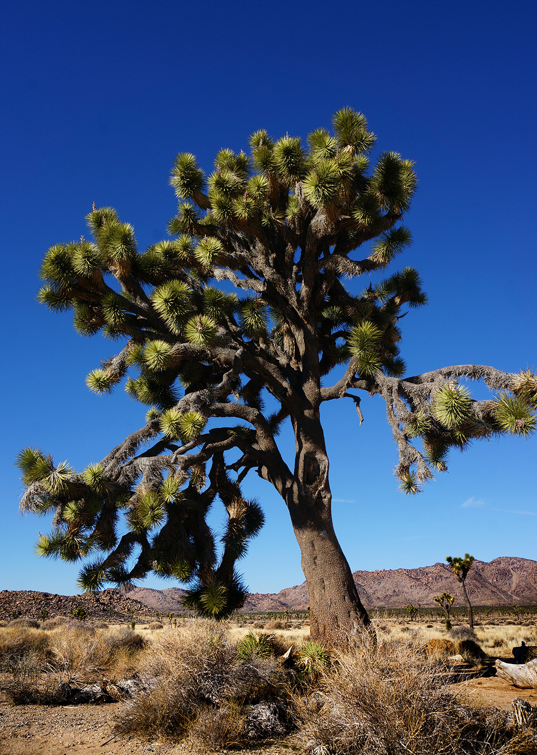
Next location?  Lots and lots of national parks!  First up is Great Basin, home of the oldest – and possibly the ugliest – trees in the world.

Follow Us On Social Media

FacebooktwitterinstagramFacebooktwitterinstagram

Latest Posts

1

Weeks 33-34: Swooning Over San Diego

We enjoyed our two weeks in the Los Angeles area, but although the weather is great and there’s tons to do, the traffic is inhumane.  As we said in our blog post / rant, it doesn’t just make it hard to get around, it turns people into animals, and animals into… well, they stay animals, actually.  But they probably hate the traffic too.

So we headed south of LA, to a place with even better weather and a much more relaxed state of mind:  “San Diego.”  We may never know what it means, but we learned what it represents:  an awesome city with cool people and the best freaking weather ever.

Fair warning, friends… we may move there.

That Weather

As you can see above, when you talk about LA, you end up talking about traffic.  (This is the royal “you,” of course.)  Well, when you talk about San Diego, you end up talking about weather.  We originally planned to stay for 1 week, but after two days of being kissed by God, we immediately added on another week.  And this was in February!

If you’ve never been to San Diego, here’s what it was like.  We would wonder to ourselves, “I wonder what it’s like outside today?”  Then we’d step outside, and no matter what time it was, or whether we were wearing clothes, or violating public indecency laws, the answer was always: “perfect.”  Not too hot, not too cold.  It’s just always perfect out, all the time, always.  Think 75 degrees high, maybe 60 degrees low.  And it almost never rains – it’s rarely even cloudy! – so every day just rocks.

It was so, so hard to leave.

Food & Drink

Beyond the weather, San Diego is known for having tons of great restaurants and breweries, and it did not disappoint in that regard.  We visited the downtown Gaslamp Quarter, and enjoyed some delicious food and drink served with a side of people-watching.  We also met up with Heather’s friend Alena, who happened to be visiting for the weekend, at the enormous Stone brewery.  (It’s actually one of several!)  While some sort of blizzard was hitting the Northeast, we were eating our dinner on the outdoor patio, and arguing over whether that was really Slash at the other table.  Take that, former home!

Sorry Northeast, that was a little bit of a cheap shot.  We just really liked it in San Diego.  If it makes you feel better, it wasn’t really him, just some guy in a Slash costume.

A Whale’s Viewing Station

Cabrillo National Monument is at the end of a peninsula that juts out into San Diego’s harbor, and it offers gorgeous views of the city and the ocean.  From the promontory cliffs, we were even able to see whales in the ocean below.  The whales can be spotted by the circular bubbles that rise to the surface when they exhale below the waves, which is pretty cool.

Less cool were the people at the viewing area, who seemed compelled to announce every bubble ring they saw, loudly, to the entire group.  “There’s one!”  “Over there!”  “There’s one!”  “Over there!”  “There’s one!”

*shudder*

After a while of that, we escaped the viewing party and headed over to an old lighthouse and museum at the monument.  They were fine, notable mainly for the in-depth explanations in the exhibits.  (Not too many museums frequented by children provide the physics equations for refracting light through a lens!)  We then took a short hike down along the waterfront, passing the spot where the US military hid a camouflaged spotlight and gun battery during World War II.  It rolled in and out of a cave on rails, just like the obese during the 19th century.  [Ed. note: that is not at all what happened in the 19th century.]

History is fun. We also took a walk down to the tide pools around low tide. We didn’t find much sea life, but the rocky shoreline was pretty neat.

Hike Life

We’ve been hiking a lot on this trip, trying to work off the pounds and urbanity of New York City.  In San Diego, we did quite a few hikes, including several that started from our campground (a county park).  One of our favorites was at Torrey Pines, where we trekked up a bluff along the ocean for some beautiful views, some of which included a randomly vibrant patch of purple wildflowers.  (Spring comes early to San Diego.)  We then headed down to the beach and looped back, and although we were fearful of repeating our Cape Cod death march, our worries were unfounded.  Hardly anybody died this time.

The crown jewel hike, however, was Potato Chip Rock.  This was a wicked climb up Mount Woodson, under a blazing sun with no shade*, roughly 8 miles round-trip with a 2000 foot elevation gain.  The mountain is about 30 miles inland from the coast towards the desert, so it was noticeably hotter than San Diego proper.  Doesn’t sound like much fun, and to be honest, it wasn’t – until we got to the top.

Where it was all so. worth. it.

Potato Chip Rock is basically a sliver of stone sticking out from the peak of the mountain, shaped a little like a crescent potato chip (think Pringles).  It’s not as dangerous as it looks in pictures – the rock looks thin, but it’s pretty solid.  You can jump up and down on it as much as you want… until the day that changes, of course.

As for the cliff… well, there is definitely a cliff there.  But there is a little bit of ground right under the rock, so falling off wouldn’t kill you.  (The roll afterwards probably would, though.)  I (Jake) definitely get a bit nervous around heights, and I made it out there just fine.

That said, as a gentleman, I let Heather go first.

Animal Crossing

One of the frequently recommended places to visit in San Diego is La Jolla, a posh beach town.  We made it there for sunset and took a few snaps, along with about 1,000,000 other people.  It was another good spot for people watching – we particularly enjoyed the person using a drone to shoot engagement pictures from an otherwise-impossible angle.

Unfortunately, the animal watching wasn’t as much fun as the people.  The main attraction is supposed to be seals, who lounge around on the beach, fish, and model for the selfies of adventurous tourists.  But when we were there, “lounging” had seemingly progressed to “comatose” – only one of them was even moving, and we are pretty sure that was more of a gravity-assisted slide.

Far be it for us to criticize a lazy afternoon, but it was a bit of a letdown.  Luckily, we had another animal outing planned: a trip to the famous San Diego Zoo!

Yes, it is kind of brutally touristy, but it was still a fun way to spend a day.  The enclosures are large and the animals seem reasonably happy, which is important.  Plus, all the megafauna were there – big cats, elephants, Galapagos tortoises, and more apes and monkeys than you can shake a banana at.

We did see the famous giant pandas, but we have to say, it’s nothing you need to see before you die.  The scene reminded us of seeing the Mona Lisa – way too many people crammed into a tiny space, all to see something that’s a lot less cool in person than you’d imagine.

And the selfies!  Good god, the selfies.

Also, to get onto our soapbox for a moment, giant pandas are pretty useless animals.  They can barely keep themselves alive under optimal conditions, they are terrible at reproducing, and China trades on their popularity by bartering them for things that are objectively way more valuable – like URANIUM.  Frankly, if giant pandas weren’t cute, they’d have been ended long ago… although to be fair, that’s true of newborns, puppies, and kittens.

All of which is a thinly disguised excuse to link you to a video about babies playing with puppies and kittens.  Enjoy.

Roadtrip Status

Still alive?  Check.

Where are you now?  Near Salt Lake City, Utah, where we accidentally booked a campground in the beautiful but freezing mountains.  Whoops!

Next location?  About to start our grand tour of southern Utah, which involves something like 8 national parks in three weeks.  You may want to start getting jealous now to save time.

Follow Us On Social Media

FacebooktwitterinstagramFacebooktwitterinstagram

Latest Posts

1

Weeks 31-32: The City of Angels (and Traffic)

After seeing the sights at Joshua Tree and smelling the smells at the Salton Sea, it was finally time to head to fabled Los Angeles.  We were there for two weeks, and we found that Southern California has great tourist attractions, excellent museums, incredible weather, and way too much traffic to handle.

Traffic Snarls

Warning:  Long Rant Ahead

We should be clear before we start: we stayed in the “Los Angeles area,” but we definitely didn’t stay in Los Angeles.  The city of LA, proper, is definitely not conducive to #RVlife.  We stayed in Riverside, a suburb that would be about 45 minutes to the east with no traffic.

Unfortunately, there is never “no traffic” in the Los Angeles area.  In fact, the LA area is routinely cited as having the worst traffic in the country, a fact exacerbated by the extreme distance between locations and the general lack of public transport.  Aside from some buses and limited light rail, you’re on your own, which means everyone drives from place to place.

Everywhere.  Always.

Combine overwhelming usage with no real alternatives, and the result is daily clusterfucks of traffic, just unholy congestion that has no analogue in the rest of the United States.  (World-wide, the only thing we’ve seen that compares is Jakarta, Indonesia.)  Leave during rush hour or just at the wrong time, and 45 minutes of travel becomes 90 minutes, which becomes two hours, and then three.

Rant intermission:  OH MY GOD HE’S SMASHING THE CITY!! 

There’s just no way around it:  traffic rules life in LA.  Our friend Jeremy’s job moved to a different part of the LA area, and he was stuck with a 3.5 hour commute – each way – until the lease ended on his apartment.  For us, even with significant flexibility as to our schedule, we still routinely found ourselves stuck in gridlock on the freeway.

Predictably, the constant traffic also means that bad/angry driving habits are endemic in Southern California.  Drivers are fairly good about staying in lane during gridlock, but they are, umm, “discourteous,” tailgating aggressively at all times and refusing to help out by changing lanes.  Having been most of the way around the country, we are confident saying the LA area is probably the most unpleasant place to drive in the United States.  We didn’t think anyone could top the Boston Massholes and NYC craziness, but Southern California proved us wrong.

Living in an RV Down By The River(side)

All of the traffic talk is a long lead-up to the fact that Riverside was about as close to LA as we could get in the RV without going insane.  The final fifteen minutes of freeway driving were some of the most stressful we have encountered – despite being far from rush hour.  That said, we were happy with our choice, as the regional park we stayed at in Riverside had a lot of charm.  (Plus, it was dirt cheap!)

Our campsite was next to a duck pond, and for the next two weeks, we enjoyed watching an incredible number of birds in and around the water.  Notable were the two “zombie” ducks – weird-looking birds that wandered around near the RVs, making loud, panting noises like zombies hunting for brains (according to a 5-year old we met).  Unfortunately, we somehow forgot to get pictures of them!  D’oh.  The park also offered mini-golf and disc golf, and the sunsets were great.

In Riverside itself, we visited Graffiti Falls, a “waterfall” hidden deep in the suburbs which has been covered with (mostly) artistic graffiti.  It was tough but rewarding to find, and super-cool in person. Graffiti Falls is also definitely a local hang-out spot for teenagers – as we were leaving, two youths were apparently preparing for a pizza party (!), hiking along the semi-dangerous trail with boxes of pizza and bottles of ginger ale.

We also hiked up Mt. Rubidoux, a local landmark.  We went on a Monday morning, expecting it to be empty, but the trail was still packed full of people, of every age and demographic.  The top features a giant cross, and has been a popular spot for Easter morning hikes for more than 100 years.  We scored some great views from the easy-to-reach peak.

The Tourists’ Tour

Despite the content specter of traffic, we had a blast visiting some of the many sights in LA.  We did the really cheesy stuff, like seeing the Walk of Fame (conveniently located next to many seedy shops) and Grauman’s Chinese Theater.  Predictably, these were overrun with the types of tourists we hate to be identified with – loud, oblivious, and committed to blocking the sidewalk – but that’s par for the course at these types of places.  We did a little better by hiking Mt. Hollywood in Griffith Park, which gave great views of the Hollywood sign and the Los Angeles Area.

We also checked out a few cool museums and attractions, including the beautiful new Broad Museum (pronounced like “brode”), next door to the iconic Disney Concert Hall.  It features some amazing contemporary art by a lot of well-known artists, the building is gorgeous, and it’s all totally free.  Thanks, rich people!

We also stopped at the La Brea Tar Pits, which was pretty unique.  There are real, bubbling tar pits in LA, full of millions of fossils from animals that wandered into the tar pits and became trapped.  There was an entire display case full of dire wolf skulls!  (Sorry, House Stark.)  The tar pits also touch on the real reason LA became huge:  not because of Hollywood, but because huge quantities of oil were found there.  By 1930, California produced about 1/4 of the world’s oil!  In fact, they still pump oil in the area today, and we actually spotted a few derricks ourselves.

Next door to the Tar Pits was the highly-regarded Los Angeles County Museum of Art. Unfortunately, we were running out of time (and museum-ed out) at this point, so we just enjoyed some of the excellent sculptures surrounding the museum.

The Locals Tour

After checking out some of the sights ourselves, we met up with Jake’s college friend Jeremy (referenced above), an LA native, who graciously offered to take us and his transplant girlfriend Katie on a “locals’ tour” of Los Angeles.  This is a rare deal, since LA types usually avoid the tourist traps; it’s like a New Yorker agreeing to go with you to Guy Fieri’s restaurant in Times Square. [Ed. note: we physically shuddered just writing that]

To minimize traffic, we went on a Sunday, and specifically Super Bowl Sunday.  None of us had a rooting interest in the game, so we figured, why not miss the crowds that do?  It was a pretty awesome day, as Jeremy showed us a variety of cool LA landmarks with an efficiency that can only come from growing up in the area.  The weather was perfect, and we saw the Venice canals and strolled along Venice Beach, walked out to the Santa Monica pier, and got some In-N-Out for lunch (Heather’s first time!).

We drove north of the city up into the hills, getting some nice views of LA.  We then headed up Mount Wilson for an even more panoramic view of the city, before heading back to catch the second half of the Super Bowl (a blowout).  It was all over by about 7 o’clock – that’s the magic of the West Coast.  Thanks again, Jeremy and Katie!

The Getty Museum

Our final stop in the LA area was the J. Paul Getty Museum.  Friends, we don’t say this lightly, but: the Getty might be the most beautiful museum in the world.  Certainly, the collection can’t compete with, say, the Louvre (artworks of people sneezing/yawning excepted), but the architecture is incredible.  Perfectly landscaped with gleaming white marble everywhere, it feels opulent, like a billionaire’s mansion, and the view is extraordinary.  Even the monorail that takes you from the parking garage to the hilltop is fancy!

We could go on and on, but really, just check out the pictures below. We can’t even imagine how beautiful it would look with the trees and flowers in bloom.

After seeing the Getty, we stopped by Jake’s aunt and uncle’s house for a great home-cooked dinner (and leftovers!).  We have to say, there are a lot of great things about this road trip, but visiting people all around the country has been one of our favorites.  Thanks for having us, Fran and Bob!

Roadtrip Status

Still alive?  Check.

Where are you now?  Seattle, Washington, where we just got another awesome locals’ tour.

Next location?  We’re visiting Vancouver, then heading southeast towards Utah – the holy grail for national park lovers.

Follow Us On Social Media

FacebooktwitterinstagramFacebooktwitterinstagram

Latest Posts

1

Week 30.1: Joshua Tree National Park

In late January, we gave our noses a respite from the smell of the Salton Sea and headed to Joshua Tree National Park.  Beloved by southern Californians and immortalized in numerous songs (even a U2 album), the park encompasses a vast and beautiful desert, as well as numerous examples of its namesake, the Joshua Tree.  It was an unforgettable day.

Cuddly Cactus

Our initial impression upon entering Joshua Tree (through its southern entrance) is that it was empty.  Most of the good stuff is in the northwestern corner, and as the park map makes plain, the other three quadrants contain mostly… nothing.

It was nonetheless a really enjoyable area, just a little lackluster after having visited the incredible Big Bend.  Guess we’re national park snobs now!  But soon, we came to the awesome Cholla Cactus Garden, named after the pretty cholla cactus.

They’re known as the “Teddy Bear Cholla,” and they’re kind of cute!  But they’re also very murderous.  Even the slightest touch can cause barbs to be implanted in your skin, where they hurt like hell and are nearly impossible to remove.  A placard near the garden provided the following quotation:

“If the plant bears any helpful or even innocent part in the scheme of things on this planet, I should be glad to hear of it.” — J Smeaton Chase

There are thousands of cholla cactuses clustered in a small area at Joshua Tree, with a little path winding its way through them.  Strangely, they seem to be found nowhere else in the park.  We enjoyed strolling through the cholla garden, but we definitely did so carefully.

Rocking Out

After our careful exploration of the cactus garden, we headed further northwest, to the “White Tanks” and imaginatively-named “Jumbo Rocks” campground area.  Here, we found huge boulders, scattered across the landscape in fascinating shapes and formations.

We stopped for a picnic lunch in an area that looked like it came right out of the Flintstones.  (We’re not the only ones who have made this connection!)  We wandered around through fields of giant boulders, many of which take on familiar shapes – ears, battlements, a Martian’s head.  It was surreal and awesome.

We soon came to a large natural archway, which Jake climbed up nearly gracefully.  The top turned out to be a little too difficult to reach, but he got pretty close.  (The theme of the day was: “don’t die at Joshua Tree.”)

We also visited a boulder known as Skull Rock, for reasons that should be apparent.  We have to say, in real life it wasn’t too impressive, but the face really comes out in the photos.

Joshua Trees!

Continuing on, we soon came to the park’s star attraction:  Joshua Trees.  These tall, spindly trees are only found in this region of the world – although not only in the park – and they grow into fantastic, gnarled shapes.  A large Joshua Tree often looks like it’s tying itself into knots!  (See the one on the far right below.)

To survive in the desert, the leaves are long, narrow, and waxy, preventing water loss.  Since there are very few other sources of shade, Joshua Trees are an integral part of the desert ecosystem.  They grow in huge, carefully spaced groves, and are endlessly fun to photograph.  We stopped the car about 12 times while driving, just to hop out and take a picture of this cool Joshua Tree, then that one… you get the picture.

Lunar Light

One great thing about National Parks is that there’s always something else to do.  After seeing our fill of Joshua Trees, we stopped at Keys View for a gorgeous look out over the desert hills, and the Coachella Valley beyond.  Our pictures don’t quite capture the panoramic effect, so you’ll have to use the power of imagination.

Afterwards, we explored an area called “Hidden Valley,” which was entirely encircled by stone until a hole was blown open by cattle ranchers.  Joshua Tree is big on literal names, apparently.  We walked a mile loop inside Hidden Valley, enjoying the scenery, which was a mixture of boulders, different boulders, and trees.

Near the end of our hike, we were treated to a full moon rising over the valley cliffs, resulting in one of our favorite pictures from our entire trip (the featured image at the top).

All Downhill From Here

With night falling, we headed back to the Salton Sea from Hidden Valley after a long but very enjoyable day.  The drive back itself was actually pretty great too, because Joshua Tree rises in elevation from south to north.  After slowly making our way uphill all day, we rode back in neutral from ~6,000 feet to lower than sea level.  It took about an hour total, and amazingly, we almost never needed to use the gas pedal the entire way.  We have to say, quietly gliding through a national park beneath the full moon was an amazing experience.

As we exited the park, we were treated to one last delight:  a spectacular sunset over the valley below.  The desert is awesome.

Roadtrip Status

Still alive?  Check.

Where are you now?  Portland, Oregon, where we’ve had an awesome string of weather (until today).

Next location?  Seattle, Vancouver, etc.

Follow Us On Social Media

FacebooktwitterinstagramFacebooktwitterinstagram

Latest Posts

1

Week 30: The Stinking Salton Sea

After camping out for three days at Elderly Burning Man, we headed west from Quartzsite into California.  Before we crossed over the border, we stopped to get some gas, because California’s gasoline taxes are insane.  At this time, in mid-January, gas in most of the country – including Arizona, but excluding the Northeast – was at around $1.70.  In California?  $2.60 if we were lucky.

So, we filled our RV’s 55 gallon tank to capacity and crossed over the border to the Golden State, our home for the next 2.5 months.  After a short distance, we turned south off the interstate, and drove through a narrow box canyon and past sprawling farmlands to our home for the next five days:  the Salton Sea.

The smell hit us almost immediately.

This Should Not Be

If you’re not from California, you probably have no idea what the Salton Sea is – we certainly didn’t.  The short answer is that it’s an ecological disaster, but the story of how it got that way is worth telling.

Let’s take a quick jaunt back in time.  In 1905, workers were attempting to cut an irrigation canal from the Colorado River into an extremely low-lying area of California, only 5 feet higher than Death Valley.  However, the canal was cut too deeply, and the water flow overwhelmed their ability to stop it.  The Colorado River poured into the valley for two years before the damage was repaired, and the resulting inflow formed the Salton Sea – California’s largest lake.

In the 1950’s, the Salton Sea was a popular tourist attraction for boating and fishing.  But the lake doesn’t receive enough new water to offset losses from evaporation, and it has been gradually shrinking for decades.  Today, because there is less water, the salt level of the lake has risen dramatically, as have levels of pesticides and other pollutants used by the nearby farming operations.  The Salton Sea is now saltier than the ocean, and the freshwater fish living in the lake are dying.

As we said, the Salton Sea is an ecological disaster.  The lake itself is surprisingly beautiful – the sunsets were some of the best we have seen, anywhere – but it is dying nonetheless.  The shore is lined with the rotting carcasses of dead fish, even at the state beach we were staying at.  From a distance, the beach looks like pristine white sand, but upon further investigation, you discover that it is composed of the bleached bones of fish and barnacles. And when the wind blows in off the water, the smell – oh, the smell! – can be totally overwhelming.  The resort towns from the 1950’s have become ghost towns.

That said, we couldn’t get a damn reservation anywhere else we wanted to go.  So we stayed by the Salton Sea, and closed our windows tight.

Desert Religion

There were two areas we wanted to see near the Salton Sea, and the first was Joshua Tree National Park.  We’re going to give that one its own post, so we’ll tell you about the second:  Salvation Mountain, Slab City, and East Jesus.

Salvation Mountain is located east of the Salton Sea off a rough desert road, just beyond the edge of normal living.  It’s the product of decades of work by a local resident, Leonard Knight, who created it from adobe, straw, and thousands of gallons of brightly-colored paint (much of which was donated by visitors).  Basically, he built and painted a mountain with slogans about God and Love.  And he didn’t stop there – nearby buildings, vehicles, and even trees were all brought into the fold.

It’s like Dr. Seuss took a bunch of acid and created a bible study class.

It’s an incredibly trippy place, a tourist attraction in its own right.  We saw at least two dozen other visitors while we were there, which is significant considering how far away it is from normal civilization.  Meanwhile, some sort of homemade flying contraption, basically a glider with a giant fan in the back, buzzed around overhead.  (If we hadn’t captured it on camera, we probably wouldn’t have believed it.)  And amidst all this surreality, a group of young women took approximately 1,000 duck-face selfies in front of the mountain.

Truly a magical place.

East of Jesus

Salvation Mountain is near, or part of (depending on where you draw the boundaries), a place called Slab City.  Basically, Slab City is our post-apocalyptic future.  The government demolished a military base here but left the foundations (the “slabs”), and people live on them in shacks, RVs, mobile homes, converted buses, and anything else with a roof.  It felt like a permanent continuation of the winter-only Quartzsite, only much more on the fringe.  Slab City is a world with no government or services, only what you can build or make use of.

To be honest, it was kind of cool.  This is where people come to live when they no longer want to live in civilization, but civilization persists nonetheless.  There are multiple give-a-book, take-a-book type libraries, and certainly a lot of solar panels.  That said, it’s also pretty trashy, with fences made from tires and beer cans, and drunken / stoned drifters wandering around and yelling in the middle of the day.

We didn’t feel unsafe – everyone keeps to themselves, really – but we didn’t exactly linger.  Instead, we drove through the “town” and around a few bends (thanks, Google Maps!) until we came to an artists’ enclave known as “East Jesus.”  It’s a crazy sculpture park made of repurposed items, and it was really freaking awesome.

East Jesus is not very large, but there are endless things to see.  An elephant made from tires and sewer hoses?  Check.

Alligator made out of… something?  Check.

Homemade desert bowling alley?  Check.

Random propaganda against dolphins (“whose team are they on, anyway”)?  Check.

A wall of TVs with satirical slogans painted on them?  That’s a big check.

The TV wall was actually the reason we came to East Jesus, after seeing pictures posted on social media by some of our new friends from Quartzsite.  The wall is really cool in person (and fun to photograph), but even better, the creator was there when we were, working on adding another layer on top.  He was very friendly, and quite sane – he’s a photographer by trade, with a great Instagram feed – and said we were actually one of the very few to have met him here.

After chatting for a bit, we left him to his building and drilling (there’s a large wood frame back there) and finished making the rounds.  We’ve got a few more pictures below.  East Jesus is deeply weird and utterly whimsical, and one of our favorite places from this trip.

Roadtrip Status

Still alive?  Check.

Where are you now?  Portland, Oregon, still getting our blog post on.

Next location?  Seattle and Vancouver!

Follow Us On Social Media

FacebooktwitterinstagramFacebooktwitterinstagram

Latest Posts

1